Alaska offshore drilling archiveBiblio.com
469 résultats
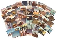
1966233371966. Cook Inlet offshore drilling photo archive of 57 chromogenic color photographs documenting the transport assembly and field operation of oil platform equipment in Alaska in 1966 including derrick sections drill pipe draw works components service trucks staging yards flare fire and rig floor assembly during the period when offshore construction expanded rapidly across the basin between 1964 and 1968. Alaska's first offshore platform was erected in Cook Inlet in 1964 exploration drilling peaked in 1966 and the photographs place the group within the short formative period when Cook Inlet became the proving ground for Alaska's offshore petroleum industry. The photographs record named individuals large platform components drill pipe derrick sections service trucks and specialized machinery moving from yard to worksite and from transport into operation.<br /> <br /> Photo archive of 57 chromogenic color photographs Kodacolor snapshot prints ranging from 3.5 x 3.5 to 3.5 x 4.5 inches Cook Inlet Alaska 1966. The derrick and draw works sections are hauled on heavy trucks across dirt roads rig components unloaded in open staging yards drill pipe rising within the derrick structure and crews in hard hats and work clothes working at the base of drilling machinery. Several photographs isolate specific stages of petroleum work rather than completed structures including a float identified on the verso as "Flatt & Doghouse" a "Tool box & work area on float" machinery captioned "Unloading Draworks from our truck #103 to Gary Bobs Road truck" pipe identified as "13000 ft pipe in deric" and repeated views of muddy haul roads flare fire active equipment and rig floor assembly from both elevated and ground level vantage points. The versos preserve contemporaneous functional captions and named personnel including "Front view with Jerry Blackwood driving" "Little Red & Ramdro discussing plans" "Putting Deric on the floor" "two trucking the Deric" "Bottom 1/2 of the Deric. This is the way we haul it" and "My truck hauling top 1/2 deric pulled over for the day too muddy to proceed to location" giving the archive unusual specificity at the level of individual labor and task sequence. A yard sign for Canadian Superior places part of the group within the corporate landscape of Cook Inlet petroleum development.<br /> <br /> Cook Inlet's offshore fields were the first large scale petroleum infrastructure projects in Alaska waters and the photographs preserve the hauling stages yard transfer pipe handling rig erection truck transport and field conditions through which the basin moved from exploration into sustained production. Named workers truck numbers hauling stages yard transfer pipe handling rig erection and field conditions place the group within the daily labor structure of offshore oil development rather than in finished platform views alone. The seller's Spurr attribution merits caution since later platform compendia place Platform Spurr in Trading Bay in 1968 but that discrepancy does not alter the archive's value as a 1966 record of Cook Inlet drilling logistics and offshore construction practice. Front surfaces show scattered paper residue or adhesion from prior storage with light wear minor discoloration and ordinary handling marks. Overall good condition. A 1966 Cook Inlet drilling archive centered on truck haulage derrick assembly pipe handling named workers and offshore construction logistics during the basin's first major oil boom. unknown
0265709482.Ghardcover. Good. Access codes and supplements are not guaranteed with used items. May be an ex-library book. hardcover
1332908128.Gpaperback. Good. Access codes and supplements are not guaranteed with used items. May be an ex-library book. paperback
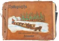
1945191491945. Unidentified compiler photograph album of United States Army troops stationed near Seward Alaska circa 1945 documenting military life and operations in a strategic northern deployment during the closing period of World War II. The material provides primary visual evidence of troop activity infrastructure development and social life within a remote military environment supporting research into wartime logistics soldier experience and the role of Alaska in U.S. military defense during the conflict.<br /> <br /> Photograph album containing 58 black and white silver gelatin prints most measuring approximately 3.5 x 6 inches depicting soldiers engaged in both formal and informal activities. Images include groups of men standing at attention with rifles constructing wooden buildings in rugged terrain and participating in daily routines within camp settings. A series of photographs documents a dance event for troops featuring a jazz band with music stands marked "153" alongside an emblem suggesting a possible connection to the 153rd Infantry Regiment which was stationed in Alaska during the period. Additional images show steamships including the S.S. Baranof S.S. Alaska S.S. Denali and S.S. Columbia navigating the Inside Passage and areas near Taku Glacier indicating transportation and supply routes. The album also contains a "memory leaves" section with handwritten notes and addresses from fellow servicemen reflecting interpersonal networks and efforts to maintain contact beyond deployment.<br /> <br /> 58 photographs mounted in an album with decorated leather covers featuring a hand-painted image of Alaskan sled dogs titled "The Malamute Limited." During World War II Alaska served as a critical military zone due to its geographic proximity to the Pacific theater with troop deployments focused on defense infrastructure and logistics in challenging environmental conditions. This album captures both operational and social dimensions of that presence including labor recreation and movement through the region. Light handling wear to album and photographs contents well-preserved; overall very good condition. A cohesive and detailed visual record of U.S. Army life in wartime Alaska. unknown
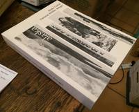
1975006921Washington D.C./Alaska: US Department of the Interior BLM 1975. 1st . Paper Back. Good/No Jacket. 4to - over 9¾" - 12" tall. 678pp.; SC white w/blk.-photo cover; slight rub w/clean pages. Binding is beginning to deteriorate and separate. In-depth description of area's environment . maps photos illus. <br/> <br/> US Department of the Interior (BLM) unknown
1974006919Washington D.C./Alaska: US Department of the Interior BLM 1974. 1st . Paper Back. Very Good/No Jacket. 4to - over 9¾" - 12" tall. 399pp.; SC white w/blk.-photo cover; slight rub w/cleantight pgs. In-depth description of area's environment . maps photos illus. <br/> <br/> US Department of the Interior (BLM) unknown
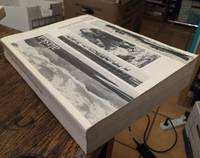
21748U.S. Government Printing Office 1975. Paper bound in original wrappers 4to illustrated with a few photos and numerous original fold-out maps which won't be found in reprints Pp672. Includes appendices and references. Short tear to side edge of front cover else in very good or better condition. 1.66 kilograms unpacked -- extra postage may be requested! All books in stock and available for immediate shipment from Winnipeg Manitoba. U.S. Government Printing Office, 1975 unknown
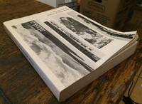
1975006929Washington D.C./Alaska: US Department of the Interior BLM 1975. 1st . Paper Back. Very Good/No Jacket. 4to - over 9¾" - 12" tall. 632pp.; SC white w/blk.-photo cover; slight rub w/cleantight pgs. In-depth description of area's environment . maps photos illus. <br/> <br/> US Department of the Interior (BLM), unknown
21747U.S. Government Printing Office 1975. Paper bound in the original binding 4to illustrated with a few photos and a large number of fold-out maps 764pp includes appendices and references. Very good condition. 1.89 kilograms unpacked -- extra postage may be requested. All books in stock and available for immediate shipment from Winnipeg Manitoba. U.S. Government Printing Office, 1975 unknown
21746U.S. Government Printing Office 1975. Paper bound 4to illustrated with a few photos and numerous fold-out maps 713pp includes appendices and references. Very minor creases to extremities of wraps else very good. 1.8 kilograms unpacked -- extra shipping charges will be requested! All books in stock and available for immediate shipment from Winnipeg Manitoba. U.S. Government Printing Office, 1975 paperback
21745U.S. Government Printing Office 1975. Paper bound 4to illustrated with a few photos and numerous fold-out maps 673pp includes appendices and references. Very good. 1.66 kilograms unpacked -- extra shipping charges will be requested! All books in stock and available for immediate shipment from Winnipeg Manitoba. U.S. Government Printing Office, 1975 unknown
15-10607Vancouver & Prince Rupert BC: Alaska Princess 1950. Folio. 12 pp. Stapled Wraps Very Good with some toning. Illustrated photographs. Onboard magazine for Alaskan cruises. Daily Radio News bulletin dated June 21 1950 for the S.S. Princess Kathleen present. Scarce piece of memorabilia. Vancouver & Prince Rupert, BC: Alaska Princess, 1950. paperback
1566121116.Gpaperback. Good. Access codes and supplements are not guaranteed with used items. May be an ex-library book. paperback
1566120381.Gpaperback. Good. Access codes and supplements are not guaranteed with used items. May be an ex-library book. paperback
1900124823San Francisco: Edw. H. Mitchell 1900. Undetermined. very good. Complete deck of 52 cards. No Jokers. Single card map with publishers inprint and date. Single advertising card. A nice example missing the box lid but with the box liner. very good The images on the cards are general views from all over Alaska but include Skaguay Canyon City Dawson and other subjects that relate to the Klondike and Yukon as well. The card backs illustrate the Seal of the District of Alaska and are decorated with totem poles. 1900 Edw. H. Mitchell unknown
0882400002New. paperback. New. Satisfaction Guaranteed or your money back. paperback
Q-0882400002Alaska Northwest Books 1962-06-01. Paperback. New. In shrink wrap. Looks like an interesting title! Alaska Northwest Books paperback
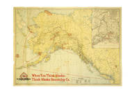
191737386Chicago: Poole Bros. 1917. 1917. ALASKA. First edition. A full-color folded map of Alaska showing both the coastal and seagoing routes that leave from Seattle to Alaska by the Alaska Steamship Company. Points of interest are indicated in red and include the Klondike Region Fairbanks Gold Placers Mt. McKinley National Park Kennecott Copper Mines etc. In the upper right corner is an 11" x 8" inset black & white map of the Copper River & Northwestern RY. and the Alaska Railroad showing Copper River Region in Alaska Prince William Sound the Richardson Automobile Highway Mt. McKinley National Park and Government Telegraph Line and Tributary Territory. Map has a few tears at folds some soiling to the map's surface and general wear from handling and use. Overall a good map of Alaska. Poole Bros., 1917. unknown
1939286138Seattle: Farwest Lithograph and Printing Co 1939. Map. Color Lithograph. 21" x 28".<br/> <br/> This beautifully colored map of Alaska and the Gulf of Alaska shows the Alaskan boat lines from Seattle and was first drawn by Edward Camy for the Alaska Steamship Company in 1934. A great pictographic map includes an inset showing the Alaska Railways route from Seward to Fairbanks and the Richardson Automobile Highway. The bottom of the map shows a series of cartoons of events on the ship. In good condition a great example of Alaska.<br/> <br/> Farwest Lithograph and Printing Co unknown
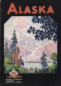
1931109085Seattle: Alaska Steamship Company 1931. Softcover. good to very good. 40pp.pp. Octavo. Black and white illustrations in text from photos and drawings and folding colour map at end in printed pocket entitled "The Alaska Line" with inset "Map of the Copper River & Northwestern Ry and the Alaska Railroad showing Copper River Region in Alaska Prince William Sound the Richardson Automobile Highway Mt. McKinely National Park Government Telegraph Line and Tributary Territory". Original pictorial wrappers stapled as issued; Old dampstain in top margin of text leaves and minor wear and short tear to rear cover. good to very good 1931 Alaska Steamship Company paperback
19353116Seattle WA: Alaska Steamship Company 1935. Paperback. Very Near Fine. Alaska Steamship travel brochure folded size is 4 x 9 inches unfolds to 8 x 9 inches staple bound pp. unpaginated 24 inc. covers illustrated with B&W photo reproductions and a color map at rear. Bright and clean with just a bit of edge wear else unmarked throughout. The Alaska Steamship Company cruise offerings for the 1935 season. Alaska Steamship Company paperback
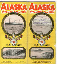
192839103Chicago: Poole Bros. Inc. 1928. 1928. ALASKA. First edition. 8vo. 9" x 8" color pictorial wrappers folded to 9" x 4" 24 pp. including covers illustrated map deck plans. Map outlines the route of the Alaska Steamship Company and connections from Seattle to various ports in Alaska in red. The remainder of the booklet provides information on various trips from one Alaskan point to another along with the steamship used a deck plan of the steamship accommodations and rates for travel and sailing schedules. Agent stamp on cover panel covers lightly soiled rubbed along spine panel and lower spine split about four inches from the bottom else a good copy. Poole Bros. Inc., 1928]. unknown
0331982595.Gpaperback. Good. Access codes and supplements are not guaranteed with used items. May be an ex-library book. paperback
0331982609.Ghardcover. Good. Access codes and supplements are not guaranteed with used items. May be an ex-library book. hardcover
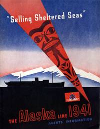
191411421Seattle: Alaska Steamship Company. Near Fine. 1941; 1914. Ephemera. Pacific brochure with 2" split top of spine 1" split bottom; closed 1" tear leading edge front cover; wear at edges with a heavy chip rear top edge causing loss on cover & several pages. Poor condition thus. Alaska Line with slight bump to lower front leading corner else fine. ; Alaska Line: illustrated stapled blue & black wrapper; tab indexed page foredges; includes charts and timetables lodging and transportation informations; information on side trips "what to see"; deck plans including 4 fould out plans in color; large folding map in rear pocket approx. "30 x 20" in color on what appears to be onion skin paper in pristine apparently unused condition. PACIFIC STEAMSHIP brochure: Illustrated stapled wrappers; 15 pp. With map photographs double page deck plan; 4to 11" - 13" tall; 21 pages . Alaska Steamship Company unknown