Alaska Agricultural Experiment StationsBiblio.com

469 résultats
0266796532.Ghardcover. Good. Access codes and supplements are not guaranteed with used items. May be an ex-library book. hardcover
0656328711.Ghardcover. Good. Access codes and supplements are not guaranteed with used items. May be an ex-library book. hardcover
1390916405.Gpaperback. Good. Access codes and supplements are not guaranteed with used items. May be an ex-library book. paperback
1396546405.Ghardcover. Good. Access codes and supplements are not guaranteed with used items. May be an ex-library book. hardcover
1391198565.Ghardcover. Good. Access codes and supplements are not guaranteed with used items. May be an ex-library book. hardcover
1391617355.Gpaperback. Good. Access codes and supplements are not guaranteed with used items. May be an ex-library book. paperback
0332888886.Ghardcover. Good. Access codes and supplements are not guaranteed with used items. May be an ex-library book. hardcover
1024478440.Ghardcover. Good. Access codes and supplements are not guaranteed with used items. May be an ex-library book. hardcover
19145195Various locations mostly in Canada and Alaska 1914. Very good plus. 36 leaves illustrated with 147 vernacular photographs and real photo postcards almost all with manuscript captions written in white pencil. Oblong quarto. Contemporary black textured cloth with "Photographs" in gilt on front cover and with handwritten caption in white pencil reading "1914 July 16 August 31." Minor wear to covers. Contents clean with easily-readable captions. A well-annotated vernacular photograph album assembled by F.A. Patterson of Arlington Heights Massachusetts documenting his or her travels through western Canada and Alaska just prior to World War I. The album opens with a small printed map of North America with the route Patterson took from "Boston to Alaska" between July 16 and August 31 1914. The photographs begin with thirteen leaves featuring scenes in Ontario and Alberta including scenes of Lake Huron St. Mary's River Sault Ste. Marie Winnipeg "Ontario farms" Banff the town wildlife mountain scenes and more Lake Minnewanka Lake Louise Laggan Valley of the Ten Peaks Morain Lake and more. The album then moves westward to British Columbia and other points then northwestward to Alaska for most of the remainder of the album. The westward photos open with scenes of the Illecillewaet Glacier Meeting of the Waters Trail Glacier and other locations in British Columbia. Scenes in Victoria picture various gardens Parliament Hotel Empress Chinese Bell and more. The scenes in Alaska begin with views of Taku Glacier and other scenes in and around Juneau. Other Alaskan images feature Lake Bennett several scenes in White Pass a view toward Skagway abandoned buildings Pitchfork Falls Sitka the harbor a "Russian Greek Church" a view of the town "Old Russian Black House" several totem poles including a "Totem Pole Patch" two angles of an "Old Russian Trading Post" and more. A particularly interesting pair of images of two buildings pictures what is left of Bennett Alaska which is captioned: "Formerly 5000 population. Now 4 houses. One occupied. August 5th 1914." The final few pages of Alaskan images features an Indian Village in Killisnoo and another in Hunter Bay as well as a close-up view of a group of indigenous peoples in Hunter Bay. The last five leaves capture scenes in Salt Lake City Utah and Colorado mostly Pike's Peak and Royal Gorge. unknown
193561878Stanford CA: Stanford University Press 1935. Hardcover. Very Good with no dust jacket. An on-the-ground investigation of the educational possibilities and needs of the native peoples of Alaska and an evaluation of the educational system so far 1934 provided for them. 472 pages 5 b/w plates many photos tables and drawings gatefold map edges rubbed and stained. Cover corners bumped spine ends rubbed "Kasigluk Alaska 1952" inked on pastedowns; 8 1/2 x 11 Stanford University Press hardcover
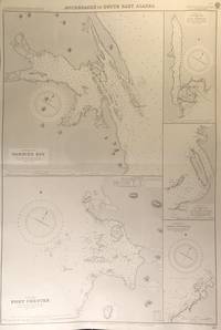
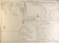
56413London: British Admiralty 1894 1928. . An engraved chart on heavy stock uncolored sheet size 27.5 x 40 inches. Published 6th August 1894; New Edition Aug. 1898; Large Corrections 14th Sept. 1928; Small corrections mss. to 1929. Clean and attractive original horizontal fold some small additions in red pen. In lower right: "Engraved by Edwd. Weller". Chart number is 2110. Small typed label on verso giving chart & folio info. Published under the Superintendence of Captain W.J.L. Wharton. Five anchorages in Frederick Sound and Clarence Strait: large plans of Gambier Bay and Port Chester; smaller plans of Woewodski and Eliza Harbours Fanshaw Bay and Cleveland Passage and Chasina Anchorage. First published 1894 this is a printing of 1928. <br/><br/> London: British Admiralty, 1894 (1928). unknown
0882401726New. paperback. New. Satisfaction Guaranteed or your money back. paperback
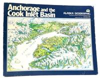
1983Q-0882401726Graphic Arts Books 1983-01-01. Paperback. New. In shrink wrap. Looks like an interesting title! Graphic Arts Books paperback
1983160498Alaska: Graphic Arts Books 1983. First Edition; First Printing. Softcover. Very Good in wraps. Rubbing along panel edges. Faint damp staining on front panel.; 10.8 X 8.5 X 0.5 inches; 168 pages. Graphic Arts Books unknown
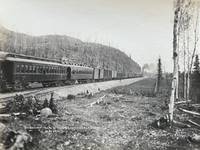
161959078Anchorage & Seward A.T.: Alaska Engineering Commission AEC Phinney S. Hunt ca. 1916-1917. 4to. 86 silver print photographs sized 6.25 x 8.25 in. nearly all w/ photographer’s imprint w/in negative at lower fore-edge as well as caption negative number and AEC some w/ occasional pencil annotations on verso all preserved in mylar sleeves occasional creasing at corners a couple w/ slight loss at corners in the small blank margin. Recent 3-ring clamshell binder an excellent set of photos with all retaining bright strong contrast. This outstanding photo archive provides not only some of the earliest photographs of Anchorage Alaska Territory but also this immense railroad project first authorized by the US Congress in 1912. The few existing privately-run railroads operating in Alaska at the time including the Alaska Northern Railway and the Tanana Valley Railroad primarily fulfilled the needs of the mining companies carrying resources to sea ports and very little allowance was made for passenger traffic and it was impossible to travel by rail from Ship’s Creek at the Cook Inlet north to Fairbanks. Through an April 1915 executive order President Wilson directed that the newly created Alaska Engineering Commission construct a railroad along the surveyed “Western Route†from Seward or Portage Bay along the Turnagain & Knik Arms of Cook Inlet North through the Suitna Valley and then follow the Nenana River until it joined the Tanana with the intent it would connect eventually to Fairbanks. Employing discarded surplus railroad equipment from the Panama Canal Railroad project and under the direction of engineer Mears who had worked on both the Panama Canal and Great Northern Railroads the tiny tent city of Ship’s Creek swelled to 5500 people within two years and was officially labeled by the Post Office as “Anchorage.†Photos included here reveal the barren original landscape of Ship’s Creek with one of the photos showing the steam launches “Alaska†& “Seagull†who carried cargo and passengers from ships offshore. In addition there are views of the construction of the immense AEC Railway machine shop by Sept. 1916 as well as the newly completed first Railroad Depot in Anchorage with the progression of buildings erected beyond. These early views of the fast developing project portray the Commissary Hospital Bunkhouses finished machine shop interiors of the powder house for blasting along with a view of the AEC’s photo studio and the completed electrical power house. Early street views of the nascent city are quite scarce and one of particular interest shows Fourth Ave. looking East with newly built stores and homes built along both sides of the roadway stretching into the distance. Brutal working conditions continually interfered with the pace of the project with one of the images showing the AEC’s “Electric Thawing Machine†on a sled whie others depict piles of snow work camps in snow and even sternwheeler and docks trapped in an ice flow in March 1917. A couple of the photographs feature the sternwheeler SS Omineca underway which had been originally constructed in 1909 for the Grand Trunk Railway running the Skeena River from 1909-1912 and powered by the original SS Caledonia’s engines. By the end of 1916 60 miles of track had been laid 100 miles were graded and right-of-way cleared for 230 miles with photos in this archive showing AEC Construction camps at various mile markers blasting activity and track laying. At the same time they rehabilitated the bankrupt Alaska Northern Railroad tracks and by Oct. 24 1917 the first AEC Railway train reached the Chickaloon coal mines 74 miles North of Anchorage. The railroad would actually not be finished until 1923 when the Tanana River Bridge was completed and last 57 miles of track to Fairbank converted to standard gauge. Photos also show the Anchorage Baseball Field which featured games for the Cook Inlet Baseball League composed at the time of Matanuska Anchorage and Turnagain Arm teams. There’s also a very fine series of the Decoration Day parade held May 30 1917 depicting many of the main streets and businesses in the background. In addition several photographs show the ocean docks completed which allowed ships to directly dock at Anchorage rather than lightering passengers and cargo to shore prior to 1917. Hunt 1866-1917 originally worked as a California optician before trekking to Valdez Alaska as a gold rush prospector but quickly established himself as a photographer opening his studio and documenting Valdez and development of the region. He would bring his wife and children to Alaska by 1907. He later secured work as one of the AEC’s official photographers shooting some of the early survey work by 1914 and through the project until suffering a heart attack Oct. 14 1917 in Seward AK. Hunt’s son A.O. Hunt also worked as an assistant photographer for the AEC. A few of these images appear as negatives in the Alaska State Library Historical Collections with a couple shown in their Digital Archives and some appear in the Alaska Engineering Commission archive at the U of W Collect. No. PH0495 but the bulk of that collection features photographs by James McPherson H.G. Kaiser and A.J. Johnson who were the other official photographers on the project; See: Phinney S. Hunt Photographs of Alaska 1902-1909 Photographs in and around Valdez and Sitka Alaska University of Washington Special Collections; Phinney S. Hunt Obituary Alaska Railroad Record Vol. I No. 49 Oct. 16 1917 p. 389. Alaska Engineering Commission, AEC, Phinney S. Hunt, unknown
56393London: British Admiralty 1900 1924. . An engraved chart on heavy stock uncolored sheet size 27.5 x 20 inches. Published 29th May 1900; Large Corrections April 1905. Small corrections printed to 1924. Unfolded a nice clean copy. In lower right: "Engraved by Davies & Company". Chart number is 3136. Small typed label on verso giving chart & folio info. Published under the Superintendence of Rear Admiral Sir W.J.L. Wharton. Maps of four anchorages on Kodiak Island: Karluk Anchorage Larsens Bay Uyak Anchorage Shearwater Bay. <br/><br/> London: British Admiralty, 1900 (1924). unknown
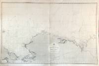
56479London: British Admiralty 1856 1932. An engraved chart on heavy stock uncolored sheet size 40 x 27.5 inches. Published Febr. 20th 1856; New Edition Dec. 1908. Large Corrections to Sept. 1932. Original vertical fold a very good copy some light wrinkling a few additions in red and some route marks in pencil. In lower right: "Engraved 1856". Chart number is 2435. Small typed label on verso giving chart & folio info. A large-scale chart extending from the Chukchi Peninsula in Asia to Liverpool Bay and Cape Bathurst in the Canadian Arctic. The course of the Mackenzie River is shown as well as the Porcupine River and Yukon River. The tip of Wrangell Island is shown at the left edge. <br/><br/> London: British Admiralty, 1856 (1932). unknown
56400London: British Admiralty 1904 1928. . An engraved chart on heavy stock uncolored sheet size 27.5 x 20 inches. Published 11th Nov. 1904; Small corrections printed to 1928. Unfolded a nice clean copy. In lower right: "Engraved 1904" and "Zc 1928". Chart number is 3464. Small typed label on verso giving chart & folio info. Published under the Superintendence of Captain A. Mostyn Field. Maps of five anchorages in the Ikatan Peninsula and Sanak Island: Dora Harbour East Anchor Cove Sanak Acherk Harbour Peterson Bay and North East Harbour. <br/><br/> London: British Admiralty, 1904 (1928). unknown
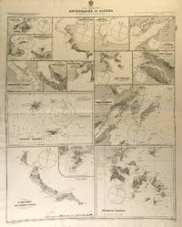
56425London: British Admiralty 1890 1925. . An engraved chart on heavy stock uncolored sheet size 27 x 33.5 inches. Published 11th Aug. 1890; New Edition July 1911; Small corrections printed to 1925 and mss. to 1929. Original horizontal fold a nice clean copy small additions in red pen. In lower right: "Engraved by Edwd. Weller". Chart number is 1454. Small typed label on verso giving chart & folio info. Published under the Superintendence of Captain W.J.L. Wharton. Fifteen anchorages various sizes: Kukak Bay Northwest and Yukon Hrs. Southwest Anche. Chernoffski Harbour Eagle Harbour Kulilyak Bay Pribilof Islands English Bay St. Matthew and Adjacent Islands Akun Cove Port Etches Port Wrangell Port Graham Kodiak Harbour and Shumagin Islands. <br/><br/> London: British Admiralty, 1890 (1925). unknown
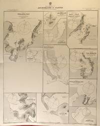
56424London: British Admiralty 1890 1924. . An engraved chart on heavy stock uncolored sheet size 27 x 33.5 inches. Published 2nd Aug. 1890; Large Corrections to Nov. 1908; Small corrections printed to 1924 and mss. to 1929. Original horizontal fold a nice clean copy small additions in red pen. In lower right: "Engraved by Edwd. Weller". Chart number is 1457. Small typed label on verso giving chart & folio info. Published under the Superintendence of Captain W.J.L. Wharton. Eleven anchorages: Unalaska Bay Captains Bay Cape Etolin Simeonof I. & Hr. Samganuda Bay Popof Strait and Humboldt Harbour Port Mulgrave Coal Harbour Doris & Anchorage Bays Nateekin Bay Liituya Bay and Sanborn Hr. <br/><br/> London: British Admiralty, 1890 (1924). unknown
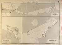
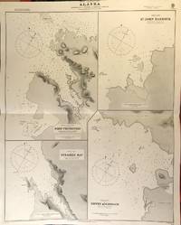
56417London: British Admiralty 1890 1925. . An engraved chart on heavy stock uncolored sheet size 27 x 34 inches. Published 2nd Aug. 1890; Small corrections printed to 1925 and mss. to 1927. Original horizontal fold a nice clean copy small additions in red pen. In lower right: "Engraved by Edwd. Weller". Chart number is 1433. Small typed label on verso giving chart & folio info. Published under the Superintendence of Captain W.J.L. Wharton. Four charts: Port Protection Steamer Bay St. John Harbour and Dewey Anchorage. Currently residents of Port Protection are featured in the National Geographic Channel reality series: Life Below Zero: Port Protection and its spinoff: Lawless Island. <br/><br/> London: British Admiralty, 1890 (1925). unknown
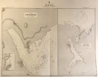
56416London: British Admiralty 1890 1924. . An engraved chart on heavy stock uncolored sheet size 33.5 x 27 inches. Published 11th Aug. 1890; Large Corrections to Aug. 1898; Small corrections printed to 1924 and mss. to 1927. Original vertical fold a nice clean copy small additions in red pen. In lower right: "Engraved by Edwd. Weller". Chart number is 1449. Small typed label on verso giving chart & folio info. Published under the Superintendence of Captain W.J.L. Wharton. Two large charts of anchorages: Port McArthur and Red Bay; the Port McArthur plan includes a small inset map of Port Conclusion. <br/><br/> London: British Admiralty, 1890 (1924). unknown
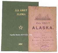
1891122196San Francisco California: Pacific Coast Steamship Co. 1891. Softcover. very good. 1st edition. 63pp. Octavo. Illustrated with 2 drawings cabin plans and tables. Original pictorial wrappers. Housed in a green cloth fold over case. Small library stamp on front cover of wrappers. Minor chips to edges and minor soiling to front cover of wrappers. A very nice example of a fragile item. Scarce. very good Tourville 3449. Information on sailing times of streamers on the Alaska route for the 1891 season stateroom rates and descriptions of the excursions. 1891 Pacific Coast Steamship Co. paperback
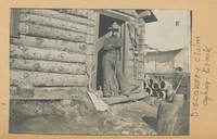
1901List2108Alaska 1901. Oblong folio 12 ½ x 9 inches. Twelve leaves with 89 photographs rebound in modern cloth. Binding in fine condition photographs generally excellent some leaves with clear tape repairs. A well preserved album of photographs showing mining operations in the Golovin Bay region about fifty to seventy-five miles northwest of Nome during the tail end of the Klondike Gold Rush period in 1900-1901. The album shows the operations of the Pioneer Company in Alaska in great detail including the travel by boat and the camps along Opher Creek as well as many photographs of the mining operation itself. According to a caption in one of the photographs $12000 worth of gold was taken out of the “Discovery Claim†on Ophir Creek. The album also includes several photographs of the indigenous population. The compiler of the book appears to have been a student at a mining college at some point as some of the photographs show a “Class of ‘04’†sign. The photographs are dated from 1897 to 1901. Interior scenes and a particularly broad portrayal of mining life and operations make this an uncommonly informative photographic document of Alaskan mining operations during this period. <br /> <br /> Lowny J.D. The Golovin Bay Region of Northwestern Alaska. In: The Engineering and Mining Journal Vol. 71 pp. 781-782. June 15 1901. Accessed online 6/23. unknown
198159672Anchorage AK: The Alaskan Historical Aircraft Society 1981. 4to. 4 1 leaves 2-119 pp. With photo illustrations text illustrations document reproductions. Printed flexible covers colour photo mounted front cover plastic-comb-binding as issued minor edgewear light dustsoiling still VG copy. First edition signed of this very scarce report on aviation and military aviation artifacts and historical aircraft in Alaska augmented with history of the U.S. Military in Alaska the Aleutians Campaign Japanese Naval Air Operations in the Aleutians and more. Worldcat locates 2 copies Alaska State Lib. Museum of Flight. The Alaskan Historical Aircraft Society, unknown