364 résultats
2000mon0000650957Butterworth-Heinemann 7/29/2013 12:00:01 A. hardcover. Good. 0.9449 in x 9.5276 in x 7.7165 in. Butterworth-Heinemann hardcover
200040-22021Butterworth-Heinemann 2000-04-13. Hardcover. New. In shrink wrap. Butterworth-Heinemann hardcover
2000DADAX075067198XButterworth-Heinemann 2000-04-13. 2. hardcover. New. 6.75x1.00x9.75. Buy with confidence. Excellent Customer Service & Return policy. Butterworth-Heinemann hardcover
2000Q-075067198XButterworth-Heinemann 2000-04-13. Hardcover. New. New. In shrink wrap. Looks like an interesting title! Butterworth-Heinemann hardcover
1990234343PN. New. 1990. Soft Cover. Date is original print. This is a reprint edition . PN paperback
19889263Miami, Dade Trust Heritage, 1988. Kartoniert, 4°, 56 S., ca 90 überwiegend farbige Abbildungen, Deckel mit Sichtfenster, gelocht; -sehr gutes Exemplar.
1996Q-0761991646AltaMira Press 1996-08-27. Paperback. New. New. In shrink wrap. Looks like an interesting title! AltaMira Press paperback
194347062Good. 1943. Softcover. Regular shelf wear; Some discoloration at edges of cover; Back cover has crease down left third of back cover; Page 45 has chip at edge; Pages are slightly yellowed concistent with age ; 98 pages . paperback
199841916ABRheda-Wiedenbrück, Bertelsmann Club, 1998. 22 cm, 672 Seiten, mit zahlreichen Farbfotos, Karten und Abbildungen, kartoniert, Englische Broschur, Karten auf den Vorsätzen. Ungekürzte Buchgemeinschafts-Lizenzausgabe, aktual insgesamt leichte Gebrauchsspuren, gut erhalten. Club-Reiseführer.
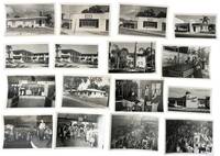
1950233651950. Clearwater Florida real estate photo archive documenting the early postwar building boom on the Gulf Coast when brokers insurers apartment operators and developers sold a rapidly changing city through new office fronts freshly finished rental courts and sharply modern commercial facades. George Fulmer worked in the middle of that expansion producing assignment photographs for the businesses and properties that turned population growth into visible street level change. The strongest material here fixes Clearwater at the point where land promotion rental housing and mid century design converged: curved corner offices lettered for real estate and insurance palm lined apartment blocks arranged around trimmed courtyards and low modern buildings meant to signal newness efficiency and Florida ease. Rather than treating real estate as an abstraction the archive shows exactly how property was marketed in these years through named firms finished exteriors and staged views ready for display advertising or client use.<br /> Photo archive of 45 items including 24 large format negatives many unique and others duplicate of 11 silver gelatin photos measuring 4" x 5" archive contained in 11 photo studio & some annotated envelopes Clearwater Florida c. 1950 to 1955. Named commissions anchor the file throughout including Al Hungerford Realty Alexander & Gauslin Real Estate Sales Rentals Insurance at 511 Park St. Bob Morrison Realtor and Southwind Apartments. Bob Morrison's office appears as a clean low commercial building with bold lettering across the facade; Alexander & Gauslin occupies a streamlined corner block beside The Owl Diner its window and signs announcing sales rentals and insurance; Al Hungerford Realty stands in a compact modern office with a tiled vertical sign tower and a curved entrance bay marked "Insurance." Southwind appears in repeated exterior views as a two story apartment court with flat rooflines metal balcony rails landscaped beds and residents seated outdoors beneath palms and a striped umbrella while another low residential property sits under large shade trees and Spanish moss suggesting the quieter rental and lodging side of the same market. The sleeves preserve the working identity of the commissions in Fulmer's filing system with handwritten entries including "Hungerford" "Bob Morrison Real Estate Office" "Southwind Apt" and "Alexander & Gauslin Realtor." Supporting material from a local Home Show remains tied to the same sales environment with merchants' booths crowds and display spaces for household goods and services aimed at the buyers renters and homeowners moving into the expanding city. Other home show images depict the culture of events- mixing consumer cuture and rapid expansion with public displays of a theatrical nature including live music and performance and auction styled sales.<br /> <br /> Across Florida's west coast the years after World War II brought surging in migration rising land values and an aggressive local market in homes apartments offices and investment property especially in towns that could sell both sunshine and modern convenience. Clearwater's brokers and builders were part of that larger remaking of the state and this archive holds onto the ordinary but highly perishable evidence of the boom: the offices where property changed hands the apartment courts offered to newcomers and the polished exteriors used to advertise stability and growth. Light wear minor surface handling and expected age toning to prints and negatives with some sleeves creased rubbed or soiled from studio use; overall in very good condition. A focused documentary record of how Clearwater's real estate economy looked branded itself and entered the local visual record during the first great postwar surge. unknown
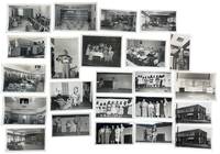
1951233191951. George Fulmer photographs of Clearwater residents businesses club spaces and service interiors recording how the residential economy of postwar Clearwater Florida functioned during early Sunbelt expansion in the 1950s. Fulmer a WWII U.S. Navy enlisted photographer and Clearwater city photographer for more than six decades worked from a studio beside the courthouse and produced a continuous visual record of the city's built environment commercial life and civic spaces; this group preserves that local documentary practice in a concentrated run of early postwar assignments tied to dining rooms lounges staged programs domestic instruction storefront promotion and everyday services. The material shows the interlocking spaces that supported residential growth in Pinellas County: hospitality rooms utility demonstrations cleaners and tailoring shops club events leisure scenes and communal interiors built for a city expanding through retirement migration consumer services and year-round settlement.<br /> <br /> Photo archive of 75 items including 36 silver gelatin photographs and 39 large format duplicate and original negatives ranging from 3 x 4 inches to 5 x 4 inches all contained in 12 original studio envelopes with some annotations by George Fulmer. Clearwater Florida and nearby Pinellas County circa 1951-1953. The most vivid images center on stage performance and organized social programming: women posed onstage around a table with boxed goods and a large lamp presenting household furnishings in a display that links entertainment to domestic consumption; girls lined across a stage in dresses for a group performance; a young female solo performer standing at microphone or center stage; a mixed adult group assembled under stage lighting in what appears to be a presentation or awards moment; and a trio of female performers in matching dance poses. These theatrical scenes are matched by audience and setting views that show older men dining together in booths and at tables large lounge interiors arranged for conversation and gathering office and reception spaces a broad institutional kitchen a man on a ladder opening a ceiling hatch in a decorated hall a child holding a large fish outdoors and exterior views of a corner cleaners and tailoring shop with painted signage reading "EST. 1909 CLEANERS" and "TAILORING." Original studio envelopes retain Fulmer job numbers dates and handwritten identifications including "Hart Cleaners" "BPW Club" "Weekend in Clearwater" "Court Crest Room" "Bank Central Pinellas Largo" and "Pinellas Utility Co. Cooking School" placing the images within the working files of a commercial city photographer covering Clearwater's residential service and promotional life.<br /> <br /> In the years after World War II Florida's Gulf Coast cities grew through in-migration small-business development utility expansion hospitality design and new forms of residential settlement aimed at permanent and seasonal residents alike. Fulmer's photographs place Clearwater within that broader transformation at street level through the rooms services labor and public-facing businesses that made postwar residential growth workable as daily life rather than as abstract development. Some negatives with light damage; photographs very good negatives largely good overall. A coherent single-photographer group of original studio material from George Fulmer's Clearwater practice with negatives prints and job-envelope evidence intact. unknown
197586086Academic Press. Good/No Dust Wrapper. 1975. Hard Cover. 012664750X T11 . Academic Press hardcover
191740682Washington D.C.: Published by the United States Coast and Geodetic Survey 1917. Nautical chart printed on heavy paper stock. Colored. A rare coastal survey of the Pensacola area including Destin Fort Walton Santa Rosa Island and Pensacola Beach.<br/> <br/> Established by President Thomas Jefferson in 1807 as the Survey of the Coast the U.S. Coast and Geodetic Survey was the United States' first civilian scientific agency. This agency has followed its mission to survey the U.S. coastline create nautical charts of the coast and help increase maritime safety since its founding and has often played fascinating roles in significant chapters of U.S. history. It served in all theaters of the Civil War in the service of the Union Army and Navy pioneered acoustic exploration in the wake of the sinking of the Titanic and during WWI it worked to detect enemy submarines. In addition this agency worked to survey and produce detailed maps and renderings of the U.S. coast. These nautical survey maps commonly referred to as "T-sheets" provide fascinating insights into the history of the United States coastline which has and will continue to shift. These maps are the most important data source for understanding the physical and ecological characteristics of the U.S. shoreline. The present map is a highly detailed and accurate sea chart of the Pensacola area and an important historical view of a developing Florida. Published by the United States Coast and Geodetic Survey unknown
192240698Washington D.C.: Published by the United States Coast and Geodetic Survey 1922. Large folding nautical chart printed on heavy paper stock. Colored with minor wear. A rare coastal survey of the Florida coast from Fort Walton Beach to Panama City Beach including Destin Grayton Beach Seaside Alys Beach Rosemary Beach and Laguna Beach.<br/> <br/> Established by President Thomas Jefferson in 1807 as the Survey of the Coast the U.S. Coast and Geodetic Survey was the United States' first civilian scientific agency. This agency has followed its mission to survey the U.S. coastline create nautical charts of the coast and help increase maritime safety since its founding and has often played fascinating roles in significant chapters of U.S. history. It served in all theaters of the Civil War in the service of the Union Army and Navy pioneered acoustic exploration in the wake of the sinking of the Titanic and during WWI it worked to detect enemy submarines. In addition this agency worked to survey and produce detailed maps and renderings of the U.S. coast. These nautical survey maps commonly referred to as "T-sheets" provide fascinating insights into the history of the United States coastline which has and will continue to shift. These maps are the most important data source for understanding the physical and ecological characteristics of the U.S. shoreline. The present map is a highly detailed and accurate sea chart of 30A area in Florida and an important historical view of the developing state. Published by the United States Coast and Geodetic Survey unknown
191940687Washington D.C.: Published by the United States Coast and Geodetic Survey 1919. Nautical chart printed on heavy paper stock. Colored. A rare coastal survey of the Florida Georgia and South Carolina including Daytona Palm Coast St. Augustine Ponte Vedra Amelia Island Jacksonville Fernandina Jekyll Island St. Simons Sea Island Tybee Savannah Hilton Head Kiawah and Folly Beach.<br/> <br/> Established by President Thomas Jefferson in 1807 as the Survey of the Coast the U.S. Coast and Geodetic Survey was the United States' first civilian scientific agency. This agency has followed its mission to survey the U.S. coastline create nautical charts of the coast and help increase maritime safety since its founding and has often played fascinating roles in significant chapters of U.S. history. It served in all theaters of the Civil War in the service of the Union Army and Navy pioneered acoustic exploration in the wake of the sinking of the Titanic and during WWI it worked to detect enemy submarines. In addition this agency worked to survey and produce detailed maps and renderings of the U.S. coast. These nautical survey maps commonly referred to as "T-sheets" provide fascinating insights into the history of the United States coastline which has and will continue to shift. These maps are the most important data source for understanding the physical and ecological characteristics of the U.S. shoreline. The present map is a highly detailed and accurate sea chart of the coasts of Florida Georgia and Alabama and an important historical view of the developing states. Published by the United States Coast and Geodetic Survey unknown
19972410020282ybvkNorfolk, UK; 100th Bomb Group Memorial Museum / Thorpe Abbotts, 1997. vii, 244 (2 blue) pages, photographically illustrated throughout. - Publisher's blue gilt-titled hardcover with colour-illustr. dustjacket; 8vo.(ca. 31 x 21 cm; ca. 1,229 kg.).
191640723Washington D.C.: Published by the United States Coast and Geodetic Survey 1916. Large folding nautical chart printed on heavy paper stock. Uncolored. A rare original coastal survey of the Cedar Keys and west-central coastline of Florida including Steinhatchee.<br/> <br/> Established by President Thomas Jefferson in 1807 as the Survey of the Coast the U.S. Coast and Geodetic Survey was the United States' first civilian scientific agency. This agency has followed its mission to survey the U.S. coastline create nautical charts of the coast and help increase maritime safety since its founding and has often played fascinating roles in significant chapters of U.S. history. It served in all theaters of the Civil War in the service of the Union Army and Navy pioneered acoustic exploration in the wake of the sinking of the Titanic and during WWI it worked to detect enemy submarines. In addition this agency worked to survey and produce detailed maps and renderings of the U.S. coast. These nautical survey maps commonly referred to as "T-sheets" provide fascinating insights into the history of the United States coastline which has and will continue to shift. These maps are the most important data source for understanding the physical and ecological characteristics of the U.S. shoreline. The present map is a highly detailed and accurate sea chart of the Cedar Keys region and an important historical view of a developing Florida. Published by the United States Coast and Geodetic Survey unknown
191740710Washington D.C.: Published by the United States Coast and Geodetic Survey 1917. Folding nautical chart printed on heavy paper stock. Uncolored. A rare original coastal survey of Florida's Cedar Keys area.<br/> <br/> Established by President Thomas Jefferson in 1807 as the Survey of the Coast the U.S. Coast and Geodetic Survey was the United States' first civilian scientific agency. This agency has followed its mission to survey the U.S. coastline create nautical charts of the coast and help increase maritime safety since its founding and has often played fascinating roles in significant chapters of U.S. history. It served in all theaters of the Civil War in the service of the Union Army and Navy pioneered acoustic exploration in the wake of the sinking of the Titanic and during WWI it worked to detect enemy submarines. In addition this agency worked to survey and produce detailed maps and renderings of the U.S. coast. These nautical survey maps commonly referred to as "T-sheets" provide fascinating insights into the history of the United States coastline which has and will continue to shift. These maps are the most important data source for understanding the physical and ecological characteristics of the U.S. shoreline. The present map is a highly detailed and accurate sea chart of Florida's Cedar Keys and an important historical view of a developing Florida. Published by the United States Coast and Geodetic Survey unknown
19981307840PN. New. 1998. Soft Cover. Date is original print. This is a reprint edition . PN paperback
192140729Washington D.C.: Published by the United States Coast and Geodetic Survey 1921. Large folding nautical chart printed on heavy paper stock. Colored. A rare original coastal survey of the Northern Gulf coast from Florida to Louisiana encompassing Panama City Rosemary Beach Seaside Grayton Destin Pensacola Gulf Shores Mobile Gulfport and the Mississippi Delta.<br/> <br/> Established by President Thomas Jefferson in 1807 as the Survey of the Coast the U.S. Coast and Geodetic Survey was the United States' first civilian scientific agency. This agency has followed its mission to survey the U.S. coastline create nautical charts of the coast and help increase maritime safety since its founding and has often played fascinating roles in significant chapters of U.S. history. It served in all theaters of the Civil War in the service of the Union Army and Navy pioneered acoustic exploration in the wake of the sinking of the Titanic and during WWI it worked to detect enemy submarines. In addition this agency worked to survey and produce detailed maps and renderings of the U.S. coast. These nautical survey maps commonly referred to as "T-sheets" provide fascinating insights into the history of the United States coastline which has and will continue to shift. These maps are the most important data source for understanding the physical and ecological characteristics of the U.S. shoreline. The present map is a highly detailed and accurate sea chart of the Gulf coasts of Florida Alabama Mississippi and Louisiana and an important historical view of the developing states. Published by the United States Coast and Geodetic Survey unknown
191640732Washington D.C.: Published by the United States Coast and Geodetic Survey 1916. Large folding nautical chart printed on heavy paper stock. Colored. A rare original coastal survey of Cape Sable and Everglades National Park.<br/> <br/> Established by President Thomas Jefferson in 1807 as the Survey of the Coast the U.S. Coast and Geodetic Survey was the United States' first civilian scientific agency. This agency has followed its mission to survey the U.S. coastline create nautical charts of the coast and help increase maritime safety since its founding and has often played fascinating roles in significant chapters of U.S. history. It served in all theaters of the Civil War in the service of the Union Army and Navy pioneered acoustic exploration in the wake of the sinking of the Titanic and during WWI it worked to detect enemy submarines. In addition this agency worked to survey and produce detailed maps and renderings of the U.S. coast. These nautical survey maps commonly referred to as "T-sheets" provide fascinating insights into the history of the United States coastline which has and will continue to shift. These maps are the most important data source for understanding the physical and ecological characteristics of the U.S. shoreline. The present map is a highly detailed and accurate sea chart of the Everglades and an important historical view of a developing Florida. Published by the United States Coast and Geodetic Survey unknown
191640727Washington D.C.: Published by the United States Coast and Geodetic Survey 1916. Large folding nautical chart printed on heavy paper stock. Colored. A rare original coastal survey of Cape Canaveral to Key West including Jupiter West Palm Beach Boca Raton Fort Lauderdale Hollywood Miami the Keys the Everglades Naples and the Bahamas.<br/> <br/> Established by President Thomas Jefferson in 1807 as the Survey of the Coast the U.S. Coast and Geodetic Survey was the United States' first civilian scientific agency. This agency has followed its mission to survey the U.S. coastline create nautical charts of the coast and help increase maritime safety since its founding and has often played fascinating roles in significant chapters of U.S. history. It served in all theaters of the Civil War in the service of the Union Army and Navy pioneered acoustic exploration in the wake of the sinking of the Titanic and during WWI it worked to detect enemy submarines. In addition this agency worked to survey and produce detailed maps and renderings of the U.S. coast. These nautical survey maps commonly referred to as "T-sheets" provide fascinating insights into the history of the United States coastline which has and will continue to shift. These maps are the most important data source for understanding the physical and ecological characteristics of the U.S. shoreline. The present map is a highly detailed and accurate sea chart of Florida's Coast and Keys region and an important historical view of the developing state. Published by the United States Coast and Geodetic Survey unknown