[California Gold Rush]Biblio.com
8 987 résultats
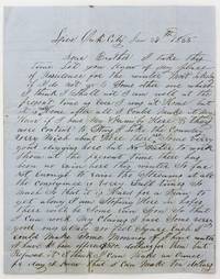
18555504Live Oak City Ca: January 27 1855. Still very good. 4pp. on a bifolium. Previously folded with manuscript docketing on lower half of second leaf verso. Minor wear along old folds with a couple of short separations. Minor soiling and dampstaining somewhat heavier to addressed area. A detailed mid-1850s California Gold Rush letter from Elias Hunt Jr. to his brother in the tiny of Poolville New York southeast of Hamilton. Hunt was camped in Live Oak north of Yuba City when he wrote this letter home on January 27th 1855. He tells his brother that he has good claims but that a lack of rain has not allowed him to work them:<br /> <br /> "It is hard for a man to get along. I am stopping here in hopes there will be some rain soon so that I can work my claims. I have some very good ones 2 only 200 feet square each. I could make some money if I had water. I have been offered $500 dollars for them but I refused it -- I think I can make an ounce per day; I know that I can make ten dollars for I have done that before."<br /> <br /> There is talk of irrigating the area but Hunt is not sure that it will be finished before he wants to return east:<br /> <br /> "There is a ditch coming in here to suply sic the place with water but it will not be completed until Spring some time in April & I should like to come home in June. I shall stay until there is water in the ditch then I can wash a part of my claims & sell the rest to a good advantage for they are situated immediately on the line of the ditch."<br /> <br /> Continuing upon his plans to return he writes:<br /> <br /> "I have had a very good offer to come home across the plains by a man in Sacramento. He is from Utica; his name is Hamilton. He is going to cross with four hundred Spanish horses or mares. He has offered me good money to come with him as I have been over to Carson Valley this last season. It will take some sixty days to do it if I should get through with my claims by the time time that he gets ready to start. I think I shall come with him if the Indians are not to hosstille sic. They were very bad this last season; they got possession of one of Uncle Sam's forts."<br /> <br /> Hunt continues writing about local hunting prospects and family in New York before delivering a Crockett-esque farewell -- "Please give my respects to all may inquire for me & let the rest go to Hell for all that I care." A good letter from one of the less trafficked areas of the California Gold Rush. January 27 unknown
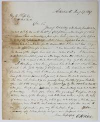
18492389Ashtabula Oh: January 29 1849. About very good. 1pp. on a bifolium. Previously folded. Light dampstaining and short closed tears along gutter somewhat affecting first few lines of text but not overall sense. An interesting letter from O.H. Field an aspirational field representative of the Connecticut Mutual Life Insurance Company in Ashtabula Ohio to the company secretary George R. Phelps inquiring about a policy for a group of men headed to the Gold Rush in California in January 1849. Connecticut Mutual was founded in Hartford three years prior to the composition of this letter in 1846. Fitch's missive begins with a report on his efforts to drum up interest in life insurance in his area with pamphlets and other materials sent to him by Phelps: <br /> <br /> "Yours of Oct 1 1849 with blanks pamphlets &c was not received by me until the 25th of Dec. following. I have not had any definitive applications for insurance. It was somewhat new here and the minds of the people had not been called to it. I have however distributed pamphlets and in other ways called the attention of our citizens to the subject. I think that something yet might be done.<br /> <br /> The letter goes on to describe a potential policy for a group soon leaving for the Gold Rush and requests a favorable rate in order to stimulate interest in policies from additional parties: <br /> <br /> "A company is now being formed to head out about ten men to work in the gold regions of California. The individuals who furnish the money wish to obtain an insurance for two years on the lives of the several persons who go out to secure the amount advanced. The men who propose to go are generally hardy healthy & of good habits & from 25 to 45 years of age. They expect to go by the overland route either from Independence Missouri or some more southerly route not south of Vera Cruz. Will you have the goodness to inform me by return mail if the company will take such risks -- & if so the rates of insurance as near as may be which you will charge -- whether you will insure more than the amt. actually advanced & if so how much & any other information you may think proper to give. If I receive a favorably sic reply I shall probably send you more proposals soon."<br /> <br /> A neat letter concerning the preparations and considerations necessary for a journey to California in the early days of the Gold Rush and the role and rise of early American insurance companies in the planning of such lengthy and dangerous overland travel. January 29 unknown
1850020857Portland OR and San Francisco: H. K. Hines and J. D. Hammond 1850 and 1899. First Edition. Letter. The letter in Near Fine condition with normal folds from mailing; the writing in red ink a little difficult to read but legible. The book is Very Good with some edgewear. A closely-written 4-page letter on one sheet of paper 15-1/2" x 9-7/8" folded in half and written on all 4 pages of neat script in black ink with another 2 pages of content overwritten vertically in red ink. Written by the wife of the Rev. Francis S. Hoyt a Methodist minister previously of the New Jersey Conference and first president of Willamette University in Salem Oregon to her parents in Cincinnati Ohio. Writing from Salem on 10 December 1850 Mrs. Hoyt describes their steamer trip from the Isthmus of Panama north along the Pacific Coast with stops at Acapulco Mexico and San Diego Monterey and San Francisco California and on to their new home. She notes that the steamer she was on was the first to "bear the news of the admission of California as a State" to the people of San Francisco. A sign was draped from the side of the ship announcing the news as it sailed along the bay front firing a 100-gun salute from its cannon the noise upsetting Mrs. Hoyt. She vividly describes the city with its summer dust and winter mud its rich gambling houses and houses of ill repute and the many miners down from the hills to "lose all they have earned and are obliged to go back to the mines again." She describes the gambling houses: "the rooms are fitted up beautifully with large mirrors and paintings and every thing to look pretty and then an orchestra of fine music that plays all the time. Frank looked into one for a little time and said he never saw such piles of money as was there." She did not note if the good reverend checked out the brothels. On one page of the letter she has drawn a small map showing their route from the Pacific to Portland and on to Salem. Her husband's life as an educator in Salem is reported in the book that comes with the letter beginning on page 431 which mentions that the steamer reached Oregon in late October 1850 "landing at Portland then a rustic hamlet of some twenty or thirty habitations and a few places of business." The book is INSCRIBED by the author on the front endpaper "To Rowland Abram Waltz/Very Truly Yours/H. K. Hines/Portland OR/June 21st 1901." In addition it is inscribed "Dr. F. S. Hoyt/with compliments of/Mr. & Mrs. Sam Gill/Portland Oregon/June 26-/1911." A fascinating letter with first-hand glimpses of life in early San Francisco and Oregon. <br/><br/> H. K. Hines and J. D. Hammond unknown
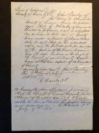
18575974Downieville: Sierra County California 1857. Loose sheet. Good. Loose leaf of blue laid paper measuring 8 x 12.5 inches with recto being a manuscript arrest warrant for a citizen who's a threat to the community and himself when drunk. Verso blank. Three old folds now mellowed with two 2-inch closed tears along the right margin of two folds. Good. An order for the arrest of J. Whittaker a printer by profession who "is not in a proper condition to take care of himself being under the influence of stimulating drinks and that for his individual safety and the public asks for an order of the Justice of the Peace . for safe keeping in the hands of the Sheriff." Written and signed by the sheriff John C. Ghauley and signed twice by the Justice of the Peace G. Harris.<p>The document attests to the unruly civic temperment of the frontier West and a casual administration of justice. That said the streets of today's Western cities appear burdened by much more than mere drunkenness.</p> . Sierra County, California unknown
196078704Atladena California: Altadena Federal Savings and Loan Association 1960. Printed on both sides on an 18 1/2" x 23 1/2" sheet of white paper that folds to 4" x 9 1/4" 24 panels. There is printing in red and a color rendering of the Altadena Federal Savings building on one side. Handwritten name on the front panel; else near fine. Scarce OCLC locates no holdings.<br /> <br /> Fully indexed street map of the unincorporated Los Angeles County California community that was devastated by the Eaton Fire in January 2025. Situated next to and within the foothills of the San Gabriel Mountains Altadena has long resisted annexation to Pasadena though that city has taken 46 "bites" of it over the years seeking tax revenues. That independent spirit is reflected in the mosaic of ethnic diversity that made Altadena one of the most integrated communities in Southern California. Altadena Federal Savings and Loan Association unknown
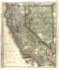
188146231Chicago: Rand McNally 1881. A very good copy some edge tears one closed tear about 1/2 inch into blank area of map one small hole at fold generous margins. Image size 23.5 x 19.14 inches on 24.5 x 20.5 sheet. Outlined color. Relief shown by hachures and spot heights. An extremely detailed if not the most detailed map of California and Nevada up to that time to be published in an Atlas. Shown are many hundreds of natural and man-made features such as mountains rivers lakes springs wells lava fields deserts plains craters dry lakes passes as well as military encampments mines Native American Reservations roads railroads and stations canals ferry crossings Missions cities towns and other human habitations many of which are long gone. Removed from the Rand McNally's Indexed Atlas of the World first edition 1881. [Rand McNally] unknown
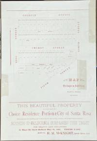
189277117Santa Rosa California: H.M. Knight 1892. Printed in red on an off-white 10 1/2" x 15" sheet. Silk tape repairs to the top edge and three other locations.<br /> <br /> Located three blocks from the courthouse and two blocks from two street car lines this tract is bounded by College Avenue Fifth Street North Street and King Street. "Nothing in California surpasses this tract for beauty and cheapness. It must be sold before May 20 1892." The map shows the locations of 51 lots for sale and the prices which range from $400 to $1000. Two are marked as sold.<br /> <br /> The agent is H.M. McKnight a Methodist minister who is described in an 1895 issue of the San Francisco Call as having been "agent of Pacific Methodist College" in Santa Rosa for several years.<br /> <br /> OCLC locates five holdings: Stanford Berkeley Sonoma County Yale and Columbia. H.M. Knight unknown
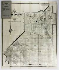
19092864Hanford Ca: Hanford Morning Journal 1909. Good plus. Folding map approximately 25.5 x 22 inches. Original printed card wrappers. A couple internal tears and separations along fold lines repaired with tape on blank verso with resultant minor losses slightly affecting printed areas. Otherwise unrecorded early 20th-century plat map of Kings County California published by the newspaper of its county seat the Hanford Morning Journal. The county south of Fresno and west of Visalia in the Central Valley was formed from Tulare County in 1893 and just over 200 acres were added in its northwestern region from Fresno County perhaps the impetus for the production of the map in the same year. In addition to the plat of the entire county the map shows the cluster of towns in the northern portion of the county the routes of the Southern Pacific and A.T. & S.F. Railroads which crossed in Hanford the outline of the "mostly dry" Tulare Lake bed and other water and geological features. Not in OCLC. Hanford Morning Journal unknown
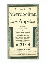
195173812Los Angeles: Mitock & Sons 1951. Postwar block map of Downtown Los Angeles which is framed with detailed lists of night clubs restaurants motion picture studios consular offices hotels beaches and other information for visitors to the City of Angels. The verso features a motor road map of the city and a chronology of important events in the history of Los Angeles County. Printed in dark green on a 22" x 17" sheet of white paper that folds to 4 ¼ x 7 ¼". Some mild toning to the outer panels with just a hint of edgewear; otherwise very good. Scarce OCLC locates no holdings. Mitock & Sons unknown
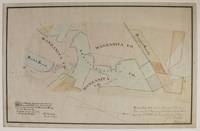
18672904Sweetland Ca 1867. About very good. Hand-colored manuscript map approximately 15 x 21.5 inches. Matted and in corner mounts. Mounted on linen. A few short closed tears and minor chips at edges not entering map area. Horizontal crease across center of map. Light tanning and scattered foxing. A neatly composed and hand-colored manuscript of the Manzanita mine in the Sweetland mining district located in Nevada County California. The settlement of Sweetland was established in 1850 by the Sweetland brothers who operated a trading post there in the early 1850s. The Manzanita mine was one of the largest in the district and the Manzanita Company was listed in the famous 1867 Bean's Directory of Nevada County contemporaneous to the drawing of the present map. It is unclear however whether the company enjoyed much ultimate success. <br /> <br /> Here the claims of the Manzanita Company along with those of the Administration Company and the Rough & Ready and Buck & Breck claims are delineated in black ink and hand shaded in six colors. Claims that were apparently established subsequent to in both pencil and light blue ink and are labeled Tennessee Kentucky Fremont Prospect Riley & Graham and so on. A note at the bottom right corner states that the map composed from a survey completed in November 1867 was "filed Feby 5th 1868 at 3 o'clock P.M. and recorded at the request of H.S. Bradley" the county surveyor. In all a quite attractive and informative manuscript California mining map composed just after the Civil War that evidently does not conform to any printed cartographic examples relating to these claims. unknown
192662437San Francisco & Oakland CA: Published by H.A. Candrian Edward P. Taylor Importer & Dealer in Books and Stationery ca. 1926. Two parts. 1st - One double-sided atlas folio map. 28 x 22 in. featuring Candrian’s wood plank logo displaying Oakland Alameda and Piedmont w/ inset map of San Leandro neatline borders and map of City of Richmond inset on verso fold creases as issued some thumbing edgewear couple closed tears 1 central closed tear at crease fold still G- copy; 2nd - 12mo. 3.4 x 7.4 in. 96 pp. With 12 pp. of maps and Car-o-Gram glyphs graphically representing streetcar lines in the East Bay with sepia-tinted photo illustrations. Green-tinted and printed softcovers rounded corners minor sunning to lower fore-edges still a VG copy. First editions thus of this very scarce pair including the detailed map of Oakland Alameda Berkeley Piedmont San Leandro and Richmond CA detailing the public buildings parks city streets and more specifically the trolley and streetcar lines across and connecting the East Bay along with Candrian’s innovative Car-o-Gram guidebook. The City of Richmond map includes not only the city boundary line but also connecting railroads such as the Santa Fe Railroad as well as electric streetcar lines. This version does not include the American Bank advertisements which appear in other examples as border to the City of Richmond inset map on verso. Candrian 1862-1928 was a Swiss-American entrepreneur who was the first to introduce Car-oGrams which were little glyphs making streetcar lines much more accessible and although not the best representations the glyphs provided vital visual information for travelers and visitors. Worldcat locates 2 copies w/ map CA Hist. Soc. & Huntington; 2 copies of maps only UCLA Berlin Staatsbibliothek; See: ‘Car-o-Grams:’ Candrian’s Early Transit Mapping Innovation Sunnyside History Project Sunnyside CA May 23 2018. Published by H.A. Candrian, Edward P. Taylor, Importer & Dealer in Books and Stationery, paperback
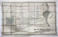
19092201N.p. perhaps Minneapolis 1909. Very good. Lithographed plat map 19.75 x 30 inches. Folded. Minor wear numerous plots rubber-stamped "Sold" and with additional shading of some portions in blue or green pencil and with prices for different groups of lots boldly penciled in ranging from $150 to $200. Stamp of a Minnesota real estate agent at bottom right. An unrecorded real estate plat map of the central valley town of Patterson along the San Joaquin River with the downtown area shown. This particular copy of the map is well used and contains vital information on the development of the town through sold lots and manuscript additions of pricing information for sections of the town. Below the title is the ink stamp of N.J. Blomgren Gen'l Northwestern Agent Patterson Colony Lands Minneapolis Minn. Evidently the aim was to get Minnesotans to trade the frigid winters of the Land of Lakes for the scorching summers of the San Joaquin Valley. "J.E.S. 12/5/1909" is printed in lower right corner. <br /> <br /> The history of Patterson begins with the Ranch Del Pueblo Mexican Land Grant Land to Mariano and Pedro Hernandez in 1844 by Governor M. Micheltorena. In 1866 John D. Patterson bought 13340 acres for $5.400 from J. O. Eldredge who bought the grant from S.G. Reed and R. S. Wade who had the patent encompassing the land grant signed by President Abraham Lincoln. John D. Patterson purchased additional land and upon his death in 1902 a total of 18462 acres were willed to Thomas W. Patterson and William W. Patterson his estate executors and other heirs. The land was sold to the Patterson Ranch Company on May 16 1908 for the sum of $540000 cash gold coin. <br /> <br /> Thomas W. Patterson subdivided the land into ranches of various sizes and plotted the design of the town of Patterson. Determined to make Patterson different from most he modeled his town after the Cities of Washington D.C. and Paris France using a series of circles and radiating streets. Major streets were planted with palms eucalyptus and sycamore trees. The Patterson Colony map was filed with the Stanislaus County Recorders office on December 13 1909. Sales of the ranch properties and city lots commenced. Patterson was the third city in Stanislaus County to incorporate in December 1919. No copies of this map are recorded by OCLC. unknown
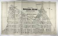
19072083Berkeley: Irwin-Patton Company 1907. Near fine. Lithograph map approximately 15 x 28 inches. Folded. Two contemporary manuscript annotations. Very minor wear at edges and faint toning; one small separation at fold point. Large early 20th-century real estate map showing a proposed subdivision on some thirty blocks in North Berkeley now adjacent to University Village. The map is oriented with due north corresponding roughly to the left edge with San Pablo Avenue at the bottom edge Cedar and Hopkins Streets running vertically at right Santa Fe Avenue running diagonally toward the upper left corner and with a plethora of streets name after the Ivy League: Princeton Harvard Columbia and Yale with Cornell running perpendicular to them. Interestingly while this area was developed roughly as delineated here it is not exact and many of the street names are also different Yale Street is today's Gilman Street for instance. Docketed in ink on the verso "Regents Park #2 & #4". Not in OCLC. Irwin-Patton Company unknown
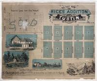
18875454Los Angeles: Los Angeles Lithographic Co 1887. Still very good. Illustrated lithograph map 20 x 24 inches. Trimmed along the left edge and borderline at the right. A few minor tears backed with rice paper. An exceedingly scarce lithograph promotional map for a late-19th-century subdivision in central Orange County California. The "Rice tract" depicted on this land development map was comprised of 194 lots for homes bounded by Prospect Avenue and Vineyard avenues and First Street and Preble Avenue in the town of Tustin east of Santa Ana. Until its proposed development the property was owned by James S. Rice 1846-1903 and his wife Cora who headed one of the pioneering families of Orange County. Rice moved his family there in 1877 and began ranching by working for his brother-in-law James Irvine who purchased the Rancho San Joaquin from José Antonio Andres Sepúlveda in 1864.<br /> <br /> In 1878 Rice purchased a small tract of land in the village of Tustin. He planted Valencia orange trees and Muscat grapes and a few years later he purchased an additional tract of fifty acres and expanded his agricultural operations. In the California real estate boom of 1886–87 he sold off all but twelve acres of his land for development at $4000 per acre allowing him to build a three-story home on his remaining property. His wife was a socialite who hosted numerous performing artists in their Tustin home including Helena Modjeska. The house was demolished in the late 1920s. The vignettes on the map show the future Tustin Hotel a three-story Victorian frame building with forty guest rooms that was built in 1888. Razed in 1914 it was designed by George Preble a Tustin builder who also designed Rice’s home. Scarce one copy is recorded in OCLC at U.C. Irvine which holds the Rice family papers. Los Angeles Lithographic Co unknown
192962441San Leandro CA: San Leandro Chamber of Commerce 1929. One oblong folio map sized 22 x 17 in. backed w/ Railways ledger paper manuscript annotations at fore-edge dating the office copy received Oct. 29 1929 dustsoiling & thumbing some edgewear minor creasing to a few corners still a VG- copy. First edition of this land promotion map touting the quadrupling of post office gross receipts during the Roaring 20’s the population tripling and includes within the map the locations of the Chrysler Motor Co. factory Fageol Motors Co. factory which was a bus builder Caterpillar Tractor Co. and more. Map has been oriented with North in the upper left corner and initials of MFB in lower right corner. Worldcat locates 5 copies UC Santa Barbara U of Chicago Bancroft UCLA Cal. Hist. Soc. San Leandro Chamber of Commerce, unknown
195879287San Bernardino California: San Bernardino County Board of Trade 1958. Large folding map 34" x 21 1/2" printed in black and green with a large county map on one side 12 city plans on the other and tourist information in the margins. A fresh example with only some very light edgewear.<br /> <br /> This pre-210 Freeway map of San Bernardino records the vast expanse of San Bernardino County the largest county in California with more than 12.8 million acres. At this time there was no city of Rancho Cucamonga which wasn’t incorporated until 1977 and is now the fourth largest city in the county by population.<br /> <br /> One side of this map shows points of interest as well as all the major military installations in the county including Norton Air Force Base a United States Air Force facility located two miles east of the city of San Bernardino. It was closed in 1994 and after years of environmental clean-up it is now home to an international airport and global logistics complex employing nearly 18000 people. Also shown is George Air Force Base in Adelanto which closed in 1988 at the end of the Cold War and is now partially home to the High Desert Power Plant.<br /> <br /> A small chart shows the county population was estimated at 46600 with predictions by the planning commission for population growth to 1160000 by 1980. The population in 1980 reached 895000 and is now over 2.2 million.<br /> <br /> OCLC records holdings at Stanford UC Riverside and the University of Kansas. San Bernardino County Board of Trade unknown
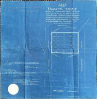
190277119Los Angeles: County of Los Angeles 1902. Blueprint: 18" x 18 1/2". Creases from prior folds with pencil markings along the top edge and a stamp for Olin Wain printing on the verso.<br /> <br /> This tract was part of Wirsching's subdivision named for its owner Robert Ernest Wirsching 1846-1912 a German immigrant who was an early settler of Los Angeles and worked as a wagon builder and blacksmith. He served on the Los Angeles City Council and the Los Angeles County Board of Supervisors.<br /> <br /> The property is adjacent to Downtown Los Angeles near the interchanges of the 10 and 5 freeways. County of Los Angeles unknown
192362444San Diego CA: Rodney Stokes Co. ca. 1923. Oblong elephant folio map sized 34 x 22 in. 96 x 56 cm. in thin translucent paper stock of San Diego w/ 1 inset map of La Jolla street index at left margin fold creases as issued minor age toning couple spots w/ minor soiling edgewear couple minor closed tears still a VG- copy. First edition thus of this larger version of the Rodney Stokes San Diego map which includes references to the Trunk Line streets public parks San Diego Electric Railway Car Lines and also specifically the San Diego Electric Railway Bus Lines which were introduced in 1922 by the system. Rodney Stokes Co. first began issuing San Diego and Vicinity maps in 1906 and this larger version for the 1920’s tends to be scarcer. Worldcat locates 1 copy Milwaukee County Fed. Library. Rodney Stokes Co., unknown
19172886Santa Clara Ca 1917. Still very good. Blueprint map approximately 35 x 31 inches. Folded. Short separations and wear along folds. A few contemporary manuscript annotations. Interesting blue print map of this ranch situated along Llagas Creek in Santa Clara County California delineated with fields for various crops such alfalfa vegetables pasture etc. and with the house barn and corrals as well as some of the irrigiation located. Some portions are indicated as being deeded to apparent family members as "Deeded to Lester" and "Deeded to Martin." Ownership of neighboring properties is also given. There are a number of light pencil notations on the map as well some indicating "Sold" as the ranch was evidently divided up around this time. unknown
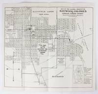
19376108Corning Ca 1937. Very good. Map 13 x 14 inches. Text on verso. Old folds minor wear. Later edition of this promotional map for the Maywood Colony near Corning California. In the 1890s real estaate entrepreneur Warren N. Woodson purchased the land that would become the Maywood Colony which he plotted out and promoted. The present map shows the various land developments and plots surrounding the town of Corning bounded by the Sacramento River on the east. Text on the verso promotes the area as rich in resources and agriculture. unknown
191262442Oakland CA: San Francisco-Oakland Terminal Railways Co. Maintenance of Way & Buildings Dept. April 1 1912. One oblong elephant folio map sized 36.5 x 12 in. w/ woodcut-engraved border with minor creasing & soiling some rubbing and edgewear a few old closed tears neatly repaired on verso still a VG- copy. First edition of this exceptionally scarce map demarcating the extent of the S.F.O.T. Railways Co. upon its formation in 1912 had after the merger of the Key System East Shore & Suburban Railway and the Oakland Traction Co. by the three main competitors to the Southern Pacific commuter ferry market who also established their own ferry system and substantially expanded their new streetcar line suburbs across the East Bay. The map depicts their growth and reach from Hawayrd to Richmond CA with stops in Albany Berkeley Piedmont Oakland Alameda San Leandro and San Lorenzo in between. Also depicted are the railroad lines of the Southern Pacific Santa Fe Western Pacific Oakland & Antioch Railway and Richmond Belt Line Railway. In 1932 the conversion to motorized buses began on August 1 when the East Richmond/23rd Street line was entirely changed over. They were then steadily converted until No. 1933 when the S.F.O.T. Railways streetcars made their last runs. No copies in Worldcat. See: San Francisco-Oakland Terminal Railways: Bond History and Sinking Fund Requirements 1915; Plan of Reorganization 1922. San Francisco-Oakland Terminal Railways Co., Maintenance of Way & Buildings Dept., unknown
19252163Ojai Ca.: Ojai Valley Company 1925. About very good. Lithographic map 28 x 27 inches. Old olds some creasing a few small tears to margins minor separations at crossfolds seven-inch closed tear to upper portion of map two-and-a-half-inch closed tear to lower portion of map upper and lower margins of map trimmed. A rare and striking subdivision map by the Ojai Valley Company founded in 1922 to develop the Arbolada neighborhood of Ojai in Ventura County. The map is annotated in lead or red pencil to denote sold lots and the names of some of the purchasers the size of each lot and other notes. In a few cases the construction of new buildings are noted on certain plots including a Catholic church and a hotel. Some additional roads and lots have been added to the map in pencil. Ojai Valley Company unknown
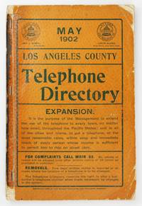
19026344Los Angeles 1902. Good plus. viii152pp. Original printed wrappers stapled. Remnants of paper spine covering. Light wear to wraps heavier at corners spine perishing but text block solid. Light dust soiling and scattered creasing internally. Scarce early 20th-century edition of the telephone directory for Los Angeles County issued by the Pacific States and Sunset Telephone & Telegraph Companies in May 1902. At this time the companies which grew out of the Los Angeles Telephone Company founded in 1881 provided manual operator service to approximately 10000 phones. This number of phones was only slightly less than the total population of Los Angeles in 1880 11000 people thereby mirroring the dramatic growth of the city during that period. Despite this increase service beyond the city limits was still very spotty as evidenced by the entries for other town in the county. With an extensive classified business directory at the rear and several local advertisements scattered throughout. OCLC notes a small handful of institutions with examples of other issues of this directory but seemingly none of the May 1902 version. unknown
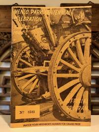
19485013Menlo Park: Menlo Park Chamber of Commerce 1948. First Edition. Self Wraps Printed Saddle-Stapled. Very Good. 8vo. Pp. 52. Includes welcoming notes from Charles P. Burgess Mayor of the City of Menlo Park and Daniel Hayes President of the Menlo Park Chamber of Commerce. With programs for various days of the celebration. Includes photos of personalities appearing during programs including Peggy Lee. Laden with ads for local businesses. Bound in stiff textured wrappers photo-illustrated. Spine has a split between staples else Fine. The program evokes the promise of the California dream following the Depression and WWII. Ads for the Longbarn all-new Austin Motor Cars at the Egan Car Co. Dinah's Shack Derry's Feed and Fuel and John S. Wickett "the Atherton Realtor" among others evoke the impending affluence of the region. A prominent full-page ad for the Oakville Terrace subdivision "homes now being built or choose your own lot" is described as "highly restricted" presumably a reference to redlining designed to keep the new neighborhood exclusively white. Now housed in an archival sleeve with acid-free backing. Menlo Park Chamber of Commerce unknown
194363912San Francisco CA: Monaco Theatre Restaurant 560 Pacific Ave. 1943. 8vo. 8 pp unpaginated. colour printed bi-fold which opens up into panoramic interior scene menu minor edgewear center creasing from folding slight scuffing still VG copy. First edition thus of this souvenir menu touting the Monaco Theatre Restaurant which anchored one end of Gavallo’s International Settlement Latin Quarter following the clean-up of the notorious Barbary Coast during the 1939-1940 Golden Gate International Exposition. The Monte Carlo-themed nightclub was authentically appointed filled with musicians singers and dancers in Spanish-revival costume and was instant hit serving De Luxe dinners for $2.50 initially $ 1.00 and featured Mixed Green Salad Minestrone Soup Raviolis or Spaghetti as well as Fresh Crab Bordelaise or Roast Duck. California Sparkling Wines including the Ambassador Red or Aristocrat White were very popular. The International Settlement thrived during the World’s Fair but really boomed after the U.S. entered World War II and armed forces swamped the city ironically returning Pacific Avenue back to its red-light roots with many of the Monaco’s neighbors offering burlesque shows honky-tonk and a smattering of prostitution. Worldcat locates 1 similar copy Bancroft; See: Woody LaBounty International Settlement Jackson Square Teh Exotic Restaurant Row San Francisco Story March 19 2025. Monaco Theatre Restaurant, 560 Pacific Ave., unknown