5 209 résultats
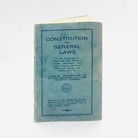
19395123Ottawa Ontario Canada: Canadian Brotherhood of Railway Employees and Other Transport Workers 1939. First Edition First Printing. Stapled Wraps. pp. 78. 12mo. measuring 4" x 6". Twice-stapled teal self-wrappers. Comprises of a detailed listing of the rules and regulations governing the organization the Canadian Brotherhood of Railway Employees and Other Transport Workers established to "promote the general welfare of railway and other transport employees and to advance their financial social moral and intellectual interests". Includes details of elections duties of officers nature of various reports etc. Faint tide-marks to the margins of the prefatory leaves entirely unaffecting text otherwise contents without blemish good. Unrecorded in OCLC. Not found in Peel LAC/BAC University of Toronto et. al. <br/><br/> [Canadian Brotherhood of Railway Employees and Other Transport Workers] paperback
19582382Montreal Quebec Canada: Canadian National Railways Grand Trunk Western Railroad Company; Duluth Winnipeg and Pacific Railway Company Central Vermont Railway Inc. 1958. First Edition First Printing. Hardcover. Unpaginated. pp. 102. 12mo. measuring 5" x 8". Stiff stapled card covers held with utilitarian cloth back-strip. Preparatory examination booklet issued to prospective Locomotive Engineers and their counterparts Firemen for the relevant locomotive exams. Comprises of three sections namely Mechanical Examination for Engine Crews: First Year Second Year and Third Year. Each section is therein comprised of progressively more difficult questions relating to all manner of mechanical regulatory and practical aspects of operating locomotive engines. Light rubbing to the extremities light intermittent foxing throughout unaffecting the legibility of the text. Overall good. Rare in commerce our offering being the only extant copy available at time of cataloguing. Unrecorded in OCLC with no institutional; Not in Peel BAC/LAC et al. Rare. <br/><br/> Canadian National Railways Grand Trunk Western Railroad Company; Duluth, Winnipeg and Pacific Railway Company, Central Vermont R hardcover
dola2502Montreal: 1928. Edwards & Lort 710 incorrectly calling for 12 colour reproductions of paintings. oblong folio. pp. 28. 11 colour illus. after paintings by H.R.Perrigard J.E.H.Macdonald C.Rungius et al. & numerous b/w illus. after photographs. self-wrs. centre crease from folding in half slight chipping to edges of last leaf. dola2502 [Montreal]: 1928 unknown
dola2503Montreal: 1930. First Edition. Edwards & Lort 712. 4to. pp. 24. 5 colour illus. after paintings by A.C.Leighton D.Maxwell A.Sheriff Scott et al. & numerous b/willus. after photographs. large folding coloured map. pictorial wrs. short split in lower spine. dola2503 [Montreal]: 1930 unknown
193627989Canada: Canadian Pacific 1936. A color map showing the world wide service of Canadian Pacific railway and steamship lines. <br /> <br /> 21 3/4 x 9 1/4" folds to 4 1/4 x 9 1/2" tan card covers black text. Cover slt. dusty otherwise fine condition. Canadian Pacific unknown
191260346London: Sir Joseph Causton & Sons Ltd. 1912. 4to. 10 x 12 in. 118 xli 1 pp. Colour-tinted frontisp. illust. border on title text border illustrations photo illustrations throughout elaborate illustrated advertising section at rear for “Celebrated Firms and Leading Companies†contracted with and using the CPR. Pebbled padded red cloth publisher’s binding gilt lettering embossed on front cover t.e.g. minor edgewear rubbing dustsoiling still VG bright copy w/ presentation printed slip on title w/ the Compliments of The Dominion Express Co. First edition of this lavishly illustrated travelogue on the Canadian Pacific Railway trains and steamships in the Edwardian era. He touts the advantages of traveling on their transatlantic ocean liners Empress of Britain and Empress of Ireland by rail across the prairies through the Rockies to Banff and onto British Columbia. Homer details sailing on the SS Princess Victoria to Vancouver Island staying at the newly built Empress Hotel and then onto Japan & China onboard the Empress of Japan. Sir Joseph Causton & Sons, Ltd., hardcover
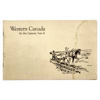
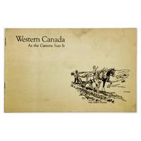
19276495Winnipeg Manitoba Canada: Canadian Pacific Railway Company Department of Colonization and Development N.D. Circa 1927-1928. First Edition First Printing. Card Covers. Unpaginated pp. 24. Oblong 12mo. measuring 14 x 22 cm. Illustrated twice-stapled covers. Published by the Canadian Pacific Railway Co. Department of Colonization as part of their efforts to recruit farmers and settlers in Western Canada in the early part of the 20th century. Comprises of twenty-one sepia-tone captioned photographs each capturing in remarkable detail various agricultural scenes throughout the Canadian Prairies. Faint tide-mark to the right margin of the front cover throughout to some of the preliminary leaves entirely affecting the legibility of the text or of the photographs. Corresponds to Peel 2198 which states a possible publication date of 1895 though this is likely too early. See also OCLC #464429637. Rare in commerce. <br/><br/>"These scenes are actual photographs and tell more emphatically than any words the story of successful agricultural production in Western Canada. They argue convincingly that you too can find prosperity and happiness on these low-priced fertile lands." Canadian Pacific Railway Company, Department of Colonization and Development unknown
19276574Winnipeg Manitoba Canada: Canadian Pacific Railway Company Department of Colonization and Development N.D. Circa 1927-1928. First Edition First Printing. Card Covers. Unpaginated pp. 24. Oblong 12mo. measuring 14 x 22 cm. Illustrated twice-stapled covers. Published by the Canadian Pacific Railway Co. Department of Colonization as part of their efforts to recruit farmers and settlers in Western Canada in the early part of the 20th century. Comprises of twenty-one sepia-tone captioned photographs each capturing in remarkable detail various agricultural scenes throughout the Canadian Prairies. One barely perceptible short closed tear to the front cover else near fine; contents uniformly without blemish with bright clean and unmarked leaves. Overall near fine. Corresponds to Peel 2198 which states a possible publication date of 1895 though this is likely too early. See also OCLC #464429637. Rare in commerce. <br/><br/>"These scenes are actual photographs and tell more emphatically than any words the story of successful agricultural production in Western Canada. They argue convincingly that you too can find prosperity and happiness on these low-priced fertile lands." Canadian Pacific Railway Company, Department of Colonization and Development unknown
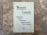
19030103564N.P. Winnipeg: Canadian Pacific Railway Company 1903. Stapled Wraps. pp. 80. 8vo. Black and white maps and photographs. Fold-out map to inside rear cover showing system of land survey and lines of the Canadian Pacific Railway Company. Age-toning and foxing to covers rear cover detached chips and tears to edges minor tear to fold-out map; good. [Canadian Pacific Railway Company] unknown
189431668San Francisco 1894. Original staples and printed wrappers with wrapper title as issued. 12pp lightly toned Very Good.<br /> <br /> The Mass Meeting attacked the "Railroad Octopus" which assails the people "by unjust accumulations and intelligent and determined concentration of power for bad ends . . . Its cupidity its selfishness its trickery the debasing pressure exerted upon every form of industry and the unprincipled use of money and of purchased intellect by a powerful railroad monopoly has checked our progress and reduced us to virtual slavery for twenty-five years." <br /> OCLC lists twelve copies under two accession numbers as of October 2024. Not located in Rocq Cowan or BRE. unknown
1889354257San Francisco: H.S. Crocker & Co 1889. 70pp. Original printed wrappers. Spine chipped. Small old stamp on titlepage. Very good. 70pp. Introductory material by Leland Stanford. A positive report on the Central Pacific's dealings with the government. <br/><br/> H.S. Crocker & Co unknown
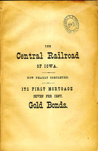
187035116New York: Brown & Hewitt Printers November 15 1870. 1870. 9" x 6" printed wrappers 32 pp. frontispiece is a double page map with color outlining tables. The wrappers are printed on each panel. The Central Railroad of Iowa is laying tracks in connection with the Milwaukee & St. Pal and the North Missouri Railroads forming a direct line from St. Paul and St. Louis. As of November 1 1870 the route is nearly complete. The route is 233 miles and to date 150 miles of track are laid operational from the Minnesota state line "and several gangs of track-layers are making rapid progress with the balance of the work. It is expected that the Road will be completed into Albia . within 22 miles of its connection with the North Missouri Road . in a few days." Orders for available bonds will be delivered free of charge. Good description of the country products projected business of the rail line etc. Light vertical crease creasing to bottom corners as well as a small blue stamp to front cover and with minor chipping to spine. Brown & Hewitt Printers, November 15, 1870. unknown
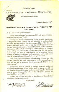
190741607N.P.: Privately printed 1907. 1907. Circular No. 153-07. "Honoring Certain Commutation Tickets for Children." 8 1/2" x 5 1/2" sheet. A document distributed to conductors and agents informing them that commutation tickets reading for the use of one individual or member of his household will now be honored for the passage of two of his children between the ages of 5 and 12 years old. Light soiling staple punch to top corner along with light wear to the extremities. Very good. Privately printed, 1907. unknown
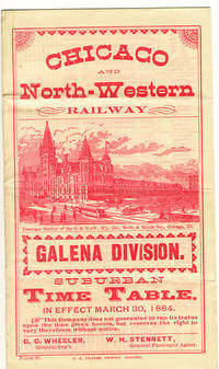
188437720Chicago: C.N. Trivess Printer 1884. 1884. Form 95. 6" x 10" sheet folded to 6 panels. Printed in pink. 3 panels of time tables to and from Chicago an between Chicago and nearby towns. 2 panels of general information and pictorial cover panel with illustration entitled "Passenger Station of the C. & N.-W. R'y Cor. Wells & Kinzie Sts. Chicago Ill." Three light horizontal creases and lightly soiled. Very good. C.N. Trivess, Printer, 1884. unknown
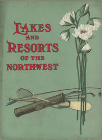
190648393Chicago: Privately printed 1906. 1906. 9" x 8" colorful pictorial wrappers. 61 pp. illustrations maps. "The purpose of this booklet is to describe the various groups of outing places their location their chief points of attraction their hotel facilities and the train service by which they are reached." The first 30-32 pp. offers an overview of the area serviced by the Chicago and North Western Line as well as numerous black and white photographs of the area. These pages are followed by charts listing hotels and boarding houses at the various summer resorts and fishing and hunting grounds reached by the Chicago and North Western Line together with rates capacity distance from train station proprietors etc. Includes resorts mostly in Wisconsin but also resorts in Illinois Minnesota South Dakota Iowa and Michigan. 3 fold-out maps printed in black and green. The first map measuring 25" x 20" is entitled "Lake Region of Northern Illinois and Southern Wisconsin." The second map measuring 25" x 18" is entitled "Hunting and Fishing Resorts of Northwestern Wisconsin Reached by the Chicago and Northwestern Railway." The final map measuring 19" x 16 1/2" is entitled "Hunting and Fishing Resorts of Northern Michigan Reached by the Chicago & Northwestern Railway." All maps are in fine condition with the exception of the first map that has a 1" closed tear to bottom edge at fold. Rubbing and wear to spine along with 1 1/2" split to bottom of spine and light wear to the extremities. Privately printed, 1906. unknown
193946531Chicago: John C. Pollock Department of Tours 1939. 1939. 9 7/8" x 7" in bright colorful pictorial wrappers depicting a man and woman riding on a train and looking at the beautiful mountain view through a large window. 65 pp. index illustrations many in color maps schedules itineraries. Booklet filled with information about pictures of and Itineraries for 15 different tours lasting from 8 - 20 days and costing from $82.02 to $363.47. Most of the tours include Yellowstone National Park and go on to offer extending tours to Salt Lake City The Royal Gorge Colorado Springs Denver Zion Bryce Canyon Grand Canyon Cedar Breaks Estes Park. Offers a 14-day tour to California Old Mexico and Yosemite and the Golden Gate International Exposition as well as a 13-day tour that visits the Pacific Northwest Mt. Rainier the Canadian Rockies Banff and Lake Louise. Descriptions of and information about Yellowstone National Park Salt Lake City Zion Bryce & Grand Canyon National Parks. Map of Yellowstone National Park with route of railroad and route of auto trips marked; Map of Southern Utah Parks with bus tour and bus side-trips marked along with a small table of distances; Map showing the routes of all tours of the National Parks. General information offered including information on hotels and lodges in the parks baggage what to wear church services information for the woman who travels alone touts the comfort convenience and pleasure of each and every tour etc. Numerous photographs throughout probably about half of all photographs are in color. Pictures include interior of train Old Faithful the Tetons Tower Canyon various wildlife important buildings Royal Gorge Bear Creek Canyon individuals participating in various activities Horseshoe Park Garden of the Gods Columbia River Lake Louise San Francisco Mariposa Grove Grand Canyon Bryce Canyon etc. Light soiling light rubbing to spine and light wear to the extremities as well as creasing to corners. Very good. A nicely produced booklet. John C. Pollock, Department of Tours, 1939. unknown
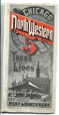
188841991Chicago: Rand McNally & Co. 1888. 1888. TIME TABLES & MAP. 16" x 46 1/2" sheet folded to 50 panels. Printed in red and black. Map. 23 panels of time tables; 1 panel showing tariff of charges for Pullman sleeping accommodations . Between Chicago and San Francisco cost $17.00; Between Chicago ad Madison cost $1.50; 1 cover panel; 1 panel showing an illustration of the North-Western dining car . "Only 75 cents for a splendid meal in these cars." Time tables offered for Council Bluffs and Omaha Line; Sioux city & Southern Dakota Line; Chicago Council Bluffs & California Line; Council Bluffs Omaha & Denver Line; Chicago St. Paul & Minneapolis Line; Minnesota and Central Dakota Line; Huron Pierre & Deadwood Lines; Janesville Watertown and Fond Du Lac Line; Rockford Freeport and Dubuque Line; St. Paul Minneapolis & Manitoba Northern Pacific and St. Paul & Duluth Railways; Milwaukee Green Bay & Marquette Line; Minnesota and Central Dakota Line; Clinton & Anamosa Line; Chicago & North-Western and Milwaukee Lake Shore & Western Railways; Kenosha and Rockford Line; Dayton & Lake city Line; Eagle Grove & Sioux Rapids Line; etc. Opposite panels offers a 24 panel color system map entitled "Geographically Correct Map of the Chicago & North-Western R'y and Its Principal Connections. Correct to September 1st 1881. It Will Be Noticed hat This Is The Leading Railway Of The West And Northwest." A statement at the bottom corner of the map touting that the Chicago & North-Western Railway is one of the largest railway corporations in the world. It controls and operates nearly 3000 miles of road forming the following lines: Chicago Council Bluffs Denver & California Line; Sioux City & Southern Dakota Line; Chicago & Des Moines Line; Chicago Freeport & Dubuque Line; Chicago St. Paul & Minneapolis Line; Chicago La Crosse & Winona Line; Chicago Minnesota & Central Dakota Line; Chicago Pierre & deadwood Line; Chicago Milwaukee & Marquette Line; and Chicago Green Bay & Lake Superior Line. Map shows all states from the west coast to the east coast and to the south showing upper 2/3ds of California and all of Nevada Utah Colorado Kansas Missouri Kentucky and Virginia. 1/2" split to edge at fold along with a couple tiny holes at folds. Very good plus. Rand, McNally & Co., 1888. unknown
34362Chicago: Chicago Milwaukee & St. Paul Railway n.d. Soft cover. Very good. Oblong string tied soft cover. Approx. 12" x 9". 22 tipped in color pictorial views of the Railway route with 3 pages of text and a map on the last page. Brown paper covers with title illustrations and color pasted down lithograph on the front. No date provided. Chicago Milwaukee & St. Paul Railway unknown
193358148Chicago: Chicago Burlington & Quincy Railroad Printed by Poole Bros. Inc. 1933. Tall 8vo. 4 x 9 in. which folds out into 8 x 9 in. 4to. 20 pp unpaginated illustrated & printed in red & black throughout numerous photo illustrations text illustrations 1 double-page maps 1 double-page. Colour-illustrated softcovers cover art on front of the Hall of Sciences back cover w/ pictorial map of Burlington Routes slight shelfwear NF copy. First edition of this very scarce promotional brochure advertising the low round trip rates being offered by the Burlington Route for tourists to the 1933 Chicago World’s Fair. Detailed descriptions are included of the Exposition exhibits a birds-eye view of the Century of Progress grounds amenities in Chicago and the Travel & Transport Building which held a special Burlington Route exhibit. Kaufmann & Fabry was an active commercial photographic firm specializing in architectural photography in Chicago from before 1910 and are still in existence. No copies located in Worldcat. Chicago, Burlington & Quincy Railroad, [Printed by Poole Bros., Inc.,] paperback
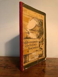
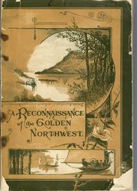
18838920Buffalo NY: Matthews Northrup & Co 1883. First edition. Softcover. Very Good. Art by John Fleming. 6.75" x 10". Pp. 104. Color pictorial wraps. Illustrated. Very Good taped reinforced spine with red cloth tape backing chips to corners tape shadows on margins of early margins. Details a journey through "Wisconsin Iowa Minnesota the Territory of Dakota and the garden portion of the Prairie State whose other name is Illinois. Matthews, Northrup & Co unknown
189837912Chicago: Poole Bros. 1898. 1898. COLORADO. 8 1/2" x 6 1/2" in color pictorial wrappers. 44 pp. illustrations. Information on Manitou Colorado Springs Pikes Peak the Manitou and Pike's Peak Railway side trip to the Grand Canon of the Arkansas various parks the Rocky Mountain Limited etc. Double-page drawing of "The Rocky Mountain Limited" above the floor plan of the train above a line map of the route from Chicago to Denver. Numerous illustrations of scenes along the Great Rock Island Route. Wear and rubbing to corners and spine. A nicely produced booklet. Poole Bros., 1898. unknown
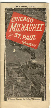
188137704Chicago: Camerion Amberg & Co. Printers and Engravers 1881. 1881. 16" x 37" sheet folded to 40 panels each 8 1/8" x 3 5/8" with attractive wrapper art of Kilbourn City and the Dells of Wisconsin. 20-panel detailed map of much of the United States their lines and connections in red from Chicago Green Bay Duluth to Kansas City Deadwood City Bismarck and up into Manitoba. Backed with 20 panels of time tables and information on connections and list of advantages of riding the Chicago Milwaukee and St. Paul Railway. Lightly worn at the extremities. Very good. Camerion, Amberg & Co., Printers and Engravers, 1881. unknown
18851099Chicago: Geo. F. Cram 1885. Good plus. Large folding pamphlet approximately 20 x 41.5 inches. A few small chips and short closed tears at edges; several short separations and very minor losses along folds. Contemporary agent's ink stamp on cover panel. Tape repair across portion of horizontal fold; one panel with patches of light staining. A scarce colorful promotional for the Rock Island Route as well as its national and international connections with a fascinating stamp of an Australian sales agent. One side of the sheet prints an extensive promotional text and timetables for the various routes and services of the Chicago Rock Island & Pacific Railway. The main side of the sheet prints a map of the United States with state borders shaded in four colors highlighting the principal routes of the Rock Island from Chicago to Minnesota Iowa and Kansas and its connections to points on both the East and West Coasts. An inset map at lower right promotes the Rock Island as part of a transcontinental route between the United Kingdom Ireland and Australia. Most interestingly this copy is stamped on the cover panel with the information of a George. H. Hibbard "Australian Passenger Agent America's Cons'd Trans-continental Railways 6 Bridge Street Sydney N.S.W." Hibbard was evidently the agent in charge of distributing information about the trans-America route in Sydney one of its end points.<br /> <br /> Several issues of this map were published during the 1880s all scarce. We locate copies of the present 1885 issue at Stanford SMU and the Library of Congress. Geo. F. Cram unknown
188328496Buffalo NY: Matthews Northrup & Co. 1883. 104pp frontispiece illustration many illustrations. Original color printed wrappers detached rubbed and chipped four staples. Light wear Good. <br /> <br /> "The time occupied in making the reconnaissance upon which this report is predicated was about three months during which time about 4000 miles of railway were traversed. These lines reach out into the best sections of the great States of Wisconsin Iowa Minnesota the Territory of Dakota and the garden portion of the Prairie State whose other name is Illinois. Matthews, Northrup & Co. unknown
186439928Chicago: Dunlop Sewell & Spalding 1864. Original printed wrappers bit of spine wear. 38 2 blanks pp two folding tables. Stitched light old folds. Very Good.<br /> <br /> The Report describes all information on this busy Railroad. Much financial information and data on travel the stock and the growing success of the Company is provided. A comprehensive report. <br /> FIRST EDITION. Ante-Fire Imprints 790. Dunlop, Sewell & Spalding unknown