5 209 résultats
185754076Chicago: Illinois Central Rail Road Office 1857. 8vo. 80 pp. plus 4 pp. of Illinois Central RR promotional ads printed on lavender-coloured paper promoting passage to St. Louis Kansas Nebraska the Michigan central Railway Line the Niagara Falls suspension bridge and St. Paul Minnesota via steamer and railroad line. With frontisp. maps 1 double-page of Illinois RR lands a bucolic farm scene in Illinois text woodcut engravings tables. Light tan printed & illustrated softcovers cover art of “typical†Illinois farm minor chipping head & foot of spine minor wear & bumping to corners faint soiling ex-library stamp on verso of title still G copy. First edition of this illustrated land promotion for Illinois extolling the advantages for prospective homesteaders and settlers for settling in Illinois rather than further west. The promotional work extolls the quality of the soil the advantages for buying land with direct access to the newly built railroads with pricing information on fuel fencing and other products. Selling the lands granted to them became a preoccupation of railroad companies as they pushed West with mixed strategies. Some the Illinois Central mortgaged to provide capital construction revenues while other lands were sold stipulating that the homesteaders or settlers needed to cultivate and occupy the land before sale in order to delay the amount of taxes owed by the Railroad. There were two different issues of this 1857 land promotion with one printed in Boston and the other scarcer version in Chicago. Ante-Fire Imprints 263; See: John Hall Patrimonialism in America: The Public Domain in the Making of Modernity In: Charrad & Adams Patrimonial Capitalism and Empire 2015 pp. 29-39. Illinois Central Rail Road Office, paperback
185638108New York: John W. Amerman Printer 1856. 1856. 9" x 5-1/2" tan printed wrappers. 64pp. Two black and white frontispiece maps. The first map is 9" x 5-1/2" and is entitled "OUTLINE MAP OF ILLINOIS." The second map covers 2 pages 10-1/2" x 6-3/4" and is entitled "RAILWAY GUIDE TO THE ILLINOIS CENTRAL RAIL ROAD LANDS." Everything you would want to know about settling down in Illinois is in this booklet to include railroad routes value of land for farming value of crops towns and villages. The Company owns valuable tracts of iron and lead ores also coal beds of immense richness. "Illinois Is now in the start of its great advance towards becoming the first producing State in the Union. Having Lake Michigan on one side furnishing a constant outlet for its produce the Mississippi to the west with its tributaries the Illinois and Rock Rivers both navigable streams running far into its interior the Wabash on its eastern borders and Ohio on the south the natural facilities would seem unequaled in the world." Several letters from successful farmers telling of the advantages and prospects of Illinois. Other subjects discussed are the climate soil health coal Illinois Central Railroad Lands the cost of opening a farm the population agriculture statistics of towns et. al. Light wear to the extremities along with chipping to spine lower fore-corner of front wrapper creased wrappers discolored else a good copy. John W. Amerman, Printer, 1856. unknown
185738092Boston: Geo. C. Rand & Avery Printers No. 3 Cornhill 1857. 1857. ILLINOIS. 9" x 5-1/2" pictorial wrapper. 84pp. including wrappers. Two black and white maps. The first map is 9" x 5-1/2" and is entitled "OUTLINE MAP OF ILLINOIS." The second map covers 2 pages 10-1/2" x 6-3/4" and is entitled "RAILWAY GUIDE TO THE ILLINOIS CENTRAL RAIL ROAD LANDS." Everything you would want to know about settling down in Illinois is in this booklet to include railroad routes value of land for farming value of crops towns and villages mechanical labor will continue to be in constant demand. The Company owns valuable tracts of iron and lead ores also coal beds of immense richness. "Illinois Is now in the start of its great advance towards becoming the first producing State in the Union. Having Lake Michigan on one side furnishing a constant outlet for its produce the Mississippi to the west with its tributaries the Illinois and Rock Rivers both navigable streams running far into its interior the Wabash on its eastern borders and Ohio on the south the natural facilities would seem unequaled in the world." Several letters from successful farmers telling of the advantages and prospects of Illinois. Other subjects discussed are the climate soil health coal Illinois Central Railroad Lands the cost of opening a farm the population agriculture statistics of towns et. al. The cove and first 2 pages are detached from spine overall chipping else a booklet full of information. Good copy. Geo. C. Rand & Avery Printers No. 3 Cornhill, 1857. unknown
185638884New York: John W. Amerman Printer 1856. 1856. 9" x 5-1/2" yellow printed wrappers. 64pp. Two black and white frontispiece maps. The first map is 9" x 5-1/2" and is entitled "OUTLINE MAP OF ILLINOIS." The second map covers 2 pages 10-1/2" x 6-3/4" and is entitled "RAILWAY GUIDE TO THE ILLINOIS CENTRAL RAIL ROAD LANDS." Everything you would want to know about settling down in Illinois is in this booklet to include railroad routes value of land for farming value of crops towns and villages. The Company owns valuable tracts of iron and lead ores also coal beds of immense richness. "Illinois Is now in the start of its great advance towards becoming the first producing State in the Union. Having Lake Michigan on one side furnishing a constant outlet for its produce the Mississippi to the west with its tributaries the Illinois and Rock Rivers both navigable streams running far into its interior the Wabash on its eastern borders and Ohio on the south the natural facilities would seem unequaled in the world." Several letters from successful farmers telling of the advantages and prospects of Illinois. Other subjects discussed are the climate soil health coal Illinois Central Railroad Lands the cost of opening a farm the population agriculture statistics of towns et. al. Ex-library copy. Wrappers lightly soiled and with light chipping to edges of front panel and with a 1" chip missing to bottom corner of rear wrapper along with chipping at tops and bottoms of spine. John W. Amerman, Printer, 1856. unknown
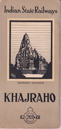
1930221365Indian State Publicity Railways. No date. Ca.1930s. Travel ephemera folding once into black and white pictorial cover 24.5 x 11.5cm sepia and white photographic illustrations brown and white pictorial/pictographic map 12pp. Light wear card covers. Very good copy. Includes tourist map of India with pictographs of tombs and other noteworthy monuments and buildings. . Indian State Publicity Railways. unknown
1917103622Quebec: Printed by the Kentville Publishing Co. Ltd for the Dominion Atlantic Railw nd c1917. Softcover. good to very good. Later issue. 310pp. 6pp. indexpp. Octavo in original three toned grey wrappers with illustrations in text from photos folding map pasted to inside rear cover showing railways in the Maritimes and eastern Quebec. good to very good An early travel guide with lovely illustrations to seaside vacation spots in Eastern Canada. 1917 Printed by the Kentville Publishing Co. Ltd for the Dominion Atlantic Railw paperback
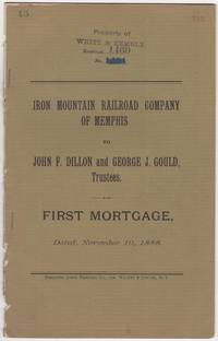
188846016N.Y.: Burgoyne Quick Printing Co. 1888. First edition. Stapled paper wrappers. Removed from a larger volume rear wrapper lacking minor soiling and browning ownership stamps and page renumbering in red. 17 pp. Sm. 4to. The Iron Mountain Railroad Company of Memphis was part of Jay Gould's extensive network of Railroads later taken over by his son named in this document George Jay Gould 1864-1923 Stamped on front wrapper & first leaf: Property of White & Kemble who'd published "Atlas and Digest of Railroad Mortgages" at the turn of the 20th century. We could locate no copies of this document in OCLC nor in other online sources. Burgoyne Quick Printing Co. unknown
3999S.l.:: The Railroad: Printed by F. P. Hoeck in Mexico City. Six halftones; the letterpress includes a time table and a description of a journey through the fruit lands. Single sheet printed in green on both sides 7 5/8 21 inches accordion folded into six panels 7 5/8 3 1/2 inches. No other copy located. Dating of this brochure. The railroad operated from 1898 until 1945; it was nationalized by the Mexican Government in 1925. The owner of record was Louis T. Haggin the son of American mogul James Ben Ali Haggin who was a great friend and business associate of the railroad’s General Manager the colorful Gen. John Baptist Frisbie. Frisbie died in 1909; the General Manager listed on this pamphlet is his son Luis Platon Frisbie. However William K. Boone’s Wikipedia entry states that he was the General Manager from 1909 to 1926 “except for a few times during the Mexican Revolution 1910–1920 when he had to seek refuge in the American Embassy at Mexico City and move temporarily to the US fearing that his life was at stakeâ€. The latest citation to the printer F.P. Hoeck that we could find was 1907. H. T. Greene the Traffic Manager was active in the late 1800s and as that as the early 1900s. S.l.:: [The Railroad: Printed by F. P. Hoeck in Mexico City],. unknown
188734305New York: Press of Fleming Brewster & Alley 1887. First Edition. Wraps. Fair. String bound wraps with illustration on the front. 8 pages. Illustrated views of Kennesaw Mountain and Confederate troops digging in defensive positions on Kennesaw Mountain. The red string on the front cover is torn and the front cover is mostly detached. Covers have light to moderate soil. Light edge stains to the interior. Poem written in facsimile hand. A fair to good copy. Published the Western & Atlantic Railroad. Press of Fleming Brewster & Alley unknown
2080202105000197Kyushu Railway Company N.A. Soft Cover. Fine. Number of pages: 239p Size: 29cm Kyushu Railway Company paperback
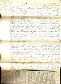
188136473N.P.: Privately printed 1881. 1881. 13-3/4" x 8-1/2." 6 pp. Legible handwritten document in ink incorporating the Lake Superior & Dakota Railway Company dated 8 August 1881. Document states that Springer Harbaugh Cushman K. Davis Jacob H. Stewart and Charles W. McIntyre residents of St. Paul Minn. and Robert Fairweather William Anglim and Frank Ives residents of Crookston in the county of Polk State of Minnesota and Michael Graver and Charles Lockhart both residents of the city of Pittsburg county of Allegheny State of Pennsylvania hereby "associate themselves for the purpose of forming a corporation under and in pursuance of the statutes of the State of Minnesota and declare First - that the name of the corporation shall be The Lake Superior & Dakota Railway company and its general purpose and the nature of its business shall be to construct in a direct line as near as may be consistent with engineering difficulties and operate a railroad from a point at or in the town of Duluth Minn. with a branch line to the boundary line between the States of Wisconsin and Minnesota to a point on the Red river of the North in Minnesota north of the eleventh standard parallel; and also to erect and operate a line or lines of telegraph between said terminal points in connection with such railroads as it may construct." Although the document is very legible newspaper article transcribes the documents though not word for word. A notary seal is on the last page with the following stated: "State of Minnesota Department of State I hereby certify that the within Instrument was filed for record in this office on the 8th day of August A.D. 1881 at 2:10 o'clock P.M. and was duly recorded in Books F of Incorporations on pages 314315316& 317. Signed by Fred von Baumbach Secretary of State." Privately printed, 1881. unknown
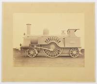
130267Very Good. Two albumen paper photographs each 280 × 372 mm on the original card mounts each approximately 405 × 485 mm. Mounts uniformly tanned and lightly marked; trifling surface loss to silverfish to one plate confined mainly to the blank upper portion where it is inconspicuous; tiny blemishes near the top corners of the second plate; overall in excellent condition. The first image shows 665 'Lord of the Isles' a Problem class or Lady of the Lake class passenger locomotive. Clearly visible on the wheel arch is its build date 'Jany 1863'. The second image shows 2146 a DX Goods class locomotive. Both locomotives are shown in 'photographic grey' livery without tender and it is likely that these are official photographs for London and North Western Railway or the Crewe Works. <p>Both models were designed by John Ramsbottom and entered service in the late 1850s. However these examples are fitted with cabs suggesting that the photographs were taken after the appointment of his successor Francis Webb in 1871. Provenance: 'Mile End Railway Museum South Australia Inc.' inkstamp on the verso of one mount with 'Ex A.E. Cottrell 1/84' in ballpoint pen below the stamp. The contents of the museum were recently dispersed. 2 items. unknown
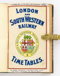
1907130806London: London and South Western Railway 1907. First Edition. Paperback. Very Good. London London and South Western Railway 1907 and 1908. Quarto three volumes bound as one 4 A-S 5-172 pages with 2 large double-sided folding maps; 4 A-K 3-192 pages with 2 large double-sided folding maps plus a leaf of advertisements for White Star Line steamers; and 4 A-C Ca-Cb D-G 3-192 pages with 2 large double-sided folding maps. The original full-colour wrappers and three-colour maps are included in the pagination. Early half leather and marbled papered boards later rebacked with cloth retaining most of the original backstrip; new endpapers; leather corners and original backstrip a little worn; acidic paper a little tanned and brittle with insignificant short tears to some edges; text at the foot of the wrappers slightly shaved when rebound; rear wrapper of the third time table a little soiled with an old tape repair; overall in excellent condition. The foot of the retained backstrip is stamped in gilt 'Supt. Superintendent of Line'; this might explain why these three handsome Edwardian time tables from the heyday of the London and South Western Railway are in such wonderful shape. London and South Western Railway paperback
1981197204Los Angeles California n.p. 1981. 1981. Folding 6 panel brochure 8" x 22". 11 tinted color photographs; map by D.W. Pontius; blue background on front panel. Very good. Scarce. Includes advertisements for Mt. Lowe Orange Empire Trolley trip to Redlands Balloon trip Old Mission Trip. No Binding. Very Good. Los Angeles, California [n.p.] 1981. unknown
188334373Louisville: Courier-Journal Job Print December 15 1883. 1883. 18" x 32" sheet that opens to a map of most of the country beige outlining inset maps and descriptions of Cincinnati St. Louis Louisville Evansville Nashville Memphis Mobile & New Orleans folded and backed with 16 panels of time tables and cover panels. Lightly worn else very good. Courier-Journal Job Print, December 15, 1883. unknown
193238836Chicago: Poole Bros. Inc. 1932. 1932. LOUISIANA. 7 1/2" x 5" in pictorial wrappers printed in green. 32 pp. illustrations map. Illustrations and photos tinted in green and text in green throughout. Strip map of railroad routes on rear wrapper. History of New Orleans descriptions of various strolls throughout the city along with various points of interest along the routes information about Mardi Gras and the story behind the celebration the French Opera House the French Market restaurants parks commerce the Cotton Terminal and its warehouses banana boats various outdoor activities train routes to New Orleans etc. Photographs and illustrations on every page. Light soiling to wrappers along with light wear to the extremities. Scuffing to rear wrapper. Very good. A very interesting booklet filled with information and interesting photos. Poole Bros., Inc., 1932. unknown
189337703Louisville: Courier-Journal Job Prtg. Co. February 1893. 1893. 20" x 33" sheet folded to 32 panels each 10" x 4." Opens to full sheet lightly colored map of the United States showing their lines in the Southeast printed in red ink. Backed with time tables. Also offers illustration and brief information on the New Union Station in Louisville Kentucky. Light soiling to covers and with light wear to the extremities. Very good. Courier-Journal Job Prtg. Co., February, 1893. unknown
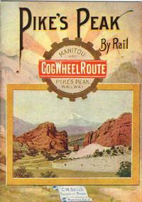
190336317Chicago: Poole Bros 1903. 1903. First edition. 5 3/4" x 4" colorful pictorial wrappers. 16 pp. plus wrappers illustrations. Offers information on Pike's Peak's scenic attractions the railway accommodations the route up Pike's Peak and what one can expect to see and experience along the route and when the peak is reached. Black and white illustrations of various points along the trip. Information on various elevations; distances on the railway to various points; and with a chart on the inside of the rear wrapper depicting the various zones of Pike's Peak along with their elevations and what types of plant life one can expect to see in each zone. Minimal wear to the extremities. A nicely produced booklet. Poole Bros, 1903. unknown
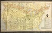
19205872Canadian Pacific Railway 1920. First Thus. Loose Sheet. Very Good-. Poole Brothers. Map measuring 31.75 inches x 17.75 inches printed four-color. Map shows the breadth of lower Canada from just north of Vancouver Island across to Newfoundland as well as all of the United States excluding southernmost Texas and Florida. CPR lines are represented in red ink whereas connecting American railroads are in black. Black stars along the CPR indicate locations of Canadian Pacific Hotels. Two slight chips to left margin and with a couple short closed tears along folds. Please see photo. A handsome map from the tail-end of the golden age of rail travel. Now preserved in a removable clear archival sleeve. Canadian Pacific Railway unknown
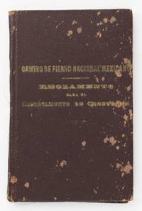
18892158Mexico City: Bouligny y Comp 1889. Good. 10555-59217pp. as issued. 12mo. Original brown pebbled cloth gilt titles on front cover. Noticeable scuffing and spotting to boards spine a bit frayed spine ends worn. Hinges separated but text block holding by spine glue. Text clean. A useful and informative pocket guide for employees of the Mexican National Railroad in the late-19th century. The work is printed in both English and Spanish and includes sections on general rules time tables signal rules train rules with separate sections detailing regulations governing "movement of trains by telegraphic order" numerous templates for train orders and concludes with a section of seventeen paginated "Diagrams Illustrating Manner of Using Signals According to the Standard Code of Train Rules. As Adopted by the General Time Convention. Approved July 15 1889." The latter illustrates the types colors and positioning of signal flags and lights depending on the movement of the train and time of day. We could locate no copies of this work in OCLC. Bouligny y Comp unknown
1936109946Minneapolis Minn.: Minneapolis St. Paul & Sault Ste Marie Railway Co. 1936. Softcover. very good. 32pp. Narrow Octavo. Illustrations from photos and maps folding colour map at end. Original pictorial wrappers stapled as issued. very good 1936 Minneapolis, St. Paul & Sault Ste Marie Railway Co. paperback
186330260Memphis 1863. Broadside 9" x 11". Lined paper with columns in blue and red inks entirely in manuscript. Two large stains at left edge moderate dusting to right edge on verso. A few small edge chips old folds with archival tape repairs of short splits on verso. Good to Good.<br /> <br /> The Mississippi Central Railroad Company was chartered in 1852; construction began in 1853 and was completed in 1860. The road ran from Canton Mississippi to Jackson Tennessee; it connected to the New Orleans Jackson and Great Northern Railroads at Canton; the Memphis and Charleston Railroad at Grand Junction Tennessee; and the Mobile and Ohio Railroad at Jackson Tennessee. The Mississippi Central Railroad was the scene of several military actions during 1862-1863 and was severely damaged.<br /> R.S. Taylor & Co. of Memphis Tennessee advertised as Cotton Factors and Grocers "We have a large and well selected stock of Groceries and Flour among which is the old favorite Grafton 000 and Reincke's Elegant." THE MEMPHIS DAILY APPEAL VOLUME 31 NUMBER 67 FEBRUARY 22 1871 Page 1. unknown
189132829St. Louis: Woodward & Tiernan Printing Co. n.d. 1891. 1891. First edition. Third edition. 12mo. Original orange wrappers printed in black ink 82 2 pp. illustrated map. advertising. Issued by the general passenger department of the Missouri Pacific Railway. A general description of the state and its place in history is provided. Plus soil rainfall churches schools higher educational opportunities newspapers population and wealth corn wheat oats stock farming wild flowers orchards and vineyards salt lead and zinc stone brick and lime coal gas hunting and fishing cities irrigation etc. Views are offered of farms and ranches parade grounds city parks etc. of various cities. Herd 1204 says "Issued by the Missouri Pacific Railway Company this book appeared in many editions though all are now rare." Prior to this copy the earliest edition of a similar booklet was a 13th edition and that was 15 years ago. Fine clean copy with a fine folding map. An exceptional copy of a rare item. Woodward & Tiernan Printing Co., n.d. (1891)]. unknown
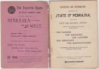
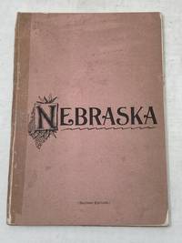
189246034St. Louis: Woodward & Tiernan Print. Co. 1892. Stapled paper wrappers. A good copy wrappers chipped soiled starting to detach seller stamp to front wrapper occasional soiling to contents. Lacking folding map. 64 pp. Illus. with b/w engravings. 12mo. Promotional booklet published by the Missouri Pacific Railway encouraging settlement in Nebraska. Lacks folding map. Woodward & Tiernan Print. Co. unknown
189287869St. Louis MO: Printed by Woodward and Tiernan Printing Co 1892. Second Edition. Staplebound Pamphlet. Good Plus. Stapled pamphlet. 7.5 in. x 5.25 in. pp. 64. Illustrated with in-text drawings and a fold-out map of Nebraska 21 in. x 26 in. Pink cardpaper wraps with black title to front. Light soiling to covers with chips to top/bottom of spine; older tape repairs to length of spine reattaching front cover and to left edge of rear cover. Fragile edges with chips to corners and several short closed tears to cover edges. Clean interior with very good plus map. This brochure was presented "With the Compliments of the General Passenger Department of the Missouri Pacific Railway." The text provides description and chart of information related to population geography geology weather land prices distances horticulture churches and more. Printed by Woodward and Tiernan Printing Co unknown