[ST JOSEPH & GRAND ISLAND RAILROAD]Biblio.com

5 209 résultats
189537909St. Joseph: Lon Hardman 1895. 1895. 10 1/2 x 14" gilt stamped light blue cloth. 160 4 pp. many portraits and other illustrations advertisements small map index. History of the railroad profiles and portraits of company officials. Profiles and portraits of all the prominent businessmen and their firms along the route in Missouri and Nebraska. Covers faded and quite soiled; a couple pages with light chipping to bottom edge. A very interesting genealogical item. Lon Hardman, 1895. hardcover
188537910St. Paul: Pioneer Press 1885. 1885. 8 1/2" x 5 3/4" in burnt orange printed wrappers and with a map on rear wrapper. 48 pp. illustrations. The letters are "from a well-known correspondent who visited the Northwest in May and June 1885." These letters will be found to contain "a large amount of valuable statistical and other information relative to the various sections of country traversed by the writer in his tour of 2000 miles." Letters discuss visits to Stearns County Norman County Swift County Alexandria Crookston Moose Island Minnesota; Devils Lake Morehead Dunseith Rolette County Dakota Territory etc. Information for the home seeker and on the St. Paul Minneapolis & Manitoba Railway; various statistics for Minnesota and Dakota. Nine full-page illustrations. Light fold to bottom corner and with agent stamp on front wrapper. Pioneer Press, 1885. unknown
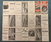
188341860Chicago: The J.M.W. Jones Stationery and Printing Co. 1883. 1883. NORTH DAKOTA. 22 ½" x 25 3/4" sheet folded to 42 panels. Outermost panels printed in red and black. Issued to promote the travel to and settlement of the Red River Valley area and lands west of there. "Every Man a Free Holder. How to Secure a Free Home in North Dakota. Sectional Map and Full Particulars Published by the St. Paul Minneapolis & Manitoba Rail-way." The text panels provide much information regarding agricultural production in the region. Wheat production stock raising soil and climate and other agricultural products are described along with information on Devil's Lake the Mouse River Valley the Turtle Mountain region Stump Lake etc. On verso the small map shows "The St. Paul Minneapolis & Manitoba Railway System and its Important Connections." The large map illustrates in detail the northwestern part of Minnesota from Breakenridge northward and east to include Barnesville Ada Crookston etc. and Dakota north from Wahpeton north and west to Ft. Stevenson on the Missouri River northward and includes southern Manitoba to Winnipeg. Also on this side is an extensive section of text describing "Government Lands and How to Get Them" with emphasis on pre-emptions homesteads and tree claims. Another large section entitled "Facts From a Farmer in North Dakota on the Line of the St. Paul Minneapolis & Manitoba R'y." In this section Mr. James Twamley a Grand Fork area farmer and wholesale grocer describes local agricultural production and recommends specific varieties of wheat oats corn squash beets cabbages carrots beans onions tomatoes asparagus cucumbers berries currants plums grapes potatoes and fodder corn. 1" closed tear to bottom edge of one panel splits at one fold and to top edge have been professionally repaired. An interesting and attractive promotional. A very scarce work. The J.M.W. Jones Stationery and Printing Co., 1883. unknown
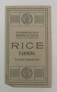
19002733Houston: Southern Pacific Sunset Route 1900. Very good. 4pp. on a single folded sheet. Minor toning and creasing. A simple but still interesting promotional leaflet touting the advantages of rice farming in Texas. The text was taken from the Southern Pacific Rice Book and lists twenty-six points of advice about the rice industry and how it is a good investment. These points are listed alphabetically by letter and each entry begins with that letter. For example: "H. Harvest rice same as wheat using a rice harvester." OCLC records just a single copy at the Autry Museum. Southern Pacific Sunset Route unknown
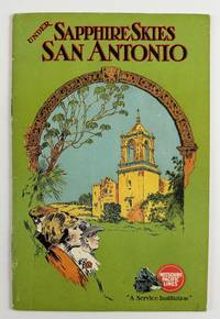
19282989Chicago: Poole Bros 1928. Very good plus. 32pp. Original pictorial wrappers stapled. Minor wear and dust-soiling to wrappers. Internally clean. A vibrant depiction of the great city of San Antonio Texas produced by the Missouri Pacific Railroad during the latter part of the Roaring Twenties. The promotional work is profusely illustrated with photographs accompanied by text touting the many advantages of the Alamo City. The images feature well-known attractions such as the Alamo Alamo Plaza various missions and the downtown commercial buildings intermixed with lesser-known aspects of San Antonio life such as the golf and polo scenes Olmos Dam Fort Sam Houston Medina Lake and others. The photographs includes an "Aerial View of the Heart of San Antonio." The Missouri Pacific also includes a bit about itself with photographs of the "Sunset Special" locomotive and the Missouri Pacific Lines' Bridge across the Mississippi River at Memphis plus a map of the line on the last page. OCLC records just a handful of institutional copies of this edition. Poole Bros unknown
192051065Nashville: Brandau-Craig-Dickerson Co. n.d. ca 1920s. 1920s. First edition. 3 1/2" x 6" in bright colorful pictorial wrappers. 16pp. Black and white photographs throughout. North and southbound schedules at center along with a route map showing all stops along the way from Chicago to Miami Key West and Havana. The “Dixie Flyer” a sleeping car service began operation in 1892 and took passengers from Chicago and St. Louis to Florida via Nashville and Atlanta. Photographs showing sights the tourist would expect to see while traveling to include important buildings street scenes railroad scenes scenery beach scenes water fronts etc. Former owner wrote message at border of first page else fine. Brandau-Craig-Dickerson Co., n.d. (ca 1920s). unknown
1920106889<p><strong>8vo paperback original wrappers with title staples illustrated four in color including wrappers 8 pp. Some wear light staining corner fold and a few chips; otherwise very good condition. This is a rather scarce children's book on trains that has black and white and color illustrations. The OCLC locates only one copy. OCLC </strong></p> Sam L. Gabriel Sons & Company,
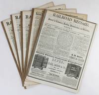
18563168Cincinnati 1856. Very good. Five issues and supplements totaling 72pp. Spines reinforced. Light tanning and dust soiling; scattered faint foxing. A lengthy extra issue of the Railroad Record with four additional eight-page supplements that together comprise a ringing endorsement from this industry periodical and its editors of the southern route through Texas and the Southwest for the American transcontinental railroad. The first two items of this extra published on October 4 1855 are by Texas Western Railroad owner and promoter Edgar Conkling who exhorts readers to examine the evidence supporting construction along the southern route and to invest in his railroad which was already sanctioned by the Texas state legislature as the text of two laws printed following his address demonstrate. Much of the issue is taken up by extracts from Secretary of War Jefferson Davis' positive report on the route through Texas and by a précis by Colonel A.B. Davis of his exhaustive survey of the proposed path through the recently completed Gadsden Purchase with a double-page map of the intended line. After several other attestations a subscription form is included at the rear for those who wish to purchase stock at $100 per share in the Texas Western Railroad Company. The additional four supplements dating from late 1855 and the first half of 1856 print more arguments in favor of the southern route including a lengthy letter from Thomas Butler King and lead articles with titles such as "What Shall Be Done for a Highway to the Pacific" and "Objections to the Construction of the Pacific Railroad reviewed." The Texas Western never built more than fifty miles of track connection Shreveport Louisiana and Marshall Texas and it was another twenty-five years before the Southern Pacific and Texas & Pacific Railroads connected near El Paso in 1881 to complete the "southern route" as it was originally conceived. unknown
193055764New York & Chicago: Atlantic Coast Line; Printed by Poole Bros. Inc. 1930. 4to. 8 x 9 in. 31 1 pp. which folds down into 4 x 9 in. printed in orange & black throughout photo illustrations orange printed borders large double-page centerfold colour map of the Florida Resorts. Self-printed colour-illustrated softcovers Art Deco cover art of golfers playing against the backdrop of boating and palm trees minor shelfwear slight rusting to couple staples still a VG bright copy. First edition of this well-illustrated promotional brochure for the Atlantic Coast Line connecting tourists and golfers to golf courses recreational resorts and parks through Georgia South Carolina North Carolina Alabama Virginia Cuba and the Bahamas. The brochure does focus on the storied ACL RR connections with Florida resorts in Palm Beach Palmetto the Lake Region Jacksonville Key West and nice section on the amenities found in Havana Cuba. Decorated with its’ splendid purple and silver livery with yellow trim the ACL RR was one of the most successful railroad operations from its original chartering as the Petersburg RR in 1830 through 1967 when it merged with Seabord Air Line RR. Atlantic Coast Line; [Printed by Poole Bros., Inc.], paperback
1932142456Chicago: U. S. Department of the Interior 1932. 10pp. Square octavo. Colourfully illustrated paper wrappers with a map of the Alaska Railroad on the verso of the back wrapper. Heavily illustrated with black and white photos and drawings within the text. Fold line down the middle where it was folded to act as a pamphlet. Very mild edgewear to the wrappers otherwise a very good copy of this scarce piece of ephemera. A wonderfully produced little pamphlet promoting the Alaska Railroad and the central portion of Alaska as having the "choicest big game fields" in America. U. S. Department of the Interior unknown
197651261Kennett Square PA: by the Author 1976. First Edition. Signed by author on title page. Octavo. Staple-bound pamphlet; printed thick paper wrappers; 36pp; illus. Includes bibliography. Faint foxing to title page else Fine. Brief illustrated historical guide to Chester County landmarks on the Underground Railroad. by the Author unknown
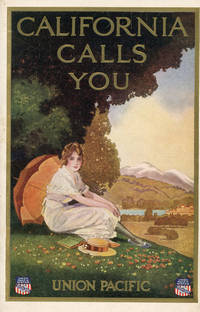
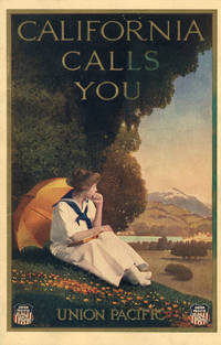
192146831Omaha: Union Pacific 1921. 1921. First edition. 9" x 6" in lovely color pictorial wrappers. 40pp. Black and white illustrations. Maps. The contents are printed on coated white paper. Southern California attractions like the Terrace Garden at Hollywood and Pershing Square in Downtown Los Angeles are featured prominently alongside Northern California destinations. Pictures include churches cityscapes scenery street scenes beach scenes etc. Center pages feature three regional Rand McNally & Co. maps. One-page map at the rear showing the Union Pacific routes west of the Mississippi. An especially fresh example with just a hint of foxing to the rear panel. Union Pacific, 1921. unknown
191346830Omaha: Union Pacific 1913. 1913. First edition. 9" x 6" in lovely color pictorial wrappers. 40pp. Black and white illustrations. Map. This brochure was reprinted through at least 1924. Unlike later editions the contents are printed on cream paper with decorative green borders. San Francisco and Northern California destinations are most prominently highlighted in this version. Illustrations include the capitol building Mt. Shasta Chinatown beach scenes street scenes scenic views missions fishing scenes etc. One page map at rear showing the Union Pacific routes west of the Mississippi. Minor smudge to the front panel with some light toning and edgewear; otherwise very good. Union Pacific, 1913. unknown
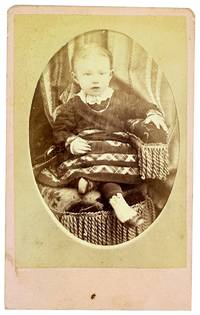
188032410N.p.: U.P.R.R. Photograph 1880. Very Good. N.p.: U.P.R.R. Photograph ca. 1880s. Small format albumen carte de visite 8.5x6cm mounted to card measuring 10x6.5cm. Brief smudging else Very Good to Near Fine. Portrait of a seated child about 18 months old. <br /> <br /> Verso printed in red with an engraved reproduction of the photographer's studio which was housed in a railway car that the photographer S.B. Silvis traveled around on the Union Pacific Railroad line. "Stereoscope & Landscape Views of Notable Points on Line of Pacific R.R. / Always on Hand." We can't find much about Silvis though a notice in Hailey Idaho in late June of 1888 announced that he was in town for a few days to take pictures through the holiday. . U.P.R.R. Photograph unknown
191951665Chicago: United States Railroad Administration; Poole Bros 1919. Very good. 62pp. Slim octavo 23 cm x 20 cm with the covers and pages folded once vertically through the center. Saddle stitched pictorial wrappers. The edges of the front wrap are moderately rubbed and chipped and there are single light 2 x 1 1/2" stains in the top edges of the front wrap and preliminary pages. Else the pages are clean and free of markings. Contents include America's Playground for Americans: An Appreciation of Colorado and Utah by Edwin L. Sabin. United States Railroad Administration; Poole Bros unknown
190049936St. Louis: Woodward & Tiernan 1900. 16mo pp. 112; 3 plates one a folding map of the Northeast US with a detail of the Detroit-Buffalo rail line illustrations throughout; green paper wrappers with white embossed details; extremities rubbed 1 plate loose good. A guidebook for summer retreats throughout the US with information on lodging sightseeing and approximate travel costs. Woodward & Tiernan unknown
192956942St. Paul MN: Great Northern Railway 1929. 8vo. 16 pp unpaginated. numerous photo illusts. 1 double-page centerfold map in black & red self-printed softcovers red & black lettering front cover lozenge logo of the Great Northern Rlwy NF copy. First edition of this illustrated souvenir brochure celebrating the completion of the 7.8 mile long New Cascade Tunnel for the electrified Great Northern Railway route between Skykomish and Wenatchee with a 2.2 percent grade reducing the miles and lowering the grade from the old troubled tunnel completed in 1900. It remained the longest railroad tunnel in the Americas until 1989 when the Mount MacDonald Tunnel in BC was completed. Great Northern Railway, paperback
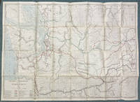
190751929Chicago: Rand McNally & Co. Engravers 1907. 1907. 34" x 47 1/2" sheet folded to 6" x 8 3/4" featuring a partially colored map of Washington with a legend identifying with various colored lines the routes of twenty-five railroads operating and/or under construction in the state. The Pacific Ocean Puget Sound and rivers are colored blue. Printed on back side is a "Counties and Towns Index to Railroad Commissioners' Map of Washington." The map shows the state of Washington from the Pacific east to just across the Idaho border and from the northern border with British Columbia south to just beyond the Columbia River and the Oregon state border. It includes town names county borders and outlines Indian reservation lands. Railroads shown include Northern Pacific Railway; Washington & Columbia River Railway; Columbia River & Northern Railway; Port Townsend Southern Railroad; Washington Idaho & Montana Railway; Portland & Seattle Railway under construction; Great Northern Railway; Spokane Falls & Northern Railway; Columbia & Red Mountain Railway; Washington & Great Northern R’y under construction; Oregon Railroad & Navigation Co; Ilwaco Railway & Navigation Co; Oregon & Washington Railway under construction; Columbia & Puget Sound Railroad; Spokane & Inland Railway electric; Coeur d’Alene & Spokane Railway electric; Puget Sound Electric Railway; Spokane & British Columbia Railway; North Coast Railway under construction; Chicago Milwaukee & St. Paul Railway under construction; Bellingham Bay & British Columbia Railroad; Tacoma Eastern Railroad; Spokane International Railroad; and North Yakima Valley Railway. The Commissioners of the Washington Railroad Commission in 1907 were H. A. Fairchild Jesse S. Jones and John C. Lawrence. O. O. Calderhead was the Secretary of the Commission. Several small closed breaks at intersecting corners else very good plus. Rand, McNally & Co., Engravers, 1907. unknown
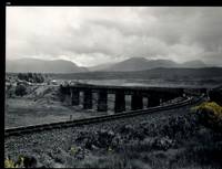
32483AB1974. Scotland 1974-2002. Oblong-Folio 44 cm wide x 36 cm high. Hardcover / Original Full-Leather Folders with stong black cardboards and original tissue-guards. Excellent condition with only minor signs of wear. With hundreds of manuscript annotations on the photography the photography-technique film used and with extensive elaborations on each photograph in these albums. More images on request ! Album 1: Covers the years 1974 1977 and 1978. The West Highland Line is walked from Arrochar a 1977 driving and camping holiday and a 1978 seventeen day touring holiday with many nights sleeping in a car fill the leaves with c. 200 b/w original photographs. Album 2: Covers the years 1991 and 1992. It is noted that 1990 is the fourth year that returning locomotives from the Mallaig line will work south over the West Highland main line. Images of Corrour Summit Glasgow to Fort William trains and many many more bridges viaducts tunnels stations and signalling equipment fill the leaves. c.182 b/w original photographs. Album 3: Covers 1993. More colour photographs now fill the leaves and annotations cease to second half of album. c 270 b/w colour and tinted original photographs. Album 4: Covers 1999 and 2002. Many images from The Highlands Rail Festival in Sept 1999. c.250 b/w and colour original photographs. An extraordinary photographic record and passion project presented in 4 huge well-bound albums containing over 900 fine photographs taken curated and annotated by an unidentified railway enthusiast and talented photographer. The albums span 4 decades recording trips to some of the most scenic and famous rail locations in the UK. The West Highland Line is returned to again and again over the decades and our photographer captures Scotlands most dramatic landscapes and railways as the route passes on its way from Glasgow to Mallaig through sections including Corrour and Rannoch Moor. Albums and contents in fine condition. A tissue guard between every leaf protects the photographs within. A single photograph of a middle aged man among every other photograph which records a detail of the railway is the only clue to the albums previous ownership and perhaps authorship. Partial description by our colleague Dr.Christian White from Christian White Rare Books in Ilkley UK. __________________________________________________________________________________________________________ The West Highland Line Scottish Gaelic: Rathad Iarainn nan Eilean "Iron Road to the Isles" is a railway line linking the ports of Mallaig and Oban in the Scottish Highlands to Glasgow in Central Scotland. The line was voted the top rail journey in the world by readers of independent travel magazine Wanderlust in 2009 ahead of the notable Trans-Siberian line in Russia and the Cuzco to Machu Picchu line in Peru. The ScotRail website has since reported that the line has been voted the most scenic railway line in the world for the second year running. The West Highland Line is one of two railway lines that access the remote and mountainous west coast of Scotland the other being the Kyle of Lochalsh Line which connects Inverness with Kyle of Lochalsh. The line is the westernmost railway line in Great Britain. At least in part the West Highland Line is the same railway line as that referred to as the West Highland Railway. History: The route was built in several sections: Glasgow Queen Street to Cowlairs Junction - Edinburgh and Glasgow Railway Cowlairs Junction to Bowling - Glasgow Dumbarton and Helensburgh Railway later absorbed into the Edinburgh and Glasgow Railway Bowling to Dumbarton Central - Lanarkshire and Dumbartonshire Railway operated by the Caledonian Railway Dumbarton Central to Dalreoch - Caledonian and Dumbartonshire Junction Railway Dalreoch to Craigendoran - Glasgow Dumbarton and Helensburgh Railway Craigendoran to Fort William opened 11 August 1894 - West Highland Railway sponsored by the North British Railway Crianlarich to Oban - Callander and Oban Railway operated by the Caledonian Railway. There is an additional section from Fort William or a junction near Fort William to Mallaig built as the Mallaig Extension Railway. The West Highland Railway approved the construction of the line at their annual meeting in January 1895. The line faced potential closure as part of the Beeching cuts in 1963 and again in 1995 due to reduced revenues. Route description: Shortly after leaving Glasgow Queen Street station and beyond Queen Street Tunnel the line diverges from the main trunk route to Edinburgh Waverley and Perth at Cowlairs and follows a northwesterly course through the suburbs of Maryhill and Kelvindale. Between Westerton and Dumbarton the route is shared with the North Clyde Line to Helensburgh Central before branching northward at Craigendoran Junction towards Garelochhead the section where the West Highland Line itself is generally accepted to begin. It gives high-level views of the Gare Loch and Loch Long before emerging alongside the northwesterly shores of Loch Lomond then climbs Glen Falloch to Crianlarich. The branch to Oban diverges at Crianlarich an important Highland junction of both road and rail and runs through Glen Lochy to Dalmally and through the Pass of Brander to reach salt water at Taynuilt and Connel Ferry before a final climb over a hill to Oban. About three miles five kilometres from Crianlarich the Mallaig and Oban routes both pass through the village of Tyndrum but they are served by separate stations making it an unusually small settlement to be served by more than one railway station. After Bridge of Orchy the line to Mallaig climbs onto Rannoch Moor past the former crossing point at Gorton Crossing to Rannoch station. In winter the moor is often covered with snow and deer may be seen running from the approaching train. The station at Corrour on the moor is one of the most remote stations in Britain and is not accessible by any public road. This is the summit of the line at 1347 ft 410 m above sea level. Carrying on northwards the line descends above the shores of Loch Treig and through the narrow Monessie Gorge. The final stop before Fort William is Spean Bridge. The section between Fort William and Mallaig passes over the Glenfinnan Viaduct through Arisaig with its views of the Small Isles of Rùm Eigg Muck and Canna and the white sands of Morar before coming to Mallaig itself. With the exception of the route between Glasgow Queen Street and Helensburgh Upper and the short section between Fort William Junction and Fort William station the railway is signalled using the Radio Electronic Token Block controlled from the signal box at Banavie station. Notable railway-related features Glenfinnan Viaduct The Horse Shoe Curve between Upper Tyndrum and Bridge of Orchy The Cruach Rock snowshed between Rannoch and Corrour Glenfinnan Viaduct between Locheilside and Glenfinnan The Pass of Brander stone signals between Dalmally and Taynuilt Arisaig is the most westerly railway station in Great Britain West Highland Line in film: Train crossing bridge at Banavie The summit of the line just north of Corrour Glenfinnan Viaduct on the line between Fort William and Mallaig is a filming location for the Hogwarts Express in the Harry Potter series of films. Eddie McConnell's poetic documentary A Line for All Seasons 1970 showcases the line and its history set against the scenery of the western highlands as it changes through the seasons. Corrour features in Trainspotting 1996 directed by Danny Boyle. Source: Wikipedia hardcover
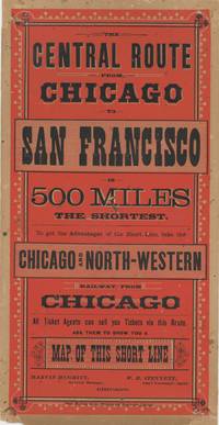
1882List2451Chicago: Rand McNally and Co 1882. Lithographic broadside illustration printed in color measuring 11 x 5 ¾ inches. Closed tear to margin paper reinforcement to corners verso very good condition quite bright and attractive. Very Good. An attractive advertisement for the Chicago and North-Western’s routes to San Francisco printed during the tenure of the railroad tycoon Marvin Hughitt as General Manager a position he held from 1876 to 1880 before being named Second Vice President. The advertisement was printed by Rand McNally and Company which in its early years focused on railroad-related materials. The Omaha and California line of the Chicago and North-West Railway connected passengers from Chicago to California. Other maps printed by Rand McNally and Co. during the period illustrate the route. We find no other examples of this broadside. Rand, McNally and Co unknown
191642739N.P.: Van Noy Inter-State Co. n.d. ca 1916. 1916. 9" x 12" in colorful pictorial wrappers showing the Golden Gate at sunset on the front wrapper. Two pages of text explaining the subjects that are illustrated in the book followed by beautiful colored 6 1/2" x 8 1/2" full-page illustrations attached to one side of each page. Includes pictures in Utah Nevada and with several in California. Pictures include the Temple Square Saltair Pavillion the Great Salt Beds Feather River Gold Lake Feather River Inn Williams Circle Ben Lomond Peak Arch Rock the Great Western Power Company Plant Blue Gorge etc. Light shadowing to pages of text and with light soiling to wrappers. Very good plus. A very nice presentation. Van Noy Inter-State Co., n.d. [ca 1916]. unknown
188937702Chicago: Rand McNally & Co. 1889. 1889. 5 1/2" x 4" printed folder with map of the United States on the rear cover. Inside front cover offers a list of advantages of living in Wisconsin. Attached to inside rear cover is a folded 12" x 9" colored map of Wisconsin with rail lines in red ink. Apparently printed for distribution at a gathering of Grand Army of the Republic Veterans. Covers lightly soiled. Map fine. Rand, McNally & Co., 1889. unknown
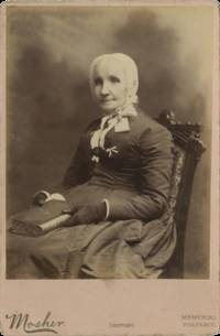
1885Cat361Chicago Illinois: C. D. Mosher National Historical Photographer to Posterity 125 State Street 1885. Albumen photograph on printed “Memorial Portrait†cabinet mount approximately 4 ¼ x 6 ½ inches. The elaborate printed verso advertisement promotes Mosher’s ambitious Centennial-era “Memorial Portraits†project and bears contemporary manuscript identifications reading “Laura Smith Haviland†and noting her authorship of A Woman’s Life Work. Very good condition with light surface wear. A late-life portrait of the celebrated abolitionist and Underground Railroad conductor Laura Smith Haviland 1808–1898 one of the most courageous white allies of the antislavery movement in the Old Northwest. Born into a Quaker family in Ontario and raised in Michigan Haviland devoted her life to reform causes including abolition women’s rights prison reform and temperance. With her husband Charles she founded the Raisin Institute near Adrian Michigan one of the earliest racially integrated schools in the United States. Haviland became deeply involved in the Underground Railroad during the 1840s and 1850s assisting hundreds of freedom seekers to escape through Michigan to Canada. At considerable personal risk she also traveled repeatedly into slave states including Kentucky and Tennessee to aid formerly enslaved families and to challenge slaveholders directly. During the Civil War she continued relief work among freedpeople in the South and remained active in reform movements well into old age.<br /> <br /> The portrait was produced by Chicago photographer Charles D. Mosher 1829–1897 as part of his Centennial-era “Memorial Portraits†project an ambitious attempt to assemble thousands of photographic likenesses of notable Americans to be preserved for future generations. Mosher exhibited hundreds of such portraits at the 1876 Centennial Exposition and later sealed many of them within a “Memorial Safe†intended to be opened at the American Bicentennial in 1976. The project sought to memorialize politicians military leaders reformers entrepreneurs and other public figures; known participants included leading African American figures such as Frederick Douglass and Mifflin Wistar Gibbs along with prominent Chicago politicians and civic leaders.<br /> <br /> An evocative photographic likeness of one of the most fearless women associated with the Underground Railroad preserved within one of the most unusual commemorative photographic projects of the nineteenth century. C. D. Mosher, National Historical Photographer to Posterity, 125 State Street unknown
194364074Philadelphia PA: Pennsylvania Railroad 1943. One elephant folio colour-printed poster sized 25 x 40 in. very slight age toning slight creasing shelfwear at fore-edges still a NF copy w/ bright colours. First edition of this exceptional wartime home front Savings Bonds drive poster for the Pennsylvania Railroad featuring the famed Raymond Loewy designed streamliner steam locomotive PRR S1 “The Big Engine†which premiered at the 1939 New York World’s Fair and whose 6-4-4-6 expanded duplex configuration made it the largest passenger locomotive ever built. For a short time the locomotive hauled the Manhattan Limited. Cornwell’s 1892-1960 powerful propaganda posters offered essential visual support for War Bonds fundraising during the War. Pennsylvania Railroad, unknown
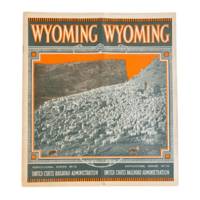
19196459Washington D.C.: United States Railroad Administration Agricultural Section 1919. First edition. 9x8" 1 35 1pp including wrappers. Photographs map. Illustrated wrappers staple bound. Some toning to wraps light vertical crease throughout small chip and some smudging to rear wrapper. Very good or better. <br /> <br /> Nicely preserved and scarce Wyoming promotional issued as part of the Agricultural Series No. 10 by the U.S. Railroad Administration. Copiously illustrated with photos of the state's scenery and agricultural industries from livestock to farmland. We date this publication by the governor's message at the front written by Robert D. Carey who took office in 1918 and served until 1922. <br /> <br /> OCLC cites only a copy at the Newberry Library in Chicago. United States Railroad Administration, Agricultural Section unknown