Wabash-Pittsburgh Terminal Railway CoBiblio.com
10 875 résultats
0428178693.Gpaperback. Good. Access codes and supplements are not guaranteed with used items. May be an ex-library book. paperback
190049936St. Louis: Woodward & Tiernan 1900. 16mo pp. 112; 3 plates one a folding map of the Northeast US with a detail of the Detroit-Buffalo rail line illustrations throughout; green paper wrappers with white embossed details; extremities rubbed 1 plate loose good. A guidebook for summer retreats throughout the US with information on lodging sightseeing and approximate travel costs. <br/><br/> Woodward & Tiernan unknown books
1896WRCAM56242Chicago: Poole Bros. 1896. Chromolithographic broadside 24 x 9 inches. Old horizontal folds. Small tear at upper margin likely from posting no text affected. Very good. Rare and colorful broadside advertising "the Shortest and Quickest Route" to "all points West" on the Wabash Line connecting through St. Louis. The sheet features a full-color image of the famous Wabash flag as well as the seals of Colorado and California. Customers are promised that all trains feature "Free Reclining Chair Cars and Pullman Buffet Sleeping Cars" and are provided a name and address to acquire maps and timetables. <br> <br> At the time this broadside was issued Charles M. Hays was general manager and the Wabash railroad was under the control of financier Jay Gould who was working feverishly to establish a full coast-to-coast system. He had merged the St. Louis Kansas City & Northern Railroad with Wabash creating the Wabash St. Louis & Pacific Railroad. Then as with many other Eastern and Midwest railroads Wabash partnered with Union Pacific to provide service further west. By 1896 Gould's son George had taken over the railroad and proceeded to expand it further swallowing up the Missouri Pacific Western Pacific Denver & Rio Grande Western Western Maryland and Wheeling & Lake Erie railroads. Hays left in 1896 to become general manager and later president of the Grand Trunk Railway in Canada which helped extend the Wabash network north. <br> <br> An attractive artifact from one of the great American railroads. We could find no copies recorded in OCLC. Poole Bros. unknown books
0243159862.Gpaperback. Good. Access codes and supplements are not guaranteed with used items. May be an ex-library book. paperback
0428576125.Ghardcover. Good. Access codes and supplements are not guaranteed with used items. May be an ex-library book. hardcover
033266581X.Ghardcover. Good. Access codes and supplements are not guaranteed with used items. May be an ex-library book. hardcover
0332433684.Gpaperback. Good. Access codes and supplements are not guaranteed with used items. May be an ex-library book. paperback
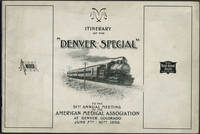
189824652American Medical Association 1898. Wraps. Very good condition. Unrecorded guide to the railway trip and preliminary program for the 1898 American Medical Association meeting in Denver by way of the Wabash Railroad St. Louis to Kansas City and the Chicago Rock Island & Pacific Railway Kansas City to Denver.<br /> <br /> The guide includes description of the train accommodations round trip fare St. Louis to Denver $26.50 special cars the train schedule with illustration of the new Union Station in St. Louis a preliminary program of meeting events and points of interest including the trans Mississippi and International Exposition in Omaha.<br /> <br /> Oblong 8vo 10 x 7" 26pp. Printed pictorial paper wrappers with route of Denver Special at rear wrapper. Front wrapper faintly dusty; bright and clean copy. American Medical Association unknown
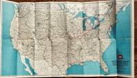
1956568Wabash Railroad Company 1956. 31 x 17 3/4 inches. Very good. This is a well composed map. The use of Blue for water enhances the internal markings of the railroads footprint. The Wabash Railroad had its beginnings in the northern Cross Railroad in Illinois in the early 1830s. The dream of connecting Toledo to the Mississippi River came through by connecting with the Great Western Railroad before the Civil War. This map was published in April of 1956 and shows the pre-interstate highway layout of the railroad. Non-line agencies were marked by the iconic Wabash flag logo. This is a superior railroad map at the end of the passenger service era of great railroads. Wabash Railroad Company unknown
1396412697.Ghardcover. Good. Access codes and supplements are not guaranteed with used items. May be an ex-library book. hardcover
1391050967.Gpaperback. Good. Access codes and supplements are not guaranteed with used items. May be an ex-library book. paperback
0332648869.Ghardcover. Good. Access codes and supplements are not guaranteed with used items. May be an ex-library book. hardcover
1333494548.Gpaperback. Good. Access codes and supplements are not guaranteed with used items. May be an ex-library book. paperback
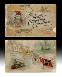
18924739Chicago IL: Wabash Railroad Passenger Department 1892. Souvenir Edition. Paperback. About Good. Promotional Pamphlet w. bird's-eye view of the Chicago World's Fair copyright 1892 by F. Chandler and printed by Poole Bros. in Chicago. String bound printed paper wraps oblong 16mo size 5-5/8 inches tall pp. 56 illustrated throughout w. color halftones. Volume covers w. small chips and rubs spine strip about half gone p.o. name in smudged ink to upper cover text with some tears and light damp staining to top edges. Upper cover w. "Compliments Passenger Department Wabash Railroad" printed at bottom corner. A complete but Good Only copy. The World's Columbian Exposition also known as the Chicago World's Fair was a world's fair held in Chicago from 5 May to 31 October in 1893 to celebrate the 400th anniversary of Christopher Columbus's arrival in the New World in 1492. wiki. Wabash Railroad Passenger Department paperback
Carta a colori in oblungo carta in litografia a colori, 98x41 cm. Più volte ripiegata. Bellissima carta degli Stati Uniti con le pricipali vie di comunicazione stradali ma specialmente frerroviarie per raggiungere la celebre Columbian Exposition a Chicago nel 1893 che si tenne per l'anniversario della scoperta dell'America da parte di Cristoforo Colombo. Sulla facciata dove è presente la cartina sono presenti gli immensi edifici, con costi e dimensioni che avrebbero composto i padiglioni dell'esposizione. Molto interessante invece il lato opposto alla carta dove la descrizione delle modalità per prendere il treno della Wabash Line (una delle prime compagnie americane per il trasporto ferroviario) per raggiungere Chicago (comprese informazioni di cosa fare con i bagagli), le istruzioni per trovare l'Esposizione e la lista degli hotel sono presenti nel margine alto a tutta carta una bella immagine di un treno a vapore con vagoni e locomotiva e delle vignete che illustrano come si presentavano al loro interno le varie carrozze: la Smoking Car (la carrozza fumatori), Reclining Chair Car (la carrozza con i sedili reclinabili), Sleeping Car (la carrozza letto), Buffet Compartment Car, Parlor Car (una carozza con sedie girevoli per facilitare il dialogo fra le persone), Dining Car (la Carrozza ristorante). Sullo stesso lato sono presenti gli orari e le fermate dei treni (nelle due direzioni) della Wabash Line da Buffalo e dalle Cascate del Niagara a Chicago e da Chicago a St.Louis con immagini delle nuove stazioni ferroviarie di Detroit e Chicago e una mappa di Chicago. Un piccolissimo ed ininfluenti forellino in corrispondenza di uan piega, riccamente illustrato e assai raro, ancor più raro a trovarsi in queste ottime condizioni di conservazione. A Very Good Copy.
30 pages. Oblong 8.5 x 11". Printed upon glossy stock. Map. Generously illustrated with archival black and white photos. "I hope this work will be of interest not only to those whose hobby is the same as mine, but also to those railroaders who worked their trains over the difficult mountain grades of the Boundary Subdivision, often under less-than-ideal conditions." - p.2. Clean and unmarked with moderate wear. A sound copy of this excellent reference. Book
26 pages. Oblong 8.5 x 11". Printed upon glossy stock. Maps. Generously illustrated with reproductions of archival black and white photos. "Canadian Pacific's Rossland Subdivision is situated in the West Kootenay District of southern British Columbia. The subdivision, 21.5 miles in length, had its origin in 1896 as a three-foot gauge railway from Trail Creek Landing, at the confluence of Trail Creek and the Columbia River, up into the mountains to Rossland. A Year later a standard gauge road was built to West Robson. Both, under the corporate title of the Columbia & Western Railway, were to be the foundation of the Rossland Subdivision as it is today." - p.1. Clean and unmarked with moderate wear. Slight bit of waviness in upper corner from past moisture exposure - hardly worth mentioning. A sound copy of this excellent reference. Book
1852100861A. Hart Philadelphia 1852. Pamphlet. Collectible. Philadelphia: A. Hart 1852. 40 pages. Engravings. 9.5 x 6" printed wrapper. "J Ravenscroft Jones'. Compares costs of plank macadam roads upkeep advantage to farmer property value New York road usage. Wrap rubbed edges chipped lower wrap detached foxed few stains fair. A.. Hart, Philadelphia unknown
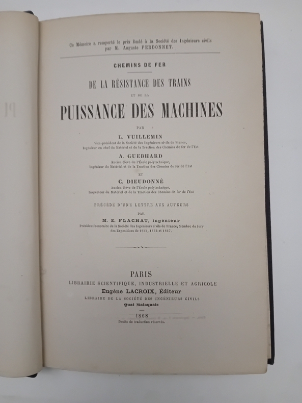
CF183P., Lacroix, 1868. In-8, 100pp., X tableaux, VIII pl. dépl. h.t., demi-chagrin.
13386Paris, Garnier, s.d. (vers 1860), 1 contrecollée sous couverture illustrée. carte coloriée de 66 x 53 cm, pliée dans un format in-12 ;
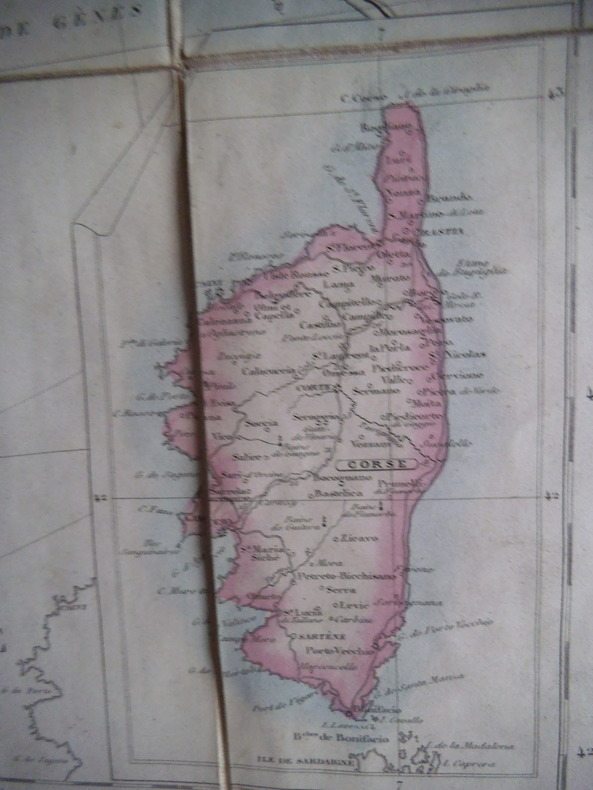
12692VUILLEMIN géographe Carte géographique des voies de communication de la France et des pays limitrophes indiquant les routes, les chemins de fer, les rivières navigables et les canaux ainsi que le parcours des bateaux à vapeur sur l’océan atlantique & la méditerranée. A. LOGEROT éditeur. Carte entoilée 690x885mm en 32 feuilles collées, de 110x175mm. Très bon état. Sous couverture cartonnée, pleine toile de l’éditeur (180x115mm) (décoloration et frottements.)
406pp. 25 cm. Hardcover Very good condition good
21616Wiesbaden, Kreidel, 1903. 175 X 265 mm. relié demi-toile noire (rel. récente). XVIII-523 pp. Zweite, umgearbeitete Auflage. Mit 672 Abbildungen im Text un 6 lithografierten Taffeln. Reliure refaite, quelques traces d'usage.
36794aafBern, A. Francke, 1945, in-8°, Frontispiz-Porträt + 120 S., Stempel a.d. Titelbl., Hlwd. (Bibl.).
194429580ABBern, Stämpfli, 1944. 8°. VI, 137 S. Orig.-Broschur + Wichtig: Für unsere Kunden in der EU erfolgt der Versand alle 14 Tage verzollt ab Deutschland / Postbank-Konto in Deutschland vorhanden + (verblichen). ="Schweizerische Beiträge zur Verkehrswissenschaft.", Heft 12.