US Department of the Navy U SBiblio.com
11 815 résultats
1396334440.Ghardcover. Good. Access codes and supplements are not guaranteed with used items. May be an ex-library book. hardcover
1391369955.Gpaperback. Good. Access codes and supplements are not guaranteed with used items. May be an ex-library book. paperback
1998295788.Gpaperback. Good. Access codes and supplements are not guaranteed with used items. May be an ex-library book. paperback
1998295796.Gpaperback. Good. Access codes and supplements are not guaranteed with used items. May be an ex-library book. paperback
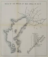
190063279RARE lithograph map. Condition: with folds as issued. Government Printing Office, Washington.
1396184325.Gpaperback. Good. Access codes and supplements are not guaranteed with used items. May be an ex-library book. paperback
1396682384.Ghardcover. Good. Access codes and supplements are not guaranteed with used items. May be an ex-library book. hardcover
026012821X.Ghardcover. Good. Access codes and supplements are not guaranteed with used items. May be an ex-library book. hardcover
1434682552.Gpaperback. Good. Access codes and supplements are not guaranteed with used items. May be an ex-library book. paperback
1015705243.Ghardcover. Good. Access codes and supplements are not guaranteed with used items. May be an ex-library book. hardcover
12399349like new. unknown
189677014Washington DC: U.S. Department of the Navy Bureau of Navigation Hydrographic Office 1896. Presumed First Edition First printing thus. Map. Good. This was published at the Hydrographic Office in Washington D.C. in February 1896. No. 1530. Charles D. Sigabee Commander U.S. N. Hydrographer. Format is approximately 26 inches by 17 inches folded. This map is disbound from Volume I of the Commercial Directory of the American Republics compiled by the Bureau of American Republics International Union of American Republics Joseph P. Smith Director 1897 Title page from Directory is present. Taped to top right of map in margin is the statement "This chart is intended solely to show tracks of steam vessels on the ocean and no authority is assumed for the boundary lines as drawn between the countries." Map has some color differentiation and several inserts presenting distance information between major ports of call. Map has been folded with approximately the top third folded down. It is also folded into four sections of different lengths to fit as the frontis to the Directory. Map has some wear and soiling/staining. This is similar to the large-scale and detailed World chart on Mercator's projection produced by the British Admiralty under the "Superintendence of Captain Wharton R.N. F.R.S Hydrographer" engraved by Edward Weller and sold by J. D. Potter chart agent. The map has no internal landmass detail unless relevant to steam ship routes thus the Suez and Panama canals are marked as is the Canadian Pacific Railway. Panels along the lower edge list major ports and give distances dependent on routes taken and average knots-per-hour speeds with daily distances covered in miles. The world's major ports are linked by ship-routes each track with its relevant distance and so on. An interesting chart at the time steam took over from sail. Charles Dwight Sigsbee 1845 - 1923 was a Rear Admiral in the United States Navy. In his earlier career he was a pioneering oceanographer and hydrographer. He is best remembered as the captain of the USS Maine which exploded in Havana harbor Cuba in 1898. U.S. Department of the Navy, Bureau of Navigation, Hydrographic Office unknown
1396596674.Ghardcover. Good. Access codes and supplements are not guaranteed with used items. May be an ex-library book. hardcover
1391496698.Gpaperback. Good. Access codes and supplements are not guaranteed with used items. May be an ex-library book. paperback
3380792like new. unknown
3190896like new. unknown
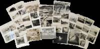
1945189141945. U.S. Army and Navy photographs of Okinawa 1945 document the immediate aftermath of the Battle of Okinawa and the establishment of American control over a strategically critical island at the close of the Pacific War. The images place American troops within the Okinawan interior and along coastal installations following the April 1945 landings including the secured Yontan airfield a primary objective of the invasion. The archive records the physical destruction resulting from one of the war's most intensive campaigns alongside scenes of civilian movement and return situating the photographs within the transition from active combat to military occupation.<br /> <br /> Archive of 37 black and white silver gelatin photographs. Okinawa Japan circa 1945. Photographs measure approximately 3.75 x 4.5 inches to 7 x 10.5 inches with brief handwritten captions on verso. Images depict American troops in villages farmland and near shrines as well as at Yontan airfield. Several photographs show destroyed aircraft including a crashed Japanese plane and associated debris along with damaged infrastructure and equipment. Naval activity is represented through images of American ships in harbor and offshore including a landing ship dock LSD transport vessel. An aerial photograph shows a harbor with multiple wrecked ships and flattened industrial areas. One image documents a column of civilians carrying belongings captioned "civilians returning to homes."<br /> <br /> The Battle of Okinawa fought from April to June 1945 resulted in extensive military and civilian casualties and widespread destruction of the island's infrastructure. The subsequent American occupation transformed Okinawa into a major U.S. military base in the western Pacific a status it retained even after reversion to Japanese administration in 1972. These photographs document both the operational objectives of the invasion and the conditions encountered in its aftermath including the displacement and return of local populations. The archive provides material for examining military strategy occupation practices and the impact of large-scale warfare on civilian landscapes in the Pacific theater. Light wear consistent with handling; overall very good condition. unknown
39888825like new. unknown
1643890336.Ghardcover. Good. Access codes and supplements are not guaranteed with used items. May be an ex-library book. hardcover
MA08C-03758Government Printing Office. Collectible - Good. S.l.: Government Printing Office 1949. Sm 4to. Unpaginated. Illus. Good book. Loose pages bound in three-ring cardboard binder. Binder edges frayed. From the library of American aeronautics author historian and curator Tom D. Crouch. airplanes recognition Inquire if you need further information. Government Printing Office unknown
2012DADAX3846583111LAP Lambert Academic Publishing 2012-02-22. paperback. New. 5.91x0.56x8.66. Buy with confidence. Excellent Customer Service & Return policy. LAP Lambert Academic Publishing paperback
3846583111.Gpaperback. Good. Access codes and supplements are not guaranteed with used items. May be an ex-library book. paperback
2022__3110766396De Gruyter 2022. Hardcover. New. 300 pages. 9.45x6.69x9.61 inches. De Gruyter hardcover
2025x-1041066872Routledge 2025. Hardcover. New. 154 pages. 8.50x5.43x8.50 inches. Routledge hardcover