Zatto, Antonio [China]Biblio.com
115 résultats
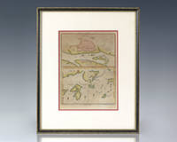
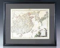
1784137611Venice: Presso Antonio Zatta 1784. Large eighteenth century hand-colored map of China and Japan by Venetian cartographer Antonio Zatta. One page hand-colored with a fine botanical cartouche. In near fine condition. The entire piece measures 19.5 inches by 23.5 inches. Venetian cartographer and publisher Antonio Zatta's major contribution to cartography was the Atlante Novissimo a four volume atlas of the world including detailed maps of China Italy North American and Eastern Europe. Presso Antonio Zatta unknown
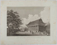
1796177641London. 1796. Large format engraving 23.9 x 35.9 cm; 35.9 x 46 cm sheet including caption and platemark spots of browning to the image affecting the sky and marginal foxing old paper abrasions to the verso the sheet a little creased and dusty but a strong dark impression in very good condition. Fine detailed engraving after a drawing by the artist William Alexander 1767-1816 of the sumptuous Hall of Audience to the Summer Palace prepared as plate 22 for the folio atlas to George Staunton's account of the Macartney Embassy to China of 1793. Staunton's commentary noted its magnificence: "Its projecting roof was supported upon two rows of large wooden columns the shafts of which were painted red and varnished; and the capitals ornamented with various scrolls and devices in vivid colouring particularly with dragons.". The engraver William Lowry 1762- 1824 specialised in architectural engravings and was later a member of the Royal Society. <br> <br>From the Estate of the late collector and scholar Arthur Hacker. . unknown
176614884Florence Italy: Giuseppe Vanni 1766. Print. Very good condition. Period hand-colored copper engraving from the Natural History of the Birds Treated Systematically and Adorned with Copperplate Engraving Illustrations in Miniature and Life-Size 1766-1777. <br /> <br /> The work carries some interesting historical importance according to Peter Dance: "The production of its five massive folio volumes must have been one of the most remarkable publishing ventures ever undertaken in Florence. Begun in 1767 and based on birds taken from the collection of Giovanni Gerini it was completed ten years later. It was larger better engraved and more vividly coloured than any previous work on birds but these are not its only claim to fame. The attitudes of the birds themselves give this book its unique character. Strutting parading posturing and occasionally flying.are birds whose real-life counterparts would surely disown them and not without reason for Manetti seems in these pictures to be depicting the human comedy the habits and mannerisms of contemporary Italian society. His book may still be rated among the very greatest bird books if only for its magnificent comicality" S. Peter Dance The Art of Natural History: Animal Illustrators and their Work. London 1978.<br /> <br /> Approx. 10 5/8 x 13 1/2" platemark on watermarked paper measuring 14 1/2 x 18". The original images were drawn by Lorenzo Lorenzi Violante Vanni or Manetti himself. HKD3680. Giuseppe Vanni unknown
17311603471731. In der Platte bezeichnet "A.Watteau inxit / Aubert Sculp." und mit dem Titel. Kräftiger und gegensatzreicher Druck auf Bütten mit gleichmäßigem Rand um die Einfassungslinie und dem Text. 24,6 x 19, 2 cm. Papier: 27,9 x 20 cm.
1796143663London: George Nicol 1796. Very Good. London George Nicol April 12th 1796. A large engraved map printed surface 640 × 451 mm sheet size 812 × 557 mm. Engraved by B. Baker. Horizontal centrefold crease as issued; occasional spots of foxing mainly in the margins; two small faint stains to the left-hand margin well clear of the printed surface; old guard on the verso with some light associated tanning on the recto about the fold; in excellent condition with wide margins. John Barrow later first Baronet was attached to the first British diplomatic mission to China led by George Macartney in 1792-94. The map is plate 9 from the atlas to the official account of the embassy George Staunton's 'An Authentic Account of an Embassy from the King of Great Britain to the Emperor of China .'. <p>The journey shown here was from Chengde formerly Jehol to Beijing and then south to Hangzhou along the Grand Canal. While Macartney failed to secure any concessions from the Qianlong Emperor the expedition nevertheless collected important information about the geography culture population and politics of the Chinese Empire. George Nicol unknown
1736137249J. Wood c. 1736. Rare eighteenth century hand-colored map providing plans of Kanton Shang Chwen Shan and Ma-kau being a plate extracted from Du Halde's celebrated Description Geographique the most important cartographic record of the region of the eighteenth century. In near fine condition. Double matted and framed. The entire piece measures 14 inches by 11.5 inches. Based on surveys conducted by French Jesuits at the behest of the Emperor Kang Hsiand Jean-Baptiste Du Halde's Description Geographique constitutes the first scientific mapping of China and remains the most important cartographic record of the region from the eighteenth century. Du Halde did not travel to China but collected seventeen Jesuit missionaries' reports and provided an encyclopedic survey of the history culture and society of China and "Chinese Tartary" that is Manchuria. Voltaire said of Du Halde's work: "Although it is developed out of Paris and he hath not known the Chinese he gave on the basis of the memoirs of his colleagues the widest and the best description the empire of China has had worldwide." J. Wood unknown
174912888Nürnberg, Homann Erben, 1749. Kupferstich, altkoloriert. Blattgröße: 54 x 62 cm, Druckspiegel: 52 x 41,5 cm [2 Warenabbildungen]
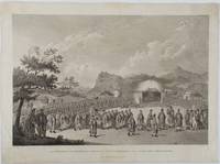
1796177644London.: G. Nicol. April 121796. Large format engraving 29.9 x 45 cm; 37 x 50 cm sheet trimmed to the platemark spots of browning to the image mainly affecting the sky and marginal foxing corners a little toned old paper repair affecting the caption only no loss the sheet creased at the corners and a little dusty but a strong dark impression in very good condition. Intricate and wonderfully composed engraving after a drawing by the artist William Alexander 1767-1816 prepared for the folio atlas to George Staunton's account of the Macartney Embassy to China of 1793. The engraver James Fittler 1758-1825 was appointed by George III to be his Marine Engraver. Despite the serried ranks of the Chinese noblemen attendants and the figure of the Emperor himself occupying almost the entire engraving it is the figure of Lord Macartney making an entrance stage right who steals the show. Fittler has amplified Macartney as "hero" with the dramatic use of tone: Lord Macartney is bathed in light a representative of the British Empire "on which the sun never sets". The page attending Macartney is the figure of George Staunton's son Thomas. <br>A dramatic evocation of the might of Empire. <br> <br>From the Estate of the late collector and scholar Arthur Hacker. . G. Nicol. unknown
175019622Augsburg, (ohne Drucker), (um 1750). Ca. 41 cm x 31 cm.
173816699London: Edward Cave at St. John's Gate 1738. Very good overall. Copper engraving period folds. 13 3/4 x 13 1/4" with margins. Map including Shanghai area from the Edward Cave folio edition of this important encyclopedic work on Chinese culture history and society by a French Jesuit who specialized in China. Du Halde's work inspired great interest in China among Europeans and was a ground breaking work in geography. The book: Cordier BS 50; Löwendahl 409; Lust 15. Edward Cave, at St. John's Gate unknown
173816705London: Edward Cave at St. John's Gate 1738. Very good overall. Copper engraving period folds. 12 1/ x 14 1/4" with margins. Closed semi-circular tear repaired archivally. Map from the Edward Cave folio edition of this important encyclopedic work on Chinese culture history and society by a French Jesuit who specialized in China. Du Halde's work inspired great interest in China among Europeans and was a ground breaking work in geography. The book: Cordier BS 50; Löwendahl 409; Lust 15. Edward Cave, at St. John's Gate unknown
173816707London: Edward Cave at St. John's Gate 1738. Very good overall. Copper engraving period folds. 15 1/4 x 18 3/4" with margins. Map from the Edward Cave folio edition of this important encyclopedic work on Chinese culture history and society by a French Jesuit who specialized in China. Du Halde's work inspired great interest in China among Europeans and was a ground breaking work in geography. The book: Cordier BS 50; Löwendahl 409; Lust 15. One small section of fold separated and repaired archivally. Edward Cave, at St. John's Gate unknown
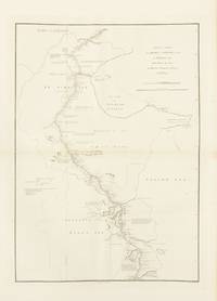
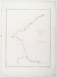
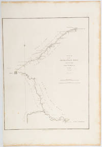
1796209283London.: George Nicol. 1796. Engraved copperplate map on Whatman paper 43.8 x 33.6 cm; 57 x 42 cm sheet including plate markscale in nautical and English miles; light undulation to sheet marginal toning and edgewear but in very good condition. Finely engraved and detailed map of two routes to Pekin Beijing along the White River Baihe from the Gulf of Petcheli and along the Imperial Highway from Jehol and includes commentary locating palaces and gardens type of cultivation "many barges" and "the road shaded by willow trees". The map elegantly drawn by Henry William Parish was published in George Staunton's account of Earl Macartney's embassy to China 1792-1794. . George Nicol. unknown
17311603461731. In der Platte bezeichnet "A.Watteau inxit / Aubert Sculp." und mit dem Titel. Kräftiger und gegensatzreicher Druck auf Bütten mit gleichmäßigem Rand um die Einfassungslinie und dem Text. 24,9 x 19 cm. Papier: 28,1 x 20 cm.
1796197217London.: George Nicol. 1796. Engraved copperplate map on Whatman paper 43.8 x 33.6 cm; 57 x 38.5 cm sheet scale in nautical and English miles; light undulation to sheet marginal toning and edgewear a couple of rust spots to the blank of the map's lower corner trimmed to the border on the inner margin but in very good condition. Finely engraved and detailed map of two routes to Pekin Beijing along the White River Baihe River from the Gulph of Petcheli and along the Imperial Highway from Jehol and includes commentary locating palaces and gardens type of cultivation "many barges" and "the road shaded by willow trees". The map elegantly drawn by Henry William Parish was published in George Staunton's account of Earl Macartney's embassy to China 1792-1794. . George Nicol. unknown
1784009888Paris: Chez De Bure Barrois Aîné et Barrois Jeune 1784. Book. Very Good. Morocco. 24mo - over 5" - 5¾" tall. Two volumes bound in full contemporary red morocco the back intricate floral gilt marbled end papers all edges gilt the armorial bookplates of De Verdon front paste downs. 5" x 3". ii 246 xxxix 230 pages. Very Good the boards soiled small hole front gutter Vol. I. The first two volumes only of this seven volume set generally considered the most interesting as they contain Noel's observations on the origin nature and effects of moral and political philosophy in China during the Qing Empire. Chez De Bure, Barrois Aîné et Barrois Jeune Hardcover
1795105181BBParis, Denné, l'an IV (1795 et 1796). 8°. [2] Bl., XXIV, 255 S.; [2] Bl., VII, 227 S. Hldr. des 19. Jahrhunderts mit goldgepr. Rüclentitel u. Linienverg. 2 Teile in 1 Band. [2 Warenabbildungen]
173858781BBNapoli, Francesco Ricciardo., 1738. 8°. Gestochenes Frontispiz, 4 n.n. Bl., 293 S., 3 n.n. S. Tavola. Mit einer mehrfach gefalteten gestochenen Karte von China und 5 (2 gefalteten) gestochenen Ansichten. Pergamentband der Zeit mit handschriftlichem Rückentitel.
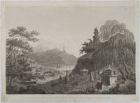
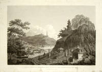
1796177640London. 1796. Large format engraving 30.8 x 45.3 cm plus caption and margins spots of browning to the image two sealed edge tears one affecting the caption and the upper edge of the image without loss two old paper repairs to the margin the sheet a little creased and dusty but a strong dark impression in good condition. Fine detailed engraving prepared as plate 41 for the folio atlas to George Staunton's account of the Macartney Embassy to China of 1793. The artist William Alexander 1767- 1816 has rendered fine architectural detail as well as capturing the natural world and background imagery. <br> <br>From the Estate of the late collector and scholar Arthur Hacker. . unknown
1796199463London.: G.Nicol. April 121796. Large format engraving 30.8 x 45.3 cms; 40.3 x 55.3 cms inc. caption and platemark margins dusty and spotted and residue from previous backing to the verso now attractively preserved loose in a window mount a strong dark impression in good condition. Detailed and elegant engraving prepared as plate 41 for the folio atlas to George Staunton's official account of the Macartney Embassy to China of 1793. The artist William Alexander 1767- 1816 has rendered fine architectural detail as well as capturing the natural world and background imagery. . G.Nicol. unknown
179061511ABWeißenfels,Leipzig. Severin, 1790. 2 Bände in Einem. 280 S. / 278 S. (2 letzten Seiten Band 2 fehlen) Or.-Kart., stärker berieb. sonst guter Zust.
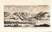
1745201080London.: Ashley. 1745-1747. Copperplate engraving 18.2 x 36.6cms image including caption; 25.6 x 41.8cms sheet original folds sheet a little age-toned faint offsetting the image in very good condition. A striking view of the Dutch Embassy approaching the Great Wall of China near Chogon Koton; the image is after the work of Johan Nieuhof 1618-1672 whose 17th century views were amongst the most influential European images of China. Nieuhof a German-born diplomat and adventurer was travelling in the service of the Dutch East India Company VOC eager to establish trade relations with China. This engraving was published in an 18th century compendium "A New General Collection of Voyages and Travels" published in London by Ashley. . Ashley. unknown
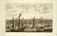
1745199411London. 1745-1747. Copperplate engraving 18 x 29cms image; 25.5 x 38cms sheet; original folds margins age-toned but the image in very good condition with fine deep tone. A striking view of the important trade city of Canton one of the first treaty ports. The harbour is a riot of activity with ships from triple-decker ships of the line to small sampans and rowing boats. The image is after the work of Johan Nieuhof 1618-1672 whose 17th century views were amongst the most influential European images of China. Nieuhof a German-born diplomat and adventurer was travelling in the service of the Dutch East India Company VOC eager to establish trade relations with China. This engraving was published in "A New General Collection of Voyages and Travels" published in London by Ashley. . unknown
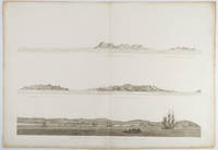
1797197707London. circa1797. Engraving 54.4 x 76 cms platemark; 57.5 x 63.5 cms sheet original fold; edgewear and toning pronounced at the fold light offsetting good dark impressions. Triptych of elegant engravings after the work of William Alexander published in George Staunton's official account of the 1st Earl Macartney's embassy to China 1792-1794; the flagship Hindostan is seen at anchorage in the lower engraving. . unknown
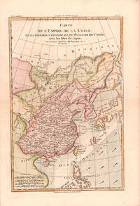
1780180203Paris. circa1780. Engraved handcoloured map 31.3 x 20.5 cm; 37.8 x 25.5 cm sheet central fold slight toning one spot of discolouration to the upper border in very good crisp condition. Attractive map showing China the Korean peninsula the Philippines Japan and Chinese Tartary/Mongolia Vietnam and Central Asia. Also shows the wind direction vital to traders at the time. Rigobert Bonne 1727-1794 was an influential French cartographer of the late-eighteenth century succeeding Jacques Nicolas Bellin as Royal Hydrographer at the Depôt de la Marine in 1773. This map was prepared for Abbe Raynal’s famous "Atlas de Toutes Les Parties Connues du Globe Terrestre." 1780. . unknown