3 141 résultats
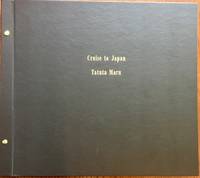
193856764Portland OR: Heathman Hotel 1938. Oblong folio. 18.5 x 16.25 in. 18 leaves unnumbered. on thick beige-coloured paper w/ 101 silver gelatin photos mounted sized from 4.25 x 6 in. up to 6.25 x 8.5 in. all identified and labeled below in neat draftsman’s hand some ruling as well two images removed by family members and 1 leaf w/o lower 3rd of leaf. Recent black cloth post-binder gilt lettering stamped on front cover still VG exemplar all images with bright strong contrast from the library of Harry Heathman 1906-1962 owner and manager of the historic Heathman Hotel in Portland OR. This interesting photo album chronicles the 1938 “Entente cordiale†trip of many noted U.S. hotel managers and owners to Japan and Manchukuo China against the backdrop of continued Japanese incursions into China including the bombing of civilians in Canton and diplomatic conflicts with the U.S. Intended by Japanese officials to entice American tourists to visit Japanese hotels the hotel execs including Harry Heathman of the Heathman Hotel Charles Baad of the Los Angeles Biltmore John Ramboz of the Los Angeles Ambassador Carl Stanley of the Hotel Del Monte and others all sailed on the N-Y-K ocean liner Tatuta Maru newly renamed in 1938. The photos show the first class lounge dances and sightseeing in Japan the Tosyogu Shrine at Nikko where they stayed at the Kanaya Hotel other temples and the Buddha at Kamakura and gifts presented at the Imperial Hotel in Tokyo. Other stops included the famed Fujiya Hotel with photos of the owner Mr. Yamaguchi and manager M. Arai a visit to the Nagoya Castle and more. Carl Stanley and his wife are shown riding the “Asia†Express in Manchukuo the Mukden Yamato Hotel the Yamato hotel near Dairen formerly Port Arthur and photos at the Port Arthur monument in Manchukuo. The Tatuta Maru sailed originally as the Tatsuta Maru including transporting Olympic athletes from Japan in 1932 and was the last passenger liner to travel between Japan and the U.S. with stop in Honolulu H.T. in Oct. 1941. She was used by the Japanese Navy as a feint supposedly to pick up another load of repatriating Japanese departing Yokohama on Dec. 2nd but reversed course the night of Dec. 6/7 and returned to Japan. See: Hotel Executives to Visit Japan Los Angeles Times Oct. 15 1938 Part II p. 22; Hotel Group Due Back From Japan San Francisco Examiner Dec. 19 1938 p. 25. Heathman Hotel, hardcover
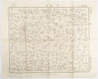
1938172168Japan.: 陸地測量部参謀本部. Rikuchi Sokuryōbu Sanbō Honbu. Showa 13 1938. Black and white folded map 45.5 x 57.5 cm scale 1:50000 Two small red pencil marks and one in blue some careless folding of map but overall very good. This 1938 map of northern China was published in 1938 by the General Staff Headquarters of the Japanese Army and was marked as military secret. By this time Japanese military was fighting in China in various regions. This military map shows parts of 單縣 Shan County in Shandong Province 虞城縣 Yucheng County in Hennan Province and 碭山縣 Dangshan County in Jiangsu Province. . 陸地測量部参謀本部. [Rikuchi Sokuryōbu Sanbō Honbu]. unknown
162134518Lisbon and Hangzhou China: Manuscripts ca.1623 and 1621. Very Rare A Similar Manuscript Exists in Brussels. We know of no others. The Latin text of both letters is written in a neat uniform cursive hand in brown. Folio leaves 33 x 20.5 cm The transcripts bound in 18th Century stiff blue wrappers the blank paste-downs and endpapers are late 18th century most likely the third quarter between 1745/1753 and 1776 since they contain a clear "lion/vryheit/pro patria" watermark with a crowned GR countermark which resembles Heawood 3148 3149 and 3154. The paper used for the manuscript contains a faint double-headed eagle watermark and it has been reinforced in the gutters. A very pleasing survival very well preserved edges slightly mellowed the wrappers show some signs of wear. VERY RARE MANUSCRIPT TRANSCRIPTS. Chrysostomus Johann Gall 1586-1643 was a German Jesuit and scholar. He left Ingolstadt Germany to teach astronomy mathematics and navigation in Lisbon fro 1620to 1627 before leaving to work in the Jesuit missions in India. The Colégio de Santo Antŕo benefitted from the arrival of many foreign mathematicians and other scholars as Lisbon serves as a gateway for all missionaries departing for Asia. The original letter by Gall was written in Lisbon September 1623 and concerns a newspaper style description of various events including details of the perseution of Christians in Japan particularly the execution of large numbers of the Christian community in Nagasaki in 1622.<br> The second letter in the present work is especially interesting as the original was written by Johannes Terentius also known as Johannes Schreck an Deng Yuhan Hanpo 1576-1630. Terentius was a prominent Jesuit scholar specialized in natural science and mathematics. Before joining the Jesuits as a novice1611 he already enjoyed a grea reputation in Germany as a scholar. In 1621 Terentius left for China to join the Jesuit mission. The original letter by Terentius was written in Hangzhou China on 30 August 1621 to the rector of teh Jesuit College in Munich Jakob Keller 1568-1631. He discusses his journey to China which he started in 1618 his intentions to participate in the planned calendar reform in China and his impressions of the city of Hangzhou which he reached in 1621 Terentius wrote several works on european medicine mathematics and technology in Chinese and together with Johann Adam Schall von Bell and G. Roho introduced European tigonometry and European astronomical instruments to China. In 1629 he began to reform the calendar which J.A. Schall von Bell ocmpleted after Terentius' early death a year later.<br><br>Backer & Sommervogel VII col. 1929-F<br> Manuscripts unknown
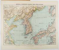
1900218968Glogau.: Verlag von Carl Flemming. Eleventh Edition. Circa1900s. Edited from the latest Russian English French and German sources by A. Herrich. Folding colour map 35 x 46cm folding to 25 x 14cm in original printed wrappers with a small loss to the edge of the lower wrapper otherwise very good copy. . Verlag von Carl Flemming unknown
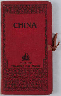
1920161936no date. circa1920. Linen backed colour folding map of China insets of Peking and Environs and Hongkong and Canton in lower left corner. 54 x 63.8cm. Table of place names at upper left gives the cities that "By a recent ordinance of the Republic all 'Fu' 'Chow'' and 'Ting' cities have been nominally reduced to the rank of 'Hsien'. The following parallel list gives the 'Fu' cities the names of which have been officially changed together with the new form adapted." Map folds into a red cloth covered case with ribbon ties 19 x 10.3cm. Title and decoration printed in black on upper cover. Trifle foxed on linen backing a little insect damage case in a few small places otherwise a very good clean map. . hardcover
19662211Tainan : Hong Ying ChuBan She ; 1966 1966. Hardcover. Very Good. Green cloth with gold decorations and lettering ; 53 738 pp. ; illustrations in black & white ; an exhaustive aircraft dictionary with military and engineering terms and several exploded views of various types of aircraft including the Boeing 707 727 and YS-11A a twin-engine Beechcraft the C-46 C-117 C-121 C-123 and the DC-54 ; detailed schematics and drawings of cables struts assemblies etc ; each page of the dictionary will contain up to six graphic figures with English label s to illustrate the Chinese definitions to the English entries ; foxing ; water stain to fore-edge of textblock does not affect the text ; front corner bumped ; VG This listing contains text in Chinese GB Fonts <br/> <br/> (Tainan : Hong Ying ChuBan She) ; 1966 hardcover
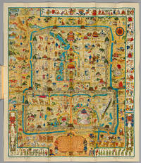
CBF24<p>Lithographed & Published by The Peiyang Press Ltd. Tientsin-Peiping 1936.</p><p>8vo 181 x 132 mm of 1 title-page 22 pp. of explanatory text and a folded map in colors measuring 86 x 74 cm. Two small tears in the white margin of the map. Preserved in the original publisher's wrappers and slipcase.</p><p><b>Very rare first edition complete with the folded map and the booklet preserved in the publisher's illustrated folder.</b></p><p><b>Finely executed pictorial map of Beijing published by Frank Dorn and the Peiyang Press. Ltd. of Tientsin and Peiping in 1936.</b></p><p><b>Dorn's map is perhaps the best known and most iconic pictorial map of Beijing published in the 20th Century offering a host of interesting ethnographic and iconographic information about Beijing and its environs while retaining the whimsical qualities of the great pictorial maps of the first half the 20th Century.</b></p><p><b>Dorn's map is considered one of the great maps of the golden era of pictorial mapmaking. </b></p><p>The map is ringed with a series of cartoon vignettes illustrating the history of the city from ancient times to 1936. Dorn was a friend and admirer of the pictorial mapmaker Jo Mora 1876-1847 and was clearly influenced by Mora's style of combining accurate pictorial details bright colors and a bit of whimsy along with vignettes providing an illustrated history of the place.</p><p>The cartouche is decorated with names and dates of historical events and this legend in the center.</p><p>Frank Dorn was an artist writer and military officer. Growing up in San Francisco he attended the San Francisco Art Institute and became an accomplished cartoonist. After graduation from West Point he was assigned a post in the Philippines and as a side project wrote a book about a clan of tribal people he got to know there. An acquaintance of California artist Jo Mora Dorn began making his own maps; an early one depicted Camp Strassenbourg in the Philippines.</p><p>While living in China Dorn made his popular pictorial map of "Peiping". He later served in the field as advisor to a Chinese army. A fluent speaker of Chinese Dorn's most important military role was in the China-Burma-India theater during World War II. There he served with Deputy Chief of Staff of the U.S. Army forces General "Uncle Joe" Stilwell during the Burma campaign from 1942 to 1944 and served as a commanding officer in 1944-45. A 1942 Life Magazine article about the Burma mission stated that "Dorn an artist drew Stilwell's campaign maps." </p><p>Dorn eventually attained the rank of Brigadier-General and retired in 1953. He settled in Carmel California living what his friend John Thompson describes as "a semi-bohemian life writing and painting. In the Sixties he did some amazing psychedelic paintings wondered if he was the incarnation of a Buddhist painter and held progressive civil rights and antiwar views." In the 1970s Dorn authored two highly-regarded scholarly books on the Chinese and Burmese theaters of World War II. </p><p><b>A fascinating pictorial map of Beijing drawn by an American officer who was a military attaché in China during the 1930s. </b></p><p><b>It features vignettes of Chinese history from 1100 BC to 1927 as well as modern tourist attractions</b> including golf and race courses. </p><p>Hints to the political situation include the 'Kuomintang Headquarters'; and the German swastika and the Japanese 'Rising Sun' flags flying in the 'Legation Quarter' the year before the official start of the Second Sino-Japanese War in 1937. </p><p>Frank Dorn 1901-81 was a graduate of West Point where he picked up the life-long nickname of 'Pinky' before being posted to Beijing in 1934 to help gather intelligence on Japanese aggression. He immersed himself in the language and culture of the city researching the Forbidden City and collecting antiquities. When war with Japan broke out Dorn became chief-of-staff to L.t General Joseph Stilwell with a rank of Colonel. At one point relations between the Americans and the leader of the Chinese Kuomintang Chiang Kai-shek were so bad that Dorn was ordered to prepare a plan to assassinate him. Although Dorn suggested giving Chiang a faulty parachute and sabotaging his plane authorization was never given. </p><p>The plan is packed full of wonderful illustrations from the border that covers the city's history from its inception in 1100B.C. its numerous dynasties - including the 'decadant period under the Ch'Ings' - through to the revolution of 1911 and the movement of the capital to Nanking in 1927. Also to the borders are illustrations of a wedding and a funeral. </p><p>The plan itself not only shows all the historic landmarks including the Forbidden City and the Temple and Altar of Heaven but also the racecourse zoo old execution ground and cocks fighting. </p><p>The color printed map is accompanied by a 22 page booklet which gives a potted history of the city together with a list of points of interest that are shown on the map.</p><p><br /></p><p><u>Français</u></p><p>Lithographed & Published by The Peiyang Press Ltd. Tientsin-Peiping 1936.</p><p>In-8 de 1 f. de titre 22 pp. de texte explicatif et carte repliée en couleurs de 86 x 74 cm. Deux petites déchirures dans la marge blanche de la carte. Conservé dans la brochure et dans l'étui d'origine.</p><p>Dimensions du livret : 181 x 132 mm.</p><p>Dimensions de la carte : 860 x 740 mm.</p><p><b>Très rare édition originale complète de la très belle carte repliée de Pékin et du fascicule de présentation accompagnant la carte le tout sous chemise illustrée d'éditeur.</b></p><p><b>La carte de Frank Dorn est sans doute la plus célèbre et la plus emblématique carte picturale de Pékin publiée au XXe siècle. </b></p><p><b>Elle offre une foule d'informations ethnographiques et iconographiques du plus haut intérêt sur Pékin et ses environs</b> tout en conservant les qualités fantaisistes des grandes cartes picturales de la première moitié du XXe siècle.</p><p>Elle présente une suite de vignettes illustrant l'histoire de la ville de Pékin aux temps anciens. La bordure de la carte regorge d'illustrations formidables qui retracent l'histoire de la ville depuis sa création en 1100 av. J.C. à travers ses nombreuses dynasties jusqu'à la révolution de 1911 et le déplacement de la capitale à Nankin en 1927. Un mariage et un enterrement sont également représentés dans cette bordure. Le cartouche comporte d'ailleurs des noms et des dates d'événements historiques majeurs. </p><p>La carte ne montre pas seulement les lieux historiques comme la Cité interdite ou le Temple du Ciel mais aussi des attractions touristiques plus récentes comme l'hippodrome le zoo les combats de coq… Elle révèle également les occupations des habitants.</p><p><b>La carte de Dorn est considérée comme une des grandes cartes de l'âge d'or de la cartographie illustrée.</b> </p><p>Frank Dorn 1901-81 était un ami et un admirateur du cartographe Jo Mora 1876-1947. Il a été clairement influencé par le style de Mora qui combinait l'illustration précise par des couleurs brillantes et un peu d'humour avec des vignettes fournissant une histoire illustrée du lieu étudié. Frank Dorn est un artiste auteur et officier militaire. En grandissant à San Francisco il a étudié à la San Francisco Art Institute et est devenu un dessinateur accompli. Après l'obtention de son diplôme d'officier à West Point il a été assigné à un poste aux Philippines. A côté de son travail militaire il a écrit un livre sur les tribus autochtones qu'il a appris à connaître là-bas. Proche de Jo Mora Dorn a commencé à faire ses propres cartes. </p><p>Plus tard vivant en Chine Dorn a réalisé sa carte illustrée de "Peiping" après s'être immergé dans la culture locale faisant des recherches sur la cité interdite et accumulant des antiquités. Il a servi dans ce pays comme conseiller militaire de l'armée chinoise. </p><p>Pendant la Deuxième Guerre mondiale il a été attaché au Chef d'Etat-Major Adjoint des Forces de l'Armée de Terre des États-Unis le Général Stilwell pendant la Campagne de Birmanie de 1942 à 1944. Un article de Life Magazine daté de 1942 a par ailleurs déclaré que "Dorn un artiste a dessiné les cartes de campagne de Stilwell." Dorn a finalement atteint le grade de Général de Brigade et est parti en retraite en 1953. Il s'est installé à Carmel en Californie vivant une semi-vie de bohème écrivant et peignant. Dans les années 1960 il a réalisé quelques peintures psychédéliques étonnantes. Dans les années 1970 Dorn a écrit deux livres savants sur les théâtres chinois et birmans pendant la Deuxième Guerre mondiale.</p><p>La carte accompagne un fascicule de 22 pages qui retrace l'histoire de la ville et présente une liste des lieux et monuments représentés sur la carte.</p><p><b>Fascinante carte picturale de Pékin dessinée par un officier Américain envoyé en Chine dans les années 1930.</b></p>
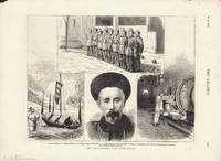
1875180155London.: The Graphic. October 231875. Four engravings together 22.5 x 30 cms captions and margins occupying a single newspaper leaf edges a little rough and chipped with a few creases scant spotting and toning the images in very good condition. Four engravings prepared for "The Graphic" illlustrated newspaper by the noted engraver and photographer Horace Harral 1817-1905. Prominent in the mosaic layout is the portrait of Li Hongzhang then Viceroy of Zhili. The murder of the British diplomat Augustus Raymond Margary and his staff in February 1875 whilst scoping potential overland trade routes between British India and China's provinces provoked a diplomatic crisis with China. It handed the British authorities an excuse to put pressure on the Qing government and hastened the build up of Chinese troops and armaments. War was averted with the negotiaton of the Yantai Treaty Chefoo Convention signed by Li and British diplomat Sir Thomas Wade. <br> <br>The four captioned engravings: <br> <br>1. Chinese soldiers; <br>2. Chinese gunboat on the Upper Yangtse-Kiang River; <br>3. Li-Hung-Chang Governor-General of Peichihli Commander-in-Chief of the Chinese Army; <br>4. Interior of a Workshop Nanking Arsenal. <br> <br>From the Estate of the late collector and scholar Arthur Hacker. . The Graphic. unknown
1860214311n.p.Paris: Hachette. c 1860. Full page black and white map of Turan Bay occupied by the Hispano-French expedition of 1859. A plan of the town of Saigon three full page engravings and a smaller portrait engraving of Doctor Livingston. Half red morocco with marbled boards titled in gilt spine lightly sunned. An extract of pages 50-64 from Le Tour du Monde nicely bound and an interesting item. 29 x 21cm.<P> French text. A French naval officer's account of Cochinchine during Le Tour du Monde Expedition of 1859. Notes from an unpublished correspondence.<P> <b>When referring to this item please quote stockid 214311</b> . (Hachette) hardcover
1923170115Peking.: 外交部. Wai jiao bu. December1923. Volume One only of three. 4 108 leaves four-hole stab binding in red paper covers. Original red wrappers a little faded in places and chipped and torn with some loss. Title pages some occasional foxing but generally very clean small numeric stamp upper wrapper barely visible light damp stain outer edge last leaves 4 x 3cm loss to paper on title page not affecting the text very clean and sound internally. Text in traditional Chinese. 32.6 x 19.2cm. Scarce. This conference also known as The Washington Naval Conference; The Washington Arms Conference or the Washington Disarmament Conference was a meeting of delegates from nine nations - the USA Japan China France Britain Italy Belgium the Netherlands and Portugal. This group which very deliberately excluded Russia met in this interesting post WWI world to discuss and negotiate their interests in the Pacific and the East Asian region. Three major treaties were some of the results of the conference: Four-Power Treaty; Five-Power Treaty also known at the Washington Naval Treaty and the Nine-Power Treaty together with a number of other smaller agreements. These treaties helped keep the peace throughout the 1920s and also helped Japan build up her navy and work on consolidating her position in China. The decisions and actions that took place at this conference clearly had an effect on the lead up to World War II in East Asia and it can be argued still have echoes today on relationships with and within the region today. . 外交部. [Wai jiao bu]. unknown
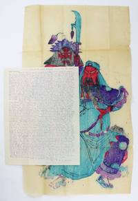
19286054Shanghai China: February 24 1928. Very good. 1p. plus colored woodblock print 21.5 x 12.5 inches. With original envelope. Old folds minor wear. Mimeographed fundraising letter sent by Reverend H.G.C. Hallock to a supporter in Vermont. Henry Galloway Comingo Hallock 1870-1951 was a West Virginia native who studied at Princeton Theological Seminary. He moved to China as a Presbyterian missionary and teacher in 1905 where he taught Sunday School served as a pastor and also taught theology at St. John's University in Shanghai. He survived war disease famine and a Japanese prison during World War II; he died in China in 1951. One thing that set Hallock apart was his inclusion of local Chinese woodblock prints with his fundraising letters which today have become desirable collectibles. Such a print is present here showing the God of War Wu-ti. His letter opens discussing the print:<br /> <br /> "Wars in China suggest sending you 'Wu-ti' the Chinese god-of-war. . The general idea about Wu-ti is that he delights in war. That is not the Chinese idea of him. . Officials and scholars worship him as the ideal of loyalty soldiers do it to make them brave and protect them in battle and the people worship him to protect them from war's horrors. He's called 'Peace Bringer Protector Great God of Loyalty.' But he makes not peace nor protects nor makes loyal so is a failure. He's also called 'Warrior Prince.' As to that name he's a great success! There are lots of wars."<br /> <br /> He goes on to discuss the many conflicts which are like "a real Chinese puzzle" noting that it's not the people of China who are at issue or fault. "Recently I have received letters from America suggesting that since 'China has altogether gone to the bad and the Chinese are absolutely impossible' and since our 'work among them has gone for nothing' then I should 'quit and come home.' I hope you don't think thus. The masses of Chinese tho reminding me of 'dumb driven cattle' are still friendly as ever. The war-lords the Nationalists the Reds the bandits wars and evil propaganda are disturbing elements; but they are NOT China nor the Chinese. . The troubles in China have come from a fiercely aggressive and 'noisy minority' who make the great mass of Chinese suffer untold hardships." He goes on to defend the Christian work being done in China as of great benefit to the people. February 24 unknown
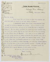
19115251London: March 29 1911. Very good. 1p. Previously folded. Contemporary manuscript annotation is left margin. Light toning. A brief but interesting letter dated March 29 1911 from Marshall Broomhall Editorial Secretary of England's China Inland Mission to the Rev. Arthur H. Smail a prominent American Missionary in China. Broomhall had recently published a book Islam in China in which he promoted the use of Arabic-speaking missionaries to proselytize Chinese Muslims. The book used information received from Smail about the Chinese Muslim population but Broomhall at certain points managed to confuse Beijing Peking and nearby Tongzhou Tungchow while apparently attempting to criticize Smail's statements. This letter apologizes to Smail for his error though the American seems to have still been cross -- having received the letter Smail noted in the left margin "Two pages gives to demolishing what I never said! March 29 unknown
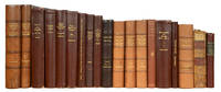
90438Various places 1764-1914. . Collection of 15 titles in 18 vols.<br /> Extensive collection of Russian works focusing mostly on Northern China and Mongolia including important and rare travel trade and exploration accounts.<br /> <br />Assembled by Angus Ivan Ward us consul in China and Russia during troubled times and ambassador in Afghanistan.<br /><br />Ward 1893-1969 served in the U.S. Army during World War I and then became U.S. Vice Consul in Mukden China in 1926; then in Tientsin in 1927-29 and again in 1932. He was sent to Moscow in 1938 and served as U.S. Consul General in Vladivostok during WWII in 1943. Before becoming U.S. Ambassador in Afghanistan in 1952-56 he was back in Mukden as Consul in 1948 where he became the subject of the Ward Incident 1948-49. During the final years of the Chinese Civil War Ward and the consulate staff were imprisoned and held under house arrest by Mao Zedong's People's Liberation Army for almost a year creating a diplomatic rift with the United States.<br /><br />Ward's collection is remarkable for its wide range comprising 150 years of Russian approach to China and their neighbouring region Mongolia before the Russian revolution. Including important as well as lesser works most in first editions and all rarely found on the market the collection not only presents an excellent panorama of Russian exploration of the region but also allows a rare understanding of the commercial and diplomatic relations between these two giant states. It is completed by scholarly works on local languages and cultures.<br /><br />Although Russian envoys and merchants were visiting and residing in Mongolia and China in the 17th century printed accounts of the relations between these countries became available to Russian readers only in the mid 18th century. At first they were Russian translations of works by Chinese authors such as An Account of the Chinese Mission to the Kalmyk Khan on the Volga in 1714 and Their Journey through Russia by Tulishen 16671741 which describes in detail the first official diplomatic mission of China to a European State. This early and important work later published in English by Staunton himself is represented here by a fine example of the first edition in Russian. <br /><br />One of the first Russian scholars of China is the celebrated and prolific monk Iakinf Bichurin 1777-1853. Leader of the 9th Russian Mission to Peking he spent 14 years in China learning the language and exploring the region. His Notes on Mongolia 1828 illustrated with fine hand-coloured plates is the first fundamental study of Mongolia by a Russian sinologist. When Bichurin's mission left Beijing the smooth transition with the new mission was under the control of the diplomat Egor Timkovskiy 1790-1875. His 3-volume Travels through Mongolia to China in the years 1820 and 1821 1824 became the first significant travel account of a Russian to China collecting material on Eastern Turkestan Mongolia Tibet China and Korea.<br />The 1860 Beijing agreement ending the Second Opium War brought a new turn to the Russian exploration of the region. It was the result of Russian diplomatic efforts to facilitate negotiations between China on one side and Britain and France on the other and it allowed the establishment of a permanent Russian diplomatic presence in Beijing. The negotiations and Russia's role are described in detail in Baron Buksgevden's Russian China 1902.<br /><br />The last quarter of the 19th century was the most fruitful period for Russian exploration and the Ward collection includes some of the most important accounts published at that time. Due to an extension of the Great Game to the East many scientific Russian expeditions to Tibet and China were subsidized by the Russian Imperial Geographical Society with often a hidden agenda focusing on mapping the region and gathering intelligence data. <br /><br />An excellent example is given by Mikhail Pevtsov 1843-1902 a Russian army officer and student of Nikolay Przhevalskiy. His Account of a Travel around Mongolia and Northern Provinces of Continental China 1883 mapped unknown parts of Mongolia and Inner China which he discovered during his 1878-79 exploration. Similarly a generation later another military Vasiliy Novitskiy published an account on central Mongolia 1911 accompanied by fifteen accurate and detailed maps of the region. <br /><br />One of the most famous Russian explorers of the region is Grigoriy Potanin 1835-1920 who conducted eight expeditions to Mongolia Tibet and China with some of them lasting up to two years. The present collection includes his rare and fundamental 2-volume study of Central Mongolia and the Eastern border of China published in 1893 to which Ward added a scarce volume of articles by Alexandra Potanina 1843-93 Potanin's wife and the first woman to be accepted as a member of the Russian Geographical Society. <br /><br />A diplomat himself Ward extended his interest to the economic and diplomatic relations between Russia China and Mongolia. Exploration missions were indeed often useful to trade missions organized by the largest Russian trading companies trying to find new routes to the East and to understand the legal and economic aspects of trading in the region. Fascinating accounts were published including for example an Expedition to China in 1874-75 by Yu. Sosnovskiy 1883 Notes the Russian-Mongolian Trade by M. Bogolepov 1911 and Moscow Trade Mission to Mongolia by V. Popov 1912.<br /><br />Ward was a bibliophile and took great care of his purchases. All books are in excellent fresh condition and except the very rare Timkovskiy they are all complete with maps and illustrations. They have been bound in the mid 20th century in a uniform dark burgundy or brown colour in full cloth or in a quality half calf for the most important works except a couple of books such as the Tulishen which is in contemporary Russian half calf. During the binding work the maps were usually professionally laid on linen and carefully stored at the back of each volume in a pocket specially made. Most of the books bear Angus Ward's bookplate on the upper pastedown; some have supplementary earlier provenances.<br />The full collection comprises the following titles. A detailed description of each with notes is available on request.<br /><br />1. - - . TULIEN Larion Kalinovich ROSSOKHIN translator Gerhard Friedrich MILLER publisher. <br /> 1714 . ' '. An Account of the Chinese Mission to the Kalmyk Khan Ayuk on the Volga in 1714 and their Journey through Russia. Published in 'Monthly Essays on Scientific Affairs'. Imper. Akad. Nauk Skt. Peterburg 1764.<br /><br />A lovely fresh example of this early account of the Chinese mission to the Kalmyk Khanate - the first Russian edition of the first diplomatic mission to China to a European state according to the sinologist Mikhail Kapitsa. In the beginning of the 18th century the Kalmyk khanate situated in the South-East of the Russian Empire enjoyed autonomy in managing its domestic and foreign affairs. Ayuka Khan had a considerable authority both within the khanate and abroad and the Russian government relied on his military support to protect the borders of the Empire and make allies with the Asian states. The Tulien's mission was pre-approved by Peter the Great and aimed at forming a military union against the Dzungar Khanate. <br /><br />Originally published in Beijing in 1723 in Chinese and Manchurian this account became known in Europe thanks to the French translation issued in 1729. In 1732 a scientist of a German origin based in Saint Petersburg and the publisher of the "Ezhemesiachnye sochineniya" "Monthly essays" Gerard Miller issued his German translation of the account. Miller however didn't fully trust the accuracy of the French text on which he based his German translation; he wished to use a Russian translation based directly on the Chinese or Manchurian original. Miller's goal was achieved when he discovered a Russian translation of the travel account done by Larion Rossokhin a knowledgeable translator from Chinese and Manchurian and a resident at the Imperial Academy of Sciences. He resided in China for many years and had a chance to work with the original Manchurian text. Before passing away in 1761 Rossokhin left all his documents and translations to the Academy of Sciences including the unpublished translation of the Tulien's work which Miller tracked down. For clarity Miller supplied his own notes and comments in addition to those of Rossokhin.<br /><br />Description and Bibliographical references: July 1764: title 96 pp.; August 1764: title 99192 pp.; September 1764: title 195-288 pp.; October 1764: title 291-384 pp.; November 1764: title 387-480 pp.; December 1764: title 481-576 pp. An account of the Chinese mission: pp. 3-48; 99-150; 195-234; 291-353; 387-427; missing upper fly leaf and small part of title page with no loss of text light spotting throughout. Contemporary half calf over marbled boards two red calf labels to spines; corners slightly bumped. <br /><br />2. TIMKOVSKIY EGOR. 1820 1821 Travels through Mongolia to China in the years 1820 and 1821. Tip. meditsinskogo dep. Ministerstva vnutrennikh del Sankt Peterburg 1824. <br /><br />First edition very rare. For several decades after its publication this account remained the most comprehensive and reliable source of information about the region and was subsequently translated into English German and French. In 1820 Egor Timkovskiy 1790-1785 writer diplomat and a Privy Councillor was entrusted to accompany a new Russian mission to Beijing led by Archimandrite Petr Kamenskiy. On the way back to Russia he was to ensure a safe return of the 9th mission headed by Iakinf Bichurin who spent 12 years fulfilling his duties in Beijing. Timkovskiy set off from Kiakhta in August 1820 and returned a year later having stayed in Beijing for 9 months. He used this time to explore geography history and culture of the region and subsequently published his findings in 1824 upon the Imperial order. <br />The first volume of his work follows the caravan route between Kiakhta and Beijing; the second one provides an overview of China Eastern Turkistan Tibet and Korea; and the third one is dedicated entirely to the description of history geography religion as well as political and economical organization of Mongolia. <br /><br />3 vols 8vo 22.3 x 14.5 cm. Half-title engr. title letterpress title XVIII 388 pp. with 1 folding plan and a map laid on linen and inserted in pocket at rear ; Half-title frontispiece letterpress title 8pp. 409 pp. with 2 facsimile 1 plate and a folding plan plan laid on linen and inserted in pocket at rear; Title 6 433 2 37 4pp. with 3 plates; lacking pp. 159-160 frontispiece and a plate in vol 3 small light marginal waterstain to some ll. in vol. 1 and 2 title and p. IX in vol. 1 with neat marginal repair not affecting text. Later half calf over maroon cloth gilt lettering to upper covers and spine exlibris of Ward to upper pastedowns. <br /><br />Provenance: Nikolay Kolchin owner's inscription to half-title in vol. II Rayskiy's library at the theologival seminary of Tambov ink stamp to title of vol. II.<br /><br />3. FAR EAST BICHURIN Monakh Iakinf. Notes on Mongolia. Skt. Peterburg 1828.<br /><br />A lovely fresh copy of a rare book illustrated with hand-coloured plates by one of the major Russian scholars on China. Bichurin 1777-1853 was named in 1805 leader of the 9th Russian Mission to Peking and head of the Sretenskiy monastery in this town. During his 14-year stay he learnt Chinese compiled his own dictionary and prepared other scholar works for later publication. The first volume of the present work gives an account of the journey and the second volume a detailed examination of the geographical and political condition of the Mongols and their life and customs.<br /><br />2 vols in one 8vo 20.5 x 13.2 cm. xii 231pp. with 5 hand-coloured lithographed plates; vi 339 pp. folding engraved map with hand-coloured outlines laid on linen and inserted in pocket at rear; occasional marginal notes in pencil. Later half calf over maroon cloth boards gilt lettering to upper cover and spine ex libris of Ward to upper pastedown.<br />Obolyaninov 1027. <br /><br />4. . ORLOV A. - Mongolian-Buryat grammar. Gladysheva Kazan 1878.<br /><br />8vo 25 x 16 cm. Title X 265 VI pp; light marginal waterstain to several pages at rear traces of removed label on title. Later calf over maroon cloth boards gilt lettering to upper cover and spine ex libris of Ward to upper pastedown. <br /><br />5. PEVTSOV M.V. . Account of the Travel around Mongolia and the Northern Provinces of the Inner China. Omsk 1883.<br /><br />First edition of this travel account describing unknown parts of Mongolia and inner China. Mikhail Pevtsov 1843-1902 a young Russian army officer devoted traveler and student of Nikolay Przhevalskiy went with a caravan of merchants from Bijsk to Kalgan and back through the Southern Altai Mongolia and Gobi Desert thoroughly mapping the territory of altogether about four thousand kilometers. His detailed account covers the region's terrain rivers lakes brief history of its settlements; and characterizes local trade and animal productions. The large folding map of Mongolia clearly delineates the main geographical points of the territory between Irkutsk in the north Peking in the south and Lake Zaysan modern Kazakhstan in the west.<br /><br />A 20-pp. extract was published earlier in Izvestija Imperatorskogo Russkogo Geograficheskogo Obschesctva 1880 Vol 16. issue 5 pp. 435-457.<br /><br />Provenance: E.I. Yakushkin important historian and ethnographer with a library of about 15000 volumes 1826-1905 stamps to wrapper and title; Library of Shanyavskiy University Moscow stamps to wrapper and title.<br /><br />Title 2 IV 354 2 pp. with folding map of Mongolia laid on linen and inserted in pocket at rear; library stamps to title and upper wrapper. Later maroon cloth gilt lettering to spine original wrappers bound in ex libris of Ward to upper pastedown. Cf. for Yakushkin: Ivask IIp. 96.<br /><br />6. SOSNOVSKIY Y.A. 1874-75 . Expedition to China in the years 1874-75. Ivanov Moskva 1883. <br /><br />An account compiled by the Ukrainian born Colonel Sosnovskiy 1842-1895 who headed the 1874-75 expedition to China aimed at finding new land routes to Chinese trade markets. Among other tasks set by the Russian government the expedition was to evaluate opportunities for expanding trade with China find most favourable locations for Russian consulates and fabrics and also collect intelligence information on the Dungan revolt taking place in the Eastern regions of the country. The expedition resulted in establishing a new route to China which was 1600 versts shorter than the one used before. <br />In the mid 1870s still weakened after Russo-Japanese war the Russian Empire concentrated its geopolitical interests in Asia. Its activity in Central Asia and attempts to create spheres of influence in Tibet and China brought Russia on the brick of war with England which was itself aiming to dominate in the region. Both countries were actively conducting military intelligence in China considering it a possible future war arena. At that point Russian Empire sent multiple missions to Mongolia China and Tibet with most of them being headed by officers of the General headquarters. Sosnovskiy headed two such expeditions. <br />His account of the 1874-75 mission first appeared in the Izvestia Russkogo Imperatorskogo Obshchestva 1876 vol 12 issues 1 2 3 5 6 with the offered example being the first edition in the book form. <br /><br />Title V 894 II pp. with large folding map of China laid on linen and inserted in pocket at rear; lacking pp. 141-2 instead bound duplicate of pp. 189-190 ink stamp and inventory number to title light occasional spotting. Later maroon cloth gilt lettering to upper cover and spine ex libris of Ward to upper pastedown.<br /><br />7. POTANIN Grigoriy Nikolaevich. - Tangut-Tibetan border of China and Central Mongolia. Skt. Peterburg Suvorin 1893.<br /><br />An account of the two years expedition led by the famous Russian explorer and scientist Potanin 1835 - 1920 to the territories on the border of China and Tibet. Apart from Potanin himself the expedition of 1884-6 included his wife ethnographer Alexandra topographer A. Skassi and zoologist M. Berezovskiy. The group travelled from Beijing through two northern Chinese provinces to arrive in Gansu in 1884. Having spent a year researching the territories on the Eastern border of Tibet they travelled back to Russia in 1886 through Nanshan district and Central Mongolia. This work presents richly illustrated material collected during the expedition including geography ethnography and zoology of the region.<br /><br />2 vols 4to 29 x 22.5 cm. Title XVIII 657 XVIII 2 pp. with 42 photogravures and 3 maps incl. 2 large folding laid on linen and inserted in pocket at rear; Frontispiece title XII 437 XIX pp. Later half calf over maroon cloth gilt lettering to upper cover and spine ex libris of Ward to upper pastedowns; very slightly rubbed. <br /><br />8. DEKEN Constant de. A Travers l'Asie. Polleunis et Ceuterick Bruxelles 1894. <br /><br />8vo 22.6 x 16.4 cm. XI including title 367 pp. with 30 plates and 1 folding map; some light occasional spotting. Contemporary brown cloth gilt lettering to spine; traces of a removed label on upper pastedown.<br /><br />9. POTANINA A.V. : . Travels around Eastren Siberia Mongolia Tibet and China: collection of articles. Moskva Gerbek 1895.<br /><br />A posthumous publication of the complete collection of articles including the unpublished ones by Potanina 1843 - 1893 a famous explorer of Asia and the first women to be accepted as a member of the Russian Geographical Society. Along with her husband Grigoriy Potanin who made a very significant contribution to the research of Central Asia she took part in four expeditions to the region researching ethnography geography and economy of Mongolia Tibet and Inner China. <br /><br />8vo 24.5 x 17 cm. Frontispiece title 4 XLII 296 pp. 5 lithographed plates incl. 3 in colour. Later maroon cloth gilt lettering to spine and upper cover ex libris of Ward to upper pastedown; extremities of spine slightly rubbed. <br /><br />10. . BUKSGEVDEN Baron A. : 1860 . Russian China: notes on the diplomatic relations between Russia and China The Convention of Peking of 1860. Noviy Kray Port Artur 1902.<br /><br />The publication of this work was triggered by the events in China in 1900 when the massive rebellion against foreign intervention in Chinese provinces resulted in extensive violent attacks on foreigners official missions and Christian monuments. To protect their interests German American British and Russian forces advanced on Beijing and put an end to the rebellion which was supported by the Chinese government. <br /><br />The author found the developments of 1900 to have direct connection to the ones that took place 40 years before when at the culmination of the Second Opium War the British and French troops entered the Forbidden City in Beijing. Reflecting on these events Baron Buksgevden describes the diplomatic efforts of the Russian representative Ignatiev in 1860 to facilitate the negotiations between China on one side and Britain and France on the other and their successful outcome for the Russian Empire. <br /><br />The editor was planning to continue the work with description of the events of 1900 in China but the second part was never published. <br /><br />Small 4to 21.5 x 15.5 cm. Title 2 II 2 III 239 pp. Later maroon cloth binding gilt lettering to spine ex libris of Ward to upper pastedown.<br /><br /><br />11. TSYBIKOV G.Ts. - - : Guide to the stages of the Path to Awakening. Vostochniy institut Vladivostok 1910 1913.<br /><br />The first translation into a European language of the first part of this important text on Indian Buddhism in a scholar edition with text in Mongolian and in Russian with many linguistic notes. The 'Guide to the stages of the Path to Awakening' is the main work of the great Tibetan religious leader Tsongkhapa 1357-1419 which outlines the ideas of Buddhism in the form of a guide and describes the stages of the path of spiritual development up to the achievement of full awakening. <br /><br />Tsybikov 1873-1930 an explorer ethnographer and orientalist was one of the first foreigners to travel in Tibet where he secretly conducted research and recorded his journey in photographs. During his travels he obtained Mongolian texts of Lam-Rim from which he wrote a translation into Russian. According to Tsybikov only the first part of Tsongkhapa's work was available in Mongolian at that time.<br /><br />Two issues bound in 1 vol. 8vo 22.8 x 16.3 cm. 8 pp. incl. title XLVIII 312 pp. 2; 10 pp. incl. title XLI 294 II pp. Later half calf over maroon cloth gilt lettering to upper cover and spine ex libris of Ward to upper pastedown; spine very slightly rubbed. <br /><br />12. . . . BOGOLEPOV M.I. and M.N. SOBOLEV. - Notes on the Russian-Mongolian Trade. Sibirskoe tov. pechatnogo dela Tomsk 1911.<br /><br />An account of the expedition organized by Tomsk Society of the Siberia Research independently of the Moscow Trade Mission that was initiated in 1910. The expedition was subsidized by the three largest companies trading with Mongolia and aimed at researching all aspects of the Mongolian trade system including its legal and economic aspects.<br /><br />8vo 26.6 x 18 cm. Title VII 498 2 pp. with 20 photoengravings on 10 plates and 1 folding map pasted on linen and inserted in pocket at rear. Later maroon cloth gilt lettering to spine ex libris of Ward to upper pastedown. <br /><br />13. NOVITSKIY V.F. - - - 1906 Travels around Mongolia in 1906. Voenneya tipografiya Skt.Peterburg 1911. <br /><br />After the end of the Russo-Japanese war the Russian troops in Manchuria where Colonel Novitskiy served where awaiting relocation that was not promising to take place soon. Therefore it was not difficult for Novitskiy to receive a permission to explore the neighbouring Mongolia in the meantime. During his expedition which was partly sponsored by the Imperial Geographical Society Novitskiy meticulously recorded his geographical and meteorological observations as well as specimens of flora and fauna that he encountered. The account also greatly benefits from the enclosed fifteen accurate maps of the region and expedition routes compiled by Novitskiy. <br /><br />Large 8vo 27.7 x 17.6 cm. IV including title 400 pp. with 15 folding maps all pasted on linen and inserted in pocket at rear; traces of old tape to inner margin of several leaves small marginal loss to the general map of expedition route in Mongolia. Later maroon cloth gilt lettering to spine and upper cover ex libris of Ward to upper pastedown; extremities of spine slightly rubbed. <br /><br />14. . . . POPOV V.L. and others. Mo Moscow Trade Mission to Mongolia. Riabushinskiy Moskva 1912.<br /><br />An account compiled by the participants of the trade mission initiated at the meeting of the Russian industrialists and entrepreneurs in 1910. The expedition was headed by the colonel Popov and included representatives of the biggest trade companies such as V. Shkarin K. Koliadov I. Morozov and others. In Mongolia the group studied stock raising production of fur local banking and trade systems as well as the country's geographical political and administrative characteristics. <br /><br />Large 8vo 27 x 18.8 cm.Title 2 353 pp. with 35 photoengr. and lith. plates and folding map pasted on linen. Later maroon cloth gilt lettering to upper cover and spine ex libris of Ward to upper pastedown. <br /><br />15. RUDNEV A.D. - : 1 2 3 Khori-Buryat dialect: issues 1 2 and 3. Petrograd 1913 1914. <br /><br />8vo. 10 pp incl. title CXX; title 128 2 pp.; title 135 2pp. 4 pp. advert. Later maroon cloth gilt lettering to upper cover and spine ex libris of Ward to upper pastedown original upper wrappers of three issues bound in extremities of spine slightly rubbed. <br /><br />Provenance: Library of the Oriental Institute stamps to upper wrapper and titles.<br /> [Various places, 1764-1914]. hardcover
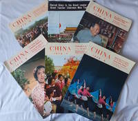
1976223365Peking.: China Pictorial. 1976. Collection of six issues of the monthly magazine each from June July August October November and December 1976. Colour and black and white photographic illustrations 44 to 59pp. 26.8 x 26.2cm. Original paper wrappers lightly browned and bumped at corners a very good set. . China Pictorial. unknown
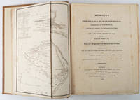
215542London and Edinburgh.: Longman Rees Orme Brown and Green and Cadell. First Edition in English. Large folding copperplate map as a frontispiece vii errata lxvi Preface and Introduction 432 pages 29.5 x 23 cm; period-style full brown morocco blind-ruled boards spine in compartments with red leather title label lettered in gilt endpapers renewed tiny prior owner and date 1827 on the flyleaf edges uncut some offsetting to the title page map spotted but on the whole a very good clean copy with large margins. The first translation into English of the Baburnama memoirs of Zahir-Ed-Din-Mohammed Baber 1483-1530 founder of the Mughal Empire. A handsome copy of a work which was a primary source for the study of 16th century Central Asia and the Indian subcontinent. <br> <br>Born in Andijan in the Fergana Valley Uzbekistan in 1483 the greater part of Baber's life was spent in war. He took Kabul in 1504 Kandahar two years later several times invading Hindustan and in 1525 finally defeated the Sultan of the Afghans and substantially became master of Hindustan. He showed himself no less able as a sovereign than as a soldier made many improvements social and political and died 1530. Baber was a gifted writer; as well as this valuable autobiography he left a rich literary and scientific heritage. DNB. . Longman, Rees, Orme, Brown, and Green, and Cadell hardcover
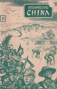
1945215424Sydney.: Ministry of Information China. 1945. Black and white photographic illustrations 72pp. Leaves evenly browned lower wrapper little damp-stained along spine upper cover abraded upper corner overall a good copy. 21 x 14cm. A well-illustrated propaganda booklet for the peoples of Allied nations touting the successes of the Kuomintang regime as the war with Japan enters its final stages. Within are multiple articles concerned with China's plight and development as well as a summary of the Communist-controlled Shaan-Gan-Ning Border Region. . Ministry of Information, China. unknown
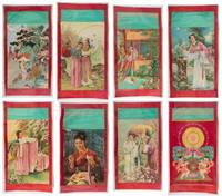
1960217264Circa1960s. Collection of eight colour-printed Nianhua posters the central images onlaid within a stiff red paper border with a thin cream paper frame worn and discoloured and at the top of each a fine aqua paper border; the sheets a little creased two of the images with a visible tide-mark minor edge tears not affecting the images strengthened neatly on the verso with washi one with an early paper repair to the verso of the margin approx. 93 x 51.5cms sheet size in good condition. Eight Nianhua posters six feature traditional narrative tales one based on a woodblock print one possibly of a movie heroine and one other features a pair of chubby toddlers holding a tray of peaches and flowers symbols of longevity and abundance. . unknown
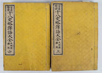
1518165201大阪.Osaka.: 明善堂. Meizendō. 明治15 1882. Volumes 1 and 2 only lacks volume 3. Map in text showing Chinese ancient battlefield of Fei River in 383 A.D. black and white illustrations original yellow embossed card covers four hole Japanese stab binding double leaves in oriental style paper title labels laid down upper covers. Covers a little marked and lightly worn at edges otherwise very good. Vol 1: 75 leaves; Vol 2: 76 leaves. Text in Chinese with Japanese translation. 17.8 x 12.1cm. Accompanying the Chinese text these volumes provide Japanese translations and some illustrations for words and terms which appeared in the 18 histories. . 明善堂. [Meizendō]. unknown
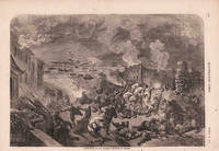
1857178579London.: Illustrated Times. March 211857. Full-page engraving 23.5 x 33.6 cm including caption on a single newspaper leaf relevant text on the verso edge tears no loss and creasing in very good condition. Dramatic and scarce engraving depicting the destruction of the Canton Factories principal site of Western trade with China at the onset of the Second Opium War 1856-1860 by a 25 year old Gustave Doré. He contributed to the "Illustrated Times" a chief rival to the monopoly of "The Illustrated London News". Whilst the self-taught Doré did not enjoy initial success in France for Victorian Britons Doré's art was celebrated producing with Blanchard Jerrold his landmark account of mid Victorian London "London: a pilgrimage" over four years 1869-1872. <br> <br>From the Estate of the late collector and scholar Arthur Hacker. . Illustrated Times. unknown
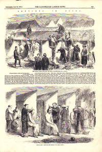
1858180046London.: The Illustrated London News. June 261858. Two half page engravings: 14.8 x 23.5 cm on a single newspaper leaf complete explanatory text neatly sealed marginal tear to a lower corner not affecting the image sheet toned and creased a few marginal spots good condition. Engravings prepared for a Supplement to "The Illustrated London News" following the Battle of Canton during the Second Opium War. <br> <br>From the Estate of the late artist collector historian and scholar Arthur Hacker. . The Illustrated London News. unknown
19612604Peking Beijing China: Foreign Languages Press 1961. Hardcover. pp. 2 82. Slim 8vo. measuring 5.5" x 7.5". 1/4 red cloth over paper boards red lettering. Lightest edgewear else near fine. Internally contents bright clean and unmarked with tight sound binding; near fine. <br/><br/>"Shortly after its founding the People's Republic of China promulgated its Trade Union Law Labour Insurance Regulations and other labour laws and regulations ensuring through legislation the freedom of the workers and staff members of organizing trade unions their other political freedoms and rights and the right to labour insurance. Following the progress of national construction the People's Government has introdued improvements in working conditions in a planned manner and enacted a series of laws and regulations on labour protection. All these documents - of which only a few are included in this booklet - show the utmost care the state led by the working class gives to the working people and the incomparable superiority of the socialist system to the capitalis system". Foreign Languages Press hardcover
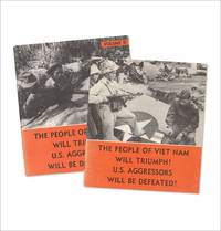
3734905<p>Peking Foreign Languages Press 1965. “Printed in the People’s Republic of China.†Quartos. 10 x 9 inches. Photo-pictorial wraps. Each title is in near fine condition with faint wear to covers.</p> <p>Profusely illustrated with vivid scenes of battle rallies and patriotic imagery these large Chinese propaganda booklets supported South Vietnam during the war and captured China’s stance and strategy at a key moment in the Cold War. First edition so stated inside rear cover of first volume. </p> unknown
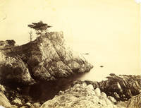
1880J6SGPBJ1IXLV1880. With 12 albumen prints ranging in size from ca. 16.5 x 23 cm to 21 x 28 cm. Collection of 12 vintage photographs from the late 19th century showing China Indonesia the Hawaiian Islands California and Egypt. Of the 4 photographs of China 2 show Hong Kong including one possibly by the famous Chinese photographer Lai Fong ca. 1839-1890 showing Queen's Road Central. The two rarest photographs show several of the 7500 imperial examination cubicles in Canton Guangzhou while a photograph by A Chan Ya Zhen shows the famous five-story pagoda on Kun Yam Hill in 1870. The Indonesian island Java can be seen on 3 photographs including one of lake Telaga Warna by the British firm Woodbury & Page based in Batavia Jakarta. Taken further to the west were 3 photographs of Hawaii probably all taken in or near Honolulu. A rare undated photograph of the statue of King Kamehameha was taken probably right after the unveiling ceremony in 1883 as it shows a small wooden fence around the statue which can be seen in an illustration in The Graphic 28 April 1883 but is absent from all later images. Of the 2 final images one by Isaiah West Taber 1830-1912 shows Midway Point in Monterey California and the other by Hippolyte Arnoux fl. 1860-1890 a group of Arabs and camels waiting for the ferry near El Qantara in Egypt. Most of the photographs are worn at the edges with small tears and folds and a few have small holes; one of the images of Hawaii with a waterstain at the lower margin. unknown
1946215694大阪. Osaka.: 每日新聞社. Mainichi Shinbusha. Showa 21 1946. Tiny lack and white photographic portraits in the text 64pp 18 x 12.6cm black and white line illustration upper cover browned throughout a good copy in original soiled wrappers. This booklet on China and the Chinese published by Mainichi Newspaper in May 1946 follows an earlier publication on the United States and Americans. It features essays on the new China including communist China aimed at helping readers understand contemporary developments in the country. . 每日新聞社. [Mainichi Shinbusha]. unknown
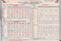
1938223511Batavia.: Java-China-Japan Lijn. 1938. Bifold pamphlet measuring 25.5 x 38cm. Very lightly browned and trifle creased at extremities two little markings in pencil a very good copy. Sailing schedule of three lines of the Java-China-Japan Lijn in 1938 showing detailed lists of ports and departure dates. <br> <br>Routes include: <br>Line 1: East Route Batavia Philippines Hong Kong China <br>Line 2: West Route Batavia Hong Kong China Manchuria <br>Line 4: Japan Service <br> <br>Java-China-Japan Lijn was a Dutch shipping company founded in 1902 to operate passenger and cargo services between Java and East Asia. . Java-China-Japan Lijn. unknown