462 résultats
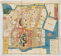
1857193964Tokyo.: Owariya Seishichi . Ansei 4:1857. Folding colour woodblock print map 45.7 x 50cm; 50 x 52cm sheet the legend shows: crest = feudal lord's main residence; black square = retired lord's residence; black dot= lord's warehouse blue = rivers; yellow = roads and bridges; green = forested areas; grey = homes of townspeople extensive worming with some minor loss to the map principally at the folds backed on the verso with archival washi. Although damaged nevertheless a scarce map with good colour and clarity. The publisher Owariya produced 31 folded maps of districts in Edo between 1850-65 called Owariya ban kiri-e zu. This is the area of and around the very important Zojoji Temple the main temple of the Pure Land sect of Buddhism. The map covers the central Tokyo area where residences of major daimyos were located as they are marked with their family crests and names. Presently Tokyo Tower and many embassies are located in the area. . Owariya Seishichi (?) unknown
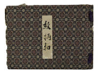
19001549731900. Sample album of designs most probably for weaving. The album contains 196 numbered paper slits for holding the design samples in place with 68 samples included. Handwritten paper tabs some damaged with loss attached to the edges of 17 leaves give the names of customers. Bound in cloth covered boards with tassel ties one place on the spine a little gnawed some other minor wear to cloth. Paper title label upper cover. A sample book which has been used for the purpose but is overall in good condition. This album contains samples of design which appear to be designs for the weaving of fabric. Many leaves have paper tabs attached which indicate the names of the customers ordering or interested in a particular design. Below each design is the name of the design and a hiragana letter and number given to the design. It is possible this album comes from Gifu Prefecture as there is a part of the letterhead of "鏡島尋常高等小學校 Kagashima Higher Elementary School. The seal of Sugiyama Shōten 杉山商店Sugiyama Shop is also included but we have not been able to locate this shop. . hardcover
1866018977San Clemente CA: Whittingham and Wilkins 1866. First Edition . Hardcover. Very Good . Drawings. 407 Pp 2 Pp Ads Ar Rear. Green Cloth Gilt First Printing With 1866 Date On Title Page. A Very Nice Example Gilt Brilliant Clothand Endpapers Very Clean Very Slight Loss To Gilt Corners Square Hinges Tight Although Front Hinge Has 1/2" Tear Near Bottom. Small Previous Owner's Label "J. W. Mackie" At Top Corner Of Front Pastedown 1" X 1/4". <br/> <br/> Whittingham and Wilkins hardcover
18817626Wien, Hölder, 1881. 5 Bll., 1013 S. mit zahlreichen Textxylographien. 3 farb. gefalt. Karten. Gr.-8°, HLdr. der Zeit mit Rückentitel (Gebrssprn, stark beschabt, bestoßen)
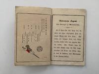
188916739ABTokyo, Hasegawa, 1889. 15 : 10 cm. 9 leaves with many coloured woodblock-printed illustrations by Eitako Kobayashi.. Coloured illustrated original Japanese binding.
18554183ABBoston, Sampson, 1855. 576 S., Karte von Japan (Knickspuren) geprägter Ln.-Einb.,frühere Rückenrestauration, kleine Bestossungen, sonst gut erh.
185563282ABNew York Redfield, 1855. New York 1855. 8°, VI, 377 S Ill., 7 von 8 ganzseitigen lithograph. Tafeln. Or.-Kart., Rü. Bibliotheksaufkl., Vorsätze und innen tls. stockfleckig, insgesamt ordentlich erhalten. The Perry mission to Japan, 1853 - 1854, / introd. by W. G. Beasley ; Vol. 3. 1855
18372092902143300151Izumiya Kinuemon Kawauchiya Mohei 1837. Soft Cover. Fine. Number of pages: 4 Size: 21.8x15.7cm Izumiya Kinuemon Kawauchiya Mohei paperback
186341236ABHamburg, Agentur des Rauhen Hauses, 1863. XVI, 428 S. Halblederband der Zeit mit reicher Rückenvergoldung.
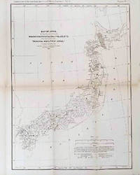
1878210211Philadelphia.: American Institute of Mining Engineers. Sherman & Co. printers. 1878. Large folding map of Japan showing "some of the more important Mining Districts Coal Fields etc." small fold split without loss tables 67pp. Covers a little scuffed and discoloured overall in very good condition. Scarce offprint separately paginated of a paper included in Volume V of the Transactions of the American Institute of Mining Engineers. The author Henry S. Munroe had been retained by the Japanese Government as Assistant Geologist and Mining Engineer with the Geological Survey of Yesso for the Hokkaidō Colonization Agency. His work laid the foundations for the future coal mining industry in Hokkaido. The report contains two lengthy tables relating to coal production and quality. . American Institute of Mining Engineers. Sherman & Co., printers. unknown
1831025792New York: J & J Harper 1831. First Edition Thus 2nd Printing. Original Printed Cloth. Good. Maps and Engravings. 1831 Printing First Published 1830 Vol I Of Harper's Family Library. Three Volumes Complete Original Printed Cloth Wear At All Corners With Some Fraying Spine Lacking On Volume 1.No Names Or Marks. <br/> <br/> J & J Harper hardcover
189016641ABTokyo, ca. 1890. 24,5 : 18,5 cm. 15 double-page coloured plates in woodcut. Contemporary cloth with title-label.
18800171-16[ca. 1880]. kl.-4°. 47 Bll. Mit 7 doppels. Holzschnitten v. Hashimoto Gyokusan. OKart.-Blockbuchbindung. m. Deckelschild. Berieb. 1 Bl. m. Wasserrand.
1890KART0060Ldn., Edward Stanford o. J. (um 1890). Flächenkol., lithogr. Landkarte in 20 Teile zerschnitt. u. auf Leinen aufgezogen, in Leporellofaltung, Ln.-Mappe m. aufkasch. Deckelbildchen der Fa. George Philip & Son, London, eine Teilkartenrückseite u. Innendeckel m. gefedertem Vorsatzpapier beklebt, am Einbd. geringe Gebrauchsspuren, am re. Kartenrand Klebeet. d. Fa. George Philip & Son, Map, Chart, and Geographical Depot London, Karte in sehr gutem Zustand.
188919432AB1889. Tokyo Kubunsha 1889. 18 : 13 cm. 11 leaves with many coloured woodblock-printed illustrations. Coloured illustrated original Japanese binding. The very scare plain paper edition. - The Kobunsha's Japanese Fairy Tales Series Vol. 10. - Text in German. - A small kink on front board. unknown
188322079Paris, Plon, 1883. Roman japonais illustrré. Le texte de Takizava-Bakin et les dessins de Chigueno. Vorwort: Emile Guimet. Mit reichem Buchschmuck und 34, meist farbigen, z.T. ganzseitigen Abbildungen nach Zeichnungen von F. Régamey in der Manier japanischer Holzschnitte. 31,5/25 cm. 83,5 S. (gedruckt im Querformat). Späterer Pappband mit gemustertem Stoffrücken. Innendeckel mit Buntpapierbezug (geprägtes, farbiges Papier, mit reichem, ornamentalem Muster). Farbschnitt. Papier gering vergilbt, eine Ecke gering bestoßen, vereinzelt Bl. leicht gelockert.
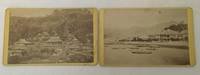
1880A37876Nagasaki Japan: No Publisher Listed. Very Good. 1880. Other. B&W Illustrations; Two Carte de Visites from Nagasaki Japan c1880-1890's. The first view is of the Bund of Oura - the waterfront where westerners were allowed with Sampans in the water. The Second view is "Oni no Jere" The Temple of Devils on a hillside. Both cards are in Very Good condition with some beginning tidemarking / foxing to the edges. "A series of encounters between the West and Japan in the 1850s ended Japan's isolationist trade policies. In particular the treaty with Russia signed on February 7 1855 established Nagasaki as an open port and further granted extraterritoriality privileges to foreigners living in Japan. These encounters finally culminated in 1859 when the Ansei Treaties and in particular the Harris Treaty with the United States took effect. These treaties demanded immediate opening of ports and also established generally unequal trade relationships between the Western powers and Japan. In 1860 development of the area around Oura Creek began; by August 15 1862 Japanese officials ordered foreign residents of Nagasaki into this new settlement area." . No Publisher Listed. unknown
185519038Boston: Phillips Sampson & Compy. . 1855. Hardcover. Very Good. Boards with light wear to extremities. Light chipping to spine ends. Tape residue to endpapers. Former owner's name on front free endpaper. Slight browning to first few pages ; Steel engraved map laid-in; 8vo 8" - 9" tall; 576 pages . Phillips, Sampson & Compy. hardcover
18644239ABBerlin, W. Korn & Co. (for R. von Decker), (1864). 23,5 : 42 cm. Original lithograph and 3 leaves description.
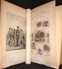
1857124314Philadelphia.: Lippincott. 1857. 29 full page black and white engravings including Bathing Scene in Japan and an engraved title page 507pp title page little creased and soiled upper hinge starting occasional light spotting professionally rebound in modern maroon cloth. The author Lieutenant A.W. Habersham of the US Navy was an officer on the North Pacific Surveying and Exploring Expedition. This account of the expedition is a fascinating and pleasing read and full of detail of the people their customs and the sights seen. Includes chapters on Cape Town Singapore Hong Kong Shanghai including an encounter with pirates Japan Kamtschatka and the northern Russian shores. . Lippincott. hardcover
18227186ABWeimar, Geographisches Institut, 1822. XVI, 920 S. Lederband der Zeit mit 2 farbigen Rückenschildern und -vergoldung.
188858469ABLeipzig, Twietmeyer, (1888). 4to. (24) S., durchgehend chromolithogr. illustriert. Orig.-Halbleinwand mit montierter Vorderdeckelillustration.
183910129ABStuttgart, Schweizerbart, 1839. 22 : 14,5 cm. XII, 529 Seiten Mit 72 Stahlstichtafeln. Leinenband der Zeit mit Blinprägung.