2 593 résultats
New English Paperback. Pbo. Color and b/w ills. In English, German, Italian, Turkish. 15 volumes set (2005 - 2012): Byzas 1. Aegyptische kulte und ihre heiligtümer im osten des Römischen Reiches. Edited by: Adolf Hoffman. Articles in English, German and Italian. 282 p. / Byzas 2. How did farming reach Europe? Anatolian-European relations from the second half of the 7th through the first half of the 6th Millennium Cal BC. Edited by: Clemens Lichter. Articles in English. 330 p. / Byzas 3. Stadtgrabungen und stadtforschung im westlichen Kleinasien. Geplantes und erreichtes. Edited by: Wolfgang Radt. 398 p. / Byzas 4. Strukturierung und datierung in der Hethitischen archaeologie.= Structuring and dating in Hittite archaeology. Edited by: D. P. Mielke, U.D. Schoop, J. Seeher. Articles in English and German. 328 p. / Byzas 5. Visualisierungen von Herrschaft. frühmittelalterliche residenzen- gestalt und zeremoniell. Edited by: Franz Alto Bauer. Articles in English and German. 351 p. / Byzas 6. Der fries des Hekateions von Lagina. Peter Baumeister. [x], 247 p., 43 b/w and 2 color plates. In German and Turkish abstract. / Byzas 7. Akdeniz çevresindeki arkeolojik kazilarda ele geçen Geç Antik ve Ortaçag seramigi ve mimari seramigi. Edited by: Beate Böhlendorf-Arslan, A.O. Uysal, J. Witte-Orr. 558 p. Articles in German, English and Turkish. / Byzas 8. Die Rizk-Moschee in Hasankeyf. Bauforschung und baugeschichte. Edited by: Peter I. Schneider. 268 p. In German. / Byzas 9. Bautechnik im antiken und vorantiken Kleinasien. Edited by: Martin Bachman. 571 p. Articles in English and German. / Byzas 10. Aktuelle forschungen zur konstruktion, funktion und semantik antiker stadtbefestigungen. Edited by: Janet Lorentzen, Felix Pirson, Peter Schneider, Ulrike Wulf-Rheidt. 298 p. In German. / Byzas 11. Holztragwerke der antike. Edited by: Alexander von Kienlin. [xviii], 322 p. In German. / Byzas 12. Dipteros und Pseudodipteros bauhistorische und archäologische forschungen. Edited by: Thekla Schulz. [x], 262 p. In German. / Byzas 13. Manifestationen von macht und hierarchien in stadtraum und landschaft. Edited by: Felix Pirson. [xx], 324 p. In German. / Byzas 14. Hellenismus in der Kilikia pedias. Edited by: Adolf Hoffmann, Richard Posamentir, Mustafa Hamdi Sayar. [xvi], 300 p. Articles in English and German. / Byzas 15. Byzantine small finds in archaeological contexts. Edited by: Beate Böhlendorf-Arslan, Alessandra Ricci. 491 p. / Byzas 16. Kulte und Heiligtümer der Demeter und Kore in Ionien. Edited by Schipporeit, Sven Th. 465, [15] p. / Byzas 17. Monopodia. Figürliche Tischfüße aus Kleinasien. Edited by Feuser, Stefan. 283 p. / Byzas 18. Handels- und Finanzgebaren in der Agais im 5. Jh v. Chr. Trade and Finance in the 5th c. BC Aegean World. Edited by Slawisch, Anja. 288 p. Articles in English, German, and Turkish. Byzas 19. 2 volumes set. Harbors and Harbor Cities in the Eastern Mediterranean from Antiquity to the Byzantine period: Recent discoveries and current approaches.= Hafen und Hafenstadte im Östlichen Mittelmeerraum. 2 volumes (836 p.). A mint, and heavy set with 19 volumes full set.
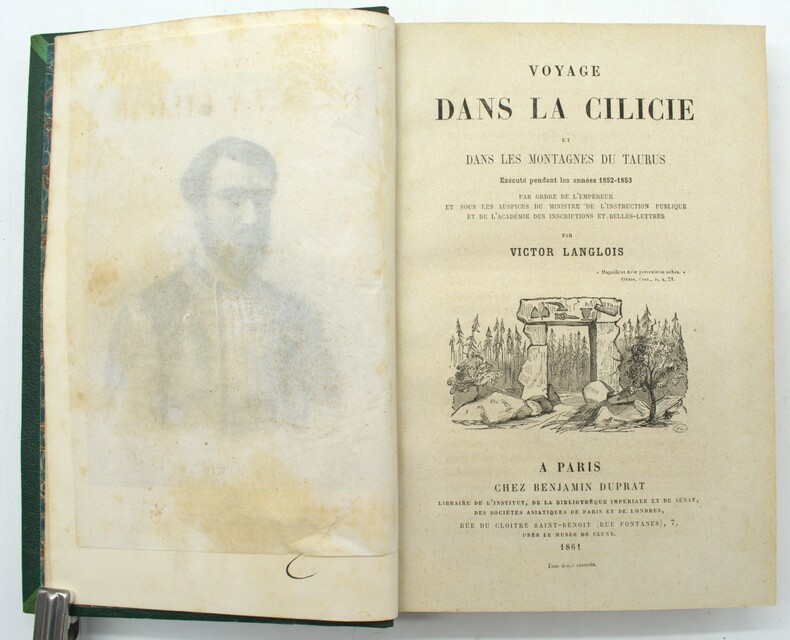
1657PHO-1458A Troyes, par Nicolas Oudot, et se vendent à Paris: Chez François Clousier, 1657. in-4; [6ff. (sur 7: feuillet de dédicace en fac-simile), dont titre, portrait légendé de La Boullaye, préface], 558p., [5ff. Table, fautes, privilège du 12 février 1657]; 33 illustrations sur bois dans le texte dont 16 à pleine page. Reliure d'époque en basane brune, dos à nerfs avec titre , coupes , coiffes et coins usés , frottements. un coin déchiré au titre sans atteinte au texte. Mouillure angulaire au premier portrait P. 73 déchirée avec manque de papier ,sans atteinte au texte. P. 165: manque en coin avec perte de qq mots; PP. 173 et 175: déchirures sans perte de texte; P. 234: manque de papier en pied avec perte de quelques mots; taches d'encre pp. 264 ; pp. 460 à 485: petites galeries de vers marginales en pied. Ex-libris manuscrit Dominium Antonium Biguet. Seconde édition
New New English Original bdg. Dust wrapper. In publisher's special box. 4to. (1934, [4] p.), color and b/w ills. A journey through maps from the Ottoman world to the Republic of Turkey. From Constantinople to Istanbul between the 15th and the 20th centuries. The cartographic collection of Erhan Öner. 4 volumes set. A project of passion and patience: For four decades Erhan Öner has been painstakingly collecting maps of Turkey, assembling a cartographic collection that is now one of the largest and most comprehensive of the area. His maps range in date from the 15th century, the early days of the Ottoman Empire, through to the 20th century and the early days of the Republic, and encompass historical, military, marine and archaeological maps, and even postcards with maps on them. Examples by the renowned cartographers Abraham Ortelius, Gerardus Mercator, Jodocus Hondius, Homann Heirs, Freres Lotter, Visscher Family, Sanson Family, John Speed and Frederick de Wit are among the highlights. A project of passion and patience, Öner's collection is finally being published in a four-volume catalogue. Displaying as many as 1,500 maps on 2,000 pages, it will be an important reference work for academics, researchers and fellow collectors. At the same time it is a visual feast, with beautiful illustrations, engravings and vignettes. Contents: Vol. 1: HISTORICAL MAPS OF TURKEY. 15th - 16th Centuries, 17th Century, 18th Century, 19th Century, 20th Century. TURKEY IN EUROPE. Vol. 2: REGIONAL MAPS. Black Sea, Thrace, Sea of Marmara Dardanelles, Aegean Archipelago. Mediterranean Sea, Central, Eastern and South East of Turkey,Middle East, Serial. OTTOMAN VILAYETS AND SANCAKS Postcard Maps, Yumni Maps. Other Vilayet Maps PORT PLANS. RAILWAYS. RELIGION RELATED MAPS, THE RETREAT OF THE TEN THOUSAND MAPS. GEOLOGICAL MAPS. POSTCARD MAPS. CLIPPINGS. Vol. 3: MILITARY MAPS. War and Peace Maps and Plans Maps of Erkan-¿ Harbiye. Harita Umum Müdürlügü, Milli Müdâfaa Vekâleti. Harita Genel Müdürlügü, Harita Genel Direktörlügü Maps of War Office & Ordnance Survey Office, Henri & Richard Kiepert Maps. ATLASES. Vol. 4: ISTANBUL NECIP BEY MAPS OF ISTANBUL: Societe Anonyme, Ottomane d'etudes et d'entreprises Urbanies. KESFlYÂT VE ¿NSAAT TÜRK ANON¿M S¿RKETl, TURKISH SURVEY AND CONSTRUCTION COMPANY UNFINISHED MAP OF ¿STANBUL, INSURANCE PLANS OF ISTANBUL. ARCHEOLOGICAL MAPS. OTHER CITIES. INFORMATION ABOUT CARTOGRAPHERS. ENGRAVERS AND BOOK PUBLISHERS.
Very Good English Original bdg. 4to. (33 x 24 cm). In English, German, French, and Turkish. 5 volumes full set: Alaca Höyük Excavations. Preliminary report on research and discoveries 1935-1967 [Les fouilles d'Alaca Höyük. Enterprises La Societe d'Histoire Turque Rapport preliminaire sur les travaux en 1935-1967].= [Ausgrabungen von Alaca Höyük, Vorbericht Über Die Forschungen und Entdeckungen von 1935-1967]. 5 volumes set. Vol.1: Türk Tarih Kurumu tarafindan yapilan Alaca Höyük hafriyati 1935'teki çalismalara ve kesiflere ait ilk rapor. Vol.2: Türk Tarih Kurumu tarafindan yapilan Alaca Höyük hafriyati 1936'daki çalismalara ve kesiflere ait ilk rapor. Vol.3: Les fouilles d'Alaca Höyük entreprises par la Societe d'Histoire Turque. Rapport preliminaire sur les travaux en 1935. Vol.4: Ausgrabungen von Alaca Höyük. Vorbericht über die Forschungen und Entdeckungen von 1940-1948.= Türk Tarih Kurumu tarafindan yapilan Alaca Höyük kazisi. 1940-1948 deki çalismalara ve kesiflere ait ilk rapor. Vol.5: Alaca Höyük Excavations. Preliminary report on research and discoveries 1963-1967.= Türk Tarih Kurumu tarafindan yapilan Alaca Höyük kazisi. 1963-1967 çalismalari ve kesiflere ait ilk rapor. REMZI OGUZ ARIK; HAMIT ZÜBEYR KOSAY, MAHMUT AKOK. In English, French, German, and Turkish. [112, 289 p., b/w ills.; 183 p., b/w ills.; [1], 119 p., [ccc] p. catalogue, ills., 13 color plates., 2 maps.; [2], 230, [1] p., 151 b/w plts., 6 color plts.; [xxii], 118, [4] p., xcv b/w plates, 1 color chromolithographic plate.], many b/w and color ills., plans, maps and some chromolithographic color plates.
Very Good English Original bdg. 4to. (30 x 25 cm). In English. [4], 96 p., 7 folding plans of plants, drawn by T. Wood, one folded huge map in the end-pocket (size: 141x50 cm) showing proposed gas pipeline, Dodan to Raman (Batman), alternative routes of the area. Scarce and very detailed typewritten report on the piping and utilization of natural gas and oil in the Batman area of Turkey, prepared under the British Technical Assistance arrangements for the Turkish Petroleum Corporation (T.P.A.O.), in September 1969. "In response to a request from the Government of Turkey, this report has been prepared under the British Technical Assistance arrangements to advise the Turkish Petroleum Corporation (T.P.A.O.) in matters relating to the use of and piping of natural gas in the Batman area of Turkey." The Dodan gas field lies approx. 70 kilometers from Batman refinery and the Bati Raman Oil Field. This study investigates the economics of piping the gas from Dodan to Batman and the separation and utilization of the gas fractions.
As New As New English Original bdg. Dust wrapper. In publisher's original slip-case. Large 4to. (48 x 35 cm). In English. Color and b/w ills. 240 p., 175 color ills. Aphrodisias was a free and autonomous city within the Roman province of Asia, in Western Turkey. It was best known for the sanctuary of its patron goddess, Aphrodite, and for its marble sculptors. The community prospered under the early and middle Roman empire (first-second centuries AD), when it built a complete set of marble buildings that made the town a proper city in ancient eyes. Aphrodisias sheds valuable light on interaction between Greek and Roman identity, the functioning of empire, religious conflict and accommodation,and transition from antiquity to the Middle Ages. Aphrodisian sculptors are known to have worked abroad on prestigious commissions, for example, at Hadrian's villa at Tivoli. The surviving body of sculpture is rich and varied. There are statues of gods, heroes,emperors, benefactors, philosophers, and athletes, as well as mythological groups, decorativefigures, and ornamental and figured relief sculptures. Many of the key pieces occupy key positions in the history of Roman art. The sculpture of the city is a legacy of unrivalled importance in this field. The archaeology of Aphrodisias gives a fuller, more vivid picture of later classical art in its ancient context than is possible at any other site. The book which is 47.8 by 35cms, is 240 pages. 175 full-colour plates, and plans with drawings give an amazing panorama of the marble city and its sculptures. Printed and hand-bound with exquisite Japanese cloth in Switzerland. Presented in a slipcase. text by Prof. R.R.R.Smith, Julia Lenagham, Photographs by Ahmet Ertug
New English Original bdg. HC. In Italian. 5 volumes set: (633 p.; 156 p.; 504 p.; 290, [15] p.; 792 p.). Color ills. All and heavy volumes. Hierapolis di Frigia. 5 volumes set: Vol. I: I. Le Attivita delle Campagne di Scavo e Restauro 2000-2003. Vol. II: Atlante di Hierapolis di Frigia. Vol. III: Architettura Dorica a Hierapolis di Frigia. Vol. IV: Hierapolis di Frigia le Monete. Campagne di Scavo 1957-2004. Vol. V: Le attivita delle Campagne di Scavo e restauro 2004-2006. Vol. VI: Hierapolis di Frigia VI: La Tomba Bella Un heroon giulio-claudio e il suo sarcofago.
New English Original bdg. HC. In Italian. 5 volumes set: (633 p.; 156 p.; 504 p.; 290, [15] p.; 792 p.). Color ills. All and heavy volumes. Hierapolis di Frigia. 5 volumes set: Vol. I: I. Le Attivita delle Campagne di Scavo e Restauro 2000-2003. Vol. II: Atlante di Hierapolis di Frigia. Vol. III: Architettura Dorica a Hierapolis di Frigia. Vol. IV: Hierapolis di Frigia le Monete. Campagne di Scavo 1957-2004. Vol. V: Le attivita delle Campagne di Scavo e restauro 2004-2006.
1861PHO-1746Paris, Chez Benjamin Duprat, 1861, in-8, X-478 pp., relié demi chagrin vert, illustré de 28 planches d’après les dessins de l’auteur , dos à nerfs avec titre et auteur, quelques brunissures aux planches, petites rousseurs. Victor Langlois nous livre le récit de son expédition arc
New English Original bdg. HC. In publisher's special box. Folio. (51 x 35 cm). In Turkish; facsimile maps and text in English and German. 412 p., ills. Klaudios Ptolemaios cografya el kitabi. It was re-discovered and carefully preserved while the palace was being transformed into a museum during the Republic era. The facsimile is being presented to the the science community for the first time in nearly 700 years. Topkapi Palace Museum Istanbul / Turkey Non-Islamic Works (GI) registered with number 57. Consists of 2 books. Book 1: Klaudios Ptolemaios El Yazmalari ve Mehmet II'nin (Fatih) Entellektüel Kisiligi Üzerine Arastirma Raporu / Klaudios Ptolemaios' Handwritings and Research Report on Mehmet II's Intellectual Personality. Presented by Ilber Ortayli and with contributions by M. Celal Sengör. Prepared by Alfred Stückelberger, Florian Mittenhuber, Robert Fuchs. Restoration stories from 1927-1929 and 2003-2011. Book 2: Klaudios Ptolemaios Cografya El Kitabi / Klaudios Ptolemaios Geography Handbook / Geographica Hypegesis. Topkapi Palace Museum Facsimile. The first global world map prepared in the early 1300's in the Constantinople scriptoriums. 10 Europe and 4 Africa maps. 12 Asian maps including Anatolia, Aegean, Mediterranean and Cyprus.
New Turkish Original bdg. HC. In publisher special box. Atlas folio. In Turkish. 336 p., fully color ills. Tarihte Türkiye haritalari: 2000 yillik harita koleksiyonu. This work begins from the first ages, continues with maps from Islamic geographers, maps with religious motifs, maps from the age of explorations and from the Ottoman Empire, goes until the Arabic letter maps from the early years of the Turkish Republic and ends with the map of Hatay joining the Turkish Republic in 1939. It is an indispensible work that traces the evolution of cartography in these lands. The collection, enriched with maps compiled from the major museums and libraries of England, France, the Netherlands, Russia and the USA, is the largest exhibition of maps of the Turkish lands. THis book is a product of nearly 20 years of work with 265 select maps in large 50 x 70 cm pages. A very heavy volume.
Very Good French Original wrappers. Roy. 8vo. (23 x 17.5 cm). In Ottoman script (Old Turkish with Arabic letters). 64 p. Chippings on extremities and spine, stains on back wrapper, clean interior, overall a good copy. First and only edition of this extremely rare administrative report of Diyarbakir Province after the first census of the Republican Turkey. The 1927 Turkey census was held on 28 October 1927 and became the first census in the history of the Turkish Republic. This book contains administrative results reported according to the results of this census across Diyarbakir Province. The Vilayet of Diyarbakir was created in 1867. In 1867 or 1868, Mamuret-ul-Aziz and the Kurdistan Eyalet merged with and joined the Vilayet of Diyarbakir. In 1879-80 Mamuret-ul-Aziz was separated again from the Vilayet of Diyarbakir, and turned into the Vilayet of Mamuret-ul-Aziz. It was one of the six Armenian Vilayets of the Empire. Not in Özege., Not in OCLC., Not in the National Library of Turkey.
Very Good Turkish, Ottoman (1500-1928) Original wrappers. Cr. 8vo. (20 x 14 cm). In Ottoman script (Old Turkish with Arabic letters). 42 p., one map, 33 unnumbered b/w ills. of panoramic and detailed snapshots of the ruined area. Water stains on cove some stains. Chipped on the spine. Otherwise a good copy. First and only edition of this uncommon first original Ottoman archaeological guide to Ephesus and Ayasuluk, places where are cities in ancient Greece on the coast of Ionia and one of the seven churches of Asia, prepared by Ogan, during he supervised the excavations of ancient cities like Sardis, Ephesus, Ayasuluk, Selçuk, Pergamon, Didyma, Miletus and conducted research on these sites, which are all very important for the ancient history of West Anatolian geography. In this period, notably, he coordinated the transfer of the artifacts that appeared in various museums all over the country. An illustrated and important guide to this one of the important cities for Christianity with a detailed Turkish Ephesus plan. Aziz Ogan's interest in fine arts and archaeology had formed at a young age thanks to the painter and the founder of the museology and archaeology in the Ottoman Empire, Osman Hamdi Bey, a close friend of Ogan's father and the owner of the neighboring vineyards in Gebze. In 1910, Aziz Ogan graduated from Sanayi-i Nefise Mektebi [i.e. The School of Fine Arts], a school he enrolled in as a result of his keen interest. While Ogan was still a student in 1907, he was appointed as a museum official to the Imperial Museum. Ogan was appointed as the inspector of the Izmir Museum of Antiquities in 1914 but with the beginning of World War I and the declaration of the military mobilization, he was drafted to the officer cadet school. After finishing his education, he served both at the Gallipoli Front and the Caucasus Front. In 1917, he was appointed by Cemal Pasha as the deputy consultant to the Museum of Antiquities established in Damascus at the behest of the Fourth Army, and as the headmaster of Damascus technical school which was under the control of the Fourth Army. At the time, the German archaeologist Dr. Theodor Wiegand was the head of the archaeological organization. They had established a deep and intimate friendship in a very short period. en World War I had ended, Izmir was under occupation. Under these conditions, Aziz Ogan couldn't start properly his duties as the inspector of the Izmir Museum of Antiquities until 1922. In 1926 his inspection field was extended to Izmir and the neighboring territory. Aziz Ogan, who played a pivotal role in the preservation of ancient artifacts and in the development of museums, was a member of institutions such as the Turkish Historical Society, the Austrian, Czechoslovakian, Finnish, and German Archaeological Institutes, the Mainz Academy of Sciences and Literature and the Istanbul Institute. (Source: Bogaziçi Archives Aziz Ogan Online Exhibition). Özege 4651.; Nine copies in OCLC 25346761 (Six in the US libraries).
Very Good French In contemporary red cloth bdg. 3 in 1. 4to (28 x 20 cm). In French. 85, 56, 14 p. 66 protocol documents and Turkish - Russian correspondence. Diplomatic correspondence exchanges between the Imperial Ottoman government and the Imperial Russian Embassy in Constantinople. Considerations concerning the dispute between the Ottoman Empire government and the Russian Empire. With regard to the indemnity to be paid to the Russian subjects for the damage suffered by them during the War of 1877. And includes
This is a fine hardcover copy with a near fine illustrated hardshell pictorial slipcase. The slipcase has a little wear at the corners. Heavy mylar dust wrapper, has a chip at the top of the spine. Completely clean inside and out. Massive visual compilation of 16 ancient Greek theaters in Anatolia (present day Turkey). R. R. R. Smith is perhaps the pre-eminent scholar of this part of the ancient world. He has been in charge of excavating the antiquities of Aphrodisias in the 1980's. Since 1995 he has been the Lincoln Professor of Classical Archaeology and Art at the University of Oxford. Each one of the 16 ancient theaters is presented with 174 detailed color photographs, technical drawings, architectural elevations and floor plans, etc. Texts by R.R.R. Smith and Jane Messeglia. Photography by Ahmet Ertug. Oversize volume: 14" high X 18" wide, 208 pages. Weight before wrapping is 14 lbs. 6 ounces. Large very heavy book, foreign shipping will be extra. This book will be securely wrapped and packed in a sturdy box and shipped with tracking.
VO601Tome I. Contenant la description de la Natolie, de la Caramanie, & de la Macedoine. – Tome II. Contenant la description de Jerusalem, de l’Egypte, & du Fioume: avec un Memoire pour servir à l’Histoire de Tunis, depuis l’année 1684]. Paris, Nicolas Simart, 1712. PREMIERE EDITION. 2 vol., in-12o (159 x 89 mm.), ΠΡΩΤΗ ΕΚΔΟΣΗ. 2 τόμοι, 12o (159 x 89 mm.), 410 et 417 p. Avec 2 cartes depliantes -dechirure a la cote inter. a l'une- un tableau depliant et 16 images sur cuivre, vignettes. Reliure d'epoque, petite usure, dos dore, tranches rouges. Brunet, III, 1204, Atabey 732, Weber, II, 465.
Very Good English Original 49 real photo postcards (with an original photograph). 9x14 cm. A very good collection. A real photo postcard collection of a Turkish soldier named Mustafa Baspak, including gelatin silver prints (one is hand-colored) of South Africa; attractive views of Cape Town (23 photos), Durban (24 photos), and Natal (2 photos). Some cards are posted to Turkey by military post. Mostly, these real photo postcards are published by Valentine's (SA) Ltd., a photographic/printing company established by Mr. James Valentine (1814-1879) in 1851. In 1963, the company became a subsidiary of John Waddington Ltd.
Fine English Paperback. Pbo. First edition. 1958 - 1961. Roy. 8vo. Vol. 1: 376 p.;161 ills.; 1 plate; 1 map; 1 plan. Vol. 2: 552 p.; 14 b/w ills.; 1 plate. Vol. 3: 384 p.; 110 b/w ills.; 89 musical notes. Vol. 4: 350 p.; 122, 3 b/w ills. Rare as set. Harput yollarinda. 4 volumes set.
Each volume with the bookplate of George Rapp, Jr. , else unmarked, tight, and clean. Light bumping to a few corners. ; Complete in 3 volumes. 968pp, 224pls. ; Aegaeum 20. Annales D'Archéologie Égéenne De L'Université De Liège Et UT-PASP; Vol. 1/3/2022; 4to - over 9¾" - 12" tall; 968 pages
Very Good Turkish, Ottoman (1500-1928) Original color map. Atlas folio. (77 x 100 cm). In Ottoman script. Scale: 1/840.000. [MAP] Mufassal Büyük Sark Vilâyeti, Dogu Karadeniz kiyilari, Van Gölü, Gürcistan, Ermenistan [General map of East Province of Ottoman Empire, Eastern Black Sea coasts, Georgia, Armenia, Eastern borders, Van Lake]. Detailed place names. Extremely rare.
New English Original bdg. HC. Oblong folio. (35 x 48 cm). In English. 205 p., color photographs. Ancient theaters of Anatolia. Photographs by Ahmet Ertug. Ertug & Kocabiyik Publications presents its latest book Ancient Theaters of Anatolia. Penned by R.R.R Smith, Lincoln Professor of Classical Archaeology and Art at Oxford University, and Director of the Aphrodisias Excavations in Turkey, the book features stunning photographs of Ahmet Ertug. Many of the extraordinary images were photographed with an 8 x 10 inch large-format camera, and show these well-preserved theaters in exceptional detail. The book starts with an introduction on the theater in classical antiquity, and then describes sixteen outstanding theatres individually. This is probably the first time that such combined high-level academic and photographic documentation has been devoted to the extraordinary legacy of theater building in Anatolia. The book is 205 pages long, in landscape format, with a page size of 33 x 46 cm and 174 color plates, showing both details and panoramic views. Striking photographs of many of the high-quality statues and friezes that decorated the theaters are also included in the book. By the second century AD, at the height of the long peace enforced by Rome, most self-respecting ancient cities in the Mediterranean region had a theatre building. Most of the theaters presented in this book belong to, or were re-conditioned in this period. Most survive in their second-century form but have long archaeological histories of re-design and addition that stretch back to the Hellenistic period. Theaters were among the largest, most imposing structures in ancient cities. Their capacity varied greatly, from 2,000 to 20,000, but most boasted a tall monumental stage-building that reared up from the surrounding cityscape - with austere masonry on the outside and majestic tiers of columns inside. Many are astonishingly well-preserved. 'Theater' has the double sense of both an institution and a building. Indeed, drama was a developed practice long before it had the building form we know and recognize as a theatre. Drama grew out of choral performance at religious festivals in honor of Dionysos, and evolved into the exciting new medium of staged tragedy and comedy. Dramatic plays soon came to share the theater first with the citizen assembly, and then under the Roman empire, with arena games - the highly popular gladiator combats and wild-beast hunts mounted in honor of the emperor. Theater building underwent a long evolution, from an irregular hillside auditorium to a proper architectural design in the Greek period, and then to a new, fully integrated form in the Roman period. The interplay of traditional Hellenistic design and new Roman design was one of the main aspects of theatre building in Anatolia in the first and second centuries AD. Many of the theaters in this book, often those in more remote locations (Sagalassos, Selge, and Termessos), remained as they had been left at the end of antiquity - unoccupied, with collapsed stage building and well-preserved auditorium, partly covered only by vegetation and fallen masonry. They present remarkable ruinscapes that are vivid testimony to antiquity's deep-rooted theater culture and to the great durability of ancient building techniques. The theatre remained one of the most vibrant institutions of the eastern provinces under the Roman empire, especially in the prosperous cities of western Anatolia. More than 100 ancient theaters are known within modern Turkey. Their distribution follows the pattern of urbanism in the Roman period. Most are found in the cities of the Aegean and south coast, and the best-preserved are in the wealthy Roman provinces of Asia and Lycia-Pamphylia. The theatre had different trajectories and building histories through the first and second centuries AD in response to Roman design, changing functions, and intercity competition. Some cities with well-design
New English Original bdg. Dust wrapper. Folio. (33 x 25 cm). In English. 424 p., color ills. Tiles: Treasures of Anatolian soil. The Seljuk and Beylik periods. "Throughout the ages, Anatolia has been a repository of unique cultural treasures that have now become heritage for mankind. Among the timeless Anatolian treasures, tiles stand out as a continuing inspiration to our present-day ceramic industry.".
Fine English Paperback. 4to. (31 x 25 cm). In English. 511 p., color ills. "This is a temporary exhibition project to display the history of Istanbul from its foundation to its transformation into a capital city during the Roman and Byzantium Empires, and its rebirth by the Turkish conquest of the city in 1453. The exhibition will feature collections from the Istanbul Archeological Museum, Topkapi Palace Museum, Museum of Turkish and Islamic Arts as well as some other State museums, along side with rare and precious items coming from the British Museum, Hermitage Museum, Bargeloo Museum, the Louvre Museum and the Vatican Museum to present the impacts and interactions of the Byzantium Empire with other entities of its time. This will be the first time that a comprehensive exhibition is opened in Turkey on Byzantium. Additionally, Istanbul's history as an Imperial capital identified with history of Europe will be reflected with its bright and turbulent phases.".
New English Original decorative cloth bdg. Folio. (33 x 33 cm). In English and Turkish.155 p., color and b/w ills., maps (some folded). Some of plans - maps and their makers from the contents of book: "The earliest city planning sketches displaying the then status of the city are the plans drawn by Livio Amedeo Missir located at the Santa Maria Church.", The well-known geographer Jean Denis barbie de Bocage's plan, In 1830s, British Navy Officer's plans, Luigi Storari's plan, Lamec Saad's plan, Charles Goad's plans, Karl Baedeker's plans, and very important maps of Izmir (Smyrna - Smyrne) city. 500 copies were printed.
Very Good English Paperback. Pbo. 4to. (30 x 22 cm). In Ottoman script and French. Light robbed on spine. Some words underlined. 31, [1], 27, [1] p. A good copy. Ozege: -. Extremely rare. A rare contract on Anatolian Railways. Republique Turque Ministere des Travaux Publics Contrat concernant la construction des lignes des chemins de fer Fevzi-Pacha-Diarbekir & Irmak - Filios.= Türkiye Cumhuriyeti Nafia Vekâleti Irmak - Filyos ve Fevzi Pasa - Diyarbekir hatlari insaat mukavelenâmesi.