1 956 résultats
1717E01353559index pages 36 of 37 maps and copper cuts of the coasts harbor cities plants and other curiosities comprising: 14 plates 3 folding 22 maps charts or plans 14 folding. title page printed in red and black. Printed from the author's original plates inserted in the Paris edition. Lacks the frontispiece map. Royal octavo 9 3/4" x 7 3/4" bound in leather with raised spine bands and red label with gilt lettering. Postscript by Dr Edmund Halley and an account of the settlement commerce and riches of the Jesuits in Paraguay. Palau 94965 Sabin 25926 Nissen ZBI 1433 Hill p117 First English edition.<br /><br />Frézier was educated in Paris and served as lieutenant of infantry from 1702 til 1707 when he entered the engineer corps. In 1712 the government sent him to examine the condition of the Spanish colonies in America. After visiting the principal points in Peru Chili and Brazil he returned to Marseilles. He pointed out several mistakes in the "Relation" of Father Feuille and this led to a bitter controversy between the two travelers. Frézier introduced the large Chili strawberry into France. First published in France in 1714. The first edition into English is preferable to the French original "because it contains Halley's. postscript which corrects certain geographical errors made by Frézier" Hill. "The first part of this book gives an interesting account of the voyage from France around Cape Horn. The second part relates to the voyage along the coasts of Chile and Peru describing the chief towns and cities. Frézier a man of observation brought back information of considerable geographical and scientific value. Much data is included about the native inhabitants.<br /><br />Condition:<br /><br /> Rebacked with original spine label laid down; lacking frontispiece map and binder's leaf free endpapers renewed intermittent foxing else a very nice copy. Jonah Bowyer hardcover books
1747BOOKS005853<p>24548 pages with three folding engraved maps present southern part of South America; part of the Pacific Ocean and the track of the Centurion round the world. Octavo 8 1/4" x 5 1/2" bound in full leather with five raised spine bands with red label to spine in gilt lettering with decorative blind-stamped ruled edges. Compiled from papers and other materials of the Right Honourable George Lord Anson and published under his direction by Richard Walter M.A. Chaplain of his Majesty's Ship the Centurion in that expedition. Hill I pp 317-138. Third edition.<br /><br />"This is the official account of Anson's voyage. England at war with Spain in 1739 equipped eight ships under the command of George Anson to harass the Spaniards on the western coast of South America for the purpose of cutting off Spanish supplies of wealth from the Pacific area. Lord Anson who was a friend and patron of Benjamin Robins after returning from the voyage around the world in the Centurion appears to have entrusted to Robins for revision the account of the voyage which had been compiled from the journals by his chaplain Richard Walter. It is probable that Robins revised and edited the work wrote an introduction and added dissertations." Hill. Perhaps the most popular account of maritime adventure of the eighteenth century. Anson's account of harrying the Spanish of South America and the taking of the Manilla galleon with treasure with a contemporary value of $800000 and his circumnavigation has long enjoyed a distinguished place as a masterpiece in descriptive travel.<br /><br /><strong>Condition:</strong><br /><br />Some small closed tears at the edges of the maps. Rebound in tooled leather with raised bands. Over all a very good to fine copy.</p> John and Paul Knapton and Office of the Lord High Admiral hardcover
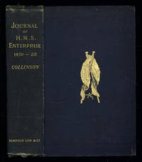
1889035576London: Sampson Low Marston Searle & Rivington. 1889. 1st Edition 1st Printing. Hardcover. Good/No Jacket. 8vo - over 7¾ - 9¾" tall. Good. Publishers cloth embossed with gilt lettering and emblem to upper cover. Front hinge cracked. Gift inscription in contemporaneous hand to free front endpaper. A touch of foxing. Two of the maps have a dog-eared fore-edge where they have not been folded quite flush with the page edges. Illustrated with tissue-guarded colour frontispiece of the ship tissue-guarded portrait of the author and 6 fold-out maps. xi i 531pp 32pp of publishers ads to rear. FIRST EDITION of the posthumously published journal by the captain who came closest to the site where Franklin's expedition ended. "In 1849 Collinson was appointed to command an expedition for the relief of Sir John Franklin by way of the Bering Strait; he himself had command of the Enterprise and with him was Commander Robert Le Mesurier McClure in the Investigator. The two ships sailed together from Plymouth on 20 January 1850 but unfortunately separated in the neighbourhood of Cape Horn and did not meet again. The Enterprise passed Point Barrow Alaska on 21 August but the ice forced Collinson to return south and winter in Hong Kong. In 1851 he was again hampered by ice and in 1852 was frozen in at Cambridge Bay for the winter. In 1853 the Enterprise was caught in the ice at Camden Bay and there passed a third winter. She reached Point Barrow on 8 August 1854 after being shut up in the Arctic entirely on her own resources for upwards of three years. Of the many who had searched for Franklin Collinson came closest to the place where the expedition had ended. Collinson's addition to geographical knowledge on this Arctic trip was very considerable and would have been tantamount to the discovery of the north-west passage had this not been already actually achieved by the men of the Investigator" DNB. Arctic Bibliography 3351; Hill 337; Ricks p 68; Tourville 986. <br/> <br/> Sampson Low, Marston, Searle, & Rivington. hardcover
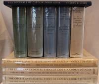
1955E01069 volumes including the three atlas volumes and portfolio volume. Volume I: <i>The Voyage of the Endeavour</i> cclxxxiv696 pages with 20 maps 25 illustrations including color frontispiece appendix and index. Reprinted with addenda and corrigenda. Volume II: <i>The Voyage of the Resolution and Adventure 1772-1775 </i>clxx1028 pages with 19 maps 63 illustrations appendixes and index. Half-title gives II as number within the set. Reprinted with addenda and corrigenda. Volume III parts 1 and 2: <i>The Voyage of the Resolution and Discovery 1776-1780</i> Part One ccxxiv718 pages with 17 maps and 64 illustrations. Half-title gives III as number within set. Admiralty instructions and the journal of the Third Voyage with supplementary extracts from journals or logs by James King Charles Clerke James Burney Richard Gilbert Thomas Edgar. Part 2: viii723-1647 with 2 maps 10 illustrations appendixes and index. Volume IV: <i>The Life of Captain James Cook</i> xi760 pages with 11 maps 38 illustrations bibliography and index. Written by J. C. Beaglehole. First separately published by A. and C. Black 1974 then for the Hakluyt Society. These volumes in royal octavo 9 1/2 x 6 1/2" bound in original publisher's deep blue cloth with blind stamped silhouette of Cook in gilt on front boards and gilt lettering to spines. Portfolio <i>Charts & Views</i> Drawn by Cook and his Officers and reproduced from the Original Manuscripts edited by R. A. Skelton. Pages viii with 58 loose maps charts plans profiles views and other illustrations some folding folio 15 3/4" x 10 1/2" in original blue cloth portfolio with gilt pictorial of cook on front in original jackets except for portfolio volume. <i>The Charts & Coastal Views</i>. Volume One: <i>The Voyage of the </i>Endeavour<i> 1768-1771</i> With a Descriptive Catalog of all the known original surveys and coastal views and the original engravings associated with them. Together with original drawings of the <i>Endeavour</i> and her boats lxiv328 pages with color frontispiece 480 half-tone plates and index. Volume Two: <i>The Voyage of the </i>Resolution<i> and </i>Adventure<i> 1772-1775</i> c332 pages with color frontispiece 23 color plates 320 half-tone plates and appendixes. Volume three: <i>The Voyage of the</i> Resolution<i> and </i>Discovery<i> 1776-1780</i> . together with the running journal of James King 1779-80 cxxxvi319 pages with color frontispiece 22 color plates 298 half-tone plates and appendixes. Volumes chief editor Andrew David. Assistant Editors for the Views Rudiger Joppien and Bernard Smith. Folios 17 1/4" x 11" bound in original publisher's deep blue cloth with gilt lettering to spine and pictorial representation of the ship <i>Victoria</i> embossed in gilt on front covers. Hakluyt Society Extra Series 34a 34b 35 36a 36b 37 43 44 and 46. First printings. Condition: Lacks jacket for portfolio volume and the spine head is bumped. Jackets: Volume one volume three part two price clipped some jackets spines toned Charts & Coastal Views with some edge wear and closed tears else a near fine set in like jackets. Hakluyt Society hardcover books
102116London H.M.S.O. 1877. . First edition; folio 33.5 x 21.5 cm; 16 folding maps a few small splits to folds 16 plates further illustrations in the text; contemporary blue half roan marbled boards lightly faded neat restoration to extremities a very good copy; viii 484 pp.<br /> One of the most valuable sources for the history of exploration in northern Canada.<br /><br />The Nares expedition so called after its commander George Nares 1831-1915 sailed in two ships HMS Alert and HMS Discovery in late May of 1875 in quest of the North Pole. The ships reached Lady Franklin Bay on North Ellesmere Island and the Alert went on to reach the extreme north of the island the highest latitude that had yet been reached by a ship. In April 1876 three separate sledge parties set out but the men showed serious signs of scurvy and several members died. Nares was forced to abandon the expedition and returned to England in September that year.<br /><br />Despite the difficulties faced by the expedition it did produce important scientific results including a study of Inuit dog disease and a volume of physical observations.<br /><br />The Nares expedition is one of the best documented Arctic expeditions with eight Parliamentary Blue Books alone devoted to it between 1875 and 1878. Arctic explorer Vilhjalmur Stefansson wrote 'The Arctic Blue Books are beyond comparison the most important tool of knowledge in this field.'<br /> London H.M.S.O., 1877. hardcover
H921Wien Tempsky/ Gerold/ Hˆlder 1892-1931. Reihe 1-5: ÷stliches Mittelmeer; ab Reihe 6: Rotes Meer und weiterf¸hrend ˆstliches Mittelmeer endet mit Reihe 11; in Reihe 9 gab es nur Berichte ¸ber das Rote Meer. Alle Reihen in den Jahresb‰nden der Denkschriften der k.k. Akademie der Wissenschaften. Meist in Original-Leinenb‰nden bzw. in Original-Broschur sehr guter Zustand. Genaue Auflistung der Forschungsergebnisse und Publikation in Kainbacher S.358-362. - Eine der groflen Tiefsee-Expeditionen gegen Ende des 19. Jahrhunderts waren die ÷sterreichischen Expeditionen des S.M. Schiffes "Pola" in das ˆstliche Mittelmeer bis 1894 und nachfolgend in 2 Reisen in das nˆrdliche und s¸dliche Rote Meer 1895/98. Die Publikation der wissenschaftlichen Ergebnisse dieser Expeditionen liegen hier vollst‰ndig vor. Der Schwerpunkt lag auf der zoologischen Erforschung daneben gab es aber auch umfangreiche meteorologische geod‰tische geologische botanische chemische und physikalische Untersuchungen Wasserproben etc. Neben der Tiefsee wurden auch die K¸sten von S¸darabien Jemen Sokotra Sudan ƒgypten Arabien Levante Kleinasien und Libyen besucht und erforscht. Die Publikation ist mit groflem wissenschaftlichem und verlegerischem Aufwand hervorragendes Karten- und Abbildungsmaterial ¸ber einen Zeitraum von fast 40 Jahren in kleiner Auflage f¸r wissenschaftliche Kreise und Bibliotheken herausgegeben worden. unknown
1829005638London: Henry Colburn 1829. 478pp/maps. Engraved folding map frontis of Arabia. BM- notes two editions of this work in 1829; single volume quarto and a two volume octavo. This is the rare single volume edition. John Lewis Burckhardt 1784 - 1817 the son of a Swiss Colonel undertook the journey to Mekkah in 1814 disguised as an Arab; he had long since used the name Sheikh Ibrahim in his travels which he began in 1809 under the sponsorship of Sir Joseph Banks and the African Association. Burckhardt's description of the Hedjaz was the first accurate one to reach Europe. Burckhardt transmitted to the Association the most accurate and complete account of the Hedjaz including the cities of Mekka and Medina which has ever been received in Europe." The folding plans include Mekkah Medina Wady Muna and Arafat. Some light foxing to maps. Minimal library markings. Beautiful tight complete scarce book with great maps. First Edition. Library Binding. Very Good/No Jacket Issued. 4to - over 9¾" - 12" tall. Ex-Library. Henry Colburn
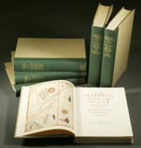
1957E0551<b>From the Spanish discovery to the opening of the Civil War</b><br /><br />5 volumes in 6. Volume One: The Spanish Entrada to the Louisiana Purchase 1540-1804 xiv264 pages with color frontispiece map and 275 maps many folding and index; Volume Two: From Lewis and Clark to Fremont 1804-1845 xiii281 pages with colored frontispiece map 143 additional maps some folding and index. Volume Three: From the Mexican War to the Boundary Surveys 1846-1854 xiii349 pages with colored frontispiece map 322 additional maps and index; Volume Four: From the Pacific Railroad Surveys to the Onset of the Civil War 1855-1860 xiii260 pages with color frontispiece map an additional 127 maps some folding and index; Volume Five From the Civil War to the Geological Survey Part One: xviii222 pages with color frontispiece map and an additional 152 maps; Volume Five From the Civil War to the Geological Survey Part Two: 223-487 pages with 124 maps and index. Folio 14 1/2" x 10 1/2" bound in quarter green leather with gilt lettering to spines. volume I printed by the Grabhorn Press; volumes II-V printed by Taylor & Taylor and James Printing based on the designs of Edwin and Robert Grabhorn. First edition limited to 1000 copies.<br /><br />Carl Wheat's Mapping of the Trans-Mississippi West is a comprehensive and readable cartographic history of the American West. The first three volumes of the work are by necessity bulky and out sized to accommodate the many maps contained with their covers. These beautifully printed books present a truly graphic picture of the exploration and peopling of the vast unknown land west of the Mississippi. The author does not merely present a catalog of significant maps of each era but tells the exciting story of many facets of history that resulted in their making-of the hard journeys the hazardous exploits the motivation the mysticism the misunderstandings and the strange blend of fact imagination false geographic concept and political necessity which were consummated in the engraver's work. These volumes will provide exciting text for the casual reader and have become eminent source book for the student and scholar.<br /><br />Condition:<br /><br />A near fine set. Institute of Historical Cartography hardcover books
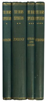
189695477London: Dulau 1896. First Edition. Hardcover. Very Good. London Dulau 1896. Quarto four volumes ii xviii 220 pages with illustrations and a map plus 11 pages of plates and a large folding map 650 × 615 mm; ii iv 432 pages with illustrations plus 28 pages of plates 1 folding 11 in colour and a corrigenda slip at page 1; vi 204 pages with illustrations plus 9 pages of plates 2 folding; and vi 200 pages with illustrations plus 20 pages of plates 6 folding 4 of them in colour. Original blue cloth lightly scuffed and bumped with the spines a little sunned; front board of Volume 2 partially cracked creasing the cloth a little; edges untrimmed and a trifle foxed in places; an excellent set uncut and with the last three volumes completely unopened. The purpose of this scientific expedition sponsored by mining magnate and philanthropist William Austin Horn and with Charles Winnecke as commander and surveyor was to examine the MacDonnell Ranges on the not unreasonable premise that 'when the rest of the Continent was submerged the elevated portions of the McDonnell sic Range existed as an island and that consequently older forms of life might be found in the more inaccessible parts'. This in fact proved not to be the case but the expedition of some fourteen weeks and 2000 camel miles was an outstanding success. 'It was not the intention . to explore a new region . But in the pursuit of natural history the expedition split into independent groups and explored undiscovered areas thus filling in more of the blank spaces in this vast region' Feeken Feeken and Spate. 'These volumes constitute one of the most substantial contributions in nineteenth-century Australian exploration but perhaps more importantly the expedition is a landmark in anthropological history because it resulted in Baldwin Spencer meeting Frank Gillen' Mulvaney. 4 items. Dulau hardcover
1790E00534 of 6 volumes. Volume 1: i-ix-372 pages with 23 plates including frontispiece plate of Cook and 4 folding maps; Volume II lacking; Volume 3: 793-1184 pages with 11 plates including frontispiece of Possession Bay and 5 fold out maps; Volume IV: 1185-1546 pages with 26 plates including frontispiece of Woman Child and Man of Van Diemen's Land and 6 folding maps; Volume V: 1547-1938 pages with 30 plates including frontispiece of A View of Huaheine and 8 folding maps; Volume VI lacking. Octavo 8 1/2" x 5 1/2" bound in original full leather with red labels to spine with gilt lettering. Abridged by George William Anderson. An earlier Large folio edition by Anderson was published earlier. This edition originally issued in 80 weekly parts and also called the Large octavo edition. M K Beddie: 39 First edition of the bound edition.<br /><br />Captain James Cook RN was a British explorer navigator and cartographer ultimately rising to the rank of Captain in the Royal Navy. Cook made detailed maps of Newfoundland prior to making three voyages to the Pacific Ocean during which he achieved the first European contact with the eastern coastline of Australia and the Hawaiian Islands as well as the first recorded circumnavigation of New Zealand. Cook joined the British merchant navy as a teenager and joined the Royal Navy in 1755. He saw action in the Seven Years' War and subsequently surveyed and mapped much of the entrance to the Saint Lawrence River during the siege of Quebec. This helped bring Cook to the attention of the Admiralty and Royal Society. This notice came at a crucial moment both in his personal career and in the direction of British overseas exploration and led to his commission in 1766 as commander of HM Bark Endeavour for the first of three Pacific voyages. Cook charted many areas and recorded several islands and coastlines on European maps for the first time. His achievements can be attributed to a combination of seamanship superior surveying and cartographic skills courage in exploring dangerous locations to confirm the facts for example dipping into the Antarctic Circle repeatedly and exploring around the Great Barrier Reef an ability to lead men in adverse conditions and boldness both with regard to the extent of his explorations and his willingness to exceed the instructions given to him by the Admiralty. Cook was killed in Hawaii in a fight with Hawaiians during his third exploratory voyage in the Pacific in 1779.<br /><br />Condition:<br /><br />Lacks volume II and VI. First signature of volume one loose inner hinges cracked some interior soiling spine ends and corners of leather rubbed some scuffing to leather else a good set. Printed for A Millar, W Law, and R Cater hardcover books
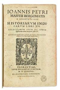
1588E05544-5702 blank28 pages. Folio 12 1/2" x 8 1/4" title with wood cut printer's device bound in contemporary vellum. European Americana 588/57; Palau 146976; Sabin 146976 First edition of Maffei's great history of India.<br /><br />Ten Latin editions two in Italian and two in French appeared before 1621. Based on primary material it still remains a valuable account today. The work is divided into 16 books. Most of it deals with the Portuguese conquests and Jesuit missionary work in the East Indies and India up to about 1557 Borba de Moraes page 508 "a classic work on the subject . writes extensively about Brazil describing it very accurately"; Maffie was the firs author to use Jesuit letters extensively as well as many secular sources including Fernando Mendes Pinto.<br /><br />Condition:<br /><br />Contemporary velum with moderate wear re-backed in vellum with original spine label laid down; minor worming and foxing intermittent moderate damp staining pages 410 and 419 blank due to a printing error; early inscription and inked stamped on title page new end papers and paste-downs else a good to very good copy. Apud Philippum Juncatam hardcover books
1588E05544-5702 blank28 pages with woodcut device on title woodcut historiated initials and decorations. Folio 12 1/2" x 8 1/4" bound in contemporary vellum. European Americana 588/57; Palau 146976; Sabin 146976 <i>Western Travellers in China</i> 11 First edition of Maffei's great history of India.<br /><br />Ten Latin editions two in Italian and two in French appeared before 1621. Based on primary material it still remains a valuable account today. The work is divided into 16 books. Most of it deals with the Portuguese conquests and Jesuit missionary work in the East Indies and India up to about 1557 Borba de Moraes page 508 "a classic work on the subject . writes extensively about Brazil describing it very accurately"; Maffie was the firs author to use Jesuit letters extensively as well as many secular sources including Fernando Mendes Pinto.<br /><br /><b>Condition:</b><br /><br />Contemporary velum with moderate wear re-backed in vellum with original spine label laid down; minor worming and foxing intermittent moderate damp staining pages 410 and 419 blank due to a printing error; early inscription and inked stamped on title page new end papers and paste-downs else a good to very good copy. Apud Philippum Juncatam hardcover
1856E05603 volumes: xvii1537 pages with 90 lithographs plates including the usual expunged bathing plate many in color including 3 "facsimiles" of Japanese woodblock prints 2 folding; 6 maps and charts 2 folding; 79 woodcuts in the text; 2414414-1xi pages with 4 color lithographs of Chinese scenes; 2 uncolored natural history engraved plates; 6 hand-colored lithographs of birds; 10 hand-colored steel-engravings of fish; 5 lithographs of shells 2 hand-colored; 16 diagram plates of winds and currents; 14-page facsimile of Japanese language version of the U.S.-Japan treaty; 17 folding charts on 16 sheets; numerous woodcuts in the text; xliii17051 pages woodcut star charts throughout. Volume III titled "United States Japan Expedition. Observations on the zodiacal light from April 2 1853 to April 22 1855 . by Rev. George Jones A.M. chaplain United States Navy". Quarto 11½ x8 ¾" bound in the original blind stamped cloth. Volume 1 rebacked with the original cloth spine laid down. Hill 1332; Sabin 30968 First edition of the House Issue.<br /><br />Detailed and profusely illustrated account of Perry's expedition to open Japan to the West; Upon his return to the U.S. his chief duty for the following year was to compile his reports of the expedition aided by Francis Hawks. The first volume has the account of the voyage and lithographs of the travel; the second volume has the natural history reports by D.S. Green and others and includes hand-colored plates of Japanese fishes and shells. In addition to the artist W. Heine from whose drawings a great number of the lithographs were made the daguerreotypist E. Brown Jr. went on the expedition taking what were undoubtedly the earliest photographic images of Japan many of them reproduced lithographically in this work. This copy with the nude bathing plate which was not included on the list of plates and not issued in all copies. <br /><br />In advance of his voyage to the Far East Commodore Perry read widely amongst available books about Tokugawa Japan. His research even included consultation with the increasingly well-known Japanologist Philipp Franz von Siebold who had lived on the Dutch island of Dejima for eight years before retiring to Leiden in the Netherlands. In 1852 Perry embarked from Norfolk Virginia for Japan in command of a squadron in search of a Japanese trade treaty. Aboard a black-hulled steam frigate he ported Mississippi Plymouth Saratoga and Susquehanna at Uraga Harbor near Edo modern Tokyo on July 8 1853. His actions at this crucial juncture were informed by a careful study of Japan's previous contacts with Western ships and what could be known about the Japanese hierarchical culture. He was met by representatives of the Tokugawa Shogunate who told him to proceed to Nagasaki where there was limited trade with the Netherlands and which was the only Japanese port open to foreigners at that time. Perry refused to leave and demanded permission to present a letter from President Millard Fillmore threatening force if he was denied. Perry ordered his ships to attack several buildings around the harbor to demonstrate US naval power. The Commodore was fully prepared for more hostilities if his negotiations with the Japanese failed and threatened to use unrestrained fire if the Japanese refused to negotiate. He sent two white flags to them telling them to hoist the flags when they wished a bombardment from his fleet to cease and to surrender. Perry's ships were equipped with new Paixhans shell guns capable of wreaking great destruction with every shell. The Japanese military forces could not resist Perry's modern weaponry; the term "Black Ships" in Japan would later come to symbolize a threat imposed by Western technology. Perry returned in February 1854 with twice as many ships finding that the delegates had prepared a treaty embodying virtually all the demands in Fillmore's letter. Perry signed the Convention of Kanagawa on March 31 1854 and departed mistakenly believing the agreement had been made with imperial representatives. The agreement was made with the Shogun the de facto ruler of Japan. On his way to Japan Perry anchored off Keelung in Formosa modern day Taiwan for ten days. Perry and crew members landed on Formosa and investigated the potential of mining the coal deposits in that area. He emphasized in his reports that Formosa provided a convenient mid-way trade location. Formosa was also very defensible. It could serve as a base for exploration as Cuba had done for the Spanish in the Americas. Occupying Formosa could help the US to counter European monopolization of the major trade routes. President Franklin Pierce declined the suggestion remarking such a remote possession would be an unnecessary drain of resources and that he would be unlikely to receive the consent of Congress. When Perry returned to the United States in 1855 Congress voted to grant him a reward of $20000 in appreciation of his work in Japan. Perry used part of this money to prepare and publish a report on the expedition in three volumes titled Narrative of the Expedition of an American Squadron to the China Seas and Japan. He was also advanced to the grade of rear-admiral on the retired list when his health began to fail as a reward for his services in the Far East.<br /><br />Condition:<br /><br />Wear and fading to cloth first volume rebacked; large map detached several others with stub tears and splitting to folds; light foxing else good to very good. A O P Nicholson hardcover books
4to [25 x 20 cm]; [ii], xxxvi, 280, xv (index) pp, 7 engraved maps, plans and plates including 6 folding, one being fldg table, engraved vignette head-pieces and tail-pieces. contemporary full leather, gilt spine title & design, raised bands, light cover wear, few tiny holes on front joint,marbled endpapers, endpaper labels of Le Chev du Blaisel & B. Mendel, few leaves with light marginal browning, else clean crisp, near fine. This is the first edition of the account of the great French Scientific Expedition to South America to measure an arc of the meridian at the equator to determine the dimension and shape of the earth. After the scientific measurements done north of the city of Quito in Ecuador, La Condamine then journeyed down the Amazon, being the first to explore that region. His measurements stood the test of time until the advent of GPS showed that the actual equator was somewhat further south, although the original monument and museums north of Quito still advertise themselves as the actual equator. The work includes a detailed plan of the city of Quito and a large map of what is now Ecuador. Hill 169: 'the greatest geographical event of the eighteenth century as regards South America. . . to measure one exact degree of meridian to determine the dimensions and shape of the earth. . . the work occupied eight years'. Sabin 38479. Norman 1250.
H4141874. Albumin Prints ca. 145 x 129 cm 15 x 106 cm und 145 x 113 cm auf Kartontafeln montiert. Mit Beschriftung in deutscher Sprache. Eine Aufnahme ist etwas gebleicht die anderen sind in gutem Zustand und von guter Qualit‰t. Die Photos wurden w‰hrend des Aufenthalts der Korvette Gazelle 1874 in Monrovia gemacht. Sie zeigen Mitglieder der Expedition. Kommandant von Schleinitz f¸hrte die Korvette Gazelle 1874 bis 1876 auf einer Weltreise mit wissenschaftlichem Auftrag. Auf den Kerguelen-Inseln verbrachte die Expedition l‰ngere Zeit um den Venustransit zu beobachten. Mitte 1875 ging es weiter nach Neu Guinea. Viele Wissenschaftler forschten in den Bereichen Zoologie Botanik Geologie Meteorologie und Meeresforschung w‰hrend Schleinitz selbst ethnologisches Material sammelte. Er benannte die Halbinsel nach seinem Schiff der Gazelle. Melanesien wurde erfirscht w‰hrend auf der R¸ckfahrt Fiji Tonga und Samoa besucht wurden. Die Ergebnisse der Expedition wurden in einem f¸nfb‰ndigen Werk publiziert. unknown
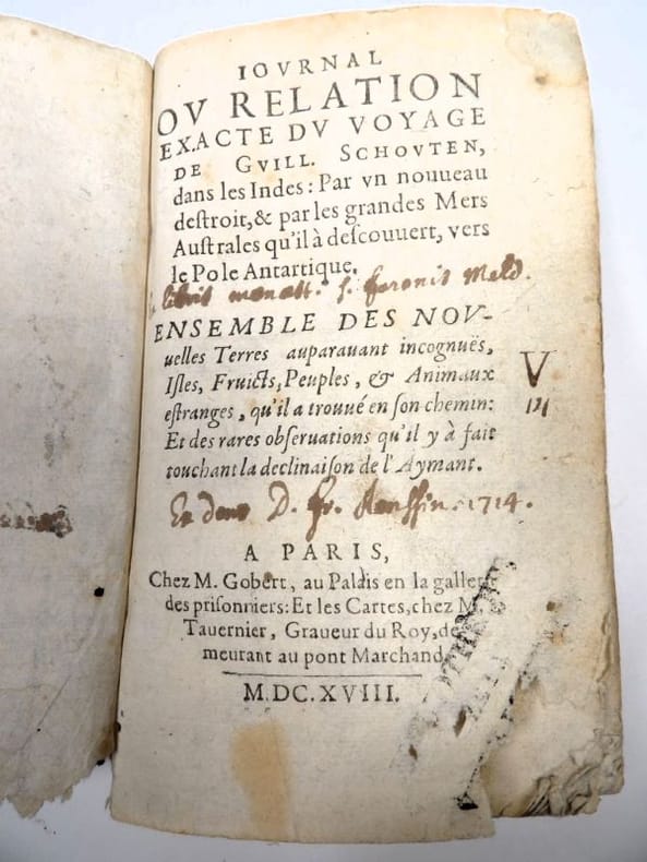
16182417Paris, Gobert (texte) & Tauernier (cartes), 1618. Petit in-8 – 11,5 x 17 cm. Reliure de l’époque en vélin, dos lisse muet. Dans une chemise-étui moderne. 7 ff., 232 pp., 4 pl. Première édition française du récit populaire de Schouten sur son voyage avec Jacob Le Maire à la recherche d’un passage alternatif au détroit de Magellan, qui a été traduit en français, allemand, latin et anglais moins d’un an après la première édition néerlandaise. Le voyage historique de Schouten n’était que le troisième tour du monde, « au cours duquel le Cap Horn fut découvert et contourné pour la première fois » (Hill). Exemplaire orné de 4 planches dépliantes (sur les 8 usuelles) : mappemonde ornée des portraits de Magellan et Schouten, carte du Cap Horn, gravure de l’Ile Horn, carte de la côte de Nouvelle Guinée. Lors d’un voyage, un ancien propriétaire a fait tamponner le dos de l’étui (XXe) au moment de son passage au Cap Horn.
185546629Gotha, Julius Perthes, 1855-1874. 4to. Bound in 18 contemp. hcalf, some wear to the first 10 vols., some a bit rubbed. Some scattered brownspots to the first volumes. Gilt spines. Wear to top of spines. With a huge amount of original maps, plates, profiles etc., lithographed and engraved, large and folded and mainly in colour. This set does not include the ""Ergänzungsbände"".
185546629Gotha Julius Perthes 1855-1874. 4to. Bound in 18 contemp. hcalf some wear to the first 10 vols. some a bit rubbed. Some scattered brownspots to the first volumes. Gilt spines. Wear to top of spines. With a huge amount of original maps plates profiles etc. lithographed and engraved large and folded and mainly in colour. This set does not include the "Ergänzungsbände". <br/><br/><em>The first 19 lacking vol. 14 volumes of this importent periodical from its "Golden Period". "Petermann's Mittheilungen" became the leading geographic publication of the world and remained so until World War I. All the new geographical discoveries all the reports from the latest exploratory expeditions were published and flowed into Petermann's Geographische Anstalt and he took care to see that it was translated into cartographic form as quickly as possible. The maps soon came to have a reputation for containing the latest and the most accurate information available. Not only German but international readers as well came to see the 'Mitteilungen' as an indispensable organ for the world of geographical research. </em> unknown
18932712376Adelaide: C.E. Bristow 1893. Wrappers torn at edges but well repaired as are the boards of the map section. Octavo complete with maps; original wrappers and boards preserved in a brown morocco bookform box. <p><p>First edition: one of 500 copies printed of the narrative of one of the last great Australian exploring expeditions written by the leader of the expedition and complete with its maps.</p> <p>Lindsay led this extensive expedition - it ran to eight men forty-four camels and five Afghan camel drivers - organised by the South Australian Branch of the Royal Geographical Society and equipped by Sir Thomas Elder to explore the unknown interior between South Australia and the west coast and to look for Leichhardt. Lindsay's exhaustive report includes the surveyor L.A. Wells's journal of the expedition. Also included is an extensive Aboriginal vocabulary collected by Wells from the Pidong tribe at the head of the Murchison River the Minninng tribe at Fraser Range from the Everard Ranges at Mount Illbillee and from the "Wallawe" tribe at Yarragabie Station Western Australia. He states "Appended is a list of native names which I have collected from four tribes met with during the expedition.".</p> <p>The separate large folding maps are original lithographs coloured to illustrate geological changes. Compiled and drawn by both Lindsay and Wells these maps show in great detail the earlier discoveries of Giles Gosse Forrest and Hunt as well as the route taken by the Elder explorers.</p> </p> . C.E. Bristow unknown
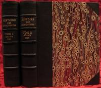
1733E05532 volumes. 8xxiv616471 pages with 4 maps ad view one folding and 3 plates one folding; 2693892 pages with 1 map and 6 plates. Quarto 10 1/4" x 10 1/4" bound in half leather with raised spine bands and gilt lettering to spine over marbled boards. Borba de Moraes page I:453; European Americana 733/146; Sabin 38591 First edition.<br /><br />Joseph-François Lafitau was a French Jesuit missionary ethnologist and naturalist. He is best known for his use of the comparative method in the field of scientific anthropology the discovery of ginseng and his writings on the Iroquois. Lafitau was the first of the Jesuit missionaries in Canada to have a scientific point of view. Lafitau is considered the first of the modern ethnographers and a precursor of scientific ethnology for his work on the Iroquois. He developed a model of studying peoples that involved describing existing cultures on their own terms—not in comparison to European society. He distinguished generic and specific traits transforming the "generic savage" into specific tribal groups. He explained that "only from specific identities can genetic relations be inferred."5 Furthermore he was the first to declare "contemporary primitive cultures throw light upon the culture of ancient people and vice versa. Lafitau is remembered for applying the comparative method with a greater level of competency than any of his contemporaries. Through original field observations he was able to critique the works of earlier writers on Primitive peoples. By using the Comparative Method Lafitau rejected all theories of social and cultural change and instead used his study to demonstrate the similarities in customs practices and usages of the Native North Americans with diverse peoples from different continents and centuries. He consistently relied on the doctrine of degeneration: all men originally shared one religion with one God but over time as people migrated to separate margins of the earth where they then lost touch with the values and traditions of this one true religion and culture. Therefore Lafitau believed in the "psychic unity of mankind" and the doctrine of primitive monotheism. His major work written in French was first published in 1724 in Paris. It is entitled <i>Customs of the American Indians Compared with the Customs of Primitive Times</i> <i>Moeurs des Sauvages Amériquains Comparées aux Moeurs des Premiers Temps</i> and is 1100 pages in total. In 1974 William Fenton and Elizabeth Moore made the first translation into English available. Lafitau published two other works. One <i>Histoire de Jean de Brienne Roy de Jérusalem et Empereur de Constantinople</i> Paris 1727 was released before he returned to Canada; it is little known and seldom seen. A two-volume <i>Histoire des découvertes et conquestes des Portugais dons le Nouveau Monde . . .</i> 1733 appeared after he came home to France. Frequently found in libraries it is not just a compilation of original sources but an attempt to make available to French readers a story of exploration and adventure otherwise denied to them; in the chronicles he sees a long development of customs hitherto unnoticed such as he had reported in the <i>Mœurs</i>; from them understood only he says in the original languages of the people who practice them he builds his "system" or philosophy of history and once more he is concerned too with the relation between custom and natural history or ecology.<br /><br /><b>Condition:</b><br /><br />Beautifully rebound in half leather. Faint dampening to second volume; early owner's signatures on title pages inked stamps of St Charles Borromeo Seminary on front paste-downs and first title page lacks frontispiece else a very good to fine set.<br /> Chez Saugrain pere, quai des Augustins, au coin de la rue Chez Saugrain pere, quai des Augustins, au coin de la rue Pavee, a la hardcover books
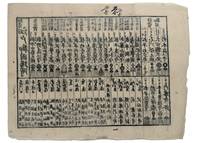
1853347481853. Three woodblock-printed sheets on mulberry paper. Mild edge wear old folds. A detailed revealing group of late Tokugawa samurai reference sheets recording the names ranks stipends heraldry standards and service obligations through which the shogunate and Edo public understood military readiness at the moment of Perry's arrival.<br/> <br/> Commodore Matthew C. Perry anchored off Uraga at the entrance to Edo Bay in July 1853. His arrival made visible the vulnerability of the Tokugawa capital and produced an immediate demand for information about coastal defence domain strength and the lords responsible for guarding the approaches to Edo. Kawaraban and related broadsides answered that demand in compressed visual form combining names crests military symbols income figures and geographical or administrative data. The first printed sheet appears to be an earlier roster of Edo office-holders or guard personnel. Its tabular format with names offices crests and standards records the recognitional system already in place within Tokugawa administration before the Perry crisis sharpened the public appetite for such information. The manuscript sheet is ruled into a large grid with headings formed from the twelve zodiac signs and the four seasons including Rat Ox Tiger Hare and the seasonal headings. The entries appear to record named houses Lords or retainers against recurring seasonal and cyclical categories probably for service attendance or ceremonial obligation. The third sheet is headed "Rekko yushinroku" here translated as "Register of Valiant Retainers of the Lords." It lists major daimyo houses and their principal retainers with domain or house headings names titles stipend figures in koku family crests standards and related insignia. Visible regional or house designations include "Kaga" "Owari" "Kii" "Satsuma" "Higo" and "Tosa." The sheet gives a graphic register of the daimyo world mobilised or imagined as mobilised around the defence of Edo Bay. Together the sheets preserve the administrative and visual language of Tokugawa defence at a moment of acute pressure. They are not formal shogunal orders and the first sheet may predate Perrys arrival but they show how late Edo Japan translated rank obligation military identity and coastal defence into portable tabular form. Their compression the names of Lords and retainers the scale of domains the crests and standards by which armed households could be recognised and the bureaucratic habits of a regime suddenly forced to account for its capacity to defend the country reveals these documents' immediacy and importance. unknown
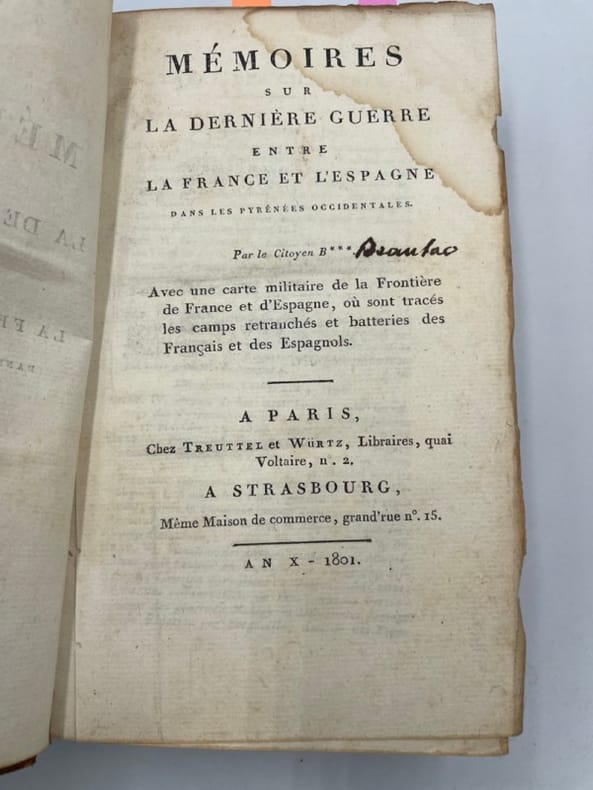
238169Paris et Milan, 1800 - 1801 7 pièces en deux vol. in-8, demi-veau fauve, dos lisses ornés de dent-de-rat et filets dorés, pièces de titre crème, coins en vélin (reliure un peu postérieure). Des mouillures claires au premier volume.
1890STLB0014Wien u. Olmütz, Eduard Hölzel 1888 und 1890. 8°. IX(1), 150 S. mit 1 kl. Titelvign., 16 Illustr. im Text, auf Tafelseiten sowie auf 1 doppelblattgr. Tafel v. Hans Fischer u. Franz Zimerman, nach Skizzen des Verfassers sowie 1 mehrf. gef., farb. Karte und VIII, 224 S. mit 18 Illustr. v. Ludwig Hans Fischer u. Franz Zimerman nach Skizzen des Verfassers, sowie nach Photographien, und einer (mehrf. gefalteten) farbigen Originalkarte. Leinenbd. d. Zt. m. goldgepr. Rückentit. u. blindgepr. Deckelrahmen. Unteres Kapital u. Ecken bestoßen u. berieben, Text papierbedingt gebräunt u. z. Tl. fingerfleckig, im hint. Falz aufgeplatzt. Henze I, 200 ff. Die überaus seltene Promotionsarbeit des bedeutenden österreichischen Afrika-Forschers Oscar Baumann (1864-1899). Seine gründlichen Aufnahmen über die Besteigung des Durmitors, während einer Reise durch Montenegro im Jahr 1883, bewegten Oskar Lenz, der 1885 die österreichisch-ungarische Kongo-Expedition vorbereitete, ihn einzuladen, die Expedition als Topograph zu begleiten. B. erkrankte jedoch nahe Stanley Falls, und wurde in einem Lager zurückgelassen, wo er während seines Aufenthaltes die Swahili-Sprache erlernte. Seine Rekonvaleszenz verbrachte er auf der Insel Fernando Póo, von deren Hauptstadt aus er eine zweimonatige Rundreise antrat und mit seinen Beobachtungen wertvolle Beiträge zur Kenntnis der Insel und ihrer Bewohner, der Bube, von deren Sprache er zwei Vokabularien zusammenstellte, lieferte. - 1887 promovierte B. in Leipzig mit dem 'Versuch einer Monographie von Fernando Póo', einer Vorarbeit zu vorliegendem Werk. In dem angebundenen Werk beschreibt B. eine Reise, die ihn als Begleiter des deutschen Forschungsreisenden Hans Meyer 1888 nach Ostafrika führte, um den Kilimandscharo zu bezwingen. Die Expedition durchquerte - von der Ostküste ausgehend - die damals noch völlig unbekannte Gebirgslandschaft zwischen den Flüssen Pangani und Umba. Wegen an der Küste ausgebrochener Araber-Unruhen sahen sie sich am südlichen Pare-Gebirge zur Umkehr gezwungen. Das Ergebnis dieser Expedition war die erste topographische Aufnahme von Usambra. Seine kartografischen und ethnologischen Aufzeichnungen waren für die schnell folgende wirtschaftliche Erschließung des Landes von unschätzbarem Wert. (vgl. dazu: Ausstellungskat. ?Abenteuer Ostafrika?. S.147).
1799biblio160<b>First French edition of Bartram's</b><b> Travels which chronicled his explorations of the southern British colonies in North America from 1773–1777</b><br /><br />2 volumes. 457 pages with frontispiece engraved portrait by Bovinet Mico Chlucco Grana King of the Seminoles and one folding plate; 436 pages without title with large folding map by J.B. Poirson engraved by Alexandre Blondeau and folding plate. Octavo 8 1/4" x 5 1/4" bound in half leather with six spine compartments with red and black labels in gilt over original marbled boards. Translated by Pierre Vincent Benoist. Sabin 3871; Palau 251346; Howes B223; Field 94 First French edition.<br /><br />William Bartram was an American naturalist. The son of the naturalist John Bartram. As a boy he accompanied his father on many of his travels to the Catskill Mountains the New Jersey Pine Barrens New England and Florida. In 1773 he embarked upon a four-year journey through eight southern colonies. Bartram made many drawings and took notes on the native flora and fauna and the native American Indians. In 1774 he explored the St. Johns River where he had memorable encounters with aggressive alligators and also visited a principal Seminole village at Cuscowilla where his arrival was celebrated with a great feast. He met Ahaya the Cowkeeper chief of the Alachua band of the Seminole tribe. When Bartram explained to the Cowkeeper that he was interested in studying the local plants and animals the chief was amused and began calling him Puc Puggy the flower hunter.2 Bartram continued his explorations of the Alachua Savannah or what is today Paynes Prairie. William Bartram wrote of his experiences exploring the Southeast in his book Travels through North & South Carolina East & West Florida the Cherokee Country the Extensive Territories of the Muscogulges or Creek Confederacy and the Country of the Chactaws Containing an Account of the Soil and Natural Productions of Those Regions Together with Observations on the Manners of the Indians published in 1791 and which is today simply known as Bartram's Travels. It was considered at the time one of the foremost books on American natural history. Many of Bartram's accounts of historical sites were the earliest records including the Georgia mound site of Ocmulgee. In addition to its contributions to scientific knowledge Travels is noted for its original descriptions of the American countryside. Bartram's writing influenced many of the Romantic writers of the day. William Wordsworth Samuel Taylor Coleridge and François René de Chateaubriand are known to have read the book and its influence can be seen in many of their works. Ephraim George Squier and Edwin Hamilton Davis in their book Ancient Monuments of the Mississippi Valley name Bartram as "the first naturalist who penetrated the dense tropical forests of Florida."<br /><br />Condition:<br /><br />Some rubbing to original boards page 143 of volume one has small burn mark affecting text half title bound upside down in back old water stain to plate of volume two. Fold-out map has repair to first fold internally pages are clean and free of toning and foxing else a very good copy. Chez Carteret et Brosson and Dogour Duran hardcover books
1957E0551<p><strong>From the Spanish discovery to the opening of the Civil War</strong><br /><br />5 volumes in 6. Volume One: The Spanish Entrada to the Louisiana Purchase 1540-1804 xiv264 pages with color frontispiece map and 275 maps many folding and index; Volume Two: From Lewis and Clark to Fremont 1804-1845 xiii281 pages with colored frontispiece map 143 additional maps some folding and index. Volume Three: From the Mexican War to the Boundary Surveys 1846-1854 xiii349 pages with colored frontispiece map 322 additional maps and index; Volume Four: From the Pacific Railroad Surveys to the Onset of the Civil War 1855-1860 xiii260 pages with color frontispiece map an additional 127 maps some folding and index; Volume Five From the Civil War to the Geological Survey Part One: xviii222 pages with color frontispiece map and an additional 152 maps; Volume Five From the Civil War to the Geological Survey Part Two: 223-487 pages with 124 maps and index. Folio 14 1/2" x 10 1/2" bound in quarter green leather with gilt lettering to spines. volume I printed by the Grabhorn Press; volumes II-V printed by Taylor & Taylor and James Printing based on the designs of Edwin and Robert Grabhorn. First edition limited to 1000 copies.<br /><br />Carl Wheat's Mapping of the Trans-Mississippi West is a comprehensive and readable cartographic history of the American West. The first three volumes of the work are by necessity bulky and out sized to accommodate the many maps contained with their covers. These beautifully printed books present a truly graphic picture of the exploration and peopling of the vast unknown land west of the Mississippi. The author does not merely present a catalog of significant maps of each era but tells the exciting story of many facets of history that resulted in their making-of the hard journeys the hazardous exploits the motivation the mysticism the misunderstandings and the strange blend of fact imagination false geographic concept and political necessity which were consummated in the engraver's work. These volumes will provide exciting text for the casual reader and have become eminent source book for the student and scholar.<br /><br /><strong>Condition:</strong><br /><br />A near fine set. Due to the size and/or weight of this lot extra shipping and/or handling charges may apply.</p> Institute of Historical Cartography hardcover