1 956 résultats
236613Paris, Berquet et Pétion, 1842 3 vol. in-8, 6 fac-similés dépl., demi-veau prune, dos lisse, filets dorés (reliure de l'époque). Rousseurs.
17791399Venetiis (Venise), Apud Franciscum Sansoni, 1779. In-folio - 26,5x37cm. Reliure postérieure (XIXe) en demi-chagrin vert, dos à 4 nerfs orné de filet, pointillés, dentelle et fleurons dorés. (2 ff.) - 608 pp. Ouvrage en latin orné de lettrines et culs-de-lampe. Ultime publication du prêtre jésuite et historien Pierre-Francois-Xavier de Charlevoix (1682-1761). Il y aborde notamment la colonisation espagnole en Amérique. Cet ouvrage relate l'histoire du Centre de l'Amérique du Sud : Paraguay, Bolivie, Brésil, Uruguay, Argentine. Sabine 12131. Leclerc 1882 : "Cette traduction latine, anonyme, est du Père Dominique Muriel, espagnol. Elle est plus complète que l’édition française. Le Père Muriel y a ajouté de nombreuses notes".Cette édition ne comporte pas de carte. Ouvrage de toute rareté.
1717E01353559index pages 36 of 37 maps and copper cuts of the coasts harbor cities plants and other curiosities comprising: 14 plates 3 folding 22 maps charts or plans 14 folding. title page printed in red and black. Printed from the author's original plates inserted in the Paris edition. Lacks the frontispiece map. Royal octavo 9 3/4" x 7 3/4" bound in leather with raised spine bands and red label with gilt lettering. Postscript by Dr Edmund Halley and an account of the settlement commerce and riches of the Jesuits in Paraguay. Palau 94965 Sabin 25926 Nissen ZBI 1433 Hill p117 First English edition.<br /><br />Frézier was educated in Paris and served as lieutenant of infantry from 1702 til 1707 when he entered the engineer corps. In 1712 the government sent him to examine the condition of the Spanish colonies in America. After visiting the principal points in Peru Chili and Brazil he returned to Marseilles. He pointed out several mistakes in the "Relation" of Father Feuille and this led to a bitter controversy between the two travelers. Frézier introduced the large Chili strawberry into France. First published in France in 1714. The first edition into English is preferable to the French original "because it contains Halley's. postscript which corrects certain geographical errors made by Frézier" Hill. "The first part of this book gives an interesting account of the voyage from France around Cape Horn. The second part relates to the voyage along the coasts of Chile and Peru describing the chief towns and cities. Frézier a man of observation brought back information of considerable geographical and scientific value. Much data is included about the native inhabitants.<br /><br />Condition:<br /><br /> Rebacked with original spine label laid down; lacking frontispiece map and binder's leaf free endpapers renewed intermittent foxing else a very nice copy. Jonah Bowyer hardcover
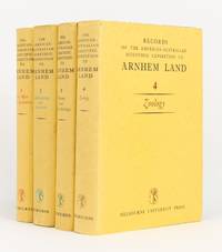
1956144270Carlton: Melbourne University Press 1956. First Edition. Hardcover. Very Good/Very Good. Carlton Melbourne University Press 1956 1960 1958 and 1964 all first - and only - editions. Quarto four volumes xxx 513 pages with 68 figures and 157 plates plus 2 colour plates; xiv 515 pages with 7 graphs 281 maps and illustrations and 47 plates plus a colour plate; xvi 522 pages with 81 maps and illustrations and 17 plates; and xviii 533 pages with a map and 100 plates plus 5 colour plates. Cloth; minimal signs of age and use; an excellent set with the lightly used dustwrappers. Charles Mountford was the leader of the expedition; he was also the author of the first volume the editor of the second and co-editor of the third with R.L. Specht who edited the fourth volume. 4 items. Melbourne University Press hardcover
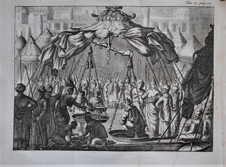
1699P1-3K-1Amsterdam, Paul Marret, 1699. 2 tomes en 2 volumes in-12 (160x100mm) de 349 pp et 358 pp., reliure d'époque XVIIIe, demi-veau brun granité, dos à nerfs ornés de fers dorés, pièce de titres. Rare édition originale illustrée de 2 frontispices, 2 pl. hors-texte et 9 planches dépliantes hors-texte gravées dont 3 cartes. François Bernier (1620-1688), médecin et philosophe, disciple de Pierre Gassendi, occupe une place particulière parmi les Européens qui font le voyage vers la Perse et l’Inde au milieu du XVIIe siècle. Ni marchand ni missionnaire, ni militaire ni diplomate, François Bernier voyage par "désir de voir le monde". Et c’est presque par hasard qu’il débarque à Sourate, alors premier port de la côte occidentale de l’Inde, fin 1658 ou début 1659. Bernier va séjourner presque dix ans en Inde où, engagé comme médecin auprès d’un haut fonctionnaire de la cour moghole, il devient un témoin privilégié de la vie politique indienne. Bernier explore une partie du sous-continent indien ; quittant Delhi et Agra il descend le Gange jusqu’à son delta, visite Golconde et le Cachemire. Esprit curieux et critique, il observe avec attention, s’informe et ausculte les pratiques politiques, sociales et religieuses de la société indienne de cette époque. Il est joint une lettre imprimée de Madame de Lenclos à Monsieur de St Evremond, avec la réponse de ce dernier ou il relate une piquante anecdote lors de sa rencontre avec Bernier en le surnommant le "Joli philosophe", surnom qui devait d'ailleurs lui rester. Bon exemplaire.
1787E0052<p>Two volumes: xv462 pages with two folding maps; xv430 pages with three folding plates. Octavo 8 1/4" x 5 1/4" bound in original full leather with black and red labels to spine lettered in gilt. translated from the French by an English gentleman who resided in America at that period ; with notes by the translator. Translated by G. Grieve Watt and Sabin ascribe the translation to J. Kent. Sabin 12229 First Irish edition.<br /><br />Chastellux was a military officer who served during the War of American Independence as a major general in the French expeditionary forces led by general Comte de Rochambeau. Being on general Rochambeau's staff for the duration of the war Chastellux acted as the principal liaison officer between the French commander in chief and George Washington. However the Chevalier de Chastellux was also widely recognized at the time of his campaigns in America as a highly talented man of letters and a member of the French Academy. After arriving in America in July 1780 Chastellux participated to the American Revolutionary War as Major General in the French expeditionary force led by general Rochambeau. During the following year he was third in command of the French forces engaged at the decisive Siege of Yorktown in 1781 where the British were ultimately defeated. Major General de Chastellux was fluent in English and with his strong ideological support of the American cause he served the alliance well. During the latter part of the campaign he was the principal liaison officer between George Washington and French general Rochambeau. Thereafter Chastellux remained a personal friend of George Washington for life. Furthermore the College of William and Mary and the University of Pennsylvania also awarded Chastellux with honorary degrees. After his return to France Chastellux also remained in contact with Thomas Jefferson now the American representative in Paris whom he had previously visited on his Virginia estate at Monticello.<br /><br /><strong>Condition:</strong><br /><br />Title page clipped at top corner first fold out map repaired map edges repaired hinges repaired previous owner's names on front paste downs and content pages else a good set.</p> Printed for Messrs. Colles, Moncrieffe, White, H. Whitestone, Byrne, Cash, Marchbank, Heery, and Moore hardcover
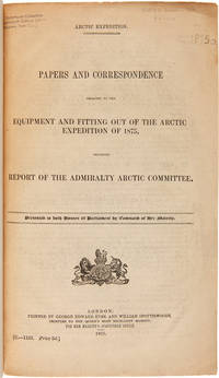
1875WRCAM50678London 1875. 402pp. plus folding map. Folio. 20th-century three-quarter calf and marbled paper boards spine gilt. Stefansson Library stamp on titlepage deaccessioned. Toned minor chipping at edges of some leaves. Final leaf repaired with archival paper with no loss to text; small tears in margin of map. Very good. This scarce document describes the plans for the 1875 Nares Expedition includes specifications for the H.M.S. Discovery data on supplies needed estimations of costs and a hydrographer's report as well as a color chart of the North Polar Sea. The chart is a Polar projection map showing the seas navigated by British expeditions as well as coasts discovered by British American German Swedish and Austrian explorers through 1874. <br> <br> The Nares expedition which sailed from 1875 to 1876 strove to be the first to reach the North Pole and to explore its coasts and region. Though unsuccessful in this venture the expedition was the first to sail ships through the channel between Greenland and Ellesmere Island and as far north as the Lincoln Sea recording valuable information about the mysterious region. A sledging party under Captain Albert Hastings Markham also set a new record on land reaching as far north as 83° 20'. The British Parliament printed occasional reports of the various expeditions and related Arctic subjects which became known as the Arctic "blue books" named after the distinctive blue wrappers in which they were originally issued. This copy has the stamp of the Stefansson collection at the Dartmouth library but was deaccessioned as a duplicate to his widow. ARCTIC BIBLIOGRAPHY 45251. hardcover books
177432872NY: James Rivington. Good with no dust jacket. 1774. Hardcover. 18th Century; Maritime; 12mo 7" - 7½" tall; 2 17 1 4 2 260p pages; A New Voyage Round The World In The Years 1768 1769 1770 And 1771; Undertaken by Order of his present Majesty performed by Captain James Cooke In the Ship Endeavour Drawn up from his own Journal and form the Papers of Joseph Banks Vol I of 2. Contemp leather. Covers scuffed edgeworn lacking eps and both plates though small part of folding map is present. Foxed some stains. Upper blank margin of 2nd leaf roughly removed list of subscribers losses to printed area of pp67-68 amounting to a dozen words the normal tears to printed area of a few dozen leaves pencil sketches to rear flyleaf and inside of rear cover. Various old ink markings to title page. JCB Annuel Report for 1931 pp. 12-15; Sabin 30936; Evans 13324 Mitchell Library Cook 656; Holmes 9. 2 . Withal a rare and important American edition of Cook's first voyage. Rivington pirated this American edition to undercut the price of the London First Edition in the American market. . James Rivington hardcover
1843E01482 volumes. xxxvii23878 ad pages with frontispiece woodcuts in text and 7 steel-engraved plates; vi2474 pages with frontispiece woodcuts in texts and 10 steel-engraved plates. Royal octavo 9¼x5½" in publisher's original green cloth spine lettered in gilt covers decorative blind stamped. First Edition.<br /><br />In 1825 Edward Belcher accompanied Frederick William Beechey's expedition to the Pacific and Bering Strait as a surveyor. In 1836. he commanded a surveying ship on the north and west coasts of Africa and in the British seas. Belcher took up the work which Beechey had left unfinished on the Pacific coast of South America. He was on board the bomb vessel HMS Sulphur which was ordered to return to England in 1839 by the Trans-Pacific route. Belcher made various observations at a number of islands which he visited having been delayed by being dispatched to take part in the war in China in 1840. On 26 January 1841 the then Commander Belcher landed on Possession Point at the north shore Hong Kong Island and made the first British survey of Hong Kong harbor. After the war's end in 1842 he reached home and for his services was made a Knight Bachelor in the following year. He was then engaged in HMS Samarang in surveying work in the East Indies the Philippines Geomun-do Port Hamilton and other places until 1847. In 1852 Belcher led the last and largest Admiralty expedition to rescue Sir John Franklin. He was also to look for his former surveying officer in Hong Kong Richard Collinson and Robert McClure whose ships had not been seen after entering the Bering Strait. He did a great deal of sledge exploration rescued McClure and abandoned four of his five ships in the ice. He had five ships: Assistance Belcher Resolute Henry Kellett second mate George Nares the steam tenders PioneerSherard Osborn and Intrepid Leopold McClintock and the depot ship North Star William Pullen. Belcher and one tender were to enter Wellington Channel where Franklin was thought to be while Kellett was to go west to Melville Island and look for Collinson and McClure. North Star was to stay at Beechey Island as a supply base. He left the Nore in April 1850. By early winter Assistanceand Pioneer were frozen in at Northumberland Sound to the north of Wellington Channel while Resolute and Intrepid were frozen in off Melville Island Arctic—the first ships this far west since William Edward Parry in 1819. A great deal of exploration was done by man-hauled sledges. In April 1853 Leopold McClintock and others left the Resolute on sledges and returned 105 days later having covered 1400 miles and discovered Prince Patrick Island. Another party went west and discovered Robert McClure whose ship was frozen in at Mercy Bay. Belcher went north by sledge and found a channel at the northern tip of Devon Island hinting that Franklin might have used it to escape to Baffin Bay. When the ice broke up that summer he pushed his ships up Wellington Channel and became trapped again. By February 1854 Belcher was becoming increasingly worried about the safety of his ships and men. In April he ordered Kellett to abandon his ships and return by sledge to North Star. Belcher abandoned his two ships in late July. Aided by two ships that showed up at Beechey Island Phoenix and Breadalbane the whole party returned to England. Belcher went through a court martial which was automatic for any captain who had lost a ship. He was exonerated but his sword was returned to him 'without observation'. He never again received an active command. Curiously Resolute broke free of the ice and drifted all the way to Davis Strait where it was picked up by an American whaler.<br /><br />Condition:<br /><br />Some staining and wear to covers spines a bit faded ends chipped and worn rear joint of Vol. I with chipping and loss; hinges repaired at endpapers some light foxing and occasional mostly marginal damp staining within the three folding maps which should be loose in a pocket not present; overall good uncommon in the original cloth. Henry Colburn hardcover
1843E01482 volumes. xxxvii23878 ad pages with frontispiece woodcuts in text and 7 steel-engraved plates; vi2474 pages with frontispiece woodcuts in texts and 10 steel-engraved plates. Royal octavo 9¼x5½" in publisher's original green cloth spine lettered in gilt covers decorative blind stamped. First Edition.<br /><br />In 1825 Edward Belcher accompanied Frederick William Beechey's expedition to the Pacific and Bering Strait as a surveyor. In 1836. he commanded a surveying ship on the north and west coasts of Africa and in the British seas. Belcher took up the work which Beechey had left unfinished on the Pacific coast of South America. He was on board the bomb vessel HMS Sulphur which was ordered to return to England in 1839 by the Trans-Pacific route. Belcher made various observations at a number of islands which he visited having been delayed by being dispatched to take part in the war in China in 1840. On 26 January 1841 the then Commander Belcher landed on Possession Point at the north shore Hong Kong Island and made the first British survey of Hong Kong harbor. After the war's end in 1842 he reached home and for his services was made a Knight Bachelor in the following year. He was then engaged in HMS Samarang in surveying work in the East Indies the Philippines Geomun-do Port Hamilton and other places until 1847. In 1852 Belcher led the last and largest Admiralty expedition to rescue Sir John Franklin. He was also to look for his former surveying officer in Hong Kong Richard Collinson and Robert McClure whose ships had not been seen after entering the Bering Strait. He did a great deal of sledge exploration rescued McClure and abandoned four of his five ships in the ice. He had five ships: Assistance Belcher Resolute Henry Kellett second mate George Nares the steam tenders PioneerSherard Osborn and Intrepid Leopold McClintock and the depot ship North Star William Pullen. Belcher and one tender were to enter Wellington Channel where Franklin was thought to be while Kellett was to go west to Melville Island and look for Collinson and McClure. North Star was to stay at Beechey Island as a supply base. He left the Nore in April 1850. By early winter Assistanceand Pioneer were frozen in at Northumberland Sound to the north of Wellington Channel while Resolute and Intrepid were frozen in off Melville Island Arctic—the first ships this far west since William Edward Parry in 1819. A great deal of exploration was done by man-hauled sledges. In April 1853 Leopold McClintock and others left the Resolute on sledges and returned 105 days later having covered 1400 miles and discovered Prince Patrick Island. Another party went west and discovered Robert McClure whose ship was frozen in at Mercy Bay. Belcher went north by sledge and found a channel at the northern tip of Devon Island hinting that Franklin might have used it to escape to Baffin Bay. When the ice broke up that summer he pushed his ships up Wellington Channel and became trapped again. By February 1854 Belcher was becoming increasingly worried about the safety of his ships and men. In April he ordered Kellett to abandon his ships and return by sledge to North Star. Belcher abandoned his two ships in late July. Aided by two ships that showed up at Beechey Island Phoenix and Breadalbane the whole party returned to England. Belcher went through a court martial which was automatic for any captain who had lost a ship. He was exonerated but his sword was returned to him 'without observation'. He never again received an active command. Curiously Resolute broke free of the ice and drifted all the way to Davis Strait where it was picked up by an American whaler.<br /><br />Condition:<br /><br />Some staining and wear to covers spines a bit faded ends chipped and worn rear joint of Vol. I with chipping and loss; hinges repaired at endpapers some light foxing and occasional mostly marginal damp staining within the three folding maps which should be loose in a pocket not present; overall good uncommon in the original cloth. Henry Colburn hardcover books
1928000893SAN PEDRO CALIFORNIA CA. Good. 1928. On offer is a fascinating vintage collection autograph materials an ALS clippings and maps of Congressional Medal of Honor winner Admiral Richard Byrd's First Antarctic Expedition 1928-30. Included are original newspaper clippings from The New York Times including a full page from May 19 1929 headline "What Byrd's Men Do In The Antarctic Night" with photographs of one of Byrd's planes his two ships the Headquarters Hut the setting sun and radio equipment and antennas. Also included; an 8pp rotogravure section from May 4 1930 illustrating "Admiral Byrd's Great Adventure in the Antarctic" with numerous photographs of Little America including the expedition members landscapes polar life and much more; also a column-length article relating to his second expedition headlined "Byrd's Ship Bear To Sail Tomorrow" 1933-35; two color maps approx 28"x20" one a 1930 Geographic Society detailed lithograph of the "Antarctic Regions" with insets of "Byrd's South Pole Flight" "King Edward VII Land" "Part of Marie Byrd Land" and "Antarctic Archipelago" indicating routes of various explorers including Admunsen and Shackleton; and the other a 1933 "Little America Aviation and Exploration Club Map Used by Admiral Byrd exclusively on both of his Antarctic Expeditions" courtesy of "The Tide Water Oil Co." Also present is letterhead of the Freeport NY Order of Elks signed by eight members of both the first and second expeditions with second page penned in another hand adding further information; plus an ALS by expedition member ARTHUR B. CREAGH San Pedro CA Sep 28 1930 to Albin Johnson "Part Exalted Ruler" of the Order of Elks in Freeport. Creagh thanks him "for the wonderful time you and your brother Elks gave us that night at Freeport Long Island on our return from the Byrd's South Pole Expedition " accompanied by original mailing envelope. Lastly a lengthy printed Washington Bureau biographical printed pamphlet 4pp 7"x8½" by Ruth Robertson entitled "A Brief Account of Read Admiral Byrd's Flights Over the North and South Poles and Other Achievements". The newspaper clippings are generally toned and brittle the photogravure in particular is fragile. All evidence usual folds with occasional partial fold separations with only small paper loss. Letter is in excellent condition. All have been preserved in large vintage envelope. This period collection of historic content remains an important reflection of the early exploration of Antarctica by America's foremost explorer of the time. G.; English; 4to - over 9¾" - 12" tall; ANTARCTIC EXPLORATION TRAVEL CONGRESSIONAL MEDAL OF HONOR EXPLORER AMUNDSEN SHACKLETON ELKS HANDWRITTEN MANUSCRIPT DOCUMENT LETTER AUTOGRAPH WRITER HAND WRITTEN DOCUMENTS SIGNED LETTERS MANUSCRIPTS HISTORICAL HOLOGRAPH WRITERS AUTOGRAPHS PERSONAL PERSONAL HISTORY RELIGION ROYALTY NOBILITY CALLIGRAPHY PAPAL VATICAN CATHOLIC ROMAN CATHOLIC ECCLESIASTICantiquité contrat vélin document manuscrit papier Antike Brief Pergament Dokument Manuskript Papier oggetto d'antiquariato atto velina documento manoscritto carta antigüedad hecho vitela documento Manuscrito . unknown
180272327London: A. Arrowsmith 1802. A fine and high quality facsimile of this seminal map commissioned in 2001 by renown Lewis & Clark collector Roger Wendlick. Backed on canvas and measuring 150 x 58 inches in color Wendlick commissioned the firm of Ford Graphics of Portland to make this map. Only 21 copies were made and this is the last one with a letter from Wendlick attesting to this fact. Fine. "The 1802 revision of the map of North America on display delineates the complete length of the Missouri River as well as Mackenzie's journey to the Pacific in 1793. The depiction of the Missouri headwaters which Arrowsmith studied from Peter Fidler's drawing of a map by the Blackfoot Indian Ac Ko Mo Ki shows several streams joining into two branches of the Missouri which flow almost due east. The southern branch of the Missouri appears to be the main branch of the river and connects to the Knife River; the northern branch is a good representation of the actual course of the Missouri.Although the revised map still shows a single ridge of mountains in the west a note near the southern sources of the Missouri states: "Hereabout the Mountains divide into several low Ridges." This note which was based on the reports of Fidler Mackenzie and Thompson was more encouraging to Jefferson and Lewis than the note about the Stony Mountains on the 1795 map which unfortunately turned out to be more accurate. Arrowsmith's map situates the Great Lake River on the western slopes of the mountain range and connects this river to the Columbia River with a dotted line. Since another note claims that this river can be descended to the sea in eight days the Arrowsmith map supported the erroneous belief in a convenient route to the Pacific Ocean.Both the 1795 and 1802 versions of Arrowsmith's map served as resources that Nicholas King consulted as he prepared his map for the Lewis and Clark Expedition. Lewis and Clark in fact carried the 1802 Arrowsmith map along on the expedition. Thomas Jefferson owned the 1802 map as well as an 1802 edition of Arrowsmith's map of the United States. Arrowsmith's 1802 map of North America was the most comprehensive map of the West available to Jefferson and Lewis and it was probably the most important map used in the planning of the expedition." University of VirginiaAaron Arrowsmith's 1802 map was the most current and accurate cartographic representation of the American West available to Lewis on the eve of the journey. Lewis studied this edition closely during the summer of 1803 and even carried a copy on the first leg of the expedition. Among Arrowsmith's sources were Indian maps reports and manuscript maps from the British fur trade and British Navy exploration reports and charts of the Pacific Coast. But various elements in the map reinforced Jefferson's misconceptions of western geography among these were depictions of the Rocky Mountains as a single long chain and the headwaters of the upper Missouri River at the eastern edge of the Rockies suggesting those mountains were readily portaged. A. Arrowsmith unknown
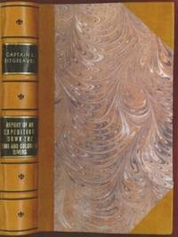
1853E0014198 pages with 23 plates. Royal octavo 9 1/2" x 6" rebound in 3/4 leather with marbled boards and black label with gilt lettering to spine. 79 plates with one Buffalo Dance folding and some with a single tint in this first issue there are errors in the list of illustrations corrected in later issues viz. Landscapes etc. 23 plates numbered as 1-13 15-23 plus one unnumbered at end; Mammals 6 plates; Birds 5 plates numbered 1 3-6 plate 2 Struthus Canicops Woodhouse male is called for but not present and most likely not to be found in this issue; Reptiles 21 plates with 10a miss-numbered as 10 12 as 13 and 13 as 16; Fishes 3 plates; Plants 21 plates plate 21 Aploppus Nuttalii present but not called for. Includes <i>Reconnaissance of the Zuni Little Colorado and Colorado Rivers Made in 1851</i> map as called for but includes Lithographed map <i>Boundary of the Creek Country</i> 24" x 36" laid in not called for. Senate Executive Document 59 Howes: 528 First edition.<br /><br />Survey of the watershed of the Canadian River and Red Fork of the Arkansas River in Indian Territory extending from Fort Smith to the border with Texas. The lands of the Cherokee Creek Seminole and Choctaw Indians are located. The map locates numerous forts including Smith Coffee Gibson and Old Fort Holmes and their connecting wagon roads. Talasee is shown at the site of Tulsa. This map was issued with the "Northern and Western Boundary Line of the Creek Country" report by Sitgreaves and Lt. J.C. Woodruff. The surveys were made in 1848 and 1850 but the report in which the map was issued wasn't published until 1858.<br /><br />After the conquest of New Mexico and California it was apparent that transportation and communications needed to be improved between these new territories and the rest of the United States east of the Mississippi. Geographical knowledge of most of this area particularly northwestern New Mexico now northern Arizona was very limited and inaccurate. Some maps of the day showed a river system that might provide a possible navigable water corridor between New Mexico and the Gulf of California via the Zuni Little Colorado and Colorado Rivers. In September of 1851 Captain Lorenzo Sitgreaves along with a small crew of topographers naturalists artists and support personnel and an escort of 30 infantrymen left the Zuni Pueblo in western New Mexico by pack train with instructions to explore and map the Zuni and Colorado Rivers and evaluate their navigability in light of a possible impending war with the Mormons in Utah. They traveled southwest along the Zuni River to its mouth and then headed northwest along the Little Colorado intending to follow it to the Colorado. When they reached Grand Falls northwest of present-day Winslow Arizona their guide Antoine Leroux advised them that it was unwise to follow the river any further because it flowed in a deep canyon for the rest of its course and emptied into the great canyon of the Colorado River. They left the river and struck off due west around the north side of the San Francisco Mountains discovering the Wupatki Indian Ruins along the way and looped southwestward around the south side of Bill Williams Mountain. The rest of their westward march followed near the future alignment of Route 66 to the Colorado River near the modern town of Bullhead City Arizona. After a difficult march south along the Colorado River they reached Camp Yuma on November 30. Of course Sitgreaves discovered that the Zuni and Little Colorado Rivers were not at all navigable and would be useless to transport troops and supplies. The Colorado River however was found to be navigable along the entire distance that he explored. Sitgreaves' official report "Report of an Expedition Down the Zuni and Colorado Rivers in 1851" was published in 1853.<br /><br /><b>Condition:</b><br /><br />Foxing left margin trimmed as issued for folding all other plates present as called for in Howes as well as Lithographed map <i>Boundary of the Creek Country</i> laid in and not called for some folding. Rebound in attractive three quarter leather else a about very good. Robert Armstrong hardcover books
1716BB0841Paris: chez Jean-Geoffroy Nyon quay de Conti au coin de la rue Guenegaud au Nom de Jesus Etienne Ganeau rue Saint Jacques aux Armes de Dombes vis-à-vis la Fontaine de S. Severin Jacque Quillau imprimeur-juré-libraire rue Galande aux Armes de l'Université 1716. First Edition. A defective first edition missing one map and one plate of this classic in the literature of Pacific voyages of exploration. 4to: xiv2982pp with 35 of 37 maps plans and plates 18 of which are folding; ornamental engraved vignettes and woodcut musical notation in the text never bound in were the map of Détroit de le Maire no. v and the plate of Indiens en habits simples no. ix; plate xvi was bound in twice. Contemporary calf spine richly gilt in six compartments brown leather lettering piece gilt "Caissotti" in gilt script on upper board all edges stained red marbled end papers red silk page marker. An exceptional wide-margined copy text maps and plates fresh and clean marred only by a stain in the gutter of first three leaves. Provenance: copper-engraved bookplate "Il Cittadino / Carlo Giac. Caissotti." Sabin 25924. Borba de Moraes 328. Hill p. 115. Leclerc 1736. Palau 94964. Gibson's Library p. 128. Item #BB0841. Frézier set sail in 1712 with a French commission to assess the strength of Spanish settlements on the Pacific coast and to revise existing charts. According to Hill he "brought back information of considerable geographical and scientific value" to later navigators and his account is today appreciated for its keen observations of the customs commerce and natural history—including the cotton and strawberry plants—of Chile Peru and Tierra del Fuego. It's interesting to note that Frezier's surname was itself derived from fraise the French for strawberry. The chapters on Indian and Creole life include descriptions of costume and architecture as well as musical instruments. The folding plans of cities visited are often enhanced by panoramic views as in the case of Callao Concepción Valparaíso La Serena Salvador de Bahía and Angra Azores. Amongst the most important plates are the general map of the expedition the Strait of Lemaire Valdivia Bahía de an Vicente Santiago de Chile Lima and Bahía de Todos los Santos. An immediate success the work was soon translated into English and German and republished several times in the eighteenth century. N. B. With few exceptions always identified we only stock books in exceptional condition with dust jackets carefully preserved in archival removable mylar sleeves. All orders are packaged with care and posted promptly. Satisfaction guaranteed. Fine Editions Ltd is a member of the Independent Online Booksellers Association and we subscribe to its codes of ethics. chez Jean-Geoffroy Nyon, quay de Conti, au coin de la rue Guenegaud, au Nom de Jesus, Etienne Ganeau, rue Saint Jacques, aux Arm unknown
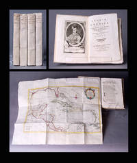
1783BB0692In Venezia Venice: Nella stamperia Gatti a spese di Leonardo e Giammaria Fratelli Bassaglia 1783. Original Wraps. Fine. Second Venice Edition of Antonio Pillori's translation of Robertson's standard work on the discovery of America and the conquest of Mexico and Peru. Demy 8vo 202 x 136mm: xxiv240pp with frontispiece portrait of Columbus and large folding map of Gulf of Mexico showing Florida Cuba Jamaica and farther Caribbean islands; 25-328pp with frontispiece portrait of Bartolomé de las Casas and folding map of South America; 23-359 p. 181 misnumbered "281"; p. 304 "204"1pp with frontispiece portrait of Cortés and folding map of Mexico; 42951pp with frontispiece portrait of Pizarro and large folding map of Middle America. Original paper-case bindings with yapped edges manuscript titles and volume numbers to spines text block sewn on tawed tongs vol. iv with modern replacements. Worming to upper cover portrait title page and map margins of vol. iv now expertly restored by a paper conservationist. A remarkably fresh wide-margined set in original paper-case bindings complete in four volumes eight books as issued with all four folding maps colored in outline by a contemporary hand as the John Carter Brown Library copy. Borba de Moraes p. 740-41 first edition. Sabin 71997 noting the Venice editions of 1778 and 1802 only. Originally published in two volumes in 1777 by Strahan and Cadell in London and Balfour in Edinburgh "to a very positive reception" ODNB; first Venice edition published in 1778. "Its success" according to the ODNB "was even more marked on the continent where it was considered Robertson's masterpiece . . . With its dramatic sweep of narrative combined with a provocative confrontation of two very different stages of civilization Spanish and Native American and a prose that was more flexible and evocative than that of his earlier books the History of America is often regarded as Robertson's most interesting original and even Romantic work. However it also shows the Eurocentric limits of his stadial thinking because it presents an unsympathetic account of Native Americans and glosses over Spanish atrocities." Borba de Moraes credits Roberston with writing the "first history of the discovery and Spanish conquest of America based on ample bibliographical information and documents in the Simancas archives. . . . The bibliography at the end of the second volume is remarkable for the time." Franklin D. Roosevelt owned the first Venice edition. N. B. With few exceptions always identified we only stock books in exceptional condition carefully preserved in archival removable mylar sleeves. All orders are packaged with care and posted promptly. Satisfaction guaranteed. Fine Editions Ltd is a member of the Independent Online Booksellers Association and we subscribe to its codes of ethics. Nella stamperia Gatti a spese di Leonardo e Giammaria Fratelli Bassaglia unknown
4to [32 x 25 cm]; xx, 452, [ii, errata and additions, often lacking] pp, engraved view Cape of Good Hope, 17 plates including four folding, other illus, tables. contemporary blind-stamped full calf, gilt spine title lettering, all edges gilted, rubbed, joints cracking with repair, few leaves lightly foxed including few plates, inscription & bookplate on endpaper, very good clean copy with nice wide margins. A pic Most plates include several figures including some of instruments and equipment. Norman 1056: 'With this monumental survey of the stars of the southern hemisphere, Herschel completed the task begun by his father William, who fifty years earlier had catalogued the northern celestial hemisphere. Using a twenty foot reflecting telescope, which he erected just south of Cape Town, Herschel swept the whole of the southern sky, cataloging nebulae, cluster and binary stars, carrying out the counts of over 68,000 stars.. . . he made detailed drawings and maps.' Honeyman 1663: 'The first great star-atlas of the southern hemisphere'. Includes a chapter on Halley's comet. Norman Catalogue 1056.
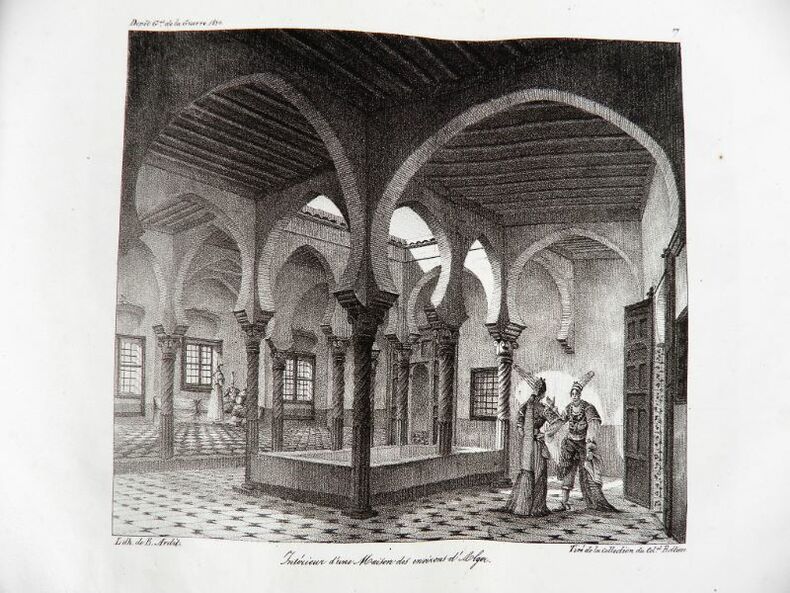
18302192Paris, Ch. Piquet, 1830. Texte + Atlas, complet. In-12, 10,5 x 17,5 cm (texte) ; In-folio oblong, 36 x 28 cm. Reliure postérieure pastiche en demi-veau fauve et coins crème en vélin, dos lisse orné de filets à froid et roulettes dorées, pièce de titre en maroquin noir, tranches du volume de texte marbrées. viii, 238 pp. ; 21 pl. (atlas). Deuxième édition, publiée la même année que l’originale. « La première édition de cet Aperçu a été envoyée à l’armée expéditionnaire d’Afrique. On trouvera, à la fin de celle-ci, quelques plans nouveaux, et, dans le texte ou en appendice, quelques additions que de nouvelles recherches nous ont mis à même de présenter au lecteur ». L’atlas contient 7 cartes ou plans gravés, dont 6 dépliants (2 établis d’après les relevés du Capitaine Boutin) et 14 planches lithographiées, dont plusieurs issues de la collection du Colonel Rottiers représentant des vues et des costumes, le tout monté sur onglets.« Ouvrage publié par le Dépôt Général de la Guerre à l'usage de l'armée expéditionnaire d'Afrique, qui quitta le port de Toulon le 25 mai 1830, en direction d'Alger. Il fut rédigé par le géographe Charles Piquet, en grande partie d'après le rapport du capitaine Boutin, envoyé en mission d'espionnage, en 1808, dans la régence d'Alger ». Gay, 852 et 873 ; Tailliart, 1455. Ex-dono JJL de Querelles sur la première carte.
17571407Paris, de l'imprimerie de Didot, 1757. In-4 - 20x26cm. Reliure de l’époque en plein veau marbré, dos à 5 nerfs orné caissons et fleurons dorés, pièce de titre en maroquin rouge, tranches rouges. 4ff, 471pp. Exemplaire complet de son frontispice, 36 vignettes et de ses 5 cartes. Jacques Nicolas Bellin entra au Dépôt des cartes et plans de la Marine peu après la création de celui-ci, en 1721, et y passa toute sa vie. Nommé ingénieur hydrographe en août 1741, il incarne le type même du géographe en chambre car il ne voyagea jamais lui-même et se borna à travailler sur les documents qui lui étaient fournis par les navigateurs. Il a compilé en cinquante ans d’activité une masse énorme de connaissances géographiques de son temps en plagiant bien souvent les travaux des marins comme d’Après Mannevillette qui déposa à ce propos une plainte à l’Académie des Sciences. Il a publié 59 cartes de toutes les régions du monde, réunies en volumes sous le titre d’ « Hydrographie française » (1753) puis en 1764 le « Petit Atlas Maritime » en 5 volumes qui fut pendant plusieurs décennies le bréviaire des navigateurs. Auteur d’une « Nouvelle méthode pour apprendre la géographie » (1769), il fut membre de l’Académie de Marine et de la Société royale de Londres. (Taillemite)
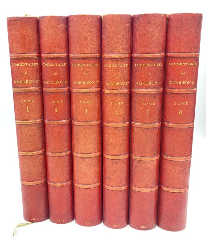
220056Paris, Imprimerie Impériale, 1867 6 vol. in-4, nbx plans et cartes en couleurs, demi-chagrin rouge, dos à nerfs (reliure de l'époque). Dos passé.
222758Paris, Imprimerie Impériale, 1867 6 vol. in-4, nbx plans et cartes en couleurs, demi-chagrin rouge à coins, dos à nerfs, tête dorée (reliure de l'époque). Dos un peu passé avec de petites traces noires, qqs épid. sans gravité.
234305Paris, Panckoucke, 1819-1820 7 vol. in-8, veau fauve, dos lisse orné, tranches mouchetées (reliure de l'époque). Dos un peu frotté mais bon exemplaire.
188110061DBLeipzig, F. A. Brockhaus, 1881. 8°. 21,5 cm. VIII, 559 (1) Seiten. Blauer Original-Leinenband mit goldgeprägtem Rücken- und Deckeltitel.
17526264BBHalle, Johann Justinus Gebauer, 1752. 4°. (48) 688 S. Mit 1 gest. Frontispiz von Schleuen, 1 gest. Vignette, mehreren Holzschnitt-Vignetten, 1 gest. Karte u. 41 gest. Tafeln. Pergamentband der Zeit mit goldgepr. Rückenschild. + Wichtig: Für unsere Kunden in der EU erfolgt der Versand alle 14 Tage verzollt ab Deutschland / Postbank-Konto in Deutschland vorhanden +, A|B|C|D 1. und 2. Teil in 1 Band (von 2).
186454080Berlin Decker 1864-73. Lex8vo. 3 contemp. hcalf. Gilt spines and with gilt lettering. Spines slightly rubbed. XXII4352;VI4375;XI4426 pp. 24 engraved plates and 3 folded maps. Faint brownspots to margins in volume 1. <br/><br/><em>First edition. The offered volumes contains the general description of the expedition which relates to Japan and China. They do not comprise the scientific parts zoology botany of the expedition and not the landscape plates published as "Ansichten aus Japan China und Siam". </em> unknown
186454080Berlin, Decker, 1864-73. Lex8vo. 3 contemp. hcalf. Gilt spines and with gilt lettering. Spines slightly rubbed. XXII,(4),352VI,(4),375"XI,(4),426 pp., 24 engraved plates and 3 folded maps. Faint brownspots to margins in volume 1.