Martin Sauer (1785-1806)Biblio.com
1 955 résultats
1802E0151<p>2 volumes with Atlas. 4xxiv385 pages with xxii-xxiv lists books of voyages available from the publisher; 4418 pages with appendix containing vocabularies of the languages of Yukagir Yakut Tungoose Kamchatka the Aleutian Islands and Kadiak and inex. Atlas with title list of plates 14 engraved plates & large folding engraved map. Text volumes are small octavo 7¾" x 4½" 19th century quarter calf & boards spines tooled in gilt morocco lettering pieces; atlas is quarto 11" x 7½" in period tree calf spine tooled in gilt. Translated by J Castéra. Howes S-117 First French Edition.<br /><br />Martin Sauer was an English civil servant who knew Russian French and German. He became acquainted with Joseph Billings in St Petersburg in the 1780s. He agreed to join Billings expedition as his secretary and interpreter. It was agreed that he would write the official account but there is some controversy about his actives when he returned to St Petersburg in 1794. It has been suggested that he left hurriedly for England with much of the important archival material from the voyage including diaries and secret reports so that he could publish a record of the expedition before Russian authorities and scholars in the Academy of Sciences could review its details. Sauer's <em>An account of the Geographical and Astronomical Expedition to the Northern Parts of Russia</em> was published in London in 1802. It contains an abundance of detail about eastern Siberia and the Aleutian Islands and records the expeditions visits to Kodiak Island Prince William Sound and the coast south as far as Yakutat Bay. <br /><br />The chart was made by Aaron Arrowsmith from Sauer's notes and Billings observations and the whole complements well the other contemporary accounts of the expedition by the cartographer Gavriil Sarychev and the naturalist Carl Heinrich Merck. Aaron Arrowsmith 1750–1823 was an English cartographer engraver and publisher and founding member of the Arrowsmith family of geographers. He moved to Soho Square London from Winston County Durham when about twenty years of age and was employed by John Cary the engraver and William Faden. He became Hydrographer to the Prince of Wales ca. 1810 and subsequently to the King in 1820. In January 1790 he made himself famous by his large chart of the world on Mercator projection. Four years later he published another large map of the world on the globular projection with a companion volume of explanation.<br /><br /><strong>Condition:</strong><br /><br />Some rubbing and wear to coves of both atlas and text volumes some chipping to spine ends small gouge at back of atlas and stamp to front end paper else in very good condition.</p> Chez F Buisson hardcover
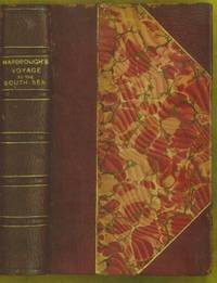
1711E0013iixxixvii1911blank 223 pages with 1 of 3 large fold out maps and 15 of 19 engraved fold out plates. Octavo 8" x 5" bound three quarter leather with raised spine bands and gilt lettering to spine over marbled boards. Edited by Sir Tancred Robinson. Second edition preferred over the first edition "because it has the chart of the western and southern oceans." Hill In 1699.<br /><br />First published in 1694 which contained only two maps The book is important because it contains one of the earliest English accounts of Abel Janszoon Tasman's famous voyage of 1642 from Batavia during which he discovered Tasmania and New Zealand and visited Tonga and Fiji Hill 1475.<br /><br />Rear Admiral Sir John Narborough RN was an English naval commander of the 17th century who served with distinction during the Anglo-Dutch Wars and against the Barbary Coast pirates. He was descended from an old Norfolk family. He received his commission in 1664 and in 1666 was promoted lieutenant for gallantry in the action with the Dutch fleet off the Downs in June of that year. After the peace he was chosen to conduct a voyage of exploration in the South Seas. He set sail from Deptford on November 26 1669 and entered the Straits of Magellan in October of the following year. In 1670 he visited Port Desire in Argentina and claimed the territory for the Kingdom of Great Britain but returned home in June 1671 without accomplishing his original purpose. A narrative of the expedition was published at London in 1694 under the title <i>An Account of several late Voyages and Discoveries to the South and North</i>. During the Third Anglo-Dutch War Narborough was second captain of the Lord High Admiral's ship the Prince and conducted himself with such conspicuous valor at the battle of Solebay Southwold Bay in May 1672 that he won special approbation and shortly afterwards was made rear-admiral and knighted. In 1675 he was sent to suppress the Tripoline piracies and by the bold expedient of dispatching gun-boats into the harbor of Tripoli at midnight and burning the ships he induced the them to agree to a treaty. Shortly after his return he undertook a similar expedition against the Algerians. In 1680 he was appointed commissioner of the Navy an office he held till his death. He was buried at Knowlton church Kent where a monument has been erected to his memory. The island of Fernadina the youngest and westernmost island of the Galapagos Archipelago was originally named 'Narborough Island' in his honor by the 17th century buccaneer William Ambrosia Cowley.<br /><br /><b>Condition:</b><br /><br />Marginal foxing soiling and damp staining through out paper fault across second C2 affecting one letter some rubbing hinges and corners else a better than good copy. Printed for D Brown hardcover books
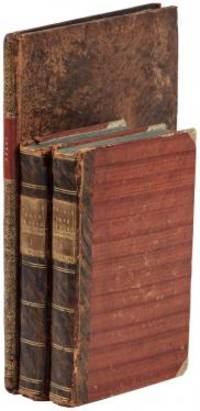
1802E01512 volumes with Atlas. 4xxiv385 pages with xxii-xxiv lists books of voyages available from the publisher; 4418 pages with appendix containing vocabularies of the languages of Yukagir Yakut Tungoose Kamchatka the Aleutian Islands and Kadiak and inex. Atlas with title list of plates 14 engraved plates & large folding engraved map. Text volumes are small octavo 7¾" x 4½" 19th century quarter calf & boards spines tooled in gilt morocco lettering pieces; atlas is quarto 11" x 7½" in period tree calf spine tooled in gilt. Translated by J Castéra. Howes S-117 First French Edition.<br /><br />Martin Sauer was an English civil servant who knew Russian French and German. He became acquainted with Joseph Billings in St Petersburg in the 1780s. He agreed to join Billings expedition as his secretary and interpreter. It was agreed that he would write the official account but there is some controversy about his actives when he returned to St Petersburg in 1794. It has been suggested that he left hurriedly for England with much of the important archival material from the voyage including diaries and secret reports so that he could publish a record of the expedition before Russian authorities and scholars in the Academy of Sciences could review its details. Sauer's <i>An account of the Geographical and Astronomical Expedition to the Northern Parts of Russia</i> was published in London in 1802. It contains an abundance of detail about eastern Siberia and the Aleutian Islands and records the expeditions visits to Kodiak Island Prince William Sound and the coast south as far as Yakutat Bay. <br /><br />The chart was made by Aaron Arrowsmith from Sauer's notes and Billings observations and the whole complements well the other contemporary accounts of the expedition by the cartographer Gavriil Sarychev and the naturalist Carl Heinrich Merck. Aaron Arrowsmith 1750–1823 was an English cartographer engraver and publisher and founding member of the Arrowsmith family of geographers. He moved to Soho Square London from Winston County Durham when about twenty years of age and was employed by John Cary the engraver and William Faden. He became Hydrographer to the Prince of Wales ca. 1810 and subsequently to the King in 1820. In January 1790 he made himself famous by his large chart of the world on Mercator projection. Four years later he published another large map of the world on the globular projection with a companion volume of explanation.<br /><br /><b>Condition:</b><br /><br />Some rubbing and wear to coves of both atlas and text volumes some chipping to spine ends small gouge at back of atlas and stamp to front end paper else in very good condition. Chez F Buisson hardcover books
8vo [26 x 17.5 cm]; xiv, 370, 16 [ads] pp, 38 hand colored plates, including 32 of birds by Keulemans, 6 of plants, 26 heliotype illus on 16 plates, frontis, colored plates of geological sections, other illus, fldg map (tear at stub) part colored, tables. later cloth with gilt title on front cover, cover lightly rubbed, signature on half title page, lightly foxed on few margins, very good sound and tight copy. A picture of this book is available upon request by email. Kaul 690: "A description of the route from Jammu to Ladakh via Banihal". Wood 383: "Report of an important scientific expedition". Zimmer 298: "The ornithological report contains descriptions of several new species". RGS Catalogue 215. The first 150 pages contains Henderson's travel narrative, with the rest of the book on natural history, mostly on birds by Hume. The narrative describes the 2,000 mile trip each way over a period of six months. The entomological report is by H. W. Bates and the botanical one by Henderson and J. D. Hooker, with a meteorological appendix. Notable especially for its fine plates, the hand colored plates of birds are very attractive.
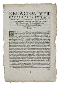
1625ABC_46574Lisbon: Pedro Craesbeeck 1625. Not bound. Folio. With a small woodcut decorated initial opening the text. Rare Spanish propagandistic news publication emphasizing the success of the Spanish fleet against the English and Dutch during the Anglo-Spanish and Eighty Years' War discussing the heavy losses of the Anglo-Dutch fleet on their way to Cádiz in 1625. In 1624 negotiations for the marriage between Charles Prince of Wales son of King James I and the Spanish infanta Maria sister of Philip IV broke down and war broke out because the Spanish court could not accept a marriage as long as Charles refused to convert to Catholicism. In 1625 the English prepared a fleet to sail to Spain more specifically Cádiz an important trading port of the Spanish silver fleet. In October 1625 approximately 100 ships including 15 Dutch warships sailed for Cádiz. Soon the ships were plagued with difficulties especially storms. Many ships were left barely seaworthy and it caused major delays. On 1 November 1625 fleet entered the Bay of Cádiz but in the end the mission failed.The present publication can be seen as Spanish propaganda presented as "news" emphasizing their victories. While sailing to Cádiz the Anglo-Dutch fleet came in heavy weather near Dunkirk. The text describes in great detail how ships went down or how they were captured but also the drowning of many people on board. The present publication in Spanish was printed in Lisbon in 1625 still under the rule of the Spanish monarchs the Crown of Portugal was united with the Crowns of Castile and Aragon from 1580 to 1640. It is an outstanding example of the Spanish annus mirabilis praising the Spanish victories during the wars with England and the Dutch Republic.Edges frayed and slightly browned with a few spots the two leaves nearly separated at the fold some minor foxing and a small jagged tear in the second leaf with minor loss of text. Otherwise in good condition. A rare piece of news and propaganda on the successes of the Spanish fleet against the Dutch and English ships.l Ensayo de bibliografía marítima Española 2467; Palau 257848; Pohler Bibliotheca Historico-Militaris p. 246; USTC 5025988 9 copies; Wilkinson & Lorenzo eds. Iberian Books 55774; WorldCat 1 copy noting no place of publication or publishers name. Pedro Craesbeeck, unknown
190755717BBWien, In Kommission bei Alfred Hölder, 1907-1908. Groß-8°. 24,5 cm. XXIII, 443, XII, 343, X, 299 und XV, 550 Seiten. Schwarze und dunkelbraune Halblederbände mit goldgeprägten Rückentiteln.
1855E0558<p>2 volumes. xx383 pages with hand colored frontispiece 3 maps in pockets plates many colored; vii41923 ad pages with color frontispiece and plates some colored. Small quarto 10 1/2" x 6 3/4" bound in original publisher's pictorial brown cloth with blind-stamped cover with gilt pictorial in gilt. Notes on the Natural History by John Richardson. Abbey Travel 645; Arctic Bibliography 1241; Books on Ice 5.8a; Hill 106; Sabin 4389; TPL 3409 First edition.<br /><br />Belcher's five-ship 1852-54 expedition in search of Franklin would be the last official British attempt. On the HMS Assistance Belcher successfully navigated through the Wellington Channel but beset by ice was unable to return to Lancaster Sound and was forced to abandon the ship. This account of the expedition also includes several essays on the natural history of the region by Richardson Owen Bell Salter and Reeve.<br /><br /><strong>Condition:</strong><br /><br />Minor wear re-backed with parts of original back-strips laid down; minor foxing short separations at folds to the largest map; inked stamps on title pages Edinger bookplates else a good set internally very good.</p> Lovell Reeve hardcover
1700E0566xxiii43313 table pages with two folding maps of the Marsianes and Guam. Duodecimo 6 1/2 x 3 1/4" bound in contemporary full sheep with red label in gilt spine and five raised spine bands speckled red end pages. Brunet 28230 Cioranescu 41783 First edition.<br /><br />Charles Le Gobien was a French Jesuit writer founder of the Lettres édifiantes et curieuses a collection of reports from Jesuit missionaries in China. It is a major source of information for the history of Catholic missions and life in China in those times. Le Gobien was born at Saint-Malo Brittany. He entered the Society of Jesus on 25 November 1671. As professor of philosophy and especially while procurator of the Franco-Chinese mission he sought in a series of papers to awaken interest in the work of Christianizing Eastern Asia. In 1697 appeared at Paris his Lettres sur les progréz de la religion à la Chine. Apropos of Chinese Rites controversy he published among other things Histoire de l'édit de l'empereur de la Chine en faveur de la religion chrétienne avec un éclaircissement sur les honneurs que les Chinois rendent à Confucius et aux morts Paris 1698; and in the year 1700: Lettre à un Docteur de la Faculté de Paris sur les propositions déférées en Sorbonne par M. Prioux. Under the same date there appeared in Paris the Histoire des Isles Mariannes nouvellement converties à la religion chrétienne. The second part translated into Spanish by J. Delgado is found in the latter's Historia General de Filipinas Manila 1892. In 1702 Père Le Gobien published Lettres de quelques missionnaires de la Compagnie de Jésus écrites de la Chine et des Indes Orientales; this was the beginning of the collection soon to become celebrated under the title of Lettres édifiantes et curieuses écrites des missions étrangéres par quelques missionnaires de la Compagnie de Jésus. The first eight series were by Le Gobien the latter ones by Fathers Du Halde Patouillet Geoffroy and Maréchal. The collection was printed in thirty-six volumes duodecimo Paris 1703–76 and reissued in 1780-81 by Fathers Yves de Querbeux and Brotier in twenty-six volumes duodecimo omitting the prefaces. New editions appeared in 1819 1829–32 and 1838-43. One abridgment in four volumes octavo was entitled Panthéon Littéraire by L. Aimé Martin 1834–43. A partial English translation came out in London in 1714. The publication incited the Austrian Jesuit Stöcklein to undertake his Neuer Welt Bott about 1720 at first considered merely a translation but soon an independent and particularly valuable collection five volumes folio in forty parts substantially completing the Lettres Edifiantes.<br /><br />This is a history of the Christian missions in the Marianas or Ladrones Islands in the north-western Pacific the principal island of which is Guam. Reprinted in the text are several letters from early missionaries Medina Clain Sanvitores &c. The Jesuit mission was established there by Diego Luis de Sanvitores. Father Le Gobien never visited the Mariana islands but based his account chiefly on the relations and letters of missionaries sent to him from Rome Spain the Netherlands etc. Includes a letter by P. Clain about the discovery of the Caroline Islands.<br /><br />Condition:<br /><br />Rebacked with original spine laid down provenance: Jesuit College library with old stamps to front free endpaper half title and title page else about very good. Nicolas Pepie hardcover books
1700E0566xxiii43313 table pages with two folding maps of the Marsianes and Guam. Duodecimo 6 1/2 x 3 1/4" bound in contemporary full sheep with red label in gilt spine and five raised spine bands speckled red end pages. Brunet 28230 Cioranescu 41783 First edition.<br /><br />Charles Le Gobien was a French Jesuit writer founder of the <i>Lettres édifiantes et curieuses</i> a collection of reports from Jesuit missionaries in China. It is a major source of information for the history of Catholic missions and life in China in those times. Le Gobien was born at Saint-Malo Brittany. He entered the Society of Jesus on 25 November 1671. As professor of philosophy and especially while procurator of the Franco-Chinese mission he sought in a series of papers to awaken interest in the work of Christianizing Eastern Asia. In 1697 appeared at Paris his Lettres sur les progréz de la religion à la Chine. Apropos of Chinese Rites controversy he published among other things <i>Histoire de l'édit de l'empereur de la Chine en faveur de la religion chrétienne avec un éclaircissement sur les honneurs que les Chinois rendent à Confucius et aux morts</i> Paris 1698; and in the year 1700: <i>Lettre à un Docteur de la Faculté de Paris sur les propositions déférées en Sorbonne par M. Prioux</i>. Under the same date there appeared in Paris the<i> Histoire des Isles Mariannes nouvellement converties à la religion chrétienne</i>. The second part translated into Spanish by J. Delgado is found in the latter's <i>Historia General de Filipinas</i> Manila 1892. In 1702 Père Le Gobien published <i>Lettres de quelques missionnaires de la Compagnie de Jésus écrites de la Chine et des Indes Orientales</i>; this was the beginning of the collection soon to become celebrated under the title of <i>Lettres édifiantes et curieuses écrites des missions étrangéres par quelques missionnaires de la Compagnie de Jésus</i>. The first eight series were by Le Gobien the latter ones by Fathers Du Halde Patouillet Geoffroy and Maréchal. The collection was printed in thirty-six volumes duodecimo Paris 1703–76 and reissued in 1780-81 by Fathers Yves de Querbeux and Brotier in twenty-six volumes duodecimo omitting the prefaces. New editions appeared in 1819 1829–32 and 1838-43. One abridgment in four volumes octavo was entitled <i>Panthéon Littéraire</i> by L. Aimé Martin 1834–43. A partial English translation came out in London in 1714. The publication incited the Austrian Jesuit Stöcklein to undertake his <i>Neuer Welt Bott</i> about 1720 at first considered merely a translation but soon an independent and particularly valuable collection five volumes folio in forty parts substantially completing the <i>Lettres Edifiantes</i>.<br /><br />This is a history of the Christian missions in the Marianas or Ladrones Islands in the north-western Pacific the principal island of which is Guam. Reprinted in the text are several letters from early missionaries Medina Clain Sanvitores &c. The Jesuit mission was established there by Diego Luis de Sanvitores. Father Le Gobien never visited the Mariana islands but based his account chiefly on the relations and letters of missionaries sent to him from Rome Spain the Netherlands etc. Includes a letter by P. Clain about the discovery of the Caroline Islands.<br /><br /><b>Condition:</b><br /><br />Rebacked with original spine laid down provenance: Jesuit College library with old stamps to front free endpaper half title and title page else about very good. Nicolas Pepie hardcover
1799biblio160<p><strong>First French edition of Bartram's</strong><strong> Travels which chronicled his explorations of the southern British colonies in North America from 1773–1777</strong><br /><br />2 volumes. 457 pages with frontispiece engraved portrait by Bovinet Mico Chlucco Grana King of the Seminoles and one folding plate; 436 pages without title with large folding map by J.B. Poirson engraved by Alexandre Blondeau and folding plate. Octavo 8 1/4" x 5 1/4" bound in half leather with six spine compartments with red and black labels in gilt over original marbled boards. Translated by Pierre Vincent Benoist. Sabin 3871; Palau 251346; Howes B223; Field 94 First French edition.<br /><br />William Bartram was an American naturalist. The son of the naturalist John Bartram. As a boy he accompanied his father on many of his travels to the Catskill Mountains the New Jersey Pine Barrens New England and Florida. In 1773 he embarked upon a four-year journey through eight southern colonies. Bartram made many drawings and took notes on the native flora and fauna and the native American Indians. In 1774 he explored the St. Johns River where he had memorable encounters with aggressive alligators and also visited a principal Seminole village at Cuscowilla where his arrival was celebrated with a great feast. He met Ahaya the Cowkeeper chief of the Alachua band of the Seminole tribe. When Bartram explained to the Cowkeeper that he was interested in studying the local plants and animals the chief was amused and began calling him Puc Puggy the flower hunter. Bartram continued his explorations of the Alachua Savannah or what is today Paynes Prairie. William Bartram wrote of his experiences exploring the Southeast in his book Travels through North & South Carolina East & West Florida the Cherokee Country the Extensive Territories of the Muscogulges or Creek Confederacy and the Country of the Chactaws Containing an Account of the Soil and Natural Productions of Those Regions Together with Observations on the Manners of the Indians published in 1791 and which is today simply known as Bartram's Travels. It was considered at the time one of the foremost books on American natural history. Many of Bartram's accounts of historical sites were the earliest records including the Georgia mound site of Ocmulgee. In addition to its contributions to scientific knowledge Travels is noted for its original descriptions of the American countryside. Bartram's writing influenced many of the Romantic writers of the day. William Wordsworth Samuel Taylor Coleridge and François René de Chateaubriand are known to have read the book and its influence can be seen in many of their works. Ephraim George Squier and Edwin Hamilton Davis in their book <em>Ancient Monuments of the Mississippi Valley</em> name Bartram as "the first naturalist who penetrated the dense tropical forests of Florida."<br /><br /><strong>Condition:</strong><br /><br />Some rubbing to original boards page 143 of volume one has small burn mark affecting text half title bound upside down in back old water stain to plate of volume two. Fold-out map has repair to first fold internally pages are clean and free of toning and foxing else a very good copy.</p> Chez Carteret et Brosson and Dogour Duran hardcover
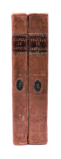
1790029884<p>London: J. Johnson 1790. Volume I: folding map xvi 283 pages; volume 2: viii 408 pages. De Lesseps accompanied La Perouse on the first part of his attempted circumnavigation of the globe. After investigation of the west coast of North America La Perouse sent de Lesseps overland to take the journals and maps of the expedition to Paris. La Perouse and his ships subsequently were lost after they left Australia and the journals carried by de Lesseps assumed great historical significance when published. Even more scarce than those records today are de Lesseps' report of his own overland travels through the Kamtschatka peninsula. The report also includes 25 pages of vocabulary translating common English words into Russian Kamtschadale Koriac Tchouktchi and Lamont languages. Internally clean with only minor foxing the two volumes in 3/4 leather over marbled paper covered boards have recently been sympathetically rebacked original title and volume patches retained. Very attractive example of a quite scarce title. Howes L269 Howes & Hartley rate this item dd "superlatively rare". First English Language Edition. Hardcover. Collectible-Very Good . 8vo - over 7¾" - 9¾" tall. Book.</p> J. Johnson hardcover
1733E0553<p>2 volumes. 8xxiv616471 pages with 4 maps ad view one folding and 3 plates one folding; 2693892 pages with 1 map and 6 plates. Quarto 10 1/4" x 10 1/4" bound in half leather with raised spine bands and gilt lettering to spine over marbled boards. Borba de Moraes page I:453; European Americana 733/146; Sabin 38591 First edition.<br /><br />Joseph-François Lafitau was a French Jesuit missionary ethnologist and naturalist. He is best known for his use of the comparative method in the field of scientific anthropology the discovery of ginseng and his writings on the Iroquois. Lafitau was the first of the Jesuit missionaries in Canada to have a scientific point of view. Lafitau is considered the first of the modern ethnographers and a precursor of scientific ethnology for his work on the Iroquois. He developed a model of studying peoples that involved describing existing cultures on their own terms—not in comparison to European society. He distinguished generic and specific traits transforming the "generic savage" into specific tribal groups. He explained that "only from specific identities can genetic relations be inferred." Furthermore he was the first to declare "contemporary primitive cultures throw light upon the culture of ancient people and vice versa. Lafitau is remembered for applying the comparative method with a greater level of competency than any of his contemporaries. Through original field observations he was able to critique the works of earlier writers on Primitive peoples. By using the Comparative Method Lafitau rejected all theories of social and cultural change and instead used his study to demonstrate the similarities in customs practices and usages of the Native North Americans with diverse peoples from different continents and centuries. He consistently relied on the doctrine of degeneration: all men originally shared one religion with one God but over time as people migrated to separate margins of the earth where they then lost touch with the values and traditions of this one true religion and culture. Therefore Lafitau believed in the "psychic unity of mankind" and the doctrine of primitive monotheism. His major work written in French was first published in 1724 in Paris. It is entitled <em>Customs of the American Indians Compared with the Customs of Primitive Times</em> <em>Moeurs des Sauvages Amériquains Comparées aux Moeurs des Premiers Temps</em> and is 1100 pages in total. In 1974 William Fenton and Elizabeth Moore made the first translation into English available.</p><p>Lafitau published two other works. One <em>Histoire de Jean de Brienne Roy de Jérusalem et Empereur de Constantinople</em> Paris 1727 was released before he returned to Canada; it is little known and seldom seen. A two-volume <em>Histoire des découvertes et conquestes des Portugais dons le Nouveau Monde . . .</em> 1733 appeared after he came home to France. Frequently found in libraries it is not just a compilation of original sources but an attempt to make available to French readers a story of exploration and adventure otherwise denied to them; in the chronicles he sees a long development of customs hitherto unnoticed such as he had reported in the <em>Mœurs</em>; from them understood only he says in the original languages of the people who practice them he builds his "system" or philosophy of history and once more he is concerned too with the relation between custom and natural history or ecology.<br /><br /><strong>Condition:</strong><br /><br />Beautifully rebound in half leather. Faint dampening to second volume; early owner's signatures on title pages inked stamps of St Charles Borromeo Seminary on front paste-downs and first title page lacks frontispiece else a very good to fine set.</p> Chez Saugrain pere, quai des Augustins, au coin de la rue Chez Saugrain pere, quai des Augustins, au coin de la rue Pavee, a la hardcover
181886Paris, Berquet et Pétion, 1842 3 vol. in-8, 4 fac-similés dépl., bradel demi-percaline brune (rel. de l'époque). Qqs rousseurs.
1831E01322 volumes. xxi472 pages with three maps two folding and one double page figures and 13 plates; iv452 pages with 10 plates some folding tables and appendices. Octavo 9 1/2" x 5 1/2" Bound in contemporary half leather with marbled boards and gilt lettering to spine. Ferguson 1418; Hill I p. 19; Howes B309; Lada-Mocarski 95; Sabin 4347. Second edition published after quarto edition of the same year.<br /><br />Frederick William Beechey 17 February 1796 – 29 November 1856 was an English naval officer and geographer. He was the son of Sir William Beechey RA and was born in London. 1806 he entered the Royal Navy and saw active service during the wars with France and America. In 1818 he served under Lieutenant afterwards Sir John Franklin in David Buchan's Arctic expedition of which at a later period he published a narrative. In the following year he accompanied Lieutenant W. E. Parry in HMS Hecla. In 1821 he took part in the survey of the Mediterranean coast of Africa under the direction of Captain afterwards Admiral William Henry Smyth. He and his brother Henry William Beechey made an overland survey of this coast and published a full account of their work in 1828 under the title of Proceedings of the Expedition to Explore the Northern Coast of Africa from Tripoly Eastward in 1821-1822. In 1825 Beechey was appointed to command the HMS Blossom. His task was to explore the Bering Strait in concert with Franklin and Parry operating from the east. In the summer of 1826 he passed the strait and a barge from his ship reached 71°23'31" N. and 156°21'30" W. near Point Barrow which he named a point only 146 miles west of that reached by Franklin's expedition from the Mackenzie river. The whole voyage lasted more than three years and in the course of it Beechey discovered several islands in the Pacific and an excellent harbor near Cape Prince of Wales. In July 1826 he named the three islands in the Bering Strait. Two were the Diomede Islands that Vitus Bering had named in 1728: "Ratmanoff Island" Big Diomede and "Krusenstern Island" Little Diomede. Beechey called the uninhabited third islet "Fairway Rock" which is still its contemporary name. One of his crew Petty Officer John Bechervaise gave a detailed account of the voyage in his Thirty Six Years if a Seafaring Life by an Old Quartermaster published privately in 1839. In 1831 there appeared his Narrative of a Voyage to the Pacific and Beering's Strait to Co-operate with the Polar Expeditions 1825-1828. In 1835 and the following year Captain Beechey was employed on the coast survey of South America and from 1837 to 1847 carried on the same work along the Irish coasts. He was appointed in 1850 to preside over the Marine Department of the Board of Trade. In 1854 he was made rear-admiral and in the following year was elected president of the Royal Geographical Society. Beechey Island where Sir John Franklin wintered is named after him.<br /><br />Condition:<br /><br />Name neatly excised from head corner of titles small inconspicuous stamp to last pages. Inner hinges beginning marble to boards rubbed some stains to map. some toning to some plates some plates not bound in order to the printer but are all accounted for corners gently bumped else about a very good set. Henry Colburn and Richard Bentley hardcover books
1831E0132<p>2 volumes. xxi472 pages with three maps two folding and one double page figures and 13 plates; iv452 pages with 10 plates some folding tables and appendices. Octavo 9 1/2" x 5 1/2" Bound in contemporary half leather with marbled boards and gilt lettering to spine. Ferguson 1418; Hill I p. 19; Howes B309; Lada-Mocarski 95; Sabin 4347. Second edition published after quarto edition of the same year.<br /><br />Frederick William Beechey 17 February 1796 – 29 November 1856 was an English naval officer and geographer. He was the son of Sir William Beechey RA and was born in London. 1806 he entered the Royal Navy and saw active service during the wars with France and America. In 1818 he served under Lieutenant afterwards Sir John Franklin in David Buchan's Arctic expedition of which at a later period he published a narrative. In the following year he accompanied Lieutenant W. E. Parry in HMS Hecla. In 1821 he took part in the survey of the Mediterranean coast of Africa under the direction of Captain afterwards Admiral William Henry Smyth. He and his brother Henry William Beechey made an overland survey of this coast and published a full account of their work in 1828 under the title of Proceedings of the Expedition to Explore the Northern Coast of Africa from Tripoly Eastward in 1821-1822. In 1825 Beechey was appointed to command the HMS Blossom. His task was to explore the Bering Strait in concert with Franklin and Parry operating from the east. In the summer of 1826 he passed the strait and a barge from his ship reached 71°23'31" N. and 156°21'30" W. near Point Barrow which he named a point only 146 miles west of that reached by Franklin's expedition from the Mackenzie river. The whole voyage lasted more than three years and in the course of it Beechey discovered several islands in the Pacific and an excellent harbor near Cape Prince of Wales. In July 1826 he named the three islands in the Bering Strait. Two were the Diomede Islands that Vitus Bering had named in 1728: "Ratmanoff Island" Big Diomede and "Krusenstern Island" Little Diomede. Beechey called the uninhabited third islet "Fairway Rock" which is still its contemporary name. One of his crew Petty Officer John Bechervaise gave a detailed account of the voyage in his Thirty Six Years if a Seafaring Life by an Old Quartermaster published privately in 1839. In 1831 there appeared his Narrative of a Voyage to the Pacific and Beering's Strait to Co-operate with the Polar Expeditions 1825-1828. In 1835 and the following year Captain Beechey was employed on the coast survey of South America and from 1837 to 1847 carried on the same work along the Irish coasts. He was appointed in 1850 to preside over the Marine Department of the Board of Trade. In 1854 he was made rear-admiral and in the following year was elected president of the Royal Geographical Society. Beechey Island where Sir John Franklin wintered is named after him.<br /><br /><strong>Condition:</strong><br /><br />Name neatly excised from head corner of titles small inconspicuous stamp to last pages. Inner hinges beginning marble to boards rubbed some stains to map. some toning to some plates some plates not bound in order to the printer but are all accounted for corners gently bumped else about a very good set.</p> Henry Colburn and Richard Bentley hardcover
191384790May 24 1913. The Sphere. London. 1913. May 24. The Complete Magazine including original coloured cover and all adverts. Folio. Pagination: Coloured front cover iv 1 - b/w second cover with portrait of Scott publishing details of this issue - see second photo. 182 182a - 220 v- xxii. Includes double page photo 182b-183 of Captain Scott in his Antarctic Home by Herbert Ponting taken at Cape Evans. This famous portrait shows the space allotted to Scott and you can see all the photos of Lady Scott and baby Peter that he put up on the wall above his desk. This issue contains very good prints of many photographs not previously seen and also of a much higher quality than when reproduced in future publications. There are also diary entries. This publication predates the Strand Magazine which used some of the same photos. Front cover creased and worn and lacks small portions along spine. Close tears to edges of rear cover. VERY SCARCE. unknown
1855E0558xx383 pages with hand colored frontispiece 3 maps in pockets plates many colored; vii41923 ad pages with color frontispiece and plates some colored. Small quarto 10 1/2" x 6 3/4" bound in original publisher's pictorial brown cloth with blind-stamped cover with gilt pictorial in gilt. Notes on the Natural History by John Richardson. Abbey Travel 645; Arctic Bibliography 1241; Books on Ice 5.8a; Hill 106; Sabin 4389; TPL 3409 First edition.<br /><br />Belcher's five-ship 1852-54 expedition in search of Franklin would be the last official British attempt. On the HMS Assistance Belcher successfully navigated through the Wellington Channel but beset by ice was unable to return to Lancaster Sound and was forced to abandon the ship. This account of the expedition also includes several essays on the natural history of the region by Richardson Owen Bell Salter and Reeve.<br /><br /><b>Condition:</b><br /><br />Minor wear re-backed with parts of original back-strips laid down; minor foxing short separations at folds to the largest map; inked stamps on title pages Edinger bookplates else a good set internally very good. Lovell Reeve hardcover books
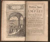
1695E0561xxiv21612 pages with frontispiece folding map and eight engraved costume plates. Duodecimo 6 ¼" x 3 ½" early full calf later spine label. First Edition in English. First published in French the prior year which was published without the plates.<br /><br />François Pidou de Saint Olon was a French diplomat under Louis XIV. In 1682 he was nominated as the first French resident envoy to the Republic of Genoa following the Bombardment of Genoa. He was then sent as an envoy to Madrid. In 1689 François Pidou was appointed ambassador to the court of Sultan Moulay Ismail for the signing of a commercial treaty and to release prisoners now slaves of Barbary corsairs of Salé for 233 including 29 bedridden Moroccan prisoners held by the French. His mission was not successful however he continued to stay more than three weeks more in Morocco. The book gains particular interest through its author's position as ambassador giving him access not always voluntary to areas of Moroccan society previously unrecorded by travelers. There are detailed descriptions of Moroccan dress and the book is beautifully illustrated with eight engraved plates of Moroccan men and women in traditional costume.<br /><br />Condition:<br /><br />With the fine copper engraved frontispiece of the overall state of Morocco which is quite rare and is often found missing in most copies. Joints cracking spine chipped at edges; foxing else very good. R. Bently hardcover
1695E0561xxiv21612 pages with frontispiece folding map and eight engraved costume plates. Duodecimo 6 ¼" x 3 ½" early full calf later spine label. First Edition in English. First published in French the prior year which was published without the plates.<br /><br />François Pidou de Saint Olon was a French diplomat under Louis XIV. In 1682 he was nominated as the first French resident envoy to the Republic of Genoa following the Bombardment of Genoa. He was then sent as an envoy to Madrid. In 1689 François Pidou was appointed ambassador to the court of Sultan Moulay Ismail for the signing of a commercial treaty and to release prisoners now slaves of Barbary corsairs of Salé for 233 including 29 bedridden Moroccan prisoners held by the French. His mission was not successful however he continued to stay more than three weeks more in Morocco. The book gains particular interest through its author's position as ambassador giving him access not always voluntary to areas of Moroccan society previously unrecorded by travelers. There are detailed descriptions of Moroccan dress and the book is beautifully illustrated with eight engraved plates of Moroccan men and women in traditional costume.<br /><br />Condition:<br /><br />With the fine copper engraved frontispiece of the overall state of Morocco which is quite rare and is often found missing in most copies. Joints cracking spine chipped at edges; foxing else very good. R. Bently hardcover books
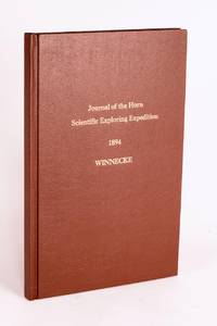
189658059Adelaide: C.E. Bristow Government Printer 1896. First Edition. Hardcover. Fine. Adelaide C.E. Bristow Government Printer 1896. Foolscap folio 32 pages including Appendix B: Report of the Physical Geography of Central Australia by Professor R. Tate and J.A. Watt plus 24 plates on 13 leaves printed rectos only and a folding meteorological chart 2 folding maps a topographical map of Mount Watt and a Survey of Hermannsburg Mission Station and a very large folding colour map 1210 × 1210 mm. Modern cloth lettered in gilt on the front cover; blank bottom margin of the main map slightly creased with one tiny tear expertly sealed; a fine copy. South Australian Parliamentary Paper 19 of 1896: only 650 copies printed. Winnecke was the leader of the expedition and in 'the natural order of things these journals and maps should have been published in connection with the scientific and other records of the Horn Expedition as both supplementary and complementary to them'. After a financial disagreement with W.A. Horn the organiser and backer of the venture this did not occur and this first edition was published under the auspices of the South Australian branch of the Royal Geographical Society of Australasia in conjunction with the Department of the Minister for the Northern Territory and the Survey Department. McLaren 16973; an octavo edition was published the following year see McLaren 16969 - not noting the very large map. C.E. Bristow, Government Printer hardcover
1823040517John Murray. Good with no dust jacket. 1823. First Edition. Hardcover. Hardcover; Hardcover. Brown leather boards with gold design at board edges. Title in gold over black leather label on gold decorated spine. Boards are noticeably scuffed and worn. Frayed edges some sunning. Marbleized edges match marbleized endpapers. Occasional foxing throughout. 4 maps 30 plates of which 11 are hand colored. All are in nice condition some light foxing/soil. Always carefully wrapped and shipped in cardboard boxes to protect your purchase.; B/w Illus; 4TO . John Murray hardcover
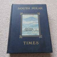
41Smith Elder London 1914. First Edition. Hardcover Original Cloth. Good Condition/No Dust Jacket. 1st Edition: Number 35 of a limited edition of 350. Original covers page edges gilt no dust jacket. PLEASE NOTE: Pages 16 3342434493125 and 148 are PHOTOCOPIES. Contents clean. Volume 1 & 2 were Scott's 1st "Discovery Expedition" whilst Volume 3 is from his 2nd "Terra Nova" Expedition. Although often sold as a set Volume 3 is a complete book in its' own right. The original broadsheets were produced at Cape Evans to amuse the men on the 'Terra Nova' Expedition. It was designed to be published separately from Volume 1 & 2. Cherry-Garrard was the Editor and typist and Wilson the main illustrator. The 1st issue was presented on Midwinter's Day 1911 the 2nd on 8th September and the 3rd on 15th October. Content included poetry humorous articles illustrations of sledging flags and caricatures. Includes Wilson's moving poem 'The Barrier Silence'. Copiously illustrated drawings in the text and full-page plates from sketches and paintings by E. Wilson H. Ponting and others. Spine shaken gutta-percha binding delicate some pages loose as is usual with the 1st Edition. This copy is still bright and handleable with care Gutta Percha was used as the binding glue in many early books it is not a difficult job to remove and reback using modern glues The South Polar Times was a magazine written and printed by the members of Antarctic Expeditions during the various voyages they undertook and forms what is perhaps the most personal of the printed documents to have come out of that most remarkable of periods of Antarctic adventures revealing so many often contradictory aspects of these men's various personalities. It contains a diary of the events of each month a record of the proceedings of the local Debating Society a monthly acrostic humorous notes besides articles of a more solid nature as well as stories sketches of various kinds and poems. One of the corner stones of an Antarctic collection. Quantity Available: 1. Shipped Weight: Under 5 kilogram. Category: Arctic & Antarctic; Exploration. Pictures of this item not already displayed here available upon request. Inventory No: 41. . This book is extra heavy and may involve extra shipping charges to some countries. Smith Elder hardcover
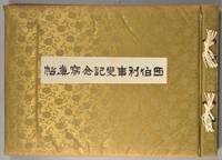
1918880611918. SIBERIAN EXPEDITION. Teikoku Gunjin Kyoiku-kai editors. SHIBERI JIHEN KINEN SHASHIN-CHO. Tokyo Taisho Tsushinsha Taisho 7 1918 Oblong folio bound western-style in cloth gilt. Illustrated throughout in collotype. Photos and cations on the International Siberian Expedition in support of the Whites against the Red Army in which the Japanese played a prominent role. 4 page folding panorama of Vladivostok harbor and views of the cities the countryside troops inhabitants diplomats war preparations etc. etc. One can feel the Winter coming. Very good condition throughout. Very scarce. unknown
1918880611918. SIBERIAN EXPEDITION. Teikoku Gunjin Kyôiku-kai editors. SHIBERI JIHEN KINEN SHASHIN-CHÔ. Tôkyô Taishô Tsûshinsha Taishô 7 1918 Oblong folio bound western-style in cloth gilt. Illustrated throughout in collotype. Photos and cations on the International Siberian Expedition in support of the Whites against the Red Army in which the Japanese played a prominent role. 4 page folding panorama of Vladivostok harbor and views of the cities the countryside troops inhabitants diplomats war preparations etc. etc. One can feel the Winter coming. Very good condition throughout. Very scarce. unknown books
197738Paris, Berquet et Pétion, 1842 3 vol. in-8, 4 fac-similés dépl., demi-basane verte, dos à nerfs orné (reliure moderne). Mouillures.