52 résultats
50306For the lot of approximately 250 items $6000. a Correspondence with various government officials hunting guides and others involved with preparing and carrying out the trip including14 letters to Furlong typed and autograph one accompanied by four photographs of members of the expedition with trophies; five retained copies of letters from Furlong to the correspondents four telegrams seven typed and manuscript recapitulations of various aspects of the trip e.g. titles for the "Dance of the Nandi" film and a three page typed press release on the expedition dated Nairobi 27 March 1930 accompanied by a photograph of Furlong and two bearers with a leopard he has killed.<br/>b Two hunting licenses issued by the Uganda Protectorate to Furlong 22 April 1930 one "For a First Elephant" the other a "Visitor's Full Game License."<br/>c Three maps period road map of Kenya and Uganda published by Bullows and Roy for the Royal East Africa Automobile Assn.; Map Showing Cairo-Mombasa Route published by the Sudan Survey Dept Khartoum 1929; and a period National Geographic Society map of Africa.<br/>d An account book narrow 12mo 19 pp. 22 March - 8 June 1930 and approximately 125 receipts most partly printed for a wide range of services and material necessary for the trip.<br/>e 21 photographs in addition to those mentioned above many picturing Furlong in the field with his rifle and trophies some with Furlong's notations on verso and 34 unused photo postcards featuring tribesmen animals and scenery of East Africa.<br/>f 42 promotional pamphlets ca. 1925-1934 for the various parts of Africa along Furlong's route 36 of which are unrecorded on OCLC. The pamphlets were issued by African railway companies and governmental agencies outfitters e.g. Thomas Cook and "Safari Africa Limited" London ship lines and other travel agencies and taxidermy concerns.<br/>g A wooden carved string instrument from the Para Mountains in present day Tanzania with Furlong's ownership label "Col. Wellington Furlong / c/o Safariland Ltd. / Musical Instrument / Para Mountains" still attached; the instrument is shaped like a hollowed-out bread tray 27 x 7 1/2 inches three holes in the shape of crosses in the bottom six strings stretched across the opening.<br/>Furlong 1874-1967; American explorer army officer author artist and photographer embarked on this big game expedition in 1930 partly as an effort to recover relics of Sir Henry M Stanley in East and Central Africa. Gateway to the Sahara New York 1909 is among several books he published. A member of the Explorers Club he was the first American to explore the interior of Tierra del Fuego 1907-1908. Most of his personal papers are held by the Stefansson Collection at Dartmouth. <br/><br/> unknown books
189677993Washington: Printed by the Journal Publishing Company in Meriden Conn 1896. 1st ed. Hardcover. Very Good. frontis photos folding map 125p. Original cream-colored cloth. 21cm. Moderate soil and creasing on covers. Old paper clip mark. Clara Barton's report as President and treasurer appears at pages 3-44 of this scarce report; George H. Pullman reports as Financial Secretary at pages 45-55; and various other reports on relief field work in Anatolia are found at pages 57-96 and then followed by the text of various telegrams. <br/><br/> Printed by the Journal Publishing Company in Meriden, Conn hardcover books
1748BOOKS00585324548 pages with three folding engraved maps present southern part of South America; part of the Pacific Ocean and the track of the Centurion round the world. Octavo 8 1/4" x 5 1/2" bound in full leather with five raised spine bands with red label to spine in gilt lettering with decorative blind-stamped ruled edges. Compiled from papers and other materials of the Right Honourable George Lord Anson and published under his direction by Richard Walter M.A. Chaplain of his Majesty's Ship the Centurion in that expedition. Hill I pp 317-138. Third edition.<br /><br />"This is the official account of Anson's voyage. England at war with Spain in 1739 equipped eight ships under the command of George Anson to harass the Spaniards on the western coast of South America for the purpose of cutting off Spanish supplies of wealth from the Pacific area. Lord Anson who was a friend and patron of Benjamin Robins after returning from the voyage around the world in the Centurion appears to have entrusted to Robins for revision the account of the voyage which had been compiled from the journals by his chaplain Richard Walter. It is probable that Robins revised and edited the work wrote an introduction and added dissertations." Hill. Perhaps the most popular account of maritime adventure of the eighteenth century. Anson's account of harrying the Spanish of South America and the taking of the Manilla galleon with treasure with a contemporary value of $800000 and his circumnavigation has long enjoyed a distinguished place as a masterpiece in descriptive travel.<br /><br /><b>Condition:</b><br /><br />Some small closed tears at the edges of the maps. Rebound in tooled leather with raised bands. Over all a very good to fine copy. John and Paul Knapton hardcover books
1808E0058ix366 pages. Duodecimo 7 1/4" x 4 1/4" in the original leather binding with black label in gilt to spine. Howes:354 First printed in 1806 in London in three volumes. Second printing.<br /><br />Thomas Ashe 1770-1835 was born in Dublin Ireland and was a soldier and memoirist. Much of his life was checkered with intrigue and fraud. His Memoirs and Confessions 1815 is an autobiographical account of 'criminal and delinquent' escapades beginning with the seduction of a girl in France. In America he edited the National Intelligencer and was arrested when attempting to steal treasures from churches in Latin America. His Travels in America first appeared in 1806. The narrative chronicles Ashe's travels by flatboat down the Ohio and Mississippi Rivers in 1806 and is one of the first travelogues written by a foreigner to comment specifically on the American inhabitants of the region. A unrestrained hatred of Americans can be found throughout the work. While the account is interesting and highly readable it was to create quite a stir and added to the wave of anti-British sentiment that would ultimately lead to the War of 1812. Printed Newburyport [Mass.] Reprinted for W. Sawyer and Co. by E.M. Blunt hardcover books
191034322Philadelphia: University of Pennsylvania 1910. 8vo. Frontis. x 65 1 pp. 2 plts. <br><br>Edited by H.V. Hilprecht. Offered here is Volume V fascicle I printing "The earliest version of the Babylonian deluge story and the temple library of Nippur." Illustrated with a frontispiece and two plates. Uncut unopened copy in original wrappers; wrappers discolored in certain areas back one probably from a newspaper clipping Interior clean very good. University of Pennsylvania unknown books
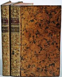
1799biblio160<b>First French edition of Bartram's</b><b> Travels which chronicled his explorations of the southern British colonies in North America from 1773–1777</b><br /><br />2 volumes. 457 pages with frontispiece engraved portrait by Bovinet Mico Chlucco Grana King of the Seminoles and one folding plate; 436 pages without title with large folding map by J.B. Poirson engraved by Alexandre Blondeau and folding plate. Octavo 8 1/4" x 5 1/4" bound in half leather with six spine compartments with red and black labels in gilt over original marbled boards. Translated by Pierre Vincent Benoist. Sabin 3871; Palau 251346; Howes B223; Field 94 First French edition.<br /><br />William Bartram was an American naturalist. The son of the naturalist John Bartram. As a boy he accompanied his father on many of his travels to the Catskill Mountains the New Jersey Pine Barrens New England and Florida. In 1773 he embarked upon a four-year journey through eight southern colonies. Bartram made many drawings and took notes on the native flora and fauna and the native American Indians. In 1774 he explored the St. Johns River where he had memorable encounters with aggressive alligators and also visited a principal Seminole village at Cuscowilla where his arrival was celebrated with a great feast. He met Ahaya the Cowkeeper chief of the Alachua band of the Seminole tribe. When Bartram explained to the Cowkeeper that he was interested in studying the local plants and animals the chief was amused and began calling him Puc Puggy the flower hunter.2 Bartram continued his explorations of the Alachua Savannah or what is today Paynes Prairie. William Bartram wrote of his experiences exploring the Southeast in his book Travels through North & South Carolina East & West Florida the Cherokee Country the Extensive Territories of the Muscogulges or Creek Confederacy and the Country of the Chactaws Containing an Account of the Soil and Natural Productions of Those Regions Together with Observations on the Manners of the Indians published in 1791 and which is today simply known as Bartram's Travels. It was considered at the time one of the foremost books on American natural history. Many of Bartram's accounts of historical sites were the earliest records including the Georgia mound site of Ocmulgee. In addition to its contributions to scientific knowledge Travels is noted for its original descriptions of the American countryside. Bartram's writing influenced many of the Romantic writers of the day. William Wordsworth Samuel Taylor Coleridge and François René de Chateaubriand are known to have read the book and its influence can be seen in many of their works. Ephraim George Squier and Edwin Hamilton Davis in their book Ancient Monuments of the Mississippi Valley name Bartram as "the first naturalist who penetrated the dense tropical forests of Florida."<br /><br />Condition:<br /><br />Some rubbing to original boards page 143 of volume one has small burn mark affecting text half title bound upside down in back old water stain to plate of volume two. Fold-out map has repair to first fold internally pages are clean and free of toning and foxing else a very good copy. Chez Carteret et Brosson and Dogour Duran hardcover books
1831E01322 volumes. xxi472 pages with three maps two folding and one double page figures and 13 plates; iv452 pages with 10 plates some folding tables and appendices. Octavo 9 1/2" x 5 1/2" Bound in contemporary half leather with marbled boards and gilt lettering to spine. Ferguson 1418; Hill I p. 19; Howes B309; Lada-Mocarski 95; Sabin 4347. Second edition published after quarto edition of the same year.<br /><br />Frederick William Beechey 17 February 1796 – 29 November 1856 was an English naval officer and geographer. He was the son of Sir William Beechey RA and was born in London. 1806 he entered the Royal Navy and saw active service during the wars with France and America. In 1818 he served under Lieutenant afterwards Sir John Franklin in David Buchan's Arctic expedition of which at a later period he published a narrative. In the following year he accompanied Lieutenant W. E. Parry in HMS Hecla. In 1821 he took part in the survey of the Mediterranean coast of Africa under the direction of Captain afterwards Admiral William Henry Smyth. He and his brother Henry William Beechey made an overland survey of this coast and published a full account of their work in 1828 under the title of Proceedings of the Expedition to Explore the Northern Coast of Africa from Tripoly Eastward in 1821-1822. In 1825 Beechey was appointed to command the HMS Blossom. His task was to explore the Bering Strait in concert with Franklin and Parry operating from the east. In the summer of 1826 he passed the strait and a barge from his ship reached 71°23'31" N. and 156°21'30" W. near Point Barrow which he named a point only 146 miles west of that reached by Franklin's expedition from the Mackenzie river. The whole voyage lasted more than three years and in the course of it Beechey discovered several islands in the Pacific and an excellent harbor near Cape Prince of Wales. In July 1826 he named the three islands in the Bering Strait. Two were the Diomede Islands that Vitus Bering had named in 1728: "Ratmanoff Island" Big Diomede and "Krusenstern Island" Little Diomede. Beechey called the uninhabited third islet "Fairway Rock" which is still its contemporary name. One of his crew Petty Officer John Bechervaise gave a detailed account of the voyage in his Thirty Six Years if a Seafaring Life by an Old Quartermaster published privately in 1839. In 1831 there appeared his Narrative of a Voyage to the Pacific and Beering's Strait to Co-operate with the Polar Expeditions 1825-1828. In 1835 and the following year Captain Beechey was employed on the coast survey of South America and from 1837 to 1847 carried on the same work along the Irish coasts. He was appointed in 1850 to preside over the Marine Department of the Board of Trade. In 1854 he was made rear-admiral and in the following year was elected president of the Royal Geographical Society. Beechey Island where Sir John Franklin wintered is named after him.<br /><br />Condition:<br /><br />Name neatly excised from head corner of titles small inconspicuous stamp to last pages. Inner hinges beginning marble to boards rubbed some stains to map. some toning to some plates some plates not bound in order to the printer but are all accounted for corners gently bumped else about a very good set. Henry Colburn and Richard Bentley hardcover books
1843E01482 volumes. xxxvii23878 ad pages with frontispiece woodcuts in text and 7 steel-engraved plates; vi2474 pages with frontispiece woodcuts in texts and 10 steel-engraved plates. Royal octavo 9¼x5½" in publisher's original green cloth spine lettered in gilt covers decorative blind stamped. First Edition.<br /><br />In 1825 Edward Belcher accompanied Frederick William Beechey's expedition to the Pacific and Bering Strait as a surveyor. In 1836. he commanded a surveying ship on the north and west coasts of Africa and in the British seas. Belcher took up the work which Beechey had left unfinished on the Pacific coast of South America. He was on board the bomb vessel HMS Sulphur which was ordered to return to England in 1839 by the Trans-Pacific route. Belcher made various observations at a number of islands which he visited having been delayed by being dispatched to take part in the war in China in 1840. On 26 January 1841 the then Commander Belcher landed on Possession Point at the north shore Hong Kong Island and made the first British survey of Hong Kong harbor. After the war's end in 1842 he reached home and for his services was made a Knight Bachelor in the following year. He was then engaged in HMS Samarang in surveying work in the East Indies the Philippines Geomun-do Port Hamilton and other places until 1847. In 1852 Belcher led the last and largest Admiralty expedition to rescue Sir John Franklin. He was also to look for his former surveying officer in Hong Kong Richard Collinson and Robert McClure whose ships had not been seen after entering the Bering Strait. He did a great deal of sledge exploration rescued McClure and abandoned four of his five ships in the ice. He had five ships: Assistance Belcher Resolute Henry Kellett second mate George Nares the steam tenders PioneerSherard Osborn and Intrepid Leopold McClintock and the depot ship North Star William Pullen. Belcher and one tender were to enter Wellington Channel where Franklin was thought to be while Kellett was to go west to Melville Island and look for Collinson and McClure. North Star was to stay at Beechey Island as a supply base. He left the Nore in April 1850. By early winter Assistanceand Pioneer were frozen in at Northumberland Sound to the north of Wellington Channel while Resolute and Intrepid were frozen in off Melville Island Arctic—the first ships this far west since William Edward Parry in 1819. A great deal of exploration was done by man-hauled sledges. In April 1853 Leopold McClintock and others left the Resolute on sledges and returned 105 days later having covered 1400 miles and discovered Prince Patrick Island. Another party went west and discovered Robert McClure whose ship was frozen in at Mercy Bay. Belcher went north by sledge and found a channel at the northern tip of Devon Island hinting that Franklin might have used it to escape to Baffin Bay. When the ice broke up that summer he pushed his ships up Wellington Channel and became trapped again. By February 1854 Belcher was becoming increasingly worried about the safety of his ships and men. In April he ordered Kellett to abandon his ships and return by sledge to North Star. Belcher abandoned his two ships in late July. Aided by two ships that showed up at Beechey Island Phoenix and Breadalbane the whole party returned to England. Belcher went through a court martial which was automatic for any captain who had lost a ship. He was exonerated but his sword was returned to him 'without observation'. He never again received an active command. Curiously Resolute broke free of the ice and drifted all the way to Davis Strait where it was picked up by an American whaler.<br /><br />Condition:<br /><br />Some staining and wear to covers spines a bit faded ends chipped and worn rear joint of Vol. I with chipping and loss; hinges repaired at endpapers some light foxing and occasional mostly marginal damp staining within the three folding maps which should be loose in a pocket not present; overall good uncommon in the original cloth. Henry Colburn hardcover books
1855E0558xx383 pages with hand colored frontispiece 3 maps in pockets plates many colored; vii41923 ad pages with color frontispiece and plates some colored. Small quarto 10 1/2" x 6 3/4" bound in original publisher's pictorial brown cloth with blind-stamped cover with gilt pictorial in gilt. Notes on the Natural History by John Richardson. Abbey Travel 645; Arctic Bibliography 1241; Books on Ice 5.8a; Hill 106; Sabin 4389; TPL 3409 First edition.<br /><br />Belcher's five-ship 1852-54 expedition in search of Franklin would be the last official British attempt. On the HMS Assistance Belcher successfully navigated through the Wellington Channel but beset by ice was unable to return to Lancaster Sound and was forced to abandon the ship. This account of the expedition also includes several essays on the natural history of the region by Richardson Owen Bell Salter and Reeve.<br /><br /><b>Condition:</b><br /><br />Minor wear re-backed with parts of original back-strips laid down; minor foxing short separations at folds to the largest map; inked stamps on title pages Edinger bookplates else a good set internally very good. Lovell Reeve hardcover books
1875WRCAM50727London 1875. 349-356pp. Modern blue wrappers printed paper label. Fine. The report extracted from a larger volume was compiled by George Richards Francis M'Clintock and Sherard Osborn to provide guidance to the impending proposed British expedition to the North Pole to be led by Sir George Strong Nares. In late May of the same year Nares would command two ships north around Greenland failing to reach the North Pole but becoming the first explorer to successfully pilot ships through the channel between Greenland and Ellesmere Islands; the channel was later named for him. In this report Richards M'Clintock and Osborn recommend two ships the Alert and the Bloodhound for Nares though the Bloodhound would be renamed the Discovery before the expedition began. The scope of the expedition is defined: "to attain the highest northern latitude and if possible to reach the North Pole." Also includes information on the route of the expedition the orders to be given various kinds of stores and provisions to be taken whether or not dogs should be used and much more. No listing in OCLC. unknown books
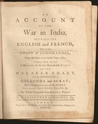
1761E6754xxxiii270215148xix1 pages 14 of 18 engraved plates maps many folding and index. Quarto 10 1/4" x 8 1/4" in original leather binding. First edition.<br /><br />Richard Owen Cambridge was a British poet. He was educated at Eton and at St John's College Oxford. Leaving the university without taking a degree he took up residence at Lincolns Inn in 1737. Four years later he married and went to live at his country seat of Whitminster Gloucestershire. In 1751 he removed to Twickenham where he enjoyed the society of many notable persons. Horace Walpole in his letters makes many jesting allusions to Cambridge in the character of news-monger. His chief work is the <i>Scribleriad</i> 1751 a mock epic poem the hero of which is the Martinus Scriblerus of Alexander Pope John Arbuthnot and Jonathan Swift. The poem is preceded by a dissertation on the mock heroic in which he avows Cervantes as his master. The satire shows considerable learning and was eagerly read by literary people; but it never became popular and the allusions always obscure have little interest for the present-day reader. He made a valuable contribution to history in his <i>Account of the War in India on the Coast of Coromandel from the year 1750 to 1760</i> 1761. He had intended to write a history of the rise and progress of British power in India but this enterprise went no further than this one work as he found that Robert Orme who had promised him the use of his papers contemplated the execution of a similar plan. The Works of Richard Owen Cambridge includes several pieces never before published. It contains an <i>Account of his Life and Character</i>by his Son George Owen Cambridge 1803 the Scribleriad some narrative and satirical poems and about twenty papers originally published in Edward Moore's paper The <i>World</i>. His poems are included in Alexander Chalmers' English Poets 1816.<br /><br /><b>Condition:</b><br /><br />Previous owner's name in neatly written dated 1806 on front end paper with his book plate on front past down with his library stamp. Lacks rear free end paper. Front hinge separated back hinge cracked. Lacks the Mongol on horse back plate map of Maratta County view of the attack on Geriah and view of Surat. Front worn spine ends and corners reinforced and repaired new spine label else about very good. Printed for T Jefferys hardcover books
1785BOOKS0033095 volumes: 520 pages with frontispiece tables and six plates; 492 pages with tables 479 pages 587 pages 504 pages with nine plates. Octavo 8" x 5" bound in leather with raised spine bands and black labels with gilt lettering to spine. Complied by John Kent principally from Campbell's Lives of the Admirals Hill page 358 First Dublin edition. First published in London in 1776-1777.<br /><br />A London man of letters Campbell was quite successful with his numerous works of an historical and biographical nature. He collect a large and valuable library. He first published his Lives of the Admirals in four volumes in the years 1742 to 1744. There were several later editions. From 1744 to 1748 he compiled and published what became known as Campbell's enlarged edition of John Harris's Complete collection of voyages and travels originally published in 1702-1705. Campbell also made numerous important contributions to the Biographia Britannica under the signatures E and X including his own noble Scottish ancestors the Campbells. A memoir of him was inserted by Andrew Kippis in this same work. Campbell was an expert on the histories of Spain Portugal France and the British and the Dutch. In 1765he was appointed the royal agent for the province of Georgia and held that office until his death. There are many interesting references to him in James Boswell's Life of Johnson. John Kent published only tow editions of his compilation; this one and one published in London in 1776-1777.<br /><br />Condition:<br /><br /> New spines with original leather boards. Volume one closed page edge tears with occasional page edges chipped only affecting margins. volume two damp stain to title gutter some occasional foxing. Some pages stained else a good to very good set Printed for J Williams hardcover books
30786Other: Other. Very Good. Hardcover. by Members of the Expedition. NY 1935. 325 pages clothbound no jacket very good condition. Binding a little rubbed and sunned but firm. . Other hardcover books
1790E00534 of 6 volumes. Volume 1: i-ix-372 pages with 23 plates including frontispiece plate of Cook and 4 folding maps; Volume II lacking; Volume 3: 793-1184 pages with 11 plates including frontispiece of Possession Bay and 5 fold out maps; Volume IV: 1185-1546 pages with 26 plates including frontispiece of Woman Child and Man of Van Diemen's Land and 6 folding maps; Volume V: 1547-1938 pages with 30 plates including frontispiece of A View of Huaheine and 8 folding maps; Volume VI lacking. Octavo 8 1/2" x 5 1/2" bound in original full leather with red labels to spine with gilt lettering. Abridged by George William Anderson. An earlier Large folio edition by Anderson was published earlier. This edition originally issued in 80 weekly parts and also called the Large octavo edition. M K Beddie: 39 First edition of the bound edition.<br /><br />Captain James Cook RN was a British explorer navigator and cartographer ultimately rising to the rank of Captain in the Royal Navy. Cook made detailed maps of Newfoundland prior to making three voyages to the Pacific Ocean during which he achieved the first European contact with the eastern coastline of Australia and the Hawaiian Islands as well as the first recorded circumnavigation of New Zealand. Cook joined the British merchant navy as a teenager and joined the Royal Navy in 1755. He saw action in the Seven Years' War and subsequently surveyed and mapped much of the entrance to the Saint Lawrence River during the siege of Quebec. This helped bring Cook to the attention of the Admiralty and Royal Society. This notice came at a crucial moment both in his personal career and in the direction of British overseas exploration and led to his commission in 1766 as commander of HM Bark Endeavour for the first of three Pacific voyages. Cook charted many areas and recorded several islands and coastlines on European maps for the first time. His achievements can be attributed to a combination of seamanship superior surveying and cartographic skills courage in exploring dangerous locations to confirm the facts for example dipping into the Antarctic Circle repeatedly and exploring around the Great Barrier Reef an ability to lead men in adverse conditions and boldness both with regard to the extent of his explorations and his willingness to exceed the instructions given to him by the Admiralty. Cook was killed in Hawaii in a fight with Hawaiians during his third exploratory voyage in the Pacific in 1779.<br /><br />Condition:<br /><br />Lacks volume II and VI. First signature of volume one loose inner hinges cracked some interior soiling spine ends and corners of leather rubbed some scuffing to leather else a good set. Printed for A Millar, W Law, and R Cater hardcover books
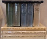
1955E01069 volumes including the three atlas volumes and portfolio volume. Volume I: <i>The Voyage of the Endeavour</i> cclxxxiv696 pages with 20 maps 25 illustrations including color frontispiece appendix and index. Reprinted with addenda and corrigenda. Volume II: <i>The Voyage of the Resolution and Adventure 1772-1775 </i>clxx1028 pages with 19 maps 63 illustrations appendixes and index. Half-title gives II as number within the set. Reprinted with addenda and corrigenda. Volume III parts 1 and 2: <i>The Voyage of the Resolution and Discovery 1776-1780</i> Part One ccxxiv718 pages with 17 maps and 64 illustrations. Half-title gives III as number within set. Admiralty instructions and the journal of the Third Voyage with supplementary extracts from journals or logs by James King Charles Clerke James Burney Richard Gilbert Thomas Edgar. Part 2: viii723-1647 with 2 maps 10 illustrations appendixes and index. Volume IV: <i>The Life of Captain James Cook</i> xi760 pages with 11 maps 38 illustrations bibliography and index. Written by J. C. Beaglehole. First separately published by A. and C. Black 1974 then for the Hakluyt Society. These volumes in royal octavo 9 1/2 x 6 1/2" bound in original publisher's deep blue cloth with blind stamped silhouette of Cook in gilt on front boards and gilt lettering to spines. Portfolio <i>Charts & Views</i> Drawn by Cook and his Officers and reproduced from the Original Manuscripts edited by R. A. Skelton. Pages viii with 58 loose maps charts plans profiles views and other illustrations some folding folio 15 3/4" x 10 1/2" in original blue cloth portfolio with gilt pictorial of cook on front in original jackets except for portfolio volume. <i>The Charts & Coastal Views</i>. Volume One: <i>The Voyage of the </i>Endeavour<i> 1768-1771</i> With a Descriptive Catalog of all the known original surveys and coastal views and the original engravings associated with them. Together with original drawings of the <i>Endeavour</i> and her boats lxiv328 pages with color frontispiece 480 half-tone plates and index. Volume Two: <i>The Voyage of the </i>Resolution<i> and </i>Adventure<i> 1772-1775</i> c332 pages with color frontispiece 23 color plates 320 half-tone plates and appendixes. Volume three: <i>The Voyage of the</i> Resolution<i> and </i>Discovery<i> 1776-1780</i> . together with the running journal of James King 1779-80 cxxxvi319 pages with color frontispiece 22 color plates 298 half-tone plates and appendixes. Volumes chief editor Andrew David. Assistant Editors for the Views Rudiger Joppien and Bernard Smith. Folios 17 1/4" x 11" bound in original publisher's deep blue cloth with gilt lettering to spine and pictorial representation of the ship <i>Victoria</i> embossed in gilt on front covers. Hakluyt Society Extra Series 34a 34b 35 36a 36b 37 43 44 and 46. First printings. Condition: Lacks jacket for portfolio volume and the spine head is bumped. Jackets: Volume one volume three part two price clipped some jackets spines toned Charts & Coastal Views with some edge wear and closed tears else a near fine set in like jackets. Hakluyt Society hardcover books
1749E0529<p>2 volumes. 182 pages with fold out frontispiece map and three additional folding engravings; 319 pages with seven folding engravings. half-titles in each title pages improperly marked first volume as second and vice versa. Duodecimo 6 1/2" x 3 1/2" bound in original publisher's full uniform contemporary French sponged calf with gilt-tooled spines. First French edition after the 1748 English edition.<br /><br />Henry Ellis was a traveler hydrographer and colonial governor returned from Italy in 1746 just in time to find an expedition to search for a north-west passage on the point of sailing. He appears to have been in easy circumstances; his name stands in the list of subscribers to the north-west expedition and he had sufficient interest to get attached to it nominally as agent for the committee and really as hydrographer surveyor and mineralogist the expedition consisting of two vessels the <i>Dobbs</i> galley of 180 and <i>California</i> of 150 tons left Gravesend on 20 May 1746 joined the Hudson's Bay convoy in Hollesley Bay and finally sailed from Yarmouth on the 31st. They parted from the convoy on 18 June made Resolution Island on 8 July and after a tedious passage through Hudson's Straits rounded Cape Digges on 8 August and on the 11th 'made the land on the west side the Welcome in latitude 64° N.' Bad weather drove them to the southward and prevented their doing anything more that season. They wintered in Hayes River in a creek about three miles above Fort York where a quarrel with the agent of the Hudson's Bay Company gave an unwonted piquancy to the dark and weary days. They suffered much from scurvy the prevalence of which Ellis attributes to their having got two kegs of brandy from Fort York for their Christmas merrymaking and in a minor degree to the 'governor' not permitting the Indians to supply them with fresh provisions. On 29 May 1747 the ice broke up and they were able to warp to the mouth of their creek; on 9 June they got down to Fort York. There they were allowed to get some provisions and stores and on the 24th cleared the river and 'stood to the northward on the discovery'. On 1 July each of the two ships sent away her long-boat but owing apparently to some ill-feeling between the two captains without any prearranged plan for working in concert. The consequence was that they separately went over the same ground discovering naming and examining the several creeks and inlets on the west side of Hudson's Bay the double examination perhaps compensating for the confusion arising from the double naming. Before the season closed in they had satisfied themselves that the only possible exit from Hudson's Bay on the west must be through the Welcome and that very probably there was no way out except that on the east by which they had come in. The result may not seem much; but as it served to put an end to the idea that the passage must lie through Hudson's Bay it was at least so much gain to accurate knowledge. After 21 August the weather broke and they decided in council 'to bear away for England without further delay.' On the 29th they entered Hudson's Straits passed Resolution Island on 9 September and arrived at Yarmouth on 14 Octivwe. Ellis's share in the work of the expedition had really been very slender but the reputation of it has been commonly assigned to him by reason of the narrative which he published the following year under the title <i>A Voyage to Hudson's Bay by the DobbsGalley and California in the years 1746 and 1747 for Discovering a North-West Passage</i> 1748; a work which with many valuable observations on tides on the vagaries of the compass and on the customs of the Eskimos a people then practically unknown mingles a great deal of speculation on the certain existence of the passage on magnetism on fogs on rust and other matters all more or less ingenious but now known to be wildly erroneous. Such as it was the book commended its author to the scientific workers of the day and on 8 February 1748-9 he was elected a fellow of the Royal Society. Possibly in acknowledgment of his scientific labors but more probably by some family interest he was afterwards appointed successively governor of Georgia and of Nova Scotia from which employment he retired about 1770. He seems to have spent his later years as a wanderer on the continent was at Marseilles in 1775 and died at Naples on 21 January 1806.<br /><br /><b>Condition:</b><br /><br />Some dark spot to spine else a very good copy.</p> Ballard Fils hardcover books
1848E0530<p> 614 pages illustrated with 64 lithographed or engraved plates 3 battle-plans plus some figure drawings within the text. Octavo 8¾x5¼" bound in original publisher's black cloth and paper spine label. Thirtieth Congress - First Session. Ex. Doc. NO. 41. Cowan page 195; Graff 1249; Howes E145; Wagner-Camp 148:5; Zamorano Eighty 33 First edition House of Representatives issues of the report containing the reports of Lieutenant Abert Colonel Cooke and Captain Johnson as well as that of Emory; the Senate issue only contained the Emory report.</p><p><br />In 1844 Emory served in an expedition that produced a new map of Texan claims westward to the Rio Grande. He came to public attention as the author of the <i>Notes of a Military Reconnaissance from Fort Leavenworth in Missouri to San Diego California</i> published by the Thirtieth United States Congress in 1848. This report described terrain and rivers cities and forts and made observations about Indians Mexicans primarily in New Mexico Territory Arizona Territory and Southern California. It was and is considered one of the important chronicles and descriptions of the historic Southwest particularly noted for its maps. Emory was a reliable and conscientious cartographer. There is a story of testament as to Emory's dedication to accuracy that says John Bartlett his supervisor in the Corps of Topographical Engineers made him sign off on a misplaced boundary marker creating a sweet revenge for Emory who replaced him as Head of the International Boundary Commission in 1855. So accurate were his maps that when topographical engineers were surveying possible routes for the transcontinental railroad the most Southern route did not need to be surveyed thanks to the outstanding work by William H. Emory. But William H. Emory did more than just map the terrain; he also made notes about the plant life as well as the people who inhabited the sparsely populated southwest. Notating the social relations of some of the Native American people he wrote: "Women when captured are taken as wives by those who capture them but they are treated by the Indian wives of the capturers as slaves and made to carry wood and water; if they chance to be pretty or receive too much attention from their lords and masters they are in the absence of the latter unmercifully beaten and otherwise maltreated. The most unfortunate thing which can befall a captive woman is to be claimed by two persons. In this case she is either shot or delivered up for indiscriminate violence.<br /><br /><b>Condition:</b><br /><br />Binding worn at edges and spine ends cloth splitting along front joint; occasional light foxing lacking the two maps as noted very good.</p> Wendell & Van Benthuysen, Printers hardcover books
1779BOOKS0003374282 pages lacking the map. Small quarto 10" x 7½" rebound in ¾ morocco & marbled boards spine lettered in gilt top edges gilt. Sabin 22572 First edition.<br /><br />Rare account of travels into the arctic most notably Nova Zemblya to the north of Europe. Twelve years earlier Engel wrote his notable work on explorations on the other side of the Arctic Circle Memoires et observations geographiques et critiques sur la situation des pays septentrionaux de l'Asie et de l'Amerique. Lausanne 1765. <br /><br />Condition:<br /><br />Rubbing to joints and extremities; some minor staining and soiling within hinge professionally repaired else a very good copy. Only five copies found on worldcat.<br /> F Sanuel Fetscherin hardcover books
1717E01353559index pages 36 of 37 maps and copper cuts of the coasts harbor cities plants and other curiosities comprising: 14 plates 3 folding 22 maps charts or plans 14 folding. title page printed in red and black. Printed from the author's original plates inserted in the Paris edition. Lacks the frontispiece map. Royal octavo 9 3/4" x 7 3/4" bound in leather with raised spine bands and red label with gilt lettering. Postscript by Dr Edmund Halley and an account of the settlement commerce and riches of the Jesuits in Paraguay. Palau 94965 Sabin 25926 Nissen ZBI 1433 Hill p117 First English edition.<br /><br />Frézier was educated in Paris and served as lieutenant of infantry from 1702 til 1707 when he entered the engineer corps. In 1712 the government sent him to examine the condition of the Spanish colonies in America. After visiting the principal points in Peru Chili and Brazil he returned to Marseilles. He pointed out several mistakes in the "Relation" of Father Feuille and this led to a bitter controversy between the two travelers. Frézier introduced the large Chili strawberry into France. First published in France in 1714. The first edition into English is preferable to the French original "because it contains Halley's. postscript which corrects certain geographical errors made by Frézier" Hill. "The first part of this book gives an interesting account of the voyage from France around Cape Horn. The second part relates to the voyage along the coasts of Chile and Peru describing the chief towns and cities. Frézier a man of observation brought back information of considerable geographical and scientific value. Much data is included about the native inhabitants.<br /><br />Condition:<br /><br /> Rebacked with original spine label laid down; lacking frontispiece map and binder's leaf free endpapers renewed intermittent foxing else a very nice copy. Jonah Bowyer hardcover books
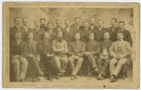
1885WRCAM54151Newburyport Ma.: S.C. Reed 1885. Cabinet photograph mounted on card 5 x 8 inches. Minor edge wear two later presentation inscriptions and photographer's studio stamp on verso. Very good. A rare cabinet card photograph picturing the members of the ill-fated Greely Arctic Expedition. Greely led a scientific expedition aboard the Proteus to Lady Franklin Bay in 1881. He and his crew were stranded at Fort Conger on Ellesmere Island without supplies. Nineteen of the twenty- five crew members would perish in the Arctic and one more would die on the journey home after Greely's party was rescued near Cape Sabine. Rumors of cannibalism would haunt the survivors of the expedition for the rest of their lives. Pictured here are several of the expedition members including Adolphus Greely just before they departed. The standing men are identified as follows: D. Schneider D. Cross D. Linn S. Long S. Frederick D. Henry S. Connell D. Bender D. Salor S. Bierdersack D. Gardner D. Ellis and D. Ralston; and the men seated are identified from left to right as: S. Brainard D. Keslingbury S. Greeley leader D. Lockwood D. Israil D. Jewell and D. Rice. S.C. Reed unknown books
188439550Washington: GPO 1884. "Voluminous documentation on the bungled attempt to rescue Greely and his men. The rescue expedition consisted of the Yantic and the Proteus the latter being lost in Kane Basin. The head of the expedition never followed his orders for re-supplying Greely" -. Arctic Bib 18416. A very good copy in quarter calf over boards. sep 22 2017. 310 265 pp. b/w photo plates folding maps. GPO hardcover books
195421020New York: E.P. Dutton 1954. Hardcover. Very good/near fine. First American edition signed on the front free endpaper by expedition members Edmund Hillary George Lowe and Charles Evans and the London Times correspondent James Morris now Jan Morris who accompanied the party. xx 300 pp with index photographic illustrations. Two-tone cloth boards have some old inert mildew spotting internally clean and sound. Original owner's name at top of front free endpaper well above the signatures. Dust jacket has minor creasing to top of front panel and one 1/4 inch closed tear. Original $6.00 price present. Account of the 1953 British Mount Everest Expedition which when Edmund Hillary and Tenzing Norgay reached the summit on May 29 was the first confirmed complete ascent. Hunt led the expedition with physician Charles Evans as his deputy. Evans was the leader of the first expedition to summit Kangchenjunga the world's third highest peak in 1955. George Lowe directed an Academy Award-nomnated documentary during the Everest expedition and went on to join the Commonwealth Trans-Antarctic Expedition--the first to reach the South Pole by land since Amundsen 1911 and Scott 1912--and to participate in many other notable mountaineering expeditions. Neate H135. E.P. Dutton hardcover books
197031246Nicosia Cyprus: Republic of Cyprus 1970. 8vo pp. 16. Paper wraps. Illustrated with drawings plans and photographs. VG. Republic of Cyprus unknown books
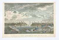
1797406875Paris: L'Imprimerie de la Republique 1797. Tape remnants from mounting along upper edge verso some foxing overall good condition and color. Hand-colored engraving by Dequevauviler after Nicolas Marie Ozanne. 9 7/8 x 15 3/4 inches image 11 x 17 inches sheet. A fine print from 'Atlas du voyage de la Perouse' depicting the capsizing of two rowboats in Alaska during La Perouse's 1786 expedition. The wreck took place off of the Port des Francais today known as Lituya Bay in Glacier Bay National Park Alaska. <br/><br/> [L'Imprimerie de la Republique] unknown books
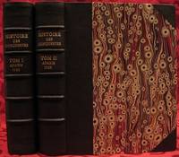
1733E05532 volumes. 8xxiv616471 pages with 4 maps ad view one folding and 3 plates one folding; 2693892 pages with 1 map and 6 plates. Quarto 10 1/4" x 10 1/4" bound in half leather with raised spine bands and gilt lettering to spine over marbled boards. Borba de Moraes page I:453; European Americana 733/146; Sabin 38591 First edition.<br /><br />Joseph-François Lafitau was a French Jesuit missionary ethnologist and naturalist. He is best known for his use of the comparative method in the field of scientific anthropology the discovery of ginseng and his writings on the Iroquois. Lafitau was the first of the Jesuit missionaries in Canada to have a scientific point of view. Lafitau is considered the first of the modern ethnographers and a precursor of scientific ethnology for his work on the Iroquois. He developed a model of studying peoples that involved describing existing cultures on their own terms—not in comparison to European society. He distinguished generic and specific traits transforming the "generic savage" into specific tribal groups. He explained that "only from specific identities can genetic relations be inferred."5 Furthermore he was the first to declare "contemporary primitive cultures throw light upon the culture of ancient people and vice versa. Lafitau is remembered for applying the comparative method with a greater level of competency than any of his contemporaries. Through original field observations he was able to critique the works of earlier writers on Primitive peoples. By using the Comparative Method Lafitau rejected all theories of social and cultural change and instead used his study to demonstrate the similarities in customs practices and usages of the Native North Americans with diverse peoples from different continents and centuries. He consistently relied on the doctrine of degeneration: all men originally shared one religion with one God but over time as people migrated to separate margins of the earth where they then lost touch with the values and traditions of this one true religion and culture. Therefore Lafitau believed in the "psychic unity of mankind" and the doctrine of primitive monotheism. His major work written in French was first published in 1724 in Paris. It is entitled <i>Customs of the American Indians Compared with the Customs of Primitive Times</i> <i>Moeurs des Sauvages Amériquains Comparées aux Moeurs des Premiers Temps</i> and is 1100 pages in total. In 1974 William Fenton and Elizabeth Moore made the first translation into English available. Lafitau published two other works. One <i>Histoire de Jean de Brienne Roy de Jérusalem et Empereur de Constantinople</i> Paris 1727 was released before he returned to Canada; it is little known and seldom seen. A two-volume <i>Histoire des découvertes et conquestes des Portugais dons le Nouveau Monde . . .</i> 1733 appeared after he came home to France. Frequently found in libraries it is not just a compilation of original sources but an attempt to make available to French readers a story of exploration and adventure otherwise denied to them; in the chronicles he sees a long development of customs hitherto unnoticed such as he had reported in the <i>Mœurs</i>; from them understood only he says in the original languages of the people who practice them he builds his "system" or philosophy of history and once more he is concerned too with the relation between custom and natural history or ecology.<br /><br /><b>Condition:</b><br /><br />Beautifully rebound in half leather. Faint dampening to second volume; early owner's signatures on title pages inked stamps of St Charles Borromeo Seminary on front paste-downs and first title page lacks frontispiece else a very good to fine set.<br /> Chez Saugrain pere, quai des Augustins, au coin de la rue Chez Saugrain pere, quai des Augustins, au coin de la rue Pavee, a la hardcover books