52 résultats
197031246Nicosia Cyprus: Republic of Cyprus 1970. 8vo pp. 16. Paper wraps. Illustrated with drawings plans and photographs. VG. Republic of Cyprus unknown books
1799biblio153a1-42 binders direction8 subscribers4c-4204 additional subscribers pages with 7 maps 5 folding and 6 plates. Quarto 11 3/4" x 9 1/2" with new spine in six compartment with red label in gilt over original decorative blind stamped calf boards. Ferguson 329; Sabin 104.633 First edition first printing.<br /><br />Captain James Wilson 1760–1814 brought the first British missionaries to Tahiti on ship Duff in 1797. Wilson was a deeply religious man. The missionaries he brought were from the London Missionary Society. There were thirty men six women and three children. Wilson on the Duff also explored and visited many islands in the Pacific some of which had never had any recorded visit by a European. Among these the most important are Mangareva in the Gambier Islands and Pukarua in the Tuamotus. Duff Paid a visit as a missionary ship to Tahiti during 1796 as a result Missionary Society has first been established in Tahiti. Three years after the establishment the directors of the Society appointed a committee to consider a suitable memorial for presentation to Wilson for his services in helping to establish the first mission in the South Seas.<br /><br />Wilson fought with the British army during the American War of independence and then served nine years with the East India company. While in India he was captured by Hyder Ali and after a daring bid for escape was imprisoned in the black hole of Seringapatam. After his release he continued service as a captain and despite illness and further dangerous missions accumulated sufficientr esources to retire. throughout it all Wilson remained fast in his irreligious opinions. While living in England with his niece however he was converted to an evangelical faith. he felt called to volunteer for missionary service after reading the Evangelical Magazine. Haweis did not know Wilson before receiving a letter volunteering his services in the Pacific. his skills and newfound devotion seemed perfectly suited to the situation and Haweis saw him as "God's man." the Duff arrived at Tahiti on march 5 1797. the settlement at Tahiti of twenty of the missionaries five of them with wives and two children gives further examples of the role of the missionary captain. A pattern of intercourse had already been established by other voyagers according to which the captain of a vessel would take the leading role in meetings. It is therefore not surprising that the focus of the chapter describing the arrival is on meetings between significant island figures and Captain Wilson. For example Manemane a "high priest" Frommo'orea sought Wilson as a tayo or friend not Jefferson the president of the missionaries.<br /><br />The official account of the first mission appeared in 1799 under the lengthy title A missionary voyage to the southern Pacific Ocean performed in the years 1796 1797 1798 in the ship Duff commanded by Captain James Wilson compiled from thejournals of the officers and the missionaries; and illustrated with maps charts and views drawn by Mr William Wilson.it was placed firmly within the tradition of the voyages ofdiscovery by an introduction compiledby samuel Greatheed that described previous european contacts with the islands and anappendix "including details never before published of the natural and civil state of otaheite." the main narrative was taken from Wilson's journal with additions from his son and a journal kept by the missionaries during the period when the Duff was away from Tahiti at Tonga. Wilson dominated the events recorded in the narrative.<br /><br />Condition:<br /><br />Some offset toning from maps occasional foxing water mark to upper margin on some leaves two leaves miss-bound at back re-backed with contemporary blind stamped calf boards. S Gosnell for T Chapman hardcover books
1790E00534 of 6 volumes. Volume 1: i-ix-372 pages with 23 plates including frontispiece plate of Cook and 4 folding maps; Volume II lacking; Volume 3: 793-1184 pages with 11 plates including frontispiece of Possession Bay and 5 fold out maps; Volume IV: 1185-1546 pages with 26 plates including frontispiece of Woman Child and Man of Van Diemen's Land and 6 folding maps; Volume V: 1547-1938 pages with 30 plates including frontispiece of A View of Huaheine and 8 folding maps; Volume VI lacking. Octavo 8 1/2" x 5 1/2" bound in original full leather with red labels to spine with gilt lettering. Abridged by George William Anderson. An earlier Large folio edition by Anderson was published earlier. This edition originally issued in 80 weekly parts and also called the Large octavo edition. M K Beddie: 39 First edition of the bound edition.<br /><br />Captain James Cook RN was a British explorer navigator and cartographer ultimately rising to the rank of Captain in the Royal Navy. Cook made detailed maps of Newfoundland prior to making three voyages to the Pacific Ocean during which he achieved the first European contact with the eastern coastline of Australia and the Hawaiian Islands as well as the first recorded circumnavigation of New Zealand. Cook joined the British merchant navy as a teenager and joined the Royal Navy in 1755. He saw action in the Seven Years' War and subsequently surveyed and mapped much of the entrance to the Saint Lawrence River during the siege of Quebec. This helped bring Cook to the attention of the Admiralty and Royal Society. This notice came at a crucial moment both in his personal career and in the direction of British overseas exploration and led to his commission in 1766 as commander of HM Bark Endeavour for the first of three Pacific voyages. Cook charted many areas and recorded several islands and coastlines on European maps for the first time. His achievements can be attributed to a combination of seamanship superior surveying and cartographic skills courage in exploring dangerous locations to confirm the facts for example dipping into the Antarctic Circle repeatedly and exploring around the Great Barrier Reef an ability to lead men in adverse conditions and boldness both with regard to the extent of his explorations and his willingness to exceed the instructions given to him by the Admiralty. Cook was killed in Hawaii in a fight with Hawaiians during his third exploratory voyage in the Pacific in 1779.<br /><br />Condition:<br /><br />Lacks volume II and VI. First signature of volume one loose inner hinges cracked some interior soiling spine ends and corners of leather rubbed some scuffing to leather else a good set. Printed for A Millar, W Law, and R Cater hardcover books
1748BOOKS00585324548 pages with three folding engraved maps present southern part of South America; part of the Pacific Ocean and the track of the Centurion round the world. Octavo 8 1/4" x 5 1/2" bound in full leather with five raised spine bands with red label to spine in gilt lettering with decorative blind-stamped ruled edges. Compiled from papers and other materials of the Right Honourable George Lord Anson and published under his direction by Richard Walter M.A. Chaplain of his Majesty's Ship the Centurion in that expedition. Hill I pp 317-138. Third edition.<br /><br />"This is the official account of Anson's voyage. England at war with Spain in 1739 equipped eight ships under the command of George Anson to harass the Spaniards on the western coast of South America for the purpose of cutting off Spanish supplies of wealth from the Pacific area. Lord Anson who was a friend and patron of Benjamin Robins after returning from the voyage around the world in the Centurion appears to have entrusted to Robins for revision the account of the voyage which had been compiled from the journals by his chaplain Richard Walter. It is probable that Robins revised and edited the work wrote an introduction and added dissertations." Hill. Perhaps the most popular account of maritime adventure of the eighteenth century. Anson's account of harrying the Spanish of South America and the taking of the Manilla galleon with treasure with a contemporary value of $800000 and his circumnavigation has long enjoyed a distinguished place as a masterpiece in descriptive travel.<br /><br /><b>Condition:</b><br /><br />Some small closed tears at the edges of the maps. Rebound in tooled leather with raised bands. Over all a very good to fine copy. John and Paul Knapton hardcover books
1717E01353559index pages 36 of 37 maps and copper cuts of the coasts harbor cities plants and other curiosities comprising: 14 plates 3 folding 22 maps charts or plans 14 folding. title page printed in red and black. Printed from the author's original plates inserted in the Paris edition. Lacks the frontispiece map. Royal octavo 9 3/4" x 7 3/4" bound in leather with raised spine bands and red label with gilt lettering. Postscript by Dr Edmund Halley and an account of the settlement commerce and riches of the Jesuits in Paraguay. Palau 94965 Sabin 25926 Nissen ZBI 1433 Hill p117 First English edition.<br /><br />Frézier was educated in Paris and served as lieutenant of infantry from 1702 til 1707 when he entered the engineer corps. In 1712 the government sent him to examine the condition of the Spanish colonies in America. After visiting the principal points in Peru Chili and Brazil he returned to Marseilles. He pointed out several mistakes in the "Relation" of Father Feuille and this led to a bitter controversy between the two travelers. Frézier introduced the large Chili strawberry into France. First published in France in 1714. The first edition into English is preferable to the French original "because it contains Halley's. postscript which corrects certain geographical errors made by Frézier" Hill. "The first part of this book gives an interesting account of the voyage from France around Cape Horn. The second part relates to the voyage along the coasts of Chile and Peru describing the chief towns and cities. Frézier a man of observation brought back information of considerable geographical and scientific value. Much data is included about the native inhabitants.<br /><br />Condition:<br /><br /> Rebacked with original spine label laid down; lacking frontispiece map and binder's leaf free endpapers renewed intermittent foxing else a very nice copy. Jonah Bowyer hardcover books
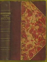
1711E0013iixxixvii1911blank 223 pages with 1 of 3 large fold out maps and 15 of 19 engraved fold out plates. Octavo 8" x 5" bound three quarter leather with raised spine bands and gilt lettering to spine over marbled boards. Edited by Sir Tancred Robinson. Second edition preferred over the first edition "because it has the chart of the western and southern oceans." Hill In 1699.<br /><br />First published in 1694 which contained only two maps The book is important because it contains one of the earliest English accounts of Abel Janszoon Tasman's famous voyage of 1642 from Batavia during which he discovered Tasmania and New Zealand and visited Tonga and Fiji Hill 1475.<br /><br />Rear Admiral Sir John Narborough RN was an English naval commander of the 17th century who served with distinction during the Anglo-Dutch Wars and against the Barbary Coast pirates. He was descended from an old Norfolk family. He received his commission in 1664 and in 1666 was promoted lieutenant for gallantry in the action with the Dutch fleet off the Downs in June of that year. After the peace he was chosen to conduct a voyage of exploration in the South Seas. He set sail from Deptford on November 26 1669 and entered the Straits of Magellan in October of the following year. In 1670 he visited Port Desire in Argentina and claimed the territory for the Kingdom of Great Britain but returned home in June 1671 without accomplishing his original purpose. A narrative of the expedition was published at London in 1694 under the title <i>An Account of several late Voyages and Discoveries to the South and North</i>. During the Third Anglo-Dutch War Narborough was second captain of the Lord High Admiral's ship the Prince and conducted himself with such conspicuous valor at the battle of Solebay Southwold Bay in May 1672 that he won special approbation and shortly afterwards was made rear-admiral and knighted. In 1675 he was sent to suppress the Tripoline piracies and by the bold expedient of dispatching gun-boats into the harbor of Tripoli at midnight and burning the ships he induced the them to agree to a treaty. Shortly after his return he undertook a similar expedition against the Algerians. In 1680 he was appointed commissioner of the Navy an office he held till his death. He was buried at Knowlton church Kent where a monument has been erected to his memory. The island of Fernadina the youngest and westernmost island of the Galapagos Archipelago was originally named 'Narborough Island' in his honor by the 17th century buccaneer William Ambrosia Cowley.<br /><br /><b>Condition:</b><br /><br />Marginal foxing soiling and damp staining through out paper fault across second C2 affecting one letter some rubbing hinges and corners else a better than good copy. Printed for D Brown hardcover books
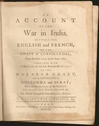
1761E6754xxxiii270215148xix1 pages 14 of 18 engraved plates maps many folding and index. Quarto 10 1/4" x 8 1/4" in original leather binding. First edition.<br /><br />Richard Owen Cambridge was a British poet. He was educated at Eton and at St John's College Oxford. Leaving the university without taking a degree he took up residence at Lincolns Inn in 1737. Four years later he married and went to live at his country seat of Whitminster Gloucestershire. In 1751 he removed to Twickenham where he enjoyed the society of many notable persons. Horace Walpole in his letters makes many jesting allusions to Cambridge in the character of news-monger. His chief work is the <i>Scribleriad</i> 1751 a mock epic poem the hero of which is the Martinus Scriblerus of Alexander Pope John Arbuthnot and Jonathan Swift. The poem is preceded by a dissertation on the mock heroic in which he avows Cervantes as his master. The satire shows considerable learning and was eagerly read by literary people; but it never became popular and the allusions always obscure have little interest for the present-day reader. He made a valuable contribution to history in his <i>Account of the War in India on the Coast of Coromandel from the year 1750 to 1760</i> 1761. He had intended to write a history of the rise and progress of British power in India but this enterprise went no further than this one work as he found that Robert Orme who had promised him the use of his papers contemplated the execution of a similar plan. The Works of Richard Owen Cambridge includes several pieces never before published. It contains an <i>Account of his Life and Character</i>by his Son George Owen Cambridge 1803 the Scribleriad some narrative and satirical poems and about twenty papers originally published in Edward Moore's paper The <i>World</i>. His poems are included in Alexander Chalmers' English Poets 1816.<br /><br /><b>Condition:</b><br /><br />Previous owner's name in neatly written dated 1806 on front end paper with his book plate on front past down with his library stamp. Lacks rear free end paper. Front hinge separated back hinge cracked. Lacks the Mongol on horse back plate map of Maratta County view of the attack on Geriah and view of Surat. Front worn spine ends and corners reinforced and repaired new spine label else about very good. Printed for T Jefferys hardcover books
50306For the lot of approximately 250 items $6000. a Correspondence with various government officials hunting guides and others involved with preparing and carrying out the trip including14 letters to Furlong typed and autograph one accompanied by four photographs of members of the expedition with trophies; five retained copies of letters from Furlong to the correspondents four telegrams seven typed and manuscript recapitulations of various aspects of the trip e.g. titles for the "Dance of the Nandi" film and a three page typed press release on the expedition dated Nairobi 27 March 1930 accompanied by a photograph of Furlong and two bearers with a leopard he has killed.<br/>b Two hunting licenses issued by the Uganda Protectorate to Furlong 22 April 1930 one "For a First Elephant" the other a "Visitor's Full Game License."<br/>c Three maps period road map of Kenya and Uganda published by Bullows and Roy for the Royal East Africa Automobile Assn.; Map Showing Cairo-Mombasa Route published by the Sudan Survey Dept Khartoum 1929; and a period National Geographic Society map of Africa.<br/>d An account book narrow 12mo 19 pp. 22 March - 8 June 1930 and approximately 125 receipts most partly printed for a wide range of services and material necessary for the trip.<br/>e 21 photographs in addition to those mentioned above many picturing Furlong in the field with his rifle and trophies some with Furlong's notations on verso and 34 unused photo postcards featuring tribesmen animals and scenery of East Africa.<br/>f 42 promotional pamphlets ca. 1925-1934 for the various parts of Africa along Furlong's route 36 of which are unrecorded on OCLC. The pamphlets were issued by African railway companies and governmental agencies outfitters e.g. Thomas Cook and "Safari Africa Limited" London ship lines and other travel agencies and taxidermy concerns.<br/>g A wooden carved string instrument from the Para Mountains in present day Tanzania with Furlong's ownership label "Col. Wellington Furlong / c/o Safariland Ltd. / Musical Instrument / Para Mountains" still attached; the instrument is shaped like a hollowed-out bread tray 27 x 7 1/2 inches three holes in the shape of crosses in the bottom six strings stretched across the opening.<br/>Furlong 1874-1967; American explorer army officer author artist and photographer embarked on this big game expedition in 1930 partly as an effort to recover relics of Sir Henry M Stanley in East and Central Africa. Gateway to the Sahara New York 1909 is among several books he published. A member of the Explorers Club he was the first American to explore the interior of Tierra del Fuego 1907-1908. Most of his personal papers are held by the Stefansson Collection at Dartmouth. <br/><br/> unknown books
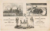
1838WRCAM55549New York: H.R. Robinson 1838. Lithograph 12 1/2 x 20 inches. Light foxing and soiling. Two short closed tears in the right edge and left edge of the sheet. Very good. A very rare print satirizing the recently undertaken United States Exploring Expedition commanded by Charles Wilkes. The Expedition departed in August 1838 and Robinson's eagerness to satirize it and the politicians who supported it is ample evidence that the endeavor was not universally popular. The print is made up of three humorous vignettes. "The upper left is Charles Wilkes in a rowboat with an oarsman and two members of the scientific corps who make observations with a transit or telescope and draw fauna. The upper right image depicts a group of sailors and Charles Wilkes huddled together on the snow surrounded by a ring of polar bears and an upturned rowboat foxes penguins and a campfire. They are flying an inverted U.S. flag to signal distress. At the bottom between the two titles is an inset of the three Navy Commissioners Isaac Chaucey Charles Morris and Alexander S. Wadsworth at sea in a bowl. They are framed by a shield surmounted by a jester and flanked on the left by a man in naval uniform James Kirke Paulding Secretary of the Navy and a sailor with a sad expression on the right" - Harry T. Peters Collection at the Smithsonian Institution online catalogue. The print is "Respectfully inscribed to the Secretaries of the Navy and Army and the Board of Navy Commissioners by their humble servant Robinson Crusoe." <br> <br> Not in Reilly's catalogue of American political prints in the Library of Congress though OCLC does locate a copy at the Library of Congress. That is one of two copies listed on OCLC the other copy is at the American Antiquarian Society. There are also copies in the Peters collection at the Smithsonian and at the Australian National Maritime Museum. OCLC 299947747 752795742. Herman J. Viola ed. MAGNIFICENT VOYAGERS THE U.S. EXPLORING EXPEDITION 1838-1842 Washington 1985 p.13. H.R. Robinson unknown books
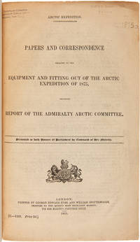
1875WRCAM50678London 1875. 402pp. plus folding map. Folio. 20th-century three-quarter calf and marbled paper boards spine gilt. Stefansson Library stamp on titlepage deaccessioned. Toned minor chipping at edges of some leaves. Final leaf repaired with archival paper with no loss to text; small tears in margin of map. Very good. This scarce document describes the plans for the 1875 Nares Expedition includes specifications for the H.M.S. Discovery data on supplies needed estimations of costs and a hydrographer's report as well as a color chart of the North Polar Sea. The chart is a Polar projection map showing the seas navigated by British expeditions as well as coasts discovered by British American German Swedish and Austrian explorers through 1874. <br> <br> The Nares expedition which sailed from 1875 to 1876 strove to be the first to reach the North Pole and to explore its coasts and region. Though unsuccessful in this venture the expedition was the first to sail ships through the channel between Greenland and Ellesmere Island and as far north as the Lincoln Sea recording valuable information about the mysterious region. A sledging party under Captain Albert Hastings Markham also set a new record on land reaching as far north as 83° 20'. The British Parliament printed occasional reports of the various expeditions and related Arctic subjects which became known as the Arctic "blue books" named after the distinctive blue wrappers in which they were originally issued. This copy has the stamp of the Stefansson collection at the Dartmouth library but was deaccessioned as a duplicate to his widow. ARCTIC BIBLIOGRAPHY 45251. hardcover books
1785BOOKS0033095 volumes: 520 pages with frontispiece tables and six plates; 492 pages with tables 479 pages 587 pages 504 pages with nine plates. Octavo 8" x 5" bound in leather with raised spine bands and black labels with gilt lettering to spine. Complied by John Kent principally from Campbell's Lives of the Admirals Hill page 358 First Dublin edition. First published in London in 1776-1777.<br /><br />A London man of letters Campbell was quite successful with his numerous works of an historical and biographical nature. He collect a large and valuable library. He first published his Lives of the Admirals in four volumes in the years 1742 to 1744. There were several later editions. From 1744 to 1748 he compiled and published what became known as Campbell's enlarged edition of John Harris's Complete collection of voyages and travels originally published in 1702-1705. Campbell also made numerous important contributions to the Biographia Britannica under the signatures E and X including his own noble Scottish ancestors the Campbells. A memoir of him was inserted by Andrew Kippis in this same work. Campbell was an expert on the histories of Spain Portugal France and the British and the Dutch. In 1765he was appointed the royal agent for the province of Georgia and held that office until his death. There are many interesting references to him in James Boswell's Life of Johnson. John Kent published only tow editions of his compilation; this one and one published in London in 1776-1777.<br /><br />Condition:<br /><br /> New spines with original leather boards. Volume one closed page edge tears with occasional page edges chipped only affecting margins. volume two damp stain to title gutter some occasional foxing. Some pages stained else a good to very good set Printed for J Williams hardcover books
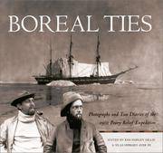
BL2086Albuquerque:: University of New Mexico Press N.D. Oblong 8vo. xiii 232 pp. Heavily illustrated with photographs index. Brown cloth gilt-stamped spine title dust-jacket. Burndy bookplate. Fine. ISBN: 0826328105 University of New Mexico Press, (N.D.). hardcover books
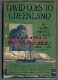
19262222001<p>First edition "October 1926". Octavo. Four page foreword by Bob Bartlett. Illustrated with 47 photographs and drawings by the Eskimo Kakutia; endpaper maps. Dust jacket unclipped; few nicks and creases. Very good. 167 pages.</p><p>Signed and inscribed on verso of frontispiece by the publisher and father of the author: "From one who is merely. David's Dad! G. P. Putnam."</p> G. P. Putnam's Sons hardcover books
1836185920Leipzig: Hirschfeld 1836. Hardcover. G Cover has fading cracking edge/corner damage. Bookblock has age toning. Interior pages have age toning foxing some water staining. Title page has some text work away. Brown leather decorative boards with 2 metal clasps. Decorative carved and colored bookblock. VIII 920 257 pages. Hirschfeld hardcover books
182232323Philadelphia: Harrison Hall 1822. 8vo. 8 5/8 x 6 inches. 4 449-532pp. Engraved frontispiece plate after T. R. Peale depicting a skin lodge Kaskaias. Foxing. Publisher's lettered wrappers.<br/> <br/>Ephemeral announcement of the publication of the account of the Long Expedition to the Rocky Mountains.<br/> <br/>Major Stephen Long was the principal proponent of government-sponsored exploration of the West following the War of 1812. He travelled farther than Pike or Lewis and Clark and blazed trails that were susequently followed by Fremont Powell and others. The expedition travelled up the Missouri and then followed the River Platte to its source in the Rocky Mountains before moving south to Upper Arkansas. From there the plan was to find the source of the Red River but when this was missed the Canadian River was explored instead. The expedition added significantly to the earlier discoveries of Lewis and Clark and Zebulon Pike. Edwin James was the botanist geologist and surgeon for this important government expedition initially named the Yellowstone Expedition. In addition to his duties on the expedition James subsequently served as the editor and compiler of the official account of the expedition relying "upon his own records the brief geological notes of Major Long and the early journals of Thomas Say who served as the expedition's naturalist" Wagner-Camp. The present December 1822 issue of The Port Folio Vol. II No. 6 includes a full-page announcement on the rear wrapper advertising the publication of the first edition of James account of the Long Expedition. In addition pages 496 to 503 include a lengthy review of the work and the engraved frontispiece depicts a skin lodge of the Kaskaias after expedition artist T. R. Peale printed from the same plate as the engraving within the first edition atlas to the James account. Rare and ephemeral. Harrison Hall unknown books
1844E0023xcii616 pages with bibliography. Octavo 8 1/2" x 5 1/2" bound in contemporary half calf with black spine label and gilt lettering. Publications de la Societe d'Etudes pour la colonisation de la Guyane francaise Number 4. The bibliographical catalogue occupies pages 579-616 and contains descriptions of 240 works on Guiana. Sabin 56097. First edition.<br /><br />French Guiana French: Guyane française officially Guyane is an overseas department French: département d'outre-mer or DOM of France located on the northern coast of South America. It has borders with two nations Brazil and Suriname. Like the other DOMs French Guiana is also an overseas region of France one of the 26 regions of France. Its currency is the euro. The prefecture is Cayenne. The addition of the adjective "French" comes from colonial times when three such colonies existed: British Guiana now Guyana Dutch Guiana now Suriname and French Guiana. The three are still often collectively referred to as the Guianas. French Guiana was originally inhabited by a number of indigenous American people. It was settled by the French during the 17th century. After the Treaty of Paris in 1763 Louis XV sent 12000 settlers to French Guiana to colonise the region. One and a half years later only a few hundred survived.2 Its infamous Île du Diable Devil's Island was the site of penal settlements from 1852 until 1951. More than 70000 French convicts were deported to French Guiana between 1852 and 1939.3 In 1809 a Portuguese-British naval squadron took French Guiana for the Portuguese Empire. With the signing of the Treaty of Paris in 1814 the region was handed back to the French though a Portuguese presence remained until 1817. A border dispute with Brazil arose in the late nineteenth century over a vast area of jungle leading to the short-lived pro-French independent state of Counani in the disputed territory and some fighting between settlers before the dispute was resolved largely in favor of Brazil by the arbitration of the Swiss government.<br /><br />Condition:<br /><br />Front inner hinge cracked rubbing to hinges and corners some internal foxing else a very good copy. Imprimerie de Bethune and Plon hardcover books
196422638Glendale: Clark 1964. First Edition. 356pp. Illus. 2 maps 7 plates. Original small 4to cloth. First edition. Western Frontiersman Series Xl. With original prospectus laid in Clark hardcover books
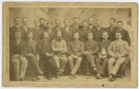
1885WRCAM54151Newburyport Ma.: S.C. Reed 1885. Cabinet photograph mounted on card 5 x 8 inches. Minor edge wear two later presentation inscriptions and photographer's studio stamp on verso. Very good. A rare cabinet card photograph picturing the members of the ill-fated Greely Arctic Expedition. Greely led a scientific expedition aboard the Proteus to Lady Franklin Bay in 1881. He and his crew were stranded at Fort Conger on Ellesmere Island without supplies. Nineteen of the twenty- five crew members would perish in the Arctic and one more would die on the journey home after Greely's party was rescued near Cape Sabine. Rumors of cannibalism would haunt the survivors of the expedition for the rest of their lives. Pictured here are several of the expedition members including Adolphus Greely just before they departed. The standing men are identified as follows: D. Schneider D. Cross D. Linn S. Long S. Frederick D. Henry S. Connell D. Bender D. Salor S. Bierdersack D. Gardner D. Ellis and D. Ralston; and the men seated are identified from left to right as: S. Brainard D. Keslingbury S. Greeley leader D. Lockwood D. Israil D. Jewell and D. Rice. S.C. Reed unknown books
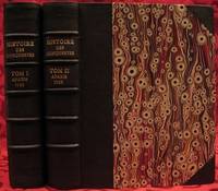
1733E05532 volumes. 8xxiv616471 pages with 4 maps ad view one folding and 3 plates one folding; 2693892 pages with 1 map and 6 plates. Quarto 10 1/4" x 10 1/4" bound in half leather with raised spine bands and gilt lettering to spine over marbled boards. Borba de Moraes page I:453; European Americana 733/146; Sabin 38591 First edition.<br /><br />Joseph-François Lafitau was a French Jesuit missionary ethnologist and naturalist. He is best known for his use of the comparative method in the field of scientific anthropology the discovery of ginseng and his writings on the Iroquois. Lafitau was the first of the Jesuit missionaries in Canada to have a scientific point of view. Lafitau is considered the first of the modern ethnographers and a precursor of scientific ethnology for his work on the Iroquois. He developed a model of studying peoples that involved describing existing cultures on their own terms—not in comparison to European society. He distinguished generic and specific traits transforming the "generic savage" into specific tribal groups. He explained that "only from specific identities can genetic relations be inferred."5 Furthermore he was the first to declare "contemporary primitive cultures throw light upon the culture of ancient people and vice versa. Lafitau is remembered for applying the comparative method with a greater level of competency than any of his contemporaries. Through original field observations he was able to critique the works of earlier writers on Primitive peoples. By using the Comparative Method Lafitau rejected all theories of social and cultural change and instead used his study to demonstrate the similarities in customs practices and usages of the Native North Americans with diverse peoples from different continents and centuries. He consistently relied on the doctrine of degeneration: all men originally shared one religion with one God but over time as people migrated to separate margins of the earth where they then lost touch with the values and traditions of this one true religion and culture. Therefore Lafitau believed in the "psychic unity of mankind" and the doctrine of primitive monotheism. His major work written in French was first published in 1724 in Paris. It is entitled <i>Customs of the American Indians Compared with the Customs of Primitive Times</i> <i>Moeurs des Sauvages Amériquains Comparées aux Moeurs des Premiers Temps</i> and is 1100 pages in total. In 1974 William Fenton and Elizabeth Moore made the first translation into English available. Lafitau published two other works. One <i>Histoire de Jean de Brienne Roy de Jérusalem et Empereur de Constantinople</i> Paris 1727 was released before he returned to Canada; it is little known and seldom seen. A two-volume <i>Histoire des découvertes et conquestes des Portugais dons le Nouveau Monde . . .</i> 1733 appeared after he came home to France. Frequently found in libraries it is not just a compilation of original sources but an attempt to make available to French readers a story of exploration and adventure otherwise denied to them; in the chronicles he sees a long development of customs hitherto unnoticed such as he had reported in the <i>Mœurs</i>; from them understood only he says in the original languages of the people who practice them he builds his "system" or philosophy of history and once more he is concerned too with the relation between custom and natural history or ecology.<br /><br /><b>Condition:</b><br /><br />Beautifully rebound in half leather. Faint dampening to second volume; early owner's signatures on title pages inked stamps of St Charles Borromeo Seminary on front paste-downs and first title page lacks frontispiece else a very good to fine set.<br /> Chez Saugrain pere, quai des Augustins, au coin de la rue Chez Saugrain pere, quai des Augustins, au coin de la rue Pavee, a la hardcover books
1700E0566xxiii43313 table pages with two folding maps of the Marsianes and Guam. Duodecimo 6 1/2 x 3 1/4" bound in contemporary full sheep with red label in gilt spine and five raised spine bands speckled red end pages. Brunet 28230 Cioranescu 41783 First edition.<br /><br />Charles Le Gobien was a French Jesuit writer founder of the Lettres édifiantes et curieuses a collection of reports from Jesuit missionaries in China. It is a major source of information for the history of Catholic missions and life in China in those times. Le Gobien was born at Saint-Malo Brittany. He entered the Society of Jesus on 25 November 1671. As professor of philosophy and especially while procurator of the Franco-Chinese mission he sought in a series of papers to awaken interest in the work of Christianizing Eastern Asia. In 1697 appeared at Paris his Lettres sur les progréz de la religion à la Chine. Apropos of Chinese Rites controversy he published among other things Histoire de l'édit de l'empereur de la Chine en faveur de la religion chrétienne avec un éclaircissement sur les honneurs que les Chinois rendent à Confucius et aux morts Paris 1698; and in the year 1700: Lettre à un Docteur de la Faculté de Paris sur les propositions déférées en Sorbonne par M. Prioux. Under the same date there appeared in Paris the Histoire des Isles Mariannes nouvellement converties à la religion chrétienne. The second part translated into Spanish by J. Delgado is found in the latter's Historia General de Filipinas Manila 1892. In 1702 Père Le Gobien published Lettres de quelques missionnaires de la Compagnie de Jésus écrites de la Chine et des Indes Orientales; this was the beginning of the collection soon to become celebrated under the title of Lettres édifiantes et curieuses écrites des missions étrangéres par quelques missionnaires de la Compagnie de Jésus. The first eight series were by Le Gobien the latter ones by Fathers Du Halde Patouillet Geoffroy and Maréchal. The collection was printed in thirty-six volumes duodecimo Paris 1703–76 and reissued in 1780-81 by Fathers Yves de Querbeux and Brotier in twenty-six volumes duodecimo omitting the prefaces. New editions appeared in 1819 1829–32 and 1838-43. One abridgment in four volumes octavo was entitled Panthéon Littéraire by L. Aimé Martin 1834–43. A partial English translation came out in London in 1714. The publication incited the Austrian Jesuit Stöcklein to undertake his Neuer Welt Bott about 1720 at first considered merely a translation but soon an independent and particularly valuable collection five volumes folio in forty parts substantially completing the Lettres Edifiantes.<br /><br />This is a history of the Christian missions in the Marianas or Ladrones Islands in the north-western Pacific the principal island of which is Guam. Reprinted in the text are several letters from early missionaries Medina Clain Sanvitores &c. The Jesuit mission was established there by Diego Luis de Sanvitores. Father Le Gobien never visited the Mariana islands but based his account chiefly on the relations and letters of missionaries sent to him from Rome Spain the Netherlands etc. Includes a letter by P. Clain about the discovery of the Caroline Islands.<br /><br />Condition:<br /><br />Rebacked with original spine laid down provenance: Jesuit College library with old stamps to front free endpaper half title and title page else about very good. Nicolas Pepie hardcover books
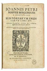
1588E05544-5702 blank28 pages. Folio 12 1/2" x 8 1/4" title with wood cut printer's device bound in contemporary vellum. European Americana 588/57; Palau 146976; Sabin 146976 First edition of Maffei's great history of India.<br /><br />Ten Latin editions two in Italian and two in French appeared before 1621. Based on primary material it still remains a valuable account today. The work is divided into 16 books. Most of it deals with the Portuguese conquests and Jesuit missionary work in the East Indies and India up to about 1557 Borba de Moraes page 508 "a classic work on the subject . writes extensively about Brazil describing it very accurately"; Maffie was the firs author to use Jesuit letters extensively as well as many secular sources including Fernando Mendes Pinto.<br /><br />Condition:<br /><br />Contemporary velum with moderate wear re-backed in vellum with original spine label laid down; minor worming and foxing intermittent moderate damp staining pages 410 and 419 blank due to a printing error; early inscription and inked stamped on title page new end papers and paste-downs else a good to very good copy. Apud Philippum Juncatam hardcover books
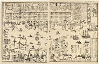
1855WRCAM46844Tokyo 1855. 24 1/2 x 16 inches. Matted. Old fold lines some minor wear and soiling. Near fine. Large wood block print comprised of two sheets showing the disposition of the Japanese soldiers and ships in preparation for the arrival of Commodore Perry's American fleet seen sailing into Tokyo harbor at the right side of the image. The top third of the print is comprised of text in Japanese characters. Three large American ships dominate the right side of the print while several smaller boats dot the rest of the harbor. The whole is dotted with Japanese characters denoting various people and places around the harbor. <br> <br> Perry first arrived in Japan on July 8 1853 with a fleet of four ships flying his pennant on the steam frigate Susquehanna. This first visit lasted ten days and culminated on July 14 with Perry's presentation of a letter from the President of the United States to the Japanese commissioners. Perry then absented himself for seven months returning on February 11 1854 for a stay of over four months. He negotiated a treaty opening Japan to trade with the western world providing for a U.S. consul in Japan and protecting visiting ships and crews. Perry's visit to Japan remains one of the most important events in the diplomatic history between western and eastern nations. <br> <br> A handsome print showing the Japanese side of this important historic event. unknown books
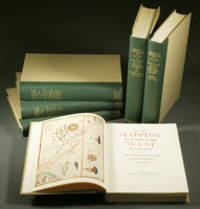
1957E0551<b>From the Spanish discovery to the opening of the Civil War</b><br /><br />5 volumes in 6. Volume One: The Spanish Entrada to the Louisiana Purchase 1540-1804 xiv264 pages with color frontispiece map and 275 maps many folding and index; Volume Two: From Lewis and Clark to Fremont 1804-1845 xiii281 pages with colored frontispiece map 143 additional maps some folding and index. Volume Three: From the Mexican War to the Boundary Surveys 1846-1854 xiii349 pages with colored frontispiece map 322 additional maps and index; Volume Four: From the Pacific Railroad Surveys to the Onset of the Civil War 1855-1860 xiii260 pages with color frontispiece map an additional 127 maps some folding and index; Volume Five From the Civil War to the Geological Survey Part One: xviii222 pages with color frontispiece map and an additional 152 maps; Volume Five From the Civil War to the Geological Survey Part Two: 223-487 pages with 124 maps and index. Folio 14 1/2" x 10 1/2" bound in quarter green leather with gilt lettering to spines. volume I printed by the Grabhorn Press; volumes II-V printed by Taylor & Taylor and James Printing based on the designs of Edwin and Robert Grabhorn. First edition limited to 1000 copies.<br /><br />Carl Wheat's Mapping of the Trans-Mississippi West is a comprehensive and readable cartographic history of the American West. The first three volumes of the work are by necessity bulky and out sized to accommodate the many maps contained with their covers. These beautifully printed books present a truly graphic picture of the exploration and peopling of the vast unknown land west of the Mississippi. The author does not merely present a catalog of significant maps of each era but tells the exciting story of many facets of history that resulted in their making-of the hard journeys the hazardous exploits the motivation the mysticism the misunderstandings and the strange blend of fact imagination false geographic concept and political necessity which were consummated in the engraver's work. These volumes will provide exciting text for the casual reader and have become eminent source book for the student and scholar.<br /><br />Condition:<br /><br />A near fine set. Institute of Historical Cartography hardcover books
1779BOOKS0003374282 pages lacking the map. Small quarto 10" x 7½" rebound in ¾ morocco & marbled boards spine lettered in gilt top edges gilt. Sabin 22572 First edition.<br /><br />Rare account of travels into the arctic most notably Nova Zemblya to the north of Europe. Twelve years earlier Engel wrote his notable work on explorations on the other side of the Arctic Circle Memoires et observations geographiques et critiques sur la situation des pays septentrionaux de l'Asie et de l'Amerique. Lausanne 1765. <br /><br />Condition:<br /><br />Rubbing to joints and extremities; some minor staining and soiling within hinge professionally repaired else a very good copy. Only five copies found on worldcat.<br /> F Sanuel Fetscherin hardcover books
1787E00402 volumes: 576xv pages; 499xv pages. Octavo 8 3/4" x 5 1/2" bound in 3/4 period leather. Translated from the first German edition 1781 which includes a chapter entitled: "Observations and additions to by Johann Gottlob Theaenus Schneider". Translated with additional notes and reviews by Jean Baptiste Lefebvre Villebrune. First Spanish edition published in 1772 Madrid. Sabin 36805 First French edition.<br /><br />Antonio de Ulloa 12 January 1716 – 3 July 1795 was a Spanish general explorer author astronomer colonial administrator and the first Spanish governor of Louisiana. He was born in Seville the son of an economist. Ulloa entered the navy in 1733. In 1735 he was appointed with fellow Spaniard Jorge Juan a member of the French Geodesic Mission a scientific expedition which the French Academy of Sciences was sending to Ecuador to measure a degree of meridian arc at the equator led by Pierre Bouguer. He remained there from 1736 to 1744 during which time the two Spaniards discovered the element platinum. In 1745 having finished their scientific labors Ulloa and Jorge Juan prepared to return to Spain agreeing to travel on different ships in order to minimize the danger of losing the important fruits of their labors. The ship upon which Ulloa was traveling was captured by the British and he was taken as a prisoner to England. In that country through his scientific attainments he gained the friendship of the men of science and was made a Fellow of the Royal Society of London. In a short time through the influence of the president of this society he was released and was able to return to Spain. He published an account of the people and the countries they have met 1748 which was translated into English as A Voyage to South America. He became prominent as a scientist and was appointed to serve on various important scientific commissions. He is to be credited with the establishment of the first museum of natural history the first metallurgical laboratory in Spain and the observatory of Cadiz. In 1758 he returned to South America as governor of Huancavelica in Peru and the general manager of the quicksilver mines there. He held this position until 1764. He arrived on 5 March 1766 in New Orleans to serve as the first Spanish governor of West Louisiana. The French colonists refused to recognize Spanish rule and de Ulloa was expelled from Louisiana by a Creole uprising during the Louisiana Rebellion of 1768. For the remainder of his life he served as a naval officer. In 1779 he became lieutenant-general of the naval forces. As a result of his scientific work in Peru he published Madrid 1784 Relación histórica del viaje á la América Meridional which contains a full accurate and clear description of the greater part of South America geographically and of its inhabitants and natural history. In collaboration with the Jorge Juan mentioned above he also wrote Noticias secretas de América giving valuable information regarding the early religious orders in Spanish America.<br /><br />Condition:<br /><br />Sever worming to spines exterior hinges cracked point chipped library stamps to title pages else a good copy of a scarce item. Chez Buisson hardcover books