52 résultats
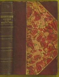
1799biblio153a1-42 binders direction8 subscribers4c-4204 additional subscribers pages with 7 maps 5 folding and 6 plates. Quarto 11 3/4" x 9 1/2" with new spine in six compartment with red label in gilt over original decorative blind stamped calf boards. Ferguson 329; Sabin 104.633 First edition first printing.<br /><br />Captain James Wilson 1760–1814 brought the first British missionaries to Tahiti on ship Duff in 1797. Wilson was a deeply religious man. The missionaries he brought were from the London Missionary Society. There were thirty men six women and three children. Wilson on the Duff also explored and visited many islands in the Pacific some of which had never had any recorded visit by a European. Among these the most important are Mangareva in the Gambier Islands and Pukarua in the Tuamotus. Duff Paid a visit as a missionary ship to Tahiti during 1796 as a result Missionary Society has first been established in Tahiti. Three years after the establishment the directors of the Society appointed a committee to consider a suitable memorial for presentation to Wilson for his services in helping to establish the first mission in the South Seas.<br /><br />Wilson fought with the British army during the American War of independence and then served nine years with the East India company. While in India he was captured by Hyder Ali and after a daring bid for escape was imprisoned in the black hole of Seringapatam. After his release he continued service as a captain and despite illness and further dangerous missions accumulated sufficientr esources to retire. throughout it all Wilson remained fast in his irreligious opinions. While living in England with his niece however he was converted to an evangelical faith. he felt called to volunteer for missionary service after reading the Evangelical Magazine. Haweis did not know Wilson before receiving a letter volunteering his services in the Pacific. his skills and newfound devotion seemed perfectly suited to the situation and Haweis saw him as "God's man." the Duff arrived at Tahiti on march 5 1797. the settlement at Tahiti of twenty of the missionaries five of them with wives and two children gives further examples of the role of the missionary captain. A pattern of intercourse had already been established by other voyagers according to which the captain of a vessel would take the leading role in meetings. It is therefore not surprising that the focus of the chapter describing the arrival is on meetings between significant island figures and Captain Wilson. For example Manemane a "high priest" Frommo'orea sought Wilson as a tayo or friend not Jefferson the president of the missionaries.<br /><br />The official account of the first mission appeared in 1799 under the lengthy title A missionary voyage to the southern Pacific Ocean performed in the years 1796 1797 1798 in the ship Duff commanded by Captain James Wilson compiled from thejournals of the officers and the missionaries; and illustrated with maps charts and views drawn by Mr William Wilson.it was placed firmly within the tradition of the voyages ofdiscovery by an introduction compiledby samuel Greatheed that described previous european contacts with the islands and anappendix "including details never before published of the natural and civil state of otaheite." the main narrative was taken from Wilson's journal with additions from his son and a journal kept by the missionaries during the period when the Duff was away from Tahiti at Tonga. Wilson dominated the events recorded in the narrative.<br /><br />Condition:<br /><br />Some offset toning from maps occasional foxing water mark to upper margin on some leaves two leaves miss-bound at back re-backed with contemporary blind stamped calf boards. S Gosnell for T Chapman hardcover books
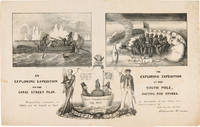
1838WRCAM55549New York: H.R. Robinson 1838. Lithograph 12 1/2 x 20 inches. Light foxing and soiling. Two short closed tears in the right edge and left edge of the sheet. Very good. A very rare print satirizing the recently undertaken United States Exploring Expedition commanded by Charles Wilkes. The Expedition departed in August 1838 and Robinson's eagerness to satirize it and the politicians who supported it is ample evidence that the endeavor was not universally popular. The print is made up of three humorous vignettes. "The upper left is Charles Wilkes in a rowboat with an oarsman and two members of the scientific corps who make observations with a transit or telescope and draw fauna. The upper right image depicts a group of sailors and Charles Wilkes huddled together on the snow surrounded by a ring of polar bears and an upturned rowboat foxes penguins and a campfire. They are flying an inverted U.S. flag to signal distress. At the bottom between the two titles is an inset of the three Navy Commissioners Isaac Chaucey Charles Morris and Alexander S. Wadsworth at sea in a bowl. They are framed by a shield surmounted by a jester and flanked on the left by a man in naval uniform James Kirke Paulding Secretary of the Navy and a sailor with a sad expression on the right" - Harry T. Peters Collection at the Smithsonian Institution online catalogue. The print is "Respectfully inscribed to the Secretaries of the Navy and Army and the Board of Navy Commissioners by their humble servant Robinson Crusoe." <br> <br> Not in Reilly's catalogue of American political prints in the Library of Congress though OCLC does locate a copy at the Library of Congress. That is one of two copies listed on OCLC the other copy is at the American Antiquarian Society. There are also copies in the Peters collection at the Smithsonian and at the Australian National Maritime Museum. OCLC 299947747 752795742. Herman J. Viola ed. MAGNIFICENT VOYAGERS THE U.S. EXPLORING EXPEDITION 1838-1842 Washington 1985 p.13. H.R. Robinson unknown books
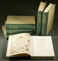
1957E0551<b>From the Spanish discovery to the opening of the Civil War</b><br /><br />5 volumes in 6. Volume One: The Spanish Entrada to the Louisiana Purchase 1540-1804 xiv264 pages with color frontispiece map and 275 maps many folding and index; Volume Two: From Lewis and Clark to Fremont 1804-1845 xiii281 pages with colored frontispiece map 143 additional maps some folding and index. Volume Three: From the Mexican War to the Boundary Surveys 1846-1854 xiii349 pages with colored frontispiece map 322 additional maps and index; Volume Four: From the Pacific Railroad Surveys to the Onset of the Civil War 1855-1860 xiii260 pages with color frontispiece map an additional 127 maps some folding and index; Volume Five From the Civil War to the Geological Survey Part One: xviii222 pages with color frontispiece map and an additional 152 maps; Volume Five From the Civil War to the Geological Survey Part Two: 223-487 pages with 124 maps and index. Folio 14 1/2" x 10 1/2" bound in quarter green leather with gilt lettering to spines. volume I printed by the Grabhorn Press; volumes II-V printed by Taylor & Taylor and James Printing based on the designs of Edwin and Robert Grabhorn. First edition limited to 1000 copies.<br /><br />Carl Wheat's Mapping of the Trans-Mississippi West is a comprehensive and readable cartographic history of the American West. The first three volumes of the work are by necessity bulky and out sized to accommodate the many maps contained with their covers. These beautifully printed books present a truly graphic picture of the exploration and peopling of the vast unknown land west of the Mississippi. The author does not merely present a catalog of significant maps of each era but tells the exciting story of many facets of history that resulted in their making-of the hard journeys the hazardous exploits the motivation the mysticism the misunderstandings and the strange blend of fact imagination false geographic concept and political necessity which were consummated in the engraver's work. These volumes will provide exciting text for the casual reader and have become eminent source book for the student and scholar.<br /><br />Condition:<br /><br />A near fine set. Institute of Historical Cartography hardcover books
1844E0023xcii616 pages with bibliography. Octavo 8 1/2" x 5 1/2" bound in contemporary half calf with black spine label and gilt lettering. Publications de la Societe d'Etudes pour la colonisation de la Guyane francaise Number 4. The bibliographical catalogue occupies pages 579-616 and contains descriptions of 240 works on Guiana. Sabin 56097. First edition.<br /><br />French Guiana French: Guyane française officially Guyane is an overseas department French: département d'outre-mer or DOM of France located on the northern coast of South America. It has borders with two nations Brazil and Suriname. Like the other DOMs French Guiana is also an overseas region of France one of the 26 regions of France. Its currency is the euro. The prefecture is Cayenne. The addition of the adjective "French" comes from colonial times when three such colonies existed: British Guiana now Guyana Dutch Guiana now Suriname and French Guiana. The three are still often collectively referred to as the Guianas. French Guiana was originally inhabited by a number of indigenous American people. It was settled by the French during the 17th century. After the Treaty of Paris in 1763 Louis XV sent 12000 settlers to French Guiana to colonise the region. One and a half years later only a few hundred survived.2 Its infamous Île du Diable Devil's Island was the site of penal settlements from 1852 until 1951. More than 70000 French convicts were deported to French Guiana between 1852 and 1939.3 In 1809 a Portuguese-British naval squadron took French Guiana for the Portuguese Empire. With the signing of the Treaty of Paris in 1814 the region was handed back to the French though a Portuguese presence remained until 1817. A border dispute with Brazil arose in the late nineteenth century over a vast area of jungle leading to the short-lived pro-French independent state of Counani in the disputed territory and some fighting between settlers before the dispute was resolved largely in favor of Brazil by the arbitration of the Swiss government.<br /><br />Condition:<br /><br />Front inner hinge cracked rubbing to hinges and corners some internal foxing else a very good copy. Imprimerie de Bethune and Plon hardcover books
1787E00402 volumes: 576xv pages; 499xv pages. Octavo 8 3/4" x 5 1/2" bound in 3/4 period leather. Translated from the first German edition 1781 which includes a chapter entitled: "Observations and additions to by Johann Gottlob Theaenus Schneider". Translated with additional notes and reviews by Jean Baptiste Lefebvre Villebrune. First Spanish edition published in 1772 Madrid. Sabin 36805 First French edition.<br /><br />Antonio de Ulloa 12 January 1716 – 3 July 1795 was a Spanish general explorer author astronomer colonial administrator and the first Spanish governor of Louisiana. He was born in Seville the son of an economist. Ulloa entered the navy in 1733. In 1735 he was appointed with fellow Spaniard Jorge Juan a member of the French Geodesic Mission a scientific expedition which the French Academy of Sciences was sending to Ecuador to measure a degree of meridian arc at the equator led by Pierre Bouguer. He remained there from 1736 to 1744 during which time the two Spaniards discovered the element platinum. In 1745 having finished their scientific labors Ulloa and Jorge Juan prepared to return to Spain agreeing to travel on different ships in order to minimize the danger of losing the important fruits of their labors. The ship upon which Ulloa was traveling was captured by the British and he was taken as a prisoner to England. In that country through his scientific attainments he gained the friendship of the men of science and was made a Fellow of the Royal Society of London. In a short time through the influence of the president of this society he was released and was able to return to Spain. He published an account of the people and the countries they have met 1748 which was translated into English as A Voyage to South America. He became prominent as a scientist and was appointed to serve on various important scientific commissions. He is to be credited with the establishment of the first museum of natural history the first metallurgical laboratory in Spain and the observatory of Cadiz. In 1758 he returned to South America as governor of Huancavelica in Peru and the general manager of the quicksilver mines there. He held this position until 1764. He arrived on 5 March 1766 in New Orleans to serve as the first Spanish governor of West Louisiana. The French colonists refused to recognize Spanish rule and de Ulloa was expelled from Louisiana by a Creole uprising during the Louisiana Rebellion of 1768. For the remainder of his life he served as a naval officer. In 1779 he became lieutenant-general of the naval forces. As a result of his scientific work in Peru he published Madrid 1784 Relación histórica del viaje á la América Meridional which contains a full accurate and clear description of the greater part of South America geographically and of its inhabitants and natural history. In collaboration with the Jorge Juan mentioned above he also wrote Noticias secretas de América giving valuable information regarding the early religious orders in Spanish America.<br /><br />Condition:<br /><br />Sever worming to spines exterior hinges cracked point chipped library stamps to title pages else a good copy of a scarce item. Chez Buisson hardcover books
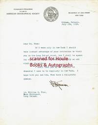
1920501237<p>"V. Stefansson" in black fountain pen ink on pictorial American Geographical Society letterhead Ottawa Ontario Canada July 9 1920. 8 1/2" x 11"; 1 page; very good. Together with the original typed envelope stamped and postmarked Ottawa Ont. July 9 1920 with two stamps. To Dr. William C. Thro East Northport Long Island New York "Dear Dr. Thro: If I were only in New York I should take instant advantage of your invitation to visit you on the Long Island coast but I shall be spending most of my summer in Canada with only an odd visit to the city. I shall look you up in the fall or whenever I come to be regularly in New York. I hope both you and Mrs. Thro have a delightful summer. V. Stefansson." Stefansson 1879-1962 American ethnologist/explorer/author; lived amongst the Eskimo 1906-07; Canadian/Alaskan Arctic expedition commander 1913-18; consultant to Dartmouth College's Northern Studies program 1947-62.</p> unknown books
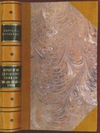
1853E0014198 pages with 23 plates. Royal octavo 9 1/2" x 6" rebound in 3/4 leather with marbled boards and black label with gilt lettering to spine. 79 plates with one Buffalo Dance folding and some with a single tint in this first issue there are errors in the list of illustrations corrected in later issues viz. Landscapes etc. 23 plates numbered as 1-13 15-23 plus one unnumbered at end; Mammals 6 plates; Birds 5 plates numbered 1 3-6 plate 2 Struthus Canicops Woodhouse male is called for but not present and most likely not to be found in this issue; Reptiles 21 plates with 10a miss-numbered as 10 12 as 13 and 13 as 16; Fishes 3 plates; Plants 21 plates plate 21 Aploppus Nuttalii present but not called for. Includes <i>Reconnaissance of the Zuni Little Colorado and Colorado Rivers Made in 1851</i> map as called for but includes Lithographed map <i>Boundary of the Creek Country</i> 24" x 36" laid in not called for. Senate Executive Document 59 Howes: 528 First edition.<br /><br />Survey of the watershed of the Canadian River and Red Fork of the Arkansas River in Indian Territory extending from Fort Smith to the border with Texas. The lands of the Cherokee Creek Seminole and Choctaw Indians are located. The map locates numerous forts including Smith Coffee Gibson and Old Fort Holmes and their connecting wagon roads. Talasee is shown at the site of Tulsa. This map was issued with the "Northern and Western Boundary Line of the Creek Country" report by Sitgreaves and Lt. J.C. Woodruff. The surveys were made in 1848 and 1850 but the report in which the map was issued wasn't published until 1858.<br /><br />After the conquest of New Mexico and California it was apparent that transportation and communications needed to be improved between these new territories and the rest of the United States east of the Mississippi. Geographical knowledge of most of this area particularly northwestern New Mexico now northern Arizona was very limited and inaccurate. Some maps of the day showed a river system that might provide a possible navigable water corridor between New Mexico and the Gulf of California via the Zuni Little Colorado and Colorado Rivers. In September of 1851 Captain Lorenzo Sitgreaves along with a small crew of topographers naturalists artists and support personnel and an escort of 30 infantrymen left the Zuni Pueblo in western New Mexico by pack train with instructions to explore and map the Zuni and Colorado Rivers and evaluate their navigability in light of a possible impending war with the Mormons in Utah. They traveled southwest along the Zuni River to its mouth and then headed northwest along the Little Colorado intending to follow it to the Colorado. When they reached Grand Falls northwest of present-day Winslow Arizona their guide Antoine Leroux advised them that it was unwise to follow the river any further because it flowed in a deep canyon for the rest of its course and emptied into the great canyon of the Colorado River. They left the river and struck off due west around the north side of the San Francisco Mountains discovering the Wupatki Indian Ruins along the way and looped southwestward around the south side of Bill Williams Mountain. The rest of their westward march followed near the future alignment of Route 66 to the Colorado River near the modern town of Bullhead City Arizona. After a difficult march south along the Colorado River they reached Camp Yuma on November 30. Of course Sitgreaves discovered that the Zuni and Little Colorado Rivers were not at all navigable and would be useless to transport troops and supplies. The Colorado River however was found to be navigable along the entire distance that he explored. Sitgreaves' official report "Report of an Expedition Down the Zuni and Colorado Rivers in 1851" was published in 1853.<br /><br /><b>Condition:</b><br /><br />Foxing left margin trimmed as issued for folding all other plates present as called for in Howes as well as Lithographed map <i>Boundary of the Creek Country</i> laid in and not called for some folding. Rebound in attractive three quarter leather else a about very good. Robert Armstrong hardcover books
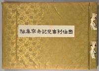
1918880611918. SIBERIAN EXPEDITION. Teikoku Gunjin Kyôiku-kai editors. SHIBERI JIHEN KINEN SHASHIN-CHÔ. Tôkyô Taishô Tsûshinsha Taishô 7 1918 Oblong folio bound western-style in cloth gilt. Illustrated throughout in collotype. Photos and cations on the International Siberian Expedition in support of the Whites against the Red Army in which the Japanese played a prominent role. 4 page folding panorama of Vladivostok harbor and views of the cities the countryside troops inhabitants diplomats war preparations etc. etc. One can feel the Winter coming. Very good condition throughout. Very scarce. unknown books
1802E01512 volumes with Atlas. 4xxiv385 pages with xxii-xxiv lists books of voyages available from the publisher; 4418 pages with appendix containing vocabularies of the languages of Yukagir Yakut Tungoose Kamchatka the Aleutian Islands and Kadiak and inex. Atlas with title list of plates 14 engraved plates & large folding engraved map. Text volumes are small octavo 7¾" x 4½" 19th century quarter calf & boards spines tooled in gilt morocco lettering pieces; atlas is quarto 11" x 7½" in period tree calf spine tooled in gilt. Translated by J Castéra. Howes S-117 First French Edition.<br /><br />Martin Sauer was an English civil servant who knew Russian French and German. He became acquainted with Joseph Billings in St Petersburg in the 1780s. He agreed to join Billings expedition as his secretary and interpreter. It was agreed that he would write the official account but there is some controversy about his actives when he returned to St Petersburg in 1794. It has been suggested that he left hurriedly for England with much of the important archival material from the voyage including diaries and secret reports so that he could publish a record of the expedition before Russian authorities and scholars in the Academy of Sciences could review its details. Sauer's <i>An account of the Geographical and Astronomical Expedition to the Northern Parts of Russia</i> was published in London in 1802. It contains an abundance of detail about eastern Siberia and the Aleutian Islands and records the expeditions visits to Kodiak Island Prince William Sound and the coast south as far as Yakutat Bay. <br /><br />The chart was made by Aaron Arrowsmith from Sauer's notes and Billings observations and the whole complements well the other contemporary accounts of the expedition by the cartographer Gavriil Sarychev and the naturalist Carl Heinrich Merck. Aaron Arrowsmith 1750–1823 was an English cartographer engraver and publisher and founding member of the Arrowsmith family of geographers. He moved to Soho Square London from Winston County Durham when about twenty years of age and was employed by John Cary the engraver and William Faden. He became Hydrographer to the Prince of Wales ca. 1810 and subsequently to the King in 1820. In January 1790 he made himself famous by his large chart of the world on Mercator projection. Four years later he published another large map of the world on the globular projection with a companion volume of explanation.<br /><br /><b>Condition:</b><br /><br />Some rubbing and wear to coves of both atlas and text volumes some chipping to spine ends small gouge at back of atlas and stamp to front end paper else in very good condition. Chez F Buisson hardcover books
18584741baY2Toronto Ontario: John Lovell 1858. Book. Very good condition. Hardcover. First Edition. Octavo 8vo. Canada; Manitoba; Red River expedition 1857; Assiniboine and Saskatchewan expedition 1858; 258pages; 25.5cm; full black leather binding re-backed; inserted folded map: 35 x 77cm; part of Red River Valley north of 49th parallel to accompany report of H. Y. Hind's Canadian Red River expedition; small tear bottom left corner small breaks at 2 folds; detached folded map: 76.5 x 142cm; plan 'shewing' proposed route from Lake Superior to Red River settlement compiled from Dawson & Napier's maps T. Devine surveyor branch west Crown Lands Department Toronto 29th May 1858 Andrew Russell assistant commissioner; across map bottom: Profile of canoe route by Professor Hind horizontal scale 10 miles to 1 inch vertical scale 600 feet to 1 inch; center top of map: Plan of country between Red River settlement and Lake of the Woods scale 8 miles to inch; signed S. J. Dawson note-this is reduced copy of map from actual survey accompanying Dawson's report of 15th March 1858; Red River expedition under direction of George Gladman 1800-63 and Simon James Dawson 1820-1902; report by Henry Youle Hind 1823-1909; Canada Legislative Assembly Victoria 21 appendice No 3. A. 1858. First edition. John Lovell Hardcover books
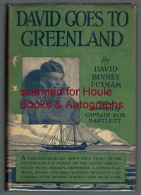
19262222001<p>First edition "October 1926". Octavo. Four page foreword by Bob Bartlett. Illustrated with 47 photographs and drawings by the Eskimo Kakutia; endpaper maps. Dust jacket unclipped; few nicks and creases. Very good. 167 pages.</p><p>Signed and inscribed on verso of frontispiece by the publisher and father of the author: "From one who is merely. David's Dad! G. P. Putnam."</p> G. P. Putnam's Sons hardcover books
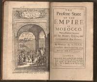
1695E0561xxiv21612 pages with frontispiece folding map and eight engraved costume plates. Duodecimo 6 ¼" x 3 ½" early full calf later spine label. First Edition in English. First published in French the prior year which was published without the plates.<br /><br />François Pidou de Saint Olon was a French diplomat under Louis XIV. In 1682 he was nominated as the first French resident envoy to the Republic of Genoa following the Bombardment of Genoa. He was then sent as an envoy to Madrid. In 1689 François Pidou was appointed ambassador to the court of Sultan Moulay Ismail for the signing of a commercial treaty and to release prisoners now slaves of Barbary corsairs of Salé for 233 including 29 bedridden Moroccan prisoners held by the French. His mission was not successful however he continued to stay more than three weeks more in Morocco. The book gains particular interest through its author's position as ambassador giving him access not always voluntary to areas of Moroccan society previously unrecorded by travelers. There are detailed descriptions of Moroccan dress and the book is beautifully illustrated with eight engraved plates of Moroccan men and women in traditional costume.<br /><br />Condition:<br /><br />With the fine copper engraved frontispiece of the overall state of Morocco which is quite rare and is often found missing in most copies. Joints cracking spine chipped at edges; foxing else very good. R. Bently hardcover books
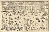
1855WRCAM46844Tokyo 1855. 24 1/2 x 16 inches. Matted. Old fold lines some minor wear and soiling. Near fine. Large wood block print comprised of two sheets showing the disposition of the Japanese soldiers and ships in preparation for the arrival of Commodore Perry's American fleet seen sailing into Tokyo harbor at the right side of the image. The top third of the print is comprised of text in Japanese characters. Three large American ships dominate the right side of the print while several smaller boats dot the rest of the harbor. The whole is dotted with Japanese characters denoting various people and places around the harbor. <br> <br> Perry first arrived in Japan on July 8 1853 with a fleet of four ships flying his pennant on the steam frigate Susquehanna. This first visit lasted ten days and culminated on July 14 with Perry's presentation of a letter from the President of the United States to the Japanese commissioners. Perry then absented himself for seven months returning on February 11 1854 for a stay of over four months. He negotiated a treaty opening Japan to trade with the western world providing for a U.S. consul in Japan and protecting visiting ships and crews. Perry's visit to Japan remains one of the most important events in the diplomatic history between western and eastern nations. <br> <br> A handsome print showing the Japanese side of this important historic event. unknown books
1853347471853. 31; 31; 61pp. plus a loose sheet. Original paper wrappers stitched. Contemporary manuscript annotations in red ink in one volume Scattered worming heavy in places. Some dampstaining and dust soiling. About very good.<br/> <br/>Separate Accounts of the Arrival of Commodore Perry<br/> <br/>Three fascinating Japanese manuscript accounts of the arrival of Commodore Perry to Japan in 1853. Then first Uraga Kurotone Ni Kansaru or "The Black Ship Arriving in Uraga" comprises the official government report of events when Perry steamed into Uraga Bay. This volume contains contemporary edits to the text in red ink. The second account of Perry's arrival Edo Urgga Bikoku Fune Torai Ikken or "Arrival of the Ships at Uraga" contains a double-page manuscript sketch of the coastline of Uraga Bay together with the disposition of Perry's ships. The final volume consists of a third manuscript entitled GASSHUKKO SHOKAN WAGE UTSUSHI a copy of the report on the Perry arrival prepared by Abe Masahiro Chief Senior Councillor in the Toguwara Shogunate which includes translations of the letters from Fillmore and Perry delivered by Perry on July 8 1853. Also with a single manuscript sheet that provides a description of Perry's ship. Vital contemporary manuscript accounts of this monumental transformation in Japanese foreign relations from significant Japanese participants in events. unknown books
1856E05603 volumes: xvii1537 pages with 90 lithographs plates including the usual expunged bathing plate many in color including 3 "facsimiles" of Japanese woodblock prints 2 folding; 6 maps and charts 2 folding; 79 woodcuts in the text; 2414414-1xi pages with 4 color lithographs of Chinese scenes; 2 uncolored natural history engraved plates; 6 hand-colored lithographs of birds; 10 hand-colored steel-engravings of fish; 5 lithographs of shells 2 hand-colored; 16 diagram plates of winds and currents; 14-page facsimile of Japanese language version of the U.S.-Japan treaty; 17 folding charts on 16 sheets; numerous woodcuts in the text; xliii17051 pages woodcut star charts throughout. Volume III titled "United States Japan Expedition. Observations on the zodiacal light from April 2 1853 to April 22 1855 . by Rev. George Jones A.M. chaplain United States Navy". Quarto 11½ x8 ¾" bound in the original blind stamped cloth. Volume 1 rebacked with the original cloth spine laid down. Hill 1332; Sabin 30968 First edition of the House Issue.<br /><br />Detailed and profusely illustrated account of Perry's expedition to open Japan to the West; Upon his return to the U.S. his chief duty for the following year was to compile his reports of the expedition aided by Francis Hawks. The first volume has the account of the voyage and lithographs of the travel; the second volume has the natural history reports by D.S. Green and others and includes hand-colored plates of Japanese fishes and shells. In addition to the artist W. Heine from whose drawings a great number of the lithographs were made the daguerreotypist E. Brown Jr. went on the expedition taking what were undoubtedly the earliest photographic images of Japan many of them reproduced lithographically in this work. This copy with the nude bathing plate which was not included on the list of plates and not issued in all copies. <br /><br />In advance of his voyage to the Far East Commodore Perry read widely amongst available books about Tokugawa Japan. His research even included consultation with the increasingly well-known Japanologist Philipp Franz von Siebold who had lived on the Dutch island of Dejima for eight years before retiring to Leiden in the Netherlands. In 1852 Perry embarked from Norfolk Virginia for Japan in command of a squadron in search of a Japanese trade treaty. Aboard a black-hulled steam frigate he ported Mississippi Plymouth Saratoga and Susquehanna at Uraga Harbor near Edo modern Tokyo on July 8 1853. His actions at this crucial juncture were informed by a careful study of Japan's previous contacts with Western ships and what could be known about the Japanese hierarchical culture. He was met by representatives of the Tokugawa Shogunate who told him to proceed to Nagasaki where there was limited trade with the Netherlands and which was the only Japanese port open to foreigners at that time. Perry refused to leave and demanded permission to present a letter from President Millard Fillmore threatening force if he was denied. Perry ordered his ships to attack several buildings around the harbor to demonstrate US naval power. The Commodore was fully prepared for more hostilities if his negotiations with the Japanese failed and threatened to use unrestrained fire if the Japanese refused to negotiate. He sent two white flags to them telling them to hoist the flags when they wished a bombardment from his fleet to cease and to surrender. Perry's ships were equipped with new Paixhans shell guns capable of wreaking great destruction with every shell. The Japanese military forces could not resist Perry's modern weaponry; the term "Black Ships" in Japan would later come to symbolize a threat imposed by Western technology. Perry returned in February 1854 with twice as many ships finding that the delegates had prepared a treaty embodying virtually all the demands in Fillmore's letter. Perry signed the Convention of Kanagawa on March 31 1854 and departed mistakenly believing the agreement had been made with imperial representatives. The agreement was made with the Shogun the de facto ruler of Japan. On his way to Japan Perry anchored off Keelung in Formosa modern day Taiwan for ten days. Perry and crew members landed on Formosa and investigated the potential of mining the coal deposits in that area. He emphasized in his reports that Formosa provided a convenient mid-way trade location. Formosa was also very defensible. It could serve as a base for exploration as Cuba had done for the Spanish in the Americas. Occupying Formosa could help the US to counter European monopolization of the major trade routes. President Franklin Pierce declined the suggestion remarking such a remote possession would be an unnecessary drain of resources and that he would be unlikely to receive the consent of Congress. When Perry returned to the United States in 1855 Congress voted to grant him a reward of $20000 in appreciation of his work in Japan. Perry used part of this money to prepare and publish a report on the expedition in three volumes titled Narrative of the Expedition of an American Squadron to the China Seas and Japan. He was also advanced to the grade of rear-admiral on the retired list when his health began to fail as a reward for his services in the Far East.<br /><br />Condition:<br /><br />Wear and fading to cloth first volume rebacked; large map detached several others with stub tears and splitting to folds; light foxing else good to very good. A O P Nicholson hardcover books
BL2086Albuquerque:: University of New Mexico Press N.D. Oblong 8vo. xiii 232 pp. Heavily illustrated with photographs index. Brown cloth gilt-stamped spine title dust-jacket. Burndy bookplate. Fine. ISBN: 0826328105 University of New Mexico Press, (N.D.). hardcover books
192561378New York and London: Longmans Green & Edward Arnold & Co 1925. First American edition from British sheets. Large thick 8vo. xi 372 pp. Illustrated from photographs plates some in color double-page panorama large folding map at rear. With a commemorative stamp celebrating this expedition mounted on the front endpaper and signed by N.E. Odell one of the members of the expedition and a contributor of several chapters to this work underneath also underneath his ink inscription written in a local language Nepali or Hindi perhaps "The noblest lore of frontiers". Neate 573: "Norton climbed to a height of about 28100 feet without oxygen." Very good. Original gilt-stamped blue cloth. #8425. <br/><br/> Longmans, Green & Edward Arnold & Co hardcover books
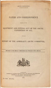
1875WRCAM50678London 1875. 402pp. plus folding map. Folio. 20th-century three-quarter calf and marbled paper boards spine gilt. Stefansson Library stamp on titlepage deaccessioned. Toned minor chipping at edges of some leaves. Final leaf repaired with archival paper with no loss to text; small tears in margin of map. Very good. This scarce document describes the plans for the 1875 Nares Expedition includes specifications for the H.M.S. Discovery data on supplies needed estimations of costs and a hydrographer's report as well as a color chart of the North Polar Sea. The chart is a Polar projection map showing the seas navigated by British expeditions as well as coasts discovered by British American German Swedish and Austrian explorers through 1874. <br> <br> The Nares expedition which sailed from 1875 to 1876 strove to be the first to reach the North Pole and to explore its coasts and region. Though unsuccessful in this venture the expedition was the first to sail ships through the channel between Greenland and Ellesmere Island and as far north as the Lincoln Sea recording valuable information about the mysterious region. A sledging party under Captain Albert Hastings Markham also set a new record on land reaching as far north as 83° 20'. The British Parliament printed occasional reports of the various expeditions and related Arctic subjects which became known as the Arctic "blue books" named after the distinctive blue wrappers in which they were originally issued. This copy has the stamp of the Stefansson collection at the Dartmouth library but was deaccessioned as a duplicate to his widow. ARCTIC BIBLIOGRAPHY 45251. hardcover books
1711E0013iixxixvii1911blank 223 pages with 1 of 3 large fold out maps and 15 of 19 engraved fold out plates. Octavo 8" x 5" bound three quarter leather with raised spine bands and gilt lettering to spine over marbled boards. Edited by Sir Tancred Robinson. Second edition preferred over the first edition "because it has the chart of the western and southern oceans." Hill In 1699.<br /><br />First published in 1694 which contained only two maps The book is important because it contains one of the earliest English accounts of Abel Janszoon Tasman's famous voyage of 1642 from Batavia during which he discovered Tasmania and New Zealand and visited Tonga and Fiji Hill 1475.<br /><br />Rear Admiral Sir John Narborough RN was an English naval commander of the 17th century who served with distinction during the Anglo-Dutch Wars and against the Barbary Coast pirates. He was descended from an old Norfolk family. He received his commission in 1664 and in 1666 was promoted lieutenant for gallantry in the action with the Dutch fleet off the Downs in June of that year. After the peace he was chosen to conduct a voyage of exploration in the South Seas. He set sail from Deptford on November 26 1669 and entered the Straits of Magellan in October of the following year. In 1670 he visited Port Desire in Argentina and claimed the territory for the Kingdom of Great Britain but returned home in June 1671 without accomplishing his original purpose. A narrative of the expedition was published at London in 1694 under the title <i>An Account of several late Voyages and Discoveries to the South and North</i>. During the Third Anglo-Dutch War Narborough was second captain of the Lord High Admiral's ship the Prince and conducted himself with such conspicuous valor at the battle of Solebay Southwold Bay in May 1672 that he won special approbation and shortly afterwards was made rear-admiral and knighted. In 1675 he was sent to suppress the Tripoline piracies and by the bold expedient of dispatching gun-boats into the harbor of Tripoli at midnight and burning the ships he induced the them to agree to a treaty. Shortly after his return he undertook a similar expedition against the Algerians. In 1680 he was appointed commissioner of the Navy an office he held till his death. He was buried at Knowlton church Kent where a monument has been erected to his memory. The island of Fernadina the youngest and westernmost island of the Galapagos Archipelago was originally named 'Narborough Island' in his honor by the 17th century buccaneer William Ambrosia Cowley.<br /><br /><b>Condition:</b><br /><br />Marginal foxing soiling and damp staining through out paper fault across second C2 affecting one letter some rubbing hinges and corners else a better than good copy. Printed for D Brown hardcover books
19359003721New York: Macmillan 1935. 1st. Illustrated with maps and plates in black-and-white. Bound in the publisher's original blue cloth with the front cover and spine stamped in white. Light fading to the spine and minimal wear to the extremities otherwise very good condition. <br/><br/> Macmillan hardcover books
178927184Leiden: Etienne Luzac 1789. Small 4to. 8 1/2 x 6 1/4 inches. Woodcut arms of the Netherlands at the head of the first sheet. 4pp. With a 4pp. "Supplement aux Nouvelles Extraordinaires de Divers Endroits du Numero LXXV" inserted. Together 8pp. Unbound.<br/> <br/>Extremely rare broadsheet containing news of the Malaspina expedition: among the earliest printed records of Spain's greatest scientific voyage to the Pacific Ocean California and the Northwest Coast of America in the 18th century.<br/> <br/>The extract under the above heading continues: ". Les Corvettes de la Marine Royage la Découverte & l'Entreprenante commandées par Don Alexandre Malespina Capitaine de Frégate ont mìs à la voile de Cadix le 30 Juillet dernier. L'Expédition dont elles son chargées ayant pour objet les progrès des Sciences & de la Géographie elles ont été munies de tout ce qui est nécessaire pour faire un voyage autour du Monde; & outre des Oficiers d'une habilité reconnuë elles ont à bord des Astronomes des Naturalistes des Botanistes des Peintres de Perspective & de Botanique pourvus d'une Collection ample & précieuse d'Instruments de Mathématiques de Physique & Astronomie." Other news in the broadsheet concerns revolutionary events in France including a lengthy speech from Necker given at the National Assembly as well as news from Russia Stockholm the Hague and elsewhere. In 1789 Malaspina and Bustamente drew up plans for this scientific circumnavigation which was to rival Captain Cook the purposes being to chart the most remote regions of America and to observe the political state of America relative to Spain. Alexander Dalrymple assisted them with scientific instruments a brilliant team of scientists was assembled and ships specially constructed. Surveys were made of the east and west coasts of South America they fixed the exact position of Cape Horn correcting Cook's reading. On receipt of orders to investigate the apocryphal Strait of Anian they sailed for Alaska and entered Yakutat Bay at the supposed latitude of the strait where the Malaspina Glacier flows into the sea and followed the coast to Prince William Sound and Nootka. Malaspina surveyed the coast south to California at Monterey Bay and crossed the Pacific in 1791. Two of his officers and Jose de Espinosa y Tello returned north in search of a North-West Passage and published the charts and account of this secondary voyage in 1802. In the Philippines New Zealand and New South Wales Malaspina continued charting before making an easterly passage around the Horn for Spain. "In spite of having commanded Spain's greatest scientific voyage of exploration to the South Seas in the eighteenth century Malaspina is virtually unknown. He had enemies in the Spanish court who suppressed his reports which were not printed until.1885. Some scholars consider the exploits of his five-year voyage as great as those of La Pérouse or of Captain Cook" Hill. Eighteenth century material concerning the voyage is of the utmost rarity.<br/> <br/>Howgego M26; Cf. Hill 1068. Etienne Luzac unknown books
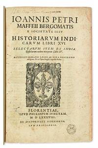
1588E05544-5702 blank28 pages. Folio 12 1/2" x 8 1/4" title with wood cut printer's device bound in contemporary vellum. European Americana 588/57; Palau 146976; Sabin 146976 First edition of Maffei's great history of India.<br /><br />Ten Latin editions two in Italian and two in French appeared before 1621. Based on primary material it still remains a valuable account today. The work is divided into 16 books. Most of it deals with the Portuguese conquests and Jesuit missionary work in the East Indies and India up to about 1557 Borba de Moraes page 508 "a classic work on the subject . writes extensively about Brazil describing it very accurately"; Maffie was the firs author to use Jesuit letters extensively as well as many secular sources including Fernando Mendes Pinto.<br /><br />Condition:<br /><br />Contemporary velum with moderate wear re-backed in vellum with original spine label laid down; minor worming and foxing intermittent moderate damp staining pages 410 and 419 blank due to a printing error; early inscription and inked stamped on title page new end papers and paste-downs else a good to very good copy. Apud Philippum Juncatam hardcover books
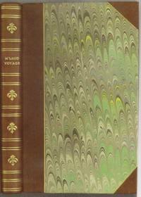
1818E0061323 pages with a portrait frontispiece and five colored aquatints. Octavo 8 3/4" x 5 1/2" bound in attractive half leather with marbled boards and gilt lettering to spine. Hill 1168 Second and best edition<br /><br />The Alceste brought Lord Amherst to China to serve as ambassador and specifically to negotiate the China trade at the time a matter of dispute between China and Great Britain.M'Leod who was surgeon on the ship describes the voyage out the various calls in the East Indies including touching at Batavia surveying off Korea the visit to Okinawa another to Manila and the shipwreck off the coast of Sumatra and subsequent rescue from Malay pirates. A brief but interesting interview with Napoleon at St. Helena is also included in the narrative. This was one of the most popular travel books of its time portraying the Far East to a much wider audience than had been reached by earlier accounts. The idyllic descriptions of Lewchew undoubtedly appealed to the romantic sensibilities of the era. Indeed buoyed by its success M'Leod published another work recounting his time as a slaver <i>A Voyage to Africa with some Account of the Manners and Customs of the Dahomian People</i>.<br /><br /><b>Condition:</b><br /><br />Attractive half rebind some foxing through out with no spotting to plates else a very good copy. John Murray hardcover books
1836185920Leipzig: Hirschfeld 1836. Hardcover. G Cover has fading cracking edge/corner damage. Bookblock has age toning. Interior pages have age toning foxing some water staining. Title page has some text work away. Brown leather decorative boards with 2 metal clasps. Decorative carved and colored bookblock. VIII 920 257 pages. Hirschfeld hardcover books
182232323Philadelphia: Harrison Hall 1822. 8vo. 8 5/8 x 6 inches. 4 449-532pp. Engraved frontispiece plate after T. R. Peale depicting a skin lodge Kaskaias. Foxing. Publisher's lettered wrappers.<br/> <br/>Ephemeral announcement of the publication of the account of the Long Expedition to the Rocky Mountains.<br/> <br/>Major Stephen Long was the principal proponent of government-sponsored exploration of the West following the War of 1812. He travelled farther than Pike or Lewis and Clark and blazed trails that were susequently followed by Fremont Powell and others. The expedition travelled up the Missouri and then followed the River Platte to its source in the Rocky Mountains before moving south to Upper Arkansas. From there the plan was to find the source of the Red River but when this was missed the Canadian River was explored instead. The expedition added significantly to the earlier discoveries of Lewis and Clark and Zebulon Pike. Edwin James was the botanist geologist and surgeon for this important government expedition initially named the Yellowstone Expedition. In addition to his duties on the expedition James subsequently served as the editor and compiler of the official account of the expedition relying "upon his own records the brief geological notes of Major Long and the early journals of Thomas Say who served as the expedition's naturalist" Wagner-Camp. The present December 1822 issue of The Port Folio Vol. II No. 6 includes a full-page announcement on the rear wrapper advertising the publication of the first edition of James account of the Long Expedition. In addition pages 496 to 503 include a lengthy review of the work and the engraved frontispiece depicts a skin lodge of the Kaskaias after expedition artist T. R. Peale printed from the same plate as the engraving within the first edition atlas to the James account. Rare and ephemeral. Harrison Hall unknown books