1 090 résultats
19694318Bonn/Bad Godesberg, Inter Nationes, 1969. 8°, 171 Seiten. mit vielen Abbildungen auf Tafeln. Orig.Karton.
1873184026Einsiedeln, New York und Cinncinnati, 1873. 423 Seiten. Mit zahlreichen Schwarz-Weiß- Illustrationen. Originalhalbleinen
1857000151London: J.B. Nichols and Sons 1857. Hardcover. See Description. Tall 4to. pp. viii 2 508. Volume XXVII. 12 plates including several in color and 2 folding maps one map is folded in six sections and backed with thin gauze or mull. B&W illustrations with the text. Pages are generally clean with a couple small marginal tears. Light brown cloth; re-backed preserving part of the original spine minus 25mm at the tail and 15mm at the top. Inner hinges neatly strengthened. Some rubbing and wear; corners bumped. Contents include: An accound of the discovery of Anglo-Saxon remains at Kemble in North Wilts; On choirs and chancels particularly as to their use in the South of Europe; Remarks on some early churches in France and Switzerland partly in the time of Charlemagne; The City of Cumae and the recent excavations there; An account of the investigation of some remarkable circular trenches and the discovery of an ancient British cemetery at Stanlake Oxon.; The Burning and burial of the dead.and many other articles. <br/> <br/> J.B. Nichols and Sons hardcover
191282999Hamburg, Expedition Bauschaffen der Neuzeot, 1912. 797 S. 4° Quart, Leinen
1995AEGY0218Paris, Bibliothèque de l'Image 1995. 4°. 24 S. u. 419 Tafeln mit über 1000 (teils farbigen) Abb., OKart., sehr guter Zustand.
198691447CBMünchen, Beck, 1986. 4°. 84 S. mit zahlr. Abb. u. Diagrammen im Text u. auf gefalt. Tafeln. OKart. mit Leinenrücken. (Deutsche Geodätische Kommission bei der Bayerischen Akademie der Wissenschaften : Reihe B, Angewandte Geodäsie, H. Nr.
199977880Leipzig, Museum für Völkerkunde+, 1999. 182 S. 4° Quart, Softcover/Paperback
186979541Braunschweig, Vieweg, 1869. VIII, 384 S. Mit zahlr., xylograph. Illustr. 3to (30 x 23). HLwd d. Zeit m. Rückenverg.
188488663Hamburg, Aug. Meyer & Dieckmann, ( 1884). 61, [3] S. Mit Kalendarium u. 2 Abb. auf Tafeln. 18 cm. OBrosch.
2009REIS1107Bonn, Kunst- und Ausstellungshalle 2009. 4°, 276 S., mit über 600 teils farbige Abb., ill. OPpbd., ill. Vorsätze, ausgezeichnetes Exemplar.
192218376Leipzig F. A. Brockhaus, 1922. XXXII + 744 S. Gr. 8° Groß-Oktav Ln. 2 Bände
032520Bertelsmann, Gütersloh 0. Sehr gut Hardcover Sehr gut
20031159440München: Rogner und Bernhard, 2003. 213 S. Originalhardcover mit Schutzumschlag.
197095513o. O., o. V., 1970. 216 S. 8° Oktav, Softcover/Paperback
194032320Amstutz & Herdeg, Zürich, 1940. 2. Auflage, 152 Seiten, einige Abbildungen; Gr.-8°, ca. 23 xy 16 cm, Leinen
H921Wien Tempsky/ Gerold/ Hˆlder 1892-1931. Reihe 1-5: ÷stliches Mittelmeer; ab Reihe 6: Rotes Meer und weiterf¸hrend ˆstliches Mittelmeer endet mit Reihe 11; in Reihe 9 gab es nur Berichte ¸ber das Rote Meer. Alle Reihen in den Jahresb‰nden der Denkschriften der k.k. Akademie der Wissenschaften. Meist in Original-Leinenb‰nden bzw. in Original-Broschur sehr guter Zustand. Genaue Auflistung der Forschungsergebnisse und Publikation in Kainbacher S.358-362. - Eine der groflen Tiefsee-Expeditionen gegen Ende des 19. Jahrhunderts waren die ÷sterreichischen Expeditionen des S.M. Schiffes "Pola" in das ˆstliche Mittelmeer bis 1894 und nachfolgend in 2 Reisen in das nˆrdliche und s¸dliche Rote Meer 1895/98. Die Publikation der wissenschaftlichen Ergebnisse dieser Expeditionen liegen hier vollst‰ndig vor. Der Schwerpunkt lag auf der zoologischen Erforschung daneben gab es aber auch umfangreiche meteorologische geod‰tische geologische botanische chemische und physikalische Untersuchungen Wasserproben etc. Neben der Tiefsee wurden auch die K¸sten von S¸darabien Jemen Sokotra Sudan ƒgypten Arabien Levante Kleinasien und Libyen besucht und erforscht. Die Publikation ist mit groflem wissenschaftlichem und verlegerischem Aufwand hervorragendes Karten- und Abbildungsmaterial ¸ber einen Zeitraum von fast 40 Jahren in kleiner Auflage f¸r wissenschaftliche Kreise und Bibliotheken herausgegeben worden. unknown
1922314367Ottawa: F. A. Acland 1922. 5 of 12 parts comprised of the Introduction Preface and errata and parts A B and G. With a duplicate of the Preface part. 5 vols. 8vo. Three in original wrappers. 5 of 12 parts comprised of the Introduction Preface and errata and parts A B and G. With a duplicate of the Preface part. 5 vols. 8vo. Five individual parts from Volume III of the official reports of the Expedition organized and led by Vilhjalmur Stefansson. <br/><br/> F. A. Acland unknown
1923321730Ottawa: F. A. Acland 1923. Vol XII Part B: Physical Characteristics 12 photographic plates. Vol. XII Part C: Osteology: 9 plates. 2 vols. 8vo. Publisher's lettered wrappers. Vol XII Part B: Physical Characteristics 12 photographic plates. Vol. XII Part C: Osteology: 9 plates. 2 vols. 8vo. Two individual wrappered parts from the official reports of the Expedition organized and led by Vilhjalmur Stefansson. Vol. XII part B on the physical characteristics of the Copper River Eskimos by D. Jenness is particularly noteworthy due to its portraits of the aboriginal peoples encountered. <br/><br/> F. A. Acland unknown
1928321731Ottawa: F. A. Acland 1928. Vol XII Part B: Physical Characteristics 12 photographic plates. Vol. XII Part C: Osteology: 9 plates. 3 vols. 8vo. Publisher's lettered wrappers. One part lacking upper wrapper. Vol XII Part B: Physical Characteristics 12 photographic plates. Vol. XII Part C: Osteology: 9 plates. 3 vols. 8vo. Three individual wrappered parts from the official reports of the Expedition organized and led by Vilhjalmur Stefansson. Vol. XII part B on the physical characteristics of the Copper River Eskimos by D. Jenness is particularly noteworthy due to its portraits of the aboriginal peoples encountered. <br/><br/> F. A. Acland unknown
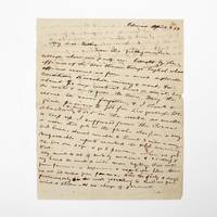
1854369733Palmas Panama 1854. 2pp. single 4to sheet. With: Carte-de-visite photograph of Mayo signed and inscribed to his sister on verso. Folds minor separations. 2pp. single 4to sheet. With: Carte-de-visite photograph of Mayo signed and inscribed to his sister on verso. Seeking a low-level train or canal route to bridge the Atlantic and Pacific Oceans in late 1853 President Franklin Pierce ordered a U.S. Naval exploring expedition to participate in an international attempt affiliated with a venture by the Atlantic and Pacific Junction Company. Although ships from Great Britain New Grenada and the United States were involved the principle overland portion of the expedition through 40 miles of dense jungle would be led by Lieutenant Isaac G. Strain who had previously led exploring expeditions in Brazil Baja California and Chile. With a party of 27 officers and men and including the author of the present letter they entered the jungle on January 20 1854.<br /> <br /> Problems began almost immediately. While puting ashore a boat was swamped and a portion of the party's provisions lost. Next the route Strain had been tasked with following contained no gap in the cordillera as had been previously believed. Led through the jungle by several groups of indigenous people the promise of a few days hike turned into months of wandering in the jungle before being abandoned by the guides. Subsisting on plantains and bananas and drinking river water Stain divided his men with an advance party striking out to seek rescue. On March 9 forty-nine days after starting from Caledonia Bay Strain and his advance party reached Yavisa; it would be another nearly three weeks before the main body was rescued but not before at least five had died of starvation or disease. Sometimes compared with the trials of the crew of the Essex or the members of the Donner Party the men on the Darien expedition endured extreme harship and resorted to unspeakable things. <br /> <br /> This remarkable letter was written by one of the expedition's survivors shortly after his rescue and return to civilization. George Upshur Mayo 1834-1896 was born into a prominent family in Norfolk VA. He attended the Virginia Military Institute served as an assistant engineer on the Strain Expedition was involved in the United States Geodetic Survey and was later a major in the Confederate Army. Here he writes:<br /> <br /> "My dear father From this filthy native village where our party are brought by the officers of the war steamer Virago English whose officers rescued us from a most deplorable condition starvation misery & want for about 70 days without bread or meat living on roots & nuts from the trees. May the rescue be never forgotten & I thank & give praises to God for his goodness. We abandoned & buried 4 or 5 in the woods as unable to keep up. I suffered from the cusano a worm that gets in the flesh also from a very bad knee. Almost unable to travel 3 miles a day. Unfavorable reports reached the U.S. concerning us. We are safe & go to Panama when we get well. My mind is out of sorts by medicine & sickness & my hand too weak to write more legibly. Will write from Panama or Aspinwall a respectable letter there. We are 100 miles from Panama. Had the party 8 days provisions only in the woods yet nothing to shield us from wind & storm & no change of garments. The suffering was intense & the rescue came at the most dreadful & important for our safety. I with 3 others on the river bank washing at sundown when the canoes came in sight. Captain Strain had no pants or underdraws to protect him from the briars & vermin. God be praised for rescue. Love to Annie. . . . In all probability will meet the Cyane at Aspinwall."<br /> <br /> A remarkable first-hand account of a desperate struggle for survival. unknown
a26142Cambridge 1935.Volume 1 General Ethnography. Hardcover. 4to. 421pp. 11 full page photo plates on glossy stock brown buckram cloth. FINE. clean bright; no owner marks no DJ. no ownership marks. Volume 1 only. . hardcover
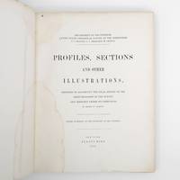
1872373132New York: Jules Bien 1872. First edition. Limited to 100 copies. 65 lithographed plates many folding preceded by 4pp. text. 4to. Original green cloth boards upper cover lettered in gilt rebacked endpapers renewed. Dampstaining. First edition. Limited to 100 copies. 65 lithographed plates many folding preceded by 4pp. text. 4to. This book was prepared to illustrate the work of the Hayden survey. It contains numerous panoramic illustrations many on folding sheets depicting sites in Wyoming Utah Colorado and Montana. This report contains the bulk of Henry Wood Elliott's art work for the Hayden Survey see preceding entry most of which was published nowhere else. These images are important because of their scientific contribution to several fields historical significance documentation of the Hayden expedition and their beauty and attention to detail. Elliott's illustrations were among the early images of many locations in the new territories of the West.<br /> <br /> From an edition of 100 copies issued in advance of the text. The Prefatory Note states p. 3: "A small edition of one hundred copies of the Profiles and Sections are issued in advance of the text for the purpose of placing them in the hands of the principal geologists in this country and in Europe. The first issue of two thousand copies in colors will be published with descriptions in about one year." We find no evidence that a subsequent edition in color was ever printed and it is stated of the present work in the Checklist of United States Public Documents 1789-1909 Washington: Government Printing Office 1909: "Originally intended to illustrate v. 4 of quarto series of reports but never thus used." <br /> <br /> The Hayden Survey was the most important of the four major government surveys of the American West undertaken after the Civil War the others being Powell King and Wheeler. Collectively these surveys filled in the map of the United States using accurate scientific methods to chart the land and investigate not only its geology but natural resources wildlife and plants as well. Schmeckebier Catalogue and Index of the Publications of the Hayden King Powell and Wheeler Surveys p. 32 #3 Jules Bien unknown
188473300Washington: Government Printing Office 1884. First edition. Octavo. 75 1 pp. plus folding map of the Lena Delta in Russia and four full page heliotypes. Original blue printed wrappers. Small piece missing from outer edge of front wrapper three small and excellent paper repairs to wrappers. A very good and very clean copy in the original wrappers.The heliotypes in this publication are particularly interesting as they show Russian soldiers guarding the graves of the Jeannette crew. The final photograph shows all the coffins loaded into a Russian train."In February 1882 Secretary Thompson had despatched naval lieutenants Giles Harber and William Schuetze to the delta to search for any traces of the lost explorers particularly of Chipp's party. They were unsuccessful but in November received orders from the secretary to supervise the return of the bodies of De Long and his comrades to the United States. Weather and bureaucracy delayed them for a year; finally in November 1883 the bodies were taken from Yakutsk by train to Moscow Berlin and finally Hamburg. Here they were placed on board the U.S. steamer Frisia which arrived in New York in February 1884. The funeral cortège was escorted by naval and military detachments to the Church of the Holy Trinity on Madison Avenue for a memorial service. Afterwards the bodies of Ambler Collins and Boyd were claimed for private burial; those of De Long and six others were taken to Woodlawn Cemetery in the Bronx and buried together there. In October 1890 a large monument to the expedition's dead was unveiled at the United States Naval Academy in Annapolis. Its design is based on the original cairn and cross raised at the burial site on the Lena Delta." Wiki [Government Printing Office] unknown
198058338Gütersloh, Prisma (Sonderausgabe), 1980. 8 Bll., 365 SS., 1 Bl., 1 gefaltete Karte (beiliegend in Einstecklasche). 8°, Original-Leinen mit Schutzumschlag.
180272327London: A. Arrowsmith 1802. A fine and high quality facsimile of this seminal map commissioned in 2001 by renown Lewis & Clark collector Roger Wendlick. Backed on canvas and measuring 150 x 58 inches in color Wendlick commissioned the firm of Ford Graphics of Portland to make this map. Only 21 copies were made and this is the last one with a letter from Wendlick attesting to this fact. Fine. "The 1802 revision of the map of North America on display delineates the complete length of the Missouri River as well as Mackenzie's journey to the Pacific in 1793. The depiction of the Missouri headwaters which Arrowsmith studied from Peter Fidler's drawing of a map by the Blackfoot Indian Ac Ko Mo Ki shows several streams joining into two branches of the Missouri which flow almost due east. The southern branch of the Missouri appears to be the main branch of the river and connects to the Knife River; the northern branch is a good representation of the actual course of the Missouri.Although the revised map still shows a single ridge of mountains in the west a note near the southern sources of the Missouri states: "Hereabout the Mountains divide into several low Ridges." This note which was based on the reports of Fidler Mackenzie and Thompson was more encouraging to Jefferson and Lewis than the note about the Stony Mountains on the 1795 map which unfortunately turned out to be more accurate. Arrowsmith's map situates the Great Lake River on the western slopes of the mountain range and connects this river to the Columbia River with a dotted line. Since another note claims that this river can be descended to the sea in eight days the Arrowsmith map supported the erroneous belief in a convenient route to the Pacific Ocean.Both the 1795 and 1802 versions of Arrowsmith's map served as resources that Nicholas King consulted as he prepared his map for the Lewis and Clark Expedition. Lewis and Clark in fact carried the 1802 Arrowsmith map along on the expedition. Thomas Jefferson owned the 1802 map as well as an 1802 edition of Arrowsmith's map of the United States. Arrowsmith's 1802 map of North America was the most comprehensive map of the West available to Jefferson and Lewis and it was probably the most important map used in the planning of the expedition." University of VirginiaAaron Arrowsmith's 1802 map was the most current and accurate cartographic representation of the American West available to Lewis on the eve of the journey. Lewis studied this edition closely during the summer of 1803 and even carried a copy on the first leg of the expedition. Among Arrowsmith's sources were Indian maps reports and manuscript maps from the British fur trade and British Navy exploration reports and charts of the Pacific Coast. But various elements in the map reinforced Jefferson's misconceptions of western geography among these were depictions of the Rocky Mountains as a single long chain and the headwaters of the upper Missouri River at the eastern edge of the Rockies suggesting those mountains were readily portaged. A. Arrowsmith unknown