502 résultats
2009DADAX1418175714University of Michigan Library 2009-04-28. hardcover. New. 6.00x0.44x9.00. Buy with confidence. Excellent Customer Service & Return policy. University of Michigan Library hardcover
1418175714.Ghardcover. Good. Access codes and supplements are not guaranteed with used items. May be an ex-library book. hardcover
DG-52-1Fine. Signed by both Authors inscribed and personalized. Like New Book and Dust jacket in Mylar. unknown

1330370015.Gpaperback. Good. Access codes and supplements are not guaranteed with used items. May be an ex-library book. paperback
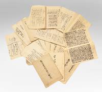
7712Several dozen manuscripts in various formats incl. long folded sheets stitched pamphlets sewn volumes and letters. Japan: ca. 1853-63.<br/> <br/> A substantial group of documents revealing internal high-level debates and discussions in response to Commodore Perry’s landings and later controversies that arose as Western powers established a foothold in Japan. This is an exceptional collection filled with top-secret information on government intrigues as the Japanese state responded to aggressive foreign expansion and dissenting groups within the government urging top-to-bottom reforms.<br/> <br/> The manuscripts touch upon pivotal events in Japan’s history:<br/> <br/> –Commodore Perry’s two expeditions July 1853 & February-March 1854 and the resulting ratification of the Treaty of Shimoda.<br/> <br/> –Japanese translations of the treaties signed with the United States Russia France and the United Kingdom from 1854 to 1858.<br/> <br/> –The assassination of Ii Naosuke in March 1860 also known as the Sakuradamon Incident which precipitated a violent backlash against foreigners under the banner of Sonno joi “Honor the Emperor expel the barbariansâ€.<br/> <br/> –General dissatisfaction with the bakufu and efforts to reform it.<br/> <br/> –The attempted assassination of Ando Nobumasa a chief councillor during this period.<br/> <br/> –The Namamugi Incident in September 1862 when the British merchant Charles L. Richardson was killed by Satsuma domain warriors.<br/> <br/> –The bombardment of Kagoshima August 1863.<br/> <br/> Among all these materials we must highlight several examples of manuscript kengen proposals and commentaries written by aristocrats with policy advice on the difficult situations faced by the Japanese state. These offer compelling perspectives on the most pressing dilemmas of the day. While they were not composed by the decision-makers these documents are filled with the minutiae and data employed in the policy-making process.<br/> <br/> All of the items are in a fine state of preservation.<br/> <br/> â§ John McMaster “Alcock and Harris. Foreign Diplomacy in Bakumatsu Japan†Monumenta Nipponica Vol. 22 No. 3/4 1967 pp. 305-367. unknown
185970480Harper 1859. Hardcover. Fair. 5 x 7 inches. 340 pp. Illustrated. Folded map at rear. Ex-library book rebound in older buckram cloth spine label stickers on rear cover. Few normal reference non-circulating library markings else interior good text block secure. Title page little soiled scattered light margin foxing. Map has few stains one inch tear to left margin. Ships in box. Professional bookseller for 20 years. Orders shipped daily in cardboard bookfolds. Harper hardcover
8522Copenhagen: Munksgaard 1967-69 London: Curzon Press 1988. First edition. Some light wear to the paper-covered boards of volumes I-III volume IV as new; a bright and clean set in very good condition. Pp. vol. I: pp. 129 33 black-and-white photo-plates; vol. 2: pp. 164 140 full page plates black-and-white photos and line-drawings 2 plates are double foldouts of the excavation in progress 4 maps or excavation plan views in pocket at rear; vol. III: pp. 53 24 black-and-white photo-plates of human skeletal remains; vol. IV: pp. xii 150 6 38 photo-plates of cave interior and kettle-drums numerous text-figures. vols. I-III: one-quarter green cloth lettered in white on the spine over orange and white pictorial boards lettered in white and black vol. IV: white pictorial boards lettered in black 4to all volume hardback. The contents of each volume are: Volume I: Sai-Yok Stone-Age Settlements in the Kanchanaburi province; Volume II: Ban-Kao Neolithic Settlements with Cemeteries in the Kanchanaburi province Part 1 - Archaeological Materials from the Burials; Volume III: Ban-Kao Neolithic Settlements with Cemeteries in the Kanchanaburi province Part 2 - The Prehistoric Thai skeletons and Volume IV: Surface Finds and Minor Excavations. Archaeological Excavations in Thailand is a voluminous record of the finds of the Thai-Danish Prehistoric Expedition 1960-1962. The first three volumes were published in Copenhagen in 1967-1969. The fourth volume appeared as Occasional Paper no. 1 of the Scandinavian Institute of Asian Studies in 1988. No ownership marks and few signs of use. Copenhagen: Munksgaard, 1967-69 + London: Curzon Press, 1988. First edition. hardcover
196744603Copenhagen 1967-69. 4to. Orig. hcloth. 12918453 pp. tables and more that 200 plates. some folding. Clean and fine. hardcover
1808E0058<p>ix366 pages. Small octavo 7 1/4" x 4 1/4" in the original leather binding with black label in gilt to spine. Howes:354 First printed in 1806 in London in three volumes. Second printing.<br /><br />Thomas Ashe 1770-1835 was born in Dublin Ireland and was a soldier and memoirist. Much of his life was checkered with intrigue and fraud. His Memoirs and Confessions 1815 is an autobiographical account of 'criminal and delinquent' escapades beginning with the seduction of a girl in France. In America he edited the National Intelligencer and was arrested when attempting to steal treasures from churches in Latin America. His Travels in America first appeared in 1806. The narrative chronicles Ashe's travels by flatboat down the Ohio and Mississippi Rivers in 1806 and is one of the first travelogues written by a foreigner to comment specifically on the American inhabitants of the region. A unrestrained hatred of Americans can be found throughout the work. While the account is interesting and highly readable it was to create quite a stir and added to the wave of anti-British sentiment that would ultimately lead to the War of 1812.</p> Printed Newburyport [Mass.] Reprinted for W. Sawyer and Co. by E.M. Blunt hardcover
2010Q-1568527551Konecky & Konecky 2010-07-22. Hardcover. New. In shrink wrap. Looks like an interesting title! Konecky & Konecky hardcover
1938TRAF00004New York: The Macmillan Company 1938 WYSIWYG pricing--no added shipping charge for standard shipping within USA. Full red cloth reverse foil titles on spine xi 265 pp 4 maps 20 ff b & w photo plates. Half of plate 17 missing large chip to margin of pp 135-6 tears to margins of plate 16 pp 127-8 otherwise very good cloth sunned on spine & near top & fore-edges partially removed bookplate on fpd. Memoir of the author's fourteen years in Africa during which time he farmed land awarded to war veterans in British East Africa later Kenya climbed mountains Kenya Mountain Ruwenzori and Kilimanjaro prospected for gold and finally began his return to England by bicycling most of the way across the continent from Uganda to Cameroon. In the same year this book was published Tilman led an attempt to climb Mt. Everest having previously taken part in a 1935 reconaissance expedition. Bad weather forced the abandonment of the 1938 attempt. 95 pages and 16 of the 20 plates are devoted to mountaineering. Shipping weight 2 lbs. First US Edition. . Fair/No dj. 22 X 15 cm. The Macmillan Company Hardcover
1959075934Los Angeles: Westernlore Press 1959. 1st printing. Inscribed by Timberman on second front flyleaf. A square clean copy in full cloth binding. Map endpapers. 163pp. Photos. Unclipped 4.95 dust jacket is lightly rubbed with some chipping at spine ends. In a protective mylar cover. Inscribed and Signed By Author. First Edition. Hardcover. Very Good/Very Good. 8vo - 8" - 9" Tall. Westernlore Press Hardcover
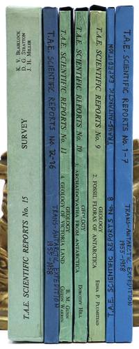
1960144913London: The Trans-Antarctic Expedition Committee 1960-1. Large quarto. 14 volumes. Original printed wrappers string-bound. Edges of wrappers slightly sunned. Fifteenth part comprises 15 folding maps and the written report housed in a slipcase. Front board of slipcase bowed-in with a few creases to the spine. All volumes complete tightly-bound and clean internally. Most parts in modern blue card slip cases. A beautiful set. Spence 1213. The complete scientific reports from the Commonwealth Trans-Antarctic Expedition 1955-1958 lead by Dr. Vivian Fuchs who was knighted for his efforts and Sir Edmund Hillary. The TAE was the first complete overland crossing of Antarctica and the third expedition ever to reach the South Pole overland after Amundsen in 1911 and Scott in 1912. The expedition conducted a variety of oceanographic glacial geological meteorological and biological sampling the results of which are presented here and illustrated by hundreds of figures from photographs folding maps and tables. Although the reports were issued in 15 parts #6 was never printed. Uncommon to find this set complete and in fine condition. 1960 The Trans-Antarctic Expedition Committee unknown
196016525Moscow: Editions en langues etrangeres. Very Good in Very Good- dust jacket. c.1960. Hardcover. Dust jacket shows edgewear chipping and short tears water damage across top edge. White cloth covered boards with silver and black design show water damage to front board; A tight solid book dust jacket in Mylar jacket protector. Fold out map showing the areas of influence of the various countries and the extent of progress of the Russian expedition during the 1956-1958 period. Many B&W photos show life on the expedition and the equipment they used. Text in French; B&W Photographs; Small 8vo 7½" - 8" tall; 270 pages; Trechnikov/Treshnikov/Tryoshnikov was a Russian geographer and oceanologist who lived 1914-1991 and published many articles and books on conditions at both the Arctic and Antarctic. He was so highly regarded that he had a star and an icebreaker named for him. During the International Geophysical Year in 1957-1958 the Soviet Union established its presence in the Antarctic starting a series of Soviet Antarctic Expeditions. The first expeditions led by Mikhail Somov Aleksei Treshnikov and Yevgeny Tolstikov made multiple discoveries in the inner areas of Antarctica and reached the Southern Pole of inaccessibility and the Southern Pole of Cold. At the latter location on the site of the Vostok Station the subglacial Lake Vostok one of the last major geographical discoveries on Earth was detected deep below the Antarctic ice shield. This book is an account of that expedition with observations about ice conditions weather and wildlife seals & the different varieties of penguins. . Editions en langues etrangeres hardcover
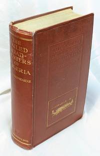
191232967London : Seeley Servive & Co 1912 . Second Edition . Very Good . 8VO . The second edition published in the same year as the first and identical to it with the addition of a new Preface. With 38 black and white photos and a small folding map of Nigeria at rear. A little bit of shelfwear and wear to the corners and light wear to the spine tips some very mild foxing on some of the early pages. A bright solid and very attractive copy bound in the original blind and gilt stamped terra cotta cloth. A handsome book. Seeley, Servive & Co hardcover
2005067089Varanasi India: Pilgrims Publishing 2005. Large book: NO international orders. Clean square and unmarked. xxviii 473pp. Very nice jacket offered in a new mylar cover. Hardcover. Very Good/Very Good. 4to - over 9" - 12" Tall. Pilgrims Publishing Hardcover
0666812748.Ghardcover. Good. Access codes and supplements are not guaranteed with used items. May be an ex-library book. hardcover
1332996973.Gpaperback. Good. Access codes and supplements are not guaranteed with used items. May be an ex-library book. paperback
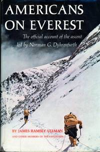
1964007892Philadelphia PA: J.B. Lippincott 1964. First Edition First Thus . Hardcover. Fine/Good. Stated First Edition. Text/BRAND NEW & Bright. Embossed blue linen boards/NF. DJ/Good; nips chips to edges & small losses to upper/lower spine & lower corners. Dyed upper text edge; map to endpapers. Record of first American ascent of Mt. Everest 1963. Led by Swiss born explorer film-maker and veteran mountaineer Norman G. Dyhrenfurth whose father led international expeditions to Kangechejunga and Batoro in the 1930s. Sponsored by Nat'l Geographic Society the expedition was scientific research in nature; the team was the most academically brilliant . 5 members with doctorates and 8 holding masters degrees. May 22nd 1963. Luther G/ Jerstad and Barry Bishop reach the summit of the South East Ridge via South Col route while Will Usoeld and Tom Hornbein of the West Ridge team conquered the West Ridge/Northface; the two teams rendevous and descend together. July 8th the Expedition was received at the White House by President Kennedy and awarded the Nat'l Georgraphic Society's Hubbard Metal. An exciting chronicle by celebrated author on the subject of mountaineering and official historian for the expedition James Ramsy Ullman 1907 - 1971 who was distinguished by being the oldest member of the team at the age of fifty-five. Illustrated with b/w photographs. <br/> <br/> J.B. Lippincott hardcover
1787E00402 volumes: 576xv pages; 499xv pages. Octavo 8 3/4" x 5 1/2" bound in 3/4 period leather. Translated from the first German edition 1781 which includes a chapter entitled: "Observations and additions to by Johann Gottlob Theaenus Schneider". Translated with additional notes and reviews by Jean Baptiste Lefebvre Villebrune. First Spanish edition published in 1772 Madrid. Sabin 36805 First French edition.<br /><br />Antonio de Ulloa 12 January 1716 – 3 July 1795 was a Spanish general explorer author astronomer colonial administrator and the first Spanish governor of Louisiana. He was born in Seville the son of an economist. Ulloa entered the navy in 1733. In 1735 he was appointed with fellow Spaniard Jorge Juan a member of the French Geodesic Mission a scientific expedition which the French Academy of Sciences was sending to Ecuador to measure a degree of meridian arc at the equator led by Pierre Bouguer. He remained there from 1736 to 1744 during which time the two Spaniards discovered the element platinum. In 1745 having finished their scientific labors Ulloa and Jorge Juan prepared to return to Spain agreeing to travel on different ships in order to minimize the danger of losing the important fruits of their labors. The ship upon which Ulloa was traveling was captured by the British and he was taken as a prisoner to England. In that country through his scientific attainments he gained the friendship of the men of science and was made a Fellow of the Royal Society of London. In a short time through the influence of the president of this society he was released and was able to return to Spain. He published an account of the people and the countries they have met 1748 which was translated into English as A Voyage to South America. He became prominent as a scientist and was appointed to serve on various important scientific commissions. He is to be credited with the establishment of the first museum of natural history the first metallurgical laboratory in Spain and the observatory of Cadiz. In 1758 he returned to South America as governor of Huancavelica in Peru and the general manager of the quicksilver mines there. He held this position until 1764. He arrived on 5 March 1766 in New Orleans to serve as the first Spanish governor of West Louisiana. The French colonists refused to recognize Spanish rule and de Ulloa was expelled from Louisiana by a Creole uprising during the Louisiana Rebellion of 1768. For the remainder of his life he served as a naval officer. In 1779 he became lieutenant-general of the naval forces. As a result of his scientific work in Peru he published Madrid 1784 Relación histórica del viaje á la América Meridional which contains a full accurate and clear description of the greater part of South America geographically and of its inhabitants and natural history. In collaboration with the Jorge Juan mentioned above he also wrote Noticias secretas de América giving valuable information regarding the early religious orders in Spanish America.<br /><br />Condition:<br /><br />Sever worming to spines exterior hinges cracked point chipped library stamps to title pages else a good copy of a scarce item. Chez Buisson hardcover
1828073384London: Longman Rees Orme Brown and Green 1828. "Being Extracts from The Journal of a Detenu Who Continued a Prisoner on Parole in the French Capital From the Year 1803 to 1814. Also Anecdotes of Buonaparte's Journey to Elba." Written by artist Thomas Richard Underwood 1772-1836 and published confidentially at his behest by editor friend John Britton. Full green cloth binding. Title page is loose but present. Patterned endpapers. Small prior bookstore label on front pastedown; prior owner's address stamp on verso of front flyleaf. A small bit of foxing inside some age toning. xix 208pp. plus 4 pages adverts. First Edition. Hardcover. Good/No Dust Jacket. 8vo - 8" - 9" Tall. Longman, Rees, Orme, Brown, and Green Hardcover
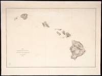
1850423<p><strong>Chart and Capt. Charles Wilkes Calling Card Details</strong>:<br />Lot of 15 black and white independently issued engraved charts on heavy paper bearing a printed oval stamp with Navy anchor and "U.S.Ex.Ex." and "Price thirteen cents" on each chart with occasional period manuscript notation on verso<br />engravers: G.W. Boynton J. Knight George G. Smith 2 and unsigned<br />dimensions: 26 1/2" x 19 1/2" approx. sheet size<br />condition: professionally conserved good condition working charts have manuscript notations</p><p>Capt. Charles Wilkes calling card:<br />as found with manuscript ink inscription<br />dimensions: 3 1/2" x 2 1/8"</p><p><strong>Please see </strong><u><strong>Part II</strong></u><strong>. for a list of the fifteen 15 U.S. Ex.Ex. chart titles and individual chart descriptions.</strong></p><p><strong>I. Brief History and Description of the U.S. Exploring Expedition</strong>:</p><p>Like a Homeric odyssey the United States Exploring Expedition 1838-1842 its six vessels2/ 346 man crew3/ of scientists artists naval officers and other personnel commanded by then U.S. Navy Lieut. Charles Wilkes 1798-1877 set out on a four year journey that touched six continents covered 87 780 miles and set a circuitous course en route to mapping and exploring the islands of the South Pacific and the Pacific Ocean the earth's largest body of water. The outcome of the squadron's journey was yet unknown. The U.S. Ex.Ex. as it came to be known was America's first exploring expedition funded by Congress.4/ Congress recognized that American commercial interests in the lucrative Pacific trade faced both opportunities and perils in this region due to incomplete knowledge especially the lack of surveys and maps to identify and chart a course to the Pacific Ocean islands their safe harbors coastlines inner terrain resources such as fresh water and hazardous coral reefs. Congress also responded to whaling interests in New England who had for a decade been a powerful advocate for Congress to finance improved charting of this dangerous sailing region. Congressional authorization in 1836 for this exploring expedition also spoke to America's identity as a new world power with the skill hunger for knowledge and ambition to demonstrate that America was on a par with older European nations' scientific explorations. 5/</p><p>On offer is a remarkable lot of fifteen U.S. Ex.Ex. navigation charts of the South Pacific islands America's first surveying and charting of the South Pacific. The charts were published after the expedition returned its mission fulfilled. The charts on offer in this lot sold separately to be distinguished from those bound into the two volume <strong><em>Atlas of Charts</em></strong> 1850 1858 from the same plates being the expedition's signal American contribution to the mapping of the Pacific Ocean and South Seas. These full size engraved charts on heavy paper were and are intended to be used for navigation. These charts are not to be confused with the small illustrations bound into the other U.S. Ex.Ex. <em>Volumes I -XXII</em> or even with those illustrating Wilkes' five-volume <em>Narrative</em> or its bound atlas of five larger folded maps on thin paper.</p><p>This rare to market 15-chart lot consists of 13 unique titles and two duplicate titles that are representative of the historic mapping highlights of the U.S.Ex.Ex.: accurate surveys of the volcanic Fiji Group6/; islands newly identified by Western surveys new surveys of safe harbors harbor profiles island profiles7/; an expansive survey of the heavily traveled Sandwich Islands for the chart <em>Map of the Hawaiian Group or Sandwich Islands</em> <em>1841 </em>representing Hawaii's three active volcanoes and volcanic landscape and the features of the other islands in this chain8/; <em>Island of</em> <em>Upolu Samoan Group 1839</em> the controversial chart that triggered the U.S. Ex.Ex. squadron courts martial; and <em>Tawara</em> the 1841 survey chart still unique by WWII and thus used in WWII by the American Navy and Marines to take strategic Tawara and establish an air base for the WWII Pacific air campaign.9/ Please see a more detailed description of each chart below in <u>Part II. Description of Charts</u>.</p><p>These nautical charts are part of a larger context. The U.S. Ex.Ex. squadron collected and prior to its return sent ahead crates of animal and plant specimens and artifacts. In 1842 the squadron arrived home to New York City with even more <em>flora</em> and <em>fauna</em>. This trove with accompanying notes journals art work and other materials by 1858 became the foundation of the Smithsonian Institution. 10/ The U.S. Exploring Expedition true to its mandate and name returned with discoveries in the natural sciences mammals and birds botany mollusks and shells corals ethnography and philology geology hydrography and physics observations on astronomy geography and meteorology. These scientific discoveries complement the survey and mapping mission at the heart of the 1836 Congressional authorization for the exploring expedition.</p><p>Charles Wilkes prepared the squadron specifically for mapping. He traveled to Europe in 1836 to purchase the finest available surveying instruments for the U.S.Ex.Ex. survey and charting mission. As importantly he purchased European books and atlases of the Pacific including Dumon d'Urville's <em>Voyage</em> and <em>Atlas</em> folio of 69 plates Cook's reports of his three voyages Vancouver's <em>Voyage of Discovery</em> and <em>Atlas</em> with 10 plates. 11/ He also purchased existing hydrographic charts. Wilkes drafted a surveying handbook for his naval crew to follow strictly. The U.S.Ex.Ex. surveyed 280 Pacific islands and both discovered and mapped a new continent. At Wilkes' direction ships twice sailed south to the Antarctic and upon survey and observation determined that the Antarctic's icy body was in fact a continent and not just an ice shelf. 12/ Yet the official reception of Charles Wilkes and the squadron was tarnished by court martial trials 13/ recriminations among officers and mixed signals from the public and Capitol Hill.</p><p>A publishing odyssey of the U.S.Ex.Ex. findings ensued from 1844 to 1872 also commanded and championed by Charles Wilkes.14/ Congress established a Library Committee to which Wilkes reported over this twenty-eight year span as he brought to fruition in manuscript twenty-four illustrated reports of both the U.S.Ex.Ex. scientists and the hydrographic work of the squadron's naval officers. Our subject the set of large navigation charts sold separately15/ along with the large bound folio <em>Atlas of Charts Vol.I. and Vol. II</em> of 106 navigational charts fulfilled Congress' 1836 mandate for a "<em>surveying expedition</em>" of the "<em>Pacific ocean and South seas." </em>to supply navigators whalers and trading ships with reliable nautical charts.</p><p>Wilkes himself is the author of several of these reports beginning with Vols. I.-V his illustrated <em>Narrative</em> accompanied by its <em>Atlas </em>of five folded maps one colored. 16/ The entire published body of work became twenty-one published volumes. Congress had authorized an official edition of 100 copies of each volume although that goal was not met due to lack of funding.17/ As Wilkes' scope of work grew Congress met his repeated requests for additional funding with scepticism if not outright hostility. The outbreak of the U.S. Civil War ultimately caused the Congressional Library Committee to suspend its work and afterwards only two thirds of the intended edition of 100 published and distributed. The numbered volumes appear frequently in the trade. The full scale separately sold 1850 issue of nautical charts are rare to market and scarce in collections.18/</p><p>This massive and complex bibliographic output requires an expert guide. The indispensable bibliographic guide to the U.S. Ex.Ex. reports atlases and nautical charts is by Daniel C. Haskell New York Public Library Bibliographer published by the NYPL in 1942 in recognition of the one hundredth anniversary of the squadron's return. 19/ Haskell is cited here as the definitive source on editions issues and related matters except as otherwise noted. Haskell's extraordinary book collates all of the texts atlases legislation correspondence and third party commentary pertaining to the United States Exploring Expedition. He also lists extant holdings. The Smithsonian Institution amplified Haskell's work in 2004 with an equally extraordinary undertaking to digitize the entire U.S. Ex.Ex. bibliography and provide extensive educational materials about the exploration the specimens the U.S. Ex.Ex. brought back now in its and national collections and the knowledge the expedition fostered. 20/The Smithsonian digital library also includes in chart form a summary of Haskell's bibliography. Yet research questions remain regarding the separately sold nautical charts.21/</p><p><u><strong>The U.S. Ex.Ex. Nautical Charts on Offer</strong></u><strong>:</strong><u><strong> Themes and Highlights</strong></u></p><p>Each of the charts in this set on offer belongs to an island group - a chain or archipelago - formed as a result of distinct volcanic activity. This set of fifteen charts is thus a teaching tool both for America's first mapping of the South Pacific islands and to illustrate the correct hypothesis of the U.S.Ex.Ex. "Scientifics" that the South Pacific islands were not "scattered" as often described but rather each belonged to a distinct island chain with surrounding reefs that were produced by geologic forces and shifting tectonic plates below the ocean that gave rise to volcanoes. The ocean floor beneath the oldest volcanoes experienced subsidence or sinking to create what appears on these rare nautical charts as numerous patterns of amoeba- shaped atolls lagoons and islands ringed by coral reefs. The U.S.Ex.Ex. mapped both these island chains and the relationship among the chains of the South Pacific islands documented in the <em>Atlas of Charts</em> Vol.I and sold separately.</p><p>Several graphic features distinguish the charts in this lot as individually sold nautical charts: i each nautical chart includes a <u>printed</u> oval stamp containing within its oval frame the U.S. Navy's insignia anchor and the text "US Ex.Ex." and outside the frame the words "Price 13 Cents"; ii the charts are unnumbered as are the charts in <em>Atlas of Charts</em> Vol. I. 1850 issue and possibly certain of the charts printed prior to <em>Atlas of Charts</em> Vol. II 1858 issue as the <em>Map of the Hawaiian Group </em>navigation chart on offer is unnumbered yet this title is bound into Vol.II of the <em>Atlas of Charts</em>1858 that Haskell notes is numbered; iii none of these charts show any indication of being bound and in fact have pencil notations that are typical of charts used for navigation. In manuscript the name "<em>BGosnold</em>"22/ appears twice on the backs of charts a Massachusetts family name in the maritime region where these charts were purchased and the name of an 1832 whaler out of New Bedford.</p><p>Every aspect of publishing the U.S. Ex.Ex. reports and charts from inception to publication was overseen by Joseph Drayton one of the two artists on the expedition who Wilkes chose because he was familiar with Drayton's range of professional skills and the excellence of his work. The technical and aesthetic standards set by Drayton and Wilkes for U.S. Ex.Ex. publications - text illustrations and nautical charts - de facto became the standards of excellence for America's subsequent illustrated government reports.23/ Drayton selected the printer engravers paper manufacturers and binders. He drew or reviewed and prepared for engraving many of the manuscript maps 24/ and reviewed the engraved plates. Drayton and other U.S. Ex.Ex. officers reviewed printer's proofs of these charts made manuscript corrections and had the copper plates corrected. Hampered in printing the engraved nautical charts by the poor quality of printing paper Drayton continued to seek good paper that would withstand the numerous steps of wetting inking and press without distorting the surveys. 25/Drayton died in 1856 before completion of the mammoth publishing project. 26/ The U.S. Ex.Ex. reports atlases and charts were received with critical acclaim. Within a decade they were distributed by the French and British hydrographic offices in their chart series with survey attribution to Charles Wilkes. These U.S.Ex.Ex. South Pacific charts are of more than historic interest today.</p><p><u>Conclusion</u>:<br />The nautical charts on offer are art American history and science. Then as now these maps are also baseline studies of human settlement patterns in the Pacific islands of Pacific island ecology and records of how the Pacific islands themselves were altered by natural geological forces. These maps deserve further attention today with reference to current altered environmental conditions such as sea water rise shoreline changes damage to these islands by foreign commercial or military uses as well as other circumstances.</p><p>An overarching theme of the U.S.Ex.Ex. <em>Atlas of Charts</em> Vol. I and Vol.II to which these charts on offer belong is American innovation artistry and scientific excellence in naval surveying and map making. A second theme is political: America's presence as a new world power in scientific exploration and discovery. A third and final theme is less tangible yet perhaps the most graspable namely the American quest for knowledge and its preservation by public institutions as a legacy to future generations.</p><p><strong>II. <u>Lot of 15 Charts on Offer: Alphabetical by Island Group</u></strong><u><br />Fiji Archipelago: </u> <strong><em><br />Whippy Harbour South Side of Viti Levu By The U.S.Ex.Ex. 1840.; Suva Harbour South Side of Viti Levu By The U.S.Ex.Ex. 1840.; Granby Harbour South Side of Viti Levu By The U.S.Ex.Ex. 1840.; Ndronga Harbor South Side of Viti Levu</em></strong> <strong>By The U.S. Ex.Ex. 1840</strong>. one sheet four maps of different views of Viti Levu largest island of the Fiji nation<br />26 ½ x 19 ½ inches<br />no engraver's name<br />paper toned edge repair<br />maps show anchorage topography villages areas "bare at low water" and boat passage</p><p><strong><em>Island of Yendua Feejee Group By The U.S.Ex.Ex. 1840; Nucumurry Harbour West End of Vanua Levu By The U.S.Ex.Ex. 1840; Wallea Bay</em></strong> <strong><em>North Side of Vanua Levu</em></strong> <strong>By The U.S. Ex.Ex. 1840</strong>. one sheet three island maps<br />Eng by Sherman & Smith N.Y.<br />26 ½ x 19 ½ inches<br />lower edge damage repaired<br />pencil inscription on rev. "<em>Navigation Islands Feejee."</em><br />volcanic mountainous terrain shown with curved lines observatory location noted harbor bottom soils described reefs outlined</p><p><strong><em>Port Safety Island of Kea East End of Vanua Levu By The U.S.Ex.Ex. 1840.; Fawn Harbour South Side of Vanua Levu By The U.S.Ex.Ex. 1840.; Kombelau Harbour South Side of Vanua Levu By The U.S.Ex.Ex. 1840.; Baino Harbour South Side of Vanua Levu</em></strong> <strong>By The U.S. Ex.Ex. 1940</strong>. one sheet four views<br />Engr. by Sherman & Smith N.Y.<br />26 ¾ x 19 ½ inches<br />repaired tear in left margin edges reinforced paper toned.<br />mountainous topography drawn with concentric lines coral reefs detailed harbor and lagoon soil bottoms identified and numerous harbor soundings in fathoms</p><p><strong><em>Harbour of Muthuata North Side of Vanua Levu By the U.S. Ex.Ex. 1840.</em></strong><strong><em><br />Tibethe & Vicuna Harbour's on the North Side of Vanua Levu</em></strong> <strong>by the U.S. Ex.Ex. 1840</strong>. one sheet two maps two islands of Vanua Levu<br />26 ½ x 19 ½ inches<br />detached paper chip reattached.<br />town of Muthuata and villages identified two rivers shown steep terrain drawn with contour lines rocky atolls drawn extensive triangular patterned depth soundings</p><p><u>Hawaiian Group</u><strong><em><br />Map of Hawaiian Group or Sandwich Islands</em></strong> <strong>By The U.S. Ex.Ex. 1841</strong>.<br />Engr by Sherman & Smith N.Y.<br />Survey of all Sandwich Islands with perimeter and topographic features: Hawaii Maui Kahoolawe Lanai Molokai Oahu Kauai Niihau; three volcanoes on Hawaii-Mauna Kea Mauna Loa Mauna Hualalai other mountains town names labeled no missions or churches.<br />manuscript pencil charting and calculations compass rose on face of map<br />surface abrasion and vertical wrinkles and puckering repaired tear in body of map near Kauai Island repaired tear in lower margin a working map possibly printed on poor paper<br />dimensions: 19 ½ x 27 inches</p><p><u>Kingsmill Group</u>Gilbert Islands<strong><em><br />Taputeouea or Drummond's Island Kingsmill Group</em></strong><strong> By The U.S. Ex.Ex.1841</strong>.<strong><em><br />Peacock's Anchorage at Drummond's Island Kingsmill Group </em></strong><strong>By The U.S. Ex. Ex. 1841</strong>. one sheet two island maps seaman John Anderson disappeared and was presumed killed by villagers on Drummond's island when a small crew went ashore. The crew returned to the <em>Peacock</em> to report and a Naval crew of 87 returned with force and burned the village.<br />Engraved by G.W.Boynton Boston<br />26 ½ x 19 1/2 inches<br />paper toned<br />town of Utiroa labeled location where Flying Fish struck marked with "x"<em><br />Peacock's</em> Anchorage "very foul rocky bottom" and a village noted</p><p><strong><em>Hudsons Island By The U.S.Ex.Ex. 1841 Maraki or Matthews Island Kingsmill Group By The U.S.Ex.Ex. 1841; Maiana or Hall's Island Kingsmill Group By The U.S.Ex.Ex. 1841 Apamama or Hopper's Island Kingsmill Group By The U.S.Ex.Ex. 1841 Kuria and Nanuki Islands Kingsmill Group</em></strong> <strong><em>By The U.S.Ex.Ex. 1841</em></strong>. one sheet five maps six islands<br />Eng. by Sherman & Smith N.Y.<br />26 ½ x 19 ½ inches<br />harbor profile Hudson's I. Maraki I. Apamama I. Maiana harbor profile Kuria with boat landing noted and Nanouki or Henderville Is. Knoll on small island</p><p><strong><em>Hudsons Island </em></strong><strong>By The U.S. Ex.Ex. 1841</strong>.<strong><em>; Maraki or Mathews Island Kingsmill Group </em>By The U.S. Ex.Ex. 1841</strong>.<strong><em>; Maiana or Halls Island Kingsmill Group </em>By The U.S. Ex.Ex. 1841</strong>.<strong><em>; Apamama or Hopper's Island Kingsmill Group </em>By The U.S. Ex.Ex. 1841<em>; Kuria and Nanouki Islands Kingsmill Group</em></strong> <strong>by the U.S. Ex.Ex. 1841</strong>.one sheet five maps six islands<br />Eng. by Sherman & Smith N.Y.<br />26 ½ x 19 ½ inches<br />harbor profile Hudson's I. Maraki I. Apamama I. Maiana harbor profile Kuria with boat landing noted and Nanouki or Henderville Is. Knoll on small island<br />manuscript ink signature:<strong><em> "B. Gosnold" </em></strong>on reverse<br />small loss lower right corner and on bottom edge</p><p><strong><em>Api</em></strong><strong><em>á</em></strong><strong><em> or Charlotte Island Kingsmill Group By The U.S.Ex.Ex. 1841; Tarawa or Knox Island Kingsmill Group</em></strong> <strong>By the U.S. Ex.Ex. 1841</strong> one sheet two islands each with its own map<br />Eng. by Sherman & Smith N.Y.<br />26 ½ x 19 inches<br />Island profile Knox I. and printed note where the <em>Peacock</em> touched. <em>Flying Fish</em> anchorage<br />Apiá chart shows passage through the reef to Lagoon site where <em>Flying Fish</em> struck on low ebb. Note "coral bottom from 2 to 10 fathoms."</p><p><u>Paumotu Group</u><strong><em><br />Metia Island Paumotu Group By The U.S.Ex.Ex. 1841; Taweree or St. Simeon or Resolution Island Paumotu Group By The U.S.Ex.Ex. 1841; Takurea or Wolconsky Island Paumotu Group and Seagull Islands Paumotu Group</em></strong> <strong>By The U.S. Ex.Ex. 1841</strong>. one sheet 4 island maps <br />Engraved by Sherman & Smith N.Y.<br />26 ½ x 19 ½ inches<br />Metia island profile village shown island profile at 6 miles other islands not settled ink notation on back<br />repaired tear to right margin. Reinforced top edge.</p><p><strong><em>Metia Island Paumotu Group </em></strong><strong>By The U.S. Ex.Ex. 1841</strong><strong><em>; Taweree or St. Simeon or Resolution Island Paumotu Group </em></strong><strong>By The U.S. Ex.Ex. 1841</strong><strong><em>; Takurea or Wolconsky Island Paumotu Group </em></strong><strong>By The U.S. Ex.Ex. 1841</strong><strong><em> and Seagull Islands Paumotu Group</em></strong> <strong>by the U.S. Ex.Ex. 1841</strong>. one sheet4 island maps<br />Engraved by Sherman & Smith N.Y.<br />26 ½ x 19 ½ inches<br />Metia island profile village shown island profile at 6 miles other islands not settled<br />paper toned</p><p><strong><em>Kawahe or Vincennes Island Paumotu Group By The U.S.Ex.Ex. 1839; Raraka Island Paumotu Group</em></strong> <strong>by the U.S. Ex. Ex.1839</strong><br />Eng by Sherman & Smith N.Y.<br />20 x 27 inches<br />bottom edge repair<br />entrance to Lagoon on Kawahe island profile Raraka Island 5 miles distant. Village noted. Entrance to Lagoon on Raraka.<br />ink notation on reverse</p><p><u>Samoan Group</u><strong><em><br />Island of Upolu Samoan Group</em></strong> <strong>by the U.S. Ex. Ex. 1839.</strong><br />Engraved by J. Knight Philadelphia<br />27 x 19 ¼ inches<br />Mapping of mountains and volcanoes. Bird's eye-like view of palm groves mountains and terrain. Island profile with detailed labeling of features and town viewed at 10 miles. "Good Boat harbour" noted. Entire perimeter of island labeled with "boat openings"<u>.</u></p><p><u>Tuamotu Archipelago</u><strong><em><br />King Georges Group</em></strong> <strong>By the U.S. Ex. Ex. 1839</strong> and<br /><strong><em>Aratica or Carlshoff Island</em></strong> <strong>by the U.S. Ex.Ex. 1839</strong> <br />Engraved by Sherman & Smith N.Y.<br />26 ½ x 19 ½ inches one sheet 2 maps two islands<br />harbor profile at 4 miles of Aratica Island location labeled "fresh water" entrance "deep water" on Tiokea I.</p><p><strong><em>Ahii and Manhii or Peacock and Wilsons Islands</em></strong> <strong>By The U.S. Ex. Ex. 1839</strong><br />Engraved by Sherman & Smith N.Y.<br />26 ½" x 19 ½" one sheet two maps<br />harbor profile of each island 3 miles distant. entrance for small vessels labeled on Ahii entrance for vessels labeled on Manhii.<br />paper curls on map surface flattened and reattached to underlayer lighter than background after conservation</p><p><u>Notes</u>:<br />1. The Act of Congress limited the edition size of each volume in the U.S.Ex.Ex. reports to 100. Fewer than 100 copies of some volumes were printed. For the official issue of <em>Hydrography</em> <em>Atlas of Charts</em> <em>Vol.I</em>. Haskell states that for the 1850 issue of Vol.I 100 copies were printed consisting of 55 unnumbered charts of which 30 copies were destroyed by fire.<strong><em> Haskell notes that in this issue charts were also sold individually. </em></strong>An 1858 issue of Vol. I was printed in thirty copies to replace the burned copies. These charts were numbered and the Vol. I table of contents reset. For Vol.II Haskell states that 100 copies were printed and all charts were numbered. A table of contents lists the chart titles in each issue of each volume.<br />2. The squadron consisted of the <em>Vincennes</em> <em>Peacock</em> <em>Porpoise</em> storeship <em>Relief</em> <em>Sea</em> <em>Gull</em> and <em>Flying Fish</em>. The <em>Sea Gull</em> was lost at sea in 1839 near the Cape of Good Hope and all crew members died. In 1839 the slow <em>Relief</em> was sent home.<br />3. The crews of the six vessels were recorded by Midshipman William Reynolds cited in Stanton p.279-280. His accounts included the initial crew of 346 diminished renewed with accounts for those discharged those who deserted or died with a cumulative record of 524 men who had participated and recorded that 181 original crew returned to New York. Depending on the source authors thus quote the crew size variously.<br />4. Act of Congress dated May 14 1836 appropriating $150000 to send out a surveying and exploring expedition to the "<em>Pacific ocean and South seas."</em> including "<em>other means in the control of the Navy Department not exceeding $150000.".</em> The full scope of the expedition included the South Pacific the American Northwest Oregon and the mouth of the Columbia River San Francisco areas in South America Antarctica Australia New Zealand Singapore and other islands near China.<br />5. The August 26 1842 Act provided authority and funding for publishing the reports of the expedition's discoveries under the Joint Committee on the Library. The Act specified that the U.S. Ex.Ex. reports would be illustrated and modeled on the French government's 1829 publication of the <em>Astrolabe</em> expedition to the Pacific.Congress published a notice in the <em>National Intelligencer</em> March 23 1844 requesting proposals and selected C.onger Sherman of Philadelphia the low bidder as printer.<br />6. The U.S.Ex.Ex. Fiji charts were a source of pride and scientific accomplishment.<em> Magnificent Voyagers</em> p. 178 notes that Wilkes exhibited them - possibly in manuscript.<br />7. Stanton states at p. 245 that at the conclusion of surveying Tawara and the other small Pacific islands the U.S.Ex.Ex. surveys had corrected the positions of ten islands on existing charts and had completed their work "<em>with sufficient accuracy to answer all the purposes of Navigation</em>."<br />8. See below <em>Ulukau. Hawaiian Electronic Library</em>.<br />9. Tawara was the site of a WWII battle with thousands of casualties. The island was deemed strategic by the U.S. Command for establishing the first air base in the Gilbert chain to support American forces in the Pacific campaign against Japan. The next Gilbert island airfield was on Apamama another U.S.Ex.Ex. chart on offer.<br />10. For a staggering description of the whole see the Smithsonian Libraries digital Collection article <em>From the Ends of the Earth The United States Exploring Expedition Collections</em>. www.sil.si.edu/DigitalCollections/usexex/learn/Walsh-01.htm.<br />11. <em>Magnificent Voyagers</em> p. 167.<br />12. Wilkes' report of the 1839-1840 discovery of a new continent Antarctica was not universally accepted when announced notwithstanding that the discovery was documented with surveys reports and a nautical chart.<br />13. The court martial arose over allegations that one survey of Upolu Island in the Samoan Island group was erroneous. The island was surveyed twice early and late in the expedition by two different U.S.Ex.Ex. naval officers with an 8 mile discrepancy between their two surveys. The <em>Island of Upolu</em> chart is on offer.<br />14. Congressional funding acts expressly pertaining to printing charts texts and plates ensued in 1843 1844 1845 1847 1848 1850 twice 1854 1856 1859 1861 1862 1866 1872 twice. The June 1844 act states: "<em>For the publication under the direction of the Secr. of the Navy and of the Secretary of the Treasury of such maps of the ex.ex as in their judgment will be serviceable to the navy and the commerce of the country. $2000." </em>The March 3 1845 act includes the language<em> "For completing the publication of the work on the Ex.Ex. including the printing of an extra number of charts." </em>The language of the Congressional Acts on several occasions also specifically provides funding to replace charts lost in fires either at the publisher bindery or in government hands.<br />15. The separately sold charts on heavy paper to be used for navigation bearing a printed price stamp are from the plates used for the <em>Atlas of Charts</em> Vol. I. 1850 and Vol. II 1858 to accompany <em>Vol. XXIII Hydrography</em> 1861 by Charles Wilkes distributed separately in 1873.</p><p>Haskell cites correspondence dated 1844 from Wilkes to the Library Committee and Tappan that the <em>Atlas of Charts</em> was ready for inspection. However the <em>Atlas of Charts</em> was not printed until 1850. The separately sold charts sale dates are treated variously in the literature reviewed. Haskell seems to date first sale to 1850. Viola cites a 1845 report by Wilkes that the copper plates for large charts were 1/3 finished and elsewhere states certain charts were published as early as that year.<br />16. Wilkes' five volume <em>Narrative </em> 1844 official edition was accompanied by an atlas that contained five folded charts measuring 13.4 x 9.65 inches 34 x 24.5 cm: U.S. Ex.Ex. <em>track Chart of the World</em> <em>Chart of the Antarctic Continent</em> <em>Chart of the Viti Group or Feejee Islands</em> <em>Map of the Oregon Territory </em>and <em>Map of part of the island of Hawaii Sandwich Islands</em> <em>shewing craters and eruption of May and June 1840</em>. These charts are on thin paper and bound in. The <em>Narrative</em> was published in an official issue distributed in 1845 and other unofficial issues. These folded bound atlas maps on thin paper are not to be confused with the separately sold large navigation charts on heavy paper from the plates of the <em>Atlas of Charts</em> Vol.I 1850and Vol.II.1858 to accompany Vol.XXIII <em>Hydrography 1861.</em><br />17. Congress specified in 1845 that 100 copies of each volume produced for the U.S.Ex.Ex. be distributed according to an official distribution list - to each American state and territory and to foreign governments. France Great Britain and Russia each were to receive two sets. Other countries were also named. The Naval Lyceum and the three commanders of the principal ships Wilkes Hudson and Ringgold each were allocated one set. Unallocated sets were reserved for future distribution.</p><p>In 1845 when the extent of the U.S.Ex.Ex. materials was not yet known Wilkes and others estimated a set of fifteen volumes. To account for the growth in the number of volumes as the scope of the U.S.Ex.Ex. collections became apparent and to replace plates pages and books lost to fire Congressional appropriations were sought and with great effort obtained almost annually until 1872. Ultimately twenty-four manuscript volumes were put forward by Wilkes not all of which were funded and only two-thirds of that set printed sometimes in fewer than 100 copies. The volumes were not published sequentially.<br />18. Few separately sold charts come to market. A complete set of such separately issued charts has not been located during this stage of research. See the New Bedford Whaling Museum collection. Harvard University. Rumsey. More typical are assembled or original whole editions of the bound <em>Atlas of Charts</em> Vol.I and Vol.II.<br />19. Daniel C. Haskell <strong>The United States Exploring Expedition 1838-1842 and Its Publications</strong> <strong>A Bibliography</strong> New York Public Library New York 1842.</p><p>Haskell's <em>Bibliography</em> documents what was published distinguishing the date of actual publication from the publication date in the text and the official and unofficial issues or editions printed and number of volumes printed. How many charts were sold separately is not stated.</p><p>Haskell identifies the separately published unnumbered nautical charts as associated exclusively with the 1850 issue of <em>Atlas</em> <em>VOL.I.</em> to accompany <em>VOL. XXIII</em> <em>Hydrography</em>. In fact one chart on offer the <em>Map of the</em> <em>Hawaiian Group or Sandwich Islands</em> is unnumbered yet identified in the index of the 1858 <em>Atlas Vol.II</em> that Haskell describes as only containing numbered charts. This small but intriguing fact illustrates that the separately sold charts are hard to classify as to publication date if only with reference to the 1850 and 1858 <em>Hydrography</em> atlases. Haskell dates the printing of the <em>Atlas</em> of large folio charts on correspondence of Drayton to Wilkes in 1850 stating ".<em>Vol.I Atlas is now printed</em>."<br />20. Smithsonian Libraries <strong>The United States Exploring Expedition 1838-1842</strong> digital edition https://www.sil.si.edu/Digital Collections/usexex/learn/Overstreet-0.<br />21. Ehrenberg in <em>Magnificent Voyagers</em> at p. 174 states that navigational charts were printed between 1843 and 1856. When all plates for the U.S.ExEx large scale charts were finished or whether plates were used for printing as they became available or were only used in 1850 and 1858 and whether such plates were revised in the course of their being used is documented variously but not consistently.<br />22. "<em>Gosnold</em>" is a historic Massachusetts family name from the 17th century. <em>Bartholomew Gosnold</em> is the name of a bark built in Falmouth Massachusetts in 1832 and sailed from New Bedford Massachusetts from 1847-1851 and again later. see ShipIndex.org for further details.<br />23. The finely drawn illustrations for the U.S.Ex.Ex. reports by artists Drayton and Agate marry art and accuracy. Their artwork predates photography as the scientific mode of presenting natural science culture and other disciplines of the U.S.Ex.Ex. That Drayton also had control over the production of the art prints was essential to the fineness of the art prints. Wilkes also insisted that the engravers be of the highest level of skill. The books of art prints are also termed "atlases" of the reports.<br />24.The nautical charts were drawn by James Alden William May Frederick D. Stuart Robt. E. Johnson and the artist Joseph Drayton. <em>Magnificent Voyagers</em> p. 167. Wilkes ruled that no surveyor draftman or artist was permitted to put his name on any of the mapping work. Final drawings were prepared by Stuart and Drayton prior to shipping the manuscript maps to the engraver to create the copper plates. These plates were used to pull proofs that were then corrected by Wilkes and Stuart with Drayton making small corrections on the plates and larger corrections made by the plate engraver. In 1866 the charts' copper plates were transferred to the U.S. Navy Hydrography Office and updated as new surveys were performed. Stanton p.365.<br />25. Drayton ultimately sourced quality paper from Milton Massachusetts paper mills located either at Milton Upper or Lower Falls the site of the first paper mill in New England. See Library of Congress and <em>Magnificent Voyagers</em> p.173.<br />26. Drayton's legacy is a body of art and scientific literature about the world that were hitherto unknown and beyond the capacity of a single institution to manage. Drayton's art work guides generations in the ongoing appreciation of the U.S.Ex.Ex.</p><p><strong><u>References</u></strong>:<u><br />Primary</u>:<br />Daniel C. Haskell <strong>The United States Exploring Expedition 1838-1842 and Its Publications</strong> <strong>A Bibliography</strong><br />New York Public Library New York 1842.<br />Smithsonian Digital Library:<em><br />From the Ends of the Earth The United States Exploring Expedition Collections</em>. www.sil.si.edu/DigitalCollections/usexex/learn/Walsh-01.htm.<br />Smithsonian Libraries <strong>The United States Exploring Expedition 1838-1842</strong> digital edition https://www.sil.si.edu/Digital Collections/usexex/learn/Overstreet-0.<br />https://www.sil.si.edu/DigitalCollections/usexex/learn/Overstreet-02.pdf<br />Smithsonian Collections video of specimens collected see https://www.c-span.org/video/300321-1/us-exploring-expedition-1838-42-part-2<br />Stanton William <strong>The Great United States Exploring Expedition of 1838-1842</strong><br />University of California Press Berkeley and London 1975<strong><br />Ulukau</strong> the Hawaiian Electronic Library Early Mapping of Hawaii please see:<br />http://www.ulukau.org/elib/cgi-bin/librarye=d-0map01-000Sec--11haw-50-20-frameset-book--1-010escapewin&a=d&d=D0&toc=0<br />Viola Herman J. and Margolis Carolyn Editors<strong> Magnificent Voyagers The U.S. Exploring Expedition 1838-1842</strong> Smithsonian Institution Press Washington D.C. 1985</p><p><u>Other References</u>:<br />D.Graham Burnett "<em>Chapter 5 Hydrographic Discipline Among the Navigators Charting an Empire of Commerce and Science in the Nineteenth Century Pacific</em>" from James R. Akerman Editor <strong>Cartography and the Mastery of Empire The Imperial Map</strong> The University of Chicago Press Chicago and London 2009<br />Fiji Islands and U.S.Ex.Ex. first contact please see<br />https://scholarspace.manoa.hawaii.edu/bitstream/10125/15538/1/OP31-12-49.pdf</p> By Authority of the U.S. Congress
1331951879.Gpaperback. Good. Access codes and supplements are not guaranteed with used items. May be an ex-library book. paperback
1855rbr1-mar64<p>Scattered light foxing. 556 pages incl. index; 3 fold-out maps 1 large panorama - chromolithiograph; 10 illustrations one of which is in color. Vol. I only</p><p>4 raised bands. gilt lettring on black leather label on spine is VG. 1" portion of Leather missing at top of spine. Leather corners worn and generally edge worn boards. Water staining to side edges of front free endpapers and frontis and title page along with additional water marks of 2 additional fold out maps prior to the beginning of the numbered pages. Not affecting the images of these fold outs. No foxing or internal markings. Front hinge jsut starting to crack. Still a quite good copy in better than average condition.</p><p>Photos on request. Additional shipping charges will apply based on destination and speed.</p> U. S. Government Printing Office, A. O. P. Nicholson, printer hardcover
0332935930.Ghardcover. Good. Access codes and supplements are not guaranteed with used items. May be an ex-library book. hardcover