Greely, Adolphus WBiblio.com
502 résultats
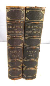
188615246N. Y.: Charles Scribner's Sons 1886. Book. Very Good . Half-Leather. First Edition. About fine but for rubbing and wear to extremities and prev. owner name in vol. 2. Half leather over pebbled boards. Gilt stamped spine with 5 raised bands. All edges gilt. Marbled endpapers. Complete with all illustrations and maps. Internally clean and solid. 428 and 444 pages. Weighs over 3.5 kilos so extra postage will be required. Charles Scribner's Sons Hardcover
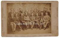
18811002651881. Cabinet photo. fine. Horizontal albumen cabinet photo on white mount 4 7/8" X7 7/8" image:4 1/8" X6 1/8". Nice group portrait of members of the expedition - Standing from left to right: D. Schneider D. Cross D. Linn S. Long S. Frederick D. Henry S. Connell D. Bender D. Salor S. Bierdersack D. Gardner D. Ellis and D. Ralston - Seated from left to right: S. Brainard D. Keslingbury S. Greeley leader D. Lockwood D. Israil D. Jewell and D. Rice. fine Rare. Portrait of members of the U.S. International Polar Year Scientific Expedition to Lady Franklin Bay Ellesmere Island sponsored by the U.S. Signal Service and other government agencies. After two winters and the failure of relief expeditions in 1882 and 83 Greeley abandoned Fort Conger and moved to Cape Sabine as per his orders. Eighteen men would die that winter including one by suicide and one execution - Pvt. Charles B. Henry Seven survivors were rescued by Schley's relief expedition on the June 22 1883 but Elison would perish before they reached St. John's on July 17. 1881 unknown
19432090502124700698Mokuro Bookstore 1943. Soft Cover. Fine. The book is in fine condition. Mokuro Bookstore paperback
1840ZB592269Washington 1840. 34 pp self wrappers very good. - If you are reading this this item is actually physically in our stock and ready for shipment once ordered. We are not bookjackers. Buyer is responsible for any additional duties taxes or fees required by recipient's country. Photos available upon request. Washington unknown
1747BOOKS005853<p>24548 pages with three folding engraved maps present southern part of South America; part of the Pacific Ocean and the track of the Centurion round the world. Octavo 8 1/4" x 5 1/2" bound in full leather with five raised spine bands with red label to spine in gilt lettering with decorative blind-stamped ruled edges. Compiled from papers and other materials of the Right Honourable George Lord Anson and published under his direction by Richard Walter M.A. Chaplain of his Majesty's Ship the Centurion in that expedition. Hill I pp 317-138. Third edition.<br /><br />"This is the official account of Anson's voyage. England at war with Spain in 1739 equipped eight ships under the command of George Anson to harass the Spaniards on the western coast of South America for the purpose of cutting off Spanish supplies of wealth from the Pacific area. Lord Anson who was a friend and patron of Benjamin Robins after returning from the voyage around the world in the Centurion appears to have entrusted to Robins for revision the account of the voyage which had been compiled from the journals by his chaplain Richard Walter. It is probable that Robins revised and edited the work wrote an introduction and added dissertations." Hill. Perhaps the most popular account of maritime adventure of the eighteenth century. Anson's account of harrying the Spanish of South America and the taking of the Manilla galleon with treasure with a contemporary value of $800000 and his circumnavigation has long enjoyed a distinguished place as a masterpiece in descriptive travel.<br /><br /><strong>Condition:</strong><br /><br />Some small closed tears at the edges of the maps. Rebound in tooled leather with raised bands. Over all a very good to fine copy.</p> John and Paul Knapton and Office of the Lord High Admiral hardcover
1385144548.Ghardcover. Good. Access codes and supplements are not guaranteed with used items. May be an ex-library book. hardcover
1385692375.Ghardcover. Good. Access codes and supplements are not guaranteed with used items. May be an ex-library book. hardcover
1717E01353559index pages 36 of 37 maps and copper cuts of the coasts harbor cities plants and other curiosities comprising: 14 plates 3 folding 22 maps charts or plans 14 folding. title page printed in red and black. Printed from the author's original plates inserted in the Paris edition. Lacks the frontispiece map. Royal octavo 9 3/4" x 7 3/4" bound in leather with raised spine bands and red label with gilt lettering. Postscript by Dr Edmund Halley and an account of the settlement commerce and riches of the Jesuits in Paraguay. Palau 94965 Sabin 25926 Nissen ZBI 1433 Hill p117 First English edition.<br /><br />Frézier was educated in Paris and served as lieutenant of infantry from 1702 til 1707 when he entered the engineer corps. In 1712 the government sent him to examine the condition of the Spanish colonies in America. After visiting the principal points in Peru Chili and Brazil he returned to Marseilles. He pointed out several mistakes in the "Relation" of Father Feuille and this led to a bitter controversy between the two travelers. Frézier introduced the large Chili strawberry into France. First published in France in 1714. The first edition into English is preferable to the French original "because it contains Halley's. postscript which corrects certain geographical errors made by Frézier" Hill. "The first part of this book gives an interesting account of the voyage from France around Cape Horn. The second part relates to the voyage along the coasts of Chile and Peru describing the chief towns and cities. Frézier a man of observation brought back information of considerable geographical and scientific value. Much data is included about the native inhabitants.<br /><br />Condition:<br /><br /> Rebacked with original spine label laid down; lacking frontispiece map and binder's leaf free endpapers renewed intermittent foxing else a very nice copy. Jonah Bowyer hardcover
1716BB0841Paris: chez Jean-Geoffroy Nyon quay de Conti au coin de la rue Guenegaud au Nom de Jesus Etienne Ganeau rue Saint Jacques aux Armes de Dombes vis-à-vis la Fontaine de S. Severin Jacque Quillau imprimeur-juré-libraire rue Galande aux Armes de l'Université 1716. First Edition. A defective first edition missing one map and one plate of this classic in the literature of Pacific voyages of exploration. 4to: xiv2982pp with 35 of 37 maps plans and plates 18 of which are folding; ornamental engraved vignettes and woodcut musical notation in the text never bound in were the map of Détroit de le Maire no. v and the plate of Indiens en habits simples no. ix; plate xvi was bound in twice. Contemporary calf spine richly gilt in six compartments brown leather lettering piece gilt "Caissotti" in gilt script on upper board all edges stained red marbled end papers red silk page marker. An exceptional wide-margined copy text maps and plates fresh and clean marred only by a stain in the gutter of first three leaves. Provenance: copper-engraved bookplate "Il Cittadino / Carlo Giac. Caissotti." Sabin 25924. Borba de Moraes 328. Hill p. 115. Leclerc 1736. Palau 94964. Gibson's Library p. 128. Item #BB0841. Frézier set sail in 1712 with a French commission to assess the strength of Spanish settlements on the Pacific coast and to revise existing charts. According to Hill he "brought back information of considerable geographical and scientific value" to later navigators and his account is today appreciated for its keen observations of the customs commerce and natural history—including the cotton and strawberry plants—of Chile Peru and Tierra del Fuego. It's interesting to note that Frezier's surname was itself derived from fraise the French for strawberry. The chapters on Indian and Creole life include descriptions of costume and architecture as well as musical instruments. The folding plans of cities visited are often enhanced by panoramic views as in the case of Callao Concepción Valparaíso La Serena Salvador de Bahía and Angra Azores. Amongst the most important plates are the general map of the expedition the Strait of Lemaire Valdivia Bahía de an Vicente Santiago de Chile Lima and Bahía de Todos los Santos. An immediate success the work was soon translated into English and German and republished several times in the eighteenth century. N. B. With few exceptions always identified we only stock books in exceptional condition with dust jackets carefully preserved in archival removable mylar sleeves. All orders are packaged with care and posted promptly. Satisfaction guaranteed. Fine Editions Ltd is a member of the Independent Online Booksellers Association and we subscribe to its codes of ethics. chez Jean-Geoffroy Nyon, quay de Conti, au coin de la rue Guenegaud, au Nom de Jesus, Etienne Ganeau, rue Saint Jacques, aux Arm unknown
1831E0132<p>2 volumes. xxi472 pages with three maps two folding and one double page figures and 13 plates; iv452 pages with 10 plates some folding tables and appendices. Octavo 9 1/2" x 5 1/2" Bound in contemporary half leather with marbled boards and gilt lettering to spine. Ferguson 1418; Hill I p. 19; Howes B309; Lada-Mocarski 95; Sabin 4347. Second edition published after quarto edition of the same year.<br /><br />Frederick William Beechey 17 February 1796 – 29 November 1856 was an English naval officer and geographer. He was the son of Sir William Beechey RA and was born in London. 1806 he entered the Royal Navy and saw active service during the wars with France and America. In 1818 he served under Lieutenant afterwards Sir John Franklin in David Buchan's Arctic expedition of which at a later period he published a narrative. In the following year he accompanied Lieutenant W. E. Parry in HMS Hecla. In 1821 he took part in the survey of the Mediterranean coast of Africa under the direction of Captain afterwards Admiral William Henry Smyth. He and his brother Henry William Beechey made an overland survey of this coast and published a full account of their work in 1828 under the title of Proceedings of the Expedition to Explore the Northern Coast of Africa from Tripoly Eastward in 1821-1822. In 1825 Beechey was appointed to command the HMS Blossom. His task was to explore the Bering Strait in concert with Franklin and Parry operating from the east. In the summer of 1826 he passed the strait and a barge from his ship reached 71°23'31" N. and 156°21'30" W. near Point Barrow which he named a point only 146 miles west of that reached by Franklin's expedition from the Mackenzie river. The whole voyage lasted more than three years and in the course of it Beechey discovered several islands in the Pacific and an excellent harbor near Cape Prince of Wales. In July 1826 he named the three islands in the Bering Strait. Two were the Diomede Islands that Vitus Bering had named in 1728: "Ratmanoff Island" Big Diomede and "Krusenstern Island" Little Diomede. Beechey called the uninhabited third islet "Fairway Rock" which is still its contemporary name. One of his crew Petty Officer John Bechervaise gave a detailed account of the voyage in his Thirty Six Years if a Seafaring Life by an Old Quartermaster published privately in 1839. In 1831 there appeared his Narrative of a Voyage to the Pacific and Beering's Strait to Co-operate with the Polar Expeditions 1825-1828. In 1835 and the following year Captain Beechey was employed on the coast survey of South America and from 1837 to 1847 carried on the same work along the Irish coasts. He was appointed in 1850 to preside over the Marine Department of the Board of Trade. In 1854 he was made rear-admiral and in the following year was elected president of the Royal Geographical Society. Beechey Island where Sir John Franklin wintered is named after him.<br /><br /><strong>Condition:</strong><br /><br />Name neatly excised from head corner of titles small inconspicuous stamp to last pages. Inner hinges beginning marble to boards rubbed some stains to map. some toning to some plates some plates not bound in order to the printer but are all accounted for corners gently bumped else about a very good set.</p> Henry Colburn and Richard Bentley hardcover
182447632Vol. I has a large partial coloured map as frontis and Vol. II has 3 large folding maps in the rear The record of Franklin's first Arctic expedition fraught with hardship and tragedy constitutes one of the classics in the annals of travel literature. In all the party travelled 5500 miles overland and with the aid of canoes exploring the territory from York Factory to the mouth of the Coppermine River on Coronation Gulf east along the Arctic coast as far as Point Turnagain and back across the Barren Lands. Provisions were poor and scant and on the return journey many crew members died of cold and starvation; the young naval artist Robert Hood was murdered and another executed for the crime. The work also includes accounts by Richardson and Back of the last leg of the desperate journey across the Barren Lands. This edition omits the appendix on the natural history of the region and scientific observations on the aurora borealis and the magnetic needle. Arctic Bib. 5195. Sabin 25625. TPL 1249. Lande 1181-82. Peel 151n. John Murray hardcover
1823040517John Murray. Good with no dust jacket. 1823. First Edition. Hardcover. Hardcover; Hardcover. Brown leather boards with gold design at board edges. Title in gold over black leather label on gold decorated spine. Boards are noticeably scuffed and worn. Frayed edges some sunning. Marbleized edges match marbleized endpapers. Occasional foxing throughout. 4 maps 30 plates of which 11 are hand colored. All are in nice condition some light foxing/soil. Always carefully wrapped and shipped in cardboard boxes to protect your purchase.; B/w Illus; 4TO . John Murray hardcover
200323857Adelaide: The Friends of the State Library of South Australia. Fine. 2003. First thus. Hardcover. 1876154381 . Limited to 400 copies with 99 copies bound in leather and the remaining 301 copies bound in cloth this is a cloth bound copy. An as new copy. Foreword by John Ling and an introduction by Anthony J. Brown. With illustrations / plates foldout chart and a map in pocket at the rear of book. The first published translation into English from the French by Christine Cornell of chapters XXII to XXXIV of Peron's journey as part of the Baudin expedition as zoologist aboard the Geographe. ; 245 x 160mm; xxxviii 278 pages . The Friends of the State Library of South Australia hardcover
1787E0052<p>Two volumes: xv462 pages with two folding maps; xv430 pages with three folding plates. Octavo 8 1/4" x 5 1/4" bound in original full leather with black and red labels to spine lettered in gilt. translated from the French by an English gentleman who resided in America at that period ; with notes by the translator. Translated by G. Grieve Watt and Sabin ascribe the translation to J. Kent. Sabin 12229 First Irish edition.<br /><br />Chastellux was a military officer who served during the War of American Independence as a major general in the French expeditionary forces led by general Comte de Rochambeau. Being on general Rochambeau's staff for the duration of the war Chastellux acted as the principal liaison officer between the French commander in chief and George Washington. However the Chevalier de Chastellux was also widely recognized at the time of his campaigns in America as a highly talented man of letters and a member of the French Academy. After arriving in America in July 1780 Chastellux participated to the American Revolutionary War as Major General in the French expeditionary force led by general Rochambeau. During the following year he was third in command of the French forces engaged at the decisive Siege of Yorktown in 1781 where the British were ultimately defeated. Major General de Chastellux was fluent in English and with his strong ideological support of the American cause he served the alliance well. During the latter part of the campaign he was the principal liaison officer between George Washington and French general Rochambeau. Thereafter Chastellux remained a personal friend of George Washington for life. Furthermore the College of William and Mary and the University of Pennsylvania also awarded Chastellux with honorary degrees. After his return to France Chastellux also remained in contact with Thomas Jefferson now the American representative in Paris whom he had previously visited on his Virginia estate at Monticello.<br /><br /><strong>Condition:</strong><br /><br />Title page clipped at top corner first fold out map repaired map edges repaired hinges repaired previous owner's names on front paste downs and content pages else a good set.</p> Printed for Messrs. Colles, Moncrieffe, White, H. Whitestone, Byrne, Cash, Marchbank, Heery, and Moore hardcover
ria9781020943584_inpHardcover. New. New Book; Fast Shipping from UK; Not signed; Not First Edition; This volume part of a series documenting the findings of the 1893-1896 Norwegian North Polar Expedition focuses on scientific results. Featuring contributions from expedition leader Fridtjof Nansen and other leading scientists the te hardcover
0266173373.Ghardcover. Good. Access codes and supplements are not guaranteed with used items. May be an ex-library book. hardcover
0666425922.Ghardcover. Good. Access codes and supplements are not guaranteed with used items. May be an ex-library book. hardcover
1332448097.Gpaperback. Good. Access codes and supplements are not guaranteed with used items. May be an ex-library book. paperback
1332447988.Gpaperback. Good. Access codes and supplements are not guaranteed with used items. May be an ex-library book. paperback
B9781020943584Hardback. New. hardcover
1982BOOKS0001824 Volumes: xvii182 pages with frontispiece 5 plates some folding and 1 folding map: viii183-370 pages with 8 plates and 5 maps; vii371-553 pages with 9 plates and 5 maps; vii555-831 pages with 9 plates 6 maps appendixes and index. Octavo 8 3/4" x 5 1/2" issued in blue cloth with gilt lettering to spine and gilt sailing ship to front cover. Second Series volumes 152-155 and 139. First edition. Overshadowed for nearly two hundred years in European scholarship by the literary and scientific achievements and reputation of his eldest son George Forster the author of this journal J R Forster Principal naturalist on James Cook's second voyage was nevertheless recognized by many contemporaries as one of the 'universal geniuses' of the late eighteenth century. Despite Forster's diverse prodigious and sometimes brilliant output the constant circumstances of his career and personality were such that his work was dogged by debilitating disputes and vendettas with the result that those many longer more epoch-making and polished works which would have established him as the leading pioneering comparative anthropologist linguist geographer and zoologist of the Pacific and a most competent student in those disciplines of Africa North America and Europe especially Russia have remained only as obscure and seldom-used manuscripts. After Forster's death in 1798 his books and manuscripts - 'there has never been . a private library in Germany to compare with it.' wrote the royal Librarian in Berlin - were sold to the royal Library of the King of Prussia later the Prussian State Library. Among the numerous Forster 'treasurers' deposited in Berlin as his six volume journal in the Resolution. As the journal o a highly literate landsman-at-sea it offers many new typically unrestrained insights into the day-to-day relationships life and thinking and theory-testing on this the most scientific and epic of Cook's three voyages. It is also the fundament upon which George Forster wrote his classic travelogue A Voyage round the World 1777 that humane influence - in many translations - upon science and belles-lettres. It is too the key to the science and anthropology of this voyage the central document to understanding the naturalists' day-to-day work and finds. Set alongside the journals of Cook and his other principals - which it often surpasses intellectually and empirically - anthropologists ethnolinguists geographers geologists botanists zoologists especially ornithologists and medical and literary historians as well as students of James Cook and the eighteenth century mind will find much new observation and theory. For the two Forsters fashioned forces to influence Alexander von Humboldt and foretell Charles Darwin. Condition: Jackets with light edge wear spine ends rubbed else very good to fine in like jacket. Hakluyt Society hardcover
199823860Adelaide: The Friends of the State Library of South Australia. Fine. 1998. Facsimile Edition. Hardcover. 1876154195 . Australiana Facsimile Editions No. 217. With introduction by Valmai Hankel. With 8 illustrations and 4 maps this is an unread as new copy. Limited to 600 copies of which 99 are numbered deluxe issue this is an unnumbered cloth bound edition. ; 225 x 145mm; xiiviii 354 pages . The Friends of the State Library of South Australia hardcover
199624580Perth: Corkwood Press. Fine. 1996. Facsimile of 1887 Edition. Hardcover. A Facsimile Limited Edition of 400 copies the first Seventy Five of which are Bound in Half Leather this being number 367 with 6 full page colour plates at rear and large foldout map to inside of rear cover a fine copy. ; 330 x 215mm; vi 43 6 pages . Corkwood Press hardcover
19381262London: Jonathan Cape. 1938. First Edition. Hardcover. Very Good. Front hinge weakening ; 8vo 8" - 9" tall; 415 pages . Jonathan Cape hardcover
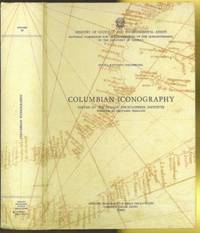
1991CA0239654 pages with plates reproductions illustrations maps bibliographies and indexes. Quarto 12" x 8 1/2" bound in pictorial stiff boards. Translated by Luciano F Farina and Carla Onorato Wysokinski. Edited by Gianni Eugenio Viola. Volume XI of National Commission for the Celebration of the quincentennial of the Discovery of America. First edition.Contents:In Search of an Image by Gaetano Ferro; Landscapes Plants and Animals by Gaetano Ferro; Peoples and Cultures of the New World by Luisa Faldini; Sixteenth Century Cartography and the Origin of the Columbian Tradition by Marcia Milanesi; In Search of an Image: Illustrations by Carla Pampaloni; Other Landscapes Other Plants Other Animals: Text and Illustrations by Carla Pampaloni; People and Cultures of the New World: Illustrations by Luisa Faldini and Laura Monferdini; New World Images from Cartographic Sources: Illustrations by Maria Teresa de Palma.Condition:Light edge wear else a near fine copy. Instituto Poligrafico e Zecca Dello Stato Liberia Dello Stato hardcover