502 résultats
0365833045.Gpaperback. Good. Access codes and supplements are not guaranteed with used items. May be an ex-library book. paperback
189531933København 1895-96. Alle 3 bind i originale bogtrykte omslag ubeskårede og uopskårede. Omslagene lettere falmede og med et par smårifter ellers aldeles frisk eksemplar. 8374;8513;8272 pp. talrige tekstillustrationer 40 plancher heriblandt farvelitograferede plancher kort m.v. <br/><br/><em>First edition of one of the first scientific expedition to Greenland lead by The Greenlandic Commission. It contains the first scientific survey of the huge areas around Scoresby Sound. Meddelelser om Grønland Bind 17-19. </em> unknown
192850893København Reitzel 1928. Royal8vo. With orig. printed frontwrapper. Spine gone. Sewing a bit loose. 6464 pp. 3 maps 2 large and folded 6 plates many photographic illustrations in the text. Small stamp on foot of wrapper and halftitle. Uncut and internally fine and clean. <br/><br/><em>First edition of the report of the famous Second Thule Expedition which brought back importent geographical and geological informations of the fjords especially Independence Fjord. - Meddelelser om Grønland Bd.65. </em> unknown
189912678London: Chatto & Windus 1899. Book. Very Good. Hardcover. New Edition. Very good with wear to extremities foxing to prelims and prize award bookplt. Large colour folding map and 33 illustrations. Chatto & Windus Hardcover
1790029884<p>London: J. Johnson 1790. Volume I: folding map xvi 283 pages; volume 2: viii 408 pages. De Lesseps accompanied La Perouse on the first part of his attempted circumnavigation of the globe. After investigation of the west coast of North America La Perouse sent de Lesseps overland to take the journals and maps of the expedition to Paris. La Perouse and his ships subsequently were lost after they left Australia and the journals carried by de Lesseps assumed great historical significance when published. Even more scarce than those records today are de Lesseps' report of his own overland travels through the Kamtschatka peninsula. The report also includes 25 pages of vocabulary translating common English words into Russian Kamtschadale Koriac Tchouktchi and Lamont languages. Internally clean with only minor foxing the two volumes in 3/4 leather over marbled paper covered boards have recently been sympathetically rebacked original title and volume patches retained. Very attractive example of a quite scarce title. Howes L269 Howes & Hartley rate this item dd "superlatively rare". First English Language Edition. Hardcover. Collectible-Very Good . 8vo - over 7¾" - 9¾" tall. Book.</p> J. Johnson hardcover
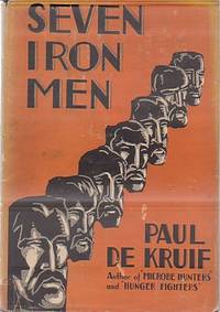
192912469New York: Harcourt Brace. 1929. Hardcover. Very Good in Very Good- dust jacket. Moderate wear and small open tears to price clipped DJ. ; About the Merritt family who prospected for iron. Very nicely INSCRIBED by the author on title page with black fountain pen dated 1931. ; B&W Photographs; 8vo 8" - 9" tall; 241 pages . Harcourt Brace hardcover
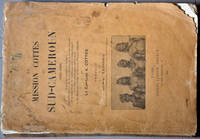
1911biblio31<p>First Edition Paris Ernest Leroux 1911; in-4 XV 254 pp. broché couverture illustrée dos insolé couverture tachée et fatiguée. Numa Broc pp. 92-95. Édition originale illustrée de 34 feuillets de planches et de 4 cartes. Augustin Cottes 1871-1913 officier et explorateur a partagé équitablement ses activités entre les deux pôles de l'Empire colonial français l'Indochine et l'Afrique noire. En 1905-1906 revenu en Afrique après 4 ans passés en Indochine "il prend part aux travaux de délimitation de la frontière entre le Congo français et le Cameroun allemand. Second de la mission Moll il est spécialement chargé du tracé de la frontière sud du territoire allemand. En compagnie du Capitaine Forster qui dirige la délégation allemande Cottes part de Ouesso sur la Sangha et par les vallées du Ngoko de l'Ivindo et du Rio Campo gagne le rivage de l'Atlantique. Au passage de nombreux points astronomiques sont calculés le cours des rivières est précisé sur les cartes les limites théoriques tracées par le Dr Cureau en 1900 sont remplacées par des lits de rivières. Please contact me ramrozzi@yahoo.fr</p><br /> Ernest Leroux paperback
183619113Philadelphia: Carey Lea & Blanchard 1836. Volume II only. Purple cloth heavily sunned along spine and outer margins. Paper label intact on spine though somewhat scuffed. Corners bumped and rubbed. No ownership or any other markings. Scattered foxing throughout. Sound binding. 239pp. The author's 1828 travelogue of Switzerland. First Edition. Hardcover. Good/No Dust Jacket. 8vo - 8" - 9" Tall. Carey, Lea & Blanchard Hardcover
1790E00534 of 6 volumes. Volume 1: i-ix-372 pages with 23 plates including frontispiece plate of Cook and 4 folding maps; Volume II lacking; Volume III: 793-1184 pages with 11 plates including frontispiece of Possession Bay and 5 fold out maps; Volume IV: 1185-1546 pages with 26 plates including frontispiece of Woman Child and Man of Van Diemen's Land and 6 folding maps; Volume V: 1547-1938 pages with 30 plates including frontispiece of A View of Huaheine and 8 folding maps; Volume VI lacking. Octavo 8 1/2" x 5 1/2" bound in original full leather with red labels to spine with gilt lettering. Abridged by George William Anderson. An earlier Large folio edition by Anderson was published earlier. This edition originally issued in 80 weekly parts and also called the Large octavo edition. M K Beddie: 39 First edition of the bound edition.<br /><br />Captain James Cook RN was a British explorer navigator and cartographer ultimately rising to the rank of Captain in the Royal Navy. Cook made detailed maps of Newfoundland prior to making three voyages to the Pacific Ocean during which he achieved the first European contact with the eastern coastline of Australia and the Hawaiian Islands as well as the first recorded circumnavigation of New Zealand. Cook joined the British merchant navy as a teenager and joined the Royal Navy in 1755. He saw action in the Seven Years' War and subsequently surveyed and mapped much of the entrance to the Saint Lawrence River during the siege of Quebec. This helped bring Cook to the attention of the Admiralty and Royal Society. This notice came at a crucial moment both in his personal career and in the direction of British overseas exploration and led to his commission in 1766 as commander of HM Bark Endeavour for the first of three Pacific voyages. Cook charted many areas and recorded several islands and coastlines on European maps for the first time. His achievements can be attributed to a combination of seamanship superior surveying and cartographic skills courage in exploring dangerous locations to confirm the facts for example dipping into the Antarctic Circle repeatedly and exploring around the Great Barrier Reef an ability to lead men in adverse conditions and boldness both with regard to the extent of his explorations and his willingness to exceed the instructions given to him by the Admiralty. Cook was killed in Hawaii in a fight with Hawaiians during his third exploratory voyage in the Pacific in 1779.<br /><br />Condition:<br /><br />Lacks volume II and VI. First signature of volume one loose inner hinges cracked some interior soiling spine ends and corners of leather rubbed some scuffing to leather else a good set. Printed for A Millar, W Law, and R Cater hardcover
1979KOS02900018Kodansha 1979. Soft Cover. Fine. KOS02900018 Kodansha paperback
1333888686.Gpaperback. Good. Access codes and supplements are not guaranteed with used items. May be an ex-library book. paperback
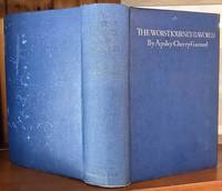
195127877London: The Author and Distributed By Chatto & Windus. 1951. Reprint. Hardcover. Very Good in No Dust Jacket dust jacket. With 9 illustrations and 4 maps spine lettering has faded and rear cover has some flecking otherwise a very good copy. ; 225 x 155mm; lxiv 612 pages . The Author and Distributed By Chatto & Windus, hardcover
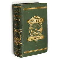
1885014624Toronto: C. Blackett Robinson 1885. 1st Edition. Hardcover. Very Good. First Edition. Beveled boards in original green cloth pictorially stamped in gilt still bright on spine and front cover. Spine rounded. Foot of spine shows light fraying; corner tips pushed and have a little exposure. Inner hinges cracked but holding firm. Half-title leaf is worn and lightly chipped along fore-edge. Two fold-out maps each showing some tears tape and tissue repairs on backside. More than sixty in-text illustrations. pp. xvi 17- 589. Explorations and description of Canada extending to the Arctic Circle primarily told through the experiences of the Canadian Government Expedition to Hudson's Bay and Strait; Otto Klotz's overland Expedition to Hudson's Bay; Dr. Robert Bell's Hudson's Bay Explorations; the Travels and Explorations in the North-West of Dr. Alfred R. C. Selwyn Marcus Smith and many others; and of the Travels and Explorations of the author Charles R. Tuttle particularly the 1884 Expedition of Lieutenant Andrew Robinson Gordon. Includes descriptions of the native peoples encountered wildlife climate and geography. C. Blackett Robinson hardcover
1967008209London: Frank Cass and Co Limited 1967. Facsimile Reprint. Text in French. Facsimile edition in two volumes. Vol. 1: pp. xiv463 4 errata includes foldout maps. Vol. 2: pp. 513 2 errata foldout maps. This book details an extremely important collection of voyages and one of the outstanding works relating to the early history of Australia. It formed the basis for Callander's Terra Australis Cognita Or Voyages to the Terra Australis or Southern Hemisphere during the Sixteenth Seventeenth and Eighteenth Centuries .In 3 Volumes Cass version of which we also have in stock: The work is divided into three principal parts Magellanie Australasie and Polynesie and includes accounts of the voyages of Quiros; Drake Cavendish Pelsart to the West coast of Australia; Tasman to North West Australia and Tasmania ; Dampier to N.W. Australia; Roggeveen the discovery of Easter Island; various early voyages across the Pacific Ocean and to the Solomon Islands New Guinea Pelew Islands etc. It is also of note that in this work Brosses proposed that France should settle Australia etc. with her foundlings beggars and criminals.THANK GOODNESS this did not happen. can you imagine "Bonjour Mate cest a vous. Cass Bilbiotheca Australiana Number 1. A FINE SET LIKE NEW.Please Email for further details or Direct Enquiries Tel : 01822 810108. This book will be POSTED AT OUR STANDARD RATES FULLY INSURED UK ONLY . Please email for further details. NOT Inscribed or Signed. The 1967 Fasimile Edition of the 1756 Ed. Cream Psuedo Buckram . FINE AS NEW/Plastic Jacket AS NEW. Illus. by Not Illustrated. 4to - over 9¾" - 12". HARDBACK. Frank Cass and Co Limited hardcover
25070107Ward Lock UK No Date. Hardcover. Good/Fine. Hardcover. 492 pages. PUBLISHING DETAILS: Ward Lock UK No Date. CONDITION: The book itself is in good condition and comes in fine dust jacket. More specifically: Covers have moderate rubbing/wear. Edges of boards have substantial wear. Dust jacket is in excellent condtion. . Pages are lightly tanned. Heavily foxing on last few pages. Marbled edges faded. ABOUT THIS BOOK: Full title: Journal of Researches into the Natural History and Geology of the Countries Visited During the Voyage of H.M.S. "Beagle" Round the World Quantity Available: 1. Category: Natural History & Resources; Exploration. Inventory No: 25070107. Ward, Lock hardcover
1016132301.Ghardcover. Good. Access codes and supplements are not guaranteed with used items. May be an ex-library book. hardcover
1016137311.Gpaperback. Good. Access codes and supplements are not guaranteed with used items. May be an ex-library book. paperback
1018592792.Ghardcover. Good. Access codes and supplements are not guaranteed with used items. May be an ex-library book. hardcover
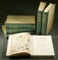
1957E0551<p><strong>From the Spanish discovery to the opening of the Civil War</strong><br /><br />5 volumes in 6. Volume One: The Spanish Entrada to the Louisiana Purchase 1540-1804 xiv264 pages with color frontispiece map and 275 maps many folding and index; Volume Two: From Lewis and Clark to Fremont 1804-1845 xiii281 pages with colored frontispiece map 143 additional maps some folding and index. Volume Three: From the Mexican War to the Boundary Surveys 1846-1854 xiii349 pages with colored frontispiece map 322 additional maps and index; Volume Four: From the Pacific Railroad Surveys to the Onset of the Civil War 1855-1860 xiii260 pages with color frontispiece map an additional 127 maps some folding and index; Volume Five From the Civil War to the Geological Survey Part One: xviii222 pages with color frontispiece map and an additional 152 maps; Volume Five From the Civil War to the Geological Survey Part Two: 223-487 pages with 124 maps and index. Folio 14 1/2" x 10 1/2" bound in quarter green leather with gilt lettering to spines. volume I printed by the Grabhorn Press; volumes II-V printed by Taylor & Taylor and James Printing based on the designs of Edwin and Robert Grabhorn. First edition limited to 1000 copies.<br /><br />Carl Wheat's Mapping of the Trans-Mississippi West is a comprehensive and readable cartographic history of the American West. The first three volumes of the work are by necessity bulky and out sized to accommodate the many maps contained with their covers. These beautifully printed books present a truly graphic picture of the exploration and peopling of the vast unknown land west of the Mississippi. The author does not merely present a catalog of significant maps of each era but tells the exciting story of many facets of history that resulted in their making-of the hard journeys the hazardous exploits the motivation the mysticism the misunderstandings and the strange blend of fact imagination false geographic concept and political necessity which were consummated in the engraver's work. These volumes will provide exciting text for the casual reader and have become eminent source book for the student and scholar.<br /><br /><strong>Condition:</strong><br /><br />A near fine set. Due to the size and/or weight of this lot extra shipping and/or handling charges may apply.</p> Institute of Historical Cartography hardcover
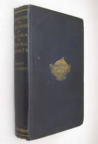
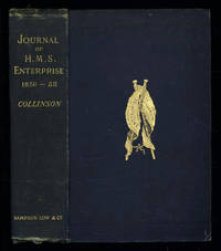
1889035576London: Sampson Low Marston Searle & Rivington. 1889. 1st Edition 1st Printing. Hardcover. Good/No Jacket. 8vo - over 7¾ - 9¾" tall. Good. Publishers cloth embossed with gilt lettering and emblem to upper cover. Front hinge cracked. Gift inscription in contemporaneous hand to free front endpaper. A touch of foxing. Two of the maps have a dog-eared fore-edge where they have not been folded quite flush with the page edges. Illustrated with tissue-guarded colour frontispiece of the ship tissue-guarded portrait of the author and 6 fold-out maps. xi i 531pp 32pp of publishers ads to rear. FIRST EDITION of the posthumously published journal by the captain who came closest to the site where Franklin's expedition ended. "In 1849 Collinson was appointed to command an expedition for the relief of Sir John Franklin by way of the Bering Strait; he himself had command of the Enterprise and with him was Commander Robert Le Mesurier McClure in the Investigator. The two ships sailed together from Plymouth on 20 January 1850 but unfortunately separated in the neighbourhood of Cape Horn and did not meet again. The Enterprise passed Point Barrow Alaska on 21 August but the ice forced Collinson to return south and winter in Hong Kong. In 1851 he was again hampered by ice and in 1852 was frozen in at Cambridge Bay for the winter. In 1853 the Enterprise was caught in the ice at Camden Bay and there passed a third winter. She reached Point Barrow on 8 August 1854 after being shut up in the Arctic entirely on her own resources for upwards of three years. Of the many who had searched for Franklin Collinson came closest to the place where the expedition had ended. Collinson's addition to geographical knowledge on this Arctic trip was very considerable and would have been tantamount to the discovery of the north-west passage had this not been already actually achieved by the men of the Investigator" DNB. Arctic Bibliography 3351; Hill 337; Ricks p 68; Tourville 986. <br/> <br/> Sampson Low, Marston, Searle, & Rivington. hardcover
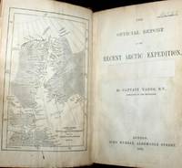
187661115030126John Murray London 1876. First Edition. Hardcover. Good Condition/No Dust Jacket. Report to the Admiralty of the expedition that left Upernivick on 22 July 1875 and returning in October 1876. This is an ex-library copy with flaws as described. Black half-leather binding with banded spine and dark blue covers are lightly rubbed at edges binding is sound with strengthened inner hinges. Crossed and stamped large library label is pasted to the inside of the front cover additional end-papers darkened no half-title-page frontis map has been pasted to previous end-paper with resultant wrinkles on both surfaces and a stamp of "Free Public Library Westminster S.W." on the obverse of the frontis shows through the pasted end-paper although not visible from the map. Title-page is darkened has a crossed out reference number in the upper leading corner and a psted paper rectangle covering a "Free Public Library Westminster S.W." stamp small feint stamp on reverse and short closed tear approx 1cm on leading edge. Pages are little darkened with some smudge marks mainly in margins page 84 to 91have a very small ink mark on the lower corner "Free Public Library Westminster S.W." stamp acorss the bottom of the final page. Quantity Available: 1. Shipped Weight: under 1 kg. Pictures of this item not already displayed here available upon request. Inventory No: 61115030126. All our books music and maps are sent by a tracked mail service. John Murray hardcover
013650London England: Frank Cass and Co Limited 1877. This was the first work devoted to an account of the geography people history and administration of Aden to be published and as such rates a special place amongst works on this controversial part of the Yemen. Written in 1877 of the request of the Indian government it is a comprehensive survey of Aden at that time which remains of considerable value today. There is a full geographical and physical description of the settlement and account of the population the various tribes their habits and occupations and a careful summary of the trade and commerce carried out within the peninsula. xii 232pp A FINE COPY in a near fine dustwrapper. In the 1870s ADEN them was administered by the Indian government and the author describes the various means of administration in detail the history of Aden before the British settlement in 1939 is briefly summarized and that of the following is told more fully. In view of the present situation in Eitan. It is felt that many readers will find this insight into the early years of the British involvement of great interest.This book will be POSTED AT OUR STANDARD RATES FULLY INSURED UK ONLY . Please email for further details. Not Signed or Inscribed. This the First New Edition of 1968. Red Cloth. NEAR FINE NEAR BRAND NEW/NEAR FINE NEAR NEW. Illus. by Two Large Foldout Maps. 8vo - over 7¾" - 9¾". HARDBACK. Frank Cass and Co Limited Hardcover
009534London England: Frank Cass and Co Limited 1877. This was the first work devoted to an account of the geography people history and administration of Aden to be published and as such rates a special place amongst works on this controversial part of the Yemen. Written in 1877 of the request of the Indian government it is a comprehensive survey of Aden at that time which remains of considerable value today. There is a full geographical and physical description of the settlement and account of the population the various tribes their habits and occupations and a careful summary of the trade and commerce carried out within the peninsula. xii 232pp A FINE COPY in a near fine dustwrapper. In the 1870s ate them was administered by the Indian government and the author describes the various means of administration in detail the history of Aden before the British settlement in 1939 is briefly summarized and that of the following is told more fully. In view of the present situation in Eitan. It is felt that many readers will find this insight into the early years of the British involvement of great interest.This book will be POSTED AT OUR STANDARD RATES FULLY INSURED UK ONLY . Please email for further details. Not Signed or Inscribed. This the First New Edition of 1968. Red Cloth. NEAR FINE NEAR BRAND NEW/VERY GOOD AVERAGE. Illus. by Two Large Foldout Maps. 8vo - over 7¾" - 9¾". HARDBACK. Frank Cass and Co Limited Hardcover
009849London England: Frank Cass and Co Limited 1877. This was the first work devoted to an account of the geography people history and administration of Aden to be published and as such rates a special place amongst works on this controversial part of the Yemen. Written in 1877 of the request of the Indian government it is a comprehensive survey of Aden at that time which remains of considerable value today. There is a full geographical and physical description of the settlement and account of the population the various tribes their habits and occupations and a careful summary of the trade and commerce carried out within the peninsula. xii 232pp A FINE COPY in a near fine dustwrapper. In the 1870s ate them was administered by the Indian government and the author describes the various means of administration in detail the history of Aden before the British settlement in 1939 is briefly summarized and that of the following is told more fully. In view of the present situation in Eitan. It is felt that many readers will find this insight into the early years of the British involvement of great interest.Small Damp stain to front board.This book will be POSTED AT OUR STANDARD RATES FULLY INSURED UK ONLY . Please email for further details. Not Signed or Inscribed. This the First New Edition of 1968. Red Cloth. Very Good Contents Fine/NEAR FINE NEAR BRAND NEW. Illus. by Two Large Foldout Maps. 8vo - over 7¾" - 9¾". HARDBACK. Frank Cass and Co Limited Hardcover
0365218367.Ghardcover. Good. Access codes and supplements are not guaranteed with used items. May be an ex-library book. hardcover