United States Exploring ExpeditionBiblio.com
502 résultats
0332935930.Ghardcover. Good. Access codes and supplements are not guaranteed with used items. May be an ex-library book. hardcover
0483581941.Ghardcover. Good. Access codes and supplements are not guaranteed with used items. May be an ex-library book. hardcover
A9781346113074Hardback. New. hardcover
A9781344703215Hardback. New. hardcover
A9781344700900Hardback. New. hardcover
B9781017722925Hardback. New. hardcover
194920542New York: E. P. Dutton & Company. 1949. Hardcover. Very Good. Boards with light rubbing to extremities. A handsome and tight copy. ; The island of Tierra del Fuego was once inhabited by nomadic hunting tribes. Author Lucas born on the island in 1874 spent most of his life there and thus was in a position to tell the tale of a now vanished way of life. Stated "special edition 1949". Including numerous half-tone printings. Bookseller sticker on front free endpaper from the Old Corner Bookstore in Boston which used to be a landmark right on the Freedom Trail. ; B&W Photographs; 8vo 8" - 9" tall; xxi 558 pages . E. P. Dutton & Company hardcover
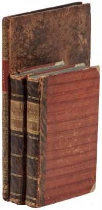
1799biblio160<p><strong>First French edition of Bartram's</strong><strong> Travels which chronicled his explorations of the southern British colonies in North America from 1773–1777</strong><br /><br />2 volumes. 457 pages with frontispiece engraved portrait by Bovinet Mico Chlucco Grana King of the Seminoles and one folding plate; 436 pages without title with large folding map by J.B. Poirson engraved by Alexandre Blondeau and folding plate. Octavo 8 1/4" x 5 1/4" bound in half leather with six spine compartments with red and black labels in gilt over original marbled boards. Translated by Pierre Vincent Benoist. Sabin 3871; Palau 251346; Howes B223; Field 94 First French edition.<br /><br />William Bartram was an American naturalist. The son of the naturalist John Bartram. As a boy he accompanied his father on many of his travels to the Catskill Mountains the New Jersey Pine Barrens New England and Florida. In 1773 he embarked upon a four-year journey through eight southern colonies. Bartram made many drawings and took notes on the native flora and fauna and the native American Indians. In 1774 he explored the St. Johns River where he had memorable encounters with aggressive alligators and also visited a principal Seminole village at Cuscowilla where his arrival was celebrated with a great feast. He met Ahaya the Cowkeeper chief of the Alachua band of the Seminole tribe. When Bartram explained to the Cowkeeper that he was interested in studying the local plants and animals the chief was amused and began calling him Puc Puggy the flower hunter. Bartram continued his explorations of the Alachua Savannah or what is today Paynes Prairie. William Bartram wrote of his experiences exploring the Southeast in his book Travels through North & South Carolina East & West Florida the Cherokee Country the Extensive Territories of the Muscogulges or Creek Confederacy and the Country of the Chactaws Containing an Account of the Soil and Natural Productions of Those Regions Together with Observations on the Manners of the Indians published in 1791 and which is today simply known as Bartram's Travels. It was considered at the time one of the foremost books on American natural history. Many of Bartram's accounts of historical sites were the earliest records including the Georgia mound site of Ocmulgee. In addition to its contributions to scientific knowledge Travels is noted for its original descriptions of the American countryside. Bartram's writing influenced many of the Romantic writers of the day. William Wordsworth Samuel Taylor Coleridge and François René de Chateaubriand are known to have read the book and its influence can be seen in many of their works. Ephraim George Squier and Edwin Hamilton Davis in their book <em>Ancient Monuments of the Mississippi Valley</em> name Bartram as "the first naturalist who penetrated the dense tropical forests of Florida."<br /><br /><strong>Condition:</strong><br /><br />Some rubbing to original boards page 143 of volume one has small burn mark affecting text half title bound upside down in back old water stain to plate of volume two. Fold-out map has repair to first fold internally pages are clean and free of toning and foxing else a very good copy.</p> Chez Carteret et Brosson and Dogour Duran hardcover
1749E0529<p>2 volumes. 182 pages with fold out frontispiece map and three additional folding engravings; 319 pages with seven folding engravings. half-titles in each title pages improperly marked first volume as second and vice versa. Duodecimo 6 1/2" x 3 1/2" bound in original publisher's full uniform contemporary French sponged calf with gilt-tooled spines. First French edition after the 1748 English edition.<br /><br />Henry Ellis was a traveler hydrographer and colonial governor returned from Italy in 1746 just in time to find an expedition to search for a north-west passage on the point of sailing. He appears to have been in easy circumstances; his name stands in the list of subscribers to the north-west expedition and he had sufficient interest to get attached to it nominally as agent for the committee and really as hydrographer surveyor and mineralogist the expedition consisting of two vessels the <em>Dobbs</em> galley of 180 and <em>California</em> of 150 tons left Gravesend on 20 May 1746 joined the Hudson's Bay convoy in Hollesley Bay and finally sailed from Yarmouth on the 31st. They parted from the convoy on 18 June made Resolution Island on 8 July and after a tedious passage through Hudson's Straits rounded Cape Digges on 8 August and on the 11th 'made the land on the west side the Welcome in latitude 64° N.' Bad weather drove them to the southward and prevented their doing anything more that season. They wintered in Hayes River in a creek about three miles above Fort York where a quarrel with the agent of the Hudson's Bay Company gave an unwonted piquancy to the dark and weary days. They suffered much from scurvy the prevalence of which Ellis attributes to their having got two kegs of brandy from Fort York for their Christmas merrymaking and in a minor degree to the 'governor' not permitting the Indians to supply them with fresh provisions. On 29 May 1747 the ice broke up and they were able to warp to the mouth of their creek; on 9 June they got down to Fort York. There they were allowed to get some provisions and stores and on the 24th cleared the river and 'stood to the northward on the discovery'. On 1 July each of the two ships sent away her long-boat but owing apparently to some ill-feeling between the two captains without any prearranged plan for working in concert. The consequence was that they separately went over the same ground discovering naming and examining the several creeks and inlets on the west side of Hudson's Bay the double examination perhaps compensating for the confusion arising from the double naming. Before the season closed in they had satisfied themselves that the only possible exit from Hudson's Bay on the west must be through the Welcome and that very probably there was no way out except that on the east by which they had come in. The result may not seem much; but as it served to put an end to the idea that the passage must lie through Hudson's Bay it was at least so much gain to accurate knowledge. After 21 August the weather broke and they decided in council 'to bear away for England without further delay.' On the 29th they entered Hudson's Straits passed Resolution Island on 9 September and arrived at Yarmouth on 14 Octivwe. Ellis's share in the work of the expedition had really been very slender but the reputation of it has been commonly assigned to him by reason of the narrative which he published the following year under the title <em>A Voyage to Hudson's Bay by the DobbsGalley and California in the years 1746 and 1747 for Discovering a North-West Passage</em> 1748; a work which with many valuable observations on tides on the vagaries of the compass and on the customs of the Eskimos a people then practically unknown mingles a great deal of speculation on the certain existence of the passage on magnetism on fogs on rust and other matters all more or less ingenious but now known to be wildly erroneous. Such as it was the book commended its author to the scientific workers of the day and on 8 February 1748-9 he was elected a fellow of the Royal Society. Possibly in acknowledgment of his scientific labors but more probably by some family interest he was afterwards appointed successively governor of Georgia and of Nova Scotia from which employment he retired about 1770. He seems to have spent his later years as a wanderer on the continent was at Marseilles in 1775 and died at Naples on 21 January 1806.<br /><br /><strong>Condition:</strong><br /><br />Some dark spots to spine else a very good copy.</p> Ballard Fils hardcover
1810ST20849Paris: Chez Arthus-Bertrand 1810. First Edition in French. 205 x 128 mm. 8 x 5". xviii 443 1 pp.Translated into French by A. J. N. Lallemant. <br/> Contemporary flamed sheep covers with thick and thin gilt rule border smooth spine divided into panels by metope and pentaglyph roll panels either with rows of interlocking gilt circles or a gilt compass ornament two black morocco labels marbled endpapers. Folding engraved map by J. B. Tardieu. Wagner-Camp-Becker 6:3; Howes G-77; Sabin 26742; Graff Collection 1519; Wheat Trans-Mississippi 300. Very small loss to head of rear joint boards faintly abraded but the binding entirely solid and pleasing; a handful of leaves with small marginal tears or paper flaws one slightly larger but not affecting text approximately one-third of volume very mildly browned other trivial imperfections but still an excellent copy extremely clean and fresh internally.<br/> <br/> Issued three years after the original English text this is the initial printing in French—and the first in any foreign language—of an important firsthand account of the Lewis and Clark voyage of discovery written by a key figure both during and after the company’s undertaking; it is also and crucially the first edition to include a map of the expedition. Tardieu's map the first to mention the names Lewis and Clark noted important landmarks on the journey including the formidable Rocky Mountains the Columbia River and Fort Clatsop on the Pacific Coast where the expedition spent the winter of 1805-06. Our French edition also adds two letters of Clark not appearing in other editions of Gass—one to William Henry Harrison 2 April 1805 from Fort Mandan and one to Clark’s brother 23 September 1806 on the day the six-month return journey came to an end. Wheat observes that this work held special interest for the French as it provided much information about lands that had until the Louisiana Purchase been part of their domain. A carpenter by training Patrick Gass 1771-1870 was in charge of constructing winter accommodations for the party and his knowledge of building informs his observations here about forts and native architecture. This account was based on journals he kept during the explorations and it was an immediate success upon its first publication in Pittsburgh in 1807. The American public was hungry for information about the Western frontier and their curiosity was shared by Europeans particularly those considering emigration to the New World. Wagner-Camp observes that Gass "became one of the best-known members of the expedition for several reasons: his key role as sergeant brought his name up frequently in the journals of Lewis and Clark; his account was the first to be published; he was the first to have a biography written about him; and finally he outlived the other members of the Corps of Discovery by decades" dying at the age of 98. . Chez Arthus-Bertrand unknown
1802E0151<p>2 volumes with Atlas. 4xxiv385 pages with xxii-xxiv lists books of voyages available from the publisher; 4418 pages with appendix containing vocabularies of the languages of Yukagir Yakut Tungoose Kamchatka the Aleutian Islands and Kadiak and inex. Atlas with title list of plates 14 engraved plates & large folding engraved map. Text volumes are small octavo 7¾" x 4½" 19th century quarter calf & boards spines tooled in gilt morocco lettering pieces; atlas is quarto 11" x 7½" in period tree calf spine tooled in gilt. Translated by J Castéra. Howes S-117 First French Edition.<br /><br />Martin Sauer was an English civil servant who knew Russian French and German. He became acquainted with Joseph Billings in St Petersburg in the 1780s. He agreed to join Billings expedition as his secretary and interpreter. It was agreed that he would write the official account but there is some controversy about his actives when he returned to St Petersburg in 1794. It has been suggested that he left hurriedly for England with much of the important archival material from the voyage including diaries and secret reports so that he could publish a record of the expedition before Russian authorities and scholars in the Academy of Sciences could review its details. Sauer's <em>An account of the Geographical and Astronomical Expedition to the Northern Parts of Russia</em> was published in London in 1802. It contains an abundance of detail about eastern Siberia and the Aleutian Islands and records the expeditions visits to Kodiak Island Prince William Sound and the coast south as far as Yakutat Bay. <br /><br />The chart was made by Aaron Arrowsmith from Sauer's notes and Billings observations and the whole complements well the other contemporary accounts of the expedition by the cartographer Gavriil Sarychev and the naturalist Carl Heinrich Merck. Aaron Arrowsmith 1750–1823 was an English cartographer engraver and publisher and founding member of the Arrowsmith family of geographers. He moved to Soho Square London from Winston County Durham when about twenty years of age and was employed by John Cary the engraver and William Faden. He became Hydrographer to the Prince of Wales ca. 1810 and subsequently to the King in 1820. In January 1790 he made himself famous by his large chart of the world on Mercator projection. Four years later he published another large map of the world on the globular projection with a companion volume of explanation.<br /><br /><strong>Condition:</strong><br /><br />Some rubbing and wear to coves of both atlas and text volumes some chipping to spine ends small gouge at back of atlas and stamp to front end paper else in very good condition.</p> Chez F Buisson hardcover
200323857Adelaide: The Friends of the State Library of South Australia. Fine. 2003. First thus. Hardcover. 1876154381 . Limited to 400 copies with 99 copies bound in leather and the remaining 301 copies bound in cloth this is a cloth bound copy. An as new copy. Foreword by John Ling and an introduction by Anthony J. Brown. With illustrations / plates foldout chart and a map in pocket at the rear of book. The first published translation into English from the French by Christine Cornell of chapters XXII to XXXIV of Peron's journey as part of the Baudin expedition as zoologist aboard the Geographe. ; 245 x 160mm; xxxviii 278 pages . The Friends of the State Library of South Australia hardcover
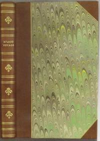
1818E0061323 pages with a portrait frontispiece and five colored aquatints. Octavo 8 3/4" x 5 1/2" bound in attractive half leather with marbled boards and gilt lettering to spine. Hill 1168 Second and best edition<br /><br />The <i>Alceste</i> brought Lord Amherst to China to serve as ambassador and specifically to negotiate the China trade at the time a matter of dispute between China and Great Britain. M'Leod who was surgeon on the ship describes the voyage out the various calls in the East Indies including touching at Batavia surveying off Korea the visit to Okinawa another to Manila and the shipwreck off the coast of Sumatra and subsequent rescue from Malay pirates. A brief but interesting interview with Napoleon at St. Helena is also included in the narrative. This was one of the most popular travel books of its time portraying the Far East to a much wider audience than had been reached by earlier accounts. The idyllic descriptions of Lewchew undoubtedly appealed to the romantic sensibilities of the era. Indeed buoyed by its success M'Leod published another work recounting his time as a slaver <i>A Voyage to Africa with some Account of the Manners and Customs of the Dahomian People</i>.<br /><br /><b>Condition:</b><br /><br />Attractive half rebind some foxing through out with no spotting to plates else a very good copy. John Murray hardcover
19010009096New York: Dodd Mead 1901. First edition. Hardcover. Fine. 8vo 313 pages untrimmed blue cloth <br/><br/>This is the American issue of the British sheets. "Though Burton wrote and published many bulky volumes of travel . none of them assumed a popular form . The essays that follow were all prepared by Burton himself . Burton here gives an epitome of his principal travels in three continents - Preface." The "three" continents are Africa South America. North America Asia. Dodd, Mead hardcover
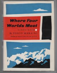
1964074833New York: Harcourt Brace & World 1964. 1st printing. Square and unmarked. Map endpapers. 290pp. Photos. 2 fold-out maps. Unclipped jacket is lightly rubbed. In a protective mylar cover. The four worlds meeting in this book are Islam Buddhism Hinduism and Communism. Traveling through Pakistan to scale 24000-foot Mount Saraghrar for the first time. First American Edition. Hardcover. Very Good/Very Good. 8vo - 8" - 9" Tall. Harcourt, Brace & World Hardcover
H714an Bord der HMS Challenger 1872-1875. 4to. Band 1: 378 S. Band 2: 98 S. Mit zahlreichen Skizzen und Pl‰nen im Text. Halblederb‰nde der Zeit in neuer Lederbox. Sehr gut leserliche Handschrift meist in deutscher Sprache. Original-Tagebuch des deutschen Biologen von der Reise der HMS Challenger. Gestorben auf Tahiti. Die letzten Eintragungen des Biologen stammen vom 2.September 1875 auf Hilo Hawaii. Die Reise f¸hrte weiter Richtung Tahiti unterwegs am 13.September 1875 starb Willemoes-Suhm. Sein Tagebuch ist eine Fundgrube an Reisenotizen und wissenschaftlichen sowohl zoologischen als auch botanischen Eintragungen. Unterteilt ist sein Tagebuch nach den Stationen u.a. Azoren St. Paul Tristan-Inseln Pince Edwards Islands Crozet-Insel Kerguelen Antarktis Australien Neuseeland Tonga Fiji Ovalau Api Neue Hebriden Arafui Ari Ke¥Dulan Ternate Lamboanga Manilla Cebri Humboldt-Bai - Neu-Guinea Yeddo Yokohama Hiogo. Yokohama - Sandwich-Inseln Honolulu Hilo. 1872-1875. Important manuscript by one of the leading naturalists on the voyage. Original scientific travel journal titled "Challenger" Rudolph von Willemoes Suhm "Journal No." "I & II." Scientific Travel Journal of the German Explorer and Zoologists aboard HMS Challenger. Text in German but occasionally in English. 2 Vols. 21 Dec. 1872-6. Sept. 1875. 4to 378; 98 pp. illustrated with sketches and 1 photograph original half calf fitted half morocco case. Autograph journal kept by the German naturalist Rudolf v. Willemoes-Suhm during his 3-year journey with the Challenger. Suhm was mainly concerned with Crustaceans and several new species were named by him. His journal covers the entire voyage until his tragic death from erysipelas on 13th September1875 while the ship was at Tahiti in the Pacific. His travel report remains unpublished and is a leading yet apparently untapped source on the history of the Challenger Expedition as well as research and discovery of the sea. Suhm born on 11. September 1847 in Glu®ckstadt on the Elbe River studied in Bonn Munich and Go®ttingen already at the age of 24 years he was a Professor of Zoology at the University of Munich. in 1872 he was appointed by Sir Charles Wyville Thomson the Scientific Director of the Challenger Expedition as the only German on the staff of the research carried out on behalf of the Royal Society. The posthumous journal covers the entire period from Suhms trip to a few days before his death in which his illness forced him to stop writing. It contains a wealth of information particularly the geographical and zoological research of the "Challenger". Suhm illustrated his records with small designs including many maps and some small Zoological representations. Die britische Challenger-Expedition 1872-1876 war die erste rein wissenschaftliche Forschungsreise. Das Expeditionsschiff HMS Challenger legte bei Ihrer Reise ca. 130.000 km zur¸ck und durchzog damit beinahe das gesamte Weltmeer. Mit dieser Expedition wurde der Grundstein f¸r die Ozeanographie gelegt. Wichtige Forschungsstationen waren die Bahamas die Marion-Inseln im s¸dlichen Eismeer Neuseeland die Auckland-Inseln und Neu-Guinea. Die Ergebnisse wurden in 50 B‰nden verˆffentlicht. unknown
19381262London: Jonathan Cape. 1938. First Edition. Hardcover. Very Good. Front hinge weakening ; 8vo 8" - 9" tall; 415 pages . Jonathan Cape hardcover
19820035761982 Original pictorial postcard with Chinese Stamps R25 postmarked 20/4/1982. Signed by Doug Scott Nick Prescott Paul Braithwaite Roger Baxter Jones and Alex McIntyre. A near fine copy. This item can be purchased with a copy of 'The Shishapangma Expedition' by Scott and McIntyre. Signed by the Team Members. Soft Cover. F-. paperback
4882New Haven: Connecticut Academy of Arts and Sciences 1934-1936. First edition. Light edge wear to wrappers on the spine many pages un-opened; a tight and clean copy in near fine condition. Pp. iv 483; 8 full page folding plates 1 folding maps 200 text-figures line-drawings. Original printed green wrappers lg 4to 12 x 9.5 inches. Memoirs of the Connecticut Academy of Arts and Sciences volume VIII-X. This work presents the entire results of the Yale North India Expedition as published by the Connecticut Academy of Arts and Sciences. The five volumes contain 24 articles on the geological history Paleolithic stone tools invertebrate and vertebrate fossils and the extant invertebrate and vertebrate faunas collected by the Yale North India Expedition of the 1930s. There are two articles in volume VIII: Hawkes et al. - Palaeolithic human industries in the Northwest Punjab and Kashmir and their geological significance; and De Terra - Geological Studies in the Northwest Himalaya between Kashmir and the Indus valley. Volume IX contains four articles: Wodehouse - The Pleistocene pollen of Kashmir; Branson - A Labrinthodont from the Lower Gondwana of Kashmir; Weller - Permain Trilobites from the Central Himalayas; and Vokes - Unionidae of the Siwaliks Series. Volume X contains 18 articles on the Diptera: Ephydridae; Triclad Turbellaria; Coleoptera: Staphylinidae; Carabidae; Phyllopod Crustacea; Gammarus; Hydracarina; terrestrial Hemiptera-Heteroptera; Rotatoria; Land Isopod; Hirudinea; Myriapods; Diplura; Thysanura; Collembola; Cladocera; and Fishes: Cobitidae Sisoridae and Cyprinidae. Single circular stamp of Staten Island Institute in the lower outer corner of the front wrapper of each volume; no other ownership marks and very few signs of use. New Haven: Connecticut Academy of Arts and Sciences, 1934-1936. First edition. unknown
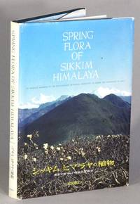
196371837Osaka: Hoikusha Publishing Co. Ltd 1963. First edition large 8vo pp. 4 169 3; text in Japanese and English; text illustrations throughout many in color; original full blue cloth; previous owner's bookplate once tipped on the title page but now loose; very good sound and clean. From the preface: "The Indo-Japanese Botanical Expedition was sent to West Sikkim and the Darjeeling and Kalimpong districts in spring of 1960. It has been known that the flora of this region is very rich and is similar to that of Japan. So the main object of our expedition is to make more clear the botanical relationship between the region and Japan. The photographs compiled in this book were taken during the Expedition by the Japanese members under various difficult conditions excepting a few ones taken by Hara in March of 1963. Hoikusha Publishing Co., Ltd unknown
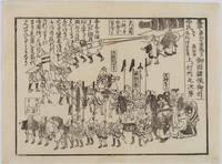
1854218512Japan. Circa1854. Black and white wood block print kawaraban 17.8 x 14cm This kawaraban is dated February 1854 and shows the retreat of the defending lords after the departure of American ships. The caption states that about 1000 people took part in the parade which was led by commanding samurai on horseback with a large cannon drawn at the rear. As it was a peaceful retreat the atmosphere appears relaxed and cheerful. . unknown
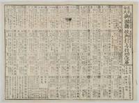
1854218513Japan. Circa1854. Black and white woodblock kawaraban 35.6 x 48.7cm ink mark upper section but text still legible otherwise a very good copy. This kawaraban dated 20 February 1854 elaborates a list of the defending lords following Commodore Perry's second visit to Edo Bay. The chart lists approximately 40 feudal lords mobilised to defend Edo each accompanied by detailed information including their house crests defensive positions and troop numbers. The total mobilisation is noted as around 375600 troops. . unknown
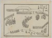
1853218506Japan. Circa1853. Black and white woodblock kawaraban 17.7 x 24cm In this kawaraban the American crew are assembled ready to board their rowing boats in anticipation of being transferred to their sailing ships. A group of American crew with pointed hats are in the middle while Japanese guards with black hats in an area surrounded by screens guard them at fore and rear. Numerous boats are ready on the beach with flags fluttering. . unknown
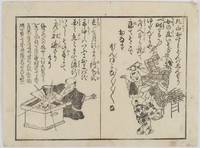
1854218390Japan. Circa1854. Black and white woodblock print 18 x 24cm a little light soiling very good. In this kawaraban two humorous and satirical poems concerning foreign arrivals are featured accompanied by illustrations. Both poems relate to foreigners and foreign ships clearly demonstrating that ordinary people were deeply interested in the arrival of foreign vessels and expressed their curiosity in various ways . unknown
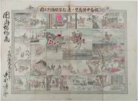
1893214562大阪. Osaka.: 福井榮之助. Fukui Einosuke. Meiji 26 1893. Handcoloured folding engraving 37.5 x 51cm. A prior owner's name is recorded in brush strokes down the left margin. Few small washi repaired tears two old repaired tears on the reverse some occasional browning particularly at centre fold light staining upper margin intruding a little into the printed image. Overall an attractive copy. Scarce. Lieutenant Colonel Fukushima Yasumasa 1852 – 1919 undertook a remarkable solo horseback expedition across Eurasia in 1892. Starting in Poland he traversed Russia and Siberia on his journey. Stationed in Berlin as a military attaché in 1887 he was tasked with researching the Trans-Siberian Railway under construction by Russia. His successful expedition was followed by further explorations in India and the Balkan Peninsula.<br><br>This sheet divided into 24 illustrated panels narrates Fukushima's story from his youth to his triumphant return after the expedition. Filled with adventure the story depicts his encounters with both danger and excitement. The narrative unfolds in a clockwise direction starting from the bottom right corner similar to a sugoroku game which this may be but it is uncertain. The central panel featuring a newly erected statue represents the final goal of his journey. Each panel is accompanied by a caption that furthers the story. . 福井榮之助. [Fukui Einosuke]. unknown