[Joint Services Expedition]Biblio.com
1 956 résultats
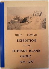
1977106929No Place: Printed by the Drawings and Publications Department of H.M.S. Collingwood nd c1977. Softcover. very good. 1st Edition. vi71pp. Quarto in original stiff illustrated card covers stapled with illustration on cover from painting by Keith Shackleton and plates from photos and maps and tables. Inscribed and signed by leader Chris Furse. Official report of the expedition which explored the islands of the Elephant Islands Group in the Antarctic summer of 1976-77. Travelling mainly by canoe between the islands the expedition divided into two main groups to perform scientific observations the Gibbs Island Party and the Clarence Island Party. 1977 Printed by the Drawings and Publications Department of H.M.S. Collingwood paperback
201626480London: Folio Society. Fine. 2016. First thus. Introduced by Pater Campbell. With many illustrations A fine copy in a fine slipcase. ; 230 x 160mm; xxviii 409 pages . Folio Society unknown
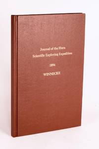
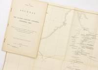
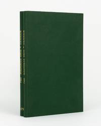
189658059Adelaide: C.E. Bristow Government Printer 1896. First Edition. Hardcover. Fine. Adelaide C.E. Bristow Government Printer 1896. Foolscap folio 32 pages including Appendix B: Report of the Physical Geography of Central Australia by Professor R. Tate and J.A. Watt plus 24 plates on 13 leaves printed rectos only and a folding meteorological chart 2 folding maps a topographical map of Mount Watt and a Survey of Hermannsburg Mission Station and a very large folding colour map 1210 × 1210 mm. Modern cloth lettered in gilt on the front cover; blank bottom margin of the main map slightly creased with one tiny tear expertly sealed; a fine copy. South Australian Parliamentary Paper 19 of 1896: only 650 copies printed. Winnecke was the leader of the expedition and in 'the natural order of things these journals and maps should have been published in connection with the scientific and other records of the Horn Expedition as both supplementary and complementary to them'. After a financial disagreement with W.A. Horn the organiser and backer of the venture this did not occur and this first edition was published under the auspices of the South Australian branch of the Royal Geographical Society of Australasia in conjunction with the Department of the Minister for the Northern Territory and the Survey Department. McLaren 16973; an octavo edition was published the following year see McLaren 16969 - not noting the very large map. C.E. Bristow, Government Printer hardcover
1904760631904 Paris, Perrin, 1904, in 8° broché, 430 pages ; non coupé ; portrait en frontispice et carte dépliante.
44956Imprimerie Royale.1844.Gd.in-8,reliure en cartonnage épais avec pièce de titre.329 p.Carte dépliante.Nombreuses gravures en noir, H-T et I-T. Bel état avec dos insolé et qques défauts au cartonnage.
2007100139650BUCHET CHASTEL 2007 in8. 2007. Broché.
4to [25 x 20 cm]; [ii], xxxvi, 280, xv (index) pp, 7 engraved maps, plans and plates including 6 folding, one being fldg table, engraved vignette head-pieces and tail-pieces. contemporary full leather, gilt spine title & design, raised bands, light cover wear, few tiny holes on front joint,marbled endpapers, endpaper labels of Le Chev du Blaisel & B. Mendel, few leaves with light marginal browning, else clean crisp, near fine. This is the first edition of the account of the great French Scientific Expedition to South America to measure an arc of the meridian at the equator to determine the dimension and shape of the earth. After the scientific measurements done north of the city of Quito in Ecuador, La Condamine then journeyed down the Amazon, being the first to explore that region. His measurements stood the test of time until the advent of GPS showed that the actual equator was somewhat further south, although the original monument and museums north of Quito still advertise themselves as the actual equator. The work includes a detailed plan of the city of Quito and a large map of what is now Ecuador. Hill 169: 'the greatest geographical event of the eighteenth century as regards South America. . . to measure one exact degree of meridian to determine the dimensions and shape of the earth. . . the work occupied eight years'. Sabin 38479. Norman 1250.
1763P2-7B-14Paris, Guillyn, 1763. In-12 (17x10) relié plein veau époque, dos à nerfs orné, pièce de titre, XXXVI-380pp-2ff. Illustré de figures dans le texte. Carte dépliante en déficit , un cahier mal placé (p168-192 relié p.216)
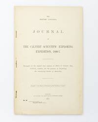
1902125441Perth: Wm. Alfred Watson Government Printer 1902. First Edition. Paperback. Very Good. Perth Wm. Alfred Watson Government Printer 1902. Foolscap folio 62 pages with 4 illustrations plus a very large folding map 625 × 865 mm. Stapled as issued without wrappers; minimal reinforcement to the map near the rusty staples; trifling signs of handling; an excellent copy. Western Australian Parliamentary Paper Number 46 of 1902; only 1200 copies were printed. The 'expedition was fitted out to explore the remaining unknown regions of Australia on similar lines to the Elder expedition'. Lawrence Allen Wells third in command on the ill-fated Elder expedition of 1891-92 was leader. The party set out from Mullewa east of Geraldton on 13 June 1896; lack of water and the gruelling conditions brought the official expedition to an end on 6 November at Noonkanbah Station on the Fitzroy River with two men unaccounted for. It was not until late May of the following year that Wells located the bodies of the missing men his cousin Charles Wells and George Lindsay Jones nephew of the explorer David Lindsay. The detailed accounts of the three search expeditions undertaken by Wells accompanied by Nat Buchanan George Keartland and Sub-Inspector Ord respectively are included. Not least strong on contemporary race relations. McLaren 16633. Wm. Alfred Watson, Government Printer paperback
190225076Perth: Wm. Alfred Watson Government Printer 1902. First Edition. Paperback. Very Good. Perth Wm. Alfred Watson Government Printer 1902. Foolscap folio 62 pages with 4 illustrations plus a very large folding map 625 × 865 mm. Title-wrappers relatively recently bound in half calf and cloth lettered in gilt on the spine; title leaf slightly marked with trifling loss to the bottom corner-tip; minimal signs of age and use; an excellent copy. Western Australian Parliamentary Paper Number 46 of 1902; only 1200 copies were printed. The 'expedition was fitted out to explore the remaining unknown regions of Australia on similar lines to the Elder expedition'. Lawrence Allen Wells third in command on the ill-fated Elder expedition of 1891-92 was leader. The party set out from Mullewa east of Geraldton on 13 June 1896; lack of water and the gruelling conditions brought the official expedition to an end on 6 November at Noonkanbah Station on the Fitzroy River with two men unaccounted for. It was not until late May of the following year that Wells located the bodies of the missing men his cousin Charles Wells and George Lindsay Jones nephew of the explorer David Lindsay. The detailed accounts of the three search expeditions undertaken by Wells accompanied by Nat Buchanan George Keartland and Sub-Inspector Ord respectively are included. Not least strong on contemporary race relations. Wm. Alfred Watson, Government Printer paperback
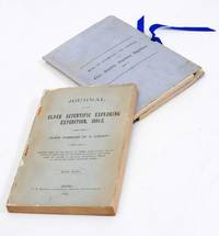
18932712376Adelaide: C.E. Bristow 1893. Wrappers torn at edges but well repaired as are the boards of the map section. Octavo complete with maps; original wrappers and boards preserved in a brown morocco bookform box. <p><p>First edition: one of 500 copies printed of the narrative of one of the last great Australian exploring expeditions written by the leader of the expedition and complete with its maps.</p> <p>Lindsay led this extensive expedition - it ran to eight men forty-four camels and five Afghan camel drivers - organised by the South Australian Branch of the Royal Geographical Society and equipped by Sir Thomas Elder to explore the unknown interior between South Australia and the west coast and to look for Leichhardt. Lindsay's exhaustive report includes the surveyor L.A. Wells's journal of the expedition. Also included is an extensive Aboriginal vocabulary collected by Wells from the Pidong tribe at the head of the Murchison River the Minninng tribe at Fraser Range from the Everard Ranges at Mount Illbillee and from the "Wallawe" tribe at Yarragabie Station Western Australia. He states "Appended is a list of native names which I have collected from four tribes met with during the expedition.".</p> <p>The separate large folding maps are original lithographs coloured to illustrate geological changes. Compiled and drawn by both Lindsay and Wells these maps show in great detail the earlier discoveries of Giles Gosse Forrest and Hunt as well as the route taken by the Elder explorers.</p> </p> . C.E. Bristow unknown
1995146579Bundaberg: Corkwood Press 1995. Hardcover. Near fine. Bundaberg Corkwood Press 1995 deluxe facsimile edition/ 1897. Octavo two volumes iv 86 pages with a frontispiece plus 23 plates many reproduced from original negatives or prints and three of them are here reproduced the correct way round for the first time plus a folding chart 2 folding maps and a very large folding map 1210 × 1210 mm loosely housed in a matching portfolio. Half calf and marbled papered boards; spines lightly sunned; a near-fine set. Number 15 of only 30 sets of the deluxe issue from a total edition of 300 out of print soon after publication. Winnecke was the leader of the expedition and in 'the natural order of things these journals and maps should have been published in connection with the scientific and other records of the Horn Expedition as both supplementary and complementary to them'; after a financial disagreement with W.A. Horn the organiser and backer of the venture this did not occur. The first edition appeared as South Australian Parliamentary Paper Number 19 of 1896; it was reissued in this octavo format the following year. 2 items. Corkwood Press hardcover
1995146811Bundaberg: Corkwood Press 1995. Hardcover. Near fine. Bundaberg Corkwood Press 1995 facsimile edition/ 1897. Octavo two volumes iv 86 pages with a frontispiece plus 23 plates many reproduced from original negatives or prints and three of them are here reproduced the correct way round for the first time plus a folding chart 2 folding maps and a very large folding map 1210 × 1210 mm loosely housed in a matching cloth portfolio. Cloth; one corner tip slightly bumped; a near-fine set. Number 52 of only 300 sets the first 30 of which were bound in half leather. Winnecke was the leader of the expedition and in 'the natural order of things these journals and maps should have been published in connection with the scientific and other records of the Horn Expedition as both supplementary and complementary to them'; after a financial disagreement with W.A. Horn the organiser and backer of the venture this did not occur. The first edition appeared as South Australian Parliamentary Paper Number 19 of 1896; it was reissued in this octavo format the following year. McLaren 16969 the original edition - not noting the very large map. 2 items. Corkwood Press hardcover
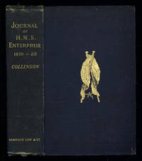
1889035576London: Sampson Low Marston Searle & Rivington. 1889. 1st Edition 1st Printing. Hardcover. Good/No Jacket. 8vo - over 7¾ - 9¾" tall. Good. Publishers cloth embossed with gilt lettering and emblem to upper cover. Front hinge cracked. Gift inscription in contemporaneous hand to free front endpaper. A touch of foxing. Two of the maps have a dog-eared fore-edge where they have not been folded quite flush with the page edges. Illustrated with tissue-guarded colour frontispiece of the ship tissue-guarded portrait of the author and 6 fold-out maps. xi i 531pp 32pp of publishers ads to rear. FIRST EDITION of the posthumously published journal by the captain who came closest to the site where Franklin's expedition ended. "In 1849 Collinson was appointed to command an expedition for the relief of Sir John Franklin by way of the Bering Strait; he himself had command of the Enterprise and with him was Commander Robert Le Mesurier McClure in the Investigator. The two ships sailed together from Plymouth on 20 January 1850 but unfortunately separated in the neighbourhood of Cape Horn and did not meet again. The Enterprise passed Point Barrow Alaska on 21 August but the ice forced Collinson to return south and winter in Hong Kong. In 1851 he was again hampered by ice and in 1852 was frozen in at Cambridge Bay for the winter. In 1853 the Enterprise was caught in the ice at Camden Bay and there passed a third winter. She reached Point Barrow on 8 August 1854 after being shut up in the Arctic entirely on her own resources for upwards of three years. Of the many who had searched for Franklin Collinson came closest to the place where the expedition had ended. Collinson's addition to geographical knowledge on this Arctic trip was very considerable and would have been tantamount to the discovery of the north-west passage had this not been already actually achieved by the men of the Investigator" DNB. Arctic Bibliography 3351; Hill 337; Ricks p 68; Tourville 986. <br/> <br/> Sampson Low, Marston, Searle, & Rivington. hardcover
25070107Ward Lock UK No Date. Hardcover. Good/Fine. Hardcover. 492 pages. PUBLISHING DETAILS: Ward Lock UK No Date. CONDITION: The book itself is in good condition and comes in fine dust jacket. More specifically: Covers have moderate rubbing/wear. Edges of boards have substantial wear. Dust jacket is in excellent condtion. . Pages are lightly tanned. Heavily foxing on last few pages. Marbled edges faded. ABOUT THIS BOOK: Full title: Journal of Researches into the Natural History and Geology of the Countries Visited During the Voyage of H.M.S. "Beagle" Round the World Quantity Available: 1. Category: Natural History & Resources; Exploration. Inventory No: 25070107. Ward, Lock hardcover
1385144548.Ghardcover. Good. Access codes and supplements are not guaranteed with used items. May be an ex-library book. hardcover
200023886Adelaide: Friends of the State Library of South Australia. Fine. 2000. First thus. Hardcover. 1876154314 . With an Introduction by Valmai Hankel portrait frontispiece folding map in a pocket to the rear pastedown endpaper an as new copy. ; Australiana Facsimile Editions No. 221; 225 x 145mm . Friends of the State Library of South Australia hardcover
199723887Adelaide: Friends of the State Library of South Australia. Fine. 1997. First thus. Hardcover. 1876154101 . Sent by the colonists of South Australia with the sanction and support of the government; including an account of the manners and customs of the aborigines and the state of their relations with Europeans. In two volumes. Edition limited to 600 copies of which the first 99 are numbered and bound in quarter leather this being an unnumbered set bound in cloth. An as new set. ; Australiana Facsimile Editions No. 213; 225 x 145mm . Friends of the State Library of South Australia hardcover
199311717Frieding-Andechs : Ambro Lacus, Buch- und Bildverlag, 1993. Expedition zu den letzten Buschleuten im südlichen Afrika 167, [77] S.; 24x21,5 cm illustrierter Pappband / gebundene Ausgabe
1994154042Hamburg : Carlsen, 1994. 46 S. ; 30 cm OPappband
197118666Herford : Busse, 1971. 211 S. Gr. 8°. Bibl.- Einbd.
192218376Leipzig F. A. Brockhaus, 1922. XXXII + 744 S. Gr. 8° Groß-Oktav Ln. 2 Bände
197215500Radebeul : Neumann, 1972. 192 S. : Ill. (z.T. farb.) Gr. 8°. 6. Aufl. OLwd mit Buntpräg. ohne SU.
12649FLAMMARION PARIS 1938 Coll. LA VIE EN MONTAGNE. Photographies n&b h.t. 10e mille. 172 pp IN8 Broché Couverture illustrée,