Stanley, Henry MortonAntiquariat.de

237 résultats
18911179838Leipzig; F. A. Brockhaus, 1891. XVI; 470 S.; zahlr. Illustr. / Ktn. und X; 518 S.; zahlr. Illustr. / Ktn.; 23,5 cm. 2 fadengeh. Orig.-Pappbände.
18363145New York: Wiley & Long 1836. First Edition . Cloth. Good. 16mo - over 5¾" - 6¾" tall. Green boards. 3vi-xviii268p12 fold out platesillus Some browning on plates. Backstrip needs to be reglued. 3" split on baxkstrip. Early owners name ink on fep 1854. Gilt title on spine From the estate of Levi Lincoln- Lieut George Lincoln MSA Oct 4 1834 <br/> <br/> Wiley & Long hardcover
180272327London: A. Arrowsmith 1802. A fine and high quality facsimile of this seminal map commissioned in 2001 by renown Lewis & Clark collector Roger Wendlick. Backed on canvas and measuring 150 x 58 inches in color Wendlick commissioned the firm of Ford Graphics of Portland to make this map. Only 21 copies were made and this is the last one with a letter from Wendlick attesting to this fact. Fine. "The 1802 revision of the map of North America on display delineates the complete length of the Missouri River as well as Mackenzie's journey to the Pacific in 1793. The depiction of the Missouri headwaters which Arrowsmith studied from Peter Fidler's drawing of a map by the Blackfoot Indian Ac Ko Mo Ki shows several streams joining into two branches of the Missouri which flow almost due east. The southern branch of the Missouri appears to be the main branch of the river and connects to the Knife River; the northern branch is a good representation of the actual course of the Missouri.Although the revised map still shows a single ridge of mountains in the west a note near the southern sources of the Missouri states: "Hereabout the Mountains divide into several low Ridges." This note which was based on the reports of Fidler Mackenzie and Thompson was more encouraging to Jefferson and Lewis than the note about the Stony Mountains on the 1795 map which unfortunately turned out to be more accurate. Arrowsmith's map situates the Great Lake River on the western slopes of the mountain range and connects this river to the Columbia River with a dotted line. Since another note claims that this river can be descended to the sea in eight days the Arrowsmith map supported the erroneous belief in a convenient route to the Pacific Ocean.Both the 1795 and 1802 versions of Arrowsmith's map served as resources that Nicholas King consulted as he prepared his map for the Lewis and Clark Expedition. Lewis and Clark in fact carried the 1802 Arrowsmith map along on the expedition. Thomas Jefferson owned the 1802 map as well as an 1802 edition of Arrowsmith's map of the United States. Arrowsmith's 1802 map of North America was the most comprehensive map of the West available to Jefferson and Lewis and it was probably the most important map used in the planning of the expedition." University of VirginiaAaron Arrowsmith's 1802 map was the most current and accurate cartographic representation of the American West available to Lewis on the eve of the journey. Lewis studied this edition closely during the summer of 1803 and even carried a copy on the first leg of the expedition. Among Arrowsmith's sources were Indian maps reports and manuscript maps from the British fur trade and British Navy exploration reports and charts of the Pacific Coast. But various elements in the map reinforced Jefferson's misconceptions of western geography among these were depictions of the Rocky Mountains as a single long chain and the headwaters of the upper Missouri River at the eastern edge of the Rockies suggesting those mountains were readily portaged. A. Arrowsmith unknown
1828073384London: Longman Rees Orme Brown and Green 1828. "Being Extracts from The Journal of a Detenu Who Continued a Prisoner on Parole in the French Capital From the Year 1803 to 1814. Also Anecdotes of Buonaparte's Journey to Elba." Written by artist Thomas Richard Underwood 1772-1836 and published confidentially at his behest by editor friend John Britton. Full green cloth binding. Title page is loose but present. Patterned endpapers. Small prior bookstore label on front pastedown; prior owner's address stamp on verso of front flyleaf. A small bit of foxing inside some age toning. xix 208pp. plus 4 pages adverts. First Edition. Hardcover. Good/No Dust Jacket. 8vo - 8" - 9" Tall. Longman, Rees, Orme, Brown, and Green Hardcover
1872R3304Québec: The « Gazette » 1872 "By a volunteer upon that Expedition". Transcribed and edited from the "volunteer's" manuscript notes but never before published. Light foxing on last pages. Soft cover. Fine. The « Gazette » paperback
186914451London & Glascow: William Collins Sons & Company. 1869. Hardcover. With two hundred illustrations after drawings by Gustave Dore Berard Lancelot Jules Noel and other eminent artists and six finely engraved maps full coloured title page reads the same for both volumes. Volume 1 first series - xii 820 pages six finely engraved maps full coloured and four others folding panorama of Jerusalem approx 200 other illustrations some full page Volume 2 second series - xii 810 pages six finely engraved maps full coloured and two others approx 200 other illustrations some full page bound in half leather as a matching 2 Volume set front hinge on Vol. 1 has small split at top new endpapers overall a very good set Heavy books may require extra postage cost. . William Collins, Sons & Company hardcover
1873184026Einsiedeln, New York und Cinncinnati, 1873. 423 Seiten. Mit zahlreichen Schwarz-Weiß- Illustrationen. Originalhalbleinen
1876100140572Plon et Cie 1876 in4. 1876. Broché.
182146092(London, W.Bulmer and W. Nicol, 1821). 4to. No wrappers as extracted from ""Philosophical Transactions"" 1821 - Part I. Pp. 164-190 a. 5 folded tables.
182146092London W.Bulmer and W. Nicol 1821. 4to. No wrappers as extracted from "Philosophical Transactions" 1821 - Part I. Pp. 164-190 a. 5 folded tables. <br/><br/><em>First appearance of the paper in which Sabine relates his discoveries with the pendulum on his 2 voyages the first on John Ross' expedition in 1818 - relating observations from Island of Brassa Shetland Hare Island London - and from the second voyage with William Parry on the arctic expedition - relating observations from Melville Island. From these observations he estimated the figure of the earth."An artillery officer Sabine was a graduate of the Royal Military Academy Woolwich. While retaining his commission - Sabine eventually reached the rank of general - the started scientific work at the close of the Napoleonic Wars. On the recommendation of the Royal Society he accompanied John Ross on an expedition to seek the Northwest Passage in 1818 and was with William Edward Parry on his 1819-1820 Arctic expedition. From the latter voyage. he said came the idea of a great ship-borne expedition of “physical discovery†to the southern hemisphere."DSB. </em> unknown
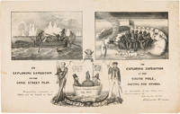
1838WRCAM55549New York: H.R. Robinson 1838. Lithograph 12 1/2 x 20 inches. Light foxing and soiling. Two short closed tears in the right edge and left edge of the sheet. Very good. A very rare print satirizing the recently undertaken United States Exploring Expedition commanded by Charles Wilkes. The Expedition departed in August 1838 and Robinson's eagerness to satirize it and the politicians who supported it is ample evidence that the endeavor was not universally popular. The print is made up of three humorous vignettes. "The upper left is Charles Wilkes in a rowboat with an oarsman and two members of the scientific corps who make observations with a transit or telescope and draw fauna. The upper right image depicts a group of sailors and Charles Wilkes huddled together on the snow surrounded by a ring of polar bears and an upturned rowboat foxes penguins and a campfire. They are flying an inverted U.S. flag to signal distress. At the bottom between the two titles is an inset of the three Navy Commissioners Isaac Chaucey Charles Morris and Alexander S. Wadsworth at sea in a bowl. They are framed by a shield surmounted by a jester and flanked on the left by a man in naval uniform James Kirke Paulding Secretary of the Navy and a sailor with a sad expression on the right" - Harry T. Peters Collection at the Smithsonian Institution online catalogue. The print is "Respectfully inscribed to the Secretaries of the Navy and Army and the Board of Navy Commissioners by their humble servant Robinson Crusoe." <br> <br> Not in Reilly's catalogue of American political prints in the Library of Congress though OCLC does locate a copy at the Library of Congress. That is one of two copies listed on OCLC the other copy is at the American Antiquarian Society. There are also copies in the Peters collection at the Smithsonian and at the Australian National Maritime Museum. OCLC 299947747 752795742. Herman J. Viola ed. MAGNIFICENT VOYAGERS THE U.S. EXPLORING EXPEDITION 1838-1842 Washington 1985 p.13. H.R. Robinson unknown books
1878W1292London: C. KEGAN PAUL & CO. 1878. x 237 pages. First printing of Stevenson's first book a description of his experiences traveling in Belgium and France. The edition is reported to have been limited to only 750 copies and few copies in collectible condition come on the market. In an early twentieth century 3/4 blue morocco binding by Riviere & Son; gilt ruled spine with 5 raised bands; gilt spine decoration and lettering; top edge gilt;. The book is clean and tight with very minor rubbing of leather and slight toning of pages. First Edition. Hardcover. Collectible-Fine-/No Dust Jacket as Issued. Illus. by Walter Crane. 12mo - over 6¾" - 7¾" tall. Book. C. KEGAN PAUL & CO. Hardcover
182414481Bourg, Bottier ; in-8, broché ; 168 pp. ; Thomas Riboud : Essai sur l'étude de l'histoire des Pays composant le département de l'Ain, par la recherche et l'observation des Monuments militaires, expédition, travaux et ouvrages de défense ou d'attaque, dont il reste les vestiges ou des notices, 60 pp. (Le Duc, 105) ; (4) pp., couverture rouge-brique décorée.
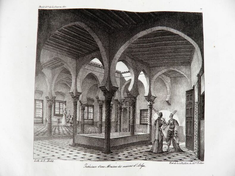
18302192Paris, Ch. Piquet, 1830. Texte + Atlas, complet. In-12, 10,5 x 17,5 cm (texte) ; In-folio oblong, 36 x 28 cm. Reliure postérieure pastiche en demi-veau fauve et coins crème en vélin, dos lisse orné de filets à froid et roulettes dorées, pièce de titre en maroquin noir, tranches du volume de texte marbrées. viii, 238 pp. ; 21 pl. (atlas). Deuxième édition, publiée la même année que l’originale. « La première édition de cet Aperçu a été envoyée à l’armée expéditionnaire d’Afrique. On trouvera, à la fin de celle-ci, quelques plans nouveaux, et, dans le texte ou en appendice, quelques additions que de nouvelles recherches nous ont mis à même de présenter au lecteur ». L’atlas contient 7 cartes ou plans gravés, dont 6 dépliants (2 établis d’après les relevés du Capitaine Boutin) et 14 planches lithographiées, dont plusieurs issues de la collection du Colonel Rottiers représentant des vues et des costumes, le tout monté sur onglets.« Ouvrage publié par le Dépôt Général de la Guerre à l'usage de l'armée expéditionnaire d'Afrique, qui quitta le port de Toulon le 25 mai 1830, en direction d'Alger. Il fut rédigé par le géographe Charles Piquet, en grande partie d'après le rapport du capitaine Boutin, envoyé en mission d'espionnage, en 1808, dans la régence d'Alger ». Gay, 852 et 873 ; Tailliart, 1455. Ex-dono JJL de Querelles sur la première carte.
1857000151London: J.B. Nichols and Sons 1857. Hardcover. See Description. Tall 4to. pp. viii 2 508. Volume XXVII. 12 plates including several in color and 2 folding maps one map is folded in six sections and backed with thin gauze or mull. B&W illustrations with the text. Pages are generally clean with a couple small marginal tears. Light brown cloth; re-backed preserving part of the original spine minus 25mm at the tail and 15mm at the top. Inner hinges neatly strengthened. Some rubbing and wear; corners bumped. Contents include: An accound of the discovery of Anglo-Saxon remains at Kemble in North Wilts; On choirs and chancels particularly as to their use in the South of Europe; Remarks on some early churches in France and Switzerland partly in the time of Charlemagne; The City of Cumae and the recent excavations there; An account of the investigation of some remarkable circular trenches and the discovery of an ancient British cemetery at Stanlake Oxon.; The Burning and burial of the dead.and many other articles. <br/> <br/> J.B. Nichols and Sons hardcover
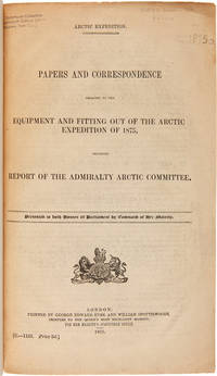
1875WRCAM50678London 1875. 402pp. plus folding map. Folio. 20th-century three-quarter calf and marbled paper boards spine gilt. Stefansson Library stamp on titlepage deaccessioned. Toned minor chipping at edges of some leaves. Final leaf repaired with archival paper with no loss to text; small tears in margin of map. Very good. This scarce document describes the plans for the 1875 Nares Expedition includes specifications for the H.M.S. Discovery data on supplies needed estimations of costs and a hydrographer's report as well as a color chart of the North Polar Sea. The chart is a Polar projection map showing the seas navigated by British expeditions as well as coasts discovered by British American German Swedish and Austrian explorers through 1874. <br> <br> The Nares expedition which sailed from 1875 to 1876 strove to be the first to reach the North Pole and to explore its coasts and region. Though unsuccessful in this venture the expedition was the first to sail ships through the channel between Greenland and Ellesmere Island and as far north as the Lincoln Sea recording valuable information about the mysterious region. A sledging party under Captain Albert Hastings Markham also set a new record on land reaching as far north as 83° 20'. The British Parliament printed occasional reports of the various expeditions and related Arctic subjects which became known as the Arctic "blue books" named after the distinctive blue wrappers in which they were originally issued. This copy has the stamp of the Stefansson collection at the Dartmouth library but was deaccessioned as a duplicate to his widow. ARCTIC BIBLIOGRAPHY 45251. hardcover books
1860P1-3i-6Sans lieu ni date (1860). Atlas in-4 (27x18cm), relié demi-chagrin et coins, dos à 6 nerfs, coins usés, 24pp de texte, 39 planches et 4 cartes dépliantes. COMPLET. Quelques rousseurs.
189718163Verlagsanstalt und Druckert Actien Gesellschaft Grand in-8 Couverture rigide illustrée Hamburg 1897
189817878CBHamburg, Verlagsanstalt u. Druckerei Actien-Gesellschaft, 1898. gr.8°, 455 S. mit 159 s/w-Abbildungen und 4 Faltkarten, original Leineneinband (Hardcover), illustratierter Vorderdeckel mit schwarzem Zierrahmen, goldener Deckel- und Rückenbeschriftung, Rückdeckel mit blindgeprägtem Verlagsemblem und blindgeprägtem Zierrahmen, Buchrücken mit Zierbünden im Stil der Zeit, Marmorschnitt und Musterpapiervorsätze, 2. Ausgabe Einbandkanten zum Teil minimal berieben, Musterpapiervorsätze am inneren Gelenk zwischen Vorderdeckelinnenseite und Vorsatzseite stellenweise minimal angeplatzt, Musterpapiervorsätze an oberer Kante der hinteren Vorsatzseite und der Rückdeckelinnenseite
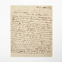
1854369733Palmas Panama 1854. 2pp. single 4to sheet. With: Carte-de-visite photograph of Mayo signed and inscribed to his sister on verso. Folds minor separations. 2pp. single 4to sheet. With: Carte-de-visite photograph of Mayo signed and inscribed to his sister on verso. Seeking a low-level train or canal route to bridge the Atlantic and Pacific Oceans in late 1853 President Franklin Pierce ordered a U.S. Naval exploring expedition to participate in an international attempt affiliated with a venture by the Atlantic and Pacific Junction Company. Although ships from Great Britain New Grenada and the United States were involved the principle overland portion of the expedition through 40 miles of dense jungle would be led by Lieutenant Isaac G. Strain who had previously led exploring expeditions in Brazil Baja California and Chile. With a party of 27 officers and men and including the author of the present letter they entered the jungle on January 20 1854.<br /> <br /> Problems began almost immediately. While puting ashore a boat was swamped and a portion of the party's provisions lost. Next the route Strain had been tasked with following contained no gap in the cordillera as had been previously believed. Led through the jungle by several groups of indigenous people the promise of a few days hike turned into months of wandering in the jungle before being abandoned by the guides. Subsisting on plantains and bananas and drinking river water Stain divided his men with an advance party striking out to seek rescue. On March 9 forty-nine days after starting from Caledonia Bay Strain and his advance party reached Yavisa; it would be another nearly three weeks before the main body was rescued but not before at least five had died of starvation or disease. Sometimes compared with the trials of the crew of the Essex or the members of the Donner Party the men on the Darien expedition endured extreme harship and resorted to unspeakable things. <br /> <br /> This remarkable letter was written by one of the expedition's survivors shortly after his rescue and return to civilization. George Upshur Mayo 1834-1896 was born into a prominent family in Norfolk VA. He attended the Virginia Military Institute served as an assistant engineer on the Strain Expedition was involved in the United States Geodetic Survey and was later a major in the Confederate Army. Here he writes:<br /> <br /> "My dear father From this filthy native village where our party are brought by the officers of the war steamer Virago English whose officers rescued us from a most deplorable condition starvation misery & want for about 70 days without bread or meat living on roots & nuts from the trees. May the rescue be never forgotten & I thank & give praises to God for his goodness. We abandoned & buried 4 or 5 in the woods as unable to keep up. I suffered from the cusano a worm that gets in the flesh also from a very bad knee. Almost unable to travel 3 miles a day. Unfavorable reports reached the U.S. concerning us. We are safe & go to Panama when we get well. My mind is out of sorts by medicine & sickness & my hand too weak to write more legibly. Will write from Panama or Aspinwall a respectable letter there. We are 100 miles from Panama. Had the party 8 days provisions only in the woods yet nothing to shield us from wind & storm & no change of garments. The suffering was intense & the rescue came at the most dreadful & important for our safety. I with 3 others on the river bank washing at sundown when the canoes came in sight. Captain Strain had no pants or underdraws to protect him from the briars & vermin. God be praised for rescue. Love to Annie. . . . In all probability will meet the Cyane at Aspinwall."<br /> <br /> A remarkable first-hand account of a desperate struggle for survival. unknown
1869149309geParis, Librairie de L. Hachette et Cie, 1869. Kaliko, mit Rahmen und goldfarbiger Deckelprägung, kl. DinA 5, kleineres Format, 351 Seiten, KEINE Abbildungen, Einband mit stärkeren Gebrauchsspuren, STARK fleckig, beschabt, berieben und bestoßen, Fleck auf der Einbandinnenseite, Schnitt und Seiten papierbedingt stark gebräunt und SEHR STARK stockfleckig, Falz zwischen Vorsatzblatt und Titelblatt fast durchgehend eingerissen, Buchblock beginnt sich vom Einband zu lösen, trotz der deutlichen Gebrauchs- und/oder Altersspuren ausreichender Zustand / used [4 Warenabbildungen]
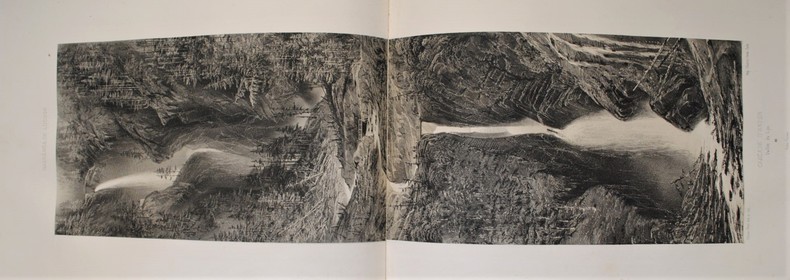
1850P1-22-1Bagnères de Luchon, Dulon, Lafont, Bassy, Boicin, s.d.(1850). In-folio oblong, titre et 30 lithographies sur Chine appliquée sur papier fort légendé, cartonnage éditeur percaline, titre orné doré sur le plat supérieur (quelques rousseurs). Bel album de 26 vues, dont 3 doubles et 1 triple. Bagnères de Luchon et ses environs, par Victor Petit. Paris, 1850, oblong folio (390x270mm), original green cloth with gilting enclosing by ornate, gilt covers, attractive collection of lithographs of medicine baths in the Pyrenees. 29 unnumbered plates of which 3 double and 1 triple.
1836100105130Armand-aubrée 1836 in8. 1836. Relié.
189010955Leipzig, Brockhaus, 1890. 10. Aufl. 137 S. 1 mehrfach gefalt. Karte. 8°. OKart. (gebräunt, fleckig, Rücken lädiert).
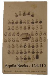
1875124110Portsea: F.Johnson 1875. Photograph. very good. Origninal vintage albumen photograph 6.5 X 10.3 CM on original printed mount. Minor soiling and small tape stain on rear. Small old crease just effecting the image but not very visible. A very nice example. very good This wonderful CDV comprises an image of each crew member and the mascot. The central image is of the ship. Souvenir photographs of both the Alert and the Discovery were taken by rival photographers before the departure of the expedition. Both produced CDV copes as well as much larger examples. Although quite small each potrait is very clear and the name of the individual is usually readable with a magnifing glass. Very Scarce. 1875 F.Johnson unknown