John W. EddyLivre Rare Book
1 955 résultats
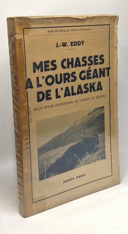
1951100098238Payot 1951 in8. 1951. Broché.
39422Paris Librairie Plon, Plon-Nourrit & Cie, Imprimeurs-Editeurs 1908 in 8 (22,5x15,5) 1 volume reliure toilée grège de l'éditeur, dos et plat supérieur titrés, vignette contrecollée sur le plat supéieur, portrait en frontispice, 294 pages [2], avec de nombreuses illustrations en noir et blanc, et une carte dépliante en couleurs insérée dans une languette sur la page de garde du plat inférieur (carte de l'expédition de Bering). Bel exemplaire ( Photographies sur demande / We can send pictures of this book on simple request )
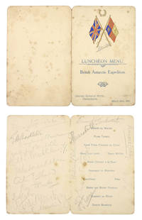
950041907-1913. . A collection of six menus and one souvenir programme various sizes and dates concerning the Nimrod British Antarctic Expedition. Preserved in archival sleeves within a blue morocco-backed fold-over box with chemise.<br /> A rare opportunity to obtain a collection of signed printed ephemera from Shackleton's first Antarctic expedition 1907-1909 during which Shackleton reached 'Farthest South' and achieved the first ascent of Mount Erebus. with the provenance of the Ship's chief engineer.<br /><br />The collection comprises:<br />1. 'To Celebrate the birthdays of our Shipmates H.J. Dunlop; & W.A.R. Michell at "Latitude 40"S. 30'/ Longitude 50"E.30'' manuscript menu in red and black ink on printed card signed on the reverse by Michell Murray Davis Mackintosh Mackay Dunlop and Captain England headed with the printed National Antarctic Expedition badge Nimrod added in ink 8vo 15.5 x 11.2 cm. <br />Menu for a meal to celebrate the birthdays of four shipmates of the Nimrod given whilst en route to Christchurch - at this point half way between South Africa and the Kerguelen Islands. Signed by four of the ship's officers and three of the eventual shore party. Food includes Potage. Dominion Crême D'Unloppè and Dessert. Abricot au Shackleton. 18 October 1907.<br /><br />2. 'Complimentary Dinner Given to Lieutenant Shackleton and the Scientists and Officers of the Antarctic Expedition of 1907' menu signed by Shackleton Bernard Day William Roberts and 7 others 4pp. upper cover printed in gilt with the 'Antarctic Expedition S.Y. Nimrod 1907'. emblem in blue 12mo 11.3 x 8.8 cm. Christchurch Freeman's Rooms. 19 December 1907. <br />Menu given for members of the Nimrod expedition by the Canterbury establishment. Shackleton was presented with a copper salver made from bolts taken from Nelson's ship Victory and Bishop Julius gave his blessing at an event attended by some eighty local dignitaries.<br /><br />3. Menu held for the 'British Antarctic Expedition' dinner held at the Canterbury Club Christchurch signed by Shackleton Wild Edgworth Davis and approximately 30 others 4pp. oval photographic illustration of polar scenes on upper and lower cover signatures on inside and lower pages punch holes at fore-edge 8vo 15.5 x 10.5 cm. 30 December 1907.<br /><br />Nimrod arrived at Lyttleton harbour on 25 March 1909 to a heroic welcome by the New Zealand public. The 'luncheon' held at the United Service Hotel the following day appears to have been a relatively intimate one the menu signed by Shackleton all but 2 members of the Shore Party and 3 of the ship's officers but none of the usual local dignitaries and was apparently unreported in the press.<br /><br />4. 'Luncheon Menu. British Antarctic Expedition. United Service Hotel Christchurch' signed by Shackleton and eighteen other members of the British Antarctic Expedition. 4-page menu the upper cover colour-printed with British flags. 26 March 1909.<br /><br />5. 'Philosophical Institute of Canterbury. Complimentary Banquet to Lieut. E.H. Shackleton M.V.C. the Shore Party and Officers of the S.Y. Nimrod on their return from Antarctica' signed by John K. Davis Nimrod's first officer Henry Dunlop and 24 other attendees 4-page menu the upper cover printed with map of the South Pole showing position reached by Discovery and Nimrod split at fold. 3 April 1909.<br />The banquet at the Philosophical Institute was a public affair at which 'a standing ovation was given to Shackleton and loud applause as he responded to the many toasts to the expedition. He said that 'They always felt dissatisfied with what might have been done. but on that plateau with no 'grub' inside them. they were forced to turn back. There had been no gentle maidens to rest their heads upon!' This was a reference to a duet that had been sung earlier in the evening and was received with laughter' The Press 5/4/09 p.8.<br /><br />6. 'South Polar Dinner given by John Howard Mcfadden. June 13. 1913' large-format menu card embellished with an original watercolour oval vignette by George Marston the Nimrod artist of a polar scene man sledge and tent against snow-covered mountains large penguin and decoration signed by the artist on the vignette 28.4 x 19.4 cm. the oval vignette c.6.8 x 9.5 cm. Oddenino's Imperial Restaurant. 13 June 1913.<br />Celebratory menu illustrated by George Marston. 'One wealthy friend was so far interested as to give an Antarctic dinner at a famous restaurant to all the available men who had been in the far South. The table was transformed into a picture of the Antarctic with artificial snow and real ice where large models of the Nimrod and the Aurora were placed at the edge of an ice-barrier thickly peopled by penguins and Marston the Antarctic artist painted special menu cards. It was a gay gathering enlivened towards the close by songs from Harry Lauder; but alas! the rich and kindly host did not pursue his hospitality to the point of providing transportation for his guests to revisit the haunts they longed for' The Life of Sir Ernest Henry Shackleton 1923 pp.191-2.<br /><br />7. Souvenir programme. 4to 'Sir Ernest Shackleton to give his Popular Lecture entitled Nearest the South Pole at the Music Hall Chester' signed twice by Shackleton 'E.H. Shackleton' in ink on the map once at the location of Farthest South and once in the lower margin 4 pages first page printed in red and black with photographic portrait of Shackleton. 21 February 1910.<br />A souvenir from Shackleton's extensive fund-raising lecture tour following the British Antarctic Expedition of 1907-9 during which Shackleton reached 'Farthest South' and achieved the first ascent of Mount Erebus. The series of talks accompanied by lantern slides proved hugely popular with audiences. An account of a similar lecture in Edinburgh describes his charismatic style of delivery: "'In the centre' he said 'you see the South Pole. Now you've seen as much as anybody else has ever seen". Hearty laughter greeted this opening as he knew it would. He had an orator's gift for dramatic effect and his humour was timed to perfection.' 'A born leader of men' article RSGSexplorers.com.<br /> 1907-1913. unknown
190215945Thüringer Verlagsanstalt, Jena, O.J. (ca 1902). (5)288(16) Seiten, ca 30x20cm, roter Rundum-Farbschnitt, grüner, geprägter und illustrierter OLeineneinband. Die ersten und letzten Seiten komplett stockfleckig, im Innenteil immer mal wieder fleckig. Insgesamt ordentliches Exemplar. Good copy.
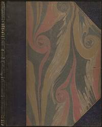
1779BOOKS0003374282 pages lacking the map. Small quarto 10" x 7½" rebound in ¾ morocco & marbled boards spine lettered in gilt top edges gilt. Sabin 22572 First edition.<br /><br />Rare account of travels into the arctic most notably Nova Zemblya to the north of Europe. Twelve years earlier Engel wrote his notable work on explorations on the other side of the Arctic Circle Memoires et observations geographiques et critiques sur la situation des pays septentrionaux de l'Asie et de l'Amerique. Lausanne 1765. <br /><br />Condition:<br /><br />Rubbing to joints and extremities; some minor staining and soiling within hinge professionally repaired else a very good copy. Only five copies found on worldcat.<br /> F Sanuel Fetscherin hardcover books
1779BOOKS000337<p>4282 pages lacking the map. Small quarto 10" x 7½" rebound in ¾ morocco & marbled boards spine lettered in gilt top edges gilt. Sabin 22572 First edition.<br /><br />Rare account of travels into the arctic most notably Nova Zemblya to the north of Europe. Twelve years earlier Engel wrote his notable work on explorations on the other side of the Arctic Circle Memoires et observations geographiques et critiques sur la situation des pays septentrionaux de l'Asie et de l'Amerique. Lausanne 1765. <br /><br /><strong>Condition: </strong>Rubbing to joints and extremities; some minor staining and soiling within hinge professionally repaired else a very good copy. Only five copies found on worldcat.</p> F Sanuel Fetscherin hardcover
1907279772Berlin, Globus, 1907. XV, 336 Seiten.Porträt-Frontispiz. Originalleinenband. 23 cm
1907260202Berlin, Globus, 1907. 8°. XV, 336 Seiten.Porträt-Frontispiz. Originalleinenband. 23 cm
1907300413Berlin, Globus, 1907. XV, 336 Seiten. Porträt-Frontispiz. Originalleinenband. 23 cm
1960295100Seebruck Heering-Verlag, 1960. 232 Seiten. Zahlreiche, teils farbige Abbildungen, Schlagwortverzeichnis Originalhalblederband. 22 cm
199531676Bern, Scherz Verlag, 1995. 1. Aul. 414 Seiten. Mit vielen farbigen Photographien auf Tafeln. Gr. 8°, Hardcover/Pappeinband mit Originalumschlag.
195430253Berlin : Verl. d. Nation, [1954]. 326 S. : Ill. 8°. 5. Aufl. OHLwd. mit ill. Einbd., Kopfbuntschnitt u. SU.
196113388Wiesbaden : Brockhaus 1961. 214 S., Mit 68 einfarb. u. mehrfarb. Bildtaf. u.e. Ktn-Skizze ; gr. 8, mit Schutzumschlag Lw., gebundene Ausgabe, Leinen, Exemplar in guten Erhaltungszustand
199215439Flein, Frankfurt am Main: EK-Concept-GmbH, [1992]. 160 Seiten , 29 cm Pappeinband
197650505Rudolstadt, Greifenverlag, 1976. 3. Auflage 327 Seiten , 22 cm, Leinen
64494aafBerlin, Kribe-Verlag, 1928, in-8vo, Frontispiz-Porträt mit Hs. Signatur vom Autor + 304 S. + photogr. Tafeln in Kupfertiefdruck, Original ill Leinenband.
193226117Berlin, Privatddruck, 1932. Folio (36 x 31 cm). 32 jew. auf lose Kartontaf. unter Seidenschutzblatt montierte photograph. Abb. zusammen mit Textheft (8 Bl. auf unbeschnittenem Bütten in OUmschlag) in OHlwd.-Mappe mit mont. Deckelbild.
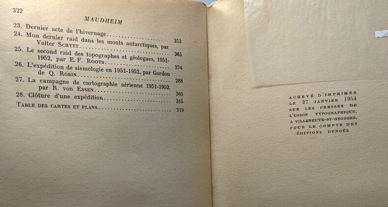
1954100087461Denoël 1954 in8. 1954. Broché. Maudheim : Deux Ans dans l'Antarctique. l'Expédition Scientifique Norvégienne Britannique et Suédoise dans l'Antarctique en 1949-1952
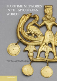
2013w210630271Cambridge 2013. 341pp. Slightly over sized hardback with glossy illustrated boards no DJ VG no names or markings index chapter notes references maps drawings photographs plans of sites tables Maritime Networks in the Mycenaean World . Hard Cover. Very Good. Cambridge Hardcover
197236313ABTübingen/Basel Erdmann 1972. 338 S., m. 31 zeitgen. Darstell. u. 1 Kart. O.-Leinen, O.-Umschl. Sehr guter Zust.
1989202106Escudo de oro 1989 95 pages in4. 1989. Broché. 95 pages.
1986100051441Praxys / Pen Duick 1986 in8. 1986. broché. cartes photographies noir et blanc
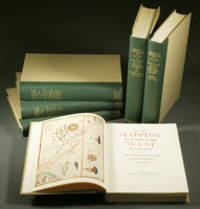
1957E0551<b>From the Spanish discovery to the opening of the Civil War</b><br /><br />5 volumes in 6. Volume One: The Spanish Entrada to the Louisiana Purchase 1540-1804 xiv264 pages with color frontispiece map and 275 maps many folding and index; Volume Two: From Lewis and Clark to Fremont 1804-1845 xiii281 pages with colored frontispiece map 143 additional maps some folding and index. Volume Three: From the Mexican War to the Boundary Surveys 1846-1854 xiii349 pages with colored frontispiece map 322 additional maps and index; Volume Four: From the Pacific Railroad Surveys to the Onset of the Civil War 1855-1860 xiii260 pages with color frontispiece map an additional 127 maps some folding and index; Volume Five From the Civil War to the Geological Survey Part One: xviii222 pages with color frontispiece map and an additional 152 maps; Volume Five From the Civil War to the Geological Survey Part Two: 223-487 pages with 124 maps and index. Folio 14 1/2" x 10 1/2" bound in quarter green leather with gilt lettering to spines. volume I printed by the Grabhorn Press; volumes II-V printed by Taylor & Taylor and James Printing based on the designs of Edwin and Robert Grabhorn. First edition limited to 1000 copies.<br /><br />Carl Wheat's Mapping of the Trans-Mississippi West is a comprehensive and readable cartographic history of the American West. The first three volumes of the work are by necessity bulky and out sized to accommodate the many maps contained with their covers. These beautifully printed books present a truly graphic picture of the exploration and peopling of the vast unknown land west of the Mississippi. The author does not merely present a catalog of significant maps of each era but tells the exciting story of many facets of history that resulted in their making-of the hard journeys the hazardous exploits the motivation the mysticism the misunderstandings and the strange blend of fact imagination false geographic concept and political necessity which were consummated in the engraver's work. These volumes will provide exciting text for the casual reader and have become eminent source book for the student and scholar.<br /><br />Condition:<br /><br />A near fine set. Institute of Historical Cartography hardcover books
1957E0551<p><strong>From the Spanish discovery to the opening of the Civil War</strong><br /><br />5 volumes in 6. Volume One: The Spanish Entrada to the Louisiana Purchase 1540-1804 xiv264 pages with color frontispiece map and 275 maps many folding and index; Volume Two: From Lewis and Clark to Fremont 1804-1845 xiii281 pages with colored frontispiece map 143 additional maps some folding and index. Volume Three: From the Mexican War to the Boundary Surveys 1846-1854 xiii349 pages with colored frontispiece map 322 additional maps and index; Volume Four: From the Pacific Railroad Surveys to the Onset of the Civil War 1855-1860 xiii260 pages with color frontispiece map an additional 127 maps some folding and index; Volume Five From the Civil War to the Geological Survey Part One: xviii222 pages with color frontispiece map and an additional 152 maps; Volume Five From the Civil War to the Geological Survey Part Two: 223-487 pages with 124 maps and index. Folio 14 1/2" x 10 1/2" bound in quarter green leather with gilt lettering to spines. volume I printed by the Grabhorn Press; volumes II-V printed by Taylor & Taylor and James Printing based on the designs of Edwin and Robert Grabhorn. First edition limited to 1000 copies.<br /><br />Carl Wheat's Mapping of the Trans-Mississippi West is a comprehensive and readable cartographic history of the American West. The first three volumes of the work are by necessity bulky and out sized to accommodate the many maps contained with their covers. These beautifully printed books present a truly graphic picture of the exploration and peopling of the vast unknown land west of the Mississippi. The author does not merely present a catalog of significant maps of each era but tells the exciting story of many facets of history that resulted in their making-of the hard journeys the hazardous exploits the motivation the mysticism the misunderstandings and the strange blend of fact imagination false geographic concept and political necessity which were consummated in the engraver's work. These volumes will provide exciting text for the casual reader and have become eminent source book for the student and scholar.<br /><br /><strong>Condition:</strong><br /><br />A near fine set. Due to the size and/or weight of this lot extra shipping and/or handling charges may apply.</p> Institute of Historical Cartography hardcover
19700037011970 Original pictorial postcard of Nampa 22162' with cachet 'Manchester Nepalese Expedition Base Camp 14000 ft'. Signed by the entire expedition team John Allen Leader Bill Rowntree Arthur Clarke Yvonne Clarke Brian Cosby and Rob Beighton. A near fine copy. Signed by the Expedition Team. First Edition. unknown