Livre Rare Book

4 751 résultats
566772Academia Litterarum Bulgarica, Sofia, 1978. In-8, publisher hardcover, dust-jacket, 571pp, portrait-frontispiece, fig. and B/W phot. and illustrations, bibliography. Autograph signed by one from the contributors.
544908Roma, Istituto per l'Oriente, 2005. In-8 broché, XII pp., p. 228-582.
Standard issue, 700 x 1024 mm. Scale 1:175,000 approx. Nautical chart of a small portion of the Red Sea, the Bab-el-Mandeb Strait, prepared by the British Admiralty. It shows Perim Island and Halib Island, as well as Mokka as its northernmost city. Other notable places include Ras al Ara, Ras Bab-el-Mandeb, Khor Omeira, and the Jezirat Sowabih islands. The chart pays particular attention to geological features, labelling larger and smaller hills including the Jebel Arrar or Chimney Peaks, as well as dunes and sandy plains. - The British Admiralty has produced nautical charts since 1795 under the auspices of the United Kingdom Hydrographic Office (HO). Its main task was to provide the Royal Navy with navigational products and service, but since 1821 it has also sold charts to the public. The present chart was composed after Admiralty surveys of 1891, 1900 and 1901; it was first published in 1902 and saw several corrections up to 1936. - With a single fold. A few manuscript notes. Captioned in print and in a former collector's hand on verso.
Standard issue, 710 x 1050 mm. Scale 1:144,820. Nautical chart of the southern portion of the Gulf of Suez, prepared by the British Admiralty. With two inset maps of the Hurghada anchorage and the approaches to the Hurghada south pier, as well as small views of the Ashrafi and Shadwán lighthouse, and three mountain views. - The chart details the Tor Bank, the Strait of Jubal, the Ashrafi Islands, and the Jifátin Islands. Among the most prominent places are Tor, Jebal, Ras Muhammed, and Hurghada. The inset map of Hurghada labels the Egyptian frontier force, oil and water tanks, as well as fishermen's huts. - The British Admiralty has produced nautical charts since 1795 under the auspices of the United Kingdom Hydrographic Office (HO). Its main task was to provide the Royal Navy with navigational products and service, but since 1821 it has also sold charts to the public. The present chart was composed after Admiralty surveys of 1871-72; it was first published in 1873 and saw several corrections up to 1931. - With a single fold. A few manuscript notes. With a stamp "Increase 50%" near lower right margin. Captioned in print and in a former collector's hand on verso. Some small marginal tears, hardly affecting image.
Coloured R.A.F. aeronautical chart. 738 by 573 mm. Scale 1:1,000,000. An excellent official British aeronautical chart of the Strait of Hormuz, covering part of Oman, a large section of the coastline of the United Arab Emirates (including Abu Dhabi, Dubai, Sharjah and Ras al Khaimah) and Hormuz Island. It was issued by the Geographical Section, General Staff (GSGS) as part of their 4695 series of 1:1,000,000 scale maps. The GSGS supplied maps to the British Armed Forces (in this case the R.A.F.), collected data on foreign survey networks and prepared survey data for Expeditionary Force mobilisation. - Light weakening and edge flaws to folds, but generally well preserved.
595276Bonn, Rudolf Habelt, 1957. In-8, rel. éd. pleine-toile vert pâle, titre doré, 518 pp., texte en allemand, 8 index, 6 cartes, 1 tableau. Qq. annotations manuscrites au crayon. Rare.
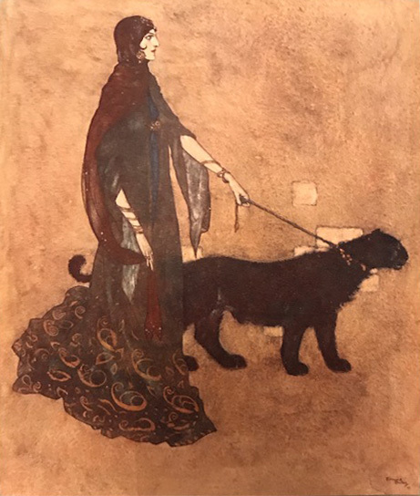
190715668London HODDER AND STOUGHTON PUBLISHER 1907 1 Retold by Laurence Housman. With drawings by Edmond DULAC. London, Hodder and Stoughton Publishers, 1907, demi-maroquin bleu pétrole à coins, dos estampé à trois nerfs, pièce de titre en maroquin caramel, plats toilés bleu, tranches dorées, xvi pp. dont titre et frontispice, 134 pages de texte, 49 feuillets d'illustrations contrecollées en couleurs.
8vo. 277, (3) pp. With engraved portrait and folding lithographed manuscript facsimile. Contemporary marbled green half cloth with giltstamped spine title. Early study of the Algerian rebel Abd el-Qadir, the Emir of Mascara (1807-83), published at the height of his insurrection against the French invaders. On 21 December 1847, after being denied refuge in Morocco because of French diplomatic and military pressure on its leaders, `Abd al-Qadir surrendered to General Louis de Lamoricière in exchange for the promise that he would be allowed to go to Alexandria or Acre. Two days later, his surrender was made official to the French Governor-General of Algeria, Henri d'Orléans, duc d'Aumale. The French government refused to honour Lamoricière's promise and `Abd Al-Qadir was exiled to France. - Binding rubbed; some brownstaining to interior. Rare. OCLC 48656095.
8vo. 277, (3) pp. With engraved portrait and folding lithographed manuscript facsimile. Original printed wrappers. Early study of the Algerian rebel Abd el-Qadir, the Emir of Mascara (1807-83), published at the height of his insurrection against the French invaders. On 21 December 1847, after being denied refuge in Morocco because of French diplomatic and military pressure on its leaders, `Abd al-Qadir surrendered to General Louis de Lamoricière in exchange for the promise that he would be allowed to go to Alexandria or Acre. Two days later, his surrender was made official to the French Governor-General of Algeria, Henri d'Orléans, duc d'Aumale. The French government refused to honour Lamoricière's promise and `Abd Al-Qadir was exiled to France. - Some brownstaining to interior. Rare. OCLC 48656095.
Milano, Mondadori, 1974, 8vo legatura editoriale cartonato telato con sovraccopertina illustrata a colori, pp. 347 con una cartine nel testo (Le Scie) .
Bibliotecca di cultura storica, 91*-91** - Presentazione dell'A. all'edizione italiana - Prefazioni - Libro primo: La prima crociata e la fondazione del regno di Gerusalemme - Libro secondo: Il regno di Gerusalemme e l'Oriente franco (1100-1187 - Libro terzo: Il regno di Acri e le ultime crociate - Appendici: Principali fonti... - La forza numerica dei crociati - La battaglia di Hattin - La vita intellettuale di 'Otremer' - Alberi genealogici - Bibliografia - Indici dei nomi e dei luoghi 2 20,5x14,5 cm., legatura in piena tela, sopraccoperta illustrata in bianconero, cofanetto telata con illustrazioni a colori, pp. XXV (1); VIII (2);; 1227 (1), (3); 35 illustrazioni in bianconero su tavole in carta patinata fuori testo, XIV carte nel testo, seconda edizione, in italiano, leggero allentamento interno dorso primo volume, buon esemplare, ben conservato. Allegato ampio ritaglio stampa quotidiano 'leggende e realt? delle crociate', Aldo Valori.
Mm 120x200 Collana "Storia e vita". Volume cartonato rigido di 276 pagine, alcune illustrazioni in bianco e nero fuori testo, sovraccoperta editoriale. Esemplare in buone condizioni. SPEDIZIONE IN 24 ORE DALLA CONFERMA DELL'ORDINE.
Mm 155x210 Collana " Saggi. Storia e Scienze Sociali ". Volume cartonato rigido, sovraccoperta editoriale a colori, xx-458 pagine, timbro di precedente proprietario. Libro in perfette. SPEDIZIONE IN 24 ORE DALLA CONFERMA DELL'ORDINE.
1 22x15 cm., legatura in mezza pelle con fregi e titolo in oro al dorso, pagg. 478, 18 bellissime incisioni a colori fuori testo, in italiano, buone condizioni. L'opera completa consta di due volumi, disponiamo solo del secondo, comunque sempre interessante
In 4o, pp. 1141, t.tela con sovracc. (strappo riparato in cop.)., 550 illustrazioni n.t. e 64 tavv. a col. e b/n f.t. Seconda edizione di questo importante testo sulle civiltà del vicino e dell'estremo oriente (501/ MEDIO ORIENTE - INDIA - CINA - GIAPPONE)
In 16o, pp. 333, cartonato, 2 carte piu' vv. ripiegata f. t. e 4 carte f. t. Vol. num. 17 della collana Manuali di Politica Internazionale. Timbri ed etichette di estinta biblioteca. Ottimo (3473/POLITICA - NAZIONALISMO - MONDO ARABO - MEDIO ORIENTE)
In-8 (cm. 23.80), tela editoriale, sovracoperta editoriale illustrata, pp. XV, 563, (5), con alcune carte geografiche in bianco e nero nel testo. Traduzione a cura di Vermondo Brugnatelli. Prima edizione italiana. Minime tracce di polvere alla sovracoperta; peraltro, volume in ottimo stato (nice copy).
(Storia - Medio Oriente - Asia - Islam) Tre volumi in 16°, legatura coeva in mezza pelle marrone, al dorso titoli, filetti e fregi impressi in oro, carta marmorizzata ai piatti, pp. 207,(1) ; 216 ; 238,(2), con complessive 9 tavole incise in rame fuori testo. Opera in ottimo stato.
In-8, brossura editoriale, pp. 400(8). Lievi tracce d’uso alla copertina. Buon esemplare.
Large 8vo. 2 parts in 3 vols. XX, 299, (135) pp. XII, 467, (1) pp. XII, 668, (8) pp. With 4 folding tables and 1 folding lithographed map of the Military Frontier. Contemporary giltstamped full calf with charmingly giltstamped spine; leading edges gilt. All edges gilt. Marbled pastedowns. First edition. - Elaborate study of the "Militärgrenze" (Military Frontier), a borderland of Imperial Austria set up for national defence against the Ottoman Empire, by Hietzinger (1786-1864), a civil servant in the Court Council of War. "Of lasting historical value" (cf. Wurzbach). The map shows the area of the Military Frontier as well as the positions of the infantry and cavalry regiments stationed there. The folding tables provide details on the size and population density of the area, various 18th century organisational reforms, as well as temperature and minerals of the Baths of Mehadia (Baths of Hercules) in modern Romania. The first part was published with a dedication to Archduke Ludwig Joseph of Austria, a younger brother of Emperor Franz Joseph I. The index of subscribers in volume I, sometimes bound after the XX pp. of preliminaries, is bound at the end of the present copy. Author's initials and shelfmarks to the flyleaves of all three volumes. - A few paper flaws to the index of volume I, not touching text. A very well preserved, appealingly bound copy. From the library of the Viennese collector Werner Habel, with his stamped and signed ownership to flyleaves, dated 1977. Kayser III, 142. Wurzbach IX, 8f. (misquoting the title).
1^edizione - in8° - brossura editoriale - pp. 223 - collana Di fronte e atrraverso n. 858 - bibliografia - condizioni:eccellenti
Carta fisico-politica molto interessante. Cartina a sette colori - Scala 1:4000000 (cm. 96x156). Milano-Ist. Studi politica intern., 1941. Sono segnalate: ferrovie, strade principali e secondarie, oleodotti, paludi, pozzi petroliferi, sorgenti, castelli, ponti, fiumi, mercati. Sono presenti riquadri in varie scale: il Bosforo, i Dardanelli, il Canale di Suez, il Delta del Nilo, Alessandria, Cairo, Istanbul. Piccole riparazioni sul retro. Ottime condizioni.
555553Thessaloniki, Inst. for Balkan Studies, 1983. In-8 broché, 126 pp.