4 751 résultats
Hand-drawn military map and organizational flowchart, 1.37 x 1.45 m. Coloured ink and watercolour on paper. Accompanied by 9 original photos. Unique hand-drawn chart of Bahrain's naval force as it was projected in the early and mid-1970s, including two large maps: firstly, of the island's location in the Gulf showing the Navy's planned 200-mile range as well as strategic points throughout the Gulf, and secondly, a smaller scale map showing the defensive coastal artillery firing range and radar ranges reaching out to the north and east of Qal'at al-Bahrain, Galali, and East Sitra bases around Manamah. An inset flowchart shows in detail the organization of Bahrain's Navy, to be headed by the Commander of Naval Forces, presiding over the branches of Supplies and Exercises (Engineers, Supplies, Medical Office), of Operations, Planning, and Signals (all commanded by the Chief of Staff), as well as the Naval Armed Forces proper (Fleet, Special Forces, and Coastal Artillery). The extensive annotation describes the maritime theatre of war around Bahrain, identifies vital targets (Port Sulayman, oil terminal, national airport, oil wells and storage tanks, refinery) and crucial points to be observed, and sketches the projected scope of the navy: initially a small fleet of armoured motor vessels with radar-guided automatic ordnance, later to be upgraded with surface-to-surface rocket launchers with a tactical range of ca. 180 nautical miles. The planning stage is to encompass some 2 to 3 months, followed by a development stage of about 3 years and an implementation phase of another year. - The chart is accompanied by a set of nine original mid-1970s photographs of members of the Egyptian General Staff who assumedly were closely involved in advising the government of Bahrain on the structure and implementation of their new Naval Forces, which became fully operational in 1979. - A fine survival, undocumented and at the time undoubtedly a closely guarded military secret.
1 27x21,5 cm., legatura in piena tela protetta da acetato, titoli in oro su tassello al piatto e al dorso, elegante cofanetto, pagg. 337 (5), numerose illustrazioni in nero e a colori, mappa dei luoghi di produzione pi? volte ripiegata, prima edizione, in italiano, buone condizioni. Classificazione: Tappeti di Persia, del Caucaso, dell'Asia Minore, dell'Asia Centrale e Orientale - Bibliografia.
4to. (6), 40 pp., final blank leaf. With numerous black-and-white photographic illustrations and a map of the Tapline. Original printed wrappers. Stapled. Illustrated history of the Trans-Arabian Pipeline - the "greatest of all long range engineering projects". The account celebrates the Tapline's completion in 1950, describing the arduous construction, with rare photographs of the work involved, including pictures of the Sidon terminal and the Badanah pump station as well as portraits of the executive management personnel of the Tapline company. - Wrappers slightly creased; margins a little rubbed. OCLC 6162918.
Large 4to (216 x 280 mm). (6), 40 pp., final blank leaf. Illustrated throughout, staple-bound in original illustrated wrappers. A celebratory magazine describing the thought put into, the hardships endured, the challenges faced, the difficulties overcome and the political points proved in the construction of what was then the world's largest oil pipeline system. The so-called "Tapline" connected Aramco's oil fields and refineries on the east coast of Saudi Arabia with the Mediterranean port of Sidon, in Lebanon. Aramco completed its Tapline in 1950 with an initial capacity of 320,000 bpd. At the same time, however, King Ibn Saud threatened to nationalize his country's oil production, prompting Aramco to offer a 50/50 split of all profits and to shift its headquarters from New York to Dhahran. - In good condition.
Large folio (680 x 500 mm). 43 plates (36 of which are in colour), 2 double-page coloured maps. XXVI, (2) pp. Original wrappers. German text in wrappers and loose plates in original grey cloth portfolio with giltstamped titles. First edition of "the first great book on turkoman rugs" (Arntzen/Rainwater). The magnificent plates in full colour are printed on special paper, each sheet bearing the label of the St. Petersburg "Manufacture des Papiers de l'État". - Title page of the text volume shows a closed tear, otherwise fine. Cf. Arntzen/Rainwater P618 (the 1973 reprint only).
4to. English manuscript on paper. (4), 306 pp. With mounted engraved frontispiece in original hand colour and 21 mounted engraved plates, 13 of which in original hand colour. Contemporary half calf over patterned boards with giltstamped spine and spine-title. Marbled endpapers. All edges red. Intriguing manuscript comprising five Arabian tales allegedly recounted by officers at a Spahi camp in Algeria in the context of an imminent raid against the Haschemu tribe loyal to Emir Abdelkader in 1842, commanded by the French general Louis Juchault de Lamoricière (1806-65). The compiler, who gives his initals as "E. H. S. de R." on the title-page, states that he transcribed the tales from another book, but gives no clear indication whether or not the account is purely fictitious. He does, however, criticize the "cruel system of warfare which the French have hitherto employed in Africa" (p. 1). - Prefaced to the tales is an introduction describing the events leading up to the frame narrative, involving the rescue of a Douair chieftain by a member of the Spahi regiment, and the officers spending the evening together at the campfire. Five of them are prompted to tell stories, some autobiographical, which the editor has titled "The Unfortunate", "The Dervish of Anatolia", "The Renegade", "The Arab's Faith", "Love and Hate", and "The Fugitive of Armenya". The last tale is followed by an account of the fate of the two Douair and Spahi officers, who became close friends after the latter saved the life of the former. - The hand-coloured engravings which illustrate the volume depict characters and scenes from the tales; the frontispiece shows a lavishly decorated room in a palace with an Arab leader smoking a long pipe, surrounded by servants and followers. Continuously paginated, but with additional pagination for each tale. The additional heading "First series" on the title-page suggests that the present manuscript was conceived as part of a larger set. - Extremities slightly rubbed; interior very clean. A very well preserved volume providing an unusual look at French rule in Algeria during its early years.
557027London, Gomidas Institute, 2011. In-8, broché, couv. ill., 70 pp., 2 cartes en couleurs sur un feuillet volant.
570 x 425 mm. Colour lithograph, signed "Ibrahim K.". Mounted on styrofoam board. Bilingual safety poster in Arabic and English. - Traces of folds.
4to (154 x 230 mm). Arabic manuscript on polished oriental paper. (45) pp., 11 lines, per extensum. Black ink with red emphases. With numerous red ink diagrams in the margins. Later full black cloth. An Arabic manuscript of the "Optics" by Euclid, a work on the geometry of vision. According to Euclid, the eye sees objects that are within its visual cone. The visual cone is made up of straight lines, or visual rays, extending outward from the eye. These visual rays are discrete, but we perceive a continuous image because our eyes, and thus our visual rays, move very quickly. - Incomplete, comprising only the first 23 ff. Paper browned; occasional light brownstaining; a paper flaw to the final leaf has been remargined.
152556635Strasbourg. 1525. Originalt tresnitt. Arkets størrelse : 535 cm X 395 cm. Latin. <br/><br/><em>Latinsk tekst. Bretten noe gulnet et par brunpletter.Med Kypros.Map of Palestine Mesopotamia and Babylonia in present day Middle East.Relief shown pictorially.Includes names of places and natural features.Descriptive text within ornamental borders on verso.Appears in the author's Geographia translated by Willibald Pirckheimer with annotations by Joannes Regiomontanus. Argentoragi i.e. Strasbourg : Iohannes Grieningerus communibus Iohannis Koberger impensis excudebat anno a Christi Natiuitate 1525 tertio Kalendas Apriles. Boston Public Library. </em> unknown
230:325 mm. Engraved map. An early Ptolemaic map, showing "the mountains as lightly shaded slopes. The map includes details on towns and watercourses. The Arabian Gulf is distorted and the size of the watercourses is exaggerated" (Al Ankary). Al Ankary 147.Tibbetts 30. Not in the Al-Quasimi collection.
4to. (2), 33, (3), 16, (36), 8 pp. Contemporary blue boards for the Danish Navy Library, later backed with cloth. First edition of this important work in the history of navigation: probably the first manual for the use of chronometers at sea. Based on observations conducted under the direction of Vice-Admiral William Fitzwilliam Owen (1774-1857). The referenced places along the Eastern coast of Arabia include Ras Morebat, the Khuriya Muriya Islands, Ras al-Hadd, and Muscat. - Several contemporary handwritten corrections in ink. Stamp of the Royal Danish Navy Library on title-page. Binding a little loosened, corners or boards bumped, but internally fine; final 8 pp. of errata printed on paper of lesser quality and thus slightly browned. OCLC 4878142.
Folio (210 x 308 mm). 60 pp. With 27 engraved and etched plates (some double-page). Contemporary speckled sheep. Marbled pastedowns. First and only edition, printed at the second printing press established in Istanbul. "A rare and very interesting work outlining the military reforms and the regulations for the New Troops established by Selim III in 1796/97" (Blackmer). The author, Mahmoud Ra'if, was a member of the reform movement instigated in Turkey by Sultan Selim III, who tried to change the traditional political structures of the Ottoman Empire and replace them with a political state that owed much to his youthful contact with Europe, and more particularly, the influence of the French Revolution. After his succession in 1789, Selim took steps to establish a new state under the Nizam-Jedid ("new order") regulations - from which the present work derives - underpinning his state with the formation of a new army and military infrastructure. Among the moves towards "Europeanisation" were the installation of printing presses at the military engineering school (where the present work, the first from the press in roman types, was printed), and the establishment of Ottoman embassies in the capitals of Europe, including London, where Mahmoud Ra'if served as secretary to the Ottoman Ambassador in the mid 1790s. As outsiders feared, the very reforms which are the subject of his work led to Selim's murder in 1808, while the author himself was "cut to pieces" by the enraged Janissaries whose elite position had been threatened. "The establishment of these troops - the Nizam-Jedid - and the jealousy which this aroused was one of the main factors leading to the revolt of the Janissaries in 1808 which cost Selim, and later the author of this work, their lives" (Blackmer). - Binding very slightly worn, interior clean and flawless throughout. Provenance: armorial bookplate of the Swedish diplomat Johan Henrik Tawast (1763-1841), who was seconded to Constantinople in 1812-13 to help negotiate the Russian-Turkish peace treaty of Bucharest; his autograph note "Scutari, 9 janvier 1813. 16 piastres, 20 pares" inscribed to front pastedown. Latterly in the collection of Thomas Fremantle, 3rd Baron Cottesloe (1862-1956), commander of the Territorial Army and president of the Society for Army History Research. Atabey 752. Blackmer 1060.
Hand-coloured engraved map (485 x 340 mm). Striking old color example of the second edition of Mercator's Ptolemaic map of the Middle East, first issued in the 1695 edition of Mercator's Geographia, based upon the works of Claudius Ptolemy. Mercator's map was a landmark in the mapping of the Arabian Peninsula, being the last published edition of Ptolemy and without question the most heavily researched and studied of all editions by its maker. Ptolemy had originally drawn on the accounts of travelers and sailors and though the information was secondhand and often inaccurate it represented the most advanced account of the world's geography at that time. In the case of Arabia, Ptolemy overestimated both the width of the southern part of Arabia and the size and shape of the Persian Gulf. Arabia Petrea and Arabia Deserta are both placed in the north and Arabia Felix is the term applied to the whole peninsula, rather than to the southern portions of it. Ptolemy's map, as interpreted by European cartographers such as Mercator, was hugely influential and served as a standard for European mapping of the peninsula for many years. Tibbetts 39. Al Ankary 262. McMinn 15. Not in Al-Qasimi.
8vo. 13 [instead of 17, lacking pp. 3-6], (1), 2, 386 pp. Contemporary half leather with coloured paper boards. Fourth volume only of the Ottoman military manual "Ta'limat al-'Askariya al-Mustajadda" ("Instructions for the New Model Army"), discussing firearms, guns and artillery in the Ottoman army. Translated from Turkish into Arabic by Captain Hasan Effendi Muzahhar with the assistance of his fellow officer Mohammed Effendi 'Abi'l Hasan. The title ("Gun Instructions - The Shishana") denotes an old Ottoman lock rifle produced mostly in Syria. - Binding severely rubbed and bumped; spine chipped; remains of old lending label on upper cover. Handwritten English note on flyleaf: "found in a tent at Tel-el-Kebir / 14 September 1882 / T. J. Jones". In the Battle of Tel El Kebir (13 Sept. 1882), fought near the Suez Canal, the British military defeated the Egyptian army led by Ahmed Urabi following an insurrection of Egyptian soldiers during the Anglo-Egyptian War.
117 x 78 cm. Constant ratio linear horizontal scale: 1:5,000,000. Relief shown by hachures, contours, and spot heights. Depth shown by soundings. Loosely stored within printer wrappers. Third edition of this German wartime map of the Middle East, parts of Asia, and India, first published thus in 1940. Based on "Stielers Handatlas" and issued within Perthes' "Ubique terrarum" series (no. 20). - In excellent state of preservation, detached from its original wrappers. OCLC 164843864.
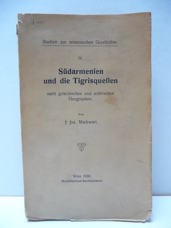
556177Wien, Mechithariten-Buchdruckerei, 1930. Fort in-12 broché, dos muet, 125-648 pp., index. (Studien zur armenischen Geschichte, 4).
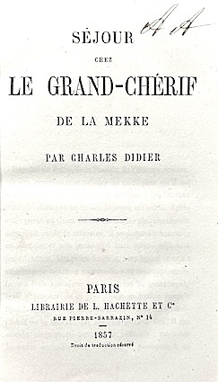
185714815Hachette et Cie Paris 1857 1 vol. In-12 de VII 310 pp. 1 f.n.ch., demi-veau de l'époque, dos lisse fileté.
185730484Hachette & Cie | Paris 1857 | 11 x 18 cm | relié
17575Etude de Paléo-environnement. Paris, Muséum d'histoire naturelle. 1969. Grand in-4 (28x23). 272 pages. Broché, couvertures rouges imprimées.
Colour-printed map. Ca. 92 x 70 cm. Constant ratio linear horizontal scale 1:850,000. Relief shown by hachures and spot heights. German map of Mesopotamia printed during the early years of the First World War, showing the travel route of Max Oppenheim during his 1893-94 journey from Cairo through the Syrian desert and Mesopotamia to Basra. Eastern sheet, reaching from Diyarbakir in south-eastern Anatolia to Kerbala and Babylon in Iraq. Includes populated places, roads, and trails, with the railways updated to 1915. - Folded; a few edge tears. Formerly in the collections of the Geographical Institute of the University of Berlin with their stamps and shelfmarks. Well preserved. OCLC 179717182.
1993606800Paris, Flammarion, Inst. du Monde Arabe, 1993. 1993 Fort in-4 broché, couv. rempl. ill. en coul., 487 pp, nb. fig. et reprod. photogr. en coul. in-t. dont beaucoup à pleine pp., texte sur 2 ou 3 colonnes, bibliographie.
Folio (285 x 358 mm). 2 volumes. (4), 12, 154, (6) pp. (8) pp. With a total of 3 maps (2 in colour) & 152 mostly full-page plates, several with tinted lithographed backgrounds. Later red half morocco with giltstamped spine titles. First edition of this detailed study of Syrian decorative architectural art. "De Vogüé travelled with William Waddington in 1853 and 1854, exploring the area from Aleppo to Damascus, Palmyra and Basra. It was an important expedition and much new material was uncovered. The author became ambassador to the Porte in 1871" (Blackmer). - Occasional foxing to plates, but a fine set. Blackmer 174. Not in Weber.
199419719Editions Hermann 1994 255 pages in-4. 1994. Cartonné/Jaquette. 255 pages. Importante iconographie
4to. 3 vols. With 3 engraved title-pages, 2 engr. maps, and 113 (instead of 117) plates. (4), 80 pp. 76 pp. 100, (4) pp. Contemporary cloth. First edition. The attractive views of Alexandria, Antioch, Beirut, Damascus, Jaffa, Jerusalem, Rhodes, Tripoli etc. are engraved from drawings by W. H. Bartlett, W. Purser and others. - Slightly rubbed and bumped, spine faded and with small tears. Blackmer 291. Aboussouan 187. Weber I, 1125. Cf. Howgego II, E4 (p. 194). Tobler 167.