1 365 résultats
45805683like new. unknown
Good Arabic Paperback. 4to. (29 x 21 cm). In Arabic. 200 p. Ex-library stamps. Splits on the spine. Otherwise a good copy. Shantarînî was an Arab poet and historian from al-Andalus. He was born in Santarém (sometimes spelled Shantarin or Xantarin) and hailed from the Banu Taghlib tribe. Ibn Bassam describes how the incessant invasions of the Castilians forced him to run away from Santarém in Portugal, "the last of the cities of the west," after seeing his lands ravaged and his wealth destroyed, a ruined man with no possessions save his battered sword. Especially well known is his anthology Dhakhira fi mahasin Ahl al-Jazira. one of the most important sources of information in the field of history, literature, and culture of the Almoravid dynasty. It was edited in eight volumes by Ihsan Abbas, written in rhymed prose, many of its biographies are contemporary and filled out with details taken from the Kitab al-Matin of Ibn Hayyan. The parts taken from that book are easily distinguishable because Ibn Bassam prefixes the words qala Ibn Hayyan ("Ibn Hayyan says") and concludes the extract with intaha kalam Ibn Hayyan ("here ends ibn Hayyan's words"). The set is 8 volumes, this is only one volume (2.1).
Rare issue of Al-Musawar, an Egyptian magazine, featuring content of assorted local interest from 90 years ago, including the latest news in aviation - Misr Airwork having only just been founded 17 days earlier, athletes in the 1st Maccabiah Games, entertainment, politics, military, education, artisanry and more. Text is in Arabic. Folio. 23 pages, opening from the left side, replete with photographic illustration throughout, plus fully illustrated front cover. Volume measures approximately 28,5 x 42 cm. Some wear to edges and spine, folded at center, otherwise in very good, original condition. The front cover is dominated by a dashing young aviator donning his leather flight helmet and goggles, surely a notable Egyptian pilot chosen by the newly formed Misr Airlines. Misr Airlines, a division of Misr Airwork (1932-1949), now known as Egypt Air, was founded on 7 June 1932 "to promote the spirit of aviation among Egyptian youth", thus becoming the seventh carrier in the world. The headquarters of Misr Airwork, S.A.E. was in Almaza Aerodrome, Heliopolis, Cairo. The initial investment was EG£20,000, with ownership split between the Misr Bank (85%), Airwork (10%), and Egyptian private investors (5%). Operations started in July 1933, initially linking Cairo with Alexandria and Mersa Matruh using de Havilland DH.84 Dragon equipment. Misr Airlines is the oldest airline servicing both Africa and the Arab world. Although several other airlines sprang up in Africa during the 1930s, no other airlines were developed in the Arab world until the mid-1940s. An article of aviation interest found within, remembers the LZ 127 Graf Zeppelin flying overhead on its 1931 Middle East Flight, with aerial images its own large shadow and the scene below. A memorial to Étienne-Jules Marey (1830-1904), French scientist, physiologist and chronophotographer, whose scientific works touched many fields, including physical instrumentation and aviation, also appears at the center of the issue. There are two full pages concerning athletes, being the elite who had participated in the 1932 Maccabiah Games. There were 390 athletes from 27 countries who participated in the first Maccabiah, including over 69 Jewish athletes from Arab countries such as Syria, Lebanon and Egypt. There were several Muslim boxers from Egypt. Al-Musawar is an Egyptian weekly magazine with its headquarters is in Cairo. Launched in 1925, its founder was George Bey Zidan. One of its longest-serving editors was journalist Fekry Abaza who held the post from 1926 to 1961. In 1960 the Egyptian government took ownership and control of the publication. Abaza was suddenly fired due to an article published on 17 August 1961.
Narrative is 53 pages, plus black and white photographic plates, and a large fold-out colour map measuring approximately 11 x 9 inches (28 x 23cm). In original condition, published in two separate consecutive monthly issues of the Geographical Journal. Seldom found in such very good condition, two complete issues with blue wrappers, titles to front, and containing all the ads. Major Bagnold's third journey into the Libyan Desert concentrated on three relatively broad fields of inquiry that included the area's series of geological events; the compilation of a fairly complete account of the series of strata present and the examination of sand sheets. Also features Sandford's geology and geomorphology of the southern Libyan desert; a section dedicated a history of the area's rainfall; sand and sand dunes: the Malha crater; the barchan dune; whalebacks, undulations or billows; sand drifts, as well as fascinating appendices relating to ornithology, entomoloy, botany, cartography, barometric altitudes, transport arrangements, food and costs of the expedition.
58 pages (Complete with all three parts, as published, in 3 consecutive issues of the Royal Goegraphical Society). Plus many photographic plates and a large fold-out color map, measuring approximately 16 x 12 inches (41 x 30cm). Original condition with blue wrappers, titles to front, and containing all the ads. Three complete issues, seldom found in such good and original condition. This is one of the most comprehensive and valuable report on the Libyan Desert, in which the author attempts to elucidate some of the important questions and problems concerning depressions, oases, and water supplies, accompanied by many incredible photographic plates and a spectacular large fold-out colour map of the Libyan Desert showing surface-relief, contours of static underground water-levels, distribution of sand-dunes, as well as routes of principal exploratory expeditions in the west and south including those of Rohlfs in 1874&1879, Hodgson in 1901, Comyn in 1906, Harding King in 1911, Ball & Moore in 1917, Mrs. Forbes & Ahmed Hassanein in 1920, Ahmed Hassanein in 1923, Bruneau de Laborie in 1923, and Prince Kemal el Din in 1925&1926. The fascinating subjects discussed in this extensive report include: whether the Nile, or a branch of it, ever flow through the Libyan Desert to the west of the present Nile Valley; origin of the depressions; the possibility of utilization of depressions in the Libyan Desert for irrigation, drainage, or hydraulic power; the origin of the artesian water supplies of the Egyptian oases of Baharia, Kharga, Dakhla, and Farafra; permanence of lakes and salt-marshes occupying the depressions of Areg, Bahrein, Sittra, and Qattara; whether the present water-supplies of the Mediterranean littoral can be supplemented by artesian borings; the possibility of the artesian water supplies of the oases diminishing; mysterious "Zerzura, or Oasis of the Blacks"; the possibility of traveling in Great Tracts of the waterless Libyan Desert by the sinking of new wells; the "Tortoise Marshes" of Ptolemy; the sand-dunes; and the distribution of stone implements. Also with references to the Pottery Hill, found by Dr. Ball in 1917, and Prince Kemal el Din's expeditions in 1923 and 1925
Authentic Facsimile Limited Edition of 750 copies produced by Pierway Publishing. This production mirrors the original in exacting detail. The book is almost completely hand made. It is printed on acid-free, vellum paper with maroon dutch comb endpapers, smyth-sewn in the traditional way and bound in morocco textured red gilt cloth. Book is in FINE Condition. This book is Richard F. Burton's rarest book and there are only 6 copies in Libraries worldwide. One copy showed up on Portobello Road in London a few years ago and another one in New England and both disappeared quickly in private collections. Elusive and rare, Burton supposedly was paid very little by the war office to acknowledge his authorship. The book never caught on in England but the Prussian Army bought most of the copies to train their troops as it was considered the best work on the use of the Bayonet at the time. It is rumored that a fire in the Prussian barracks destroyed most copies which would account for the book's rarity today.
8vo. 15 pages, plus black and white plates, 2 of which are double sided fold-out panoramas; and an extra large fold-out color map measuring 24 x 38 inches (61 x 97cm). This issue contains the fabulous map, the plates, and the first part of the narrative in original condition. The second part of the narrative was issued a month later. Original condition with blue wrappers, titles to front, and containing all the ads. This is a complete monthly issue of the Geographical Journal, containing the above described narrative and other accounts as well. Seldom found in such good and original condition. Fantastic, detailed biographical narrative of Captain William Henry Irvine Shakespear, English civil servant and explorer who mapped uncharted areas of northern Arabia and made the first official British contact with Ibn Sa'ud, future king of Saudi Arabia. The report discusses his early life, character (he was a great linguist, mastering Urdu, Pushtu and Persian) his work for the British Foreign Office, vice consulship of India and transfer to Kuwait. From there, he made seven separate expeditions into the Arabian interior, during which he became a close friend of Ibn Sa'ud, then the Emir of The Nejd. In March, 1914, Shakespear began a 1,800 mile journey from Kuwait to Riyadh and from there to Aqaba, via the Nafud Desert, which he mapped and studied in great detail, the first European to do so. In November, 1914, the British government in India asked him to secure Ibn Sa'ud's support for the British-Indian Mesopotamian Expeditionary Force, which had just taken Basra. Carruthers retraces these various routes, examining the latter's significant finds (including some inscribed stones discovered at the wells of Hinna and the rined site of Thaj) and devotes several pages to Shakespear's last journey of the title. In January, 1915, at the Battle of Jarrab, Shakespear's friend Ibn Sa'ud asked him to retreat to a place of safety before the fighting began. As an English Gentleman, he naturally declined to do so. He was struck by a bullet and killed. The victorious Rashidis cut off his head. His solar helmet was handed over to the Ottoman authorities and hung on one of the main gates of Medina as proof of the Al Sau'ds' collaboration with the British. It has been suggested by some authorities, notably St. John Philby, that the Arab Revolt against the Ottoman Empire might have been very differently directed if Shakespear had survived, i.e. the British would have supported and armed Ibn Sa'ud rather than Sherif Hussein ibn Ali. Accompanied by wonderful photographs featuring the mobilization of Ibn Saud's camels, a portrait of Shakespear and of Shakespear riding out with the Emir, among others. Endlessly fascinating, impossible to put down - the stuff of pulp fiction spy novels.
Limited to 100 copies, [x], [28] pages, one of 9 signed copies, bound in hunter green cloth with gold blocking on front board, with a colour frontispiece of Richard F. Burton shortly after returning from India in the 1850's. This Bibliography examines and cites Burton's writings to various newspapers in India while he was stationed there in the 1840's. The author painstakingly examined Indian Newspapers from that time period and located over 100 articles written by Burton. Very little is known about Burton's formative years and his time in India, which makes this Bibliography very useful for the Burton Collector and scholar. A tremendous effort and welcome addition to the Burton genre.
10 pages. Plus a large fold-out colour map measuring approximately 19.75 x 24.5 inches (50 x 62cm). Original condition with blue wrappers, titles to front, and containing all the ads. This is a complete issue, seldom found in such good and original condition. This is an exceptional report on the new updated Persia map created by the RGS and Lord Curzon. One of the major contributions to the study of Persian history. Curzon a most prolific writer and explorer is renowned for his committment to detail and exploration. Ghani writes that, "his powers of observation and analysis were extraordinary; no detail ever escaped him." (Ghani 87.) This was the first time this new Persia map was published, which also shows Afghanistan and Beluchistan. The information was pulled from all the important sources, both from British and Russian explorers. This makes this report a highly valuable important Primary Resource.
Boards with light rubbing to extremities. Light chipping to top spine. Former owner's initials on front free endpapers ; 8vo 8" - 9" tall; 309, 297 pages
23 pages. Plus many photographic illustrations and a large fold-out color map, measuring approximately 8x 19.25 inches (20 x 49cm). Original condition with blue wrappers, titles to front, and containing all the ads. This is a complete issue, seldom found in such good and original condition. This is an exceptional report Arabia expedition report which includes a fold out colour map and a profusion of plates illustrating the author's journey from the Persian Gulf to the red Sea. Philby was a British explorer, official and author, joined the British Foreign Service in 1917 and was the first European to visit the southern desert of Arabia. Philby was the first European to enter Abha, the capital of Najran, the frontier district between the Wahhabis and the Yemenites, and the second to visit Shabwa, although he was the first to explore the ruins where he discovered the great temple of Astarte. During Philby's explorations of Arabia, he came into contact with Ibn Saud, and was greatly influenced by the Wahabi ideology and culture, converting to Islam and renouncing his faith in Christianity.
26 pages. Plus black and white photographic plates and large fold-out color map, measuring approximately 15 x 15 inches (38 x 38cm). Original condition with blue wrappers, titles to front, and containing all the ads. This is a complete issue, seldom found in such good and original condition. Accompanied by a spectacular descriptive colour map, this is Philby's first-hand expedition report on early explorations into unknown regions of Arabia, under the auspices and patronage of His Majesty `Abdul `Aziz ibn Sa`ud, King of the Hejaz and Nejd and its Dependencies. Philby continues where Bertram Thomas left off - "ninety days of wanderings across Arabia by way of the Rub'al Khali" in this riveting narrative. Key to Philby's compelling story telling is his attention to detail: we learn of the breed of camels employed for the gruelling expedition - Umaniya - best of all strains; of the characters of the eighteen strong party - their fear and reluctance to navigate the Empty Quarter and the presence of evil omen; descriptions of adherence to the fast of Ramadhan, condemning the party to thirty hungry days with nothing to eat or drink between daybreak and sunset. Philby's central objective lay in as complete an observation as possible of the Jafura desert, an extensive northward continuation of the sands of the Great South Desert reaching from the line Jaub-Jabrin to within a few miles of the Hasa oasis and skirted on the east by the esturay-like depressions known as Jiban. Features Anbak, settlement of antiquity and small oasis; Qasr ibn Dahbash, Jabrin District; Dharbun ridge; arrival at Wabar; the sand slopes of Naifa; Hadhat al Hawaya and many more locations. Includes fascinating discussion of the Murra tribes people; the search for Maqainama or Magan; the wells of Bir Fadhil; the discovery of an unexpected volcano and craters at Wabar, mythical site of an ancient civilization and much more.
18 pages, including photographic illustrations and a large fold-out map, measuring approximately 9 x 17 inches (23 x 43cm). Contained within 2 complete issues of the Royal Geographical Society. Original condition with blue wrappers, titles to front, and containing all the ads. Two complete issues, small chip to cover of one issue, otherwise seldom found in such good and original condition. The region explored by Sykes in northern Mesopotamia was then little-known and only partially explored, making this a highly important expedition, as some of the earliest cultures in the world and indeed the cradle of civilization itself was thought to have sprung from the depths of these historic lands. Featuring primarily Kurdish custom, he reveals the contemporary Wetsern perceptions of Arabs being 'savage' and Kurds as 'ruthless'. While chronicling his journey he also describes astounding and legendary sites such as Ain el Arus, concluding with the important objective of a proposed railway route from Ras-el-ain, following the Khabur south to Shedadeh, to Tell Afar, then along the Tigris.
17 pages. Plus photographic plates and an extra large fold-out colour map, measuring approximately 17 x 25 inches (43 x 64cm). Original condition with blue wrappers, titles to front, and containing all the ads. This is a complete issue, seldom found in such good and original condition. Wilfred Thesiger has an immense ability to describe very vividly the life and ways of the people of the desert, the Bedu, and his work shines with his clear attachment to them. After leaving Arabia he travelled extensively in the Karakoram and the Hindu Kush (the setting of his meeting with Eric Newby immortalised in Newby's A Short Walk in the Hindu Kush), the mountains of Kurdistan and the marshlands of Iraq. But he says that none of these places moved him as did the deserts of Arabia. He spent five years in the region travelling on camels and on foot across some ten thousand miles of a vast empty land. What he found, as in his time with the people of the Iraq marshes which he described in his book "The Marsh Arabs", was a way on life on the threshold of destruction. The 20th century was very fortunate in being able to have a record of some of the glory it lost as seen through the eyes and camera of this very remarkable explorer.
Two accounts in one issue, altogether 35 pages (27 on Thesiger's account). Plus photographic plates and a fold-out colour maps, measuring approximately 11 x 11 inches (28 x 28cm) and a fold-out sketch map, measuring approximately 13 x 7.5 inches (33 xx 19cm). Original condition with blue wrappers, titles to front, and containing all the ads. This is a complete issue, seldom found in such good and original condition. Thesiger has an immense ability to describe very vividly the life and ways of the people of the desert, and his writings shine with his clear attachment to them. Accompanied by a spectacular detailed fold-out color map, illustrating Thesiger's journey through western and northern Rub al Khali. This is Thesiger's first-hand account and pre-dates his book, "Arabian Sands", published in 1959 by Longmans. His account of the Arabian Sands and its people, its tribal warfare and ancient history, its daily life and landscape, is of such range and value, so supremely well written, that the book can confidently claim to be a classic of Arabian travel literature. Also included in this issue is an 8 page account by Philby, entitled "Two Notes from Central Arabia", accompanied by a fold-out sketch map of the Jabal Tuwaiq region of Arabia. Phibly provides an illuminating description of the pools of Aflaj and the Qariya ruin field, from his excursion in 1948 and his journey in 1918. Also included is a brief description of Phibly's map.
34 pages. Plus photographic plates and a large fold-out colour map, measuring approximately 16 x 21 inches (40 x 53cm). Original condition with blue wrappers, titles to front, and containing all the ads. This is a complete issue, seldom found in such good and original condition. This is a fascinating expedition report on the author's explorations in Arabia, which Predate his All-Important Book - Arabia Felix; Across the Empty Quarter of Arabia, published in 1931. Accompanied by a vivid and descriptive map, this narrative is an outstanding early report into the harsh savage regions of Arabia. Thomas undertook the exploration of the magnificent Rub' Al Khali in three journeys. The first camel journey of 600 miles through the south-eastern borderlands was made in the winter of 1927-1928, the second, travelling nortwards 200 miles from the central south to the edge of the sands, were undertaken under his own initiative, a part of his plan to explore the unkown south and also as a preliminary reconnaissance for a final desert crossing. The realization of that journey is the subject of this report. In order to make the journeys, Thomas grew a beard, donned Arab clothing, and lived as one of the Badus themselves. On completion of his second journey he entered into a secret arrangement, sealed with only 20 Pounds Sterling, with a member of his party, an influential member of the Rashid tribe, to bring him in the following winter, by caravan to a point in the desert where occasionally Murra tribesmen would come from the north, and that from there he would make his way by being passed from tribe to tribe! The author's captivating story of his third and successful pioneering exploration, includes notes on the tribes, geography, and extensive appendices on the natural history collections. The writer of this book was one of the most talented of the younger political officers in Mesopotamia during and after the War, and served in a similar capacity in Trans-Jordan, before being selected to fill the responsible post of Financial Advisor and Wazir to His Highness the Sultan of Muscat and Oman. He showed courage and resource in circumstances of much difficulty and great danger during and after the war in Mesopotamia. He performed two remarkable journeys over territory hitherto completely unknown. The first was along the Southeastern Borderlands of the Rub 'al Khali from near Ras al Had to Dhufar, the second from Dhufar for a distance of some two hundred miles inland. The two journeys, taken together, constitute the most important and most extensive piece of geographical exploration undertaken in any part of the world since the War.
24 pages. Plus photographic plates and a large fold-out colour map, measuring approximately 14 x 13 inches (36 x 33cm) Original condition with blue wrappers, titles to front, and containing all the ads. This is a complete issue, seldom found in such good and original condition. An outstanding early narrative on Arabia accompanied by a profusion of plates and a large fold out colour map. This report pre-dates Thomas' all-important books, including; ARABIA FELIX: Across The Empty Quarter of Arabia,first published in 1932 & THE ARABS, first published in 1937. The last of the great single-handed explorations of Arabia, begun more than a century earlier. And despite the relatively modern date, not an unworthy successor to Burckhardt and Richard Burton. Bertram Thomas represented the end of an epoch - the insightful traveler who made his exploration on foot, using his own resources. The author enjoys the distinction of being the only white man to have served as Prime Minister of an independent Arab state and the first white man to have crossed the great South Arabian Desert. On reporting on his famous book, The Arabs, T.E. Lawrence writes; "Thomas was Political Officer in Mesopotamia, Assistant British Representative in Transjordania, and the only white man ever to cross the great South Arabian Desert, a feat which T.E. Lawrence described as being finest thing in Arabian exploration. The author begins in the morn of history, when Arabia formed a barbarian wedge between Egypt and Sumer. He tells of the life and teachings of the Prophet Mohammed. He traces the wars of expansion, and the gradual disintegration of a great empire under the impact of Crusaders from Europe and Mongols from Asia. And not only does he give the story of their battles and victories, but of their social life, of the arts and sciences which came to flower under their stimulation, and which made the Arab civilization pre-eminent in its day. He takes us from the earliest stirrings of racial consciousness of a people down to the days of the Great War..." References T.E. Lawrence.
Fine Arabic Paperback. Roy. 8vo. (24 x 17 cm). Text in only Arabic; bilingual title in English and Arabic on the cover. [18], 158 p. Al-Madînah al-Munawwarah fî al-wathâ'iq al-'Uthmânîyah = Al-Madinah al-Munawwarah in Ottoman documents. Pt. 2.
123830London: Jonathan Cape 1935 1st Trade Edition. 4to 672pp. Very good no dust jacket. Frontispiece 4 folding maps all called for portraits appendices. Covers are a little battle-weary and the front inner hinge is starting to crack. Also known as Lawrence of Arabia. Also known as 352087 A / C Ross. Time Period World War 1. Locale: Arabia. World War 1 Arab Revolt History--Middle East. Jonathan Cape Hardcover
1965426721 vol. in-4 dactylographié et enrichie de nombreux documents et photographies au verso de chaque feuillet, 31 ff.
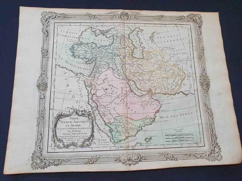
1772Tir811772 Planche seule - dimensions 38 x 29 cm - planche aquarellée - Le pli du milieu existant déjà sera donc envoyée pliée en deux .
Due volumi in 8o di 623 e 690 pagine. Numerose illustrazioni. Una carta geografica ripiegata nella tasca finale del 1° volume. Piccolo bollo e data alle pagine di titolo e in fine. Legatura editoriale in tela rossa (cerniera strappata per metà al primo volume). ---- (Additional postage charges are requested for international shipping of this book. You will be notified by email, or you may email us before you order for a shipping quote)
1909ISLA0057Lpz., Haupt 1909. gr.-8°, X, 685 S., HLn. d. Zt., abgegriff., hint. Rückenkante oben etw. zerschlissen, flieg. Vors. m. Besitzerstemp., Innentit. m. Namenszug, marmor. Schnitt.
335p., illus. Hardcover Very good condition good