Irak, Da?hanBiblio.com

108 résultats
35161138-nnew. unknown
DADAX0367249715Routledge 2019-05-02. 1. hardcover. New. 6.25x0.75x9.25. Buy with confidence. Excellent Customer Service & Return policy. Routledge hardcover
1943IRAQ029525The Golden Cockerel Press London. 1943. First edition. Published by Permission of the War Office. Royal octavo. 127 pages. Photographs; endpaper map of the Levant-Caspian Front by the author. One of 500 numbered copies. Quarter blue morocco raised bands lettered in gilt. Top edge gilt. A sequel to The Golden Carpet a description of the British occupation of Baghdad. Some tanning to endpapers from the binder's glue. Very good indeed. The Golden Cockerel Press, London. hardcover
BN67623Irak Land zwischen Euphrat und Tigris Diwersy Alfred and Wand Gisela <br/><br/> unknown
ria9780367249717_inpHardcover. New. New Book; Fast Shipping from UK; Not signed; Not First Edition; Football Fandom Protest and Democracy offers an in-depth and inside approach to the socio-political history of football in Turkey where fandom is often revered as part of the national identity presenting the historical context for fo hardcover
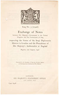
194621150551946. London: HMSO. 1946. 8vo. Unbound bifolium as issued one punch hole in inner margin; very good.This is the very rare exchange of notes printed in Arabic and English between Hugh Stonehewer-Bird and Dr. Mohamed Fadhel Al Jamali regulating the status of diplomatic missions in both London and Baghdad after the Second World War. The Iraqi statesman Muhammad Fadhel al-Jamali tied his country closely to Britain and the US during the Cold War. After the overthrow of the monarchy he was imprisioned and wrote the influential and liberal Letters on Islam. unknown
24124Without date or place but apparently written in Mesopotamia in late 1916. This poem is said to be an earlier work by ‘A Tommy’ the pseudonymous author of the collection ‘If I Goes West’ published in London by Harrap in 1918. WorldCat has no entries to support a second claim: that the present poem was published in 1917 with the subtitle ‘Verses written by a “Tommy†who has fought suffered and triumphed in Mesopotamia and is still on active service there’. While there is no indication that the poem has ever been published in its entirety extracts from it appeared in ‘The Bystander’ 27 November 1916; and ‘The Near East’ 6 July 1917; the latter headed ‘An Alphabet from Mesopotamia’ being preceded by the following: ‘A member of our Fighting Forces in Mesopotamia has composed some verses which he entitles “ The Alphabet of Mesopotamia.†Through the kindness of a correspondent we are allowed to reproduce here some specimens’. There may also be a reference in Catherine W. Reilly’s 1978 bibliography ‘English Poetry of the First World War’. Duplicated typescript titled ‘ALPHABET OF MESOPOTAMIA.’ 2pp foolscap 8vo. Text complete on two leaves of air mail paper glued together. Apparently contemporary and with the look of an item that has been handed around the mess room. Twenty-six four-line stanzas: one for each letter of the alphabet apart from a joint stanza for S and T and ending with an ‘ENVOI’. The first stanza reads: ‘ “A†Was an apple that grew so they say In the Garden of Eden down Qurnah way Till Eve came along and ate it one day And got thrown out of Mesopotamia.’ The poem includes the following stanzas: ‘ “F†Stands for Fritz who flies in the sky To bring down the brute we’ve many a try But the shells that we shoot seem to all pass him by And fall --- on Mesopotamia.’ ‘ “J†Is the jam with the label that lies And states that in Paris it won the first prize But out here we use it for catching the flies That swarm in Mesopotamia.’ ‘ “U†Is the Lake we call Umm-el-Brahm And guards our flanks from all possible karm sic And waters Gorringe’s Barley Farm In the middle of Mesopotamia.’ ‘ “V†Is the Victory we won at Dujailah I heard of it first from a friend who’s a sailor Who read it in Reuter’s on board a mahela On the Tigris in Mesopotamia.’ ‘ “W†Stands for the wonder and pain With which we regard the infirm and insane Old Indian Generals who guide the campaign Which we’re waging in Mesopotamia.’ ‘ “Y†Is the yearning we feel every day For a passage to Basra and thence to Bombay If we get there we’ll see that we stay right away From this wilderness - Mesopotamia.’ Without date or place, but apparently written in Mesopotamia in late 1916. unknown
2019x-0367249715Routledge 2019. Hardcover. New. 183 pages. 9.25x6.25x0.75 inches. Routledge hardcover
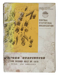
1970ABC_46826Iraq: Central Statistical Organization 1970. Original printed publisher's wrappers. Folio 28.5 x 21 cm. With multiple graphs on 8 leaves most of them in the text. The main price-information is arranged in tables all tables and other introductory information are printed on 1 side of the leaves from right to left on the recto side of the leaves excluding the information in English which has from that perspective been printed on the verso side of the leaves. A statistical overview of the changes in wholesale and retail prices of among other things agricultural animal electronic and textile products in Iraq during the second half of 1970. The elaborate information gathered and presented in the present work by the index numbers & prices department of the central statistical organization of the ministry of planning of the Republic of Iraq has mostly been arranged in tables supplemented with some graphs. The information is organised by general geographical districts in the north middle and south of the country and assessing the prices of products on markets in Baghdad the capital of Iraq separately as its own densely populated district. The present work was published as a supplement to the original bulletin on prices for the first half of 1970 in an effort to bridge the gap in data supply as the Index numbers & Prices department tried to change the publishing frequency from once or twice a year to quarterly and eventually to monthly statements on the changing prices. The information is presented both in Arabic and in English for the purpose of providing a wider range of people and organisations with the information. The Arabic information of course reads from right to left and the tables with the information in both languages are oriented in the same way and the English list of contents and introductory information can be found at the back of the work to be read from left to right. Iraq experienced considerable economic development during the second half of the 20th century. By 1980 its complex central state-planned economy had become the second largest economy in the Arab world after Saudi Arabia. To achieve such development people had to keep a close eye on changing wholesale and retail prices in order to keep changes in inflation and purchasing power in check.Wrapper worn and stained with a blue stamp on the wrapper with the title in Arabic front or back wrapper some staining to the first 4-5 leaves at both English and Arabic ends of the work otherwise internally good and clean. Central Statistical Organization, unknown
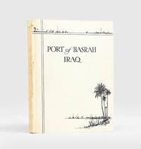
1935190813London: Printed by Waterlow & Sons Limited c.1935. First edition of this history and description of the port's operations with two maps showing the main wharves and estates as well as the proposed site for a new dock. Quarto. With 2 colour folding maps illustrations in text. Original boards front cover lettered and illustrated in black printer's label on front pastedown. Christmas 1947 gift inscription on first blank. Very good indeed. hardcover
196790149Baghdad: Dar Al-Jumhuriya Press 1967. Paperback. Good. photos 16p. Softcover in original wrapper. 22cm. Heavy horizontal crease. Minor cover soil. Photos and claims concerning the use of Napalm Bombs by Israel during The Six-Day War. Dar Al-Jumhuriya Press paperback
2h8810Railway Press Baghdad 1930. 317 pages with some glued corrections from the 30s and 40s hardcover spotted/some pencil markings. hardcover
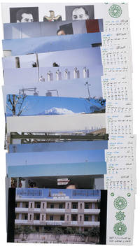
1977ABC_47947Baghdad: Ministry of Oil 1977. Original sturdy plastic case. Oblong 10 x 23 cm. With photographic illustrations all postcards are printed in colour. Remarkable complete set of 14 postcards published by the Iraqi Ministry of Oil to celebrate the flourishing petroleum industry and probably its nationalisation in 1972. The first 2 postcards show the building of the ministry and the official state portraits of then President of Iraq Ahmed Hassan al-Bakr 1914-1982 and Vice Chairman Saddam Hussein 1937-2003. The remaining 12 postcards are each printed for a different month of the year and show various aspects of the Iraqi petroleum industry including the Al-Bakr deep water terminal renamed in 2003 to Al-Basah oil terminal the Al-Khalida oil products tanker the degassing station at North Rumaila oil field the eternal fire near Kirkuk which was the first oil field found in Iraq and the Haditha-Rumaila pipeline which was newly built at the time.With a small crack in one of the sides of the sturdy plastic case. The first and last card in the set are slightly creased. Otherwise in very good condition. Ministry of Oil, unknown
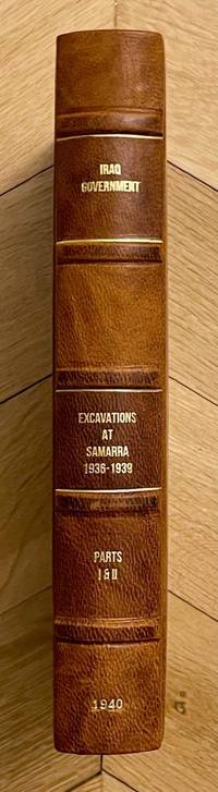
M8814Very rare complete set of two volumes bound in one. Government Press Baghdad 1940. First edition. In-8. Vol. I: 25 pages 120 plates. Vol. II: xiii & 24 pages 144 plates. Bound in an elegant modern half-leather with cloth boards a fine copy. Language: English. This book ships from Europe shipping costs will be updated accordingly BCI. Relevant subjects: Mesopotamia. unknown
1951182329London: Ordnance Survey 1951. Later editions marked "restricted" revised from those produced by the War Office in 1941-42 and with isogonals correct to 1953. They show the international borders between Iran and Iraq but warn that they are still under negotiation. These maps are in a variety of later editions all printed in 1951 Baghdad fifth; Basra eighth; Tehran third; Bushehr fourth. This was a critical year in Iranian politics as the country underwent the Abadan Crisis saw the assassination of Razmara and the election of Mosaddeq. In the same period Iraq saw a number of anti-government protests including the 1952 Iraqi Intifada against the Anglo-Iraqi Treaty. Over these years British and American forces kept close watch on the region's development and likely printed these maps printed on rayon as escape items to issue to forces in case fighting broke out. Escape maps were first introduced by MI9 during the Second World War designed to be easily smuggled into POW camps. They were printed on silk and for "good reasons: silk is flexible and durable in a way that paper is not and it is noiseless when hidden about one's person" Bond. They continued to be issued throughout the 20th century and into the modern day especially during the 1960s and the Vietnam War. 2 sheets of rayon 596 x 715 mm; 610 x 676 mm colour map on each side key on map of Tehran; text in English and French. Sometime folded edges fraying more so to sheet of Baghdad and Basra: a very good copy. Barbara A. Bond "Escape and evasion maps of World War II" The British Library 2016. unknown
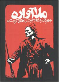
199083129Kurdistan: New Organization 1990's. Original silkscreened poster 63.5cm x 46cm printed in red and white on heavy black paper. Slight wear to edges almost neglible and some minor surface cracking to the very heavily applied paint are the only things that could be considered defects. A very good example. <br /> <br /> An exceptionally striking image printed in dramatic red and white onto black card depicting a heavily armed figure in traditional Kurdish dress beneath the legend in Kurdish:<br /> "The Displaced Mullah; The Shining Face of Revolutionary Kurdistan"<br /> <br /> The figure depicted is in all likelihood a stylized portrait of Mahmoud Barzanji a national Kurdish hero from the unrest of the early 20th century who became the first King of Kurdistan and was appointed Governor of the region by the British after the formation of the Kurdistan Protectorate after WW1. Barzanji not universally popular in Southern Kurdistan was a leader of considerable energy and ambition which far outstripped British plans for his 'control' of the region. The British and Barzanji came into direct conflict when he began arresting and imprisoning British officials who put up any opposition to his plans and embarking upon a localised uprising. The British predictably enough put a stop to his ambitions by ambushing him on the Sulamaniah road wounding him and then graciously commuting his death sentence to one of imprisonment in the British stronghold of Lahore in India where Barzanji was kept prisoner until 1922.<br /> The other possibility and with a stronger resemblance is that the poster depicts Simko Shakik early 20th century warlord and revolutionary who aside from massacring Armenians and Assyrians for the greater good of Kurdistan also led a rebellion against Iran. Although not conspicuously working from a Kurdish nationalist perspective modern critical thought suggests that Shikak should be placed "within the confines of Kurdish ethno-nationalism" Kamal Soleimani; "The Kurdish image in statist historiography: the case of Simko" 2017. Shikak himself was mainly interested in plunder and what he no doubt considered 'punitive justice against' basically anyone who sought to extert power over him or as a secondary consideration other Kurds; the results of his aggressive energy and willingness to fight anybody however are historically considered evidence of his benefit to Kurdish freedoms. No other examples of this poster can currently be traced in trade or institutional database. New Organization unknown
1936055476Baghdad: Dangoor's Printing and Publishing House / The Times Press 1936. 1st Edition . Hardcover. Very Good. 4to - over 9¾ - 12" tall. Original grey cloth bdg. 4to. 28 x 20 cm. In English and Arabic. iii 608 278 xxxxxxiii sic.Lxiii p. richly illustrated three maps two folded many separate colors and b/w plates. Fading on the Iraqi flag on the front board slightly worn on the hinges of the spine a stain on the edge overall a very good and bright copy. English edition. Exceedingly rare first and only "Iraq directory" issue as the best reference for early modern Iraq. This superb early 20th-century work on the "complete Iraq" was also published in Arabic and English separately. All published. The best reference in English of modern Iraq prepared by the Ministry of Interior in 1936 including history architecture archaeology military history economy health services jails oil companies engineering press and printing houses ports navigation army government Iraqi flag and social structure of the country in the 1930s containing minorities and ethnic groups with statistics and history. The last chapter titled "the commercial section" is also the best reference for the trade of Iraq at the beginning of the 20th century listing all trade companies with attractive colors and b/w full page and in-text advertisements. This historically significant work gives invaluable insight into the social historical and economical structure of modern Iraq. The book in almanac form which is opening with a preface contains the full page plates of His Majesty King Ghazi I views of Qasr al-Zehoor residential Palace of H.M. the King H.R.M. Amir Faisal Crown Prince of Iraq and His Late Majesty King Faisal I Creator of Modern Iraq photo-engraved in Cairo and Iraq with special permissions of the Court. Then the history of the Iraqi Royal Hashimite Family tree and biographies of the members can be found. Some tables of conversion of years A.H. into years A.D. of Sunrise and Sunsets in 1936 temperatures and eclipses and official holidays with the general calendar of 1936. This important calendar includes the special and historical days like All Saint's Day Occupation of Mosul British Forces Armistice Day Jewish Christian and Islamic feasts etc. next to a general chromo-lithographed map of Iraq. The work gives general information about Iraqi geography and administrative divisions. The next chapter gives a detailed historical account of Iraq to the present day. The government services like medicine transportation courts cabinet army sports etc. are introduced in detail. As the most important two chapters of the work including a richly illustrated account of the ethnic groups inhabitants minorities and religious demography and 'liwas' of the country give invaluable resources to the Iraqi social structure. An interesting additional notice by the new government of the period indicates "When the Iraq Directory for 1936 was still in the press a law was enacted prohibiting the use of titles such as Beg Pasha etc. in Iraq". This gives an insight into the relations of Iraq with the Republic of Turkey in the 1930s. The last chapter titled "the commercial section" contains almost all national and international Iraqi and some European firms in the 1930s trade such as shipping and transportation firms exporters merchants cinemas hotels publishers and manufacturing companies in various sectors is unsurpassed trade reference for the early 20th century Middle Eastern trade especially after the nationalism of Iraqi oil created the Iraq National Oil Company by negotiations took six years and ended with the July 1928 Red Line Agreement with the US and Britain. The maps' titles are "Historical sites in Iraq" "Provisional geological sketch map of Iraq" and "General Map of Iraq". Overall a historically important almanac of modern Iraq as well as the Middle East. Nineteen copies in OCLC 652197259 24979123 269202533. <br/> <br/> Dangoor's Printing and Publishing House / The Times Press hardcover
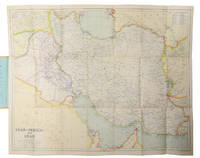
1930L6CC0NQYKB25London: George Philip & sons 1930. Colour printed map 54 x 68 cm with yellow covers 19.5 x 11 cm. Map of Iran Iraq and parts of the surrounding countries including modern Kuwait Bahrain Qatar and the UAE in the 1930s published in the series "Philips' authentic imperial maps for tourists & travellers". Published in the early years of the discovery of oil in the Middle East the map shows roads and railways but also caravan routes submarine cables and oil pipelines.Slightly soiled in very good condition. George Philip & sons, unknown
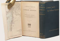
188833602London: Kegan Paul Trench & Co. 1888. 2 volumes. First Edition. With pleasing provenance. With a fine map showing the Tigris and Euphrates rivers and the surrounding geography of the Middle East. Thick 8vo publisher's original dark green cloth the upper covers and spines lettered in gilt original green endleaves. xv 447 32 publisher's catalogue; vii 492 pp. A very bright and pleasing set as fine as can be expected. FIRST EDITION OF THIS ELUSIVE AND SIGNIFICANT WORK. Ainsworth's excellent account of the Euphrates expedition to which he was appointed surgeon and geologist. The expedition was intended to "examine the feasibility of opening up the Mesopotamian rivers to steam navigation as a new route to India as well as asserting British political presence in the area promoting British commercial ties and gathering scientific and archaeological data" ODNB.<br> This is arguably the fullest contemporary account of the expedition as the fraught publication history of Chesney's account meant that his 'NARRATIVE.London 1868 was ultimately less detailed than intended.<br> This copy was owned by John Brinton who was elected member of parliament for Kidderminster in 1880 but accepted the Chiltern Hundreds next month because he was holding a government contract at the time. He was reelected without opposition and held the seat until 1886. In 1887 he presented Brinton Park to Borough of Kidderminster. He became High Sheriff of Worcestershire in 1889 and was an Alderman of the County Council from 1890. His attractive engraved plate is at each pastedown. Kegan Paul, Trench & Co. hardcover
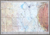
2002162482London: DGIA Ministry of Defence 2002. First edition stretching from Baghdad to Basrah and showing all of Kuwait. The sheet was likely issued to RAF pilots in the run up to the Iraq War and is printed on rayon for ease of use and durability. These charts produced by the Defence Geographic and Imagery Intelligence Agency feature many warnings about flying within controlled airspace in Iraq and Saudi Arabia. The RAF flew many missions over this region in the lead-up to the Second Gulf War and in Operation Telic. "The first documented intimations of UK involvement in the operation that became Telic can be traced to March 2002. In May the Chief of the Defence Staff CDS was advised of a potential RAF contribution to a future operation in Iraq comprising 88 fast jets and 38 support platforms - more aircraft than the RAF had deployed on a single operation since the First Gulf War and more in all probability than it will ever deploy again" Ritchie p. 5. A formal plan was drafted in August to overwhelm Hussein's government through multiple co-ordinated fronts of which the RAF's role was to eradicate the enemy air force destroy equipment support ground forces and strike important targets to shock the Iraqi people. According to the key there was another sheet issued charting northern Iraq. Single sheet of rayon 912 x 1300 mm colour map with key on recto and verso. Sometime folded and thinning along lines: a near-fine copy. Sebastian Ritchie "The Royal Air Force in Operation Telic: Offensive Air Power March-April 2003" 2021. unknown
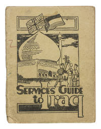
1942ABC_47444Baghdad: PAI force G. H. Q. Welfare Committee 1942. Original publisher's beige printed paper wrappers. 14.5 x 11 cm. With two full-page maps of Iraq and Baghdad on page 24 and 25 and a full-page map of the "Baghdad Amenities area" on the back wrapper. Further with 6 pages of advertisements serving as endleaves. A very rare guide intended for British armed forces stationed in Iraq during the Second World War. It was probably handed to the soldiers soon after arrival. Works like these were often discarded when they were no longer needed. As such there are usually few of them left. This particular military guide is likewise extremely rare. We have only been able to find 3 other copies 2 of which are located at the Imperial War Museum in London.The Services guide to Iraq was probably published by the welfare committee of the British PAI force which is short for "Persia and Iraq Force". The British were stationed here to prevent Nazi Germany from invading the region for oil among other reasons. The guide was meant to teach the soldiers the basics of finding their way in this new country. It explains where to go for sports music religion legal aid education the costs of sending letters home and how to recognize and prevent various tropical diseases. It also aims to instill some cultural awareness in the reader: included is an excerpt of a work about the history of Iraq by Seton Lloyd 1902-1996 archaeologist and then curator at the Baghdad museum.The paper wrappers are torn at the bottom of the spine with some loss of material barely affecting the integrity of the binding a small stain and two small pen marks in red and green on the front wrapper. Somewhat browned throughout. Otherwise in good condition.l Not in WorldCat. PAI force G. H. Q. Welfare Committee, unknown
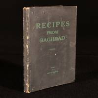
1946966F11Baghdad: The Indian Red Cross 1946 . First edition. Cloth. Good. 9" by 7". Suad Salim. The first edition of this very scarce mid 20th century cookery work presenting recipes hailing from Baghdad and Iraq. A vanishingly scarce first edition.With a folding table of weights and measures and a small number of vignette illustrations by Suad Salim.A very scarce cookery work presenting recipes popular in Iraq in the 1940s adapted for English tastes. With instructions for making various liqueurs Kubba Lebania Yuen Tsi Khankar Bakmadi and various other dishes.With an introduction from Her Majesty the Queen Mother of Iraq this work is edited by May H. Beattie with the assistance of Bedia Afnan Renée Al Kabir Helen Gaudin and Ann Walter.With bookplate of Martin and Pamela Finch to front free endpaper. They were antiquarian booksellers with an interest in antiquarian gastronomy.With a former owner's inscription to front free endpaper. In the publisher's original paper covered boards. Handling marks to boards. Rubbing to back strip head and tail and joints. Tail of front joint starting with board firmly held. Inscription and bookplate to front pastedown. Internally firmly bound. Pages lightly age toned due to paper type but generally clean with only the odd spot. Good The Indian Red Cross hardcover
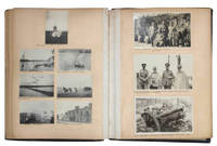
1912JBDEH1HAEOMM1912. 1/4 leather album. 4to. Approximately 120 mounted usually 2-4 to a page snap shots ranging in size from 60 x 40 mm to 120 x 100 mm. Brief captions in black ink under almost all the photos. The first half of the photos show middle class life in Edwardian England. The second and more interesting half of the photos are snap shots that appear to have been taken by a British officer and include military subjects scenes of Baghdad and the Euphrates and views of the Bosporus.An early 19th century photograpic impression of middle class life in England and the military in Iraq Some photos are faded or have minor spots or light streaks. Wretched-looking lacking backstrip with covers worn discolored and detached. hardcover
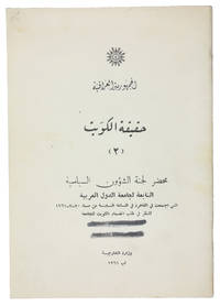
1961ABC_47301Baghdad: Wizarat al-Kharijiyah = Ministry of Foreign Affairs 1961. Original printed wrappers stapled. 8vo. Arabic text. First edition of the second of two rare pamphlets published by the Iraqi government opposing the independence of Kuwait. The first pamphlet published in English and Arabic outlined Kuwait's historical connection to Iraq and analysed its "imperialist relations" with Britain. This second one in Arabic throughout prints the minutes of the Political Affairs Committee of the Arab League which met in Cairo on 20 July 1961 to consider Kuwait's request to join the League.Kuwait emerged as an independent state in June 1961 after sixty-two years as a British protectorate. With a new constitution it held its first parliamentary elections in 1963 thereby becoming the first Arab state in the Gulf to establish a parliament. Such political developments married with growing wealth and modernisations in health culture and finance helped to make Kuwait the most prosperous state in the Arabian Peninsula.The Iraqi government argued that the move toward independence was a continuation of Kuwait's relationship with Britain albeit under a new guise. Furthermore they felt that the historical links between Iraq and Kuwait entitled the former to control over the latter and one suspects a share of its growing wealth. This position partly detailed in the pamphlet led to a point of crisis with Iraq threatening invasion. To the relief of Kuwait the Iraqis were eventually deterred by the Arab League's promise of military opposition.The wrappers are a little dusty two thick black lines on the front wrapper seemingly erasing a stamp another stamp partially visible on the back wrapper most likely a bookseller's name and address "Baghdad" is legible. Internally clean and bright. Overall in very good condition.l Jisc LibraryHub 1 copy BL; WorldCat 219629380 3 copies. Wizarat al-Kharijiyah [= Ministry of Foreign Affairs], unknown
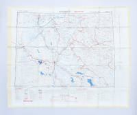
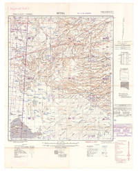
1940L7VDM2ALRS81UK Government: Geographical Section General Staff War Office 1940. 2 topographic maps colour-printed. Scale 1:500000. 820 x 640 mm and 770 x 648 mm. Previously folded. Marked "Iraq Desert Sheet 1" and "Sheet 2". Generally well preserved. Compiled from 1930s surveys and produced by the British 512 Army Field Survey Company Royal Engineers for use in the Persian war theatre. These consecutive maps cover the south-western area of Iraq including Rutba and Fallujah with parts of Saudi Arabia Jordan and Syria approximately the area between 31° and 33°30 N and 39° and 44° E.Previously folded. Marked "Iraq Desert Sheet 1" and "Sheet 2". Generally well preserved. Geographical Section, General Staff, War Office, unknown