1 159 résultats
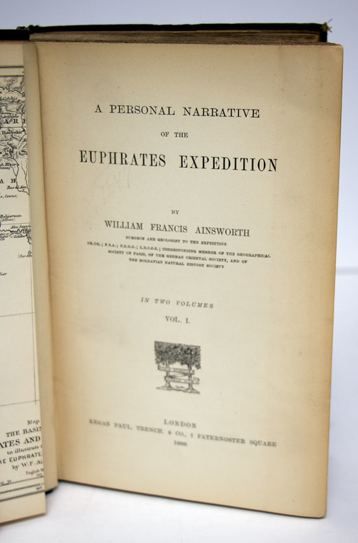
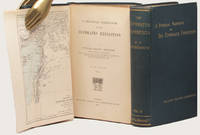
188833602London: Kegan Paul Trench & Co. 1888. 2 volumes. First Edition. With pleasing provenance. With a fine map showing the Tigris and Euphrates rivers and the surrounding geography of the Middle East. Thick 8vo publisher's original dark green cloth the upper covers and spines lettered in gilt original green endleaves. xv 447 32 publisher's catalogue; vii 492 pp. A very bright and pleasing set as fine as can be expected. FIRST EDITION OF THIS ELUSIVE AND SIGNIFICANT WORK. Ainsworth's excellent account of the Euphrates expedition to which he was appointed surgeon and geologist. The expedition was intended to "examine the feasibility of opening up the Mesopotamian rivers to steam navigation as a new route to India as well as asserting British political presence in the area promoting British commercial ties and gathering scientific and archaeological data" ODNB.<br> This is arguably the fullest contemporary account of the expedition as the fraught publication history of Chesney's account meant that his 'NARRATIVE.London 1868 was ultimately less detailed than intended.<br> This copy was owned by John Brinton who was elected member of parliament for Kidderminster in 1880 but accepted the Chiltern Hundreds next month because he was holding a government contract at the time. He was reelected without opposition and held the seat until 1886. In 1887 he presented Brinton Park to Borough of Kidderminster. He became High Sheriff of Worcestershire in 1889 and was an Alderman of the County Council from 1890. His attractive engraved plate is at each pastedown. Kegan Paul, Trench & Co. hardcover
1930L6CC0NQYKB25London: George Philip & sons 1930. Colour printed map 54 x 68 cm with yellow covers 19.5 x 11 cm. Map of Iran Iraq and parts of the surrounding countries including modern Kuwait Bahrain Qatar and the UAE in the 1930s published in the series "Philips' authentic imperial maps for tourists & travellers". Published in the early years of the discovery of oil in the Middle East the map shows roads and railways but also caravan routes submarine cables and oil pipelines.Slightly soiled in very good condition. George Philip & sons, unknown
429 pages. Numerous colour photographic plates and black and white reproductions of photos. Text in English. "Describes the stages of militant, intellectual and political life of one of the most distinguished existing leaders of the Arabian world and of the Third World. Tends to find and tell the truth to those who look for it far from fanaticism, resentments and prejudices." - from back cover. Unmarked with average wear. Binding intact. A sound copy. Book
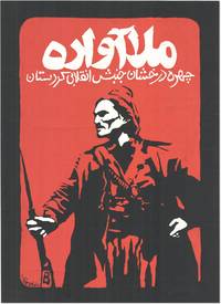
199083129Kurdistan: New Organization 1990's. Original silkscreened poster 63.5cm x 46cm printed in red and white on heavy black paper. Slight wear to edges almost neglible and some minor surface cracking to the very heavily applied paint are the only things that could be considered defects. A very good example. <br /> <br /> An exceptionally striking image printed in dramatic red and white onto black card depicting a heavily armed figure in traditional Kurdish dress beneath the legend in Kurdish:<br /> "The Displaced Mullah; The Shining Face of Revolutionary Kurdistan"<br /> <br /> The figure depicted is in all likelihood a stylized portrait of Mahmoud Barzanji a national Kurdish hero from the unrest of the early 20th century who became the first King of Kurdistan and was appointed Governor of the region by the British after the formation of the Kurdistan Protectorate after WW1. Barzanji not universally popular in Southern Kurdistan was a leader of considerable energy and ambition which far outstripped British plans for his 'control' of the region. The British and Barzanji came into direct conflict when he began arresting and imprisoning British officials who put up any opposition to his plans and embarking upon a localised uprising. The British predictably enough put a stop to his ambitions by ambushing him on the Sulamaniah road wounding him and then graciously commuting his death sentence to one of imprisonment in the British stronghold of Lahore in India where Barzanji was kept prisoner until 1922.<br /> The other possibility and with a stronger resemblance is that the poster depicts Simko Shakik early 20th century warlord and revolutionary who aside from massacring Armenians and Assyrians for the greater good of Kurdistan also led a rebellion against Iran. Although not conspicuously working from a Kurdish nationalist perspective modern critical thought suggests that Shikak should be placed "within the confines of Kurdish ethno-nationalism" Kamal Soleimani; "The Kurdish image in statist historiography: the case of Simko" 2017. Shikak himself was mainly interested in plunder and what he no doubt considered 'punitive justice against' basically anyone who sought to extert power over him or as a secondary consideration other Kurds; the results of his aggressive energy and willingness to fight anybody however are historically considered evidence of his benefit to Kurdish freedoms. No other examples of this poster can currently be traced in trade or institutional database. New Organization unknown
1936055476Baghdad: Dangoor's Printing and Publishing House / The Times Press 1936. 1st Edition . Hardcover. Very Good. 4to - over 9¾ - 12" tall. Original grey cloth bdg. 4to. 28 x 20 cm. In English and Arabic. iii 608 278 xxxxxxiii sic.Lxiii p. richly illustrated three maps two folded many separate colors and b/w plates. Fading on the Iraqi flag on the front board slightly worn on the hinges of the spine a stain on the edge overall a very good and bright copy. English edition. Exceedingly rare first and only "Iraq directory" issue as the best reference for early modern Iraq. This superb early 20th-century work on the "complete Iraq" was also published in Arabic and English separately. All published. The best reference in English of modern Iraq prepared by the Ministry of Interior in 1936 including history architecture archaeology military history economy health services jails oil companies engineering press and printing houses ports navigation army government Iraqi flag and social structure of the country in the 1930s containing minorities and ethnic groups with statistics and history. The last chapter titled "the commercial section" is also the best reference for the trade of Iraq at the beginning of the 20th century listing all trade companies with attractive colors and b/w full page and in-text advertisements. This historically significant work gives invaluable insight into the social historical and economical structure of modern Iraq. The book in almanac form which is opening with a preface contains the full page plates of His Majesty King Ghazi I views of Qasr al-Zehoor residential Palace of H.M. the King H.R.M. Amir Faisal Crown Prince of Iraq and His Late Majesty King Faisal I Creator of Modern Iraq photo-engraved in Cairo and Iraq with special permissions of the Court. Then the history of the Iraqi Royal Hashimite Family tree and biographies of the members can be found. Some tables of conversion of years A.H. into years A.D. of Sunrise and Sunsets in 1936 temperatures and eclipses and official holidays with the general calendar of 1936. This important calendar includes the special and historical days like All Saint's Day Occupation of Mosul British Forces Armistice Day Jewish Christian and Islamic feasts etc. next to a general chromo-lithographed map of Iraq. The work gives general information about Iraqi geography and administrative divisions. The next chapter gives a detailed historical account of Iraq to the present day. The government services like medicine transportation courts cabinet army sports etc. are introduced in detail. As the most important two chapters of the work including a richly illustrated account of the ethnic groups inhabitants minorities and religious demography and 'liwas' of the country give invaluable resources to the Iraqi social structure. An interesting additional notice by the new government of the period indicates "When the Iraq Directory for 1936 was still in the press a law was enacted prohibiting the use of titles such as Beg Pasha etc. in Iraq". This gives an insight into the relations of Iraq with the Republic of Turkey in the 1930s. The last chapter titled "the commercial section" contains almost all national and international Iraqi and some European firms in the 1930s trade such as shipping and transportation firms exporters merchants cinemas hotels publishers and manufacturing companies in various sectors is unsurpassed trade reference for the early 20th century Middle Eastern trade especially after the nationalism of Iraqi oil created the Iraq National Oil Company by negotiations took six years and ended with the July 1928 Red Line Agreement with the US and Britain. The maps' titles are "Historical sites in Iraq" "Provisional geological sketch map of Iraq" and "General Map of Iraq". Overall a historically important almanac of modern Iraq as well as the Middle East. Nineteen copies in OCLC 652197259 24979123 269202533. <br/> <br/> Dangoor's Printing and Publishing House / The Times Press hardcover
Very Good Arabic Original chromo-lithograph map in brown tones. On a special paper with an ongoing blindstamped "Regestre Robur" during the borders. Folded. 70x100 cm. In Arabic. Scale: 1 /1.000.000. Chipped on margins, split on folded traces. Slight discoloration and one stain on lower margin. Otherwise a good copy. An attractive and detailed map of Syria shows the capital (as Aleppo n that map), other cities like Damascus, Raqqa, Homs, Latakia, Ayn al-Arab, Idlib, Hama, Deir Ez-Zor, Jarabulus, et alli. And it shows Turkey on the north (as Turkey containing Hatay and Alexandrette), The Mediterranean shores of the land as well as Lebanon and Palestine (and Jerusalem) on the west, Sharq al-Urdun (Jordan) and Iraq on the south and east. It's very detailed on showing the roads spread throughout the land like railways and ancient roads from the Roman period. Additionally this roads can be followed to the other Arabic countries and regions on the map. This map was calligraphed by Kamel Al-Baba, (1905-1991), who was a Lebanese contemporary / modern calligrapher. He is the son of famous calligrapher Mokhtar Al-Baba. Cannot be found in WorldCat.; Not in Library of Congress Map Collection. Very scarce.
Royal octavo. Pp. xiv, 230. Plus 2 plates with maps of Baghdad in 17th and 18th centuries respectively. Hardcover, bound in contemporary quarter cloth and marbled boards, gilt lettering to spine, bit marked, with the original printed wrappers bound in, signature on title-page. In fine condition. Excellent copy. ~ First edition. Scarce.
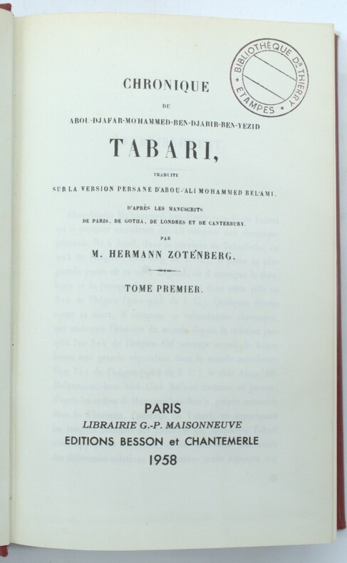
1958PHO-1454Paris, , Maisonneuve ; Besson & Chantemerle, 1958 , 4 volumes in-8 , relié pleine toile rouge , supra libro aux plats, cachets ,2ff.-viii-599pp., 2ff.-ii-552pp. ,2ff.752pp.,2ff.iii-665pp.
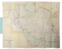
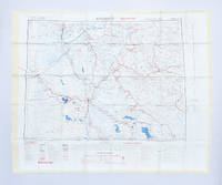
1951182329London: Ordnance Survey 1951. Later editions marked "restricted" revised from those produced by the War Office in 1941-42 and with isogonals correct to 1953. They show the international borders between Iran and Iraq but warn that they are still under negotiation. These maps are in a variety of later editions all printed in 1951 Baghdad fifth; Basra eighth; Tehran third; Bushehr fourth. This was a critical year in Iranian politics as the country underwent the Abadan Crisis saw the assassination of Razmara and the election of Mosaddeq. In the same period Iraq saw a number of anti-government protests including the 1952 Iraqi Intifada against the Anglo-Iraqi Treaty. Over these years British and American forces kept close watch on the region's development and likely printed these maps printed on rayon as escape items to issue to forces in case fighting broke out. Escape maps were first introduced by MI9 during the Second World War designed to be easily smuggled into POW camps. They were printed on silk and for "good reasons: silk is flexible and durable in a way that paper is not and it is noiseless when hidden about one's person" Bond. They continued to be issued throughout the 20th century and into the modern day especially during the 1960s and the Vietnam War. 2 sheets of rayon 596 x 715 mm; 610 x 676 mm colour map on each side key on map of Tehran; text in English and French. Sometime folded edges fraying more so to sheet of Baghdad and Basra: a very good copy. Barbara A. Bond "Escape and evasion maps of World War II" The British Library 2016. unknown
M8814Very rare complete set of two volumes bound in one. Government Press Baghdad 1940. First edition. In-8. Vol. I: 25 pages 120 plates. Vol. II: xiii & 24 pages 144 plates. Bound in an elegant modern half-leather with cloth boards a fine copy. Language: English. This book ships from Europe shipping costs will be updated accordingly BCI. Relevant subjects: Mesopotamia. unknown
Boldy signed and generically inscribed by Piper upon title page. 128 pages. Index. Footnotes. Black and white reproductions of photos. "The secret history of how America's 'Neo-Conservative' (neo-con) Trotskyites came to power and orchestrated the war against Iraq as the first step in their drive for global empire." - subtitle. "Writing about these subjects is 'radical' and 'controversial,' but it's a dirty job and someone has to do it. I make no apologies for telling the truth." - page 128. A well-studied copy with considerable pencil underlining and marginalia throughout and spine rolled. Piper (1960-2015) was a prominent talk show host and prodigious author whose works include such titles as "Confessions of an Anti-Semite". Book
8vo., First Edition, with frontispiece, 103 plates on 60 and 3 maps (one double-page) in the text; handsomely bound in dark red full morocco, sides with gilt frame border, back with raised bands, second and fourth compartments ruled and lettered in gilt, all other compartments tooled in gilt, gilt top, a most attractive copy ideal as a gift or for presentation. The Marsh Arabs occupy the region around the junction of the Tigris and Euphrates in southern Iraq. This classic account, recording eight years spent living among them, is a worthy sequel to his masterpiece 'Arabian Sands'.
1940100183Arrault & Cie, Maitres impremeurs, Tours 1940. 418 Seiten mit 154 Figuren - 105 Tafeln mit 233 photographischen Abbildungen, (418 pages avec 154 figures - 105 planches avec 233 illustrations photographiques), 4°, privates Halbleinen mit Rückentitel, Bibliotheks-Exemplar (ordnungsgemäß entwidmet), Stempel Vorsatz und Titel, Exemplar mit leichtem Wasserschaden (Buchblock gebogen, Papier teils leicht wellig, Schnitt mit leichtem Wasserrand, nur geringfügig nach innen greifend), insgesamt ordentliches und innen sauberes Exemplar, (4 °, demi-lin privé avec titre de dos, exemplaire de bibliothèque (dûment dédié), attachement de tampon et titre, copie avec de légers dégâts d'eau (bloc de livre plié, papier partiellement légèrement ondulé, coupé avec une légère marge d'eau, atteignant légèrement à l'intérieur), dans l'ensemble soigné et à l'intérieur copie propre),
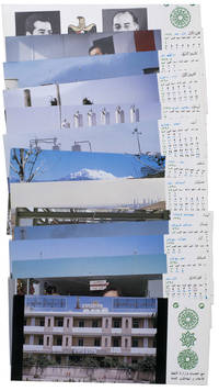
1977ABC_47947Baghdad: Ministry of Oil 1977. Original sturdy plastic case. Oblong 10 x 23 cm. With photographic illustrations all postcards are printed in colour. Remarkable complete set of 14 postcards published by the Iraqi Ministry of Oil to celebrate the flourishing petroleum industry and probably its nationalisation in 1972. The first 2 postcards show the building of the ministry and the official state portraits of then President of Iraq Ahmed Hassan al-Bakr 1914-1982 and Vice Chairman Saddam Hussein 1937-2003. The remaining 12 postcards are each printed for a different month of the year and show various aspects of the Iraqi petroleum industry including the Al-Bakr deep water terminal renamed in 2003 to Al-Basah oil terminal the Al-Khalida oil products tanker the degassing station at North Rumaila oil field the eternal fire near Kirkuk which was the first oil field found in Iraq and the Haditha-Rumaila pipeline which was newly built at the time.With a small crack in one of the sides of the sturdy plastic case. The first and last card in the set are slightly creased. Otherwise in very good condition. Ministry of Oil, unknown
1929867091929. Goverment of Iraq. MAPS OF IRAQ WITH NOTES FOR VISITORS. Baghdad London: Goverment of Iraq 1929. REvised and Enlarded Edition 1929. Folio. 34pp. Bound in original maroon cloth with gilt lettering to front cover. 8 large folding maps all required. All printed in 3 colors and produced by the Public Words Department of Iraq. 6th map has one fold with small tears and creases at edges. Head and tail are slightly worn. Includes photo-illustrated frontispiece. unknown books
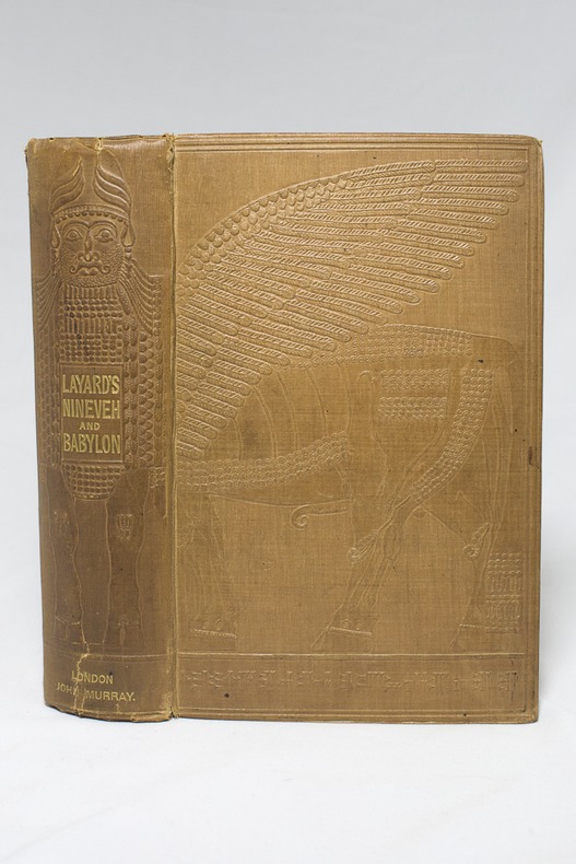
185314311London, John Murray, 1853. In-8 deXXIII-[1]-686-[2] pages, pleine percaline chocolat estampée d'un beau motif babylonien. Menues rousseurs. Etiquette des relieurs Remnants & Edmonds.
188874526London, Kegan Paul, Trench & Co 1888 2 volumes in-8, percaline bleu-vert éditeur, XIV- 447- 32 catalogue de l'éditeur et VII- 492 pages. Index. Carte repliée imprimée en 2 tons. Légères usures.
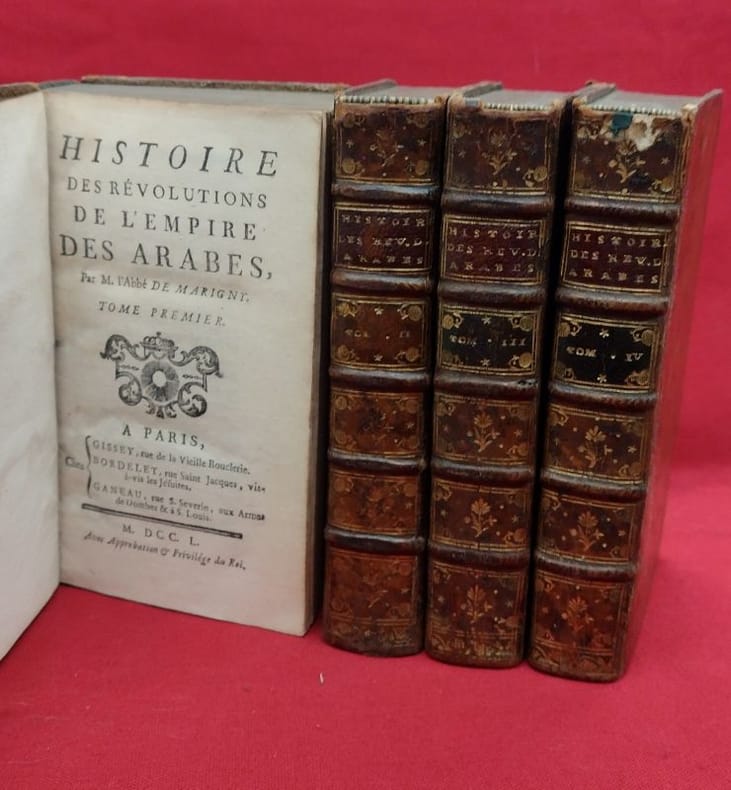
1750118710gisset, bordelet, ganeau 1750 4 in-12 A Paris, chez Gissey, Bordelet, Ganeau, 1752, 4 volumes in-12, (2) ff., LX, 58, 498 pages, (3) ff.-(2) ff., 519 pages - (3) ff., XIV, 540 pages - (2) ff., 525 pages. Plein veau marbré, dos à cinq nerfs portant titres et tomaisons dorés sur pièces de cuir, caissons ornés, filets d'encadrements des plats à froid, filet doré sur les coupes, roulette dorée sur les chasses, tranches mouchetées de rouges, gardes de papier marbré peigné. Cinq coiffes manquantes ou endommagées, coins frottés, rares rousseurs, sinon bon état général.
186 pages. Features: Rumble between Eliot Spitzer and Harvey Pitt; AOL's new music man; New Qwest CEO; With Bill Gates at Work; How a War With Iraq with Change the World; USA Today dubs itself America's paper; Will R&D Make Merck hot again?; The Olsen Twins; Craig McCaw still dreams of an internet in the sky; America's 50 best companies for minorities. Address label clipped from front cover. Average wear. A sound copy. Magazine
1740A131-2661Amsterdam / Venezia, Tirion / Giovanni Battista Albrizzi, c. 1740. Landkarte, Kupferstich, koloriert, 27 x 33 cm / Map, copperplate engraving, coloured, 27 x 33 cm
New English Original bdg. HC. Roy. 8vo. (24 x 17 cm). In Turkish. 6 volumes set: (1082 p., 1034 p., 954 p., 986 p., 972 p., 1058 p.). Turkish transcription of manuscripts Süleymaniye Yazma Eser Kütüphanesi, Hamidiye Kolleksiyonu No. 1377-1378-1379. Oversize and very heavy set. Kâmûsu'l-muhît. El-Okyânûsu'l-basît fî tercemeti'l-Kâmûsu'l-muhît. Prep. by Eyyüp Tanriverdi, Mustafa Koç. 6 volumes set.
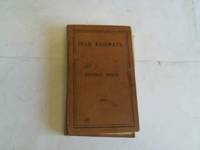
2h8810Railway Press Baghdad 1930. 317 pages with some glued corrections from the 30s and 40s hardcover spotted/some pencil markings. hardcover
In 4° (24x15,5 cm); 4 opere in un volume: 282, (2) pp. e 13 c. di tav fuori testo; 295, (1) pp. e 5 c. di tav. fuori testo; 190 pp. e 6 c. di tav. fuori testo ; 70, (2) pp. e 3 ci di tav. fuori testo. Due delle tavole sono finemente acquarellate da mano coeva. Numerose piccole testatine xilogr. L'opera contiene il Tomo XVI-XVII-XVIII della celebre raccolta di viaggi del Marmocchi, molti dei quali furono qui per la prima volta stampati in italiano. Bella legatura coeva in mezza pelle scura con dorso a 4 nervi e titolo, numero dei volumi e filettatura in oro ai tasselli. Piatti foderati con carta marmorizzata coeva. Qualche leggera strofinatura alla legatura. All'interno in buone-ottime condizioni di conservazione. Molto belle le tavole fuori testo con la riproduzione di scorci, paesaggi, personaggi e cotumi dei luoghi descritti. Good copy. First editon.
New English Original bdg. 4to. (32 x 23 cm). In English and Ottoman facsimile. 2 volumes set: (250, [218] p.), color ills. Swordsman, historian, mathematician, artist, calligrapher Matrakçi Nasuh and his Menzilname. / Account of the Stages of Sultan Süleyman Khan's Iraqi Campaign - Beyan-i menazil-i sefer-i Irakeyn-i Sultan Süleyman Han. The Facsimile Edition. 2 volumes set. Vol. 1 is the presentation of Matrakci and his work, Vol. 2 is the facsimile of Beyân-i Menâzil-i Sefer-i Irakeyn-i Sultan Süleymân Hân (Account of the Stages of Sultan Süleyman Khan's Iraqi Campaign) as preserved at the Istanbul University Rare Works Library, Manuscript ref. T5964.
8vo., First Edition, with a frontispiece, 31 plates on 16, 2 large folding maps, a full-page map and 2 full-page plans in the text, and endpaper maps in orange; original buff cloth, gilt back, a remarkably bright, fresh, clean copy in unclipped, moderately age-soiled dustwrapper. Sold from an institution with its inscription on front board, small label scar on front paste-down, bookplate on half-title verso and neat blind stamp on title. THESE ATTRIBUTES NOTWITHSTANDING, THIS IS A REMARKABLY BRIGHT, CLEAN COPY OF A PRACTICALLY UNOBTAINABLE WORK. With dustwrapper artwork by Anthony Gross. This important account covers the diplomatic and military history of the Mosul dispute between Great Britain and Turkey from 1918 to 1925, with a detailed appreciation from the author's own experiences as political officer and member of the Anglo-Iraqi delegation of the Committee of the League of Nations. In addition it contains much new information of the geography and antiquities of north-eastern Iraq , the secular frontier dispute between the Ottoman and Persian Empires, the organization and influence of the mystical dervish fraternities, modern cultural activity and other facets of Kurdish society. THIS REGION ALSO SAW THE FIRST ASSIGNMENT ANYWHERE IN THE WORLD OF THE ROYAL AIR FORCE AS THE ARM PRIMARILY RESPONSIBLE FOR EXTERNAL DEFENCE AND INTERNAL ORDER. Rare.