108 résultats
20091349396PN. New. 2009. Soft Cover. This is a reprint edition. . PN paperback
20091349426PN. New. 2009. Soft Cover. This is a reprint edition. . PN paperback
20061345410PN. New. 2006. Soft Cover. PN paperback
20131356531PN. New. 2013. Soft Cover. Date is original print. This is a reprint edition. . PN paperback
20061345881PN. New. 2006. Soft Cover. This is a reprint edition. . PN paperback
20061345438PN. New. 2006. Soft Cover. PN paperback
20061345082PN. New. 2006. Soft Cover. md . PN paperback
1904864848.Gpaperback. Good. Access codes and supplements are not guaranteed with used items. May be an ex-library book. paperback
2024x-1032524871Chapman & Hall 2024. Hardcover. New. 248 pages. 9.19x6.13x9.21 inches. Chapman & Hall hardcover
76443Bagdad The Government Press 1960. Gr.8° 11 S. Text u. 8 Taf. Geh. Umschlag etw. gebräunt u. gebrauchsspurig EA. Text des «Inspector General of Excavations». Geschichte Lage und Funde Ashurs «the earliest capital of the Assyrians». 010 Bagdad, The Government Press, 1960 unknown
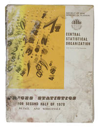
1970ABC_46826Iraq: Central Statistical Organization 1970. Original printed publisher's wrappers. Folio 28.5 x 21 cm. With multiple graphs on 8 leaves most of them in the text. The main price-information is arranged in tables all tables and other introductory information are printed on 1 side of the leaves from right to left on the recto side of the leaves excluding the information in English which has from that perspective been printed on the verso side of the leaves. A statistical overview of the changes in wholesale and retail prices of among other things agricultural animal electronic and textile products in Iraq during the second half of 1970. The elaborate information gathered and presented in the present work by the index numbers & prices department of the central statistical organization of the ministry of planning of the Republic of Iraq has mostly been arranged in tables supplemented with some graphs. The information is organised by general geographical districts in the north middle and south of the country and assessing the prices of products on markets in Baghdad the capital of Iraq separately as its own densely populated district. The present work was published as a supplement to the original bulletin on prices for the first half of 1970 in an effort to bridge the gap in data supply as the Index numbers & Prices department tried to change the publishing frequency from once or twice a year to quarterly and eventually to monthly statements on the changing prices. The information is presented both in Arabic and in English for the purpose of providing a wider range of people and organisations with the information. The Arabic information of course reads from right to left and the tables with the information in both languages are oriented in the same way and the English list of contents and introductory information can be found at the back of the work to be read from left to right. Iraq experienced considerable economic development during the second half of the 20th century. By 1980 its complex central state-planned economy had become the second largest economy in the Arab world after Saudi Arabia. To achieve such development people had to keep a close eye on changing wholesale and retail prices in order to keep changes in inflation and purchasing power in check.Wrapper worn and stained with a blue stamp on the wrapper with the title in Arabic front or back wrapper some staining to the first 4-5 leaves at both English and Arabic ends of the work otherwise internally good and clean. Central Statistical Organization, unknown
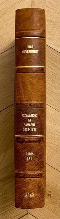
M8814Very rare complete set of two volumes bound in one. Government Press Baghdad 1940. First edition. In-8. Vol. I: 25 pages 120 plates. Vol. II: xiii & 24 pages 144 plates. Bound in an elegant modern half-leather with cloth boards a fine copy. Language: English. This book ships from Europe shipping costs will be updated accordingly BCI. Relevant subjects: Mesopotamia. unknown
1936055476Baghdad: Dangoor's Printing and Publishing House / The Times Press 1936. 1st Edition . Hardcover. Very Good. 4to - over 9¾ - 12" tall. Original grey cloth bdg. 4to. 28 x 20 cm. In English and Arabic. iii 608 278 xxxxxxiii sic.Lxiii p. richly illustrated three maps two folded many separate colors and b/w plates. Fading on the Iraqi flag on the front board slightly worn on the hinges of the spine a stain on the edge overall a very good and bright copy. English edition. Exceedingly rare first and only "Iraq directory" issue as the best reference for early modern Iraq. This superb early 20th-century work on the "complete Iraq" was also published in Arabic and English separately. All published. The best reference in English of modern Iraq prepared by the Ministry of Interior in 1936 including history architecture archaeology military history economy health services jails oil companies engineering press and printing houses ports navigation army government Iraqi flag and social structure of the country in the 1930s containing minorities and ethnic groups with statistics and history. The last chapter titled "the commercial section" is also the best reference for the trade of Iraq at the beginning of the 20th century listing all trade companies with attractive colors and b/w full page and in-text advertisements. This historically significant work gives invaluable insight into the social historical and economical structure of modern Iraq. The book in almanac form which is opening with a preface contains the full page plates of His Majesty King Ghazi I views of Qasr al-Zehoor residential Palace of H.M. the King H.R.M. Amir Faisal Crown Prince of Iraq and His Late Majesty King Faisal I Creator of Modern Iraq photo-engraved in Cairo and Iraq with special permissions of the Court. Then the history of the Iraqi Royal Hashimite Family tree and biographies of the members can be found. Some tables of conversion of years A.H. into years A.D. of Sunrise and Sunsets in 1936 temperatures and eclipses and official holidays with the general calendar of 1936. This important calendar includes the special and historical days like All Saint's Day Occupation of Mosul British Forces Armistice Day Jewish Christian and Islamic feasts etc. next to a general chromo-lithographed map of Iraq. The work gives general information about Iraqi geography and administrative divisions. The next chapter gives a detailed historical account of Iraq to the present day. The government services like medicine transportation courts cabinet army sports etc. are introduced in detail. As the most important two chapters of the work including a richly illustrated account of the ethnic groups inhabitants minorities and religious demography and 'liwas' of the country give invaluable resources to the Iraqi social structure. An interesting additional notice by the new government of the period indicates "When the Iraq Directory for 1936 was still in the press a law was enacted prohibiting the use of titles such as Beg Pasha etc. in Iraq". This gives an insight into the relations of Iraq with the Republic of Turkey in the 1930s. The last chapter titled "the commercial section" contains almost all national and international Iraqi and some European firms in the 1930s trade such as shipping and transportation firms exporters merchants cinemas hotels publishers and manufacturing companies in various sectors is unsurpassed trade reference for the early 20th century Middle Eastern trade especially after the nationalism of Iraqi oil created the Iraq National Oil Company by negotiations took six years and ended with the July 1928 Red Line Agreement with the US and Britain. The maps' titles are "Historical sites in Iraq" "Provisional geological sketch map of Iraq" and "General Map of Iraq". Overall a historically important almanac of modern Iraq as well as the Middle East. Nineteen copies in OCLC 652197259 24979123 269202533. <br/> <br/> Dangoor's Printing and Publishing House / The Times Press hardcover
1991BN149656Graz : Weishaupt 1991. 1991. Kurdistan : Schmelztiegel der Hochkulturen zwischen Anatolien und Mesopotamien. <br/><br/>Kurdistan : Schmelztiegel der Hochkulturen zwischen Anatolien und Mesopotamien. Kurdistan / Türkei / Irak - Kohl Engelbert Graz : Weishaupt unknown
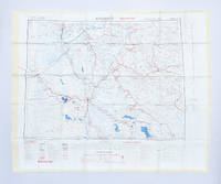
1951182329London: Ordnance Survey 1951. Later editions marked "restricted" revised from those produced by the War Office in 1941-42 and with isogonals correct to 1953. They show the international borders between Iran and Iraq but warn that they are still under negotiation. These maps are in a variety of later editions all printed in 1951 Baghdad fifth; Basra eighth; Tehran third; Bushehr fourth. This was a critical year in Iranian politics as the country underwent the Abadan Crisis saw the assassination of Razmara and the election of Mosaddeq. In the same period Iraq saw a number of anti-government protests including the 1952 Iraqi Intifada against the Anglo-Iraqi Treaty. Over these years British and American forces kept close watch on the region's development and likely printed these maps printed on rayon as escape items to issue to forces in case fighting broke out. Escape maps were first introduced by MI9 during the Second World War designed to be easily smuggled into POW camps. They were printed on silk and for "good reasons: silk is flexible and durable in a way that paper is not and it is noiseless when hidden about one's person" Bond. They continued to be issued throughout the 20th century and into the modern day especially during the 1960s and the Vietnam War. 2 sheets of rayon 596 x 715 mm; 610 x 676 mm colour map on each side key on map of Tehran; text in English and French. Sometime folded edges fraying more so to sheet of Baghdad and Basra: a very good copy. Barbara A. Bond "Escape and evasion maps of World War II" The British Library 2016. unknown
0996245774.Ghardcover. Good. Access codes and supplements are not guaranteed with used items. May be an ex-library book. hardcover
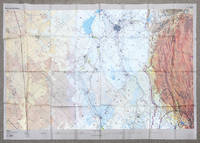
2002162482London: DGIA Ministry of Defence 2002. First edition stretching from Baghdad to Basrah and showing all of Kuwait. The sheet was likely issued to RAF pilots in the run up to the Iraq War and is printed on rayon for ease of use and durability. These charts produced by the Defence Geographic and Imagery Intelligence Agency feature many warnings about flying within controlled airspace in Iraq and Saudi Arabia. The RAF flew many missions over this region in the lead-up to the Second Gulf War and in Operation Telic. "The first documented intimations of UK involvement in the operation that became Telic can be traced to March 2002. In May the Chief of the Defence Staff CDS was advised of a potential RAF contribution to a future operation in Iraq comprising 88 fast jets and 38 support platforms - more aircraft than the RAF had deployed on a single operation since the First Gulf War and more in all probability than it will ever deploy again" Ritchie p. 5. A formal plan was drafted in August to overwhelm Hussein's government through multiple co-ordinated fronts of which the RAF's role was to eradicate the enemy air force destroy equipment support ground forces and strike important targets to shock the Iraqi people. According to the key there was another sheet issued charting northern Iraq. Single sheet of rayon 912 x 1300 mm colour map with key on recto and verso. Sometime folded and thinning along lines: a near-fine copy. Sebastian Ritchie "The Royal Air Force in Operation Telic: Offensive Air Power March-April 2003" 2021. unknown
2008Q-1931859655Haymarket Books 2008-09-01. Paperback. New. New. In shrink wrap. Looks like an interesting title! Haymarket Books paperback
1024291294.Ghardcover. Good. Access codes and supplements are not guaranteed with used items. May be an ex-library book. hardcover
1241053499.Gpaperback. Good. Access codes and supplements are not guaranteed with used items. May be an ex-library book. paperback
1015702929.Ghardcover. Good. Access codes and supplements are not guaranteed with used items. May be an ex-library book. hardcover
2h8810Railway Press Baghdad 1930. 317 pages with some glued corrections from the 30s and 40s hardcover spotted/some pencil markings. hardcover
1969IT-40FO-JC6L1969. Hardcover. Good. Oxford/RIIA 1969. Ex-library with the usual markings no jacket. Otherwise in nice shape with light wear clean pages firm binding. hardcover
196790149Baghdad: Dar Al-Jumhuriya Press 1967. Paperback. Good. photos 16p. Softcover in original wrapper. 22cm. Heavy horizontal crease. Minor cover soil. Photos and claims concerning the use of Napalm Bombs by Israel during The Six-Day War. Dar Al-Jumhuriya Press paperback
20042091502135420122Gendaijin bun-sha 2004. Soft Cover. Fine. Number of books: 1 Gendaijin bun-sha paperback