108 résultats
20061345804PN. New. 2006. Soft Cover. This is a reprint edition. . PN paperback
20051344392PN. New. 2005. Soft Cover. md . PN paperback
20071346486PN. New. 2007. Soft Cover. This is a reprint edition. . PN paperback
20081347533PN. New. 2008. Soft Cover. This is a reprint edition. . PN paperback
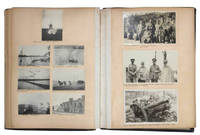
1912JBDEH1HAEOMM1912. 1/4 leather album. 4to. Approximately 120 mounted usually 2-4 to a page snap shots ranging in size from 60 x 40 mm to 120 x 100 mm. Brief captions in black ink under almost all the photos. The first half of the photos show middle class life in Edwardian England. The second and more interesting half of the photos are snap shots that appear to have been taken by a British officer and include military subjects scenes of Baghdad and the Euphrates and views of the Bosporus.An early 19th century photograpic impression of middle class life in England and the military in Iraq Some photos are faded or have minor spots or light streaks. Wretched-looking lacking backstrip with covers worn discolored and detached. hardcover
1991BN149656Graz : Weishaupt 1991. 1991. Kurdistan : Schmelztiegel der Hochkulturen zwischen Anatolien und Mesopotamien. <br/><br/>Kurdistan : Schmelztiegel der Hochkulturen zwischen Anatolien und Mesopotamien. Kurdistan / Türkei / Irak - Kohl Engelbert Graz : Weishaupt unknown
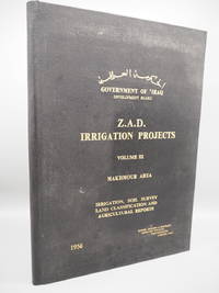
1956C189434London: Binnie Deacon & Gourley 1956. Hardcover Hardcover. Very Good. Single volume only. Folio. Black cloth slightly worn otherwise very good indeed. No dust jacket. Binnie, Deacon & Gourley, hardcover
20061345840PN. New. 2006. Soft Cover. This is a reprint edition. . PN paperback
20061345824PN. New. 2006. Soft Cover. This is a reprint edition. . PN paperback
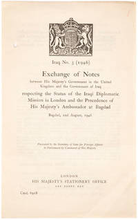
194621150551946. London: HMSO. 1946. 8vo. Unbound bifolium as issued one punch hole in inner margin; very good.This is the very rare exchange of notes printed in Arabic and English between Hugh Stonehewer-Bird and Dr. Mohamed Fadhel Al Jamali regulating the status of diplomatic missions in both London and Baghdad after the Second World War. The Iraqi statesman Muhammad Fadhel al-Jamali tied his country closely to Britain and the US during the Cold War. After the overthrow of the monarchy he was imprisioned and wrote the influential and liberal Letters on Islam. unknown
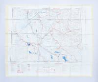
26975'Published by Survey Directorate G.H.Q. Paiforce 1944. All one page 20 x 33cms some stained but texts clear and complate. 1. Index map of Iraq and Iran for a 1:100000 scale survey series produced by the British military command PAIFORCE during World War II. All 20 x 32.5cm a couple sl. stained mainly good condition.1.Four Index maps of Iraq and Iran ¼ series I.D.R./X.D.R./G.S.G.S. 9002 3919 nos. 1-42.Index map of Iraq and Iran for a 1:100000 scale survey series produced by the British military command PAIFORCE during World War II. Index Map of 'Irq rn 1:100000 Series I.D.R. 9003'.3.Four Index Maps of places/areas of IRAN:a. Ahwaz 1:10000 series 1D MISC/563 to 573 stamped 11 June 1944b. Askaran and Sanandaj N.W. 1:25000 series …9005 stamped 25 June 1944c. Gach-I-Sar 1:50000 series stamped 11 June 1944d. Khurramshahr Abandan 1:12500 series4.Six Index Maps of places/areas of IRAQ all 1:25000 series ID 9005:a. Ba'qubab. Faidahc. Haffad. Hindiyae. Falluja f. MoselNo reference to other copies yet found. 'Published by Survey Directorate, G.H.Q. Paiforce [1944] unknown
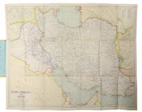
1930L6CC0NQYKB25London: George Philip & sons 1930. Colour printed map 54 x 68 cm with yellow covers 19.5 x 11 cm. Map of Iran Iraq and parts of the surrounding countries including modern Kuwait Bahrain Qatar and the UAE in the 1930s published in the series "Philips' authentic imperial maps for tourists & travellers". Published in the early years of the discovery of oil in the Middle East the map shows roads and railways but also caravan routes submarine cables and oil pipelines.Slightly soiled in very good condition. George Philip & sons, unknown
BN67623Irak Land zwischen Euphrat und Tigris Diwersy Alfred and Wand Gisela <br/><br/> unknown
20131355703PN. New. 2013. Soft Cover. Date is original print. This is a reprint edition. . PN paperback
200317531New York: Humanitarian Information Center 2003. Paperback. As New; Fine. Folio in pale green illus staple wraps; 149 pages mainly color maps; some satellite photos; lengthy index of place names ; 38 cm. Entirely in English. Highly detailed atlas of modern Iran. Scales vary. Does not include CD-ROM Iraq -- Maps. Atlases of the Middle East. Maps Baghdad Kerbala Kirkuk Erbil Mosul Dahuk. Satellite photos. Humanitarian Information Center paperback
196790149Baghdad: Dar Al-Jumhuriya Press 1967. Paperback. Good. photos 16p. Softcover in original wrapper. 22cm. Heavy horizontal crease. Minor cover soil. Photos and claims concerning the use of Napalm Bombs by Israel during The Six-Day War. Dar Al-Jumhuriya Press paperback
2009Q-0160808170U.S. Independent Agencies and Commissions 2009-02-02. Paperback. New. New. In shrink wrap. Looks like an interesting title! U.S. Independent Agencies and Commissions paperback
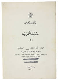
1961ABC_47301Baghdad: Wizarat al-Kharijiyah = Ministry of Foreign Affairs 1961. Original printed wrappers stapled. 8vo. Arabic text. First edition of the second of two rare pamphlets published by the Iraqi government opposing the independence of Kuwait. The first pamphlet published in English and Arabic outlined Kuwait's historical connection to Iraq and analysed its "imperialist relations" with Britain. This second one in Arabic throughout prints the minutes of the Political Affairs Committee of the Arab League which met in Cairo on 20 July 1961 to consider Kuwait's request to join the League.Kuwait emerged as an independent state in June 1961 after sixty-two years as a British protectorate. With a new constitution it held its first parliamentary elections in 1963 thereby becoming the first Arab state in the Gulf to establish a parliament. Such political developments married with growing wealth and modernisations in health culture and finance helped to make Kuwait the most prosperous state in the Arabian Peninsula.The Iraqi government argued that the move toward independence was a continuation of Kuwait's relationship with Britain albeit under a new guise. Furthermore they felt that the historical links between Iraq and Kuwait entitled the former to control over the latter and one suspects a share of its growing wealth. This position partly detailed in the pamphlet led to a point of crisis with Iraq threatening invasion. To the relief of Kuwait the Iraqis were eventually deterred by the Arab League's promise of military opposition.The wrappers are a little dusty two thick black lines on the front wrapper seemingly erasing a stamp another stamp partially visible on the back wrapper most likely a bookseller's name and address "Baghdad" is legible. Internally clean and bright. Overall in very good condition.l Jisc LibraryHub 1 copy BL; WorldCat 219629380 3 copies. Wizarat al-Kharijiyah [= Ministry of Foreign Affairs], unknown
20091349753PN. New. 2009. Soft Cover. Date is original print. This is a reprint edition. . PN paperback
2h8810Railway Press Baghdad 1930. 317 pages with some glued corrections from the 30s and 40s hardcover spotted/some pencil markings. hardcover
1951182329London: Ordnance Survey 1951. Later editions marked "restricted" revised from those produced by the War Office in 1941-42 and with isogonals correct to 1953. They show the international borders between Iran and Iraq but warn that they are still under negotiation. These maps are in a variety of later editions all printed in 1951 Baghdad fifth; Basra eighth; Tehran third; Bushehr fourth. This was a critical year in Iranian politics as the country underwent the Abadan Crisis saw the assassination of Razmara and the election of Mosaddeq. In the same period Iraq saw a number of anti-government protests including the 1952 Iraqi Intifada against the Anglo-Iraqi Treaty. Over these years British and American forces kept close watch on the region's development and likely printed these maps printed on rayon as escape items to issue to forces in case fighting broke out. Escape maps were first introduced by MI9 during the Second World War designed to be easily smuggled into POW camps. They were printed on silk and for "good reasons: silk is flexible and durable in a way that paper is not and it is noiseless when hidden about one's person" Bond. They continued to be issued throughout the 20th century and into the modern day especially during the 1960s and the Vietnam War. 2 sheets of rayon 596 x 715 mm; 610 x 676 mm colour map on each side key on map of Tehran; text in English and French. Sometime folded edges fraying more so to sheet of Baghdad and Basra: a very good copy. Barbara A. Bond "Escape and evasion maps of World War II" The British Library 2016. unknown
A9780367730024Paperback / softback. New. paperback
A9780367249717Hardback. New. hardcover
ria9780367249717_inpHardcover. New. New Book; Fast Shipping from UK; Not signed; Not First Edition; Football Fandom Protest and Democracy offers an in-depth and inside approach to the socio-political history of football in Turkey where fandom is often revered as part of the national identity presenting the historical context for fo hardcover