33 résultats
71236c.1880. . Albumen print. Four-part panorama very good tonal range and in good condition.<br /> <br /> [c.1880]. unknown
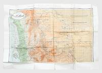
1962171426Sana'a: c.1962. Mining the border between north and south Yemen First and sole edition of this map of North Yemen with unique additions marked "top secret" in Arabic and annotated Kharitah tanbih mawaqi' al-algham "mashru' rif'at" "A map of briefing of the locations of mines of the Rifaat Plan". Although the map itself is undated and information about the "Rifaat Plan" is not publicly available it is possible that the strategy was connected to the Egyptian military officer Kamal Rifaat who visited the Yemen Arab Republic along with Anwar Sadat just after its establishment in 1962. Subsequently the Egyptians provided the YAR with a great deal of military support and advice as Abd Allah al-Sallal the country's first president fought the Federation of South Arabia later South Yemen. The long period of confrontation between North and South Yemen extended throughout the 1970s from the First Yemenite War of 1972 to the Second Yemenite War of 1979. Mines were also laid on the border before the two countries were unified in 1990 and have continued to be planted in subsequent conflicts until the present day. The map shows schematic clusters of minefields beginning due east of Sana'a around Meghdal extending in a line northwards to Wa'ir and then northwest to Jabal Mara' on the border with Saudi Arabia. The consequence of laying these minefields would have been to entrench the border between North and South Yemen the course of which they mirror almost exactly. It is annotated in pencil and colour pencil. Colour map 1000 x 690 mm. Text in Arabic. Creased where folded short closed tears and holes along fold lines and extremities a little soiled in places: a very good copy. unknown
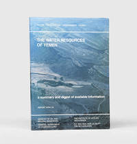
167682Sana'a and Delft: Printed for Ministry of Oil and Mineral Resources General Department of Hydrology; TNO Institute of Applied Geoscience 1995. With attractive maps and cross-sections First edition first printing consolidating hydrological data on Yemeni geography information sources climate monitoring networks and surface- and groundwater with a particular focus on evapotranspiration and flash flows. An institutional search locates only seven copies in Europe and the US. The Yemen Arab Republic formed the General Department of Hydrogeology GDR in 1978 and the Yemeni-Dutch Water Resources Assessment Yemen WRAY programme was launched four years later. WRAY investigated the water resources while building a public database and its fourth phase began in 1990 to ensure the GDR's self-reliance and consolidate earlier findings. The study focuses on western areas such as Tihama Al Jauf and Marib while the east is largely limited to the Wadi Hadhramaut. It looks at ancient water systems such as the old Marib Dam the collapse of which is noted in the Koran. Also shown is spate irrigation illustrated by Van der Gun's map of Wadi Surdud. Ghayls open canals capturing groundwater are identified as future study potential. Modern projects are assessed including the new Marib Dam and irrigation project and the increasing challenges of groundwater depletion are examined. Folio. With 6 colour folding maps and colour geological cross-section illustrations in the text. Original illustrated wrappers front wrapper lettered in white. Some rubbing of extremities soiling of rear wrapper end edges of text block internally clean. A very good copy. unknown
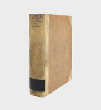
1772376213Copenhagen: Nicolaus Moeller 1772. First edition. Engraved vignettes to title page and dedication. With 24 engraved plates some folding including two Kufic facsimiles with hand-colored diacritical marks and initials; and a large folding map of Yemen colored in outline. Genealogical table folding at p. 194. xlvii 3 431 1 errata pp. 1 vols. 4to. Contemporary quarter vellum spine titled in manuscript. Early owner signature of Andreas Narr struck out by Henricus Walther 1829. Spine soiled with old library label blind stamps to bottom of first and last leaves a clean and fresh copy. Very good plus. First edition. Engraved vignettes to title page and dedication. With 24 engraved plates some folding including two Kufic facsimiles with hand-colored diacritical marks and initials; and a large folding map of Yemen colored in outline. Genealogical table folding at p. 194. xlvii 3 431 1 errata pp. 1 vols. 4to. Attractive copy of the first publication of Niebuhr's six-year travels in Arabia Felix modern Yemen and vicinity a key work of the European exploration of Arabia. Engelmann I 127; Embacher 217; Cox I237; Henze III 611; Graesse IV 674; Gay 3589; Ibrahim-Hilmy II 66; Howgego I N24. Provenance: General Theological Seminary Nicolaus Moeller unknown
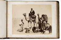
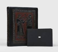
1889ABC_49512Yemen Egypt and other places 1889. Contemporary burgundy/auburn gold- and blindstamped calf lozenge-patterned blindstamping. Re-backed with the original back strip laid down. Gold-stamped turn-ins white watered silk endpapers gilt edges. Oblong folio 37.8 x 28 cm. An album containing 25 albumen prints ca. 20 x 27 cm including 1 double page mounted on thick card leaves many captioned in English. Photographic record of a journey begun in Australia and taken via Aden through the Suez canal and to the Mediterranean and then on to England. While the first image shows the steamship R.M.S. Ormuz in the port of Sydney three images including a double-page spread show the port of Aden in Yemen the famous water tanks and a native of the Southern Arabian region in a studio portrait. The majority of the album is dedicated to Egypt showing Arabs on their camels the Khedive's Ismailia Palace the Suez Canal Port Said and members the local population as well as the famous pyramids. The last few photographs show the final leg of the journey Naples and ultimately Gibraltar. Among the studios identified in the photographs are those of Hippolyte Arnoux and the Zangaki brothers based at Port Said.With a near-contemporary manuscript inscription in blue ink on the verso of the first flyleaf: "Edith Elkington or Elrington Aunt Ediths voyage home - to England about 1889". Foxed throughout slightly water stained but the prints are largely clean and clear some paper repairs in the margins the last flyleaf is lacking the final leaf is nearly detached. unknown
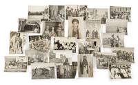
65883Yemen 1950s-1960s. 84 large-format gelatin silver prints 17.5 x 23.5cm or the reverse all with typescript caption slips in Arabic mounted to versos several captions also including series-titles e.g. 'Judges of Yemen' 'The king crown prince and Yemeni personalities' many with additional manuscript captions in Spanish. Excellent condition. An extensive visual record of the people and places of Yemen during the final years of the short-lived Mutawakkilite kingdom the majority apparently the work of a single studio based in the Arabic-speaking world and perhaps intended as an official record of Yemeni life. The Mutawakkilite regime was established after the end of Ottoman power in 1918 and lasted until 1962 when Muhammad al-Badr was deposed in a republican coup a week after succeeding his father Ahmad bin Yahya as king and imam leading to an eight-year civil war which ended in victory for the republican side. Subjects comprise: 1 Muhammad al-Badr 1926-1996 last king and imam of Yemen r.1962 5 portraits as crown prince of Yemen including one as foreign minister seated at his desk one with his uncle Sayf al-Islam 'Ali minister of science 2 during a horseback procession into Sana'a 2 photographs and one with his father Imam Ahmad this an enlarged photograph of an earlier photograph. 2 Yemeni notables 9 in total: Judge 'Abd al-Rahman al-Siyaghi minister of finance; Judge Ahmad al-Hafrani 'a man of letters of great insight and one of the greatest reciters of poetry and history'; Muhammad al-Shami minister of state and commander of the Sana'a brigade of the Yemeni army; Hasan Ibrahim minister of state and deputy foreign minister; Muhammad bin Ahmad al-Shami director of broadcasting and publications; Judge 'Abdullah al-Shawkani vice-president of the sharia council; Muhyi bin Muhammad al-Mutawakkil president of the court of appeal with assistants; Muhammad Abdullah al-Ghimizah commander of the Yemeni defence force; commander of the royal guard. 3 Daily life professions and dress 25 in total including: soldiers posed portraits and soldiers on the march; children in Ta'iz and Sana'a; teachers; tribal costume; a Yemeni 'mafraj' club or lounge; a Yemeni qaylula siesta; tennis in Sana'a; roadworks; agriculture including a coffee plantation; a student protest in support of Egypt; etc. 4 Buildings and places 21 in total including: hospitals Sana'a and Ta'iz; government ministries; mosques Janad Sana'a; palaces Ta'iz 'Dar al-Wusul'; Ta'iz airstrip; Sana'a general library; Sana'a cityscape 2 views; etc. Together with 23 further photographs: 6 of Muhammad al-Badr 9 x 14cm to 18 x 36cm depicting al-Badr addressing an open-air press conference on his arrival in Moscow 2 versions including an original large-format version on two conjoined sheets and a reduced version with typescript caption in Russian on verso attending 2 diplomatic meetings possibly in the USSR one attendee resembling Nikita Khrushchev and meeting Gamal Abdel Nasser with an informal portrait Associated Press ink-stamp and caption verso; 5 of Ahmad bin Yahya 1891-1962 King and Imam of Yemen 4 of which approx. 10 x 14.5cm 3 of these with manuscript Arabic captions on verso one depicting Ahmad and Gamal Abdel Nasser with ink-stamp and caption of Oscar Kersenbaum Argentina verso and a larger photograph 20.5 x 15cm showing Ahmad seated with Muhammad al-Badr at a victory parade Associated Press ink-stamp and caption; and 12 similar including other Yemeni notables various dimensions. Yemen, 1950s-1960s. unknown
1935169367Aden: 1935-36. A superb window onto Yemen in the 1930s Two albums depicting the experiences of British servicemen stationed in Yemen around the time of the Second Italo-Abyssinian War 1935-7 mixing the documentary and the personal. The images include very rare contemporary aerial photographs of towns including Aden Ta'izz and Shibam graphic pictures of war in Addis Ababa urban military and agricultural scenes and records of free time on the RAF base at Khormaksar. Nearly all carry explanatory manuscript captions. Aden was of crucial strategic importance to the British Empire having been brought under the control of the East India Company in 1839. After the opening of the Suez Canal in 1869 it became one of the world's busiest ports. The RAF maintained a base at Khormaksar now Aden International Airport which played host to numerous squadrons throughout the 1930s. Of these No. 8 Squadron was stationed at Khormaksar for the longest period of time maintaining a policing and day-bombing role. Photographs of military aircraft belonging to No. 8 Squadron can be seen in these albums alongside pictures of planes flown by Nos 203 41 and 55 Squadrons. The photographs give a vivid impression of the volume of air and maritime traffic - mostly British but also French and Dutch - which passed through Aden after Mussolini's invasion of Ethiopia. Aerial shots show Fairey MK IIIs and Vickers Vincent planes flying in formation as well as night and day bombers and flying boats. There are also detailed close-ups of ships including British aircraft carriers. It seems probable that the photographer who assembled these albums was involved in surveying: there are fine aerial shots of Aden and Crater the Sultan's palace at Lahij Shuqra Shibam Tarim Ibb al-Mukalla and Ta'izz giving an outstanding sense of how these towns looked in the early 20th century. The pictures of Ethiopia include one aerial photograph of Addis Ababa a number of ground shots of an execution the wounded and the dead and images of buildings on fire. There is only one photograph captioned as having been taken in Somaliland but this provides a further clue that the photographer was sent from Yemen to the Horn of Africa with the intention of documenting Italian military activities there. As a result of the Second Italo-Abyssinian War Ethiopia was incorporated into Italian East Africa consisting of Italian Somalia Ethiopia and Eritrea. Britain ruled British Somaliland and France controlled French Somaliland Djibouti. Many of the images may have been taken when the photographer was off duty. There are several almost touristic shots of everyday life in Crater showing children playing and Friday prayers images taken on the beach and in the salt pans around Aden pictures of Yemeni pastoralists with their cattle and photographs of Yemeni Indian and Somali women. A significant minority of the pictures show downtime at Khormaksar with a string of images depicting airmen in fancy dress playing football and drinking. There are even two photos of the squadron's dog in a cap and glasses and with a pipe in its mouth. 2 albums. Album I with 175 silver print photographs of various dimensions 100 x 65 mm - 240 x 180 mm mounted on card. Album II with 55 silver print photographs all c.100 x 150 mm or c.75 x 100 mm. Almost all photographs with period ink captions. Album I: quarto 290 x 230 mm. Original cloth covers spine and sides decorated with pictorial designs in relief marbled endpapers 36 card stock leaves. Album II: landscape octavo 130 x 187 mm. Contemporary black card wrappers "Aden" title sticker on front cover 22 card stock leaves. Album I: superficial rubbing to spine and rear cover short splits to inner hinges fore edges nicked. Album II: rear inner hinge split glue residue to gutters. Photographs all in very good condition. hardcover
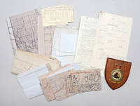
1950141716Aden & Yemen: 1950s. Into the remote places" - policing tribal disturbances in the Arabian Peninsula from the air A compelling archive of rare documents and maps. RAF operations in Aden and Yemen represented a late phase of the imperial air-policing strategy advanced by Churchill in the 1920s in response to post-Great War demobilization and Britain's expanding responsibilities in the Middle East and Africa. Claimed as a naval base on the East India route in 1839 and strengthened after the opening of the Suez Canal Aden relied on tribal treaties but as the Protectorate expanded over-stretched ground forces prompted RAF deployment from 1928 as an economical means of control. Airstrips centred on RAF Khormaksar - motto "Into the Remote Places" - supported reconnaissance leaflet-dropping and punitive strikes that helped secure the Anglo-Yemen Treaty of Friendship 1934 and later frontier policing. Reversal followed in 1954-55 with the loss of Robat while the Suez Crisis intensified unrest and Yemeni pressure leading to air attacks covert tribal agitation intervention in Oman and escalation of the frontier war into Yemen during 1958-59. The present material belongs to this volatile final phase preceding federation in 1963. Central to these operations were maps produced by the Joint Air Reconnaissance Intelligence Centre a discreet intelligence organization rooted in pre-war MI6 work. It was formalized during the Second World War and renamed in 1953 following the adoption of radar-scope photography. Headquartered at RAF Brampton and having Middle East offices in Cyprus and a detachment at Aden JARIC processed high-altitude imagery from Canberra PR9 and Victor aircraft. The archive comprises secret air-liaison instructions annotated operational maps a frontier-war-marked sketch map of Ahwar a Middle East Air Force memorandum on oxygen-mask trials RAF pilot log cards and a Khormaksar wall shield - rare survivals of evident operational use and a tangible record of Britain's final armed presence in southern Arabia. Small archive of maps memos and other documentation as detailed above. General signs of handling commensurate with active service use but overall very good. Major Michael A. Longoria "A Historical View of Air Policing Doctrine: Lessons from the British Experience Between the Wars 1919-1939" School of Advanced Airpower Studies May 1992. unknown