358 résultats
As New English Paperback. Mint. Cr. 8vo. (20 x 14 cm). In Turkish. 143 p. Milli Mücadele Dönemi'nde Yemen-Türkiye iliskileri: Imam Yahya, M. Kemal Pasa yazismalari. Turkish-Yemeni international relation during the Turkish National Struggle in the light of correspondences of Mustafa Kemal Atatürk and Imam Yahya.
As New English Paperback. Pbo. Mint. Cr. 8vo. (20 x 14 cm). 143, [1] p. In Turkish. Turkey - Yemen relations based on correspondence of Mustafa Kemal Pasha - Imam Yahya. Milli Mücadele Dönemi'nde Türkiye - Yemen iliskileri. Imam Yahya - Mustafa Kemal Pasa yazismalari.
pp.5-89 + 37 plates out-of-text + 6 folding plans, 31cm., offprint from "Archäologische Berichte aus dem Yemen, Band I (1982)", VG
1982G56450Mainz am Rhein, Philipp von Zabern 1982 pp.5-89 + 37 plates out-of-text + 6 folding plans, 31cm., offprint from "Archäologische Berichte aus dem Yemen, Band I (1982)", VG
pp.97-142 with figures in-text (plans) + 21 plates out-of-text, 31cm., offprint from "Archäologische Berichte aus dem Yemen, Band IV (1987)", VG
1987G56452Mainz am Rhein, Philipp von Zabern 1987 pp.97-142 with figures in-text (plans) + 21 plates out-of-text, 31cm., offprint from "Archäologische Berichte aus dem Yemen, Band IV (1987)", VG
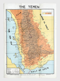
1976168409San a: Yemen Arab Republic Government 5 January 1976. Second edition labelled here as "The Yemen". It is drawn by the elusive cartographer usayn Abd All h Dham r here appearing as H. Althamary who also produced a map of San a . We have identified only six institutional copies on WorldCat at Exeter Leiden NLS Cornell LoC US Geological Survey. The first edition was published in Egypt in 1972 while an Arabic edition appeared in 1976. The map is in idiosyncratic English and marks the strategically important governorates of Taiz al-Bayda and Ma rib. Several words are misspelled including "drawen" "boundries" and "vally." The eastern border is left blank excluding the independent People's Democratic Republic of Yemen. A brief border war took place in October 1972 ending with the Cairo Agreement which proposed unification of the two Yemeni states. Each was backed by opposing Cold War powers: Saudi Arabia supported the Yemen Arab Republic while the Soviet Union backed the other. The two states ultimately united in 1990 as the Republic of Yemen. Colour lithographed map 655 x 450 mm scale 1:1000000; later laid down on board; white wooden frame overall 690 x 490 mm; text in English. Slightly toned some creasing one small hole: a very good copy. Warren P. Aston "The Origins of the Nihm Tribe of Yemen: A Window into Arabia's Past" in Journal of Arabian Studies: Arabia the Gulf and the Red Sea 4:1 2014 pp. 134-148. unknown
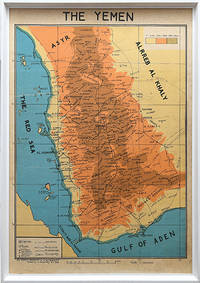
178175Egypt: M. Louts 5 January 1972. With manuscript route annotations First edition here labelled "The Yemen". It is drawn by the elusive cartographer usayn Abd All h Dham r appearing as H. Althamary who also produced a map of San a . Only three institutional copies are recorded in WorldCat at Leiden the Library of Congress and Michigan. An Arabic edition and a second English edition were published in 1976. The map is in idiosyncratic English and marks the strategically important governorates of Taiz al-Bayda and Ma rib. Several words are misspelled including "drawen" "boundries" and "vally." The eastern border is left blank excluding the independent People's Democratic Republic of Yemen. A brief border war took place in October 1972 ending with the Cairo Agreement which proposed unification of the two Yemeni states. Each was backed by opposing Cold War powers: Saudi Arabia supported the Yemen Arab Republic while the Soviet Union backed the other. The two states ultimately united in 1990 as the Republic of Yemen. The route annotations in red pen stretch from Najran in the north to the Bab al-Mandab Strait in the south. Colour map 660 x 463 mm scale 1:1000000 text in English. Old fold marks a few small holes at folds small chip to head not affecting text a little offsetting at lower margin: a very good copy. Warren P. Aston "The Origins of the Nihm Tribe of Yemen: A Window into Arabia's Past" in Journal of Arabian Studies: Arabia the Gulf and the Red Sea 4:1 2014 pp. 134-148. unknown
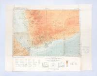
1930182334London: Geographical Section General Staff War Office 1930. Later impression overprinted with a Cassini grid in 1930 following the first edition of 1926. This map of the Aden Protectorate and its neighbours was produced for the International Map of the World a project that aimed to create a complete world map at a 1:1000000 scale. It covers South Yemen and the Hadhramaut as well as the tip of French Somaliland. The International Map of the World or the Millionth Map of the World was first proposed by German geographer Albrecht Penck in 1891. The project was adopted by ten countries in 1909 who agreed to follow consistent rules and standards for mapping their own territories. While countries like the US and UK made strides at first "production was slow in the earlier years since it was first necessary to complete basic surveys for the required data and during and after World War II there was little interest in pursuing the project" Ency. Brit. Colour lithograph map 648 x 856 mm linen-backed perhaps not as issued key printed on recto; text in English and French. A little foxed dust-soiling slight wear and a few small holes along fold lines: a very good copy. unknown
New New English Original bdg. Dust wrapper. 4to. (28 x 21 cm). In English and Turkish. [xii], 563 p., ills., 67 plts., 2 color maps. Mangir: Copper coins of Ottoman Empire.= Mangir: Osmanli Imparatorlugu bakir paralari.
New English Original bdg. HC. 4to. 4to. (30 x 22 cm). In English and Turkish. 152 p. Color and b/w ills. with participation of Dr. Vladimir Suchy. Mangir. Ottoman copper coins minted in Yemen, 1517-1640. [with participation of Dr. Vladimir Suchy].= Mangir. Yemen'de darbedilen Osmanli bakir paralari, 1517-1640. NUMISMATICS Paper money Collection Ottoman economy Yemen Middle East Turkish & Islamic numismatic Ottoman rule Ottoman Empire.
Archäologische Berichte aus dem Yemen, Bd. 11.
199715746Seuil 1997 In -4 cartonnage sous jaquette, 97 pp, illustrations en couleurs
1987AUB-6850Editions AGEP / Éd. Olizane 1987. Bel exemplaire relié, reliure pleine toile, jaquette conservée, gd in-4 ((33x28), non paginé (plus de 140 pages).
Milano, 1966, stralcio con copertina posticcia muta, pp. 345/358 con una cartina e numerose fotografie. - !! ATTENZIONE !!: Con il termine estratto (o stralcio) intendiamo riferirci ad un fascicolo contenente un articolo di rivista, sia che esso sia stato stampato a parte utilizzando la stessa composizione sia che provenga direttamente da una rivista. Le pagine sono indicate come "da/a", ad esempio: 229/231 significa che il testo è composto da tre pagine. Quando la rivista di provenienza non viene indicata é perchè ci è sconosciuta. - !! ATTENTION !!: : NOT A BOOK : “estratto” or “stralcio” means simply a few pages, original nonetheless, printed in a magazine. Pages are indicated as in "from” “to", for example: 229/231 means the text comprises three pages (229, 230 and 231). If the magazine that contained the pages is not mentioned, it is because it is unknown to us.
12597P., Grasset, 1965; in-12 (19 x 14 cm) broché, couverture souple rempliée illustrée en couleurs. 222 pp. Exemplaire très frais, accompagné du feuillet volant d'avis de parution.
89903Bruxelles, Editions Complexe, 1979. 12 x 20, 239 pp., quelques illustrations en N/B, broché, très bon état.
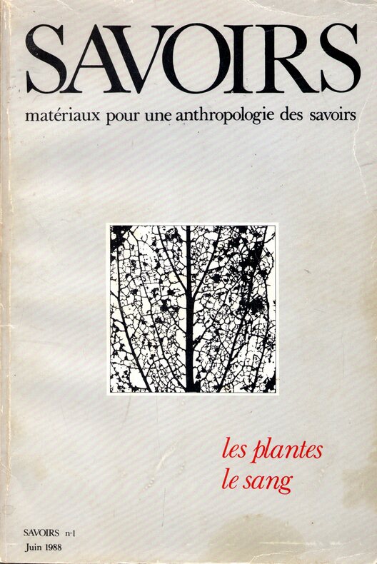
1988O7688Fondation Nemo - Savoirs n°1, 1988, 232 p.
200822623Maisonneuve & Larose 2008 In-4 broché, 350 pp;
14402La pensée moderne, 2 octobre 1973 - In-8, br, couverture rempliée souple ill ( sordats miniatures sur damier ), 220 pages, bel ensemble.
1994BN100253Mainz am Rhein : von Zabern 1994. 1994. Les fortifications d'Arabie méridionale du 7e au 1er siècle avant notre ère. par. Deutsches Archäologisches Institut Sana / Archäologische Berichte aus dem Yemen ; BD 8 1.80 <br/><br/>Les fortifications d'Arabie méridionale du 7e au 1er siècle avant notre ère. par. Deutsches Archäologisches Institut Sana / Archäologische Berichte aus dem Yemen ; BD 8 1.80 Mainz am Rhein : von Zabern unknown
201108276Paris, L'harmattan, 1994 ; in-8, 296 pp., broché, couverture illustr. Très bon état.
4468N° 33 de 1979 - revue illustrée - in-4 Broché
195331966Paris Gallimard 1953 In-12 carré 254 pp, NRF, couverture illustrée, réédition
193532894Paris Gallimard 1935 In-12 carré 254 pp, NRF, couverture illustrée