Cramm, Geo. F.MareMagnum

3 525 résultats
Outside dimensions 14.5" x 10.75". Unmarked with light wear and soiling. 4" archival tape mend to lower right corner. An attractive vintage copy. Book
Very Good Turkish Paperback. 4to. (27 x 20 m). In Turkish. 44 p., 14 military plans in the end-pocket (no missing). Some foxing on covers and pages, chipped on spine. Otherwise a good copy. 1918 senesinde Türk ordusunun Filistin ve Suriyeden çekilisinde 3. Sv. tümeninin hareketleri. 3 copies in OCLC: 70248831. First and Only Edition.
1920218041920. Early views of life under British colonial rule in Mandatory Palestine. 1920s photo archive consisting of 12 silver gelatin photographs measuring around 3.5" x 2.5" each. Circa 1920s. An evocative and unusually varied visual archive from 1920s Mandatory Palestine this collection captures everyday life and social hierarchies during the British occupation of the Levant. Taken during a critical era following the fall of the Ottoman Empire and before the full thrust of Zionist settlement these images offer rare glimpses of Palestinian Arab communities-including women clerics children merchants and street workers-across both rural and urban landscapes. Several photos appear to depict scenes in and around Jerusalem including a striking street portrait of an elder man in traditional Arab dress with a keffiyeh and striped abaya standing beside a fez-capped official or guard in front of a stone façade possibly in the Old City. Another image shows a procession of clergy and camel handlers near what appears to be a medieval gate or fortress wall-indicative of pilgrimage traffic or religious observance with camels loaded for transport. A powerful composition captures three women in dark veils and flowing garments speaking beneath a tree with rural hills and a village in the distance.<br /> Street life and labor are emphasized in one image where a young boy and several veiled women draw water at a stone cistern; one woman balances a large vessel on her head her face and body almost entirely obscured. A separate print shows a group of women-some in Western dress and hats others in religious garb-posing together at the edge of a sea or lake possibly near Tiberias or the Sea of Galilee. . Another photograph depicts a group of men in keffiyehs and Western suits gathered in what may be a town square-possibly Amman or Ramleh-with modern construction visible in the background illustrating the mixing of colonial infrastructure and traditional society. Photographs of Mandatory Palestine from this transitional decade-between Ottoman defeat and the Arab Revolt -are increasingly rare especially those depicting ordinary Palestinians rather than military or Zionist institutions. Very good condition overall. unknown
Morris, Benny 1948. Israele e Palestina tra guerra e pace. , Rizzoli 2004, Copertina rigida plastificata con alette informative; pagine leggermente ingiallite Molto buono (Very Good) . <br> <br> Copertina rigida <br> 441<br> 8817002550
Paper wrappers; 8vo. 79 pages. Illustrated. OCLC lists 17 copies worldwi de. Excellent condition. (W-62)
First edition. Original blue, grey, and black illustrated paper wrappers. 8vo. 31 pages; 21cm. Dramatic visual presentation of the fundraising methods, achievements, and goals over the 35 years since the organizations inception in 1902 including the Blue-White Box, the J. N. F. Stamp, the Golden Book, the Tree Fund, Flower Day and Flag Day, and the Dunam Land contributions efforts. Among the mementoes carefully preserved at the Jewish National Fund headquarters in Jerusalem, is a tarnished little old tin box. It was bequeathed to the Keren Kayemeth by a woman Zionist in Germany. This little box-odd as it may seem-has been the means for raising, during the past thirty-five years, the rather astounding sum of approximately $4, 000, 000 or about 18% of the Funds total income since its inception. Includes photographs, illustrations, and graphs on almost every page. SUBJECT (S) : Jewish National Fund, Israel, Fundraising. OCLC lists only one holding worldwide (Spertus) . Very good condition. (zion-11-15)
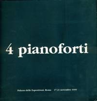
1999205042Roma: Palazzo delle Esposizioni 1999. Brossura wrappers. Molto buono Very Good. Catalogo dell'esibizione "4 pianoforti" eseguita a Roma Palazzo delle Esposizioni 17-21 novembre 1999 da <strong>Charlemagne Palestine</strong> <strong>Michael Harrison</strong> <strong>Philip Glass</strong> <strong>Terry Riley</strong> in prima mondiale/europea. Il festival era a cura di Fabio Sargentini Associazione Attico Associazione Silenzio. Testi di Renato Nicolini e Fabio Sargentini. Biografie dei performers note sulle composizioni interviste. In appendice "Breve storia della musica minimalista" di Paolo Coteni e Giovanni Antognozzi. Fotografie in bianco e nero. Edizione in italiano e inglese. 8vo. pp. 58. Molto buono Very Good. . <em>Il Palazzo delle Esposizioni guidato da <strong>Renato Nicolini</strong> ospitava il festival ideato da <strong>Fabio Sargentini</strong> con <strong>Charlemagne Palestine</strong> <strong>Michael Harrison</strong> <strong>Philip Glass</strong> <strong>Terry Riley</strong>. Un pianista per ogni serata e la quinta eccezionalmente tutti e quattro insieme nei quattro bracci del Palazzo in una sorta di jam session del<strong> pianoforte minimalista</strong> unica nel suo genere. "Non tutti sanno che Roma è"; stata negli anni Sessanta il quartier generale in Europa dei <strong>musicisti americani minimalisti</strong> che oggi vanno per la maggiore. Si esibivano nella mia <strong>galleria-garage</strong> <strong>L'Attico</strong> accanto ai migliori artisti della danza contemporanea dando luogo alle prime manifestazioni di performances che si conoscano in assoluto. Grandi tempi! . Lo spazio della galleria divenne l'alveo il letto pronto a ricevere l'ondata concettuale e minimalista che si annunciava . I giovani musicisti rispondevano ai nomi di La Monte Young Terry Riley Phil Glass Steve Reich Charlemagne Palestine. Tutto ciò accadeva nel 1968-1969 e durò per circa 10 anni è . Memori dei loro trascorsi romani trent'anni esatti fa per l'appunto nel 1969 gli stessi nomi con ben altra notorietà tornano ora in una sede prestigiosa istituzionale come è" giusto che sia" dal testo di Sragentini.</em> Palazzo delle Esposizioni, unknown
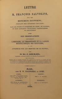
18385116<b>1</b> Dr. Conradus Leemans <i>Lettre a M. Francois Salvolini sur les Monumens Egyptiens portant des legendes royales dans musees d'antiquites de leide de londres et dans quelques collections particulieres en angleterre</i> 1838. Chez H. W. Hazenberg et Comp. Leide. 160 pp. XXXII 32 plates<br /><b>2</b> Palestine Exploration Society <i>No. 2 Second Statement </i>September 1873 Hackensack N.J. 76 pp. vi<br /><b>3</b> Henrico Brugsch <i>De Natura et Indole Linguae Popularis Aegyptiorum. Fasciculus prior de Nomine de Dialectis de Litterarum Sonis</i> 1850. Prostat in Libraria Dummleriana Berolini. 40 pp.<br /><b>4</b> Dr. Heinrich Brugsch <i>Die Adonisklage und das Linoslied</i> 1852. Ferd. Dummler's Verlagsbuchhandlung Berlin. 33 pp.<br /><b>5</b> Heinrich Hubschmann <i>Die Umschreibung der Iranischen Sprachen un des Armenischen</i> 1882. Druck und Verlag von Breitkopf und Hartel Leipzig. 44 pp. <br /><b>6</b> Dr. Martin Haug <i>Das achtzehnte Kapitel des Wendidad ubersetzt und erklart</i> 1869. F. Straub Munchen. 54 pp.<br /><b>7</b> Dr. Richard Lepsius <i>Das Allgemeine Linguistische Alphabet. Grundsatze der ubertragung fremder schriftsysteme und bisher noch ungeschriebener sprachen in Europaische Buchstaben</i> 1855. Wilhelm Hertz Berlin. 64 pp.<br />Majority are first editions. Text in French English German and Latin. Quarter cloth over marbled boards. 4 fold-out reproductions of Egyptian tablets and/or hieroglyphs; 4th fold-out has a large tear at first interior fold still intact p. 76 of Palestine Exploration Society. 1 fold-out illustration. Some occasional spotting throughout. Loss to cloth of spine and rubbing to exterior edges of covers. 160 pp. XXXII 32 plates; 76 pp. vi; 40 pp.; 33 pp.; 44 pp.; 54 pp.; 64 pp.; ~503 pp. total. 6 x 8 1/2 inches. Chez H. W. Hazenberg et Comp.; Hackensack; Prostat in Libraria Dummleriana; Breitkopf und Hartel; F. Straub; Wilhelm Hertz hardcover
Mm 140x210 Collana "I Robinson/Letture". Volume cartonato rigido di XI-426 pagine, sovraccoperta editoriale, timbro dell'editore in apertura. Libro in condizioni di nuovo. SPEDIZIONE IN 24 ORE DALLA CONFERMA DELL'ORDINE.
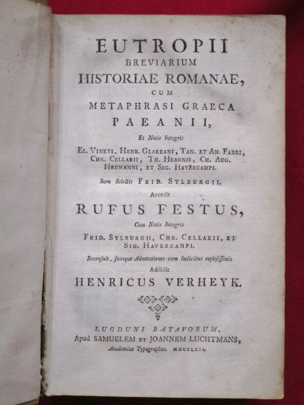
1762112506Luchtmans 1762 Lugduni Batavorum [Leyde], Samuelem et Joannem Luchtmans, 1762, 1 volume in-8 de 125 x 200 mm environ, LIV pages, (38) ff. (Dedicationes et Praefationes, Tetsimonia, Domino Valenti), 772 pages, (45) ff. (Index). Pleine reliure parchemin, dos lisse portant titres dorés sur pièce de cuir vert foncé, les deux plats comporte un estampage à la dorure armorié encadré d'une frise dorée à écoinçoins, traces de liens. Parchemin un peu sali avec un reste d'étiquette papier en queue de dos, mors interne supérieur fendu sans gravité (exemplaire solide), ex libris de Jean Varille collé sur le premier contreplat, pagination suspendue de la page 664 à 684 sans manque, une mouillure dans la marge d'une vingtaine de pages, intérieur propre pour le reste.
No Date (Mid 20th Century) . 1st edition. Large poster, ca. 42 x 67 cm. In Hebrew. Anti Zionist poster by the Neturei Karta (Ha-Eidah ha-Hareidit), group of ultra-orthodox, mainly in Jerusalem, who regard the establishment of a secular Jewish state in Erez Israel as a sin and a denial of God, and therefore do not recognize the State of Israel. Their name, which is Aramaic for "guardians of the City, " derives from a passage in the Jerusalem Talmud (Hag. 76: 3) stating that religious scholars are the guardians and defenders of the city. Neturei Karta broke away from Agudat Israel in 1935, when the latter attempted to restrain extremist demands for an independent ultra-Orthodox Jerusalem community completely separate from the rest of the Zionist community. The group first adopted the name Hevrat ha-Hayyim, after Rabbi Joseph Hayyim Sonnenfeld. It aimed at creating "a circle free from the influence of the contemporary spirit and its fallacious opinions, " and a condition of membership was "the education of sons and daughters in the traditional Jewish manner, without any change (girls' schools which teach Hebrew do not provide education in the traditional Jewish manner). " The last phrase alluded to Agudat Israel's Bet Ya'akov girls' schools, where the language of instruction is Hebrew. Large poster, age staining, creased and split on folds with archival repairs to the rear. Good Condition thus. (Zion2-3-1)
Original single-sheet map in copperplate engraving of fine quality. Overall size ca. 400 x 510 mm. Plate mark ca. 360 x 445 mm. Image size ca. 345 x 425 mm. With Inset Map, "Der Verdeelinge van Israels Land", measuring ca. 150 x 110 mm, presented by two, finely engraved cherubs. Engraved illustration, depicting Joshua's men about to embark on the entry into the Promised Land. Illustrated cartouche encloses engraved title and colophon. Fine, strong impression on heavy handmade paper with ample margins all round. First, original state, unaltered by later colouration. Preserved flat in acid-free, pH-balanced, buffered archival paper. In a very fine condition. - - First edition. Willem Albert Bachiene (1712-1783), Dutch clergyman, later a professor of geography and astronomy at the Illustere School, Maastricht. Well known cartographer. The 3-volume "Heilige geographie of aardrijkskundige beschryving van het Joodsche land, alsmede andere landen in de H. Schrift voorkomende," is considered among his most important works. It was published in Utrecht between 1763-1768, and included a suite of 12 fine geographical maps of the Holy Land and its neighbouring lands which Bachiene made during a period of ten years, the first in as early as 1758. The map offered herewith is taken from this suite. Other important cartographic works of the Holy Land by Bachiene were included in the so-called "Jehovah Bible" i.e. "De Gansche H. Schrift, Vervattende alle de regelmatige Boeken des Ouden en Nieuwen Testaments (.) Gods Gedenk-Naam Jehovah onvertaald gehouden" published in 1762 by N. Goetzee of Gorinchem, shortly before the present map first appeared in book form. Whereas other single-sheet maps by Bachiene are in relative abundance, the works from "Heilige geographie of aardrijkskundige beschryving van het Joodsche land" are very scarce, seldom found in any state, practically unavailable in their original, uncoloured state.
Original single-sheet map in copperplate engraving of fine quality. Overall size ca. 400 x 510 mm. Plate mark ca. 365 x 445 mm. Image size ca. 340 x 420 mm. Engraved illustration at lower right corner. Handsome illustrated cartouche encloses engraved title and colophon. Scale within illustrated frame. Fine, strong impression on heavy handmade paper with ample margins all round. First, original state, unaltered by later colouration. Preserved flat in acid-free, pH-balanced, buffered archival paper. In fine condition. (A touch of browning to centrefold.) ~ First edition. Willem Albert Bachiene (1712-1783), Dutch clergyman, later a professor of geography and astronomy at the Illustere School, Maastricht. Well known cartographer. The 3-volume "Heilige geographie of aardrijkskundige beschryving van het Joodsche land, alsmede andere landen in de H. Schrift voorkomende," is considered among his most important works. It was published in Utrecht between 1763-1768, and included a suite of 12 fine geographical maps of the Holy Land and its neighbouring lands which Bachiene made during a period of ten years, the first in as early as 1758. The map offered herewith is taken from this suite. Other important cartographic works of the Holy Land by Bachiene were included in the so-called "Jehovah Bible" i.e. "De Gansche H. Schrift, Vervattende alle de regelmatige Boeken des Ouden en Nieuwen Testaments (.) Gods Gedenk-Naam Jehovah onvertaald gehouden" published in 1762 by N. Goetzee of Gorinchem, shortly before the present map first appeared in book form. Whereas other single-sheet maps by Bachiene are in relative abundance, the works from "Heilige geographie of aardrijkskundige beschryving van het Joodsche land" are very scarce, seldom found in any state, practically unavailable in their original, uncoloured state.
Original single-sheet map in copperplate engraving of fine quality. Overall size ca. 400 x 510 mm. Plate mark ca. 350 x 445 mm. Image size ca. 325 x 410 mm. Incorporates a detailed Plan of the City of Jerusalem within a general, delicately illustrated topographical view of its environs. Plain cartouche encloses title and colophon. Fine, strong impression on heavy handmade paper with ample margins all round. First, original state, unaltered by later colouration. Preserved flat in acid-free, pH-balanced, buffered archival paper. In fine condition. (Single outer corner finger-soiled, well away from image and plate mark.) - - First edition. Willem Albert Bachiene (1712-1783), Dutch clergyman, later a professor of geography and astronomy at the Illustere School, Maastricht. Well known cartographer. The 3-volume "Heilige geographie of aardrijkskundige beschryving van het Joodsche land, alsmede andere landen in de H. Schrift voorkomende," is considered among his most important works. It was published in Utrecht between 1763-1768, and included a suite of 12 fine geographical maps of the Holy Land and its neighbouring lands which Bachiene made during a period of ten years, the first in as early as 1758. The map offered herewith is taken from this suite. Other important cartographic works of the Holy Land by Bachiene were included in the so-called "Jehovah Bible" i.e. "De Gansche H. Schrift, Vervattende alle de regelmatige Boeken des Ouden en Nieuwen Testaments (.) Gods Gedenk-Naam Jehovah onvertaald gehouden" published in 1762 by N. Goetzee of Gorinchem, shortly before the present map first appeared in book form. Whereas other single-sheet maps by Bachiene are in relative abundance, the works from "Heilige geographie of aardrijkskundige beschryving van het Joodsche land" are very scarce, seldom found in any state, practically unavailable in their original, uncoloured state.
Original single-sheet map in copperplate engraving of fine quality. Overall size ca. 400 x 800 mm, with 2 flapped wings. Image size, within plate mark, ca. 340 x 740 mm. Handsome ornate cartouche encloses engraved title and colophon. Fine, strong impression on heavy handmade paper with ample margins all round. First, original state, unaltered by later colouration. Preserved flat in acid-free, pH-balanced, buffered archival paper. In fine condition. - - First edition. Willem Albert Bachiene (1712-1783), Dutch clergyman, later a professor of geography and astronomy at the Illustere School, Maastricht. Well known cartographer. The 3-volume "Heilige geographie of aardrijkskundige beschryving van het Joodsche land, alsmede andere landen in de H. Schrift voorkomende," is considered among his most important works. It was published in Utrecht between 1763-1768, and included a suite of 12 fine geographical maps of the Holy Land and its neighbouring lands which Bachiene made during a period of ten years, the first in as early as 1758. The map offered herewith is taken from this suite. Other important cartographic works of the Holy Land by Bachiene were included in the so-called "Jehovah Bible" i.e. "De Gansche H. Schrift, Vervattende alle de regelmatige Boeken des Ouden en Nieuwen Testaments (.) Gods Gedenk-Naam Jehovah onvertaald gehouden" published in 1762 by N. Goetzee of Gorinchem, shortly before the present map first appeared in book form. Whereas other single-sheet maps by Bachiene are in relative abundance, mostly with added colouration for purely decorative purpose, the works from "Heilige geographie of aardrijkskundige beschryving van het Joodsche land" are very scarce, seldom found in any state. They are practically unavailable in their original, unaltered, uncoloured state.
Lot of 5 original single-sheet maps in copperplate engraving of fine quality. Fine, strong impressions on heavy handmade paper with ample margins all round. First, original state, unaltered by later colouration. Preserved flat in acid-free, pH-balanced, buffered archival paper. In fine condition. - - Full individual descriptions are available on request. - - First edition. Willem Albert Bachiene (1712-1783), Dutch clergyman, later a professor of geography and astronomy at the Illustere School, Maastricht. Well known cartographer. The 3-volume "Heilige geographie of aardrijkskundige beschryving van het Joodsche land, alsmede andere landen in de H. Schrift voorkomende," is considered among his most important works. It was published in Utrecht between 1763-1768, and included a suite of 12 fine geographical maps of the Holy Land and its neighbouring lands which Bachiene made during a period of ten years, the first in as early as 1758. The map offered herewith is taken from this suite. Other important cartographic works of the Holy Land by Bachiene were included in the so-called "Jehovah Bible" i.e. "De Gansche H. Schrift, Vervattende alle de regelmatige Boeken des Ouden en Nieuwen Testaments (.) Gods Gedenk-Naam Jehovah onvertaald gehouden" published in 1762 by N. Goetzee of Gorinchem, shortly before the present map first appeared in book form. Whereas other single-sheet maps by Bachiene are in relative abundance, the works from "Heilige geographie of aardrijkskundige beschryving van het Joodsche land" are very scarce, seldom found in any state, practically unavailable in their original, uncoloured state. - - Note regarding this lot: Each of the 5 maps in this lot is offered also separately. [Descriptive text Copyright Librarium, The Hague]
Very Good Latin Extremely rare second edition of Quaresmus' work including four parts in two volumes, which is a a contribution to history, geography, archaeology, biblical and moral science of the East and Holy Land. First Edition is 1639, printed in Antwerp. This edition was edited by Father Cypriano da Treviso. First volume has one two-page map titled 'Chorographia Terræ Sanctæ Sev Terræ Promissionis Nova Descriptio' depicting a very attractive view of the Holy Lands, which is decorated ships heading to the Holy Land. Second volume has two maps, one plate, and two plans (All is folded and huge sizes). First map is one of the most attractive views of Extremely rare second edition of Quaresmus' work including four parts in two volumes, which is a contribution to history, geography, archaeology, biblical and moral science of the East and Holy Land. First Edition is 1639, printed in Antwerp. This edition was edited by Father Cypriano da Treviso. The first volume has one two-page map titled 'Chorographia Terræ Sanctæ Sev Terræ Promissionis Nova Descriptio' depicting a very attractive view of the Holy Lands, which is decorated ships heading to the Holy Land. The second volume has two maps, one plate, and two plans (All are folded and huge sizes). The first map is one of the most attractive views of Jerusalem titled 'Novæ Ierosolymæ et Locorvm Circvmiacentivm Accvrata Imago'. Other is depicting attractively 'Montis Calvariæ' [i.e. Calvary, or Golgotha] which was, according to the canonical Gospels, a site immediately outside Jerusalem's walls where Jesus was crucified, as well as Bethlehem and Resurrection Temple's plans. Quaresmio was a writer and Orientalist of the seventeenth century. His father was the noble Alberto Quaresmi and his mother Laura Papa. At an early age, he was enrolled among the Franciscan Observantines at Mantua. For many years he held the chairs of philosophy, theology, and canon law, and became successively guardian, custos, and minister of his province. His long apostolate in the East and the magnificent works he has left us have secured Quaresmius worldwide fame, especially among earlier historians, Biblical scholars, and Orientalists. On 3 March 1616, he went to Jerusalem, where he became Guardian and Vice-Commissary Apostolic of Aleppo in Syria (1616-8), and Superior and Commissary Apostolic of the East (1618-9). During this period he was twice imprisoned by the Turks. In 1620 he returned to Europe, but in 1625 was back in Jerusalem, whence the following year he addressed from the Holy Sepulchre an appeal to Philip IV of Spain, inviting him to reconquer the Holy Land, and at the same time dedicating to him his work, "Hierosolymæ afflictæ". Between 1616 and 1626 he wrote his classical work, "Elucidatio terræ Sanctæ", adjudged by the learned a monumental contribution to history, geography, archæology, Biblical and moral science. During 1627-9 he was at Aleppo as papal commissary and as vicar-patriarch for the Chaldeans and Maronites of Syria and Mesopotamia. In 1629 he went to Italy to render an account to the Holy See of the state of the Eastern Churches; he then returned to the East, but how long he remained is not known. Meanwhile, he journeyed through Egypt and Sinai, the Holy Land, Syria, Mesopotamia, Cyprus, Rodi, Constantinople, and a large part of Asia Minor; he also visited Germany, France, Belgium, and Holland. In 1637 he was a guardian of S. Angelo (Milan), wherein 1643 he completed his other great work on the Passion of Christ. Original 1/3 black leather bdg. Six raised bands to spine. Marbled endpapers. Gilt title on spine and volume numbers. Folio. (38 x 28 cm). In Latin. 2 volumes set: (xxviii, [8], 761 p.; 893 p., 6 engraved maps and plans (5 folded)).
Single page printed letter. 28 cm. Advertisement and coupon by the Zionist Organization of America for the release of Joseph Heller's "The Zionist Idea. " The advertisement declares that "There have been many books about Israel - there have been many books about Zionism - but this is the first volume which traces in full the HISTORY OF AN IDEA! . " Joseph Elijah Heller (1888-1957) was a Lithuanian-Jewish Hebrew writer. He was one of the editors of the German Encyclopaedia Judaica. He later moved to London where he regularly contributed to Haolam, Hadoar, and others (EJ, 2007) . SUBJECTS: Zionism. Two crease marks where this letter was folded. Very good condition. (ZION2-2-30)
Very Good Turkish, Ottoman (1500-1928) Original wrappers. 16mo. (14,5 x 10,5 cm). In Ottoman script (Old Turkish with Arabic letters). 20 p. First and only edition of this extremely rare pamphlet includes the chapters of 'From Marseilles to Gabon' and 'From Libreville to Banguela' of Trivier's expeditions in Africa. First chapter includes Trivier's Mozambique travel by ship over the Strait of Gibraltar. In this chapter, Trivier described the purpose of his voyage as "After returning to France from my last trip in January 1890, I declared that many more places should be seen. I have written many articles about the necessity of looking for new ways to eliminate the fears and worries caused by McKinley tariffs that are harmed everywhere. As a nice result of this, the Paris City Council and the Bordeaux Chamber of Commerce decided not to be dispatched to the hometown of Africans with an amount of money close to 11,000 francs.". In the second chapter, he describes Congo and other parts of Central Africa. French explorer Elisee Trivier followed in the footsteps of Scottish missionary David Livingstone in his attempt to explore the interior of Africa. Trivier's expedition traveled in 1889 up the Congo and across Africa to the island of Zanzibar on the eastern coast. Trivier is considered the first French explorer to have crossed Africa. Hegira: 1313 = Gregorian: 1896 Özege 21221.; Not in OCLC.
This single page printed letter from the American Memorial Committee for the Hanged Martyrs of Eretz Israel accompanied a copy of Itzhak Gurion's very popular autobiography "Triumph on the Gallows. " The letter requests $3 for the book, the proceeds of which would be dedicated to establish a memorial for the martyred Irgun fighters who were hanged by the British. Excellent condition. (zion2-2-18)
Very Good Arabic Original pamphlet. Large roy. 8vo. (25 x 17,5 cm). Texts in completely Arabic. [4] pp., ills. An extremely rare propaganda and political proclamation in Arabian related to Jerusalem and Palestine question. It has a "call to arms" for the struggle. A unique brochure. Not in OCLC.; Not in IISG.
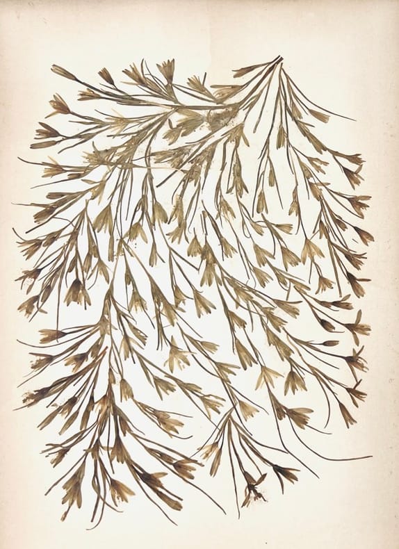
189744475Jérusalem, Boulos Meo, (c. 1897). Album in-8 oblong (23 x 32 cm), titre, 18 chromophotographies et 18 planches de fleurs séchées en regard montées sur carton fort, titres imprimés sur les montages, demi-basane, dos titré à nerfs, premier plat orné d'une plaque noire décorative illustrée au centre du Saint Sépulcre en relief accompagné d'une plaque datée 1897, second plat couvert d'une plaque noire similaire sans illustration, tranches dorées (reliure de l'époque).
First edition. Original paper. 4to, 3,1,2, 8 pages [total of 14 mostly single-sided pages]; 35.5cm. A total of 4 Mimeograph publications on Poale Zion letterhead. In English. DP/Early Statehood-era public position papers on issues of the day in the first years of the Jewish state for use in the Jewish press. Eg.: "It is becoming increasingly clear that for our organnzation to play its historic role in the building of the State of Israel and the shaping of the Jewish national future, it must become a more potent force in AMerican Jewish life....It is practically impossible for any organization to occupy a position of prominence in AMerican Jewish affairs without association with some defense agency" (p. 1 of No. 10). Baruch Zuckerman, president of the Labor Zionist Organization of America, was a leading American-Israeli zionist, one of the leading proponents of Yad Vashem, editor of Yiddishe Kempfer, and a leading figure in the Farband and Histadrut campaigns (Wikipedia, 2016) . Dr. Berl Frymer was a prominent Labor Zionist as well, holding a variety of leadership positions. SUBJECT(S) : Labor Zionism, Politics. OCLC lists no holdings. Slight toning. Minimal markings and tears. Library stamp. creases from mailing. Very good condition. (zion-12-11A)
Very Good Turkish, Ottoman (1500-1928) Original lithograph map with brown, white and blue tons. 81x57 cm. In Ottoman script (Old Turkish with Arabic letters). All toponyms are in Ottoman Turkish and Arabic. Scale: 1:500,000. Shows Mediterranean shores on the north, Bahr-i Lût [i.e. the Dead Sea], Aqaba Bay, areas of Arabic tribes in very detail, in addition, special huge lands like 'Al-Hism Land'. Also, it shows holy places, antiquities, fortresses, rivers; and Turkish Sanjaks, Qazas, Nahiyes, Qariyes based on the Ottoman administrative system. Cartographer is not indicated, but, it's composed for military purposes in the last period of the Imperial Ottoman, especially for showing Arabian tribes spreading over vast areas in its period, just before World War 1 (date of the printing of this map), such as 'Houtat Tribe'. A very detailed and attractive map of Palestine and Quds area and their topography. Following the Muslim conquest of Palestine in 636-640, several Muslim ruling dynasties succeeded each other as they wrestled control of Palestine: the Rashiduns; the Umayyads, who built the Dome of the Rock and the al-Aqsa Mosque in Jerusalem; the Abbasids; the semi-independent Tulunids and the Ikhshidids; the Fatimids; and the Seljuks. In 1099, the Crusaders established the Kingdom of Jerusalem in Palestine, which the Ayyubid Sultanate conquered in 1187. The Crusaders failed to retake Palestine despite further attempts. The Egyptian Mamluks took Palestine from the Mongols (who had conquered the Ayyubid Sultanate) in 1260. The Ottomans captured Palestine in 1516 and ruled it until Egypt took it in 1832. Eight years later, the United Kingdom intervened and returned the region to the Ottomans. Considerable demographic changes happened during the 19th century and with the regional migrations of Druze, Circassians, and Bedouin tribes. The emergence of Zionism also brought many Jewish immigrants from Europe and the revival of the Hebrew language. Arabs in Palestine, both Christian and Muslim, settled and Bedouin, were historically split between the Qays and Yaman factions. These divisions had their origins in pre-Islamic tribal feuds between Northern Arabians (Qaysis) and Southern Arabians (Yamanis). The strife between the two tribal confederacies spread throughout the Arab world with their conquests, subsuming even uninvolved families so that the population of Palestine identified with one or the other. Their conflicts continued after the 8th-century Civil war in Palestine until the early 20th century and gave rise to differences in customs, tradition, and dialect which remain to this day. Beit Sahour was first settled in the 14th century by a handful of Christian and Muslim clans (hamula) from Wadi Musa in Jordan, the Christian Jaraisa and the Muslim Shaybat and Jubran, who came to work as shepherds for Bethlehem's Christian landowners, and they were subsequently joined by other Greek Orthodox immigrants from Egypt in the 17th-18th centuries. Due to the legacy of the Ottoman period, the ethnic origins of some rural and urban Palestinians are either Albanian, Circassian, or from other non-Arab populations.
Very Good English Original color map folded in its papers. Very good. Folded. Atlas folio. (60 x 47 cm). In English. [MAP of FRENCH MANDATE SYRIA and LEBANON] Map of Syria and Lebanon. Scale: 1:1.100.000. No date.