ORIENT STEAM NAVIGATION CO, LTDBiblio.com
341 résultats
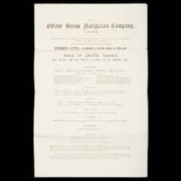
26003London : The Orient Steam Navigation Co. Ltd. 13 Fenchurch Avenue E.C. 1880. Folio 420 x 265 mm bifolium 3 pp folding to 265 x 105 mm with printed title to outer side; original share application form still loosely enclosed; outer side a little dusty but a near fine example. 'The Orient Steam Navigation Company was established in 1878 and jointly managed by the London shipowning firms of Anderson Anderson and Company and F. Green and Company until 1919 when the Peninsular and Oriental Steam Navigation Company acquired a controlling interest in its shareholding capital; at approximately the same time the dual management of the undertaking by the Anderson and Green companies came to an end and the two businesses were merged into a private limited company formed for the purpose Anderson Green and Company Limited. The Orient company was a small enterprise operating a handful of very large ships in virtually one trade the mail and passenger service to Australia and New Zealand. In due course it provided a co-ordinated service in this region with ships of the P&O fleet; in later years similarly in collaboration with P&O a passenger service between North American ports and Australia and New Zealand was instituted and in attempts to promote passenger traffic in the Pacific a series of voyages between North America the Far East and Australia were inaugurated. The company's ships were also extensively employed in ocean cruising.' Royal Museums Greenwich Internal references date this very early Company prospectus to 1880. Trove locates no copies. unknown
0872190005.Gpaperback. Good. Access codes and supplements are not guaranteed with used items. May be an ex-library book. paperback
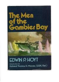
197936377Middlebury VT: Paul S. Eriksson 1979. Hardcover. Introduction by Thomas H. Moorer. Small 4to. Blue cloth spine and tan paper over boards pictorial price-clipped dust jacket. xii 254pp. Illustrations maps map endpapers. Fine/near fine. Tight attractive first edition of this surprisingly uncomon history of this World War Two aircraft carrier. Paul S. Eriksson hardcover
1747234865London: Printed for W. and J. Mount and T. Page 1747. Later approximately eleventh edition. Illustrated with woodcuts diagrams and tables. 272 pp. 1 vols. Small 8vo. Modern quarter blue morocco and cloth. Half-title and title leaves silked at upper margin early mild dampstaining to text; a good solid copy. Later approximately eleventh edition. Illustrated with woodcuts diagrams and tables. 272 pp. 1 vols. Small 8vo. First published in 1694 and innumerable times since throughout the 18th-century. Printed for W. and J. Mount, and T. Page unknown
1844054743Glasgow: Printed for the author and sold by Blackie and Son 1844. First Edition . Hardcover. Good. Small Octavo. Frontispiece; engraved title-page . FIRST EDITION. GLASGOW : 1844. Hardback. Frontispiece and engraved secondary title-page. Original brown cloth; gilt lettered cover. Later cream end-papers. Owner names. Frontispiece repaired to bottom margin and slightly foxed and stained to one corner as is the engraved title-page. Main title-page clean. Binding has moderate wear. Internally tight and clean. Overall a GOOD copy of a scarce book. vi 175 viii pages. "List of subscribers' names": p. 1-8 to the rear. Referenced by: OCLC 18332799. Sm.8vo. Will be well-packed for posting/shipping. Rosley Books for Antiquarian books CHS Cumberland Everyman GKC Inklings Keswick Literature MacDonald Rarities Theology and History. . <br/> <br/> Printed for the author, and sold by Blackie and Son hardcover
1236977394.Gpaperback. Good. Access codes and supplements are not guaranteed with used items. May be an ex-library book. paperback
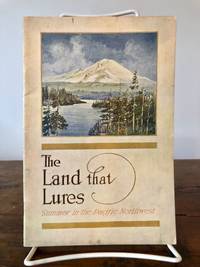
19137087Portland Oregon: Oregon-Washington Railroad & Navigation Co 1913. Fourth Edition. Stiff Illustrated Wrappers. Good. 8vo. Pp. 45 3. Frontis. scenic photograph. Illustrated with black & white halftone photo reproductions and one route map. Color illustrated wraps saddle-stapled. Light soiling and stains mellowed crease to back cover staples a tad oxidized trace of oxidized paperclip to head of the frontis. In sum a bright copy. Revised edition of the enticing 1911 tourism booklet lauding sites natural and man-made from Oregon to Alaska. Includes motoring tours and hiking in Mount Rainier National Park plus lakes and streams to cast the lure. The uncredited color illustrations are dreamy; the photography including a few shots by Asahel Curtis presents keen insight into early 1900s life in the Puget Sound Country. SMITH 7721.<p>Preserved in a removable clear archival pouch with acid-free backing. Oregon-Washington Railroad & Navigation Co unknown
0260534706.Ghardcover. Good. Access codes and supplements are not guaranteed with used items. May be an ex-library book. hardcover
187355613Washington Government Printing Office 1873. Royal8vo. Orig. full calf. Gilt boders and gilt lettering on covers. Gilt spine. Lithographed frontispiece in colour. XVI107203268 pp. 3 lithographed colourplates one large folded. unknown
0267287674.Ghardcover. Good. Access codes and supplements are not guaranteed with used items. May be an ex-library book. hardcover
1333797621.Gpaperback. Good. Access codes and supplements are not guaranteed with used items. May be an ex-library book. paperback
192723896New Haven: Yale University Press 1927. Hardcover. Small 4to. Black cloth. xx 215pp. Frontispiece numerous illustrations. Very good. Slightest bit of edgewear and bit of "flecking" to the cloth but overall tight clean and attractive. First edition limited to 1000 copies. Interesting association copy for this belonged to the noted writer HAROLD BELL WRIGHT 1872-1944 one of the most popular novelists of the early 20th century author of such bestsellers as "The Shepherd of the Hills" 1907 "The Calling of Dan Matthews" 1909 and "The Winning of Barbara Worth" 1911 -- whose descendants parted with much of HBW's personal library in December 2005. Wright was a serious long-time boating enthusiast a fanatical follower of all things nautical whose hobby was designing and building from scratch his own sailboats. A rather uncommon title with an interesting provenance. Yale University Press hardcover
0484497901.Ghardcover. Good. Access codes and supplements are not guaranteed with used items. May be an ex-library book. hardcover
1332115942.Gpaperback. Good. Access codes and supplements are not guaranteed with used items. May be an ex-library book. paperback
180755849Philadelphia: Published by B.B. Hopkins and Co. and sold by W.P. Farrand No. 170 Printed by T. & G. Palmer 1807. 8vo. xxiii 1 270; 271-275 1 40 16 15-16 17-220 4 pp. including binders instructions and publisher’s advertisement. With 7 copper-engraved plates & maps 6 engraved by Benjamin Tanner. Contemporary polished brown calf red & gilt morocco spine label chipping to head of spine minor edgewear occasional interior foxing & toning still a VG- copy from the library of John L. Gow 1797-1866 noted Pennsylvania attorney w/ ownership label and markings on front pastedown. First American edition of this classic navigation handbook which was first published in 1804 and here contained substantial corrections to the tables of the latitudes and longitudes of places on the American coast and in the West Indies as well as an improved system of finding the longitude by P. Delamar of Philadelphia. Mackay 1760-1809 was noted Scottish mathematician and astronomer taught navigation and instructed in methods of how to find longitude. Shoemaker 12965. Published by B.B. Hopkins and Co., and sold by W.P. Farrand, No. 170, Printed by T. & G. Palmer, unknown
3975Portland Oregon:: The Company; Press of C. H. Crocker . Fifty-nine halftones on 32 pp. Oblong 8vo dark gray/green pictorial wrappers. The Columbia River and Puget Sound Navigation Company was organized in 1891 by Captain U. B. Scott and John Leary. On p. 1 the company’s real name is revealed by "Compliments of Columbia River and Puget Sound Navigation Co. Portland Oregon" which was nicknamed the White Collar Line. [Portland, Oregon:: The Company; Press of C. H. Crocker, ,. unknown
19068656Portland Oregon: The Oregon Railroad & Navigation Co. Fine with no dust jacket. 1906. First Edition. Original Wraps. Map unfolds to about 1 1/2'x5'. Colored semi-topographical map of the Columbia River with towns etc. Really cool!; Map; 4 1/2x9 1/2" . The Oregon Railroad & Navigation Co. paperback
198041070Annapolis: Naval Institute Press 1980. Hardcover. Small 4to. Blue cloth with gilt spine lettering pictorial dust jacket. xxii 448pp. Illustrations. Fine/near fine. A superb and tight first edition of this collection of biographical essays -- with choice autograph addition: Tipped to the front flyleaf is a 5" X 3" heavy stock card signed boldly in black ballpoint by Elmore R. Zumwalt n.p. dated 1986 September 4 in his hand. Fine. Zumwalt was the 19th and final of the naval figures discussed in this reference. Zumwalt 1920-2000 was the American navy's youngest four-star admiral ever and the commander in Vietnam who ordered the use of Agent Orange -- from which his own son contracted cancer. Zumwalt's original transmittal envelope is laid in as well. Naval Institute Press hardcover
1333622465.Gpaperback. Good. Access codes and supplements are not guaranteed with used items. May be an ex-library book. paperback
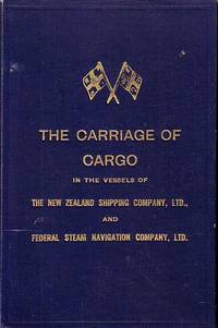
67990Shipping Companies. London. 1935. . May 1935 edition. 6 472 2 PP plus 30 folded capacity plans 13 Distance tables 14-20 Depths of water and tides 12 maps and XXIII Index. Text with b/w illustrations drawings and photos and colour illustrations 1 folded Capacity Plan 1 folded chart "Load Line 1932" and over 115 plans of Ports. Navy cloth covers with light shelf wear on corners gilt "Crossed Flags" on front cover gilt title on front cover and spine. Discreet stamp of The Tasmanian Maritime & Folk Museum with signature of previous owner on title page. Light foxing on first few pages and around a few page edges. Printed on superior paper and in near fine condition. Scarce. 25.2 x 16.3. Shipping Companies. London. 1935. hardcover
dola706np: c1910. 12mo. pp. 30. 28 full-page photographic illus. accordion-foldout. pictorial bds. soiled & rubbed spine ends worn upper front joint split np: c1910?] unknown
181555781New York: Printed for Edmund M. Blunt Oct. 1815. 8vo. xvi 297 86 pp. plus 2 pp. publisher’s ads. Woodcut-engraved front of the Blunt New York Shop 9 of 15 maps & charts 1 w/ partial loss several w/ additional sailing instructions and printed notices pasted-in manuscript sailing instructions and notes on versos of some. Original calf spine & calf on rear cover perished shaken dampstaining & toning still fair reference copy from the library of Captain Thomas Hall II 1804-1829 son of Captain Thomas Hall 1778-1816 who was lost at sea while sailing from Charleston to Boston in Feb. 1829 which his brother Charles Hall 1810-1829 ownership markings on endpapers of both w/ manuscript note on verso of ffep. that this is “good for a pint of ale†facing clippings about new lighthouses ca. 1821 listing the Ten Pound Island stone tower light house first built on the site in 1821. Preserved in brick-coloured linen cloth clamshell slipcase w/ printed label on spine. Eighth edition of this early vital tool for American sea captains and navigators first published in a much shorter version of only 122 pp. in 1796 and the first edition to bear only Edmund Blunt’s name as author. The original commissioned from Captain Lawrence Furlong proved so crude and unusable that Blunt arranged for it to be edited and rewritten. Blunt’s Coast Pilots were the earliest works of their type published in North America to cover the Atlantic Coast of the U.S. with sailing directions tide tables tables of latitudes and longitudes and as this copy shows were often working evolving documents with additional manuscript annotations and printed additions including in this case the Charleston Harbour map which is not included in the binding instructions and supposedly left out of the 8th edition. Printed for Edmund M. Blunt, hardcover
1995biblio617Bethesda Md: Defense Mapping Agency Hydrographic / Topographic Center pub no 9 1995. Fine. <p>4to 873p ill maps full red cloth</p> Defense Mapping Agency Hydrographic / Topographic Center, pub no 9 hardcover
0243300921.Gpaperback. Good. Access codes and supplements are not guaranteed with used items. May be an ex-library book. paperback
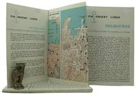
1962161834London: P&O Orient Lines 1962. Ten long single sheets folded into four five or six panels with text on one side and coloured maps on reverse the headings printed in blue & black; small cr. 8vo folded size; all numbered by hand near the top fore-corner of the upper panel with the number whited-out on number 2 Melbourne occasional slight soiling heavier on the Miami folder edges a trifle rubbed; P&O Orient Lines London 1962-1963. The folders were 'produced to assist passengers' and contain a brief history and description of each city including places of interest hotels shopping theatres currency information etc. P&O Orient Lines unknown