341 résultats
1941Alibris.0024602Washington: U S DEPARTMENT OF COMMERCE 1941. Trade paperback. Good. No dust jacket. Signed by previous owner. CONTENTS; TANK VESSELS-GENERAL PROVISIONS-INSPECTION AND CERTIFICATION-REQUIREMENTS FOR HULLS MACHINERY AND EQUIPMENT-LIFE SAVING APPLIANCES-FIRE FIGHTING EQUIPMENT-OPERATION-LICENSED OFFICERS AND CERTIFICATED MEN-SPECIFICATIONS FOR LIFE SAVING APPLIANCES-TRANSPORTATION OF LIQUEFIED INFLAMMABLE GASES. INDEX U S DEPARTMENT OF COMMERCE paperback
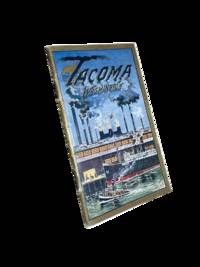
19118633Tacoma: Tacoma Commercial Club and Chamber of Commerce 1911. First edition. 14x8cm 32pp. Full color and sepia photographic illustrations throughout. Single map. Detachable post card/order form present at rear. Staple bound in color lithographed card covers. Some edge rubbing and light wear else near fine. <br /> <br /> Beautiful and scarce promotional booklet a joint effort of the Oregon-Washington Railroad and Navigation Company Bureau of Community Publicity and the Tacoma Commercial Club and Chamber of Commerce. Photos of prominent buildings factories the port Mount Rainier and Stadium High School among others. Includes information on industry and culture of the fast-growing city. <br /> <br /> <br /> OCLC cites 4 holdings only including just 1 in the state of Washington. . Tacoma Commercial Club and Chamber of Commerce unknown
181539889Lisbon: Simao Thaddeo 1815. hardcover. very good. 144pp. 8vo. Lisbon 1813. Second Edition. BOUND WITH: Taboa da Declinacao do Sol ao Meio Dia no Meridiano da Cidade de Lisboa . IV 64pp. 8vo full leather. Lisbon 1815. Scarce. Very good.<br/> <br/> Tables of latitude and longitude for marine navigation.<br/> <br/> Simao Thaddeo unknown
033229448X.Ghardcover. Good. Access codes and supplements are not guaranteed with used items. May be an ex-library book. hardcover
187838742Brazil 1878. A few small holes affecting a few letters some folds reinforced on verso additions in manuscript. Broadside. 20 3/4x29 inches. The Companhia Nacional de Navegação a Vapor replaced the Companhia Brasileira de Navegação a Vapor as the government sponsored line along the southern route in 1872. Montevidio was the furthest stop of this important Brazilian shipping company from which it also provided river service to upper Brazil. The broadside contains a listing of the rates of passage from Rio de Janeiro to Montevideo as well as the limitations and restrictions for passengers which included a prohibition on weapons and flammable materials. unknown
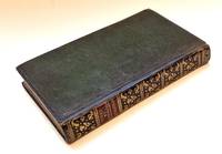
321<p><strong>NAVIGATION BEZOUT Etienne</strong> <em>Suite du cours de mathématiques à l'usage des gardes du pavillon et de la marine contenant le traité de navigation</em> Paris P. H. Pierres 1793.</p><p>8° xii 296 pages 10 folding plates 44 leaves of tables ; contemporary green morocco flat spine gilt.</p><p><strong>Last part of Bezout's mathematical course dedicated to navigation. </strong></p><p>The plates were not bound in at the time but pasted to blank leaves so they could be fully unfolded while reading the text.</p><p>The original edition was published between 1764 and 1769. Bezout was appointed examiner for the Marine Guard schools in 1764. His career was then mainly devoted to writing and teaching mathematics courses which were used for many years by candidates for military schools. This classic mathematics textbook was one of the main reference books for aspiring officers in the French royal armies in the second half of the 18th century. The last voume contains a treatise on navigation.</p><p>A beautiful copy in contemporary green morocco.</p>
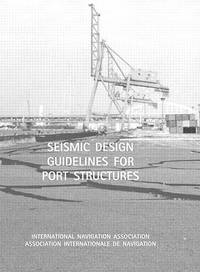
200333333336984Brussels Belgium.: PIANC General Secretariat. 2003. Report of Working Group 40. This book is part of a large purchase from a Public Sector Library and except where mentioned are for the most part LIKE NEW! MOSTLY the ONLY flaws are the blacked out they insisted Library stamps which show many of them to be UNUSED! This copy is Near Fine NEAR NEW. FEEL FREE TO E-MAIL FOR PHOTOGRAPHS AND FURTHER DETAILS. FROM A DEALER WHO TELLS YOU WHO THEY ARE AND WHAT THEIR TELEPHONE AND ADDRESS CONTACT DETAILS ARE!. EX PUBLIC SECTOR LIBRARY BLACKED OUT STAMPS. This is the First Edition. Glossy Pictorial Card. Near Fine NEAR NEW/No Jacket. 4to - over 9¾" - 12" tall. CARD COVERED PAPERBACK. PIANC General Secretariat. Paperback
192759236Washington D.C.: Government Printing Office Hydrographic Office U.S. Navy 1927-1930. Three vols. 8vo. x 4 550; viii 4 560 pp.; 1 17 2 leaves. With 4 large folding colour maps 1 w/ toning at fore-edge from being improperly folded some edgewear numerous plates showing lighthouses. Two volumes uniformly bound in red publisher’s cloth gilt lettering front cover & spine darkening to spine fore-edges minor shelfwear dustsoiling minor paint drip at fore-edge 1 vol. Supplement in self-printed softcovers edgewear toning to fore-edges minor predation still VG- set. Third editions revised & updated of vols. I & II first edition of scarce Supplement of these coast pilot guides to South America and Antarctica in the 1920’s. Prior to modern GPS systems and satellite navigation these regularly updated and revised navigation handbooks provided key sailing instructions often drawing not only from Brazilian Argentine and British coast pilots as well as sailing reports from U.S. Navy vessels and those from merchant ships. The first large map delineates the requisite coast pilots for sailing in American waters and charts to be ordered from the Hydrographic Office while the second maps depict the sailing routes. The expanded 3rd edition is quite scarce with 1 copy located of both vols. in Worldcat NYPL. Government Printing Office, Hydrographic Office, U.S. Navy, paperback
0266801900.Ghardcover. Good. Access codes and supplements are not guaranteed with used items. May be an ex-library book. hardcover
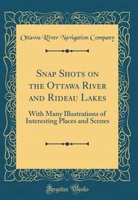
1905100722Montreal: Desbarats & Co. 1905. Book. Good. Original Wraps. 8vo - over 7¾" - 9¾" tall. Title continued: With many illustrations of interesting places and scenes also a short description of the Ottawa River and points of interest to the tourist who may make the trip via the Grand River and Rideau Lakes through the most charming scenery in America between Montreal Ottawa and Kingston. 56 p. Folding map - Route of the Ottawa River Navigation Co. 35 illustrations. Covers worn with chips in spine. Top corner stained. A scarce guide book. Desbarats & Co. Paperback
188438574Washington DC: Govenment Printing Office 1884. First edition. Hardcover. Good. 8 3/4 x 9 3/4 inches. 412 pages.Green Cloth as issued. Condition is Good Very light wear to spine ends and edges rear cover lightly soiled very light foxing on endpapers a few light stains on text pages a few pages at the beginning are loose but present binding is tight. STK Govenment Printing Office hardcover
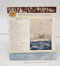
1934155424Sydney Australia: Printed by John Sands Ltd. 1934. Staplebound. Good. 12 p. 24 cm. Stapled. Colour illustration on back and front. B&w photos within. <br/><br/>K.P.M. lists its head and branch offices throught the world illustrates its ships deck diagrams gives timetables general notes itineraries. Printed by John Sands Ltd. unknown
196938798Santa Barbara CA: Coast Navigation School c1969. Black-plastic covered case. Good. Instructional kit for sailing navigation; includes 8 x 8 plastic navigation wheel for calculating speed time and distance and verso plastic Simex Course Converter wheel to find true course from compass bearing with instructions both in black plastic 9 x 9 carry-case plus unmarked folded navigational training map plus hinged parallel rulers tool 12 right-angle tool 360-degree round tool 7-in German steel calipers - all in black hard carry-case. Very good usable conditon. Rare item. <br/><br/>Carry-case case is 9-1/2 x 15 map is 8 x 11 folded 32 x 22 unfolded. Coast Navigation School unknown
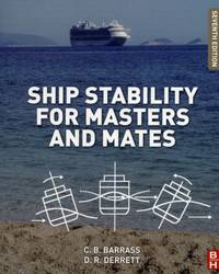
ria9780080970936_inpPaperback / softback. New. New Book; Fast Shipping from UK; Not signed; Not First Edition; Suitable for seafarers and students alike this book provides an introduction to all aspects of ship stability and ship strength squat interaction and trim materials stresses and forces with numerous worked examples to assist master paperback
6511101Taylor & Francis Group pp. 500 1st Edition . Hardback. New. Taylor & Francis Group hardcover
BN324090Segeln Schnelle Hilfe an Bord: Manöver · Navigation · Technik · Sicherheit Schwarzmeier Thomas <br/><br/>Segeln Schnelle Hilfe an Bord: Manöver · Navigation · Technik · Sicherheit Schwarzmeier Thomas Segeln Schnelle Hilfe an Bord: Manöver · Navigation · Technik · Sicherheit Schwarzmeier Thomas unknown
0331707853.Ghardcover. Good. Access codes and supplements are not guaranteed with used items. May be an ex-library book. hardcover
1913DEMO016711INew York: Dodd Mead 1913. First American edition. Hardcover. Very Good. photos color plates maps. Octavos dark green cloth. 443 376 pages <br/><br/>Dogged by difficulties and beaten to the pole by Amundsen by a month then their luck turned Scott's second and last expedition to the Antarctic was to explore the Ross Sea area and to reach the South Pole. bad. There were no survivors of the polar party. Vol.1 is the Journals of Captain R.F. Scott. Vol.2 is the Reports of the Journeys and the Scientific Work Undertaken by Dr. E.A. Wilson and the Surviving Members of the Expedition. Abundantly illustrated the maps and plates are quite well done and deserve to be appreciated in the freshness and colors of the original. Dodd, Mead hardcover
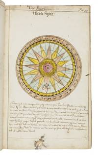
1735LC4E9Q4RAGZBHolland 1735. Green paper wrappers made from a discarded prospectus or the wrapper of an instalment of a book ca. 1865 sewn at 6 stations some perhaps without supports later green cloth spine with the title in manuscript on the front wrapper. Folio 31.5 x 20.5 cm. A manuscript course in navigation written in brown ink on laid paper in a largely upright cursive hand with 6 colour figures including 2 volvelles about 100 black and white diagrams and numerous tables of data highlighted with a yellow wash. A detailed manuscript course in the art of navigation in folio format with figures in colour including two volvelles partly based on the very rare first edition in 8vo format of Klaas de Vries 1662-1730 Schat-kamer ofte konst der stier-lieden 1702; Crone 374 probably in the first issue not known to survive before the insertion of an additional quire between B and C. But the manuscript doesn't merely copy the printed book: at least much of the text differs and also at least some of the tabular data and some of the figures also have no direct equivalents in the printed book also not in later editions as far as we have seen. The colour illustrations include a compass rose 13.8 cm diameter with a ship in the centre directly copied from the folding engraved plate in De Vries and virtually the same size but the ship in the centre is copied in mirror image and De Vries's abstract floral decorations in the corners outside the circle are replaced by colour drawings of four different flowers one in each corner. The manuscript also directly copies De Vries's woodcut illustration of a human hand marked with the numbers "29" "9" and "19" on the thumb and the letters A B and C next to them presented as an aid to calculating the epact the number of days past the new moon on 1 January but the hand is rotated 180 degrees. Most of the examples of calculations use years in the period 1700-1711 though there are a few later ones one example uses the year 1809! which also largely agrees with the 1702 edition of De Vries though the examples are not identical. The clearest indication that the present manuscript follows the 1702 edition rather than a later one is that the tables giving differences between the positions of the sun and moon cover the years 1701-1704 as in the first edition before the insertion of an extra quire extending the tables to 1710 B8 was replaced at the same time not noted by Crone. All later editions we have seen give these tables and the examples of calculations for later years. Yet even in these tables the data in the present manuscript doesn't exactly agree with De Vries's. With a bookseller's ticket ca. 1901/1919. Very slightly browned with occasional minor spots or ink stains but still in good condition. The one leaf that appears to be lacking may have been deliberately cancelled by the compiler. The wrapper has a later cloth spine as noted and is somewhat worn. A fascinating manuscript course in navigation with volvelles and other figures in colour partly based on the very rare first 1702 edition of De Vries's handbook but not merely copying it.l For De Vries's 1702 handbook: Crone 374 collation not entirely correct. hardcover
192059238Washington D.C.: Government Printing Office Hydrographic Office U.S. Navy 1920; 1930. Two vols. 8vo. viii 4 577 1 pp.; 1 38 1 leaves. With 1 large folding colour map. 1st vol. in green publisher’s buckram gilt lettering stamped on front cover & spine darkening to spine shelfwear deep embossed circular indentation at gutter margin where brass weight held book open; 2nd vol. Supplement in self-printed softcovers toning chipping & tears to spine still G set. Second edition stated of vol. I 1st edition of Supplement vol. of these surprisingly scarce coast pilot guides detailing the sailing directions for the treacherous coasts of Norway & Sweden notoriously treacherous for sailing and powered vessels. Prior to modern GPS systems and satellite navigation these regularly updated and revised navigation handbooks provided key sailing instructions drawing upon British Norwegian Swedish & Danish coast pilots. Worldcat locates only 1 copy of the Supplement U of W. Government Printing Office, Hydrographic Office, U.S. Navy, paperback
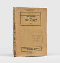
1943172166Washington DC: United States Navy Department Hydrographic Office 1943. First edition first printing pleasingly with all the printed supplement tickets still present and the detailed maps well preserved. Updated chapters offer information on general subjects such as pilotage storm and weather signals quarantine regulations and ocean currents as well as detailed discussion of stretches of river and ocean along China's east coast down to Hong Kong and up the Yangtze. While common institutionally as expected copies are now seldom encountered in commerce. Octavo. With 2 folding maps 2 diagrammatic plates illustrations in text. With all 8 leaves 4 blank of printed supplement tickets bound in at front as issued. Original brown card wrappers spine and front cover printed in black. Ex-Civil Affairs Training School University of Chicago with its ink stamps on front cover and "discard" noted in pencil. Wrappers well preserved first map with stub tear just touching neatline second map split along one fold neatly repaired on verso with archival tape couple of small nicks and chips internally not affecting text: a very good copy. unknown
1878z015738London: Russian Steam Navigation and Trading Company/ George Russell and Co 1878. Very Good. Letter from George Russell on Russian Steam Navigation and Trading Company letterhead to James M. Lincoln of the Pacific Mail Steamship Co. New York. The letter details the chaos to company affairs caused by the Russo-Turkish war 1877-78. Measures 8.5 by 10.5 inches recto only. Very good. Light chipping to extremities stain to top corner light creasing. Otherwise clean and unmarked. Russian Steam Navigation and Trading Company/ George Russell and Co unknown
025911894X.Gpaperback. Good. Access codes and supplements are not guaranteed with used items. May be an ex-library book. paperback
0259750999.Gpaperback. Good. Access codes and supplements are not guaranteed with used items. May be an ex-library book. paperback
033209460X.Ghardcover. Good. Access codes and supplements are not guaranteed with used items. May be an ex-library book. hardcover