Freeman, Douglas SouthallBiblio.com
2 455 résultats
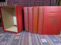
1934055819New York: Charles Scribner's Sons 1934. Hardcover. Good. 8vo - over 7¾ - 9¾" tall. Octavos. xvii 647; xi 621; xi 559 vi 594 pages. Indexed at the rear of Volumes II and IV. SIGNED and inscribed on the front flyleaf of Volume One "Autographed for / Dr. E. Howard Miller / with good wishes. / Douglas Southall Freeman". Hardcovers bound in red cloth and housed in an open front slipcase there might have originally been a front cover to the slipcase making it a box. The bindings show light to moderate rubbing and wear and are a little dulled or soiled from handling. Spines a little toned; there are a couple of splash marks on the spines of Volumes II & III. There is a diagonal crease at the top corner of Volume I. Early printings but not first printings. Each volume has the Scribner's Seal but the volumes do not have the Scribner's "A." Volumes I & II are dated 1934. Volumes III & IV are dated 1937. <br/> <br/> Charles Scribner's Sons hardcover
1988050362Lausanne Switzerland: Musee des arts decoratifs de la Ville de Lausanne 1988. Book. Near Fine. Soft cover. 1st Edition. 8vo - over 7¾" - 9¾" tall. Stiff white color pictorial wraps square format. Very minor shelf wear nearly as issued. xxix pp. text 40 color plates at rear. Catalog to accompany 1988 exhibition. Very scarce. Musee des arts decoratifs de la Ville de Lausanne Paperback
1991003702Queensbury: Author. SIGNED by author. Privately printed Queensbury NY: Author 1991. Inscribed by author on title page. 4to. wrappers 250 pp. illustrated with black and white photos of historic homes maps and extensive geneology. 19" x 25" folded map laid in - "Queensbury's Heritage Trail: A Self-Guided Driving Tour of Queensbury's Historic Places."Crisp near fine condition. . Near Fine. Soft cover. 1991. Author paperback
ria9780306449994_inpHardcover. New. New Book; Fast Shipping from UK; Not signed; Not First Edition; The operation of semiconductor devices depends upon the use of electrical potential barriers such as gate depletion in controlling the carrier densities electrons and holes and their transport. Although a successful device design is hardcover
1980059397Kennett Square PA: Western Quarterly Meeting 1980. Book. Near Fine. Soft cover. 1st Edition. 8vo - over 7¾" - 9¾" tall. Stiff goldenrod wraps. viii95 pp. Modest handling wear light surface rubbing to covers. Firm binding clean interior. Western Quarterly Meeting Paperback
1915003148Philadelphia and London: J. B. Lippincott Co. 1915. Book. VG. Decorative Cloth. First Edition. 4to - over 9¾" - 12" tall. Burgundy cloth gilt stamped lettering and cover illus. of cannon deckled edges gilt top. Modestly rubbed edges and joints cloth slightly flecked with a few light surface marks corners a bit exposed. Front endpapers affixed. Illus. w/ b&w plates. Clean interior firm binding quite decently preserved. 309 pages index 71 black and white photographs. Coverage includes New England Nova Scotia Michigan Illinois Mid Atlantic States South. J. B. Lippincott Co. Hardcover
197426799Radford VA: Commonwealth Press. 1974. Hardcover. Very Good with no dust jacket; 60 pages . Commonwealth Press hardcover
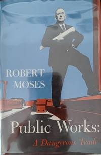
197063225<p>NY: McGraw-Hill. Very Good in Very Good dust jacket; Front flyleaf removed jacket lightly worn. 1970. First Printing. Hardcover. Inscribed to real estate developer Joe Lesser by the author Robert Moses on dedication page. Gray illustrated cloth binding. Foreword by Raymond Moley xxxvi 952pp biography index photos. Autobiography by the legendary public works commissioner and New York State and City power broker who remade many of the metropolitan parks highways neighborhoods and bridges. A doorstop of a book only bested by Robert Caro's 1974 Pulitzer Prize-winning biography of Moses. ; 8vo 8" - 9" tall .</p> McGraw-Hill hardcover
182116437New York: William A. Mercein. Very Good. 1821. First Edition. Hardcover. Rebound in clean reddish-brown cloth with title label on spine. Interior of text is clean tight & intact. Illustrated with a fold-out b/w map that has the canal in red. Both map and fold -out Appendix have neatly repaired folds. Chipped bottom corner of first two pages. Page xix with small piece missing from bottom edge but does not interfere with text. Canals New York ; Map & Appendix & Table; 8vo; 485 pages . William A. Mercein hardcover
AT 9788126915415USA Edition . New. Brand New! Fast Delivery This is an International Edition and ship within 24-48 hours. Deliver by FedEx and Dhl & Aramex UPS & USPS and we do accept APO and PO BOX Addresses. Order can be delivered worldwide within 6-10 days and we do have flat rate for up to 2LB. Extra shipping charges will be requested if the Book weight is more than 5 LB. This Item May be shipped from India United states & United Kingdom. Depending on your location and availability. unknown
1929061052Pennsylvania German Society 1929. Book. Near Fine. Hardcover. First Separate. 4to - over 9¾" - 12" tall. Burgundy cloth lettered in gilt deckled text block edges. Minor shelf wear slight spotting to cloth mild foxing along text block edges. Firm binding clean interior. iv222 pp. First separate edition limited; originally issued in Proceedings of the Pennsylvania German Society Vol. XXXVI. Alas this copy does not include the scarce 10-pp. supplement of "erotic" proverbs. Pennsylvania German Society Hardcover
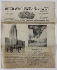
190212944New York 1902. 8pp. Illustrated. Folio. Original self wrappers stapled. Moderate staining and soiling old folds minor edge wear. Good condition. Illustrated with black & white photos and two maps one of holdings in Knox County Kentucky the other in the East Texas Oil Belt centered on Beaumont. The company -- miners and producers of crude lubricating and illuminating oils -- was incorporated in April 1901 under the state laws of Delaware. This prospectus solicited investors and presented its balance sheet and current activities listed officers and presented the "expert opinions" of geologist Major J.W. Otley the original surveyor of the Beaumont and other fields as to the worthiness of the company's properties at nearby Sour Lake Texas. No listings found on OCLC. A unique and early oil company prospectus with notable content on Kentucky and Texas oil. unknown
1894022327Harrisburg PA: Clarence M. Busch State Printer 1894. Book. VG. Unbound. First Edition. Complete set of 23 maps complete as issued Nos. 1-16 19-25 2 additional as given housed in original marbled paper portfolio worn with repair. All maps issued in conjunction with Pennsylvania Archives 3rd Series Appendix I-X except as noted with numbers given as issued and as listed in MG 11 Map Collection of PA State Archives PHMC. All printed in color sizes ranging considerably several measuring 3' x 2' or larger. Most maps show clean fronts mildly soiled backs some showing minor separations at fold junctures typical of issue. 1-608 Die Gros-Britannische Colonie-Laender In Nord-America in accuraten Special-Mappen nach den Londone Originalien 608. 2-609 The London Land Company Survey by Thomas Fairman 1709. Copy 1764 of an Island in the river Delaware in Philadelphia County above the mouth of the Schuylkill. 3-610 John McCulloch's Land Survey situated on the East side of Monongahela River between Great Redstone and Dunlap's Creek by John Lukens 1769. Shows: Fort Bird Burd. 4-611 A Map of the State of Pennsylvania by Reading Howell 1792. Shows: county and township lines roads furnaces forges grist and saw mills Indian paths and towns minerals dwelling houses. 5-612 The London Land Company Resurvey in Chester County February 21 1736. Survey of lands said to be in New Castle County but found to be in Chester County. 6-613 "Coxburg" Survey "Notingham" Township Washington County January 25 1780. John Lukens Surveyor General. 7-614 Pennsylvania Land Company in London Survey September 12-15 1760. Survey for land lying on Conestoga Creek Lancaster County by John Lukens Surveyor General. 8-615 Peters Creek Mount Pleasant Washington County Survey May 7 1785. Survey to adjust title to unpatented lands in Monongahela Youghiogheny and Ohio Counties. 9-616 Manallin Township Fayette County Survey March 22 1785. Bazil Brown's survey on the waters of the Redstone and Dunlaps Creeks for adjusting the claims to unpatented lands in Monongahela Youghiogheny and Ohio Counties. 10-617 John Estaughand Company's Land situate on Conostogoe and the Mill Creek Chester County 1717. 11-618 7500 Acres on the Delaware River Bucks County Survey August 17 1699. Copy of original by Thomas Fairman Surveyor. Shows: Delaware River 20 miles above the Falls. 12-619 Tracts of Land called New Munster and Society December 13 1763. Shows: mill dwelling house Rankin's field. 13-620 Map of the British Colonies in the Year 1765 from a Map of the Period. Shows: Indian villages forts Philadelphia New Castle Delaware rivers falls mines. 14-621 London Land Company Survey August 19 1709 of 5000 Acres Chester County by Thomas Fairman Surveyor. 15-622 London Land Company Survey of 5000 Acres bounded by the "Scholkil and Perqueaming" Creek. Thomas Fairman Surveyor. 16-623 London Land Company Survey of 5000 Acres Chester County. Surveyed by Thomas Fairman August 19 1709. 17-18: Not issued. 19-624 Map of the Province of Pennsylvania.Servt W. Scull. Philadelphia Printed by James Nevil for the author April 4 1770. 20-625 A Map of Pennsylvania Exhibiting not only The Improved Parts of that Province but also Its Extensive Frontiers: Laid down from Actual Surveys and Chiefly from the Late Map of W. Scull Published in 1770. Shows: roads ferrys churches forts houses miles coal falls Indian villages. 21-626 A Map of the Provinces of New-York and New-Jersey with a part of Pennsylvania and the Province of Quebec from the Topographical Observations of C. J. Sauthier Augsburg 1777. 22-627 Regni Mexicani seu Novae Hispaniae Ludovicianae N. Angliae Carolinae Virginiae et Pensylvaniae nec mon Insviarvm Archipelagi Mexicani in America Septentrionali accurata Tabula exhibita a Joh. Baptista Homanno n.d. 23-628 A Map of the Improved Part of the Province of Pennsylvania in America. Begun by William Penn Proprie. Clarence M. Busch, State Printer unknown
1894022328Harrisburg PA: Clarence M. Busch State Printer 1894. Book. Very Good. Unbound. First Edition. Complete set of 23 maps complete as issued Nos. 1-16 19-25 2 additional as given housed in original marbled paper portfolio worn covers separated. All maps issued in conjunction with Pennsylvania Archives 3rd Series Appendix I-X except as noted with numbers given as issued and as listed in MG 11 Map Collection of PA State Archives PHMC. All printed in color sizes ranging considerably several measuring 3' x 2' or larger. Most maps show clean fronts mildly soiled backs some showing minor separations at fold junctures typical of issue. 1-608 Die Gros-Britannische Colonie-Laender In Nord-America in accuraten Special-Mappen nach den Londone Originalien 608. 2-609 The London Land Company Survey by Thomas Fairman 1709. Copy 1764 of an Island in the river Delaware in Philadelphia County above the mouth of the Schuylkill. 3-610 John McCulloch's Land Survey situated on the East side of Monongahela River between Great Redstone and Dunlap's Creek by John Lukens 1769. Shows: Fort Bird Burd. 4-611 A Map of the State of Pennsylvania by Reading Howell 1792. Shows: county and township lines roads furnaces forges grist and saw mills Indian paths and towns minerals dwelling houses. 5-612 The London Land Company Resurvey in Chester County February 21 1736. Survey of lands said to be in New Castle County but found to be in Chester County. 6-613 "Coxburg" Survey "Notingham" Township Washington County January 25 1780. John Lukens Surveyor General. 7-614 Pennsylvania Land Company in London Survey September 12-15 1760. Survey for land lying on Conestoga Creek Lancaster County by John Lukens Surveyor General. 8-615 Peters Creek Mount Pleasant Washington County Survey May 7 1785. Survey to adjust title to unpatented lands in Monongahela Youghiogheny and Ohio Counties. 9-616 Manallin Township Fayette County Survey March 22 1785. Bazil Brown's survey on the waters of the Redstone and Dunlaps Creeks for adjusting the claims to unpatented lands in Monongahela Youghiogheny and Ohio Counties. 10-617 John Estaughand Company's Land situate on Conostogoe and the Mill Creek Chester County 1717. 11-618 7500 Acres on the Delaware River Bucks County Survey August 17 1699. Copy of original by Thomas Fairman Surveyor. Shows: Delaware River 20 miles above the Falls. 12-619 Tracts of Land called New Munster and Society December 13 1763. Shows: mill dwelling house Rankin's field. 13-620 Map of the British Colonies in the Year 1765 from a Map of the Period. Shows: Indian villages forts Philadelphia New Castle Delaware rivers falls mines. 14-621 London Land Company Survey August 19 1709 of 5000 Acres Chester County by Thomas Fairman Surveyor. 15-622 London Land Company Survey of 5000 Acres bounded by the "Scholkil and Perqueaming" Creek. Thomas Fairman Surveyor. 16-623 London Land Company Survey of 5000 Acres Chester County. Surveyed by Thomas Fairman August 19 1709. 17-18: Not issued. 19-624 Map of the Province of Pennsylvania.Servt W. Scull. Philadelphia Printed by James Nevil for the author April 4 1770. 20-625 A Map of Pennsylvania Exhibiting not only The Improved Parts of that Province but also Its Extensive Frontiers: Laid down from Actual Surveys and Chiefly from the Late Map of W. Scull Published in 1770. Shows: roads ferrys churches forts houses miles coal falls Indian villages. 21-626 A Map of the Provinces of New-York and New-Jersey with a part of Pennsylvania and the Province of Quebec from the Topographical Observations of C. J. Sauthier Augsburg 1777. 22-627 Regni Mexicani seu Novae Hispaniae Ludovicianae N. Angliae Carolinae Virginiae et Pensylvaniae nec mon Insviarvm Archipelagi Mexicani in America Septentrionali accurata Tabula exhibita a Joh. Baptista Homanno n.d. 23-628 A Map of the Improved Part of the Province of Pennsylvania in America. Begun by William Penn Pr. Clarence M. Busch, State Printer unknown
195525361Alma Ga. :: Rev. H. J. Johnston. 1955. SIGNED by author. Light cover scuffing soil; pgs tight clean unmarked although some show corner creasing/soft creasing; hinges sound uncracked. No DJ. . Rev. H. J. Johnston, unknown
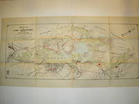
1912016735Borough of Hopatcong New Jersey 1912. Near Fine condition. SEE PHOTO. This is a beautiful and very scarce color map of Lake Hopatcong New Jersey. When unfolded it measures 18" tall by 38" wide. Some folds have been neatly reinforced on the blank side with archival-quality document repair tape. Buildings are represented by red squares water in green. Some of the properties and locations depicted are: Port Morris Landing Roxbury Township Borough of Mount Arlington Byram Township Nolans Point Atlas Powder Co. Brookland Borough of Hopatcong Byram Cove Henderson Bay Byram Bay Maxim Park Jefferson Township Woodport Hurdtown Hurd Mining Co. W. M. Force Estate John P. Lawless Mary Ingram estate Aaron Peck estate Raccoon Island Halsey Island Bertrand Island Theodore King Gertrude Otten Violet Littell Robert Dunlap estate etc. Full title: "Property Map of Lake Hopatcong New Jersey Prepared by Hudson Maxim for the Morris Canal Investigation Commission November 16 1912 Compiled from Various Maps and Actual Surveys by P. E. Boomer C. E.". First Edition. Folded map. Near Fine condition. 18" tall by 38" wide when unfolded. Borough of Hopatcong, New Jersey? Paperback
197070892Atlantic Records 1970. Poster. Collectable good. Original not a copy or reproduction. 21.5" x 14.5 "Woodstock" poster of late 60's hippie stylized illustration of young man and woman embracing; reverse side is a two-panel "Woodstock" informative flyer. Only "good plus" condition due to light wear a thumbtack hole in each corner a couple of small rips very lightly soiled. We are a small family business with over 30 years experience providing fine new and pre-owned books online. You can expect professional service and individual attention to your order daily shipments and sturdy packaging. Atlantic Records, unknown
1873004648Philadelphia: Lippincott's Press 1873. Hardcover. Near Fine -. 31 1 p.; 18 cm. Red cloth with gilt-stamped cover title: Bonds in the Bank. Gilt-stamped decoration on front board and mirror blind-stamped decoration on back board. Boards have bevelled edges. All page edges gilt. Dark brown endpapers. Pages 3-31 are printed on recto only. This booklet was probably given to the guests at the celebration of the 10th wedding anniversary of Mary Harris and Wistar Morris. The 10th anniversary is traditionally the tin anniversary which would be observed by a present of a tin bank containing railroad government or other bonds. Instead in this case it contained the poem written presumably by Wistar Morris to celebrate their anniversary as well as a shorter poem he had written 10 years earlier to welcome her to Green Hill Farm. Mary Harris Morris 1836-1924 was on the board of managers of the Orphan's Asylum of Philadelphia and the Howard Home for women discharged from prison; she also opened a school for girls in Tokyo in 1890. Wistar Morris 1815-1891 was a founder of Morris Tasker & Co. in Philadelphia a director of the Pennsylvania Railroad president of the Pennsylvania Hospital board a trustee of Haverford College and founder of the Carlisle Indian School in Carlisle Pa. Their home Green Hill Farm was sold to Friends' Central School in 1925. Very scarce. In Near Fine- Condition: cover is slightly rubbed; foxing primarily on title page and facing blank page; otherwise clean and tight. Lippincott's Press hardcover
1991248065PN. New. 1991. Soft Cover. Date is original print. This is a reprint edition . PN paperback
1935021271N.Y.: Harcourt Brace and Company 1935. First edition. Publishers blac cloth with green lettering and design small bookstore label at inside front cover else a fine copy in dust jacket not price clipped $2.00 intact although all four corners are very slightly trimmed. One small closed tear at spine head else a fine sharp jacket. An unusal title and even more so in this shape. The strangling of a wealthy woman at an opulent Andirondack estate brings Lt. Valcour to investigate. He knows immediately who committed the crime but can he prove it This copy although not marked as such originates from the auction of Gary Groton's noted crime collection. First Edition. Hardcover. Fine/Near Fine. Book. Harcourt Brace and Company
0428293786.Ghardcover. Good. Access codes and supplements are not guaranteed with used items. May be an ex-library book. hardcover
0656935952.Ghardcover. Good. Access codes and supplements are not guaranteed with used items. May be an ex-library book. hardcover
1919052196Philadelphia PA: Huguenot Society of Pennsylvania 1919. Book. Very Good. Soft cover. 1st Edition. 8vo - over 7" - 9" tall. Partial run comprised of Volumes II-III VIII-XVI XVIII XX-XXI XXIII-XXXVI 2-3 8-16 20-21 23-36 issued 1919-1965 a total of 28 volumes in 23 issues bound in original stiff light to medium blue wraps most perfect-bound several stapled. General condition VG many Near Fine to Fine. Some of the earlier issues are tanned along spine panels and toward cover edges. The Huguenots were "French" Protestants though most who emigrated to Pennsylvania actually spoke German who fled the contested border territories between France and Germany in the early 18th century and settled predominantly in the Hudson River valley of New York state and southeastern Pennsylvania. Each issue of this journal presents various historical articles on the influence of the Huguenots in the Mid-Atlantic region and elsewhere throughout North America. Very scarce. Huguenot Society of Pennsylvania Paperback
1891011525Rochester NY: Rochester Academy of Science 1891. Ex-Library. Good. Buckram. First Edition. 8vo - over 7¾" - 9¾" tall. Ex-library uniformly bound in brown buckram with gilt spine lettering. Seven volumes of 9 in six volumes all internally complete and intact: 1-2 1890-95 3 1896-1906 5 1910-18 6 1919-29 7 1929-37 9 1946-51. Typically marked/stamped relatively light wear with a few surface marks and lightly rubbed edges/extremities. Firm bindings clean interiors intact plates beyond library markings. x216xi348 vi344 vii288 vii283 iv2624 ii420 pp. illus. with b&w plates including foldouts maps etc. Prominent articles include: "Plants of Monroe County New York and Adjacent Territory" by Beckwith Macauley Fuller v3 with two supplementary lists v5; "Early Botanists of Rochester and Vicinity" by Beckwith v5; "Eskers in the Vicinity of Rochester NY" by Giles v5; "The Rochester Canyon and the Genesee River Base-Levels" "The Pinnacle Hills or the Rochester Kame-Moraine" "The Mendon Kame Area" "The Dansville Valley and Drainage History of Western New York" all by Fairchild v6; "The Fungi of our Common Nuts and Pits" "New or Rare Fungi from Various Localities" by Fairman v6; "Aboriginal Cultures and Chronology of the Genesee Country" by Parker v6; "New York Drumlins" "New York Physiography and Glaciology West of the Genesee Valley" "Genesee Valley Hydrography and Drainage" by Fairchild v7; "Arboriculture at Rochester NY" by Baxter and Maloy v7; "History and Engineering of Rochester's Water Supply in its First Century" by Fisher v7; "The Richmond Mastodon" by Sanford v7; "Petrology of the Niagara Gorge Sediments" by Alling v7; "The Bergen Swamp" by Stewart and Merrell v7; "Quantitative Petrology of the Genesee Gorge Sediments" by Alling v9; "The Vegetation of Bergen Swamp" by Muenscher Brown Hotchkiss Hohn Rogerson and Winne v9; "The Phalangida Opiliones of New York" by Bishop v9; "Stratigraphy and Structure of the Batavia Quadrangle" by Sutton v9. Beyond these articles each volume contains the expected listing of contents notes and queries necrologies minutes listings of officers indexes. Rochester Academy of Science Hardcover
0243214375.Gpaperback. Good. Access codes and supplements are not guaranteed with used items. May be an ex-library book. paperback