Admiralty ChartsMareMagnum

1 884 résultats
Plans of Islands in the South Pacific. In the left side of the chart insert of Niutao From a sketch by Captain Peters of the German Mercantile Marine, 1876, Nanomea From a sketch by Capt. Peters of the German Mercantile Marine, 1876, Hoorn I.s From the French Government Chart of 1893, Sigave Bay From a French Gov. Survey 1883, Oeno Island From a Running Survey. In the middle of the chart insert of Ducie IslandFrom a Running Survey by Capt. F.W. Beechey, 1826. In the right side of the chart Niue or Savage I. From a Survey by H.D.M. Haszard Esq. 1903, Uea or Wallis I.s From a French Government Chart of 1901, Henderson I. From a Running Survey by Capt. F.W. Beechey, 1826, Niuafou Island From an Eye Sketch by Lieut. B.T. Somerville, H.M. Surveying Ship "Penguin" 1895. London Published at the Admiralty 20th Sept. 1873, under the Superintendence of Rear Admiral G.H. Richards, Hydrographer. Small corrections: 1930. Autore: Admiralty Charts. Luogo: Pacific Ocean Islands. Anno: '900. Tecnica: incisione. Dimensioni: 631x489 mm
Raoul or Sunday I. Surveyed by Capt. H.M. Denham, assisted by Lieut: J. Hutchison, J.W. Smith, Mast. E. Wilds, F. Hixson, & F. Howard Sec. Masters 1854. In the left side of the chart insert of CMacauley I. From a Sketch Survey by the Ass. Surveyor General of New Zealand in 1887, Curtis I. From a Sketch Survey by the Ass. Surveyor General of New Zealand in 1887. London Published at the Admiralty, May 4th 1863, under the Superintendence of R. Adm. Washington, Hydrographer. Small corrections: 1930. Autore: Admiralty Charts. Luogo: New Zealand - Kermadec Group - Polynesia - Pacific Ocean. Anno: 1863 [1930]. Tecnica: incisione. Dimensioni: 471x670 mm
Rough Sketches of Anchorages in the Solomon Islands. By M.r W.T. Wawn, Master, Brigantine "Ariel", 1888. In the left side of the chart insert of Tasman I.s or Niumanno Atoll, Atta Cove, Ariel Harbour From a Survey by Lieut. A.L. Jackson, under the direction of Lieut. Com. R.L. Hancock, H.M. Surveying Ship "Sealark", 1914, Manna Kwoi H.r. In the middle part of the chart insert of Deep Bay, Uras Cove, North Sister Anchorage, Double Bay. In the right side of the chart insert of Maramasike Passage. London Published at the Admiralty, 7th Oct. 1889, under the Superintendence of Captain W.J.L. Wharton, Hydrographer. Small corrections: 1930. Folded editorially. Autore: Admiralty Charts. Luogo: Salomon Islands - Pacific Ocean. Anno: '900. Tecnica: incisione. Dimensioni: 512x741 mm
Samoa Islands Island of Tutuila From United States Naval surveys between 1901 and 1922. In the upper left corner of the chart insert of Manua Islands - Tau, Ofu and Olosega Islands From a United States Naval survey in 1915 - and insert of Rose Island From latest information. Washington D.C., published June 1923, at the Hydrographic Office, under the authority of the Secretary of the Navy. Small corrections: Printed: April 1932. Folded editorially. Autore: Admiralty Charts. Luogo: Samoa Islands - Pacific Ocean. Anno: '900. Tecnica: incisione. Dimensioni: 789x1215 mm
Santa Cruz I.s - Santa Cruz I. by Admiral Bruny D'Entrecasteaux 1793 Duff Group by Capt. J. Wilson of the Ship Duff 1797 Vanikoro I.s by Capt. Dumont D'Urville 1828 Swallow Group by Nav. Lieut. T.C. Tilly R.N. of the Mission Schooner Southern Cross. In the right side of the chart insert of Carlisle Bay Sketch by Lieut. H.R.M. Williams, H.M.S. Torch, 1897 and Graciosa Bay From a French Gov. Survey 1888. In the lower part of the chart insert of Mohawk Bay By Lieut. A.C. Scott, Assisted by Lieut. P. Robarts. H.M.S. Mohawk, 1898. London Published at the Admiralty 21st Febr. 1870, under the Superintendence of Capt. G.H. Richards, Hydrographer.Small corrections: 1929. Autore: Admiralty Charts. Luogo: Santa Cruz Island - South west Pacific Ocean. Anno: '900. Tecnica: incisione. Dimensioni: 634x474 mm
Sketches of Anchorages in the Tuamotu or Low Archipelago chiefly taken from the French Government charts to 1907. In the left side of the chart insert of Lagoon Entrance, Manihi Entrance, Avatoru Entrance, Tiputa Entrance, North passage to Rotoava , Passes into Amanu Atoll From the United States Goverment Chart, 1902, Pakaka Pass From the United States Government Chart, 1902. In the right side of the chart Lagoon Entrance, Amyot Bay, Mururoa Island, Fangahina I. From the United States Government Chart, 1902, Pakaka to Seignelay P.t.London Published at the Admiralty 9th July 1907, under the Superintendence of Rear Admiral A. Mostyn Field, Hydrographer. Small corrections: 1931. Autore: Admiralty Charts. Luogo: Tuamotu Islands - Polynesia - Pacific Ocean. Anno: 1907 [1931]. Tecnica: incisione. Dimensioni: 595x480 mm
Solomon Islands From All available information in the Hydrographic Department to 1931. In the left side of the chart insert of Gazelle Harbour From the German Government Charts to 1919, Gizo Anchorage by Lieut F.J. Rendell & Nav. Sub. Lieut J.W. Brown 1875. London Published at the Admiralty 7th July 1874, under the Superintendence of Captain F.J. Evans, Hydrographer. Small corrections. Folded editorially. Autore: Admiralty Charts. Luogo: Salomon Islands - Pacific Ocean. Anno: '900. Tecnica: incisione. Dimensioni: 660x990 mm
South Pacific Ocean - New Hebrides & Islands adjacent Surveyed by Capt. H.M. Denham, 1853-6. In the left side of the chart insert of Port Aneityum. In the right side of the chart insert of Aneityum Island or Annatam, Conway Reef. In the lower part of the chart insert of Walpole Island, Matthew Island, Hunter Island, Erronan or Futuna. London Published at the Admiralty, 4th June 1862, under the Superintendence of R.Adm. Washington, Hydrographer. Small corrections: 1920. Autore: Admiralty Charts. Luogo: New Hebrides Islands - Pacific Ocean. Anno: '900. Tecnica: incisione. Dimensioni: 481x654 mm
South Pacific Ocean. Sheet III. The curves of Variation are for 1915. Washington D.C., published Oct. 1883, at the Hydrographic Office, under the authority of the Secretary of the Navy. Small corrections Printed: July 1932. Folded editorially. Autore: Admiralty Charts. Luogo: Pacific Ocean South. Anno: '900. Tecnica: incisione. Dimensioni: 594x774 mm
Tonga Islands From British surveys between 1888 and 1898. Washington D.C., published Jan. 1903, at the Hydrographic Office, under the authority of the Secretary of the Navy. Small corrections: Printed Oct. 1930. Folded editorially. Autore: Admiralty Charts. Luogo: Tonga Islands - Pacific ocean. Anno: '900. Tecnica: incisione. Dimensioni: 988x657 mm
Tonga or Friendly Islands. In the upper part of the chart insert of Tongatabu Nukualofa Anchorage Surveyed by Captain Pelham Aldrich, assisted by Lieuts. C.J. Baker, T.H. Heming, G.C.A. Marescaux, W. Richardson, C.E. Monro and Sub Lieut. E.B. Kiddle, H.M. Surveying Ship "Egeria", 1888. In the lower part of the chart insert of Nomuka Harbour Surveyed by Lieut.ts W. Richardson and E.B. Kiddle, under the direction of Commander C.F. Oldham, H.M. Surveying Ship "Egeria", 1889, Eua Island Surveyed by Captain Pelham Aldrich, and the Officers of H.M. Surveying Ship "Egeria" 1888, Falcon Island Surveyed by Commander C.F. Oldham, and the Officers of H.M. Surveying Ship "Egeria" 1889. London Published at the Admiralty, 15th Feb. 1890, under the Superintendence of Captain W.J.L. Wharton, Hydrographer. Small corrections: 1931. Folded editorially. Autore: Admiralty Charts. Luogo: Pacific Ocean - Island Tonga. Anno: '900. Tecnica: incisione. Dimensioni: 965x652.
Upolu Island From German surveys to 1913. Washington D.C., published Jan. 1920, at the Hydrographic Office, under the authority of the Secretary of the Navy. Small corrections: Printed: July 1931. Folded editorially. Autore: Admiralty Charts. Luogo: Upolu Island - Pacific Ocean. Anno: '900. Tecnica: incisione. Dimensioni: 470x794 mm
Vanikoro Islands Surveyed by Capt. Durmont D'Urville, French Royal Navy 1828 - Tevai and Manevai Bays From the Survey by Capt Durmont D'Urville, French Royal Navy 1828. In the right side of the chart insert of Basilisk Harbour By Lieut. Hayter & Nav. Lieut. T.L. Mourilyan, 1872. Sub.Lieut. C.F.M. Malan, 1874, & Lieut. W. Munro Kerr, 1900. London Published at the Admiralty 1st Sept. 1873, under the Superintendence of Rear Admiral G.H. Richards, Hydrographer. Small corrections: 1930. Folded editorially. Autore: Admiralty Charts. Luogo: Vanikoro Islands - Pacific Ocean. Anno: '900. Tecnica: incisione. Dimensioni: 993x662 mm
v, 109 pages. Glossary. Index. Black and white illustrations. "In this manual, the techniques used to create the 32 different species in the Open Ocean exhibit have been presented in 10 groups, ranging from the simplest to the most complex. These techniques can be adapted for many uses such as reproducing archaeological artifacts as well as biological specimens." - Preface. Clean, bright and unmarked with very light wear. A nice copy. Book
197672456Hachette et CLIF Malicorne sur Sarthe, 72, Pays de la Loire, France 1976 Book condition, Etat : Bon broché, sous couverture imprimée éditeur verte grand In-8 1 vol. - 433 pages
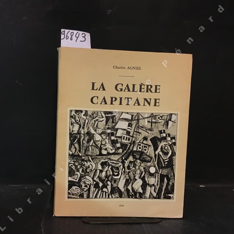
1958968431958 Imprimeur Joseph Reschly, Montpellier - 1958 - grand In-8 broché avec jaquette rempliée - 118 pages - nombreuses reproductions photographiques contrecollées - N° 270/500 sur velin bouffant "fleur d'alfa" des papeteries de France
10856Paris, Librairie Dentu, s.d. 10e édition. In-8 broché, couv. orange ill., 346 p. Bon état : dos décoloré - petit manque sur le bas du 1er plat.
1978LFA-126732671Un ouvrage de 97 pages, format 235 x 235 mm, illustré, relié cartonnage couleurs, publié en 1978, Editions B.L.T. / COOP, bon état
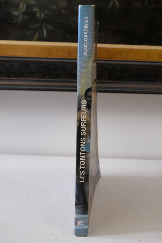
2004MER11MEdité par Atlantica, 2004. In-4 broché, couverture illustrée, légèrement usée sur les bords. Coin inférieur abîmé, voir photo. Nombreuses illustrations n&b et en couleurs. 190 pages. Quatrième de couverture et dernières pages abîmées, voir photo.
In 8. Dim. 19x12 cm. Pp. 281+(3). Interessante opera di viaggi del 1886 di Albert David che descrive il suo viaggio lungo l'Oceano Pacifico.<BR>All'interno sono presenti dieci incisioni fuori testo che mostrano vedute: Baie Borja, Lima, Indiani peruviani, Tahiti ecc... Tra i luoghi descritti: Distretto di Magellano e Canali laterali della Patagonia, Lima durante vl'occupazione cilena, Valparaiso e i Cileni dopo la Guerra del Pacifico, Peru e Cile, Callao, Pisco, Pisagua, Arica e Tacna, Iquique, Lota, Una necropoli degli Incas, Honolulu, Un mese a Noukahiva, Tahiti ecc...<BR> In buone condizioni e completo Copertina editoriale in buone condizioni generali con lievi usure ai margini e dorso. Legatura in buone condizioni. All'interno le pagine si presentano in buone condizioni con fioriture. Interesting work of travel of 1886 written by Albert David describing his travel in the Pacific Ocean.<BR>Inside there are ten out of text planches showing different views: Baie Borja, Lima, Peruvian Indians, Tahiti ecc... Between the places described: District of Magellano and channels of Patagonia, Lima during Chile occupation, Valparaiso and Cileni after Pacific war, Peru and Cile, Callao, Pisco, Pisagua, Arica e Tacna, Iquique, Lota, a city of Incas, Honolulu, a month in Noukahiva, Tahiti ecc... In good conditions and complete. Editorial cover in good general conditions slightly worn in the edges and spine. Binding in good conditions. Inside pages are in good conditions with foxings.
Imprimerie de Monaco, 1895. In 4to grande, pp. 36 + 2 (Lègende de la Planche 1 e Lègende de la Planche 2 ) + le 2 tavole con veline sciolte, rispettivamente con 14 e 12 figure in litografia in colore, testo in francese, bross. edit. in carta muta protetta da velina recante i titoli e con alette di protezione. Importante raccolta di studi scientifici di biologia marina, realizzati sotto la direzione del Principe Alberto I di Monaco (Parigi, 1848 – Parigi, 1922). Alberto I, ancora molto giovane, ad appena ventidue anni, iniziò a coltivare la passione per le scienze naturali e in particolare per l'oceanografia. Si interessò ai nuovi strumenti che la tecnica metteva a disposizione per lo studio dei fondali marini, e con il sostegno di importanti scienziati compì studi oceanografici, realizzò mappe e carte nautiche. A lui si deve la fondazione di quello che sarebbe divenuto l'”Istituto Oceanografico” di Monaco, che include oggi un acquario, un museo e una biblioteca. Disponiamo di questo fascicolo VIII relativo a Epizoanthus, Caryophillia, Deltocyathus, Flabellum, Stephanotrochus, Balanophyllia. Piccole fioriture e alcune gualciture alla brossura, alcune fioriture marginali alla prima tavola, buono tutto l'interno, ancora intonso.
large 8vo [23.5 x 16 cm]; xxiv, 328 pp, photogravure frontis of the ship, 98 illustrations on 58 plates, folding map, bibliog, tables, index. later green morocco-backed boards, gilt spine title lettering, gilt decorations on raised bands, very lightly foxed on few leaves, mostly marginal, near fine sound copy in handsome binding. A picture of this book is available upon request by email. Wood p. 184. Most of the book is a quality narrative of the voyage in the Indian Ocean, including Laccadive Sea, Bay of Bengal and Andaman Sea. Also included is a history of the ship "Investigator" and its use in gathering information on natural history over more than a decade, with the final section being on the marine biology of the Indian seas. The illustrations are of fish and other marine creatures, An important study and interesting narrative.
xxiv, 328 p. incl. front. plates., fold. map. 24 cm. Hardcover Very good condition
Gli aspetti più sconcertanti e più misteriosi di una civiltà scomparsa. Ricerche, ipotesi, conclusioni in questo libro che è diventato ormai un classico della moderna etnologia.
Gli aspetti più sconcertanti e più misteriosi di una civiltà scomparsa. Ricerche, ipotesi, conclusioni in questo libro che è diventato ormai un classico della moderna etnologia.