6 260 résultats
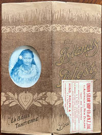
191360709Dunedin N.Z.: Union Steam Ship Co. of New Zealand Ltd. 1913. 4to. 7.75 x 10 in. 27 5 pp. including advertisements printed in blue-tinted ink. With numerous photo & text illustrations throughout 1 large double-page colour map “Chart of Routes†inserted as centerfold. Brown softcovers illustrated and printed in gold metallic ink nicely decorated Art Nouveau cover lettering & illustration die-cut window front cover for image of a Tahitian girl “La Belle Tahitienne†on front cover w/ original Union Steam Ship Co. label affixed to front cover yapp fore-edges minor edgewear tear to corner of label still VG- copy. Early printing of this nicely illustrated and informative travel brochure first issued in 1910 touting the Union Steam Ship Co. cruises to the Hervey Cook Society Tuamotu and Marquesas Islands in the South Pacific. The Union Steam Ship Co. operated over 50 steamships and round trip fairs to the Cook & Society Groups or the Western Pacific could be purchased for £16-34 at the time. Grimshaw 1870-1953 was an avid traveler and Irish writer who wrote for the Daily Graphic and The Times before moving in 1903 to the Territory of Papua where she worked as a travel publicist and would issue her books such as “In the Strange South Seas†“From Fiji to the Cannibal Islands†and “South Sea Sarah.†Union Steam Ship Co. of New Zealand, Ltd., paperback
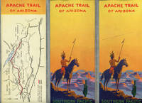
192249555N.P.: Privately printed 1922. 1922. First edition. 9" x 12" tri-folded to 9" x 4." 20 4pp. including covers. Maps. Information and color photographs about the Apache Trail which winds from Globe to Phoenix. Offers information on the Tonto Cliff Dwellings Roosevelt Dam Roosevelt Lake Apache Lodge the Walls of Bronze etc. Offers information on side trips for those who don't want to make the complete trip to include summer schedules for those trips. 3" x 7 1/4" system map of the Southern Pacific Lines. 4" x 7 1/2" map showing Apache Trail auto roads Southern Pacific Lines and Arizona Eastern Lines. At center of pamphlet is a topographical map of the Apache Trail of Arizona on the Southern Pacific Lines. Light soiling and light wear to the extremities along with a tiny light stamp for and in the absence of General Agent to center of front cover. Very good. Privately printed, 1922. unknown
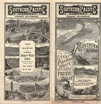
189639056N.P.: Privately printed 1896. 1896. 7" x 13 3/4" folded over twice to 7" x 3 1/2" in pictorial wrappers. 20 pp. illustrations map schedule rates 4-columns printed in red and blue ink. Information on Hotel Del Monte Monterey Santa Cruz San Luis Obispo Capitola Santa Maria Del Mar San Mateo San Jose Lick Observatory Paraiso Hot Springs El Paso de Robles Hotel Arcadia listing of Spanish and Indian names Tassajara Hot Springs Pacific Congree Springs Gilroy Hot Springs Leland Stanford Junio University Mount Hamilton Twin Lake Park Capitola the big trees of Santa Cruz etc. 7" x 13 3/4" color bird's-eye view map of California. Numerous photographs of scenery throughout brochure along with pictures of various hotels buildings points of interest. Cover wrappers lightly soiled with slight splits at spine ends and light wear to the extremities. Very good. A very interesting brochure. Privately printed, 1896. unknown
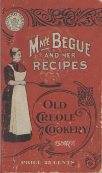
19006878San Francisco; Chicago: Southern Pacific Railroad; Printed by Poole Bros 1900. Duodecimo-size booklet 14.75 x 8.5 cm. 80 pages. Blue and brown ink on pink paper. Two photographic portraits Monsieur and Madame Bégué. Illustrations. List of railway agents. Title from cover. In logo at head of title: Southern Pacific Sunset Route. ~ Evident FIRST EDITION. A souvenir anthology of writings including sixty recipes from two landmark New Orleans restaurants offered for sale to customers traveling the Sunset Route San Francisco–New Orleans by the Southern Pacific Railroad Company. A sampling: Mutton Feet à la Créole Liver à la Bégué Jambalaya of Chicken Codish with White Beans Bisque of Crayfish Creamed Cauliflower Onion Salad Eggplant with Rice and Ham Mayonaise of Celery and Shrimps Pineapple with White Wine. ~ The title displayed on the wrappers is misleading: the atmospheric essays and testimonials – arranged by a literary journalist who contributed to Southern Pacific's promotional magazine Sunset Henry Monroe Mayo 1868-1950 – reveal little regarding the eponymous originator of the recipes or the history of the cuisine that brought her fame. Only pages 47-68 contain recipes by Elizabeth née Elisabetha Kettenring Dutreuil Bégué 1831-1906 the proprietary chef of the beloved restaurant in the Vieux Carré – the second oldest such establishment in New Orleans – located on the Rue de la Levée Decatur Street after 1870 downriver from Jackson Square and across from the French Market. An immigrant from southern Germany she had opened a coffee shop with her husband Louis Dutreuil in 1863. After his death in 1875 she married again and with her second husband Hippolyte Bégué 1842-1917 reopened in the same location with the aim of serving one meal per day – a “second breakfast†beginning at 11:00 a.m. – to accommodate laborers in the meat markets and on the docks who started work at dawn. A fuller history by David Shields is available in his The Culinarians Chicago: University or Chicago Press 2017 pages 270-273. By the mid-1880s trade fairs held in the city were bringing tourists as well and Bégué’s became a destination on its own. Madame Bégué died in 1906. The restaurant continued under management of her daughter but was sold in 1914 to relatives of the family Tujague competitors since 1856 on Decatur Street a few doors away. ~ A shorter tribute with recipes pages 69-74 is accorded another restaurateur presumably Victor Béro d. 1904 an immigrant from Belgium who had presided over Victor's Restaurant since 1873. Mayo appears to confuse the "Monsieur Victor" of his time with the founder and namesake of the establishment Victor Martin 1812-1865; cf. Shields page 136 445. ~ The Sunset Route of the Southern Pacific Company was the southernmost of the transport lines to the West Coast originally contemplated by the series of Pacific Railroad Acts between 1862 and 1866. Of the resulting publicly subsidized corporate consortia that would transform western North America – known collectively as the transcontinental railroads – Southern Pacific was already a mammoth system in 1900 including smaller subsidiaries such as the Texas and New Orleans Railroad and extending across territories that would later become New Mexico and Arizona as well as northwards through Nevada Utah and much of California. The in-house Sunset magazine appears to have been printed close to headquarters in San Francisco but like many publications issued by the transportation industry Mme. Bégué and Her Recipes was printed by Poole Brothers of Chicago who advertised as "railway printers" and also produced tickets brochures and mileage tables. ~ A few pages dog-eared. Very good in publisher's red wrappers decorated in black and white with an image of Madame Chef in kitchen apron. Rare. OCLC locates thirteen copies; Uhler 28; New Orleans Culinary History Group page 13; not in Bitting Brown or Cagle. Southern Pacific Railroad]; [Printed by] Poole Bros unknown
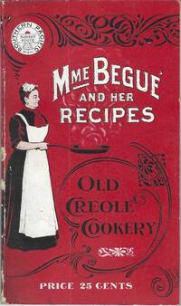
190010228San Francisco; Chicago: Southern Pacific Railroad; Printed by Poole Bros 1900. Duodecimo-size booklet 14.75 x 8.5 cm. 80 pages. Blue and brown ink on pink paper. Two photographic portraits Monsieur and Madame Bégué. Illustrations. List of railway agents. Title from cover. In logo at head of title: Southern Pacific Sunset Route. ~ Evident FIRST EDITION. A souvenir anthology of writings including sixty recipes from two landmark New Orleans restaurants offered for sale to customers traveling the Sunset Route San Francisco–New Orleans by the Southern Pacific Railroad Company. A sampling: Mutton Feet à la Créole Liver à la Bégué Jambalaya of Chicken Codish with White Beans Bisque of Crayfish Creamed Cauliflower Onion Salad Eggplant with Rice and Ham Mayonaise of Celery and Shrimps Pineapple with White Wine. ~ The title displayed on the wrappers is misleading: the atmospheric essays and testimonials – arranged by a literary journalist who contributed to Southern Pacific's promotional magazine Sunset Henry Monroe Mayo 1868-1950 – reveal little regarding the eponymous originator of the recipes or the history of the cuisine that brought her fame. Only pages 47-68 contain recipes by Elizabeth née Elisabetha Kettenring Dutreuil Bégué 1831-1906 the proprietary chef of the beloved restaurant in the Vieux Carré – the second oldest such establishment in New Orleans – located on the Rue de la Levée Decatur Street after 1870 downriver from Jackson Square and across from the French Market. An immigrant from southern Germany she had opened a coffee shop with her husband Louis Dutreuil in 1863. After his death in 1875 she married again and with her second husband Hippolyte Bégué 1842-1917 reopened in the same location with the aim of serving one meal per day – a “second breakfast†beginning at 11:00 a.m. – to accommodate laborers in the meat markets and on the docks who started work at dawn. A fuller history by David Shields is available in his The Culinarians Chicago: University or Chicago Press 2017 pages 270-273. By the mid-1880s trade fairs held in the city were bringing tourists as well and Bégué’s became a destination on its own. Madame Bégué died in 1906. The restaurant continued under management of her daughter but was sold in 1914 to relatives of the family Tujague competitors since 1856 on Decatur Street a few doors away. ~ A shorter tribute with recipes pages 69-74 is accorded another restaurateur presumably Victor Béro d. 1904 an immigrant from Belgium who had presided over Victor's Restaurant since 1873. Mayo appears to confuse the "Monsieur Victor" of his time with the founder and namesake of the establishment Victor Martin 1812-1865; cf. Shields page 136 445. ~ The Sunset Route of the Southern Pacific Company was the southernmost of the transport lines to the West Coast originally contemplated by the series of Pacific Railroad Acts between 1862 and 1866. Of the resulting publicly subsidized corporate consortia that would transform western North America – known collectively as the transcontinental railroads – Southern Pacific was already a mammoth system in 1900 including smaller subsidiaries such as the Texas and New Orleans Railroad and extending across territories that would later become New Mexico and Arizona as well as northwards through Nevada Utah and much of California. The in-house Sunset magazine appears to have been printed close to headquarters in San Francisco but like many publications issued by the transportation industry Mme. Bégué and Her Recipes was printed by Poole Brothers of Chicago who advertised as "railway printers" and also produced tickets brochures and mileage tables. ~ Internally clean and sound; in publisher's red wrappers decorated in black and white with an image of Madame Chef in kitchen apron. Wrappers with some rubbing and two small chips to the spine Near very good. Rare. OCLC locates thirteen copies; Uhler 28; New Orleans Culinary History Group page 13; not in Bitting Brown or Cagle. Southern Pacific Railroad]; [Printed by] Poole Bros unknown
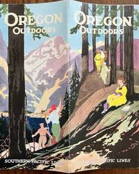
192548473Portland OR: Passenger Traffic Department Southern Pacific Lines Irwin-Hodson Co. March 11 1925. 4to. Printed & bound in double-columns center fold. 32 pp. Numerous text illustrations photo illustrations double-page colour centerfold of Crater Lake National Park maps. Colour-illustrated softcovers beautiful Jazz Age cover art of hikers amongst the mountains & forest slight shelfwear very slight rubbing VG copy. Early printing of this wonderfully illustrated promotional travel brochure for the Southern Pacific including wonderful photo illustrations of hotels motels attractions beaches and more. Passenger Traffic Department, Southern Pacific Lines, Irwin-Hodson Co., paperback
200263135Berkeley & Wilton CA: Signature Press 2002. 4to. 392 pp. Colour frontisp. colour photo plates 100’s of printed factory photo illustrations throughout. Burgundy-coloured publisher’s cloth gilt lettering front cover & spine orange endpapers w/ d.j. cover art by John Signor of a SP yard of the 1950’s NF/NF copy. First edition of this well-illustrated reference documenting the cabooses of one of the West’s largest and most historic railroads featuring here the history build dates car numbers car characteristics and the evolution of the caboose. Signature Press, hardcover
198763134Huntington Beach CA: Shade Tree Book 1987. 4to. 8 426 pp. Photo-illustrated title w/ 100’s of photo illustrations. Black publishers’ cloth gilt lettering on spine w/ d.j. NF/NF copy. First edition of this well-illustrated reference on almost 4200 steam locomotives during the company’s more than 130 years in business with specific builder information and photo illustrations throughout. Shade Tree Book, hardcover
189046165San Francisco: Crocker & Co. December 1890. 1890. 7" x 21" sheet on cream-colored stock folded to 12 panels each 7" x 3 1/2." 2 pictorial cover panels. Ticket rates from San Francisco to Monterey Pacific Grove or Santa Cruz along with excursion rates. 2 panels offering "Schedule of Stage Connections Showing Routes Distances Rates of Fare Etc." Black and white illustration showing bird's eye view of Hotel del Monte. Time schedules for the Monterey Line Pacific Grove Extension Santa Cruz Line Almaden Line Tres Pinos Line and Sta. Margarita Line. Light soiling to cover panels else near fine. Crocker & Co., December, 1890. unknown
193646200N.P.: Privately printed 1936. 1936. First edition. 9" x 8" folded in half. 8pp in pictorial wrapper. Double-column text. Illustrations. Map. Overview of the trip followed by the trip in detail with points of interest to include Hermosillo Guayamas Sinaloa Mazatlan Tepic Gaudalajara Mexico City etc. Listing of useful information for travel in Mexico. Black and white photographs include several scenes of locals going about their every-day lives and street scenes. Black and white map showing the West Coast Route of the Union Pacific. Pages lightly soiled at edges and with light wear to the extremities and light rubbing to fold. Very good. Privately printed, 1936. unknown
191046197New Orleans: Privately printed 1910. 1910. First edition. 6" x 4 1/2" in colorful pictorial wrappers. 40pp. Illustrations. Map. Overview of New Orleans in the winter. Information on various streets houses and buildings important people cemeteries and with much on Mardis Gras. Also discusses "New" New Orleans with information on cemeteries the Jackson Barracks Canal Street City Park the West End Audubon Park Riverfront etc. Listing of theaters hotels restaurants railroad depots etc. Opposite each page of text is a full-page green-tinted photograph of the various buildings streets areas etc. in New Orleans. Appears that someone unstuck the tops of the first few pages leaving page residue at tops as well as some closed tearing to those pages. Wrappers lightly soiled. Very good. Nicely produced. Privately printed, 1910. unknown
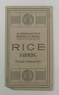
19002733Houston: Southern Pacific Sunset Route 1900. Very good. 4pp. on a single folded sheet. Minor toning and creasing. A simple but still interesting promotional leaflet touting the advantages of rice farming in Texas. The text was taken from the Southern Pacific Rice Book and lists twenty-six points of advice about the rice industry and how it is a good investment. These points are listed alphabetically by letter and each entry begins with that letter. For example: "H. Harvest rice same as wheat using a rice harvester." OCLC records just a single copy at the Autry Museum. Southern Pacific Sunset Route unknown
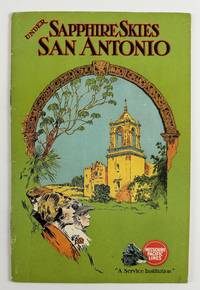
19282989Chicago: Poole Bros 1928. Very good plus. 32pp. Original pictorial wrappers stapled. Minor wear and dust-soiling to wrappers. Internally clean. A vibrant depiction of the great city of San Antonio Texas produced by the Missouri Pacific Railroad during the latter part of the Roaring Twenties. The promotional work is profusely illustrated with photographs accompanied by text touting the many advantages of the Alamo City. The images feature well-known attractions such as the Alamo Alamo Plaza various missions and the downtown commercial buildings intermixed with lesser-known aspects of San Antonio life such as the golf and polo scenes Olmos Dam Fort Sam Houston Medina Lake and others. The photographs includes an "Aerial View of the Heart of San Antonio." The Missouri Pacific also includes a bit about itself with photographs of the "Sunset Special" locomotive and the Missouri Pacific Lines' Bridge across the Mississippi River at Memphis plus a map of the line on the last page. OCLC records just a handful of institutional copies of this edition. Poole Bros unknown
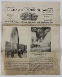
190212944New York 1902. 8pp. Illustrated. Folio. Original self wrappers stapled. Moderate staining and soiling old folds minor edge wear. Good condition. Illustrated with black & white photos and two maps one of holdings in Knox County Kentucky the other in the East Texas Oil Belt centered on Beaumont. The company -- miners and producers of crude lubricating and illuminating oils -- was incorporated in April 1901 under the state laws of Delaware. This prospectus solicited investors and presented its balance sheet and current activities listed officers and presented the "expert opinions" of geologist Major J.W. Otley the original surveyor of the Beaumont and other fields as to the worthiness of the company's properties at nearby Sour Lake Texas. No listings found on OCLC. A unique and early oil company prospectus with notable content on Kentucky and Texas oil. unknown
Previous owner's name inside front cover. Light wear to boards and with spine darkened. ; Folding map in rear. A rare Baedeker-style travel guide with dominantly b&w photographs; B&W Photographs; 16mo 6" - 7" tall; 329 pages
2004LFA017f5Revue mensuelle concernant la philatélie : environ 110 pages en couleurs, format 300 x 210 mm, illustrée, brochée couverture couleurs + fiches détachables
192061528Sydney Australia New York & San Francisco CA: Oceanic Publishing Co. A.M. Robertson 1920. Tall 8vo. xiii 1 375 1 pp. tipped-in blue errata slip on p. vii. Photo frontisp. photo plates illustrations maps. Blue publisher’s cloth white lettering & ruling front cover & spine w/ d.j. chipping & tears head & foot of spine minor loss to spine old tape repairs still NF/G- copy. First edition of the Polish-American/Australian author’s autobiographical memoir relating his travels over 40 years first as Journalist for the New York Herald and other papers and then subsequently as publisher and director for Oceanic Publishing. Coffee 1852-1929 details his travels through British Columbia the Pacific Northwest Hawaii including an automobile trip around the Island of Oahu trips to Easter Island New Caledonia Samoa Tonga Fiji New Guinea New Zealand Japan Alaska and more. Work was reprinted with corrections and additions in 1925. Very scarce in original dustjacket. See: Terry Fogarty & Joan Antarakis Frank Coffee Historical Willoughby 2024. Oceanic Publishing Co., A.M. Robertson, hardcover
CORV-BBP-17061Trust Territory of Pac. Is. Saipan MP. Plastic Comb. Very Good. Very good. Comb-bound 4to. 300pp. > Language: English > Size: 4to > Media/Binding: Comb Bound Trust Territory of Pac. Is., Saipan, MP unknown
CORV-BBP-16715Trust Territory of Pac. Is. Saipan MP. Plastic Comb. Good. Edgewear o/w good. Comb-bound 4to. 272pp. > Language: English > Size: 4to > Media/Binding: Comb Bound Trust Territory of Pac. Is., Saipan, MP unknown
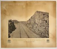
187510295Boston: Heliotype Printing 1875. Heliotype 38 cm x 48 cm on cream colored stock 55 cm x 66 cm with printed title and credit. Overall age toning. Heliotype promoting the Union Pacific line with a view of the tracks crossing Sherman Hill and the Continental Divide outside of the now ghost town of Sherman Wyoming. Sherman Hill is one of the landmarks on the transcontinental railroad and the highest point on the original U.P. line with a summit topping of 8247 feet above sea level. Sherman Hill is one of the easiest crossings of the Rockies and today it is one of the busiest lines. We are unable to locate another example of this poster. Rare. Heliotype Printing unknown
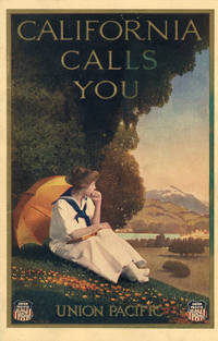
192146831Omaha: Union Pacific 1921. 1921. First edition. 9" x 6" in lovely color pictorial wrappers. 40pp. Black and white illustrations. Maps. The contents are printed on coated white paper. Southern California attractions like the Terrace Garden at Hollywood and Pershing Square in Downtown Los Angeles are featured prominently alongside Northern California destinations. Pictures include churches cityscapes scenery street scenes beach scenes etc. Center pages feature three regional Rand McNally & Co. maps. One-page map at the rear showing the Union Pacific routes west of the Mississippi. An especially fresh example with just a hint of foxing to the rear panel. Union Pacific, 1921. unknown
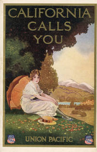
191346830Omaha: Union Pacific 1913. 1913. First edition. 9" x 6" in lovely color pictorial wrappers. 40pp. Black and white illustrations. Map. This brochure was reprinted through at least 1924. Unlike later editions the contents are printed on cream paper with decorative green borders. San Francisco and Northern California destinations are most prominently highlighted in this version. Illustrations include the capitol building Mt. Shasta Chinatown beach scenes street scenes scenic views missions fishing scenes etc. One page map at rear showing the Union Pacific routes west of the Mississippi. Minor smudge to the front panel with some light toning and edgewear; otherwise very good. Union Pacific, 1913. unknown
18709707Omaha: Omaha Herald Steam Printing Establishment 1870. First Edition. 44pp. Octavo 23 cm Black buckram with the title gilt stamped on the front board. Original printed salmon wrappers bound in. New endsheets and pastedowns. Manuscript label to head of original cover with paper of a similar color attached to the head of the verso. Small lib. ink stamp with accompanying 'Discard' stamp to title page. Complete with all three maps including the fold-out map 'Map of the Union Pacific Railroad Line in Nebraska' 19.5 cm x 56 cm / 7.5" x 22".<br /> <br /> Land promotional work from the Union Pacific encouraging the settlement of three million acres of U.P. lands that divides the available lands into three groups: agricultural lands the first 350 miles west of the Missouri River grazing lands from the forks of the Platte through the Laramie Plains in Wyoming and mineral lands between the Black Hills and the Wasatch Mountains. <br /> <br /> "No section of the United States furnishes facilities for grazing and stock raising superior to Nebraska and the lands on the line of the Union Pacific Railroad. The rich bottom lands of the valleys of the Platte Elkhorn Loup Fork Papillion Maple Shell Logan and Pebble Creeks Wood River Wahoo and Big Blue are included within these limits and present extensive tracts of the finest meadow land in America." Eberstadt 115: 856 later edition. Graff 4238 later edition. Herd 2351 later edition. Uncommon. Omaha Herald Steam Printing Establishment unknown
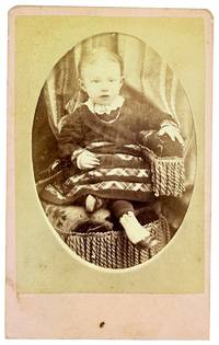
188032410N.p.: U.P.R.R. Photograph 1880. Very Good. N.p.: U.P.R.R. Photograph ca. 1880s. Small format albumen carte de visite 8.5x6cm mounted to card measuring 10x6.5cm. Brief smudging else Very Good to Near Fine. Portrait of a seated child about 18 months old. <br /> <br /> Verso printed in red with an engraved reproduction of the photographer's studio which was housed in a railway car that the photographer S.B. Silvis traveled around on the Union Pacific Railroad line. "Stereoscope & Landscape Views of Notable Points on Line of Pacific R.R. / Always on Hand." We can't find much about Silvis though a notice in Hailey Idaho in late June of 1888 announced that he was in town for a few days to take pictures through the holiday. . U.P.R.R. Photograph unknown
192444000Omaha: The Acorn Press 1924. 1924. 10" x 7" in green pictorial wrappers showing an illustration of a geyser at bottom corner. 40 pp. illustrations maps. General description of Yellowstone Park followed by information on its history the environs of the park its climate the geysers the Great Falls Mt. Washburn the Tower Falls region Mammoth Hot Springs wildlife various forms of transportation to and within the park descriptions of tours within the park as well as pricing etc. Double-page map of Yellowstone Park and area showing routes of park tours in orange trails roads railroads etc. Last page of booklet offers a full-page system map. Black and white photographs throughout to include pictures of scenery wildlife individuals participating in various activities etc. Center two pages disbound pages lightly soiled and with light wear to page edges. Wrappers lightly soiled and with light wear to the extremities. The Acorn Press, 1924. unknown