278 résultats
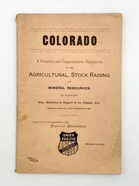
1889403718Chicago: Rand McNally & Co 1889. 8vo. 91 pp. Original salmon printed wrappers. Light wear. Second edition. The wrapper title is: 'Colorado. A Complete and Comprehensive Description of the Agricultural Stock Raising and Mineral Resources of Colorado; Also Statistics in Regard to its Climate Etc. Compiled from the Latest Reports of 1868.' Printed on the inner front wrapper is a map of the Union Pacific Overland Route from the Pacific Ocean in the West to Omaha in the East. <br/><br/> Rand, McNally & Co unknown books
3058Chicago: The Company: Passenger Department; Knight Leonard Co. Printers 1893. . 4to pictorial printed wrappers; text partially detached from wrappers; damp-staining on first two leaves First published in 1892. The illustrations are by Alfred Lambourne Chicago: [The Company: Passenger Department]; Knight, Leonard Co. Printers, 1893. unknown books
1870WRCAM34145New York: E. & H.T. Anthony & Co. 1870. Single stereocard 3 1/2 x 7 inches. Stereo image mounted onto printed orange cardstock. Slight wear at edges. Very good. An appealing stereocard image showing several long stretches of railroad track heading into the small town of Ogden Utah. It is a view of an important point crossing point in American railroad history as Ogden is the point at which the Union Pacific Railroad ends and the Central Pacific begins. A train can be seen on the tracks in the far distance as well as a few clapboard buildings. The New York photographic firm of E. & H.T. Anthony & Co. produced several stereoscopic views for the Central Pacific Railroad though few are known today. A nice image of an important railroad intersection. E. & H.T. Anthony & Co. unknown books
2221572<p>First edition. 7" x 9". Original stiff green wrappers stamped in white cord tie oval b/w halftone photograph of water front Tacoma. Illustrated with two fold out b/w panorama views and 17 b/w mounted halftone views on stiff grey papers. Uncommon. Very good.</p><p>Printed by Albertype Co. Brooklyn N.Y.</p> P. A. Kaufer unknown books
20049305San Francisco: Pacific Editions 2004. One of 90 copies all signed by the artist Charles Hobson each with pastel monotype by Hobson that has been reproduced as a digital pigment print with hand coloring. It is the penultimate image in the book. Page size: 5-1/2 X 4-3/4"; made from postcards translucent envelopes various papers and features the photographs of Robert Doisneau. There are 3 envelopes - each with a photograph and a fictional story about the person in the photographs. Bound: red linen spine with black paper over boards with surround of black corrugated board housed in Mylar envelope with string tie. There is a "lipstick" imprint in red on the black paper on the front cover and a photographic image of a woman's lips on the corrugated surround. The 3 Mylar envelopes housing the photographs and "story" are in orange pink and red. Other photographic images are mounted on various colored papers on the verso pages before the Mylar. Hobson may be the ultimate romantic - assembling these "kissable" images and creating fictions for them as a Valentine for his wife. The world of book arts benefits from his gesture. Pacific Editions unknown books
1910302511Pacific Electric Railway ca. 1910. 1910. Original photograph depicting 43 passengers men and women dressed in coats and hats at the Echo Mountain Terminal 3200 feet above sea level with printed descriptive information on the mount with pictorial green borders. 4 11/16" x 7 1/2" image on stiff 6 1/16" x 9" pictorial folder. No Binding. Fine. Pacific Electric Railway [ca. 1910]. unknown books
188433877New York: Sackett 1884-1892. First Edition. 1884. 64pp. illuslarge fold map at rear. Orignal printed wrappers $100 1885. 40pp. illuslarge fold map at rear. Orignal printed wrappers $100 1887. 40 51pp. Original printed wrappers. $75 1892. 96pp. illus two large fold maps at rear. Original printed wrappers $100 Sackett unknown books
187634111New York: Erie Railway Company 1876. First Edition. 32pp. illus colored fold map at front; numerous full page illustration throughout. Original printed wrappers with the inside rear wrapper having a map of the route and the outside wrapper a view of Niagara Falls. Extracted from a bound volume. Rather scarce. Erie Railway Company unknown books
186133741Wash D.C.: Polkinhorn 1861. First Edition. 23pp. Orig ptd wrps. First ed. Signed in type at end: "Cincinnation Deals with California the Pacific Railroads Mexico Sandwich Islands etc. Scarce. Not in Eberstadt Decker Graff Cowan or Forbes Polkinhorn unknown books
2299San Francisco: H. S. Crocker & Co. 1883. . Large 8vo printed color-lithographed wrappers; lacking one inch at the head of the spine and one half inch at the foot. Institutionally common. Scarce in trade. San Francisco: H. S. Crocker & Co., 1883. unknown books
187527665New York: Evening Post Steam Presses 1875. Original printed wrappers with wrapper title as issued. Stitched. iv 3-133 pp. Wrappers moderately worn else a clean text and Very Good.<br/><br/> A comprehensive compilation of the legal documents creating and authorizing the Railroad and its branches and affiliates. OCLC locates five copies under several accession numbers as of March 2018. A shorter version with this title appeared in 1873. Evening Post Steam Presses unknown books
1890300405Pacific Electric Railway 1890. 1890. Photograph depicting 37 passengers at the Echo Mountain Terminal 3500 feet above sea level with printed descriptive information on the verso of mount with pictorial borders. 4 1/2" x 7 3/4" image on stiff 10" x 7" mount. No Binding. Very Good/No Jacket. Pacific Electric Railway [1890]. unknown books
1869288969New York: American Photolithographic Company 1869. paperback. very good. Map: lithograph. 16" x 28.5". In very good condition. <br><br>Pamphlet: Thin 8vo. 31 pages. Staple-bound stain to paper cover binding fragile. Washington: Government Printing Office. In very good condition.<br/><br/> Map is tipped in at back cover of pamphlet and shows Northern & Southern Pacific Trunk Lines railways completed and railways projected. The majority of the committee that wrote this report included W.M. Stewart Chas D. Drake John Conness Alexander Ramsey J.C. Abbott B.F. Rice<br/><br/> American Photolithographic Company unknown books
1873403707Jay Cooke & Co 1873. 8vo. 51 4 pp. Folding map of the railroad and its inter-oceanic connections. Original printed wrappers the rear wrapper with map of the railroad. Wrappers separated along spine last two text leaves loose. FIRST EDITION. The map shows the northern half of the U.S. from the Pacific to Lake Superior and Lake Michigan. The proposed railroad extends from the Missouri River near Fort McKean westward to the towns of Olympia Portland Seattle and terminating at Whatcom just north of Bellingham. The route splits into a northern and southern branch just above Coeur d'Alene Lake. The publisher Jay Cooke was the famous financier of the Civil War; his private bank financed the construction of the railroad. This promotional pamphlet was used to gain investors. <br/><br/> Jay Cooke & Co unknown books
1911100851Souvenir pamphlet 8vo colored printed pictorial wrappers illustrated 16 pp. Folded and creased down the middle with a little wear at the fold some minor rubbing to wrappers normal aging; otherwise very good. This is a scarce piece of ephemera commemorating the 1911 groundbreaking ceremony by President William H. Taft for the exhibition in the Golden Gate Park. While the purpose of the exhibition was to celebrate the completion of the Panama Canal it seemed to function more as a worlds fair held in San Francisco. It took over three years to construct and the exhibition ran from February through December 1915. There are a number of black and white photographs in the booklet including a double page panoramic view of the city of San Francisco. The activities of the ceremony are recorded in this pamphlet which feature speakers songs marches and what they had for dinner Blair-Murdock Co., books
1884WRCAM23845New York 1884. 27pp. plus large folding map. Original printed wrappers. Some minor edge nicks and chips to front wrapper else just about very good. Annual stockholder's report for the famous western railway. With detailed financial statement and other statistics relative to western lands etc. Total surplus earnings for 1883 topped $12700000. The handsome and quite large folding map of the United States west of the Mississippi shows the Union Pacific Route and its connections. unknown books
185976593Washington DC.: Beverley Tucker Printer. Very Good. 1859. First Edition. Hardcover. Ex-library with the usual markings. This volume is hard-bound in blind-stamped brown cloth with faded gilt stamping to the spine. The binding has been repaired / reinforced at some point with some type of lacquer covering the spine and so the volume is sound and tight. There is edge-wear and rubbing to the corners and spine-ends. There is some wear/chipping to the joints. Some modest light foxing but overall the work is bright and fresh. This work is complete with plates of reptiles fishes frogs birds snakes and mammals and 28 beautifully hand colored engravings of birds. . Beverley Tucker, Printer hardcover books
503718ca. 1920 by Aerograph Co. Los Angeles with blindstamp in lower left corner. Framed in a black wooden frame with white mat. Framed size: 13 1/2" x 26". F. Soft cover. paperback books
1871761New York 1871. Good plus. Folding pamphlet 6 x 17 inches. Separated along one fold. A few later pencil annotations. Light wear and tanning. A scarce advertisement for bond investment in the Northern Pacific Railroad issued in 1871 during the first great construction push on the line. Although the company was founded in 1865 ground was only broken on construction in 1870 after considerable backing by Jay Cooke. This pamphlet outlines the plans for the railroad to be built from St. Paul to Portland and Seattle the prospects for passenger and freight business upon completion and the extent of the land grants afforded the railroad by the federal government. The text goes on to describe the financial instruments on offer their advantages over Treasury bonds chiefly a greater yield at 7-8% vs. 5-6% and their security against the commercial and financial assets of the railroad as well as its land grants. With a map of the proposed route on the rearmost panel. A scarce call for investment in the Northern Pacific from its early history. unknown books
189143969San Francisco: H. S. Crocker Company 1891. Printed self-wrappers. General wear & age-toning. A few short tears along folds. Stain upper right corner. A Good copy. One long sheet oriented horizontally printed both sides in purple folded three times to form a 12-panel brochure. Illustrated with 4 wood engravings one 3-panel "Views of Pacific Grove and Vicinity"; one 2-panel and map single panel. Unfolded: 21-3/4" x 7". Folded: 7" x 3-1/2" <br/><br/>A promotional "announcement extraordinary" for a five-day program held by the YMCA at Pacific Grove from June 17 - 21 1891 featuring a program of bible study lectures e.g. "Aggressive Christian Work" "How to Teach the Bible to Young and Old" and related preaching and readings. A special train was provided for the association by the Southern Pacific Company Coast Division. Includes a large illustrated "View" and other promotional material for Pacific Grove and a map of the Southern Pacific routes to Monterey. Not found in Rocq. H. S. Crocker Company unknown books
18851099Chicago: Geo. F. Cram 1885. Good plus. Large folding pamphlet approximately 20 x 41.5 inches. A few small chips and short closed tears at edges; several short separations and very minor losses along folds. Contemporary agent's ink stamp on cover panel. Tape repair across portion of horizontal fold; one panel with patches of light staining. A scarce colorful promotional for the Rock Island Route as well as its national and international connections with a fascinating stamp of an Australian sales agent. One side of the sheet prints an extensive promotional text and timetables for the various routes and services of the Chicago Rock Island & Pacific Railway. The main side of the sheet prints a map of the United States with state borders shaded in four colors highlighting the principal routes of the Rock Island from Chicago to Minnesota Iowa and Kansas and its connections to points on both the East and West Coasts. An inset map at lower right promotes the Rock Island as part of a transcontinental route between the United Kingdom Ireland and Australia. Most interestingly this copy is stamped on the cover panel with the information of a George. H. Hibbard "Australian Passenger Agent America's Cons'd Trans-continental Railways 6 Bridge Street Sydney N.S.W." Hibbard was evidently the agent in charge of distributing information about the trans-America route in Sydney one of its end points. Several issues of this map were published during the 1880s all scarce. We locate copies of the present 1885 issue at Stanford SMU and the Library of Congress. Geo. F. Cram unknown books
1950WRCAM43346N.p. 1950. 12 1/2 x 50 inches. Torn into two pieces measuring 35 and 15 inches in length. Folded. Else very good. Long decorated strip of tapa a cloth made from tree bark by native people in the islands of the Pacific Ocean. Though previously used as cloth for clothing by native peoples today tapa is worn primarily on ceremonial occasions and is prized as artwork in the Western world. This is a handsome example of tapa cloth which fascinated Captain Cook and other explorers of the South Pacific. hardcover books
18571004304to 11 ½ x8 ¾ original law calf morocco illustrated 4 134 85102 114 2 iv 64 pp. Some scuffing and wear to covers slight gouge to front joint chipping to edges. Two plates detached one with a chipped corner. Overall very good. Organized by the War department under the direction of Jefferson Davis who was Secretary of War at that time a collection of volumes was produced in the quest for the best route for a railroad to the West. Jefferson Davis wrote part of the introduction to this series and outlines the goals of the project. This report is on routes explored in Northern California and Oregon. Specifically the expedition was to look for a railroad route crossing the Sierra Nevada near the source of the Carson River and to see if it was feasible to connect the Sacramento valley with the Oregon Territory. Most of the color plates in this volume are located in the first three parts of the publication which is focused on topography geology and botanical subjects. This volume includes 23 color lithographs of scenery and botanical subjects 2 hand colored plates of birds and 24 steel engraved plates. Wagner-Camp 264a. Beverly Tucker, unknown books
18561004314to original cloth rebacked with original spine strip laid on new endpapers. Illustrated with 20 of 21 color lithographs several steel engraved charts and shell engravings and three color lithographed folding maps. Table of contents list 20 color plates but some copies seem to have twenty-one. Two of the folding maps/charts have been placed in a rear endpaper pocket; one has a neat repair. A little rubbing to cloth and some minor darkening within. Could be missing one plate. Overall very good and nicely restored. One of the great sources of information on the west the Pacific Railroad Reports also contains some great illustrations. This installment Vol. III is no exception. Included are some interesting and colorful pictures of the Mojave Indians and their territory. This report contains intelligence on an expedition near the 35th parallel which took the southern route due west to the Pacific Ocean from Fort Smith Kansas that was conducted by Lieutenant A.W. Whipple and assisted by Lieutenant J.C. Ives. Ives would make his own mark on western expansion a few years later in his travels on the Colorado River. Wagner-Camp 263 Beverly Tucker hardcover books
18561006214to leather spine and tips with marbled boards 36 Illustrations include 21 tinted/color lithographs one folding diagram two folding maps and a couple of black and white plates 36 14 136 127 175 pp. Binding with some wear at the spine and extremities hinges cracked some pages are a bit loose plates all present but probably not bound in correct order folding maps have a few tears some staining to front endpapers but not into the balance of the text plates and text show some aging foxing and browning but most plates resonably are clean. One of the great sources of information on the west the Pacific Railroad Reports also contains some great illustrations. This installment Vol. III is no exception. Included are some interesting and colorful pictures of the Mojave Indians and their territory. This report contains intelligence on an expedition near the 35th parallel which took the southern route due west to the Pacific Ocean from Fort Smith Kansas that was conducted by Lieutenant A.W. Whipple and assisted by Lieutenant J.C. Ives. Ives would make his own mark on western expansion a few years later in his travels on the Colorado River. The substantial amount of information on various Indain tribes makes this installment an important one. Since many of these volumes are broken for the plates they are getting somewhat scarce. Beverly Tucker, hardcover books


