6 261 résultats
1991EH416901991 84 p., 4to, paperbound. Library stamps, else good copy.
1993R240165741Atlas. 1993. In-4. Relié. Bon état, Couv. convenable, Dos satisfaisant, Intérieur frais. 130 + VIII pages - nombreuses photos en couleurs dans et hors texte. Jaquette convenable.. Avec Jaquette. . . Classification Dewey : 996-Autres régions du pacifique
Almost new condition. Turquoise hard cover with gilt lettering on spine. Illustrated with maps and tables. Clean Copy
2001MM254032001 75 p., 48 figs, stapled. Published in: Malacologia.
2001MM254042001 38 p., 24 figs, 1 col. plate, stapled. Published in: Mémoires du Muséum National d'Histoire Naturelle.
1987990701987 Les éditions du Pacifique - 1987 - In-4 couverture cartonnée grise décorée recouverte par une jaquette illustrée de l'éditeur - 175 pages - nombreuses reproductions photographiques
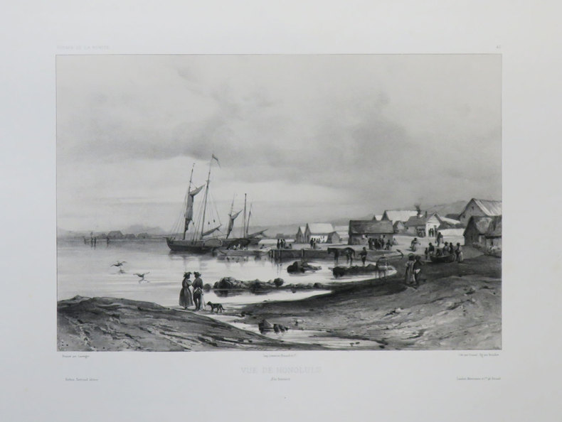
1840LBW-3642[1840]. 220 x 291 mm.
8vo., First Edition; blue cloth, gilt back, blue endpapers, a near fine copy in unclipped dustwrapper. Novel set against a once-imminent Japanese invasion of Australia. UNCOMMON IN THIS CONDITION.
8vo., First UK Edition, with photographs throughout; original pictorial wrappers, a very good, clean copy. Detailed account of the P-40 Curtiss Warhawk and its operations in WWII. Enser, p.171
6131572232.Gpaperback. Good. Access codes and supplements are not guaranteed with used items. May be an ex-library book. paperback
20132-6131572232Éditions universitaires européennes 2013. Paperback. New. 152 pages. French language. 8.66x5.91x0.35 inches. Éditions universitaires européennes paperback
19465277Chicago: Rand McNally 1946. Single sheet 46 cm x 81 cm that folds up to 23 cm x 10 cm pamphlet size. Printed in red blue and black. Very good. Folds as issued. Gentle overall wear. One side features a nice map 43 cm x 385 cm that shows the Union Pacific Routes and roads through Utah and Northern Arizona. To the right are descriptions of the lodges and camps run by the Utah Parks Company in Zion Bryce Canyon Cedar Breaks and the North Rim of the Grand Canyon. To the left is a description of tours offered by Utah Parks Company and rates for 1946. Reverse prints a variety of color views of the Parks and sites one would see on a guided trip.<br/><br/>"This folder contains a map showing the principal highway approaches to Zion Grand Canyon and Bryce Canyon National Parks and Cedar Breaks National Monument and is presented to motorists by the Utah Parks Company to assist those who are driving to these scenic wonderlands." <br/><br/>Produced to promote trips from the Utah Parks Company which was a subsidiary of U.P. that ran guided loop tours of the parks and monuments of southern Utah and northern Arizona. Rand McNally unknown books
19465277Chicago: Rand McNally 1946. Single sheet 46 cm x 81 cm that folds up to 23 cm x 10 cm pamphlet size. Printed in red blue and black. Very good. Folds as issued. Gentle overall wear. One side features a nice map 43 cm x 385 cm that shows the Union Pacific Routes and roads through Utah and Northern Arizona. To the right are descriptions of the lodges and camps run by the Utah Parks Company in Zion Bryce Canyon Cedar Breaks and the North Rim of the Grand Canyon. To the left is a description of tours offered by Utah Parks Company and rates for 1946. Reverse prints a variety of color views of the Parks and sites one would see on a guided trip.<br /> <br /> "This folder contains a map showing the principal highway approaches to Zion Grand Canyon and Bryce Canyon National Parks and Cedar Breaks National Monument and is presented to motorists by the Utah Parks Company to assist those who are driving to these scenic wonderlands." <br /> <br /> Produced to promote trips from the Utah Parks Company which was a subsidiary of U.P. that ran guided loop tours of the parks and monuments of southern Utah and northern Arizona. Rand McNally unknown
194677869Washington DC: U. S. Government Printing Office 1946. Presumed First Edition First printing thus. Hardcover. Good. Volume I xv 1 1-286 pages. Volume II 287-576 pages. 2 volumes. Illustrations including fold-outs. Maps. Tables. Index. Cover has wear and lettering has fading. Corners bumped. The United States Strategic Bombing Survey was a written report created by a board of experts assembled to produce an impartial assessment of the effects of Anglo-American strategic bombing of Nazi Germany during the European theater of World War II. After publishing its report the Survey members then turned their attention to the efforts against Imperial Japan during the Pacific War including a separate section on the recent use of the atomic bombs. In total the reports contained 208 volumes for Europe and another 108 for the Pacific comprising thousands of pages. The reports' called strategic bombing "decisive". This is designated OPNAV-P-03-100. It includes lists of Interrogations arranged numerically and by subject matter. It has an index of major battles operations and Japanese officials It includes in volume II Japanese notes of battles and brief biographies of Interrogated Japanese Officials. The interrogations were conducted in Tokyo during the final months of 1945. The purpose of the interrogations was to gain evidence for an assessment of the role of airpower in the war with Japan. Permission was obtained from General MacArthur to retain a nucleus of experienced officers at the Naval War College at Hiyoshi. In addition to being interrogated on their particular specialties and experiences these officers performed research at the direction of the Naval Analysis Division and together with the Japanese Naval Liaison Officer gave useful assistance in identifying and procuring other officers for interrogation. U. S. Government Printing Office hardcover
19461492Washington DC: U. S. Government Printing Office 1946. Presumed First Edition First printing thus. Hardcover. Good. Volume I xv 1 1-286 pages. Volume II 287-576 pages. 2 volumes. Illustrations. Maps. Tables. Index. Boards scuffed rough spots inside boards. Name in ink inside front board. Ex-Library with usual library markings such as library stamp on fore-edges & page iii. The United States Strategic Bombing Survey was a written report created by a board of experts assembled to produce an impartial assessment of the effects of Anglo-American strategic bombing of Nazi Germany during the European theater of World War II. After publishing its report the Survey members then turned their attention to the efforts against Imperial Japan during the Pacific War including a separate section on the recent use of the atomic bombs. In total the reports contained 208 volumes for Europe and another 108 for the Pacific comprising thousands of pages. The reports' called strategic bombing "decisive". This is designated OPNAV-P-03-100. It includes lists of Interrogations arranged numerically and by subject matter. It has an index of major battles operations and Japanese officials It includes in volume II Japanese notes of battles and brief biographies of Interrogated Japanese Officials. The interrogations were conducted in Tokyo during the final months of 1945. The purpose of the interrogations was to gain evidence for an assessment of the role of airpower in the war with Japan. Permission was obtained from General MacArthur to retain a nucleus of experienced officers at the Naval War College at Hiyoshi. In addition to being interrogated on their particular specialties and experiences these officers performed research at the direction of the Naval Analysis Division and together with the Japanese Naval Liaison Officer gave useful assistance in identifying and procuring other officers for interrogation. U. S. Government Printing Office hardcover
19465605Washington DC: U. S. Government Printing Office 1946. Presumed First Edition First printing. Hardcover. fair. xv 1 389 1 pages followed by several fold-outs. Illustrations. Maps. Appendices. Bibliography. Bookplate inside front board. Some minor damp stains to text no pages stuck. Boards have some scuffs and stains. The United States Strategic Bombing Survey was a written report created by a board of experts assembled to produce an impartial assessment of the effects of Anglo-American strategic bombing of Nazi Germany during the European theater of World War II. After publishing its report the Survey members then turned their attention to the efforts against Imperial Japan during the Pacific War including a separate section on the recent use of the atomic bombs. In total the reports contained 208 volumes for Europe and another 108 for the Pacific comprising thousands of pages. The reports called strategic bombing "decisive". The report opens with a discussion of the Japanese strategic plans which were based on an initial victory against the U.S. Navy which would upset any U.S. plans in the Pacific for an estimated 18 months to 2 years. It was possible to reconstruct much of wartime Japanese military planning and execution engagement by engagement and campaign by campaign and to secure reasonably accurate statistics on Japan's economy and war-production plant by plant and industry by industry. In addition studies were conducted on Japan's overall strategic plans and the background of her entry into the war the internal discussions and negotiations leading to her acceptance of unconditional surrender the course of health and morale among the civilian population the effectiveness of the Japanese civilian defense organization U. S. Government Printing Office hardcover
1946006304Washington D.C: United States Government Printing Office 1946. 389 pages. A study of the Pacific War with stress on the Japanese attack on Pearl Harbor. The Phillipines the Coral Sea Midway. Several fold-out maps and diagrams. Clean. First Edition. Buckram. Very Good/No Jacket Issued. 4to - over 9¾" - 12" tall. United States Government Printing Office hardcover
19451518n.p.: U.S. Pacific Fleet 1945. fair. 423 wraps text in Japanese only the introduction and index have been translated covers worn and soiled. This handbook was originally published in 1901 by the Keigansha Governmental Research Bureau with corrections including No. 94 to 1943. The U.S. Pacific Fleet reproduced this book because it was the latest material at hand on the political organization of Japan. The handbook was marked "Restricted " but that classification was crossed out by hand on the cover and changed to "Unclassified--1945-6. " U.S. Pacific Fleet paperback
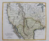
1861M9549New York: Thomas Ford c.1861. Very Good. Notes: Detailed map of the western United States and Mexico. Size : 180x208 mm 7.09x8.19 Inches Coloring: Hand Colored Category: Maps Central America Mexico; Maps United States; Thomas Ford unknown
1861M9550New York: Thomas Ford c.1861. Very Good. Notes: Map of the Western United States. Size : 178x205 mm 7.01x8.07 Inches Coloring: Hand Colored Category: Maps United States West; Thomas Ford unknown
196421237Honolulu Hawaii: U.S. Pacific Fleet 1964. fair to good. Quarto approx. 100 wraps tables appendices covers soiled ink notations and date stamp on front cover. This manual contains simulated intelligence on the naval forces of a hypothetical aggressor nation in an amphibious training exercise. U.S. Pacific Fleet paperback
200047987Washington DC: GPO 2000. First Edition. First Printing. very good. 139 wraps. Joint hearing with the Subcommittee on East Asian and Pacific Affairs of the Senate Committee on Foreign Relations. Serial No. 106-98. GPO paperback
198225904Washington DC: GPO 1982. good. 24 cm 382 wraps. GPO paperback
196936147Portland OR: North Pacific Division 1969. First Edition. First Printing. fair ex-lib. Approx. 125 wraps illus. maps usual library markings spine torn and chipped covers worn/soiled with ink marks and staples. Distribution memo stapled inside front cover. North Pacific Division paperback
19461022Tokyo: U.S. Army Forces Pacific 1946. presumed First Edition First printing thus. Hardcover. Fair. Approx. 450 pages. Tables. Appendix. Front board weak. Boards scuffed. Ex-library with library stamp inside front board and on fore-edge. :Library pocket inside rear board. Embossed stamp on title page. U.S. Army Forces, Pacific hardcover