McCoy, KeithBiblio.com
6 260 résultats
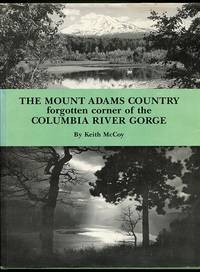
1987016972White Salmon WA: Pahto Publications 1987. Second Printing. Hardcover. Very Good/Very Good. 8-1/2 x 11 Cloth in DJ; 196pp; DJ slightly edgeworn boards square clean & bright small light stain to fore-edge text unmarked binding is tight VG/VG condition. Inscribed & Signed by Author. History of the Mount Adams area of the Columbia River Gorge in Washington state by lifelong resident. Illustrated with maps & photos. Pahto Publications hardcover
1962ED272181962 xii, 608 p., 412 pls (= second volume), 4to, publisher's cloth. Tiny hole (few mm) in upper end spine volume II, else a very good set.
1962ED423711962 xii, 608 p., 412 pls (= second volume), 4to, publisher's cloth. Library stamps, else a very good set.
185 pages. Abundantly illustrated in black and white. Recounts the voyage in 1944 of the St. Roch from Halifax to Vancouver via the Northwest Passage. While this was not the first time the passage had been traversed, the first passage by Amundsen took several years. The voyage of the St. Roch lasted only 86 days and took a more northerly route than that blazed by Amundsen. It was the first time that this shorter route - first attempted by William Parry in 1819; tried by other explorers in the nineteenth century (and later taken by the supertanker, Manhattan in 1969) - was successfully navigated. The St. Roch was a small wooden vessel only 104 feet long, constructed in 1928 by the Burrard Dry Dock Company in North Vancouver. In 1942 this vessel had become the first vessel to travel from the Pacific to the Atlantic through the Arctic Ocean. With the completion of its 1944 mission, the St. Roch became the first vessel to conquer the Northwest Passage in both directions. Light wear. Small bump to top of spine. Book
19802090202120808928Not Available 1980. Soft Cover. Fine. Volume: 1 Not Available paperback
11 pages. With two photographic plates and two colour maps in one large fold-out sheet, illustrating the Monte Bello Islands and part of North West Australia. Original condition with blue wrappers, titles to front, and containing all the ads. This is a complete issue, seldom found in such good and original condition. This is an interesting account on the study of the flora and fauna of the Monte Bello Islands - Hermite, Trimouille and North-West islands - which was of great importance since the indigenous animals were disappearing so rapidly. Montague beautifully depicts the geographical features of the islands along with the indigenous plants. Of common native birds and animals mentioned are sea-eagles, white-headed Osprey, green and Hawksbill turtles, reptiles, lizards, and abundant mound-building termites. Montague also points out that some of the introduced animals such as the invasive domestic cats and black rats have caused great damage to the islands. Black rats were apparently attributed to a schooner which was wrecked some twelve years ago. Monte Bello Islands, Located on the North-West Coast of Western Australia, Were Economically Significant for Pearl Fishing. This is a Fascinating Report on the Fauna of the Islands. Accompanied by Two Beautiful Colour Maps.
2004EL437852004 viii, 248 p., numerous figures, 17 maps, cloth (dust jacket). Very good copy, as new.
1899MM435751899 Three papers in one. 164 p. [92, 45, 17]; 80 [49, 9, 22] fine text engravings, 8vo (24.0 x 15.3 cm), green buckram with gilt author/title on the spine. Original uniform printed wrappers bound in. A small map of the tropical Pacific region is mounted on the front board. In the top margin of the title page, a stamp of the American malacologist Richard Irwin Johnson (1925-2020). Some foxing to the endpaper margins, the top outer corner of the first text leaf margin, above Johnson's stamp, clipped. The two other first leaves have, in exactly the same spot, a red stamp "With C. Hedley's Compliments".The complete Mollusca, rarely found together (often the Supplement is lacking!). Many species are described as new. Even very small shells are illustrated in great detail. Fanafuti (Tuvalu) is an island in an atoll north of Tahiti, and nowadays an independent state. Written by the British born Australian malacologist Charles Hedley (1862-1926).
0267822022.Ghardcover. Good. Access codes and supplements are not guaranteed with used items. May be an ex-library book. hardcover
8vo., First Edition, with plates; blue boards, white cloth back lettered in red and blue, blue top, a very good, bright, clean copy in unclipped, moderately age-soiled dustwrapper. Enser, p.312.
3 pages, plus 3 plates, one showing the portrait illustrations of Drake and Cavendish, and two showing the draft. Original condition with blue wrappers, titles to front, and containing all the ads. This is a complete issue, seldom found in such good and original condition. This is an enlightening succinct account of tremendous historical importance, the most significant discovery of two documents found in the British Museum, revealing the actual draft project and other correspondence concerning Drake's secret voyage, which existed prior to the dramatic expedition. Previous to this report, all discussions as to what plan and instructions Drake carried with him when he finally sailed for Magellan's strait in December of 1577 had been based upon after the events: upon the course which he actually travelled, narratives written and dispositions made when he returned a national hero. The first document found, consisting of three pages, two of which are reproduced in facsimile in this article, is the draft plan of the voyage which subsequently took shape as a circumnavigation of the world. This document gives a list of the promoters of the voyage, the Lord High Admiral (the Earl of Lincoln), Leicester, Walsingham, Hatton, Sir William Winter, George Winter, John Hawkins and Francis Drake. The second document is the report made by John Winter on the 2nd of June, 1579, the day he reached England, nearly eight months after losing sight of Drake in the South Sea, the second page of which contains the plan to be followed, revealing that the ships are to go and return by Magellan's strait, that unknown shores not in the possession of and Christain Prince are to be visited, and that, if it seems to be advisable to Francis Drake, the voyage is to be extended to 30 degrees, while its duration is to be thirteen months. Drake's circumnavigation of the globe began amidst political and religious upheaval in Europe, in 1577. The voyage was so far ahead of its time that another 200 years would pass before the eighteenth-century explorers of record reached the northwest coast of North America. Drake's secret voyage, the exploration of the Pacific Northwest in hopes of finding the fabled Northwest Passage to eastern trade routes, and to establish a British colony in the New World, was hidden under a "cloak of secrecy" due to Drake's complicated relationship with Queen Elizabeth and England's precarious political situation with Spain. One of 16th-century England's most daring adventurers, Drake sailed all the way to Alaska, much farther than anyone had envisioned, thereby rewriting the history of exploration in North America. Surviving the dangers of mutiny, the lack of knowledge about wind and current, and the arduous physical challenges faced every day, Drake earns his reputation as "one of the greatest mariners that sail[ed] the seas, both as a navigator and as a commander," feared by his enemies for the "alarming scope of his success." Together with Hondius's portraits of the first two English circumnavigators, Sir Francis Drake and Sir Thomas Cavendish on one plate and a page of explanatory text. Jodocus Hondius (1563-1612), was a Dutch engraver, and cartographer. He is best known for his early maps of the New World and Europe, for re-establishing the reputation of the work of Gerard Mercator, and for his portraits of Francis Drake. He helped establish Amsterdam as the center of cartography in Europe in the 17th century.
56 pages. Black and white photos, illustrations and maps. "Prince Rupert, the western terminus of the Grand Trunk Pacific Railway, is a distributing centre for the Skeena River and the Omineca Mining Divisions. It is the natural starting point ... because it is the seat of Government Agency for that section of British Columbia, as well as being the ocean terminus of the transcontinental railway. Starting at Prince Rupert examinations were made east as far as Lorne Creek, a distance 130 miles by railroad" - from page 5. Includes the mining operations, owners, type of resources and type of leases at Kitsumgallum Lake (near Terrace), Douglas Creek, Little Cedar River (Nass-Skeena Coal Claims), Lakelse Valley (Lakelse Hot Springs), Thornhill Mountain, Zymoetz (Copper) River, Legate Creek, St. Croix Creek, Lorne Creek and Graham Island on the Queen Charlotte Islands. Above-average wear. Assorted chips and openings, primarily to front cover. Usual library markings. Spine taped. A worthy reference copy. Book
200763615Coeur d’Alene ID: Museum of North Idaho 2007. Oblong 4to. 548 pp. Photo illustrations and maps throughout. Black publisher’s cloth silver lettering front cover & spine w/ d.j. NF/NF copy. First edition of this surprisingly uncommon and well-illustrated work detailing the “engineering techniques bold innovations such as electrification much brand-new equipment and a proactive marketing department.†Rockefeller Henry Rogers and Standard Oil made the decision in 1905 to build West from Mobridge SD to Seattle & Tacoma WA building the final transcontinental railroad in the United States considered the last final burst of the Gilded Age whose efforts forever changed Montana Wyoming Idaho and Washington. Museum of North Idaho, hardcover
189700950X.Gpaperback. Good. Access codes and supplements are not guaranteed with used items. May be an ex-library book. paperback
29755583like new. unknown
1987qi1611Metropolitan Museum of Art Cartonné avec jaquette 1987 In-4 (23,8 x 30,8 cm), cartonné avec jaquette, 160 pages, illustrations en couleurs ; quelques marques d'usage sur le bord supérieur de la jaquette, par ailleurs bel état. Livraison a domicile (La Poste) ou en Mondial Relay sur simple demande.
21 pages including 6 colour maps on 5 fold-out sheets. Original condition with blue wrappers, titles to front, and containing all the ads. This is a complete issue, seldom found in such good and original condition. Buchan's incredible paper is on the scientific questions that arose when discussing the general movements of the atmosphere and of oceanic circulation, with particular relations to physical geography. The amazing Challenger expedition was thereby undertaken for both observational purposes and scientific research. Alexander Buchan was a Scottish meteorologist, oceanographer and botanist, credited with establishing the weather map as the basis of weather forecasting. This extraordinary report is accompanied by six fold-out colour maps.
8vo [22 x 15 cm]; xii, 299 pp, numerous illustrations from photos, drwg by John Baker, map. original green cloth, gilt spine lettering clear, light foxing on edge, very good. A picture of this book is available upon request by email. An expedition in northern New Guinea with travels and descriptions of the native peoples, their customs, way of life, nature, etc.
19643107Seattle: Image Press 1964. First Edition. Hardcover. Very good. Octavo 58pp black cloth -- An obscure privatley printed book -- Closed split along the front spine edge from top to bottom -- Except for the aforementioned defect the book is in ecellent condition. -- Signed inscription on the f.e.p. by the author. -- Overall Condition. Image Press hardcover
029597611X.Gpaperback. Good. Access codes and supplements are not guaranteed with used items. May be an ex-library book. paperback
8vo., First Edition, with frontispiece, photographs in the text and numerous folding maps coloured in outline; laminated pictorial boards, a very good, bright, clean copy. Sold from an institution with its neat stamp on endpapers [only]. The official, highly detailed campaign report, profusely mapped and illustrated. Not recorded by Enser.
1995CO245961995 57 p., 30 figs, 4to, paperbound.
1999IC230991999 136 p., 142 figs, 4to, paperbound.
1996IC230981996 159 p., col. frontispiece, 85 figs, 4to, paperbound (spine worn). With author's dedication to Dr. W. Vervoort.
2003IC282852003 538 p., 108 sets of figs, col. frontispiece, 4to, hardbound. Very good copy, as new.