221 résultats
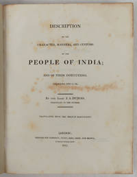
1817223218London.: Longman Hurst Rees Orme and Brown. 1817. xxvii 565pp 2 publisher's advertisements; half calf over marbled boards 27.5 x 22 cms endpapers renewed the title page and prelims spotted scant foxing elsewhere the final ten leaves tide-marked a good sound copy. Detailed account of the social cultural and religious practices of India during the late 18th and early 19th centuries. Abbé Dubois a French Catholic priest and missionary was stationed in India from 1792-1823 and his manuscript was purchased by the East India Company in 1807 publishing this English translation in 1817. . Longman, Hurst, Rees, Orme and Brown. hardcover
1885INDIA007593Henry Hansard London. 1885. First edition. Folio. 288 pages. Original wrappers. Bookseller's rubber stamp on upper cover and title-page. Spine cracked but largely intact. Wrappers a bit creased. Very good. Rare. Henry Hansard, London. unknown
1861BD4-844Pondichery, Geruzet, 1861. zeitgen?ssisch / uit dezelfde tijd / ?poque / contemporary Halbleinen / half-linnen / demi-toile / half cloth, gr.-8?, 148 pages, Seiten, Bibliothekstempel / bibliotheekstempel / cachet de biblioth?que / librarystamp, a good copy
189757629Delhi u. Dehradun, Periodical Expert Book Agency u. International Book Distributors, 1978 (Nachdruck der Ausgabe 1872-1897). 8°. Zus. ca. 5.500 S., OLwd.-Bde.
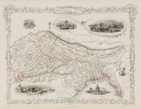
1851200119AG1851. London & New York John Tallis & Company 1851. Original steel engraving / Vintage map. Drawn and engraved by John Rapkin. Partly hand-coloured. Illustrations by A.H. Wray and Engraved by J.H. Kernot. Plate Size: 31.5 cm x 25 cm. Sheet Size: 37.2 cm x 27.2 cm. Vintage 19th century map in very good condition. Beautifully bordered map of northern India from Cambay to Chittagong and Aracan in the Bay of Bengal. The political subdivisions are colourfully included marking out independent Nepal and Bhutan. The regions of Jemer Malwa Allahabade and Assam can also be seen on the map along with the names of many towns and cities The regions rivers including the Ganges are shown and relief is depicted with hachuring. John Tallis 7 November 1817 3 June 1876 was an English cartographic publisher. His company John Tallis and Company published views maps and atlases in London from roughly 1838 to 1851. Tallis set up as a publisher with Frederick Tallis in Cripplegate in 1842; the business moved to Smithfield in 1846 and was dissolved in 1849. From 1851 to 1854 Tallis operated as John Tallis and Company. He started The illustrated news of the world and national portrait gallery of eminent personages in 1858 selling it for £1370 in 1861; it folded in 1863. Wikipedia The most important project John Tallis undertook was the 'Illustrated Atlas' from 1851. The original map we offer here was part of this exceptional Atlas and all the maps it contained are still today considered as the last reminder of an era of lavish map production. Tallis worked the project together with John Rapkin 1815-1876 and it was Rapkin's style and talent that we have to thank for when we marvel at these maps today. What makes these maps so special is the detail of engraved vignettes that surround the map and often show indigenous scenes people in their environment and even more so historical buildings or historical views of towns and cities architecture and landscape. The project of 'The Illustrated Atlas' was designed to be finished just in time for the anxiously awaited "Great Exhibition of the Works of Industry of All Nations" or The Great Exhibition sometimes referred to as the Crystal Palace Exhibition in reference to the temporary structure in which it was held was an international exhibition that took place in Hyde Park London from 1 May to 11 October 1851. It was the first in a series of World's Fairs exhibitions of culture and industry that became popular in the 19th century and it was a much anticipated event. The Great Exhibition was organized by Henry Cole and Prince Albert husband of the reigning monarch Queen Victoria. It was attended by numerous notable figures of the time including Charles Darwin Samuel Colt members of the Orléanist Royal Family and the writers Charlotte Brontë Charles Dickens Lewis Carroll George Eliot and Alfred Tennyson. Music for the opening was under the direction of Sir George Thomas Smart and the continuous music from the exhibited organs for the Queen's procession was "under the superintendence of William Sterndale Bennett". Wikipedia unknown
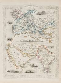
1851200124AG1851. London & New York John Tallis & Company 1851. Original steel engraving / Vintage map. Drawn and engraved by John Rapkin. Partly hand-coloured. Illustrations by H. Warren and Engraved by J. Rogers. Plate Size: 34.5 cm x 34 cm. Sheet Size: 27.2 cm x 37.4 cm. Vintage 19th century map in very good condition. Published in the Illustrated Atlas And Modern History Of The World Geographical Political Commercial & Statistical Edited By R. Montgomery Martin. Beautifully bordered and fascinating double map of the overland route between Britain and India. The upper map shows Europe and the links - both land and sea - running from England through to Alexandria Egypt. The routes are; the 'Mail Steam Packet Route' which runs around Gibraltar through Malta and onto Egypt; the 'Marseilles Overland Route' that runs across France to Marseilles and onto Alexandria via Malta and; the 'German Overland Route' that runs through across Belgium Germany before reaching Trieste and then onto the Mediterranean and then Egypt. The second map shows the differing routes on the next part of the journey - either across the Turkish controlled Middle East and through the Persian Gulf or down the Red Sea and across the Indian Ocean. What the map clearly illustrates is the importance attached to India 'Hindoostan' in the Imperial mind and the need for secure communication and transport links which necessitated control of certain choke points on the link such as Gibraltar Malta Suez etc. John Tallis 7 November 1817 3 June 1876 was an English cartographic publisher. His company John Tallis and Company published views maps and atlases in London from roughly 1838 to 1851. Tallis set up as a publisher with Frederick Tallis in Cripplegate in 1842; the business moved to Smithfield in 1846 and was dissolved in 1849. From 1851 to 1854 Tallis operated as John Tallis and Company. He started The illustrated news of the world and national portrait gallery of eminent personages in 1858 selling it for £1370 in 1861; it folded in 1863. Wikipedia The most important project John Tallis undertook was the 'Illustrated Atlas' from 1851. The original map we offer here was part of this exceptional Atlas and all the maps it contained are still today considered as the last reminder of an era of lavish map production. Tallis worked the project together with John Rapkin 1815-1876 and it was Rapkin's style and talent that we have to thank for when we marvel at these maps today. What makes these maps so special is the detail of engraved vignettes that surround the map and often show indigenous scenes people in their environment and even more so historical buildings or historical views of towns and cities architecture and landscape. The project of 'The Illustrated Atlas' was designed to be finished just in time for the anxiously awaited "Great Exhibition of the Works of Industry of All Nations" or The Great Exhibition sometimes referred to as the Crystal Palace Exhibition in reference to the temporary structure in which it was held was an international exhibition that took place in Hyde Park London from 1 May to 11 October 1851. It was the first in a series of World's Fairs exhibitions of culture and industry that became popular in the 19th century and it was a much-anticipated event. The Great Exhibition was organized by Henry Cole and Prince Albert husband of the reigning monarch Queen Victoria. It was attended by numerous notable figures of the time including Charles Darwin Samuel Colt members of the Orléanist Royal Family and the writers Charlotte Brontë Charles Dickens Lewis Carroll George Eliot and Alfred Tennyson. Music for the opening was under the direction of Sir George Thomas Smart and the continuous music from the exhibited organs for the Queen's procession was "under the superintendence of William Sterndale Bennett". Wikipedia unknown
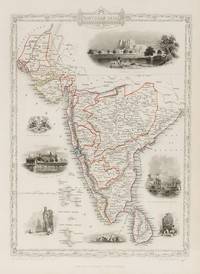
1851200109AG1851. London & New York John Tallis & Company 1851. Original steel engraving / Vintage map. Drawn and engraved by John Rapkin. Partly hand-coloured. Illustrations by A.H. Wray and Engraved by J.H. Kernot. Plate Size: 31.8 cm x 25.5 cm. Sheet Size: 37.2 cm x 27.2 cm. Vintage 19th century map in very good condition. Beautiful map of the southern Indian subcontinent from Sinde at the mouth of the Indus Estuary in the north down through Gujerat Bejapor and Mysore and down into the Carnatic region in the south. Hydrabad and Circars border the Bay of Bengal. Ceylon is also included in the map as are the Laccadive and Maldive islands in the Indian Ocean. Relief is depicting with hachuring. The major cities such as Bombay Sernigapatam and Madras are shown as are the rivers - including the Godavery and Beema rivers. This was an India dominated by the East India Company the British joint-stock company that came to rule large areas of India with its private armies exercising military power and seizing administrative functions. Formed in the early 1600s to compete with the Dutch for trade and commerce in the East the company rose to account for half of the world's trade at one point. Company rule in India lasted until 1858 when following the Indian Rebellion of 1857 the Government of India Act 1858 led to the British Crown's assuming direct control of the Indian subcontinent in the form of the new British Raj. The company was dissolved in 1874 as a result of the East India Stock Dividend Redemption Act passed one year earlier as the Government of India Act had by then rendered it vestigial powerless and obsolete. The official government machinery of British India assumed the East India Company's governmental functions and absorbed its navy and its armies in 1858. Wikipedia John Tallis 7 November 1817 3 June 1876 was an English cartographic publisher. His company John Tallis and Company published views maps and atlases in London from roughly 1838 to 1851. Tallis set up as a publisher with Frederick Tallis in Cripplegate in 1842; the business moved to Smithfield in 1846 and was dissolved in 1849. From 1851 to 1854 Tallis operated as John Tallis and Company. He started The illustrated news of the world and national portrait gallery of eminent personages in 1858 selling it for £1370 in 1861; it folded in 1863. Wikipedia The most important project John Tallis undertook was the 'Illustrated Atlas' from 1851. The original map we offer here was part of this exceptional Atlas and all the maps it contained are still today considered as the last reminder of an era of lavish map production. Tallis worked the project together with John Rapkin 1815-1876 and it was Rapkin's style and talent that we have to thank for when we marvel at these maps today. What makes these maps so special is the detail of engraved vignettes that surround the map and often show indigenous scenes people in their environment and even more so historical buildings or historical views of towns and cities architecture and landscape. The project of 'The Illustrated Atlas' was designed to be finished just in time for the anxiously awaited "Great Exhibition of the Works of Industry of All Nations" or The Great Exhibition sometimes referred to as the Crystal Palace Exhibition in reference to the temporary structure in which it was held was an international exhibition that took place in Hyde Park London from 1 May to 11 October 1851. It was the first in a series of World's Fairs exhibitions of culture and industry that became popular in the 19th century and it was a much anticipated event. The Great Exhibition was organized by Henry Cole and Prince Albert husband of the reigning monarch Queen Victoria. It was attended by numerous notable figures of the time including Charles Darwin Samuel Colt members of the Orléanist Royal Family and the writers Charlotte Brontë Charles Dickens Lewis Carroll George Eliot and Alfred Tennyson. Music for the opening was under the direction of Sir George Thomas Smart and the continuous music from the exhibited organs for the Queen's procession was "under the superintendence of William Sterndale Bennett". Wikipedia unknown
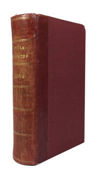
185484658London: Wm. H. Allen & Co 1854. Hardcover. Very Good. index c 145p. plus 6p. advertisements. Rebound in a red 20th century quarterbinding red leather backstrip and red cloth. 17cm. Rear joint tender. Richard F. Burton shows up in the list as does John H. Speke. Wm. H. Allen & Co hardcover
1888040755London: Spencer Blackett 1888. xi 388pp 8 bw ills. Or green gilt cloth with title and elephant in gilt. Cloth lightly rubbed at edges front hinge a little tender. A nice clean copy. Originally published in 1881 this undated second edition 1888. Lots of hunting tiger and other military comment social comment and information on the various states. . Second Edition. Hard Cover. Very Good. Illus. by The Author; Burton Miss C.G.M. 8vo. Spencer Blackett Hardcover
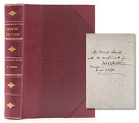
1873316648New York: Nelson & Phillips 1873. Eighth edition. Illus. with a map and 42 illustraions. 557pp. Three quarters crimson morocco and cloth sides. Fine. Eighth edition. Illus. with a map and 42 illustraions. 557pp. Inscribed on ffep"Mr David Smith/ with trhe compliments of/ Jno. W. Butler/ Mexico/ June 22/80. Nelson & Phillips unknown
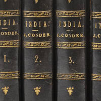
1828317758London: James Duncan and Thomas Tegg and Son 1828. Folding engraved map 15 engraved views. 4 vols. Small 8vo. Bound in half contemporary morocco and cloth. Very Good. Folding engraved map 15 engraved views. 4 vols. Small 8vo. James Duncan and Thomas Tegg and Son unknown
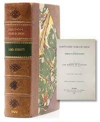
1900316898London: Macmillan and Co 1900. New Edition in One Volume. With 42 Illus. ii 601pp. 8vo. Bound in three quarters mottled brown calf and marbled boards green leather title label. Fine. New Edition in One Volume. With 42 Illus. ii 601pp. 8vo. Macmillan and Co unknown
1826L3 box764 b3v3<p>Platonis et que vel Platonis esse Feruntur vel Platonica Solent Comitari Scripta Graece Omnia ad Codices Manuscriptos Volume 3. Recensuit Variasque Inde Lectiones Diligenter Enotavit Immanuel Bekker. Annotationibus Integris Stephani Heindorfii Heusdii Wyttenbachii Lindavii Boeckhiique. Adjiciuntur Modo Non Integrae Serrani Cornarii Thompsoni Fischeri Gottleberi Astii Butmanni et Stalbaumi Necnon Ex Commentariis Aliorum Curiose Excerpta. 1826 MDCCCXXVI Londini: Excudebat A. J. Valpy A. M. Sumptibus Ricardi Priestley. Blue cloth hardcover 568 pp for Volume 3.</p> A. J. Valpy hardcover
1826L3box764 b3v4<p>Platonis et que vel Platonis esse Feruntur vel Platonica Solent Comitari Scripta Graece Omnia ad Codices Manuscriptos Volume 4. Recensuit Variasque Inde Lectiones Diligenter Enotavit Immanuel Bekker. Annotationibus Integris Stephani Heindorfii Heusdii Wyttenbachii Lindavii Boeckhiique. Adjiciuntur Modo Non Integrae Serrani Cornarii Thompsoni Fischeri Gottleberi Astii Butmanni et Stalbaumi Necnon Ex Commentariis Aliorum Curiose Excerpta. 1826 MDCCCXXVI Londini: Excudebat A. J. Valpy A. M. Sumptibus Ricardi Priestley. Blue cloth hardcover 583 pp for Volume 4.</p> A. J. Valpy hardcover
1826L3 box764 b3v5<p>Platonis et que vel Platonis esse Feruntur vel Platonica Solent Comitari Scripta Graece Omnia ad Codices Manuscriptos Volume 5. Recensuit Variasque Inde Lectiones Diligenter Enotavit Immanuel Bekker. Annotationibus Integris Stephani Heindorfii Heusdii Wyttenbachii Lindavii Boeckhiique. Adjiciuntur Modo Non Integrae Serrani Cornarii Thompsoni Fischeri Gottleberi Astii Butmanni et Stalbaumi Necnon Ex Commentariis Aliorum Curiose Excerpta. 1826 MDCCCXXVI Londini: Excudebat A. J. Valpy A. M. Sumptibus Ricardi Priestley. Blue cloth hardcover 624 pp for Volume 5.</p> A. J. Valpy hardcover
1826L3 box764 b3v7<p>Platonis et que vel Platonis esse Feruntur vel Platonica Solent Comitari Scripta Graece Omnia ad Codices Manuscriptos Volume 7. Recensuit Variasque Inde Lectiones Diligenter Enotavit Immanuel Bekker. Annotationibus Integris Stephani Heindorfii Heusdii Wyttenbachii Lindavii Boeckhiique. Adjiciuntur Modo Non Integrae Serrani Cornarii Thompsoni Fischeri Gottleberi Astii Butmanni et Stalbaumi Necnon Ex Commentariis Aliorum Curiose Excerpta. 1826 MDCCCXXVI Londini: Excudebat A. J. Valpy A. M. Sumptibus Ricardi Priestley. Blue cloth hardcover 566 pp for Volume 7.</p> A. J. Valpy hardcover
1826L3 box764 b3v8<p>Platonis et que vel Platonis esse Feruntur vel Platonica Solent Comitari Scripta Graece Omnia ad Codices Manuscriptos Volume 8. Recensuit Variasque Inde Lectiones Diligenter Enotavit Immanuel Bekker. Annotationibus Integris Stephani Heindorfii Heusdii Wyttenbachii Lindavii Boeckhiique. Adjiciuntur Modo Non Integrae Serrani Cornarii Thompsoni Fischeri Gottleberi Astii Butmanni et Stalbaumi Necnon Ex Commentariis Aliorum Curiose Excerpta. 1826 MDCCCXXVI Londini: Excudebat A. J. Valpy A. M. Sumptibus Ricardi Priestley. Blue cloth hardcover 640 pp for Volume 8.</p> A. J. Valpy hardcover
1826L3 box764 b3v9<p>Platonis et que vel Platonis esse Feruntur vel Platonica Solent Comitari Scripta Graece Omnia ad Codices Manuscriptos Volume 9. Recensuit Variasque Inde Lectiones Diligenter Enotavit Immanuel Bekker. Annotationibus Integris Stephani Heindorfii Heusdii Wyttenbachii Lindavii Boeckhiique. Adjiciuntur Modo Non Integrae Serrani Cornarii Thompsoni Fischeri Gottleberi Astii Butmanni et Stalbaumi Necnon Ex Commentariis Aliorum Curiose Excerpta. 1826 MDCCCXXVI Londini: Excudebat A. J. Valpy A. M. Sumptibus Ricardi Priestley. Blue cloth hardcover 575 pp for Volume 9.</p> A. J. Valpy hardcover
18303541FBBerlin, Verlag Königlich Preußische Kalender-Deputation, 1830. 16°. 13 x 9,5 cm. 204, 108, 107, 66 Seiten. Pappband der Zeit mit reicher Blindprägung und Rundum-Goldschnitt. Pappschuber. [8 Warenabbildungen]
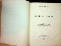
1826AA1372Edinburgh: Oliver & Boyd 1826. First. Very Good. A very good copy of this scarce study of the origins of English words Rebound in brown cloth with gilt titles on spine Ex-library but other than the gilt accession number at the base of the spine and slight paste residue on the ffep there are no other indications of its library ownership Binding is quite tight and sound There is an ink inscription on a fly leaf from the author's son Major later Major General Thomson dated Montreal 1842 and a vintage newspaper clipping about English word usage is affixed to the same page Text is age darkened There are a few minor pencil and ink annotations throughout and on the rear fly leaf but no other marks or damage to text at all A nice copy of a very uncommon volume there were recently fewer than a dozen copies found on OCLC<br /> <br /> Major-General Francis Ringler Thomson R E 1794-1863 was the son of the author He joined the Royal Engineers in 1812 and served many assignments in France and across the Empire including Ceylon Gibraltar Canada and Malta A Major in Canada when he inscribed this book in 1842 he continued to rise through the ranks and was eventually promoted to Major General in 1856 Unpaginated but approx 200 pp. Oliver & Boyd unknown
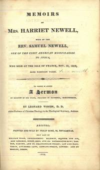
181676421Bristol 1816. 8vo. Samtidig skinnryggbind med opphøyde ryggbånd ryggforgyllng marmorerte dekler. 158 s. 8vo. Contemporary half calf raised bands spine gilt marbled boards. 158 pp. Printed and sold by Philip Rose. Engelsk. <br/><br/><em>Ikke i Sabin. Uten portrettet.Not in Sabin. Lacking portrait. </em> hardcover