18 205 résultats
Bella e decorativa carta geografica della Grecia.Sul lato destro, su un basamento, sono raffigurate quattro figure maschili a rappresentare degli abitanti dell'arcipelago nel loro costume tipico. Sulla facciata del basamento, distribuito su tre colonne, l'elenco delle isole dell'arcipelago. Decorativa carta geografica pubblicata nell'opera di Heinrich Scherer Atlas Novus exhibens orbem terraguem per naturae opera, historiae navae acveterus monumenta, artistique geographicae leges et praecepta edita in 8 parti, stampate tra il 1702 e il 1710 a Monaco di Baviera. Heinrich Scherer, professore di matematica a Monaco di Baviera, era un gesuita devoto la cui opera sottolineava la gerarchia cattolica e la diffusione delle missioni gesuite in tutto il mondo. Il suo Atlas Novus contiene mappe di tutte le altre parti che mostravano la diffusione del cattolicesimo e delle missioni gesuite. Le 180 mappe incluse in questo lavoro sono state preparate tra il 1699 e il 1700 e sono state incise da Leonard Hecknaeur, Joseph Montelegre e Matthus Wolfgang; ogni volume è introdotto da splendidi frontespizi allegorici dagli stessi incisori. Incisione su rame, in ottimo stato di conservazione. Decorative map by Heinrich Scherer for his Atlas Novus exhibens orbem terraguem per naturae opera, historiae navae acveterus monumenta, artistique geographicae leges et praecepta...published in eight volumes from 1702-1710 in Munich. Scherer, a devout Jesuit, produced this geographical compendium to depict the Catholic hierarchy and the spread of Jesuit missions throughout the world. The 180 maps included in this work were prepared between 1699 and 1700 and were engraved by Leonard Hecknaeur, Joseph Montelegre or Matthus Wolfgang with each volume introduced by fine allegorical frontispieces by the same engravers. Copper engraving, in very good condition.
(mm. 263). Solida pelle moderna con titolo in oro al dorso. Antiporta, frontespizio figurato, pp. XXIV, 458 con una carta geografica e 24 tavole f.t. di vedute e XV di monumenti. Molte illustrazioni nel testo.
Very Good Greek, Modern (post 1453) Paperback. Demy 8vo. (21 x 14 cm). In Greek (Modern). 79 p. Not in OCLC. The Metropolis of Chalcedon is an ecclesiastical territory (diocese) of the Ecumenical Patriarchate of Constantinople. Christianity spread in Chalcedon during the 2nd century AD. The city was initially the see of a bishopric before being promoted to a metropolis at 451 AD, at the time of the Fourth Ecumenical Council. It is one of the four remaining active Greek Orthodox Church metropolises of the Ecumenical Patriarchate in Turkey today and the only one surviving in Asia Minor (Anatolia). During the 14th century, the metropolitan see remained vacant, due to the Ottoman conquest of the region. However, it was reorganized in the 15th century, possibly after the Fall of Constantinople and the subsequent incorporation of the Ecumenical Patriarchate into the millet system of the Ottoman society. The first recorded metropolitan of that time was Joseph, in 1477. In the following years, the jurisdiction of the metropolis was extended to the east. During the late 17th century the see of the diocese was transferred to Kuzguncuk (Ermoulianai, Chrysokeramos), where it remained until 1855. At that period a number of monasteries were established, like the one of Saint Panteleimon, which was declared Stauropegic. The metropolitan of Chalcedon was one of the five Elder metropolitans from the wider region of Constantinople, the other being those of nearby Herakleia, Cyzicus, Nicaea, and Nicomedia. Following an Ottoman decree of 1757, they had to be always present in the Holy Synod of the Ecumenical Patriarchate and had direct access to the Ottoman Sultan, to whom they announced the election of the new Ecumenical Patriarch. From the mid-19th century, the local metropolis prospered thanks to the significant population increase and economic development of the local Orthodox population. In 1855 the see of the metropolitan returned to Chalcedon during the primateship of Metropolitan Gerasimos. Moreover, the newly erected church of Saint Euphemia became the new cathedral. The metropolitan mansion was built near the cathedral in 1902. This is the first and only known printed regulation book of the Greek Community in Chalcedonia (Kadiköy). Extremely rare.
Moderate wear to boards and with a few unobtrusive spots to front board. First few pages and most maps are a bit frail. First blank page with neat pencil notes and former owner's stamp ; Nicely taped fold-out map in rear pocket. 1905 is a rare edition. With 11 Maps, 25 Plans, and a Panorama of Athens ; 16mo - 6" to 7" tall; 434 pages
Very Good Latin Original map. Oblong 4to. (25 x 34,5 cm). In Latin. From 'Mercator Atlas'. A very good copy. A detailed and decorative engraved map. B/w. Including Europae Pars (Thrace) and Black Sea, Aegean and Mediterranean, and with all ancient toponyms and names of regions including Cyprus and Syriae (Syria). Could not be find map-maker and being from which book. An early and decorative map of Asia Minor.
Light shelfwear to book. Foxing to textblock and endpapers. Scarce. ; Deals with the question of when and how the Spartan state came into being, and how it developed. Looks at the Emergence of the Spartan State and its characteristic features; Spartan Society in the Fifth and Fourth Centuries BC; & Hellenistic Sparta; Czechoslovak Academy of Sciences; 347 pages
Minor shelfwear. Light Foxing/dustsoiling to top of textblocks. Vol 1 has bumping to upper corners and Vol 2 has very light bump to top of spine. Scholar's name to ffeps (G. P. Goold). ; 2 Volume Set; Folio 13" - 23" tall
547p. Soiled and wormed. 8vo. Rubbed contemporary full roan leather. Blue printed American Ex Libris of Maris Gibson [probably from Chester County, Pennsylvania]. First American edition of the Cyropaedia in Latin & Greek, as edited by Thomas Hut chinson (1698-1769), and substantially corrected by American editors. * First book printed in American Greek Type * The earliest substantial use of a Gree k font cast in America. The types were cast b y Binny and Rolandson under the direction of John Watts, who was brought from England to supervise the type production and the printing of this book. A la ndmark in American typography and scholarship. AI 11903. SCARCE. **PRICE JUST REDUCED! W120
196543399Burt Franklin. 1965. Hardcover. Very Good in No Dust Jacket dust jacket. Volumes range from VG a few corners mildly bumped to fine.; Reprint originally published Oxford: 1891. Likely published 1965; 4 Volume Set. Burt Franklin Research & Source Work Series 95.; Vol. I 609 pages; Vol. II 583 pages; Vol. III 749 pages; Vol. IV 551 pages. This was the definitive history of ancient Sicily from the earliest times to the death of Agathokles 361-289 B. C. ruler of Syracuse by the leading English-speaking authority of the late 19th century Edward A. Freeman who also wrote the Encyclopedia Britannica article on Sicily. Each volume contains occasional one-page black-and white topographic maps to illustrate battle locales and dominions of tyrants; Volume I also contains a fold-out frontispiece map of the Island see picture. Volume I-The Native Nations: the Phoenicians and Greek Settlements; Volume II-From the Beginning of Greek Settlement to the Beginning of Athenian Intervention; Volume III-The Athenian and Carthaginian Invasions; Volume IV-From the Tyranny of Dionysius to the death of Agathokles edited from posthumous Mss. With Supplements and Notes by Arthur J. Evans. Each volume contains a separate index. . Burt Franklin hardcover
196734568Oxford At the Clarendon Press. 1967. First Edition. Hardcover. Good in Good dust jacket. Ex-library copy with usual stamps call numbers and pocket. Tape stains to ffeps and boards. DJ is in plastic sleeve. Inner hinges have been reinforced; 847 pages . Oxford At the Clarendon Press hardcover
1374269Paris: Dentu, an XI (1803) 3 vol. in-8, 396, 408, 386 pages, 12 portraits hors texte gravés au burin par Adam et carte se dépliant de la Grèce gravée par Tardieu. Demi veau blond, dos lisse filets dorés, pièce de titre de maroquin rouge, pièces de tomaison de maroquin noir. Bel exemplaire. Barbier, II, 1225.
- EDIZIONE ORIGINALE, COLORITURA COEVA -Importante e decorativa mappa tratta dal "Nuovo Atlante Geografico Universale delineato sulle ultime osservazioni", edito a Roma dal 1792 fino al 1801, opera che la Calcografia Camerale commissionò al Cassini al fine di sostituire l’ormai obsoleto "Mercurio Geografico".Giovanni Maria Cassini, Chierico Regolare Somasco fu geografo e cartografo, ma anche intagliatore di architetture e prospettive - uno dei migliori discepoli di Giovanni Battista Piranesi - Cassini fu uno degli ultimi sferografi italiani del Settecento ed i suoi globi ebbero una notevole diffusione, come pure questo "Nuovo Atlante Geografico".Incisione in rame, coloritura coeva dei contorni, leggere bruniture, per il resto in ottimo stato di conservazione. L'Atlante del Cassini fu ristampato dalla Calcografia Camerale nel primo quarto del XIX secolo, prima del 1839. Solo gli esemplari di prima edizione come questo sono stampati su carta vergata coeva e sono colorati a mano in epoca. Le tirature del XIX secolo sono già su carta meccanica, priva di vergelle, e generalmente in bianco e nero. - FIRST EDITION, CONTEMPORARY OUTLINE COLOUR -The Italian painter and engraver, Giovanni Maria Cassini, produced this splendid map of as part of his epic three-volume atlas. Published in: Nuovo atlante geografico universale delineato sulle ultime osservazioni. Roma, Calcografia camerale, 1792-1801.Cassini was geographer and cartographer but he was also good at engraving architectural items and perspectives – he was one of the best disciples Giovanni Battista Piranesi had. Moreover, Cassini was one of the last artists to engrave spheres in the XVIII century and his globes were quite famous and widespread, and realized the most important Italian Atlas of the XVIII century; his maps always bear a cartouche, extremely rich in colours and details. Copperplate with fine original hand colour, some foxing, otherwise in very good condition.The Cassini's Atlas was reprinted by the Calcografia Camerale in the first quarter of XIXth century (before 1839). Only the first edition of the atlas is printed on contemporary laid paper, while the late issue are on XIXth century paper and often without colour.
185621151New York: Harper & Brothers Publishers. 1856. Hardcover. Very Good-. Boards with light rubbing to extremities. Gilt spine lettering a bit faded. A bit of creasing to front pastedown. Endpapers with a bit of browning. ; An early and detailed account of modern Greece with a steel-engraved front fold-out map and 53 vignettes on the title pages it reads: illustrated by about 60 engravings. INSCRIBED by the author on front free endpaper: "Miss A. L. Barber with the author's kind regards. March 09 1890". Dark green boards with bindstamped circular pattern. ; 12mo 7" - 7½" tall; xii 380 pages . Harper & Brothers, Publishers hardcover
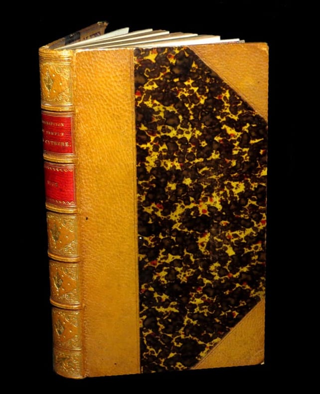
175215535A Cythère, chez Cupidon / Librairie des Amours, 1752. Deux parties reliées en un volume au format in-12 (171 x 96 mm) de 1 f. bl. et 208 pp. ; 238 pp. et 1 f. bl. Reliure postérieure (XIXème) de demi-maroquin fauve à coins, double filet à froid portés sur les plats, dos à nerfs orné de filets gras à froid, filet doré sur les nerfs, doubles caissons d'encadrement dorés, fleurons dorés, semis d'étoiles dorées, pièce de titre de maroquin vieux-rouge, titre doré, palette dorée en queue, toutes tranches dorées. (Belz-Niédrée).
Dodici tomi in mezza pelle coeva con titoli dorati su tassello, 8vo piccolo cm11x16, complessive circa 5000 pagine con 29 (su 31) tavole ripiegate, in coloritura d’epoca. Tomo I: pp XVI 309 (3), 4 tavole; tomo II: pp 301 (3), 7 tavole; tomo III: pp 288, 3 tavole; tomo IV: pp 196, 3 tavole; tomo V: pp 311 (1), 2 tavole; tomo VI: pp 332, 4 tavole; tomo VII: pp (8) 304, 2 tavole; tomo VIII: pp (8) 312, 1 tavola; tomo IX: pp (8) 344; tomo X: pp (8) 360, 1 tavola; tomo XI: pp 359 (1), 2 tavole; tomo XII: pp VIII 384. Mancanti dall’origine due cartine (Elide e Messenia); difetti sui soli margini di circa 10 carte del tomo XI (morsure/mancanze che non intaccano il testo, estese a tutta la larghezza del margine per circa 5cm sul bordo superiore e 3cm sull’esterno delle pagine da 167 a 176, con la sola perdita del numero di pagina sull’ultima carta; trascurabili e assai contenute nelle altre carte); per il resto esemplare genuino e completo, complessivamente discreto esemplare da studio. Romanzo didattico sulle antichità greche che costò all’autore trent’anni di lavoro e conobbe enorme fortuna a cavallo fra il XVIII e il XIX secolo, pilastro del neoclassicismo tardo Settecentesco e del filellenismo che avrebbe infiammato i cuori della gioventù romantica europea pochi anni dopo; la prima edizione italiana qui offerta è arricchita di numerose tavole incise da Antonio Zatta e in coloritura coeva, ed è tradotta presumibilmente (secondo Melzi, Dizionario... 3, 217) da Vincenzo Antonio Formaleoni (Fiorenzuola d’Arda 1752 - Mantova 1797), viaggiatore, cartografo, tipografo e romanziere, collaboratore di Zatta e Zannoni, nonché protagonista di vicende di spionaggio fra la Francia giacobina e la Serenissima. [Brunet I, 675; Graesse I, 300]
xii + 574pp., 24cm., publisher's hardcover in blue cloth, dustwrapper worn (some signs of wear at ends and some small tears and stains), text and interior are clean and bright, good condition, weight: 1kg., F105304
In 8, pp. 40 con 1 veduta a volo d'uccello di Siracusa (cm 33 x 19) e con 21 incisioni all'acquaforte n. t. (cm 13 x 9 ca.). Brossura editoriale. Si tratta della seconda edizione (la prima risale al 1835) di questa guida realizzata da Vincenzo Politi, padre del piu' famoso Raffaello. Sono descritti (e raffigurati) monumenti come il Tempio di minerva, il Sepolcro di Archimede, il Linfeo, il Teatro, la Latomia ecc. Mira, II, 236.
19817492Oxford University Press. 1981. Hardcover. Very Good in Very Good dust jacket. Very light bumping to bottom corners else book is fine. DJ is price-clipped. Dustjacket is protected in mylar.; A credible representation of a lost narrative describing struggles among the successors of Alexander.; Oxford Classical Monographs; 314 pages . 0198147171 . Oxford University Press hardcover
19828977Oxford Clarendon Press. 1982. First Edition. Hardcover. Near Fine in Near Fine dust jacket. Creasing to DJ now protected in mylar. Signed by author to scholar. Corrigenda page taped to inner cover.; This book is a study of the fourth-century-BC Hekatomnid dynasty whose members ruled Karia a district in south-west Asia Minor as Persian satraps. The title of the book denotes only the central figure in the story of the hellenization of Karia. Recent archaeological finds and newly discovered inscriptions help bring alive this fascinating dynasty whose members though native Karians actively diffused Greek culture through their corner of Anatolia in the two generations before Alexander.; 424 pages; Signed by Author . 0198148445 . Oxford Clarendon Press hardcover
22075115-nnew. unknown
22075115like new. unknown
1700015795Circa 1700 1700. First Edition . No Binding. Good. 27 Cm x 42.5 Cm. Hand Colored Engraving. A Very Large Engraved View Of A Military Parade Ground And Surrounding Buildings In Constantinople With About 100 Figures Mostly Soldiers. 17" X 10 5/8". Trimmed To Edges. Many Figures In Foreground Walking Or On Horseback With Dogs Horses Etc. 1/2" Square Area With Some Rubbing Away Of Engraving Repairs Along At Top 1" Similar Horizontal Lines Representing Sky Have Been Attached From Another Engraving A Little Soiling To White Sky. Colored In Red Blue Pink Green Yellow. <br/> <br/> unknown
167033392-ya8Lugdunum Batavorum (Brittenburg) & Amstflod: Gaasbekios 1670. 359 Seiten. Pergament mit durchgezogenen Bändern und handgestochenen Kapitalbändern (der Einband nachgedunkelt, etwas bestoßen, der Buchblock zwischen dem Frontispiz und dem Titelblatt leicht angebrochen, auf dem vorderen Vorsatzblatt kleine Annotationen von alter Hand, sonst sehr gutes und sauberes Exemplar) 10 x 5,5 cm. [3 Warenabbildungen]
175034330-yc7126Leipzig: Carl Ludwig Jacobi 1750. 14 unpaginierte Blatt, 768 Seiten. Halbleder der Zeit auf fünf echten Bünden mit Rückenschild, Lederecken, Rückenvergoldung und allseitigem roten Farbschnitt (etwas berieben und bestoßen, auf dem vorderen weißen Referenzblatt ein handschriftlicher Besitzvermerk von alter Hand "Ex Libris / Joh. Leop. Seyffertii", sonst ungewöhnlich gutes und absolut sauberes Exemplar). 8°. [2 Warenabbildungen]
1875GR028PARIS, Lib. Firmin-Didot, 1875. In-12o, VI+432 p. L'art à Sparte - Arcadie - La Triphylie - Elide - L'Archaïe - Sicyone - Corinthe. Reliure contemp. 1/3 chevre, dos a faux nerfs, tranches coloriees.