[BRANCUSI Constantin] TABART Marielle, LEMNY Doïna & al.Livre Rare Book

2 025 résultats
1988SCULPTU2686762020324Paris, Centre Georges Pompidou, "Les carnets de l'Atelier Brancusi - La série et l'oeuvre unique", 1998, 15 x 21, 96 pages cousues sous couverture rempliée illustrée. Photographies noir & blanc. "De 1918 jusqu'à la fin de sa vie, Constantin Brancusi réalise plusieurs versions de sa Colonne sans fin, dans des tailles et des matériaux différents. La structure reste cependant identique, fondée sur la répétition de formes rhomboïdales superposées. Dans un élan vertical, apparaissent les qualités rythmiques, l'harmonie des proportions et la simplicité des motifs. Sa dernière colonne (1938) de près de 30 mètres de haut est installée au milieu d'un parc à Târgu Jiu en Roumanie, dans un sanctuaire dédié aux morts de la Première Guerre mondiale."
2020PEINTURMONOGRAP0224Paris Musées, 2020 24,5 x 32,5, 312 pages sous cartonnage éditeur illustré. Iconographie noir & blanc et couleurs. Ouvrage publié à l'occasion de l'exposition présentée au Musée d'Art moderne de Paris du 18 septembre 2020 au 10 janvier 2021. "Je suis le rêve. Je suis l’inspiration. » Ces mots employés par Victor Brauner (1903-1966) dans une lettre adressée à André Breton en 1940, révèlent l’importance du rêve et de la création chez l’artiste et le placent au cœur de la poétique surréaliste."
1928339801928 Paris - Nouvelle Société d'Edition - 1928 - 1 volume in8 broché de 157 pages - trés bon état -
1970LFA00d87Une revue de 75 pages, format 270 x 210 mm, brochée, illustrée
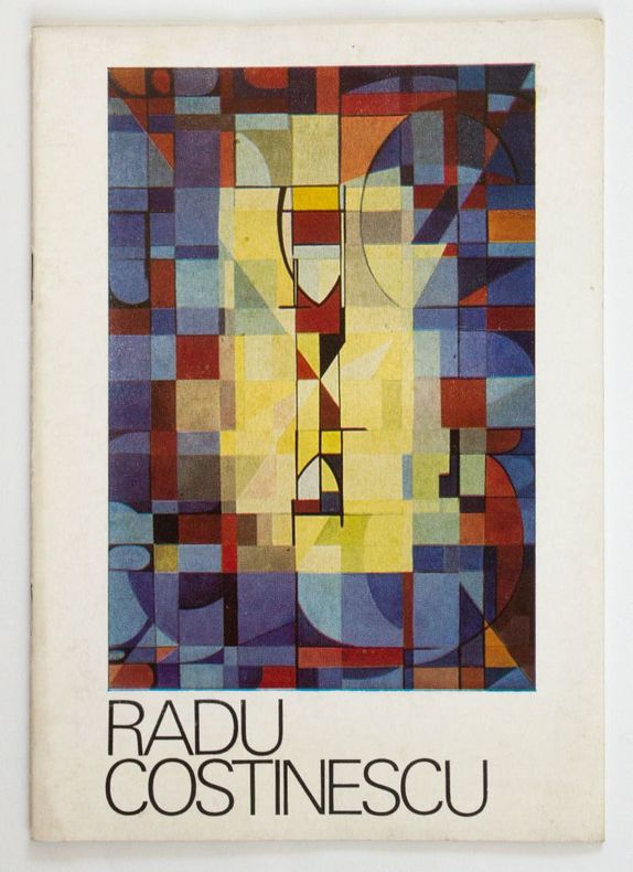
19794543Bucarest Galeria de arta "Orizont" / Uniunea Artistilor Plastici din R. S. Romania 1979 in-8 plaquette agrafée [Bucarest], Galeria de arta "Orizont" / Uniunea Artistilor Plastici din R. S. Romania, 1979. 24 x 17 cm, 14 ff. n. ch. (28 pp.), illustrations en noir (1 en couleurs), plaquette agrafée sous couverture illustrée en couleurs.
199013973Paris, Presses de la Fondation nationale des sciences politiques, 1990 1 volume 17 x 24cm Broché sous couverture au 1er plat orné d'une photo. 151p. Bon état.
Au sommaire, dossier: "Le Brésil au pluriel": "Pluralité des développements brésiliens" par Ignacy SACHS, "La conquête de l'espace brésilien" par Hervé THERY, "Autoportraits du Brésil" par Mario CARELLI; suivi de: "La rupture franco-britannique de 1940. Le conseil suprême interallié, de l'invasion à la défaite de la France" par François BEDARIDA, "Nationalisme et réactions fondamentalistes en France. Mythologies identitaires et ressentiment antimoderne" par Pierre-André TAGUIEFF, "L'affaire Rajk, quarante ans plus tard" par François FEJTÖ, "Le système Ceausescu. Utopie totalitaire et nationalisme insulaire" par Catherine DURANDIN; Enjeux: "Martin Malia dans l'historiographie soviétique" par Michel WINOCK. Français
1985877721985 Aix-en-Provence, Université, 1985, in 8° broché, 312 pages
in-16, 415 pages, broché, couverture illustree. Bel exemplaire. [LP]
1930771221930 Paris, Gamber, 1930, in 8° relié demi-percaline noire, dos muet (reliure modeste), 153 pages.
31083P., Librairie de Paris, Firmin-Didot (Collection "Histoires de France"), 1929, in 8° broché, XXI-111pp. ; illustrations ; trace d'humidité aux premières pages ; couverture défraichie et salie.
2004LITTROUMANIE440220Paris, L'Esprit des Péninsules, 2004, 13,5 x 21, 240 pages sous couverture souple illustrée.
1879123812Librairie militaire de J. Dumaine, 1879-1883, 3 vol. gr. in-8°, 801, 796 et 804 pp, une carte, qqs figures, croquis et tableaux (4 dépliants), reliures demi-chagrin grenat, dos à 4 nerfs soulignés à froid, titre et tomaisons dorés, tranches orange (rel. de l'époque), dos uniformément passés, qqs rousseurs, bon état. Rare
2005LFA0170aRevue trimestrielle de l'Institut international de géopolitique : environ 100 pages, format 210 x 280 mm, illustrée, brochée couverture couleurs
27101P., beauchesne, 1942, in 12 broché, 136 pages.
85486Bucarest, Editions Méridiane, sans date, grand in 8°, cartonnage illustré de l'éditeur, XL-336 pages ; illustrations in et hors-texte ; petits frottis.
Very Good German Original color map on cloth. A little foxing on cloth. Very good. Folded. Oblong folio. (45 x 51 cm). In German. Shows N. Enyed, Zalathna, Mediasch, Hermannstadt, Hatszeg, Petroseni, Ôzt River, etc. Scale: 1/300,000. Sibiu (Sibiiu - Hermannstadt - Nagyszeben) is a city in Romanian Transylvania. The city straddles the Cibin River, a tributary of the river Olt. The first official record referring to the Sibiu area comes from 1191 when Pope Celestine III confirmed the existence of the free prepositure of the German settlers in Transylvania, the prepositure having its headquarters in Sibiu, named Cibinium at that time. In the 14th century, it was already an important trade center. As of the year 1376, the craftsmen were divided into 19 guilds. Sibiu became the most important ethnic German city among the seven cities that gave Transylvania its German name Siebenbürgen (literally "Seven Citadels"). It was home to the Universitas Saxorum (Community of the Saxons), a network of pedagogues, ministers, intellectuals, city officials, and councilmen of the German community forging an ordered legal corpus and political system in Transylvania since the 1400s. During the 18th and 19th centuries, the city became the second -and then the first most important center of Transylvanian Romanian ethnics. The first Romanian-owned bank had its headquarters here (The Albina Bank), as did the ASTRA (Transylvanian Association for Romanian Literature and Romanian's People Culture). After the Romanian Orthodox Church was granted status in the Habsburg Empire from the 1860s onwards, Sibiu became the Metropolitan seat, and the city is still regarded as the third-most important center of the Romanian Orthodox Church. Between the Hungarian Revolution of 1848 and 1867 (the year of the Ausgleich), Sibiu was the meeting-place of the Transylvanian Diet, which had taken its most representative form after the Empire agreed to extend voting rights in the region (Source: Wikipedia). A sheet of the collection of 'The general map of Central Europe'. appeared in the years between 1873-1876 with the work of Joseph Ritter von Scheda, (1815-1888) who was a general, geographer, and cartographer.
1981LFA-126740964Revue de 20 pages, format 225 x 300 mm, brochée couverture couleurs, illustrée, Editions Atlas, bon état
244745Bucarest, 20 février 1804, in-folio, [3] ff. n. ch., un f. vierge, en feuilles.
231999Paris, Édition des Informations politiques et financières, 1924 in-8, 116 pp., broché.
2018LFA-126731855Un guide de 522 pages, format 115 x 220 mm, broché couverture couleurs rempliée, illustré, édition de 2018, bon état
1930108080Paris, Librairie Ernest Leroux, coll. « Monuments de l'art byzantin », n° VI 1930 2 volumes. In-folio 39 x 29,5 cm. Brochés, couvertures beiges report du titre rouge et noir sur les dos et les premiers plats, 1 volume de 320 pp., 82 figures dans le texte, 3 planches repliées, bibliographie, index général des noms propres, index iconographique, table des matières, accompagné d’un album contenant 68 planches, table des planches. Couvertures poussiéreuses, intérieur très frais.
195197633Paris, P. E. G. 1951 In-12 19 x 12 cm. Broché, couverture ivoire, titre rouge et noir, 227 pp., table des matières. Exemplaire non coupé à l’état neuf.
192659234Washington D.C.: Government Printing Office Hydrographic Office U.S. Navy 1926; 1930. Two vols. 8vo.viii 478 pp.; 1 22; 1 leaves. With 1 large folding colour map. First vol. in tan publisher’s buckram black lettering front cover & spine minor soiling spotting fore-edges of covers darkening to spine very slight uniform interior toning; 2nd. vol. w/ self-printed softcovers toning to fore-edges minor chipping still VG set. Second edition stated of vol. I and 1st edition of Supplement. These uncommon coast pilot guides to Eastern Mediterranean waters the Black Sea and the Sea of Azov draw upon British Royal Navy Ottoman Empire & Turkish coast pilots Russian & U.S. Navy reports. Prior to modern GPS systems and satellite navigation these regularly updated and revised navigation handbooks provided key sailing instructions. The maps outlines the available charts for the designated areas surrounding the Black Sea as well as detailing those for the extensive set of the Mediterranean Sea. Government Printing Office, Hydrographic Office, U.S. Navy, paperback
Album in-4° 159 pp, abondamment illustre en N/B et en couleurs (images collees), cartonnage editeur pleine toile, jaquette illustree. Bel exemplaire. [PCL-4] Ouvrage en langue roumaine.