LA PEROUSE, Jean-Francois de Galaup deBiblio.com
104 résultats
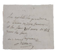
1781H1RDFKW35E6FAt sea 1781. Short manuscript note in ink on a small sheet of laid paper 12 x 13.5 cm. An exceptionally rare autograph note signed by the great French explorer La Pérouse. The extraordinary story and achievements of La Pérouse are well known and recounted in the handsome official account of his expedition. However because he was lost without trace mid-voyage manuscript material relating to his life is very rare indeed. In the present note La Pérouse asks that his boat be given an impressive 286 "aunes" of canvas which is needed on board. An "aune" is an old-fashioned French measure usually translated as ell or cubit: its length could vary but the normal French/Parisian aune was about 118 cm meaning that La Pérouse is in fact asking for about 340 metres of canvas. The sheer quantity of the request speaks to La Pérouse having written the note while in charge of a large vessel.The document is counter-signed and noted as "delivered" by one "Deletombe": it seems very likely that this is Philippe-André-Joseph de Létombe who arrived in the United States in 1781 and was the French Consul in Boston and a correspondent of Thomas Jefferson. If this identification is correct the note would possibly date from La Pérouse's cruising in the West Indies and along the coast to Hudson Bay in 1781 and 1782.With old folds clearly and legibly written and docketed; in very good condition. unknown
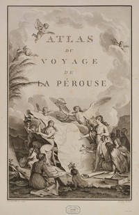
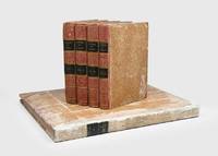
98498Paris Imprimerie de la République An V An V 1797. . First edition. 4 text vols 4to 30 x 23 cms and folio atlas 58 x 45 cms engraved portrait of La Pérouse after Tardieu atlas with engraved allegorical title-page by Moreau le Jeune titled Atlas du voyage de La Pérouse without imprint and 69 engraved plates comprising folding world map 35 views and natural history plates 33 maps or coastal profiles of which 20 double-page. Text volumes contemporary half-calf marbled boards chip to head of spine vol. I light marginal water-staining vol. II and title-page vol. III bound without half-titles joints vol. I cracked but sound lightly rubbed some scraping to boards; atlas 19th-century red morocco-backed boards neatly rebacked royal cypher of Prince Philippe of Belgium to cover and spine marginal repair to tear circa 7 cms to blank outer margin plate 15 not touching image occasional light foxing at beginning and end a very good set.<br /> The first edition of one of the most important scientific explorations ever undertaken to the Pacific and the northwest American coast and the first scientific voyage to California. 'The voyage round the world under the command of La Pérouse was intended as the French equivalent of Captain Cook's Third Voyage and was enthusiastically endorsed by the Academy of Sciences and particularly by Louis XVI. The most significant results of the voyage are the charts of the then imperfectly known Asiatic coast of the Pacific' Forbes. <br /><br />La Pérouse was the first explorer to navigate and chart the Japan sea and the strait between the island of Sakhalin and the northernmost island of Japan which bears his name. At Kamchatka he received instructions to proceed to Australia to assess the extent of British plans. He arrived at Botany Bay in January 1788 just hours after Governor Phillip had arrived with the First Fleet. La Pérouse's habit of forwarding copies of journals and drawings when opportunity offered ensured their survival for as is well known the accomplishments of the voyage have been overshadowed by the disappearance of the entire expedition. The folio atlas contains magnificent maps of Russian Asia Japan the Pacific North-West Coast Hawaii San Francisco and Monterey; the views include a fine series of botanical and ornithological plates including the California quail. Of particular interest to Hawaii is the plate that depicts French ships off Makena Maui. It is the first fully developed view of that island.<br /> Hill 972; Forbes 272; Lada-Mocarski 52; Ferguson 251; Brunet III 828-829; Sabin 4797. Paris, Imprimerie de la République, An V, An V [1797]. hardcover
1797181908Paris: L'Imprimerie de la Republique 1797. One of the great documents of French exploration" in the original boards First edition an attractive set with strong impressions of the plates. La Pérouse's work is a "magnificent production and some authorities consider the engraving and craftsmanship to be superior even to that in the Cook-Webber atlas It is one of the finest narratives of maritime exploration ever written and certainly deserves to hold a place of high honour among the great travel accounts of the 18th century" Howell. La Pérouse's 1741-c.1788 expedition left France in 1785 to seek an inter-oceanic passage examining the parts of the Pacific not yet explored by Cook conducting scientific observations on the various peoples and regions assessing the extent of Spanish settlement in California and determining the possibilities of French expansion in the Pacific. En route to Kamchatka La Pérouse was the first to navigate safely and chart the Japan Sea and the strait between the island of Sakhalin and the northernmost island of Japan which bears his name. At Kamchatka he received instructions to proceed to Australia arriving at Botany Bay in January 1788 just hours after Captain Phillip had arrived with the First Fleet. After leaving later the same year the expedition was never seen again. Evidence slowly came to light that both ships were wrecked on the reefs around the islands north-west of Australia. This account is based on dispatches sent from Australia and Kamchatka before this. The atlas volume contains maps of Russian Asia Japan San Francisco Monterey and the Sandwich Islands. The most significant results of La Pérouse's voyage are the charts of the Asiatic side of the Pacific and the details of "the peculiarities he observed in the Native Americans of the northwest coast of North America are especially valuable" Sabin. It also features the first representation of the crested quail. The engraved portrait of La Pérouse counted as the 70th plate is here bound as the frontispiece in Volume I as often. The atlas was published in two forms: on regular usually trimmed and large or thick paper. Forbes and Lada-Mocarski give the measurements for the large paper issue variously at 620 x 455 and 563 x 420 mm. Provenance: Amandine Doré 1911-2012 the French painter illustrator and writer her pencilled signature on the front free endpaper of Volume I dated 1955 her signature and initialled booklabel on the front endpapers of the atlas. Doré produced works for travel narratives such as Mexique pay a trois etages 1955. 5 vols comprising 4 quarto text vols 307 x 256 mm and folio atlas 585 x 440 mm. Engraved portrait of La Perouse after Tardieu. Atlas: engraved allegorical title page by Moreau le Jeune 69 engraved plates and maps some double-page or folding many with original tissue guards loosely inserted. Original pulled paste paper boards flat paper covered spines tinted pink twin dark green spine labels original sheep corners housed together in light brown slipcase; atlas original pulled paste paper boards flat vellum spine covered with white paper dark green morocco spine label recent sheep corners. Text with occasional marginal pencillings or notes. Text vols: bookplate removed from front pastedown of vol. I rubbed a few superficial chips to spines and early recolouring vol. I starting before title; atlas: spine and sides extensively rubbed superficial split to foot of front joint marginal tear to Plate 28 and two others. A very good copy. Anker 276; Ferguson 251 dated 1798; Forbes 272; Hill 972; Lada-Mocarski 52; Sabin 38960; Streeter VI: 3493. Richard Reed in Howell Anniversary Catalogue 72 1982. hardcover
179718688Paris: Imprimerie de la République 1797. Contemporary uniform gold-tooled marbled calf richly gold-tooled spines with a red title-label and a small green volume number label both lettered in gold gold-tooled board edges marbled endpapers. 4to 30 x ca. 23 cm. and large folio ca. 57 x 40 cm. Ad 1: with an engraved portrait of De la Pérouse by Tardieu and tables in the text. The atlas contains an engraved title page 1 large double-page folding map of De la Pérouse's journey 20 double-page maps and 48 full-page maps views and illustrations. Ad 2: with tables in the text. The atlas contains an engraved title page 1 double-page map and 43 full-page plates. Ad 3: with 33 folding engraved plates and with tables in the text. The atlas contains an engraved title page an engraved table of contents 37 large double-page folding maps 2 large double-page folding views and 10 full-page maps and illustrations. The three atlases for ads 1-3 are bound together in a large folio matching contemporary gold-tooled marbled calf binding. 9 volumes: ad 1 in 4 volumes; ad 2 in 2 volumes; ad 3 in 2 volumes with the atlases of the 3 works bound together in 1 volume. With:2 LABILLARDIÉRE Jacques Julien Houton de. Voyage à la recherche de Lapérouse.Paris H.J. Jansen An VIII = 1799-1800.3 ENTRECASTEAUX Antoine Raymond Joseph de Bruni chevalier d'. Voyage envoyé à la recherche de Lapérouse.Paris Imprimerie Impériale 1808. Three first editions of descriptions of the rarest and most interesting 18th-century expeditions bound as a set in beautiful contemporary uniform bindings. A milestone set in the history of exploration of the Pacific.Ad 1: Record of an important French scientific expedition in which participated a number of scientists and artists. De la Pérouse left France in 1785 with two frigates the Astrolabe and Boussole to explore the Pacific and the west coast of North America. He was sent there to explore the regions not explored by Captain Cook. Furthermore he was to seek for an interoceanic passage to scientifically observe the various countries peoples and products and to obtain reliable information about the fur trade and the extent of the Spanish settlements in California. This way De la Pérouse made a valuable contribution to the history of geographical discovery particularly concerning the American coast and its natives. The account describes expeditions to Easter Island Hawaii Macao Formosa the Aleutian Islands Samoa Tonga and Australia. The best results were obtained in exploring and mapping the unknown territories on the Asiatic side of the Pacific. This includes the discovery of the strait - still bearing De la Pérouse's name - between the island of Sakhalin and the northernmost island of Japan. De la Pérouse sent his accounts to France from Kamchatka and Botany Bay. But after the expedition left Botany Bay it was never heard from again. Two expeditions were sent out to look for him: the first was led by Dillon in 1827 the second by Dumont d'Urville in 1828. Only 39 years later the remnants of De la Pérouse's two frigates were discovered on the reef of Vanikoro one of the Santa Cruz Islands by Peter Dillon. The maps included in the present travel account is a large general map of the journey detailed maps of different isles several views and beautiful illustrations of plants birds ships people etc.Ad 2: Account of the naturalist De Labillardiére who accompanied one of the futile searches for De la Pérouse. The present expedition was sent out under d'Entrecasteaux and Huon de Kermadec in 1791-1794. Although the expedition was not successful it is of considerable importance because of the scientific observations and surveys of the coasts of Tasmania New Caledonia the north coast of New Guinea and the southwest coast of Australia it produced. De Labillardière's account of the Tongans is among the best contributions to their ethnology. The illustrations include views a portrait of a native illustrations of jewellery and 14 engraved botanical plates after Redouté.Ad 3: Scientific account of a search for De la Pérouse the same expedition as described in the work mentioned above ad 2. The expedition did not succeed but d'Entrecasteaux made important geographical discoveries and his account is extraordinarily rich in cartographical and astronomical material. The Recherche and the Espérance were under his command second captain was Huon de Kermadec after whom the islands north of New Zealand were named. The d'Entrecasteaux Islands near New Guinea were discovered and named for the admiral who later died of colic near the north coast of New Guinea. The beautiful large maps in the atlas depict wonderfully detailed illustrations of isles and coasts along the South Sea. The French Revolution divided the expedition: the royalists joined the Dutch on Java and the Republicans fell into the hands of the British Royal Navy. Also captured were the expedition's journal charts and natural history specimens. Sir Joseph Banks ordered that they be delivered to the coast of France under a flag of truce. With two small book plates on the front endpapers of Clemens Platen-Hallermund and IvR in every volume. Occasionally very slightly foxed in the margins and with a few minor tears in the bottom margin of some leaves otherwise in very good condition. Beautiful copies of an extremely rare and complete set of De la Pérouse's expedition and two descriptions of one of the two expeditions in search of De la Pérouse.l Ad 1: Chadenat 106; Cox I 67; Hill p. 173; Lada-Mocarski 52; Nissen ZBI 281; Sabin 38960; ad 2: Chadenat 99; Cox I 68; Nissen ZBI 2331; Sabin 38420; cf. Hill p. 168 English ed.; ad 3: Chadenat 5056; Hill p. 97 only 32 plates in text vols.; Poggendorf I 671; Sabin 22671. Imprimerie de la République, unknown