LA PEROUSE, Jean-Francois de GalaupBiblio.com
104 résultats
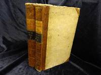
REIS0790Berlin und Hamburg 1800. 2 Bde. 8°. Gest. Taf. gest. Titelbl. Titelbl. 1 nn. Bl. 410 S. mit 2 gest. Taf.; gest. Taf. gest. Titelbl. Titelbl. 344 S. mit e. gef. gest. Karte mit e. Porträtmedaillon des Perouse am Kupfertitel des ersten u. e. Illustrationsvignette am Kupfertitel des zweiten Teiles. Halblederbände d. Zeit mit je zwei Rückenschildchen u. Rückenzierlinien in Goldprägung Einbanddeckel mit Kiebitzpapier überzogen Vorsätze aus zweifärbig bedrucktem Buntpapier Ecken und Kanten bestoßen Ecken teilw. aufgespalten Einbanddeckel berieben fliegende Vorsatzblätter fehlen. Mit je e. Bibliotheksschildchen Joseph Bermann auf den vorderen Innendeckeln. Henze III146; vgl. Bibliotheca geographica 98; ADB 7166ff. Als zweiter und dritter Band der Reihe 'Bibliothek der neuesten und interessantesten Reisebeschreibungen' erschienene Ausgabe der 'Voyage de la Perouse autour du monde'. La Perouse 1741-1788 französischer Geograph und Weltumsegler unternahm diese umfassende Erforschung und Kartographierung des pazifischen Raums im Auftrag der französischen Krone. Am 1. August 1785 stachen die beiden Schiffe von Brest aus in See. Die erste Station war Teneriffa. Im Januar 1786 wurde Patagonien erreicht. Über Kap Hoorn und die Osterinsel ging es nach Hawaii und weiter nach Alaska. La Pérouse der sich zu den Aufklärern zählte verzichtete als erster Europäer bewusst auf die Inbesitznahme noch unerforschter Inseln. In Alaska knüpfte er wichtige Kontakte mit Indianern bevor er die Küste Kaliforniens bereiste. Beide Expeditionsschiffe 'Astrolabe' und 'Bousolle' mit ihrer Besatzung erlitten vermutlich im Bereich der Salomonen Schiffbruch und kehrten nicht nach Frankreich zurück. - Herausgegeben und redigiert wurde das Werk von Louis Marie Antoine Destouff de Milet-Mureau 1756-1825 die deutsche Übersetzung stammt von Johann Reinhold Forster 1729-1798 und C. L. Sprengel. Der vielseitige Naturwissenschaftler und Entdecker J. R. Forster hatte wenige Jahre zuvor James Cook auf dessen zweiter Südseereise begleitet. Erster Band mit nur zwei von drei Kupfertafeln. Berlin und Hamburg 1800. unknown
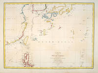
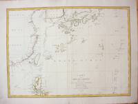
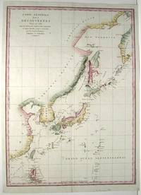
179755879Paris:. 1797. From the Voyages of La Pérouse who set sail from France in 1785 to continue the discoveries of Captain Cook. He was shipwrecked in 1788 but his narrative maps and views survived and were published in 1797. Fine large chart shows the southern coast of China Japan Korea Formosa & the Philippines and the Marianas as well as many small islands in the region. Locates the tracks of the Boussoles the Astrolabe the ships of La Perouse on his voyage from Manila to Kamtschatka. Chart shows very detailed soundings and all known harbours straits and island chains. Engraved by BOUCLET. Atlas Du Voyage De La Pérouse Size: 675 x 490 mm. Copper engraving. Hand coloured. Fine condition. Slight browning to the lower margin. Good margins. unknown
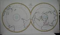
1788M5521Paris 1788. Very Good folding map flattened and folds reinforced laid on acid free canvas for long term preservation. Notes: "Double hemispherical world map with each hemisphere shown on polar projection. Plate probably accompanied: Histoire naturelle generale et particulare / George Louis Leclerc Buffon. Paris 1749-1804. Plate "No. 8" of an 8 sheet map which was probably compiled from the reports of La Perouse’s last voyage in the Pacific and is by Jean-Charles Borda." National Library of Australia Digital Collection map-rm3253 Size : 480x940 mm 18.875x37 Inches Coloring: Hand Colored in Outline Category: ; Maps Polar Antarctic Regions; Maps Polar Arctic Regions unknown
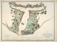
179755881Paris: 1797. From the Voyages of La Pérouse who set sail from France in 1785 to continue the discoveries of Captain Cook. He was shipwrecked in 1788 but his narrative maps and views survived and were published in 1797. Thirty-eight years later the scattered remains of La Boussole and L'Astrolabe was discovered wrecked on a vicious reef on an atoll in the New Hebrides. Attractive sea chart showing the entrance to Port des Français. Engraved by BOUCLET. Atlas Du Voyage De La Pérouse. Size: 680 x 495 mm. Copper engraving. Hand coloured. Fine condition. Good margins. unknown
elala4672London: G.G. and J.Robinson 1798. cfWagner 841 & Falk Alaskan Maps 1797-9 French edition. 16 ºî x 21 ºî 41.3 x 54.3 cm. engraving paper weakness at centre fold London: G.G. and J.Robinson, 1798 unknown
1787M7397Paris c.1787. Very Good;. Size : 495x680 mm 19.49x26.77 Inches Coloring: Hand Colored in Outline Category: Maps Asia Far East China; Maps Asia Far East Japan & Korea; unknown
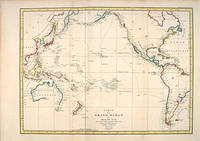
179755869Paris: 1797. A splendid large chart of the Pacific Ocean and of those countries that border it. Only coastal information is given. From the Voyages of La Pérouse who set sail from France in 1785 to continue the discoveries of Captain Cook. He was shipwrecked in 1788 but his narrative maps and views survived and were published in 1797. Copper engraving. Very good condition. Faint waterstain along the left vertical fold. Very slight foxing not affectong the image. Hand coloured. Size: 68.5 x 49.5 cm. unknown
elala4673London: G.G. and J.Robinson 1798. cfWagner 842 & Falk Alaskan Maps 1797-9 French edition. London. 16 ºî x 20 æî 41.3 x 52.1 cm. engraving paper weakness at centre fold London: G.G. and J.Robinson, 1798 unknown
1797M753Paris 1797. Excellent. Size : 685x495 mm 27x19.5 Inches Coloring: Hand Colored Category: Maps Asia Far East China; Maps Asia Far East Japan & Korea; unknown
1788M6851Paris 1788. Very Good; laid on acid-free canvas for long-term preservation. Notes: This handsome sea chart depicts magnetic needle readings along various routes in the North Pacific ocean.<br> Size : 590x1090 mm 23.23x42.91 Inches Coloring: Hand Colored in Outline Category: Maps Sea Chart; Maps Ocean Pacific; Maps United States West; unknown
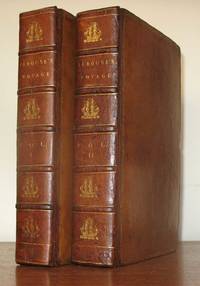
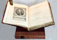
179823577London: John Stockdale 1798. First Stockdale edition. Hardcover. Recently expertly rebacked retaining all original materials some toning to text and plates but a very good copy. 2 volumes contemporary full tan calf by H. Faulkner; 20 cxc 290; viii 442 119 pp 51 engraved plates in the 2 volumes including 3 folding maps in first volume. Printed label at upper corner of verso of front free endpaper: "Bound by H. Faulkner George Court Adelphi." The British Book Trade Directory finds a Henry Faulkner Sr. succeded by Henry Faulkner Jr. at a George Court Adelphi from 1790 to 1825. <br/><br/>Originally published in French in 1797 this is one of two English-language translations published in 1798. This edition preceded earlier in the year by the Johnson edition which had only 41 plates. "The narrative of the enterprising but ill-fated Pérouse is full of interest in all portions but his relations of the peculiarities he observed in the natives of the northwest coast of North America are especially valuable. The mysterious fate of this distinguished navigator has never been satisfactorily cleared up. The above account was transmitted from Botany Bay after leaving this place the expedition was never heard of again" Sabin. In fact recent investigations into the fate of La Perouse have determined that both ships in the expedition were wrecked on the reefs of Vanikoro in the Solomon Islands. Cox I p. 67; Hill 974 observing that "The preface to the Stockdale edition leads one to suppose that the Johnson edition was published slightly earlier; Sabin 38964. John Stockdale hardcover
elala4671Paris: 1797. This map shows La PÈrouseís 1786 northwest coast exploration route from Mount St. Elias on the Alaska-Canada border to ëBaie de Clonardí a cove on the west side of Graham Island. La PÈrouse was appointed to lead a French expedition which would further the scientific and geographical exploration of the northwest. He was also charged with continuing the search for the North-West passage from the Pacific side. Wagner Cartography Of The Northwest Coast Of America 841. Phillips Atlases 688. Falk Alaskan Maps 1797-9. 19 ºî x 26 æî. engraving paper flaws below upper border & lower margin [Paris: 1797] unknown
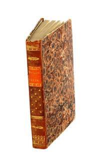
18274011312Livorno: Tipografia Vignozzi 1827. Three leaves a little short at the margins printer's error a little foxing but very good. Three volumes duodecimo three frontispieces and three plates all with good contemporary handcolouring; contemporary quarter roan binding lettered in gilt marbled boards with vellum tips. <p><p>Attractive early Italian edition of La Pérouse's voyage containing six charming coloured plates three of which are not recorded in the standard bibliographies. The first of these unrecorded plates is a costume study captioned "Uomo e Donna volgari della Concezione"; the second a view of Macao and the third depicts the death of botanist and savant Robert de Lamanon amidst a melée in Samoa during 1787. Neither Ferguson Forbes nor McLaren note the three plates additional to the frontispieces. Forbes did not in fact manage to inspect a copy of the book. Ferguson cites his own copy while McLaren consulted the Nan Kivell copy held by the National Library. </p> <p>This edition was part of a larger collection of voyages published in uniform duodecimo format with the series title Biblioteca Istruttiva e Piacevole ovvero raccolta dei più interessanti viaggi. Forbes confirms that each of the voyages was available separately. The spines in this set number the volumes within the series.</p> </p> . Tipografia Vignozzi unknown
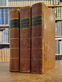
1798117441Paris: chez Plassan An VI - 1798. In-8 p. mm. 216x136 4 volumi brossura muta coeva dorsi con mancanze pp. 4LXVIII368; 4414; 316148; 4328; con una grande carta geografica più e più volte ripieg. i.e. mappemonde ou carte reduite des parties connues du globe. In Appendice al III volume: Tables de la route de "La Boussole" pendant les années 1785-1786-1787-1788 depuis son départ d'Europe jusqu'à Botany-Bay Tables de la route de "L'Astrolabe" pendant les années 1785-1786-1787 depuis son départ d'Europe jusqu'au Kamtschatka. "Manca l'Atlante di tavole".Relazione del viaggio intorno al mondo in cui si tratta anche di astronomia fisica chimica mineralogia zoologia botanica e medicina. "Seconda edizione" la prima è del 1797 di questa importante opera che fu anche tradotta in varie lingue. Cfr. BrunetIII828 - GraesseIV103 - The Hill Collect. of Pacific Voyages972 per la prima edizione di one of the most important scientific explorations ever undertaken to the Pacific and the West coast of North America.Solo qualche lieve fioriture altrimenti esemplare con barbe ben conservato."Jean-François de Galaup Conte di La Pérouse navigatore francese 1741-1788 ebbe da Luigi XVI il comando di un grande viaggio di circumnavigazione allo scopo di esplorare le regioni ancora sconosciute del Pacifico. Partito con due navi su cui erano alcuni scienziati 1785 si portò all'isola di Pasqua alle Hawaii e quindi lungo le coste dell'Alasca. Nel 1787 toccate le Marianne Macao e Manila costeggiò la Manciuria ed esplorò i mari intorno al Giappone settentrionale spingendosi fino alla Camciatca. Mandò dalla Nuova Olanda le sue ultime notizie in patria e salpato dalla Baia del Botanico con le due navi scomparve per sempre 1788. Secondo le tracce scoperte da P. Dillon e da Dumont d'Urville sarebbe naufragato presso l'isola Vanikoro gruppo S. Croce". Così Diz. TreccaniVI p. 691. chez Plassan, unknown
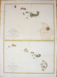
1798M7217Paris 1798. Very Good;small restoration at left margin. Size : 490x678 mm 19.29x26.69 Inches Coloring: Hand Colored Category: Maps United States West Hawaii; unknown
H492Berlin und Hamburg 1800. Bibliothek der neuesten und interessantesten Reisebeschreibungen Band 23. 8vo. 410 S. mit 1 gest. Frontispiz 1 Portraitvignette auf dem Titel 2 Kupfertafeln 1 gef. Karte; 344 S. mit gest Frontispiz 1 Titelvignette 1 gefalt. Karte. Halblederb‰nde der Zeit mit RSchild etwas berieben Rotschnitt guter Zustand. unknown
1801843601801. LA PEROUSE Jean Francois. A Voyage Round the World. Performed in the Years 1785 1786 1787 1788.TO which are added A Voyage from Manilla to California by Don Antonio Maurelle: and an Abstract of the Voyage and Discoveries of the Late Capt. G. Vancouver. Boston: Joseph Bumstead 1801 333pp. Contemporary full leather morocco spine label skillfully rebacked. Some toning throughout else very good. Hill 976. Sabin 38966. Howes L-93. Forbes 331. Shaw & Shoemaker 789. Ferguson 333. Reese Best of the West 20. Kroepelien 1331.The rare first American edition of one of the most important Pacific voyages. The La Perouse account was first published in Paris in French in 1797 and in English in 1798. This is one of the earliest Pacific voyages to appear in an American edition and published much less modestly than the French and British editions would have been the way the average American would have learned about La Perouse's important surveys of the Pacific coast and his descriptions of native Americans there. This is also the first American version although only a precis of Vancouver's voyage first published in London in 1798. The 1781 voyage of Spanish naval officer Francisco Antonio Mourelle incorrectly spelled in this edition's title went from the Philippines to the South Pacific where he explored in the vicinity of New Guinea and the Tonga Islands before sailing to Mexico. Howes is inaccurate in his pagination of this edition and the Hill copy contains a map that was added later. unknown
17993812959Stockholm: Johan Pfeiffer 1799. A few light spots but a very good copy. Small octavo; in attractive original Scandinavian half calf binding. <p><p>Rare Swedish edition of the voyage of La Pérouse whose fame was so widespread that there was a ready market for accounts of his voyage across Europe and beyond. Within four years of the publication of the official French edition in 1797 translations appeared in London Edinburgh Paris Stockholm Leipzig Berlin Copenhagen Haarlem St. Petersburg Boston and Amsterdam.</p> <p>This Swedish version was prepared by Samuel Ödmann from the octavo French edition. He also provides a preface. Not in the catalogue of the Hill collection; Ferguson knew the book only from copies in the Mitchell Library and the Kroepelien Collection Oslo.</p> </p> . Johan Pfeiffer unknown
17988611<p><strong>First visit of a foreigner to missionary establishments in Upper California</strong></p><p>3 volumes. Octavo 8½x5 inches. Pp. x 2 532 x 498 viii 466 1-60 Tables. 42 copper-engraved maps views charts and specimens mostly folding. Full brown calf gilt & blind rules on spines black leather spine labels. Volume I rebacked to match with original spine label and new endpapers. Bookplates on inner covers of volumes II and III. Early inked signature on each title page crossed out ink on verso of titles. Front hinges of volumes II and III broken but attached rear hinges starting. General wear to edges and corners. Most maps and plates foxed or toned small closed tear to p.477-78 of Volume II with remnants of old repair folding frontis plate in volume III with early paper reinforcement on the verso of one fold. Overall a very good set. Collated complete.</p><p>First English edition. "There are three separate translations into English from the original French of which two this one published by Johnson and another one published by Stockdale appeared in the same year 1798. Johnson's was issued slightly earlier. Both of these 1798 editions are abridged. In both first English printings the number of maps were reduced "Stockdale's edition reproduced only fifty-one of the original plates and Johnson's edition only forty-two" Hill. La Perouse sailed to the Pacific and the west coast of North America to examine regions not explored by Cook; to seek the famous Northwest Passage; to obtain information about the fur trade and the Spanish settlements in California; to make scientific observations; and to promote French enterprise in the region. He made valuable contributions to the history of geographical discovery particularly in regard to the American coast. He sent his dispatches from Kamchatka and Botany Bay. After leaving Botany Bay his expedition disappeared and his ships' wrecks were not discovered for another 39 years on one of the Santa Cruz Islands. Hill <em>Collection of Pacific Voyages</em>: p. 974.</p> Printed for J. Johnson, St. Paul’s Church Yard hardcover
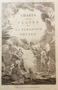
1798000252<p><strong>Atlas to the English edition of the report of the famous voyage around the world by La Pérouse who - in addition to Bougainville and Cook - contributed decisively to the exploration of the Pacific region. Without the two text volumes.</strong></p><p><strong>Description:</strong> Contemporary quarter calf with marbled paper boards. Flat spine lettered and decorated in gilt. Quarto: 44 × 28.5 cm; unpag. 1 engr. frontispiece 1 engr. title page and 67 full-page copper-engraved plates thereof are: 37 plates and 30 maps 20 fold-outs.</p><p><strong>Ref.:</strong> Boucher i p. 149-54; Cox i 67; Sabin 3896</p><p><strong>Condition:</strong> Binding a bit scuffed and with a few surface abrasions at edges. Light waterstains to the gutter of first few leaves. Contents occasionally somewhat soiled more noticeable in the first few leaves slight tanning at edges. Three small brown spots on plate 29 visible between plates 27-37. Lacking plates 1 map of the world and 36 male and female Partridge of California. Some offsetting from plates. Despite the occasional minor blemish a good copy.</p><p><strong>Notes:</strong> La Pérouse 1741-1788 a French naval officer and explorer was appointed in 1785 to lead a scientific expedition to explore the Pacific. The expedition stopped in Chile Hawaii Alaska California Mauritius Réunion Macau Japan Russia and Australia. However his journey ended tragically. In January 1788 he reached Botany Bay. He sent his final notes to France from there before sailing on towards Tonga in March. When no further reports arrived in France for a long period of time the first search expedition was launched in 1791. However it remained unsuccessful. It was not until 1826 that Peter Dillon an Irish sea captain proved that the island of Vanikoro was the site of the accident where the expedition's ships met a tragic end on the reef.</p><p>The first English edition was published in two volumes in octavo format by John Stockdale in London in 1798. Two other translations were published by two different publishers in 1798 and 1799: J. Johnson's first edition appeared in 1798 and J. Robinson's in 1799. Regarding these editions Edward Cox writes in his Reference Guide to the Literature of Travel: "On the unexpected publication of this famous voyage at Paris in the previous year 1797 there was considerable competition among English publishers to bring out the English translation. Three different translations were made and published during 1798-99 and different engravers were employed for making the plates. Stockdale's appeared first in June 1798. Robinson's edition of 1799 is the most esteemed edition in English later editions being usually based on it."</p> G. G. & J. Robinson hardcover
179843609London: Published as the Act directs Nov 1st 1798. by G.G.& J. Robinson 1798. Folio. 43x 27cm. 17" x 14.5". Atlas Volume First English Edition foliated engraved frontis portrait and engraved title-page 68 fine engraved plates maps charts and views many double page and include several plate illustrations on botanical and ornithological subjects. The plates are numbered 2 - 69 without the world map as usual plates are all very good to fine in contemporary half crimson morocco and marbled boards binding heavily dust worn similar wear on the edges upper hinge loose internally very good to fine condition. The map of the world is sometimes described as wanting however it would usually be in the two volume and is not call for in the list of plates <br /> <br /> ~ ~ ~ Hill #'s 972-979. "La Perouse expedition was one of the most important scientific explorations ever undertaken to the Pacific and North West Coast of North America. Hill. "Sabin 38960; Cox I-67. Fine copy of this Important 'Surveying Atlas' to the Pacific and west coast of North America. 1798. The plates are spectacular. - Atlas to the English edition of the report of the famous voyage around the world. Cook Bougainville and La Pérouse contributed decisively to the exploration of the Pacific. <br /> On the unexpected publication of this famous voyage at Paris in the previous year 1797 there was considerable competition among English publishers to bring out the English translation. Three different translations were made and published during 1798-99 and different engravers were employed for making the plates. Stockdale's appeared first in June 1798. Robinson's edition of 1799 is the most esteemed edition in English later editions being usually based on it." The atlas bears the date 1798 in the imprint but was published together with two text volumes in 1799. Published, as the Act directs, Nov, 1st, 1798. by G.G.& J. Robinson unknown
1799101564London: A. Hamilton for G. G. and J. Robinson J. Edwards and T. Payne. 1799. First thus two text volumes quarto later half-leather binding with gilt title labels and raised bands spines cloth sides Vol. I: pp. x lvi 539; Vol. II: pp. viii 531 plus index and errata page pp xiii. Engraved frontis portrait plate of La Perouse by Heath in first volume light water stain to upper plate and title page all edges untrimmed some unopened at top edge very light scattered foxing mostly to title pages minor scuffs to leather spine. The two text volumes without the Atlas volume complete and unabridged. Very good condition. The first quarto unabridged and "best edition" in English. A translation of La Perouse's scientific voyage around the world which departed France in 1785 and visited Chile and Hawaii Alaska California Japan Russia the South Pacific and Australia visiting Botany Bay in 1788 before sailing on and eventually discovered to have been wrecked in the Solomon Islands. A landmark work of exploration. 1st thus. Half leather. A. Hamilton for G. G. and J. Robinson, J. Edwards and T. Payne, hardcover
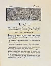
17913590A Dijon: De l'Imprimerie de Capel 1791. First edition. Woodcut headpiece. Contemporary manuscript certification at the end signed by two officials of the Département de la Côte-d'Or dated Dijon 23 avril 1791. Unbound as issued. In fine condition. First edition. Woodcut headpiece. Contemporary manuscript certification at the end signed by two officials of the Département de la Côte-d'Or dated Dijon 23 avril 1791. Unbound as issued. 3 1 blank p. <p><br /> The first formal document acknowledging fears of La Pérouse's disappearance in a rare provincial printing issued shortly after the royal decree.<br /> <p><p><br /> Very rare Dijon printing of the first formal decree acknowledging concern over the disappearance of La Pérouse's expedition. This decree issued by the Assemblée Nationale and promulgated in the name of Louis XVI on 25 February 1791 initiated the official search for La Boussole and L'Astrolabe last heard from in 1788 following their departure from Botany Bay. It instructed France's ambassadors consuls and agents abroad to solicit assistance from foreign powers and navigators-especially in the southern Pacific-"de faire toutes recherches des deux frégates Françoises La Boussole & L'Astrolabe. de même que toute perquisition qui pourroit constater leur existence ou naufrage."<br /> <p><p><br /> The decree also called for the arming of one or more vessels carrying scientists naturalists and artists tasked with both locating La Pérouse and conducting a broader exploratory mission "utile & avantageuse à la navigation à la géographie au commerce aux arts & aux sciences." This ultimately led to the voyage of Rear Admiral Bruni d'Entrecasteaux 1791-1794.<br /> <p><p><br /> La Pérouse's expedition 1785-88 commissioned by Louis XVI and modelled in part on the voyages of Cook was the most ambitious French maritime expedition of the Enlightenment. Departing from Brest in August 1785 the two frigates visited South America including Chile Easter Island Alaska California Macao the Philippines and Australia Botany Bay sending reports and scientific observations until their disappearance after March 1788. Their fate remained a mystery until the wreckage was found decades later on Vanikoro Island.<br /> <p><p><br /> The Dijon edition printed by Capel and officially certified by the departmental administration is part of a coordinated provincial dissemination of the decree alongside other issues printed in Pau Orléans Grenoble Valenciennes Auxerre and Évreux.<br /> <p><p><br /> References: cf. Ferguson 106a Auxerre ed.; Kroepelien 710; McLaren 132 Valenciennes ed.; Horner Looking for La Pérouse pp. 4-6.<br /> <p>. De l'Imprimerie de Capel unknown
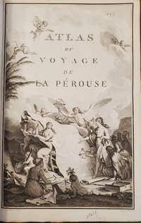
17978615<p><strong>Atlas to the first edition of "Voyage de La Perouse"</strong></p><p>Folio. 17 ¼ x 11 ¼ inches.Frontis portrait engraved title page 69 engraved plates. Extra map from English edition.Contemporary binding of leather over marbled boards. Covers very worn front cover completely detached remnants of a hand-written label. Embossed stamp to corner of the title page. A few plates with minor discoloration in the gutter from old tape residue but the plates generally clean some trimmed a bit close. A good copy collated complete and with maps and plates in generally fine condition.</p><p>First edition. Atlas volume only. Bound into this copy is an additional map from the English version of the Atlas; Plate 3 "Chart of the Great Pacific Ocean" as well as a partial piece of the English Plate 4 "Plan of the Bay of Conception in Chili". La Perouse sailed to the Pacific and the west coast of North America to examine regions not explored by Cook; to seek the famous Northwest Passage; to obtain information about the fur trade and the Spanish settlements in California; to make scientific observations; and to promote French enterprise in the region. He made valuable contributions to the history of geographical discovery particularly in regard to the American coast. He sent his dispatches from Kamchatka and Botany Bay. After leaving Botany Bay his expedition disappeared and his ships' wrecks were not discovered for another 39 years on one of the Santa Cruz Islands.</p> [Imprimerie De La Republique] hardcover
179853622Paris Plassin 1798. 8vo. and folio 44 x 30 cm. Textvolumes bound in 4 contemporary half calf. Gilt spines with gilt lettering. Tome-label on volume one eroded. Stamp on title-pages. 4LXVIII368;4414;316120 = Tables;4328 pp. A few scattered brownspots. Atlasvolume bound in matching hcalf. Spine gilt and rubbed. Lower compartment of spine with wear and tear. Engraved portrai of Pérouse as frontispiece. Engraved pictorial titlepage with cupids and naviogational instruments dessinée par Moreau le Jeune and 69 engraved maps plans and plates of which 32 are large folded engraved maps. Mild foxing to some parts of some maps occasionally mild dampstains to some plates marginal browning and some spotting. One map with a repair to folding. <br/><br/><em>Second edition of the textvolumes the first appeared the year before 1797 and first edition of plates. 69 plates to the first 70 to the second."In 1785 Jean-Francois de Galaup Comte de la Perouse began preparations for an extensive sea voyage. His aim was to explore the Pacific regions of North and South America Asia and Australasia. The sponsor of the expedition was the French king Louis XVI who was inspired by Captain James Cook's Pacific voyages. Louis ordered the French expedition to show the world that France could also dominate in ocean exploration. The expedition consisted of two ships - La Boussole and L'Astrolabe. They carried a total of 225 crew officers and scientists. The ships left France in August 1785 and sailed south around Cape Horn. The voyage was expected to last four years. During the voyage La Perouse sent back regular reports to France. The expedition mapped coastlines and explored uncharted areas of ocean. The expedition's scientists also spent time onshore at various ports observing the habits and customs of local people and collecting natural history specimens. The expedition's progess until September 1787 was published by the French government as Voyage de La Perouse autour du monde La Perouse's voyage around the world. It was reprinted many times and translated into several languages. In 1791 when La Perouse had not returned to France or made any contact by dispatch the French government sent out a search party. It was commanded by Rear Admiral Joseph Antoine Bruni d'Entrecasteaux and consisted of two ships Recherche and Esperance. The complete disappearance of La Perouse caught the imagination of the European public. Songs stories and plays were written about the possible fate of the expedition including a popular play called Perouse or The desolate island. It was not until 1964 that the wreck of La Boussole was finally discovered on Vanikoro's reefs. At last the fate of La Perouse and his crew was known. The expedition is commemorated in the name of a Sydney suburb on the shores of Botany Bay - La Perouse." State Library of New South Wales Website.Sabin 38960. </em> unknown